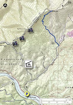
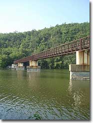
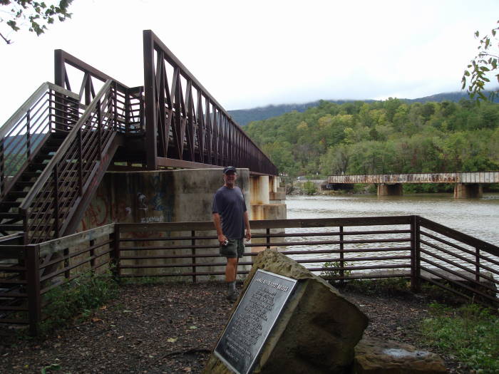
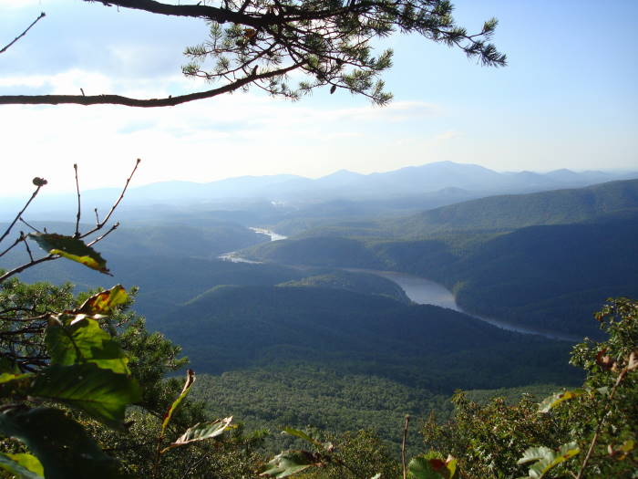
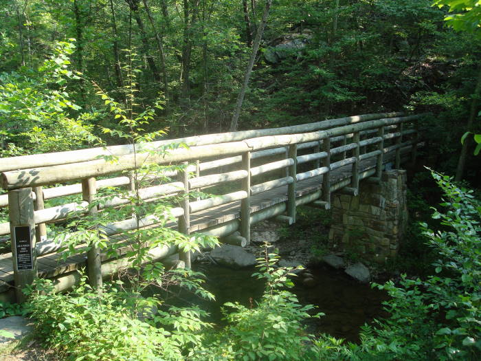
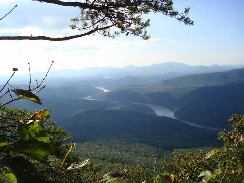
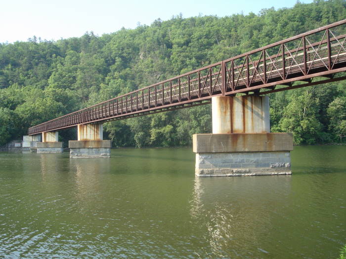
Ever wonder where the James River goes through the Blue Ridge Mountains? Do this hike and you'll see it. The hike starts at the $2.0M Appalachian Trail James River Foot Bridge. Once on the ridge you will have multiple awesome views of the James River cutting its way through the mountains, the geological term for this is water gap.
We have mapped this as a 12.3 mile loop but recommend doing it as a 10.8 mile out and back for multiple reasons: The last part of the loop utilizes a rarely used overgrown trail (read ticks), 1.5 miles is on a paved road, trail markings are intermittent/faded, no views or sites, etc.
The beginning of the trail is on the far side of the parking lot, just to the left of the information kiosk. Prior to starting the hike take a short detour to look at the A.T. Foot Bridge.
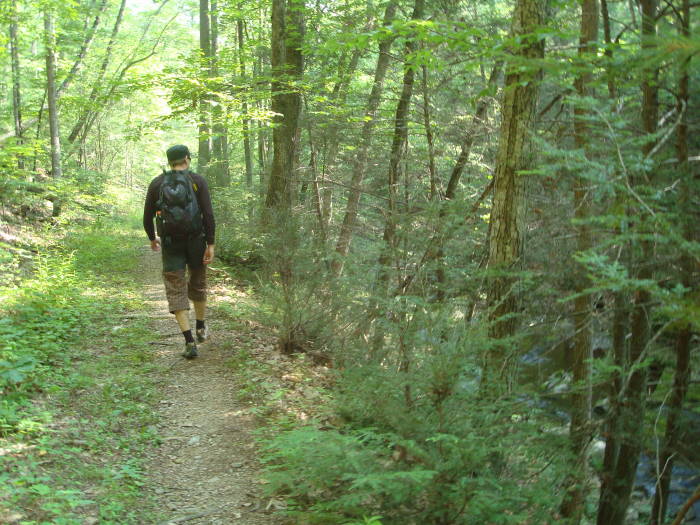
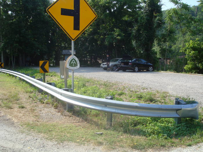
Mile 0.0 – Head North on the Appalachian Trail and in about 300 yards cross Route 130/501 towards Hercules Rd (Route 812). Once on Route 812, in 20 yards you will take right onto the trail with red markings on rocks and trees, look a little down the trail and you should see a tree with double white blazes.
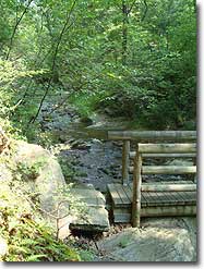
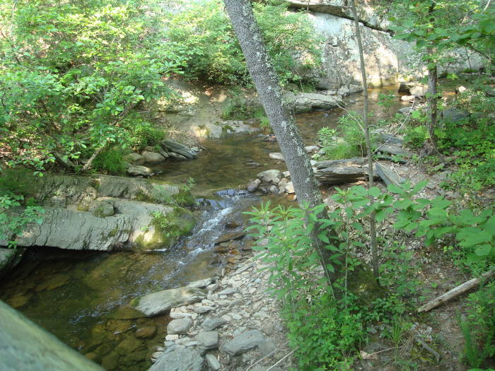
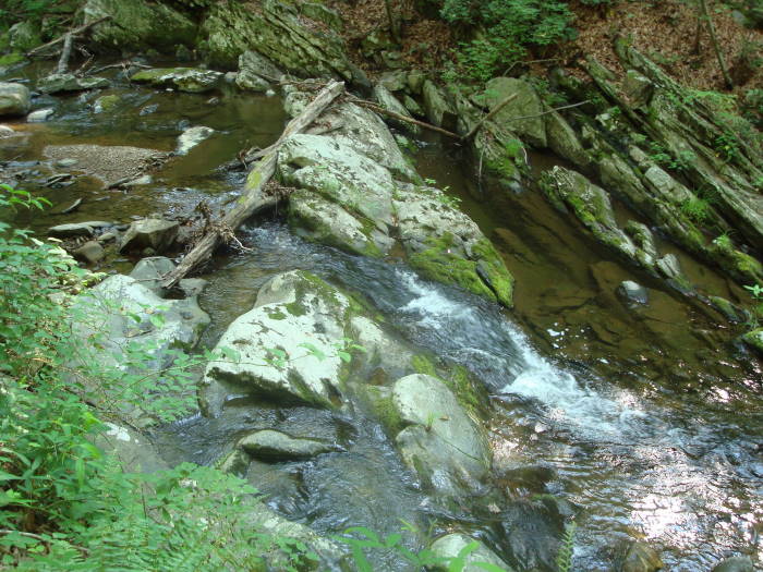
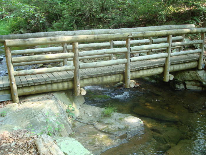
Mile 1.0 – The next mile you will be paralleling Rocky Run Row creek, crossing a couple of small bridges and the AT will take a sharp turn to the left and climb away from the creek.
Mile 1.2 – Cross Route 812, gravel road and continue on AT towards Johns Hollow Shelter.
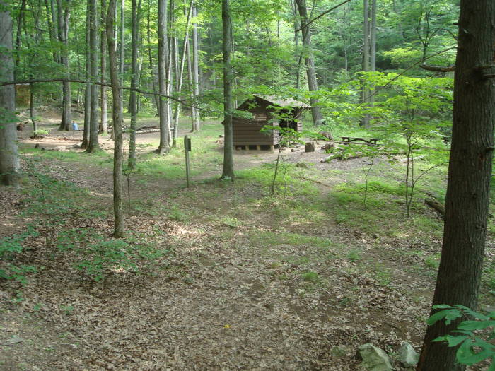
Mile 1.8 – Reach Johns Hollow Shelter spur trail, Blue blazed. It is a short hike (0.1 miles) down to the shelter with a nice creek to the east of the shelter and a fairly new privy behind the shelter with a plexi-glass roof, I wonder if you can see the stars at night?
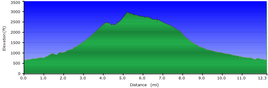
Mile 2.9 – Reach the first of 21 switchbacks. The AT is a pleasant/gradual climb until this point. It is a tough climb to Fuller Rocks.
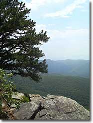
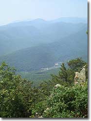
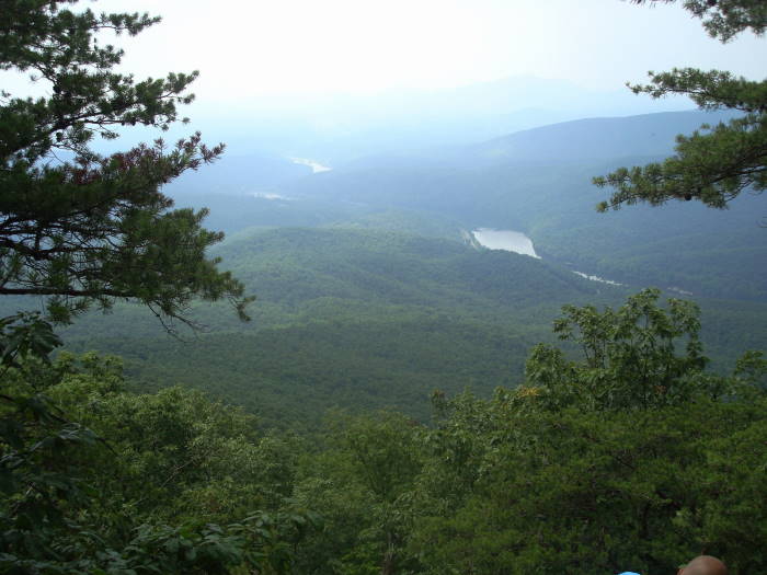
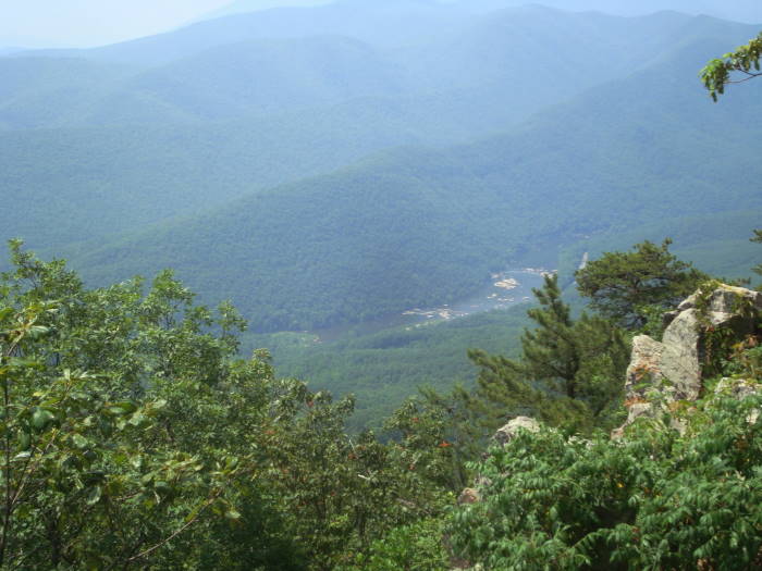
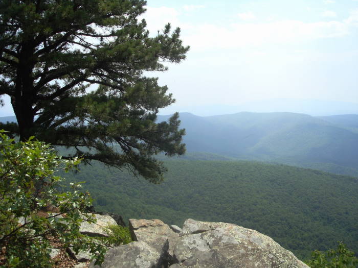
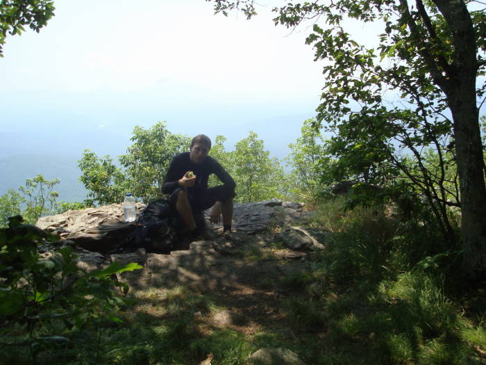
Mile 4.0 – Reach Fuller Rocks, great views of the James River. To the southwest you should be able to see the FAA radar dome on Apple Orchard Mountain. About 50 yards beyond Fuller Rocks is the intersection of the AT and Little Rocky Row. Supposedly there are good views on Little Rocky Row trail but we beared to the right and stayed on the AT. Small campsite near this intersection but no water source.
Mile 4.1 – Reach another great viewing area, in fact, over the next ½ mile there are multiple overlooks.
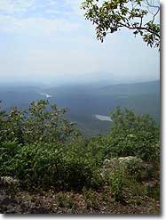
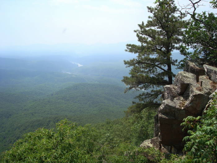
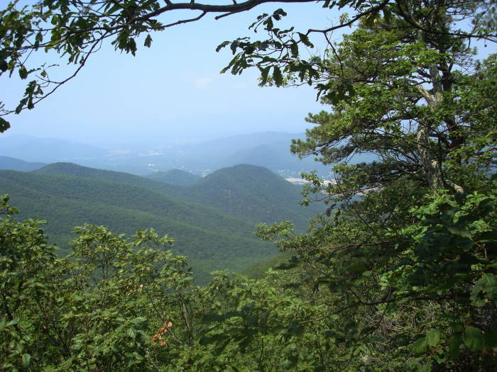
Mile 4.7 – Overlook with a view of Glasgow looking west. You will start climbing just before this overlook and will gain about 550' over Big Rocky Row Mountain prior to going downhill to the Big Rocky Row overlook.
Mile 5.4 – Big Rocky Row overlook. Great place for lunch and some additional views of the James River. Campsite near the overlook but no water source. We were able to see this set of cliffs from Thunder Ridge while backpacking through the James River Face Wilderness last fall.
Note: Decide whether to do the loop or turn around for the out and back. We recommend the out and back as previously suggested and warned. To do the loop, continue North on the A.T.
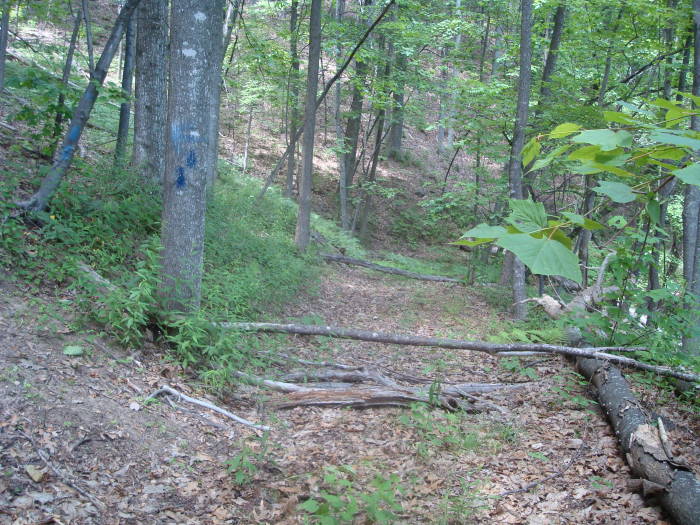
Mile 6.7 – Saddle Gap Trail intersection, sign says 2.5 miles to FDR 36 which we think is also Route 812. Bear right, it is 1.1 miles to an unnamed fire road. There are occasional faded intermittent blazes on this trail. It has not been used in some time and is over-grown in many places.
Mile 7.8 – Fire Road intersection, bear right. The next section gets extremely over-grown in many places and with minimal blazes.
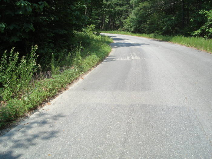
Mile 9.3 – Route 812, huge boulder just before the paved road, bear right onto Route 812, paved for most of the next 1.5 miles until you intersect the AT again. Follows Rocky Row Run creek.
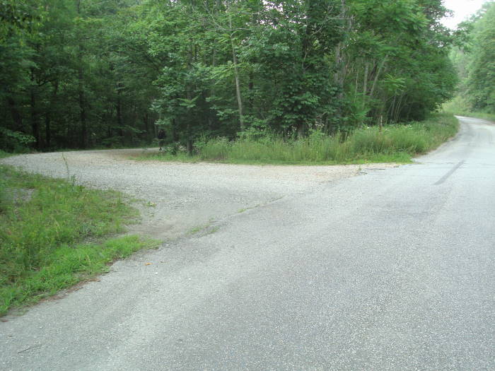
Mile 10.9 – Route 812 goes straight, unnamed gravel road bears to the left, take unnamed gravel road
Mile 11.2 – Gravel road will start to cross the creek, don't cross the creek, stay straight on path , look for 2 big boulders and in 50 yards intersect the A.T. Stay straight on AT to return to parking lot at the James River Foot Bridge. You were on this section of the AT earlier in the hike.
Mile 12.3 – Parking area
Mid June
Big Rocky Row
Big Rocky Row Hike Comments
Archived Comments
By:Dan
Rating:
Date of Hike: Friday, January 25, 2019
Great hike. Not crowded and a good workout. Did in winter so no bug or shrub issues
By:hawkman
Rating:
Date of Hike: Saturday, November 25, 2017
I live in Lynchburg so this is one of my favorite hikes because of the convenience, challenge, views, and distance. I do it a little different though. I leave my mountain bike at the saddle gap trail head, then drive back down to where the AT crosses 812 (Hercules Rd). There I hike the AT up rocky row to fuller rocks and on to Saddle gap. Saddle gap is usually in pretty good shape. Back at the saddle gap trail head I ride my mountain bike down Hercules road to my truck at the AT crossing. That way I don't have to walk a couple miles on asphalt and it is all down hill on my bike. This make for a nice 8 mile point to point hike for a solo hiker.
By:Don Mc
Rating:
Date of Hike: Monday, October 5, 2015
We did this hike as suggested, 10.8 miles. The trail is in great shape and the views were spectacular. We are in our mid 60's so this hike was somewhat difficult regarding the distance and elevation gain but the trip was worth it again.
By:Ken
Rating:
Date of Hike: Saturday, April 26, 2014
This hike really delivered the views of the James River that I was hoping to see. I walked to the Saddle Gap Trail intersection before I turned around and retraced my steps for a total of just over 13 miles. It was a pretty gentle hike until the switchbacks and even the switchbacks were not too difficult until the last 4 or 5 close to Fuller Rocks. The view from Fuller Rocks was picture perfect and one AT thru hiker had set up his tarp to enjoy the view and an early lunch right on the edge of one of the overlooks. From Fuller Rocks Big Rocky Row looks pretty imposing and though there are switchbacks up to the summit, there aren't many and that meant a lot of steep grades on each leg. The view from the overlook was unobstructed but the bugs were out in force and intent on sharing my lunch. The walk to the intersection (and back) was pretty easy, mostly along the ridgeline. I'm not the type to gush about blooming flowers but there were portions of this stretch that were literally blanketed with white, pink and light purple flowers (trillium?). There were several pairs of backpackers, 4 thru hikers, and a couple of day hikers along the way. Not crowded by any stretch. I didn't see any wildlife other than a few lizards and some hawks glding below the summit. A great hike to take on a clear day.
By:SMELL N ROSES
Rating:
Date of Hike: Sunday, September 15, 2013
Check out my video slideshow from this hike here: http://www.youtube.com/watch?v=EWpkjchm5js
This is a great hike! The switchbacks are tough, but not nearly as bad as some others have commented. Really the entire trail is uphill, mostly following a ridge, all the way up to above Fuller's Rocks. The climb up to the summit of Big Rocky Row is also tough and rocky, and as others mentioned the summit area is basically an overgrown jungle and at times it was difficult to follow the trail. I imagine the summit area would be nice in the winter or early spring before the weeds take over. The views at the "Big Rocky Row Overlook" are basically the same as back around Fuller's Rocks so I am not sure its really worth the effort to go all the way to the overlook. Over all this is a great hike with some awesome views.
By:John
Rating:
Date of Hike: Sunday, September 8, 2013
Wonderful hike! Hiked to Big Rocky Row then turned around. Big RR was buggy, overgrown, hot, steep, and the views were not as good as L'l RR but glad I did it! No bears but lots of squirrels. Highly recommend this hike.
By:Brock D
Rating:
Date of Hike: Sunday, December 9, 2012
I had never heard of this hike until this past week. My GPS made the parking lot slightly difficult to find. This hike has a great reward at the top. It is rather boring and uneventful until the last mile or so to the top when you start to get some stunning views. My dog loved this hike on this unusually warm day in December. I expected to see a few people along the trail, but was pleasantly surprised to not see another soul the entire hike!
Overall, I enjoyed this hike. The view at the top was simple stunning.
By:JD Bashore
Rating:
Date of Hike: Sunday, April 15, 2012
The 'tough climb to Fuller Rocks' comment is a little understated. The first 10 switchbacks aren't too bad (crossing an old logging road from time to time), but the last 11 are very steep and rocky. But a beautiful view awaits.
Also not mentioned is the fact that the last 8/10 mile to Big Rocky Row overlook are also very tough (steep).
It's a tough (but worth it) 10.8 miles. Burned 6200+ Kcal on the hike! My 14yo son & I (who hike pretty regularly) did the out & back in 6:00 incl 30 min at the overlook for rest & lunch. Whoever does it routinely in 4:30 - 5:00 are pretty studly men and women.
Great hike!
By:Ariell
Rating:
Date of Hike: Saturday, November 5, 2011
Keep a sharp eye out for the:
"sharp turn to the left and climb away from the creek.
Mile 1.2 and Cross Route 812, gravel road and continue on AT towards Johns Hollow Shelter"
I missed it and ended up marching along 812/36, all the way to the that "huge" boulder (described in Mile 9.3). It is not huge, but it is a boulder.
That turned out OK, since the climb up was fun and challenging.
One of the best views I've seen in the Blue Ridge!
By:BigBob
Rating:
Date of Hike: Saturday, April 30, 2011
Lynchburg's best kept secret. I saw two hikers total on this hike. Lots of misquetoes and gnats. Very challenging hike. The view are well worth it. When your looking east across lynchburg at the Candler's mt range, try to see if you can spot the LU monogram imprinted on the mountain. This was done by Liberty University. It looks like a brown fuzzy dot on the mt. Good to see this hike made it to hikingupward.


