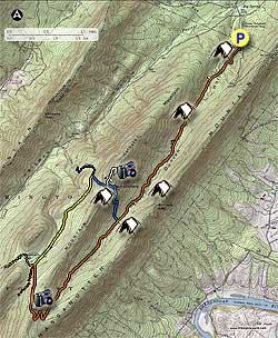
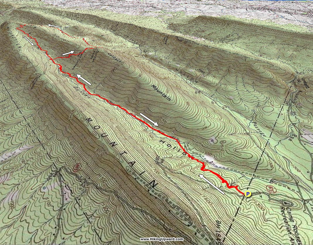
The Duncan Knob Hollow hike is essentially the same circuit as the Duncan Knob Hike, except starting from the other side of Middle Mountain. This hike is also longer, with several excellent multi-tent camping sites, and is accessible in the winter and late spring months when FDR674/VA211 is closed.
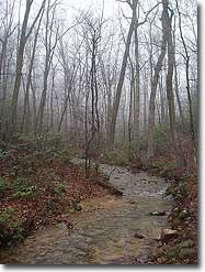
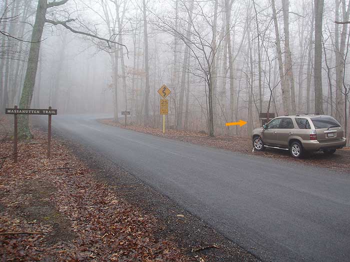
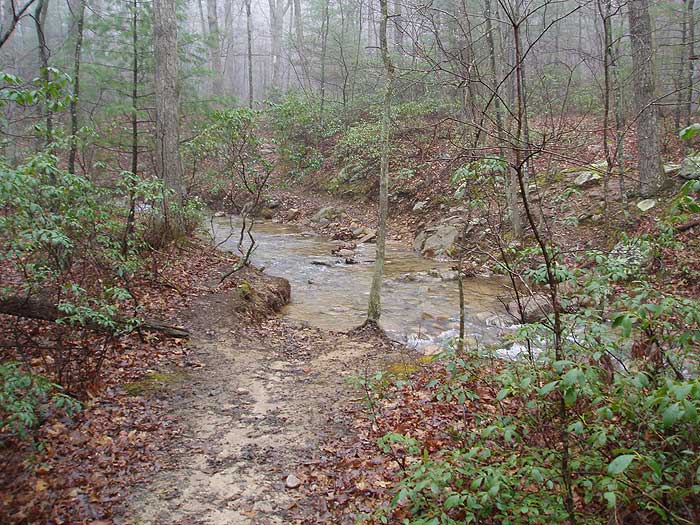
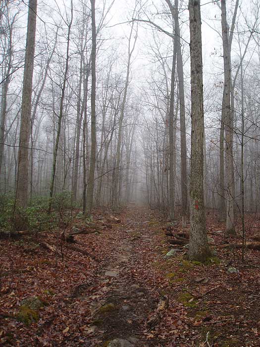
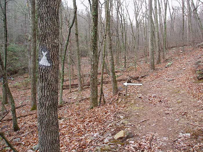
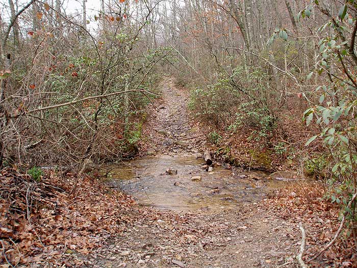
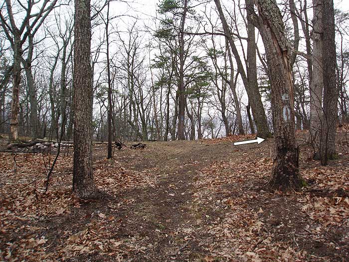
Start south on the orange blazed Massanutten Trail as it winds along the valley on the east side of Little Passage Creek. Cross a small wooded footbridge placed over one of the side streams, and come to the first of three crossing points on Little Passage Creek in 0.7 miles.
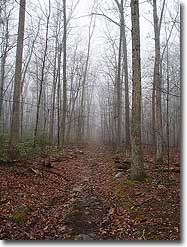
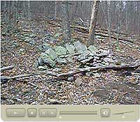
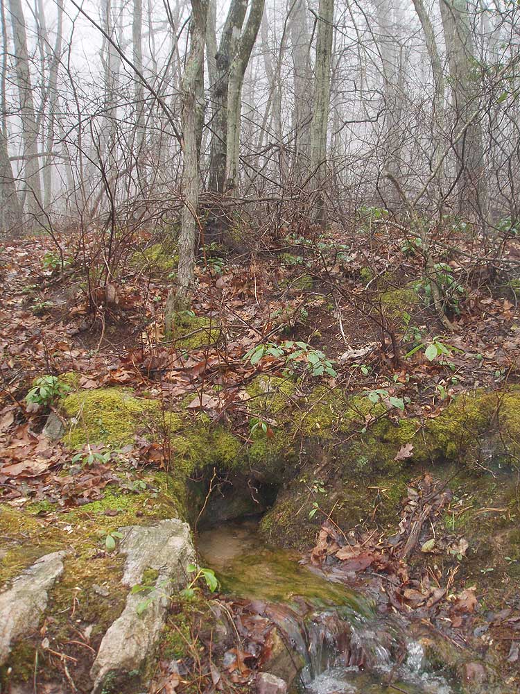
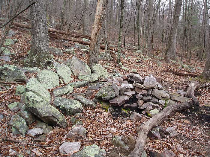
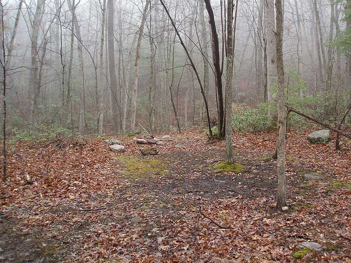
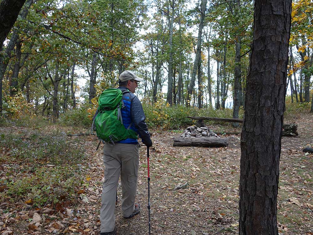
After crossing Little Passage Creek, pass the second campsite on the opposite bank (the first campsite is 100 yards from the trailhead). Continue up the valley on the orange blazed trail and pass a small seasonal spring in another 1.0 miles. In 1.1 miles from the spring is the best multi-tent campsite on the circuit, right on the banks of Little Passage Creek. This campsite has a large fire pit with several stone seats.
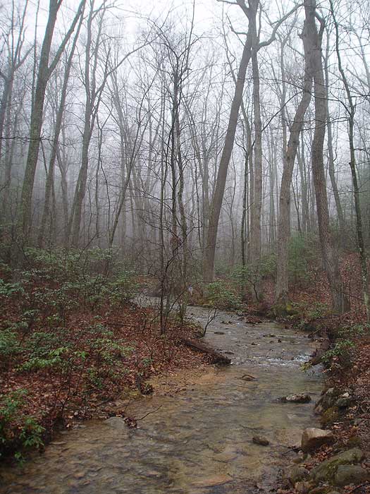
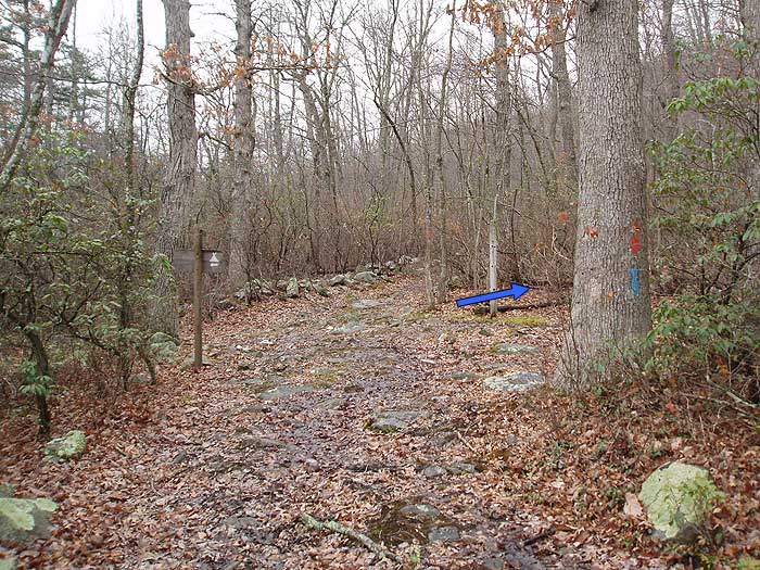
After passing the campsite cross Little Passage Creek, then back again, and continue 0.3 miles to the intersection of the blue blazed Gap Creek Trail. On the left/east bank of Little passage Creek is another multi-tent campsite with a large fire pit and stone seats.
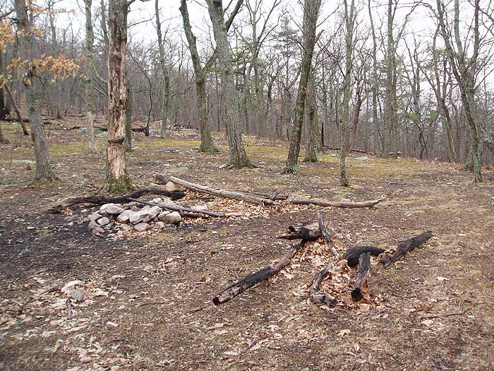
From the orange blazed Massanutten Trail, turn right uphill on the blue blazed Gap Creek Trail for the steepest section of the route. In 0.8 miles arrive at the ridge of Middle Mountain, and third multi-tent campsite.
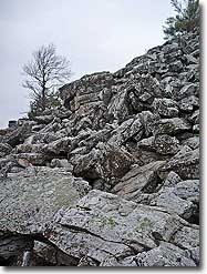
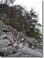
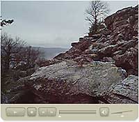
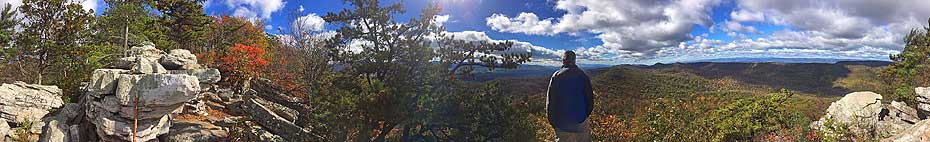
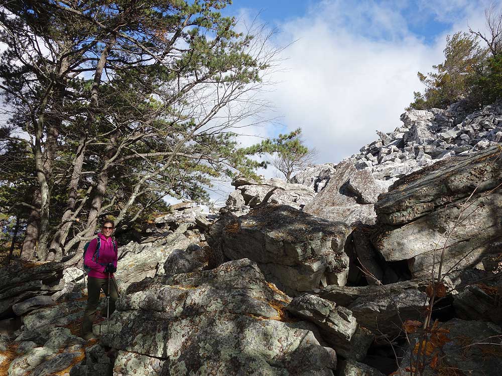
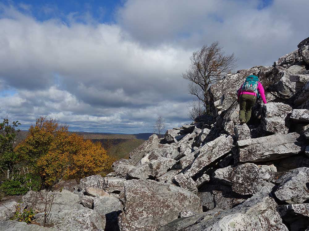
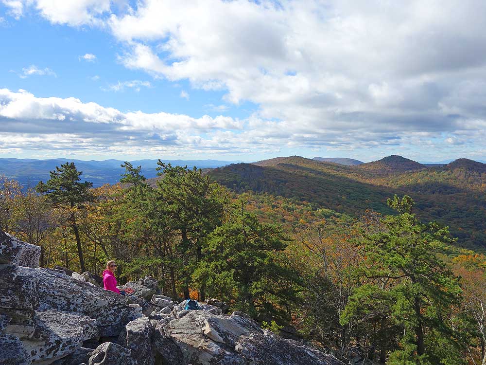
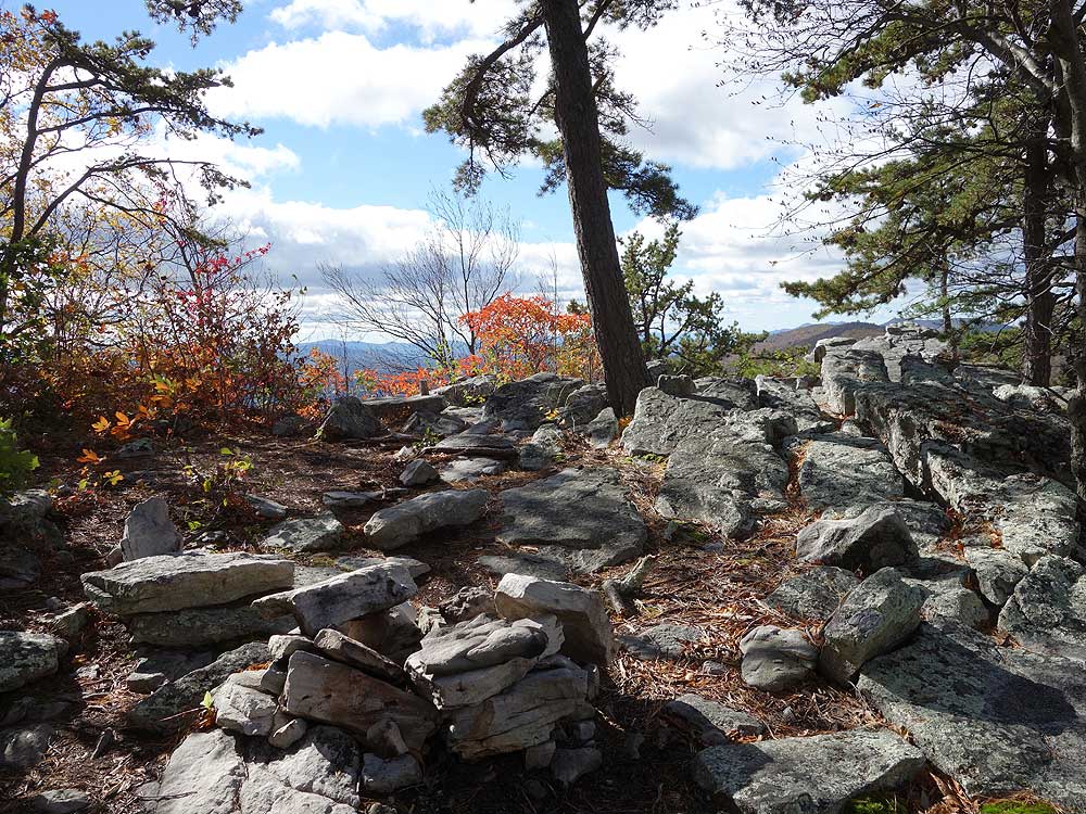
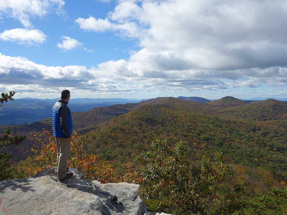
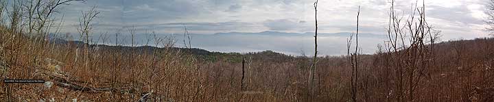
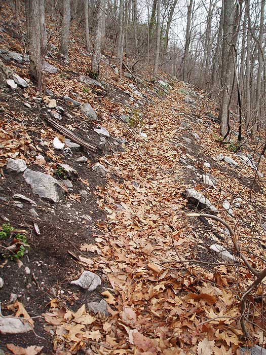
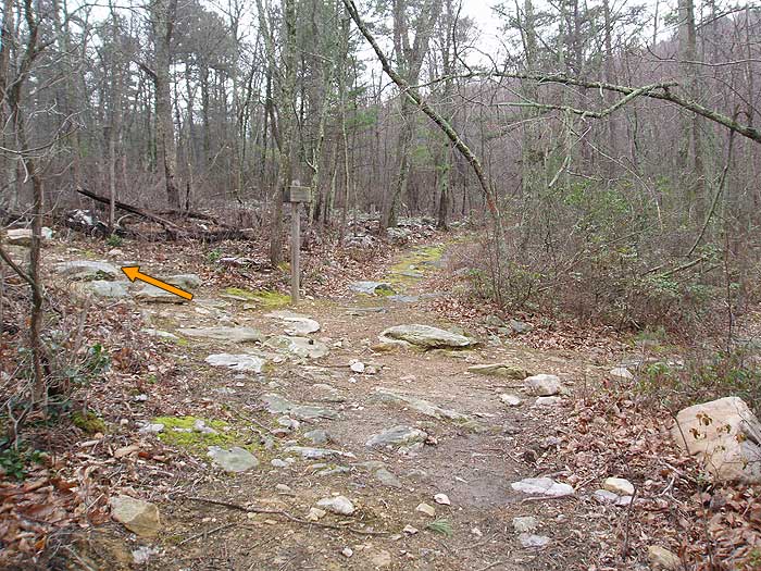
Turn right on the white blazed trail that leads up to Duncan Knob. In 0.1 miles there is a multi-tent campsite on the right of the trail, and single tent campsite on the left. In another 100 yards from these campsites enter the rock slide portion of the white blazed trail. The blazes can be hard to locate during the rock scramble to the summit. At the top of the rock slide, stay right to the Duncan Knob vista.
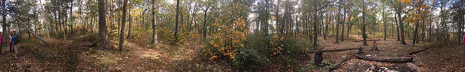
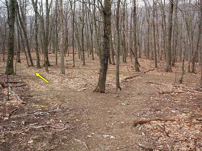
After returning to the saddle, and blue blazed Gap Creek Trail, turn right downhill on the west side if the mountain, and in 0.3 miles reach the intersection of the yellow blazed Scothorn Gap Trail. Turn left on the yellow blazed trail and in 0.6 miles pass through a small clearing. In 1.0 mile from the clearing reach at the four way intersection of the Massanutten Trail. The Massanutten Trail comes in from the left and continues straight, and the Scothorn Gap Trail turns right.
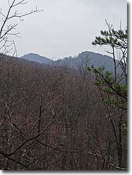
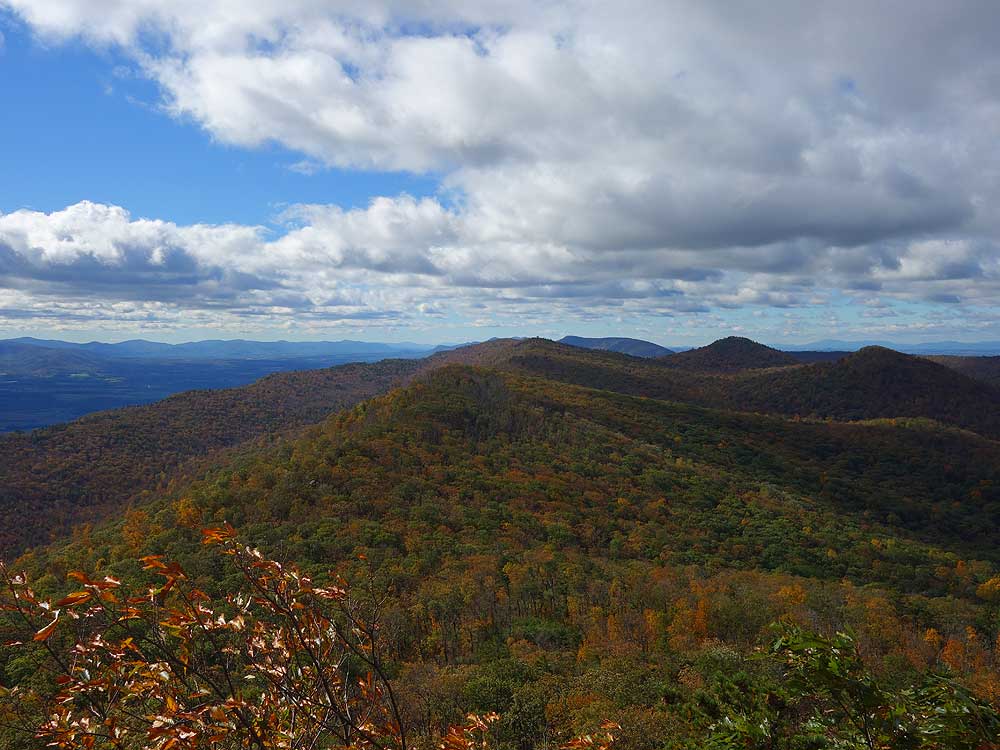
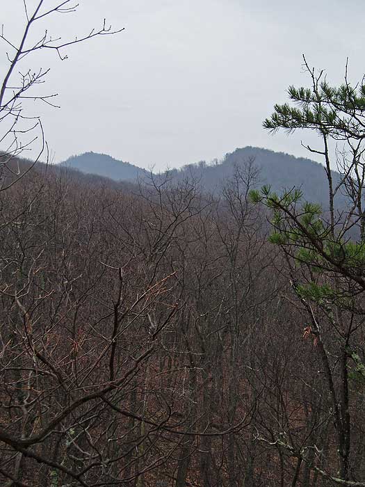
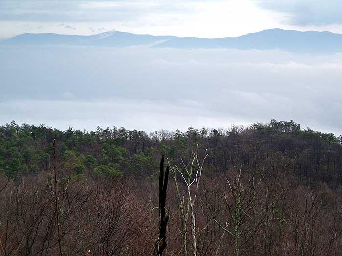
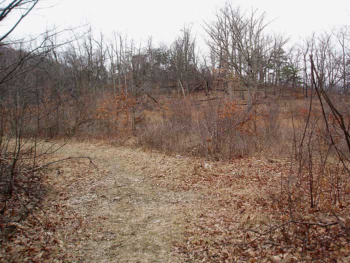
Turn left uphill on the orange blazed Massanutten Trail and arrive the ridge line in 0.7 miles. At the ridge there is a nice vista point 100 yards off the trail to the left/north. Continue downhill 0.4 miles on the east side of Middle Mountain as the orange blazed trail steeply descends to the valley, then makes a turn back to the left/north where the descent is less steep.
From the left turn, continue on the trail for 1.8 miles back to the intersection of the Gap Creek Trail. From this point continue straight on the orange blazed Massanutten Trail, retracing your steps across Little passage Creek three times, and arriving back at the trailhead and VA675 in 3.1 miles.
Mid October
Late March
Duncan Knob
Duncan Knob Hollow Hike Comments
Archived Comments
By:Ron
Rating:
Date of Hike: Saturday, September 21, 2019
Like the previous reviewer, my son and I went into this hike with the intention of doing the loop as it is outlined, but ended up turning back. The hike to the blue/orange intersection wasn't terrible except for the hordes of gnats and flies that wouldn't leave us alone no matter how much repellent we used. We brought some empty bottles for water because we knew once we reached the campsites near Duncan's Knob we wouldn't have a water source. We loaded up on water at the intersection and started up the hill. I'm not in great shape, but not terrible shape either, and that 0.8 mile was the toughest hiking I've ever done. Extremely rocky, and overgrown in places to the point that you can't see the rocks that you're putting your feet on. Add the relentless gnats and flies, and you don't have the makings for a fun weekend backpacking trip.
When we finally reached the campsite, we rested for while and had lunch, then decided to do the extra 1/4 mile up to Duncan's Knob. Please, for your own safety, read the next part carefully. The trail to the knob is completely unmarked. The trail is well worn, but once you reach the edge of the boulder field, the trail stops. My son and I went up and did the rock scramble, checked out the view and when we came back down we could not find the trail. We were bushwhacking in the general direction of our campsite, but I realized that we could easily miss the campsite and end up very lost with no food or shelter, and very little water. We made our way back to the knob, and after about an hour of searching, we finally found the trail. Again, there are exactly ZERO trail markings up to the knob, so drop a pin on your GPS, build cairns as you go, drop breadcrumbs, whatever you have to do to keep yourself safe.
After all this, we were low on water again, and with no other water source ahead of us on the loop, we decided to camp and then the next morning go back the way we came in. This trail is definitely at least a 4 difficulty. It might be better in the fall or winter when the bugs aren't an issue, but I can't imagine how bad the rocky trail would be if there was any ice.
By:Laura
Rating:
Date of Hike: Friday, September 20, 2019
My friend and I had intentions to hike this trail as laid out in the description. The trail is very rocky so I recommend sturdy shoes with good ankle support. We did not see anyone else on the trail until we were hiking back out and were almost to the trailhead so the solitude on the trial was fantastic. The trail is very overgrown, and there were a few portions where we briefly thought we had gotten off trail because the brush was so dense I recommend wearing long pants. The stream that runs along the trail was bone dry up until the point where the orange trail meets up with the blue trail near the third campsite (~3.8 miles from trailhead according to my GPS). According to other reviews, this is the last point to gather water along the trail. The stream was barely flowing but it was thankfully enough to gather water for filtering. We turned right onto the blue trail which was rocky and steep, but doable. We camped at the multi-tent site where the blue trail met up with the white trail and it was pretty nice. After we set up camp, we tried to make it all the way up to Duncan Knob but stopped just short of the summit. Even though our backpacks were mostly empty at this point, the large mass on our backs made the rock scramble a little more challenging than we were comfortable with. Although I think it would be completely fine if we were only wearing daypacks.
There were lots of spiderwebs across the trail which was super annoying to keep walking through, but even worse were the gnats and flies that swarmed us relentlessly. Thankfully I don't think they were biting, but we had to keep swatting them away to keep them out of our faces. Our campsite was slightly better, but after dinner, we pretty much stayed in the tent to avoid the bugs. The next morning we realized that we didn't have enough water to feel comfortable hiking the rest of the loop, so we decided to just hike back to the car from the way we came. Although even if we had enough water, I think the bugs alone would have pushed us to altering our trip back to the car. I swear the swarming bugs were even worse on the way back to the car. It was like a giant sigh of relief when we exited the trail and the bugs suddenly left us alone. The only way I would attempt this hike again would be in winter when hopefully the bugs aren't as bad.
By:Schnitzel
Rating:
Date of Hike: Friday, October 26, 2018
El Hefe and I decided to make the trek knowing the forecast called for wet. No cars were present at the trailhead at around 1pm where we debated about and then parked off the road at the horse trailer / hiking parking (past the gate) -- no problems with the vehicle upon our return. We hiked in and found many of the creeks we walked across as dry. Came across the Spring which is almost in the middle of the trail. We camped shortly before the trail that leads to the right up to Duncan's Knob. We found the very nice stone seats (and a bear bag line) which would be great for use by a large group. A very nice creek runs to left of this site -- note: the tent spaces are packed hard (as they often are) and once the rain began, a very good amount of water found itself right beneath my tarp and tyvek -- lesson learned. The next day's hike up to Duncan's Knob and the saddle was tough but not too difficult. Once on the saddle there are several additional sites beyond those listed on the map -- however no water. I expect the wind would whistle across this area given the right conditions. The scramble over granite at the top added to the challenge and getting down requires some careful descending -- look for the cairns. Determined, we hiked out to the trailhead the same day completing the loop and then heading back to the car. Arrival at approximately 6pm found all parking spots filled alongside the road -- but no others where we left the car. Overall, the trail was wet, well marked, and relatively level except for the climb up to and over the ridge near Duncan's Knob. A great two day hike although if you choose to stay two nights, the second night looks to very similar to where one stays the first night.
By:Sara G.
Rating:
Date of Hike: Saturday, September 22, 2018
A nice hike but VERY wet after this extraordinarily rainy summer! The stream was swift but relatively easy to cross the trail was passable but muddy and full of puddles and on the second day (after a night of rain) the trail was basically a stream the whole way back to the road. We were prepared and had a lot of fun with it!
We did this as a front-loaded overnight, hiking into the "best" campsite at the blue/orange fork with the rock couch (~3 miles) and setting up camp. This site was great and fit 2-2 person tents, a 1-person tent and a hammock. There were other spots that were too soggy for tents but could work in drier weather! Obviously good access to water as you have to cross the stream to get to the site a little tricky to find a suitable tree for the bear hang but we got it.
After setting up camp we hiked the long way up to the Knob (continuing on the orange to the yellow to the blue - opposite direction as the arrows show on the map) which was your typical GWNF walk in the woods. The actual knob is a fun rock scramble with lovely views and then it was a quick walk down the hill back to camp for dinner! We'd recommend doing the loop in this direction as it's never that steep of an ascent and it makes for a short day 2.
By:Tearz for Gearz
Rating:
Date of Hike: Saturday, March 31, 2018
This was a phenomenal overnight! This past weekend was the best weather in months and my girlfriend and I did Duncan Knob Hollow/Strickler Knob as a first backpack together. Our basic plan was to walk to the second campsites (where the blue blazes depart), drop our tent/gear there, then do the Duncan knob and Strickler knob as two out-and-backs, Saturday afternoon and Sunday morning.
We ended up stuck behind a large group for the first 3-4 miles into the trail. This part of the hike is beautiful. Flat, easy, with the stream babbling by just steps away in case you need water (which you shouldn't, you've just started hiking). The large group ended up taking the first, larger of the two campsites near the blue blaze fork (the third campsite marked on the map). That ended up being a blessing: we continued on to the second, smaller campsite which was fantastic! Space for two, maybe three tents, a cute fire-pit and easy creek access.
We decided to drop our tent/sleeping bags at the campsite and hike Stricklers. In retrospect, definitely the right move. The trail basically climbs uninterrupted for the next three miles, so having lighter packs helped. Note: you quickly climb away from the creek, which is the only source of water on this hike (to my knowledge). Make sure your bottles are full! There were a half-dozen trees fallen across the trail on the way up -- but then again this is national forest so you get what you pay for! After summiting the ridge, we clambered out onto Stricklers, getting distracted along the way by smaller gorgeous rock outcroppings. Push all the way to the end if you can. A decent rock clamber at the very end, but VERY much worth it. The views are just stunning.
Overall, our milage was around 10 on day one. After sharing our campsite with a exceptionally lovely couple (thank for the company Elisha and Jim!) we slept like logs on our bed of moss.
Sunday, we hiked up to Duncan knob. This was much shorter, but a MUCH steeper ascent. It's about a mile of straight climbing up the side of the ridge. There's campgrounds up on the ridge but you'd have to hump your water all the way up. Didn't look pleasant to us but maybe some of you lunatics would enjoy waking up to sunrise on the ridge.
The Duncan knob path is much shorter than Stricklers, maybe half the length, but the rock scramble is twice as long and more vertical. Again, fantastic views and a great backdrop for lunch. Since we got going late on Sunday, we figured rather then hiking the full loop, we'd just hike back out the way we came. A lovely decent and four-or-so miles later we were back at our car. Which we immediately drove to Hawksbill Brewery for some post-hike hydration.
Overall, lovely two day trip! Great summits, varied terrain, not too strenuous. Options for shorter/longer hikes. We're planning on bringing friends back in the summer/fall.
By:Diego S
Rating:
Date of Hike: Saturday, December 16, 2017
Did this as an overnighter but only an out & back to the knob, omitting the loop portion of the trail. Camped at one of the sites on the white spur trail just below the rocks.
The stream was still good to draw from in multiple locations even this time of year. The best points were around 3 miles in (by the good campsites). There is PLENTY of room for camping on the ridge. It is kind of weird being able to see all the lights from Luray from the campsites, but oh well. The views from the top of the rocks are a 5 for sure. Hopefully I can do this one again and add Strickler Knob in.
By:C Swizzle and the BUG BOYZ
Rating:
Date of Hike: Saturday, November 18, 2017
This was a great hike. Did it as an overnight with a 35-40 lb pack with a buddy. The ascent was fairly brutal, 1000' of elevation gained in under .8 miles (40 lbs on your back doesn't help). The view was fantastic, the trail was fairly smooth and the creek crossings easy.
Awesome tent sites. Water could be an issue in the middle third of the hike, no streams or water on the mountain at all. We pitched camp about a mile in from the road at a small camp by the creek.
All in all this was a fantastic hike, one of the better ones in the GW.
By:Kaitlyn
Rating:
Date of Hike: Saturday, May 20, 2017
An excellent overnight hike! About 3- 3.5 miles in, we found the fantastic multi-tent campsite along the Little Passage Creek, which is situated approx. 100 feet off the Massanutten Trail and includes a pre-made stone fire pit, direct access to the creek for water refills, and many tent spaces (it likely can sleep 12-14 people). We set down our gear and continued to hike the rest of the loop, circling back to our tentsite and hiked out first thing Sunday morning. The trails are extremely well maintained, though were recently drenched with a storm the day before and the trail was muddy/soggy in many parts. Overall, the terrain was flat with a moderate climb once you turned right onto blue-blazed Gap Creek Trail from Massanutten to begin the loop (certainly enough of a climb to break a good sweat!). This is a lovely little trail through the lush forest and includes a nice scenic outlook (and great place to catch a breeze) half-way through the hike. Would highly recommend to anyone looking for fresh air, scenery, and a moderate (i.e, not too strenuous) hike.
By:Jim
Rating:
Date of Hike: Wednesday, December 21, 2016
This was a great day-hike, and I can see how it would make a very good overnight trip as well. I started at Route 675 near Camp Roosevelt & kept on the Massanutten Trail past the intersection with the Gap Creek Trail. At the top of the ridge, I would recommend taking the side trip to Strickler Knob, which is green blazed trail that ends in a short rock scramble and one of the best views in the area. It added about an hour to my hike, but I did some socializing once I got out to the knob. The Scothorn Gap trail is very nice, although it looks like it could get quite soupy at certain times of the year. The climb up on the Gap Creek Trail is much less strenuous from the west side than from the east side, one reason why I would suggest doing this loop clockwise (rather than counter-clockwise, as suggested in the description). The scramble up to Duncan Knob is a bit of a free for all, with a few white blazes giving way to cairns. I didn't have any close calls, but the nature of the rocks made me the slightest bit nervous, since I was by myself and light was fading. However, I made it up and down no problem. Overall, the hike took me a little over 6.5 hours and included the side trip to Strickler Knob and a few substantial breaks. I hope to go back some time and try out one of the many campsites.
By:RPADC
Rating:
Date of Hike: Wednesday, November 2, 2016
Did this one as an overnight with myself and the mutt. Fall colors and weather were perfect. That's my favorite time of year for overnight hikes. In summer, I only car camp and day hike. Too hot and buggy.
We got a late start so we camped along the east bank of Little Passage Creek across from the right turn onto the Gap Creek trail. Easy water refilling access, big fire ring and stone seats made this a good choice.
We had more miles to cover on the 2nd day but the climbs were rewarded with great views.
I've got a strong, athletic and nimble pitbull but we didn't venture far onto the rock scramble that leads to Duncan Knob. Went about halfway and turned back. Some reviewers noted that their canines handled it but I felt it was unsafe.
Overall, lovely hike and I would return.


