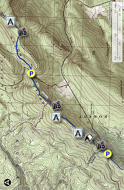
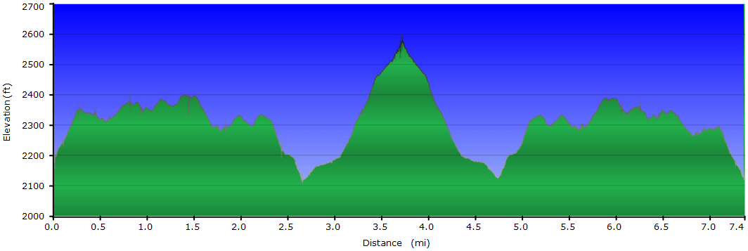
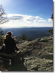
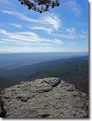
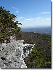
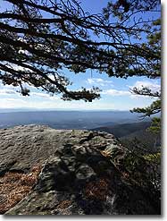
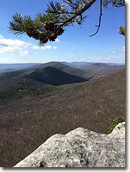
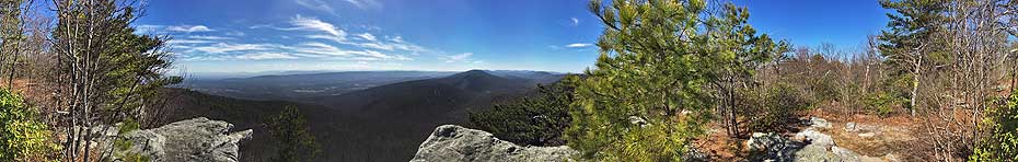
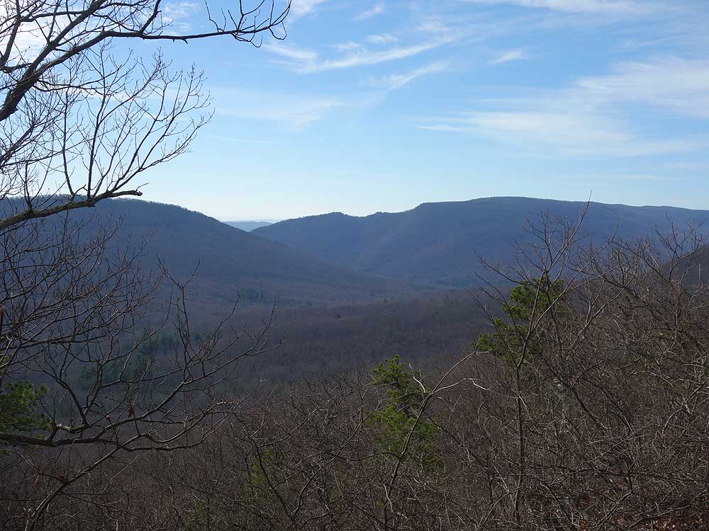
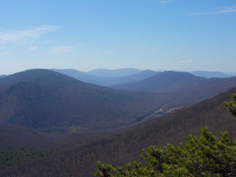
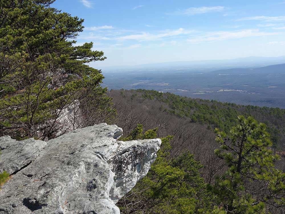
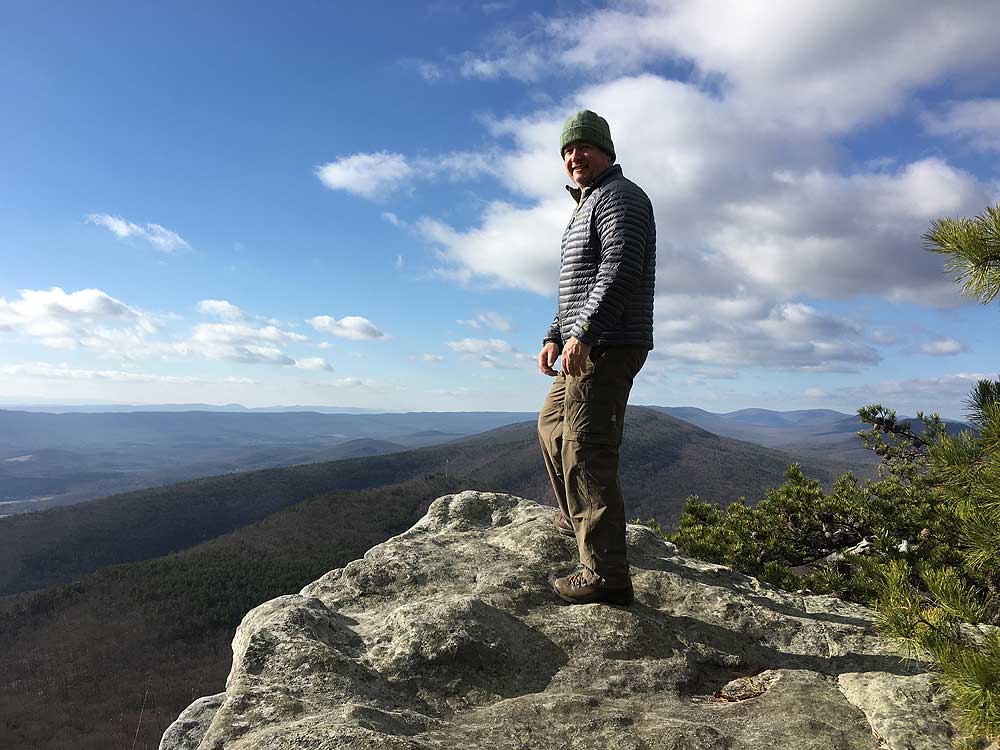
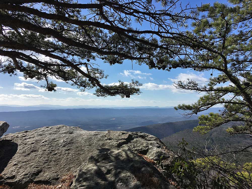
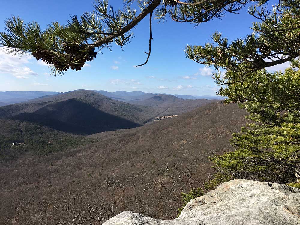
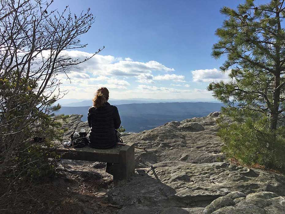
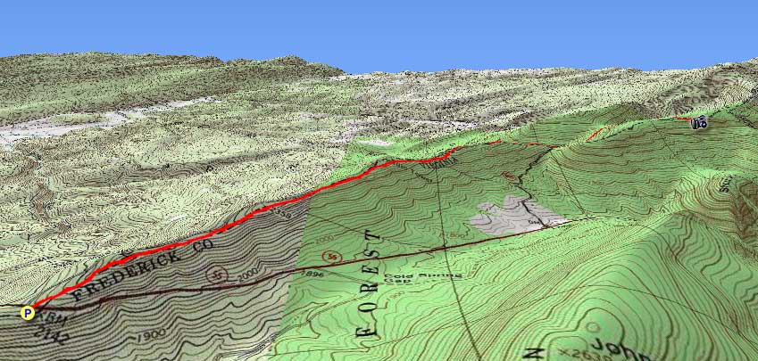
Eagle Rock has some of the best vistas in the Great North Mountain range. The Tuscarora Trail was re-routed in 2014 to include the Eagle Rock Trail, and now this spectacular hike can be done as either a 7.2 mile out-and-back from US48/55, or as a family friendly 2.1 mile hike from Dry Gap VA609. The longer 7.2 mile version also includes a rolling ridge walk with views of Paddy Gap as well as the gap between Paddy Mountain and Short Mountain. The Eagle Rock Trail and overlook have never received the high traffic found on similar hikes such as Big Schloss just to the south.
The Eagle Rock Trail and a portion of the Tuscarora Trail that was re-routed in 2014 pass through the private property of the Capon Springs Hunt Club. Please respect private property, remain on the trail, and practice Leave No Trace hiking etiquette.
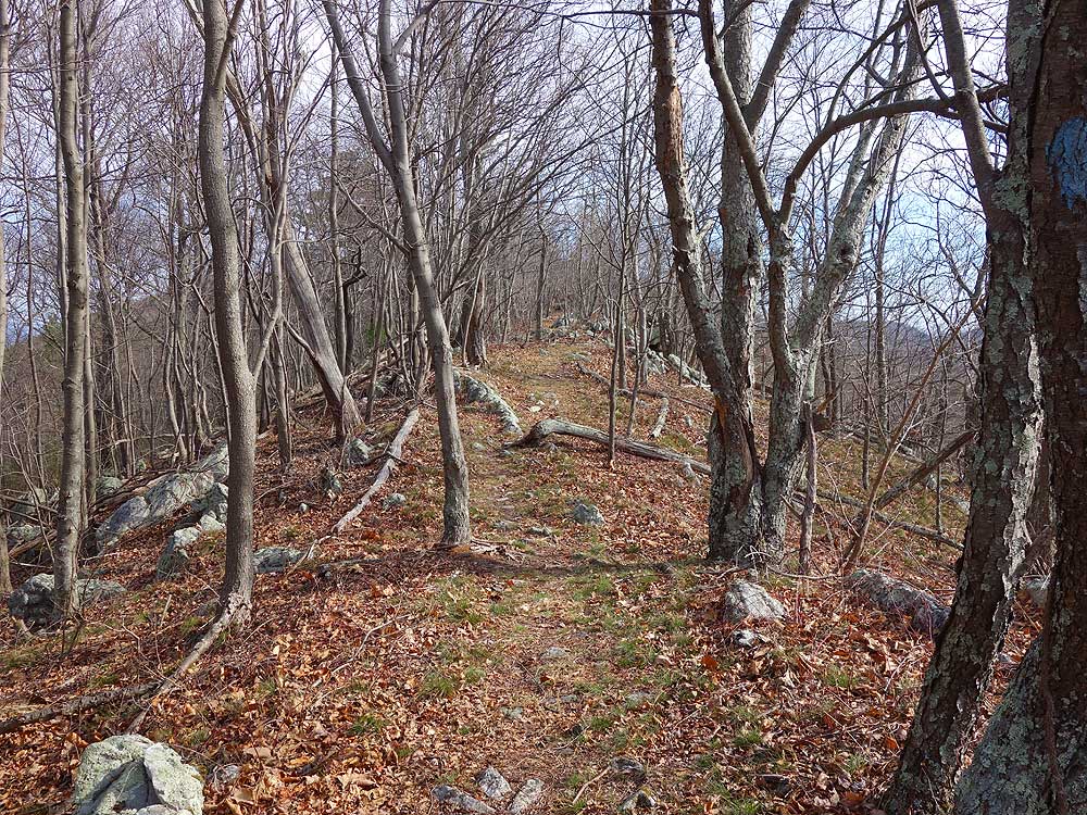
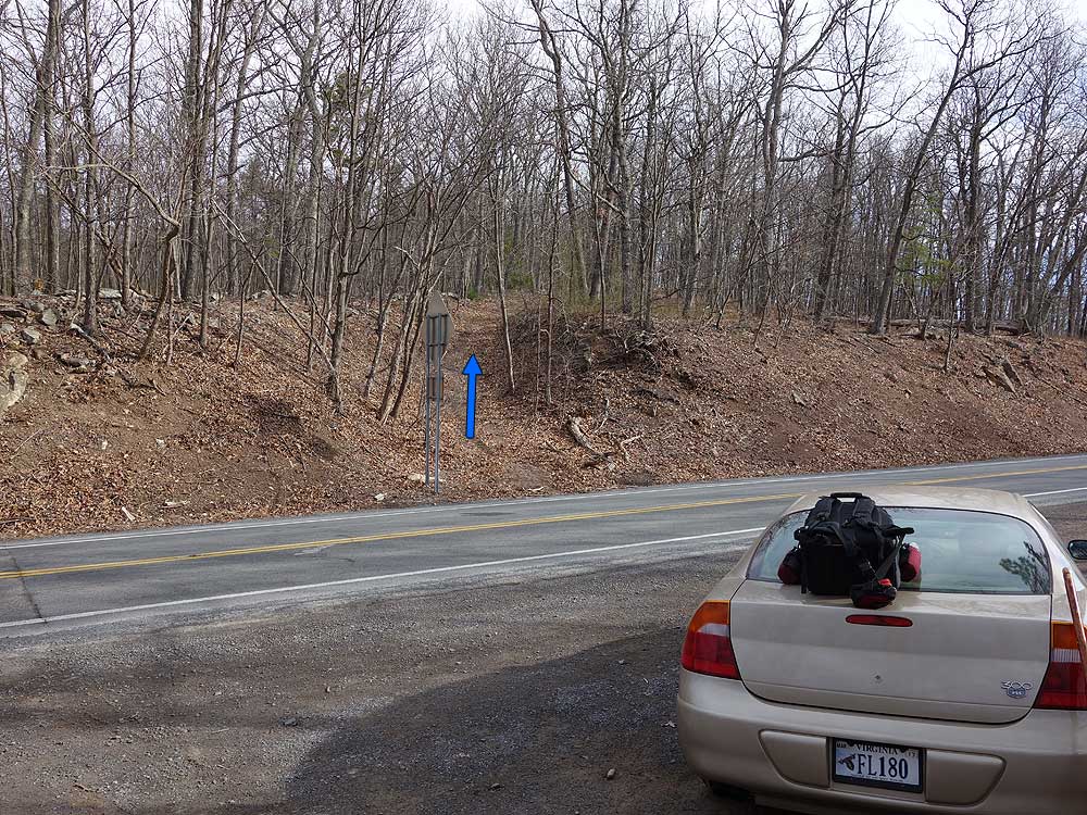
Mile 0.0 - From the parking area along 48/55 carefully cross to the north side of the road. Vehicles crest the ridge here at high speed, so use extreme caution crossing 48/55. In 200 yards arrive at a Y intersection with an old forestry road on the left. Stay right on the blue blazed Tuscarora Trail as it continues to climb the ridge. This section of the Tuscarora Trail from 48/55 to Dry Gap straddles the border of Virginia and West Virginia.
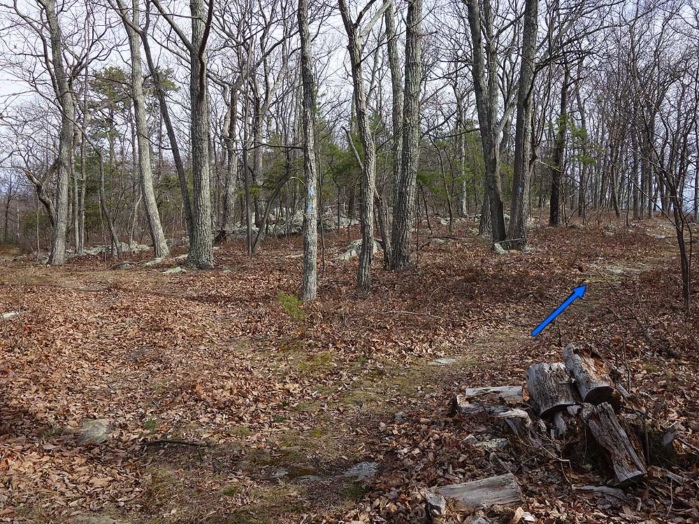
Mile 0.61 - Pass a campsite on the right that has views through the trees of the gap between Short Mountain and Paddy Mountain. There is no water source here, so if you decide to camp you will have to carry it in. From this point the communications tower service road will become more prominent on the left.
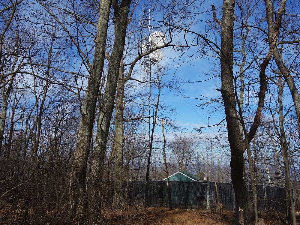
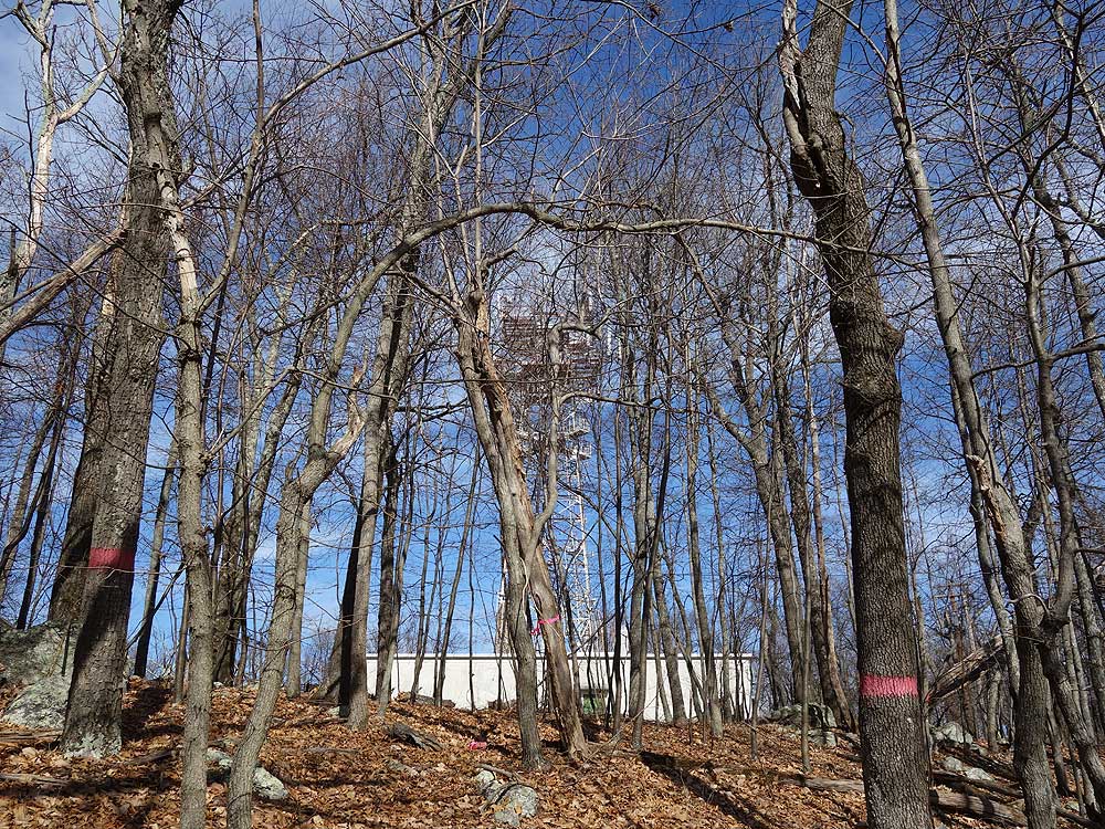
Mile 0.77 - Pass a communications relay tower on the left. The Tuscarora Trail continues on the right side of the ridge.
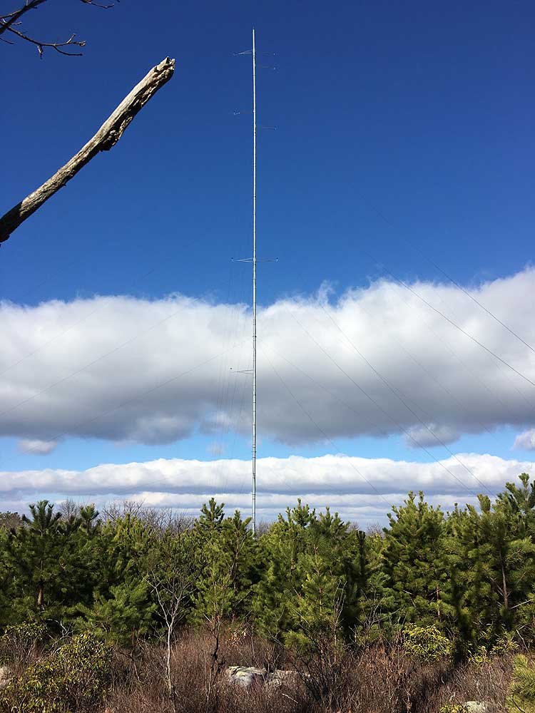
Mile 1.40 - Pass a second larger communications tower on the left. This tower is also a cellular station, so you should have excellent mobile coverage for those serviced by this provider. 30 yards past the tower is a power line clear cut that has a good view of the gap between Short Mountain and Paddy Mountain. The blue blazed trail now descends to a saddle on the ridge.
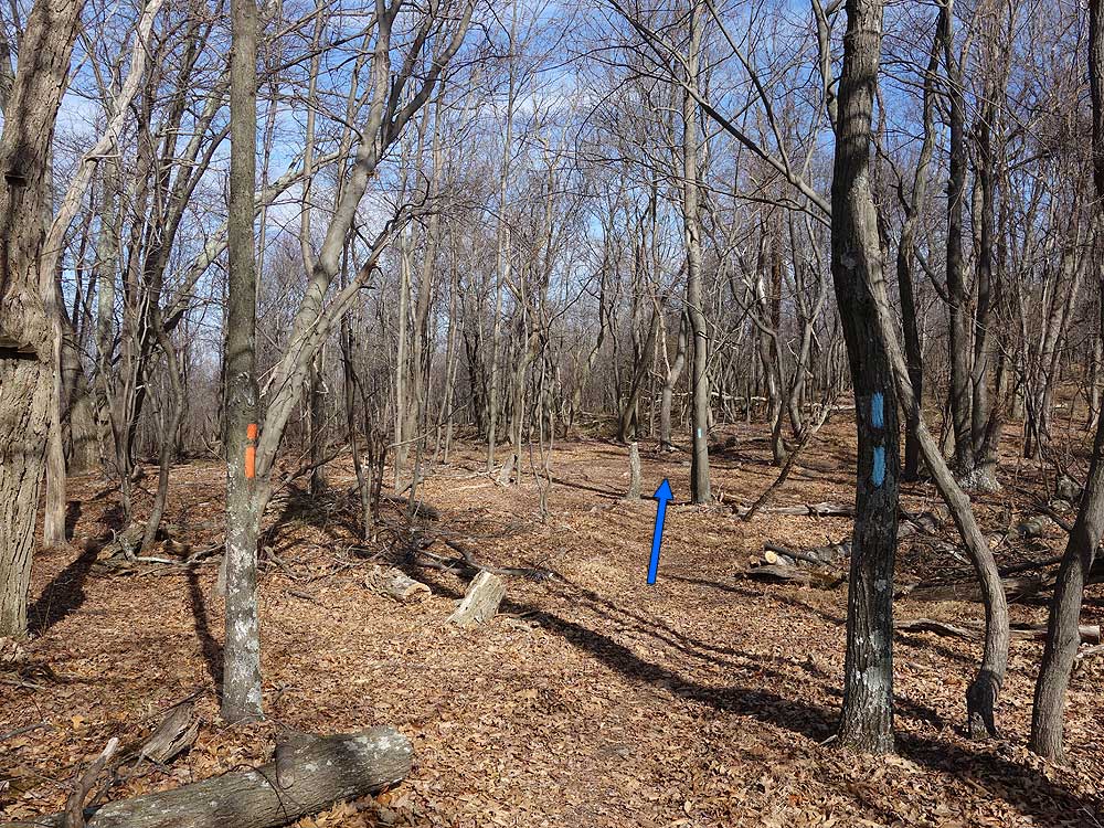
Mile 1.79 - Arrive at the intersection of the orange blazed connector trail to the Hawk Recreation Area. The orange blazed trail was previously part of the blue blazed Tuscarora Trail before the Tuscarora Trail was re-routed in 2014. Stay straight on the blue blazed Tuscarora Trail as it the leaves George Washington National Forest property on the west side of the ridge. The right side of the trail is private property owned by the Capon Springs Hunt Club. Please respect private property and remain on the trail. After passing another knoll the blue blazed trail descends to the parking area at Dry Gap and VA690/Capon Springs Grade Rd.
Mile 3.08 - At the saddle and split in the trail stay right, remain on the blue blazed trail which proceeds more steeply uphill. Just before arriving at the ridge pass through a section of Mountain Laurel.
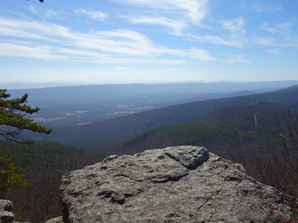
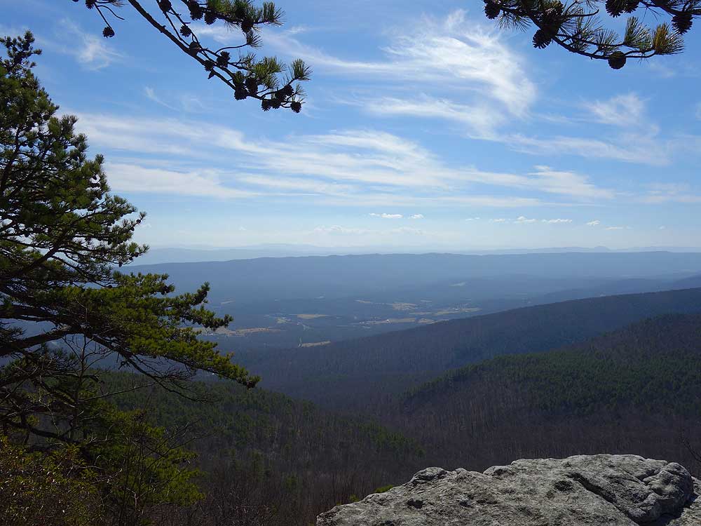
Mile 3.55 - Arrive at the ridge where the trail turns left. Stay on the trail for another 70 yards to the main Eagle Rock overlook.
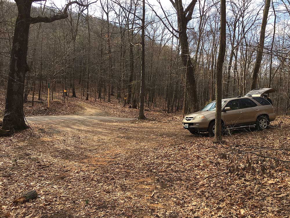
I find some of the comments here regarding parking confusing. If you are taking the longer version of the hike as I did and parking along Route 48/55, you want to be parking along the eastbound side of the road east of the gate. The parking photo shows a car parked near the gate, and not blocking the gate. That's where I parked. East of that point is a wide shoulder on which several cars were parked when I returned. That's apparently OK. In no way do you want any of your car on the pavement. This was a good hike. The cellular tower along the hike I figured out was for Sprint, so those customers will have a good signal. Not many people on the segment between the 48/55 and Dry Gap Route 609 parking areas. About 12 cars were in and around the Dry Gap parking area. The small lot was full and cars were parked down the road along the shoulder -- apparently that's OK. Eagle Rock was crowded -- about 15-20 people, mostly families. Descending from Eagle Rock to Dry Gap parking I passed another 15 or so going uphill. The earlier the better for Eagle Rock if you want to avoid the crowds.
By:Wojo
Rating:
Date of Hike: Monday, October 14, 2019
One of my kids has been bugging me about hiking so I put out feelers and this one was the 2nd most "recommended". I am fat and out of shape and this did exhaust me and the rest of my family. One of the reviewers below comments that their car was towed. NOTE: If you park on the WB side of 55/48 just past the trail, it is clearly marked NO PARKING, so do not park there. I almost did until I saw the NO PARKING sign which could be easy to miss. This was Columbus Day holiday, so both parking areas had 6-10 cars at them each and we encountered several other hiking groups along the trail.
For a first hike, I don't recommend this particular one, however, if you start at the Capon Springs Grade Road point, then Eagle Rock is a great first hike. There is not much to see from 55/48 to the next parking area. The first vista of Paddy's Mountain was nice but it's partially grown in so it's not the best picture spot. After that, there was nothing scenic or picturesque about the rest of the trail until reaching Eagle Rock. We saw no wildlife at all but heard there was a snake on the trail approaching Eagle Rock. There are a could of grades that are steep enough to take the spirit of the out-of-shape. That happened to us.
Eagle Rock's panorama is a definite 5 star view. That made the hike a delight. This was a perfect day to hit the trails. Cloudless sky and 70 degrees. The foliage hasn't changed yet but it's close. The majority of this hike is under the forest canopy so even in the heat of summer, it won't be in direct sunlight. Our round trip encounter took us about 6 hours. We stopped a few times and spent a good half hour on the "rock."
By:Julie
Rating:
Date of Hike: Saturday, October 5, 2019
Very nice hike although easier than a '3' (and I'm an out of shape, old fart). Think it would be even better in the winter. No problems parking on Rt. 55/48.
By:mtnjohn
Rating:
Date of Hike: Friday, August 23, 2019
I have done this hike many times. You will not be towed if you park legally ...duh. It's a pretty easy hike and very scenic. You may see a bear or a rattlesnake because you are in the National forest, though you probably wont see them, just be aware that this is their turf.
We usually do the shorter version as a late afternoon /evening hike. it's nice and if you go in late april/early may you can see the azaleas blooming and they are just beautiful. enjoy and respect.
By:Dan
Rating:
Date of Hike: Tuesday, May 21, 2019
The 7-mile version of this trek is a lovely hike! The majority is a pleasant walk in the woods albeit, there is a generous amount of scree, so be sure to bring boots. The trail is in good condition and is impeccably blazed. And OMG, that view!!
By:George
Rating:
Date of Hike: Sunday, April 7, 2019
No parking on Rt 55. Car was towed. Long hike through the brush to get there. Saw a timber rattler on the rocks at the overlook.......not good!!! On the way back we ran into some other hikers who appeared frightened. Apparently they saw a large black bear. So we all left together. We will never go back. Terrible hike, dangerous wildlife and no parking.
By:Arjun
Rating:
Date of Hike: Saturday, March 30, 2019
We did the longer 7 miles version. It is fairly easy hike with great views from the top. it was little windy at the overlook which made it even better hike.
Parking is limited but we didn't had any trouble parking at 11am. There was still spots left for few more cars but maybe that was just that day. Will do this one again for the views and solitude
By:Rocky
Rating:
Date of Hike: Sunday, October 14, 2018
Great views, well worth the hike. Please be aware the Dry Gap area crosses Hwy 609, not 690 (as in directions), and 609 is a gravel road with little traffic.
By:Landowner
Rating:
Date of Hike: Monday, July 23, 2018
Eagle rock is on private property. Hike at your own risk and please be respectful. No trash or campfires!!!
Watch out for Bears and rattlesnakes!!!
By:Arlene
Rating:
Date of Hike: Saturday, April 28, 2018
Nice day, although cloudy, and finished just before cold front rolled in. A lot more rocks on the trail than I expected. Dogs apparently are permitted, but had to continually watch our step because owners did not pick up after their pets. Horses also use the trail.


