Fridley Gap in the George Washington National Forest has
a little bit of everything. From gentle mountain streams, to
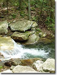
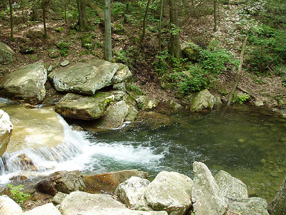
ridge climbs and a great swimming hole this hike has it all. Located at the southern end of the Massanutten range just east of Harrisonburg Virginia the hike is secluded. Consider taking a swim at the Fridley Gap swimming hole which is perfect on a hot summer day a 1/2 mile from the parking area, but remember this is cold mountain water anytime of the year!
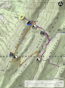
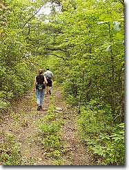
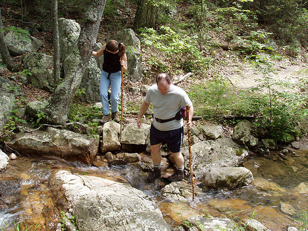
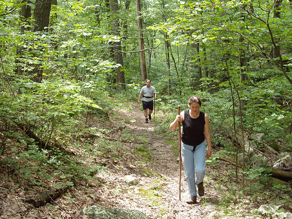
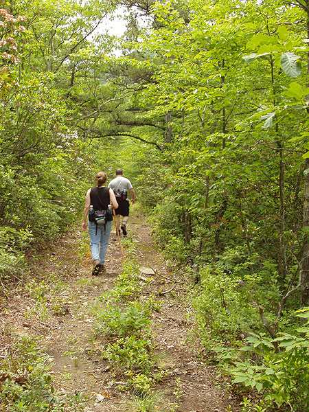
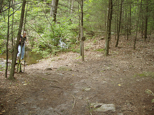
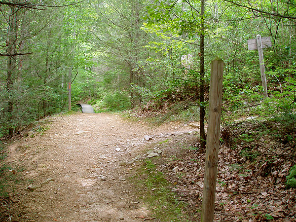
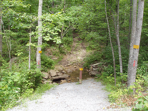
Mile 0.0 - From the parking area on Airey Road walk up to the trailhead of the Fridley Gap Trail where the road turns left towards private property. Follow the Fridley Gap Trail next to Mountain Run on the left bank. The trail will climb through the gap and pass a side trail on the left. This leads to the private road up from the parking area. Continue upstream on the Fridley Gap trail crossing through Mountain Run twice.
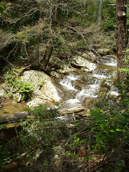
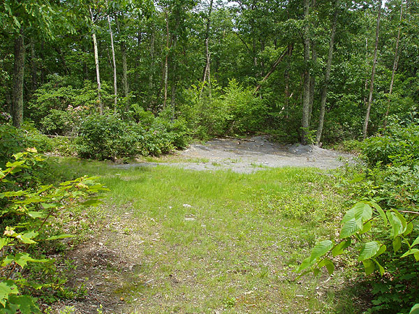
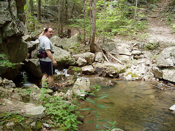
Mile 0.46 - Arrive at the swimming hole. This large pool and table rock falls is a perfect place to take a swim on a hot summer day. From the swimming hole there is a campsite directly upstream, and the intersection with the Massanutten South Trail is in another 100 yards.
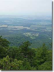
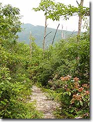
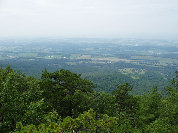
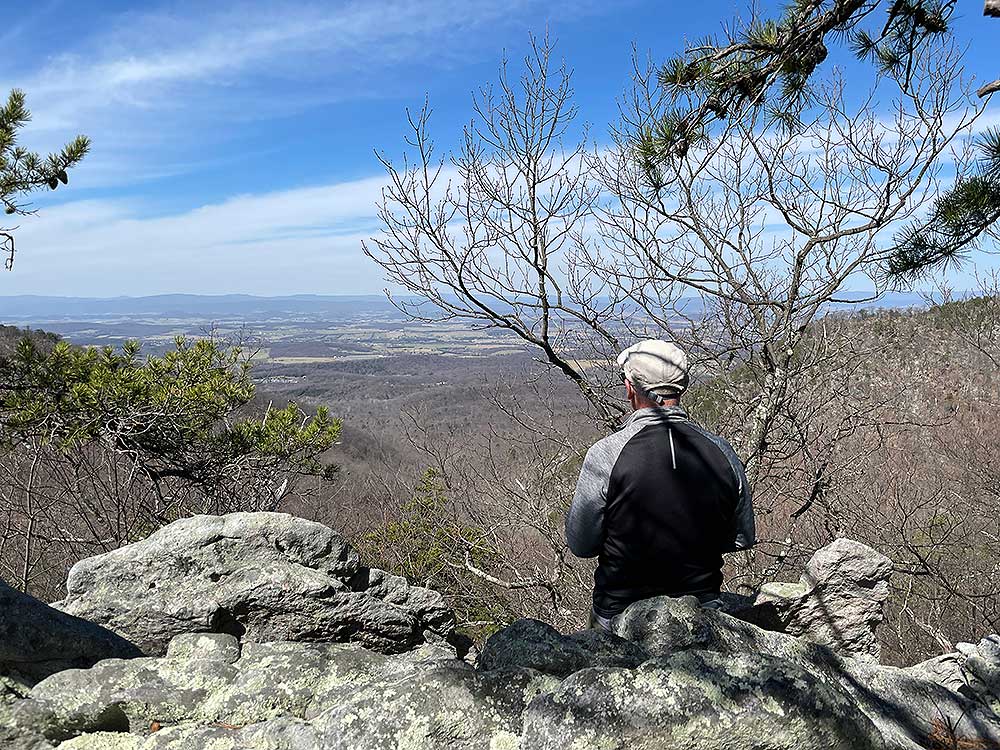
Mile 0.5 - Arrive at the intersection with the orange blazed Massanutten South Trail. Turn right crossing the run. There will be another larger campsite just upstream from this crossing. Continue on the orange trail south as it begins to climb on the eastern side of Fourth Mountain. In 1.4 miles from the run the trail will arrive at the ridge, with an unmarked side trail to a rock outcropping and view westward towards the Harrisonburg valley. There is also a campsite at the saddle here.
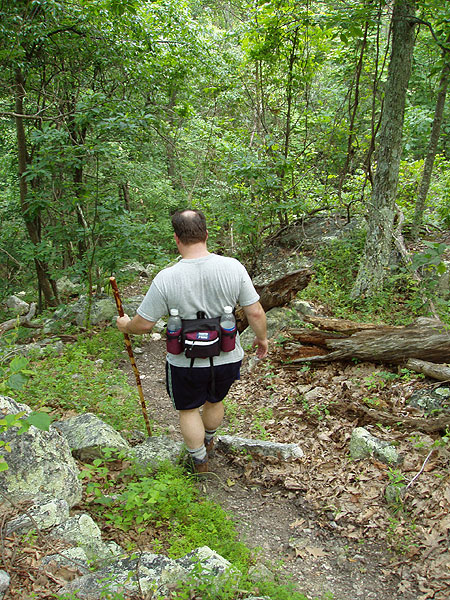
Mile 1.9 - Continue south on the orange Massanutten South Trail as it follows the ridge then makes two switchbacks and descends to Fridley Run. Across the run is a small camping area. Continue upstream for 60 yards then cross Fridley Run. The trail then turns back to the north and climbs on the western side of Third Mountain. Pass over the ridge of Third Mountain and through a small open area. The trail now follows a wider path that also serves as a forestry road, and descends for 0.3 miles to the 4-way intersection with the purple blazed Fridley Gap Trail.
Mile 3.9 - At the 4-way intersection the Massanutten South Trail turns right, with the Fridley Gap Trail coming n from the left and continuing straight. Turn left at this intersection onto the purple blazed Fridley Gap Trail. The Fridley Gap Trail follows a gravel forestry road at this point. The trail will descend for 0.7 miles and arrive at the intersection where the Fridley Gap Trail turns off the forestry road left uphill, and the forestry road continues as the blue blazed Martin Bottom Trail.
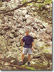
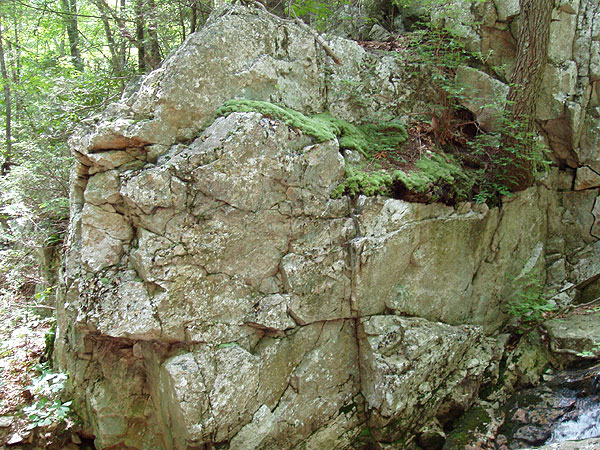
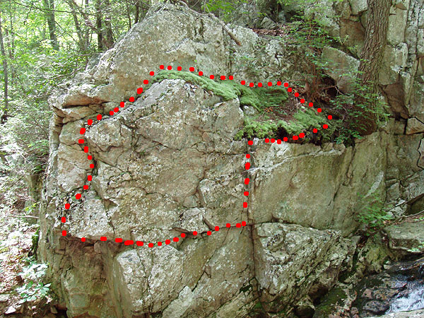
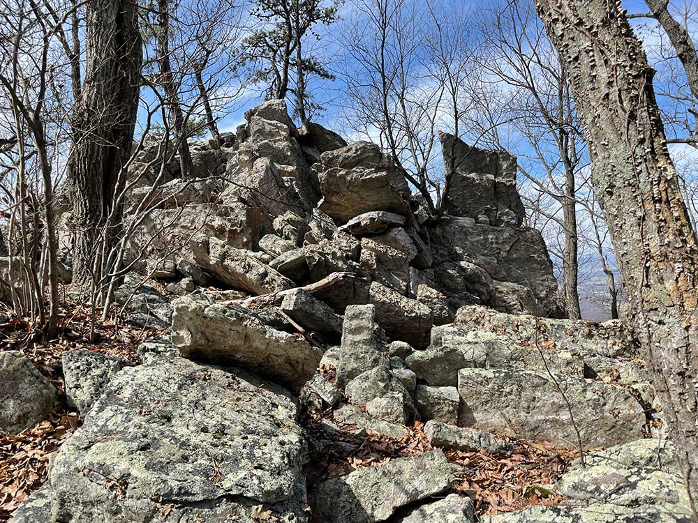
Mile 4.6 - Turn left off the gravel forestry road as the purple blazed Fridley Gap Trail now starts climbing Third Mountain. The trail is rocky and steep and makes several small switchbacks then arrives at the ridge in 0.35 miles. Descend the steep western side of Third Mountain for 0.3 miles where there is a large rock stack 70 yards off the left side of the trail. From the top of the stack there is an excellent view through Fridley Gap to the west. Note: There is no trail to the stack, so if you decide to bushwack to the overlook be careful to look for rattlesnakes in the warmer months. The trail continues downhill and is rocky with only a couple of switchbacks before levelling out, and arriving at the intersection with the orange blazed Massanutten South Trail.
Mile 5.6 - Turn left on the orange blazed Massanutten Trail for 0.1 miles back to Mountain Run and the intersection with Fridley Gap Trail you hiked up earlier.
Mile 5.7 - Turn right downstream on the Fridley Gap Trail passing the swimming hole on the left. Retrace your route back to Airey Rd. and the parking area.
Mile 6.2 - Arrive back at the parking area on Airey Rd.
Late June
Video
Mountain Run Swimming Hole
Fridley Gap Hike Comments
Archived Comments
By:Kevin
Rating:
Date of Hike: Saturday, October 12, 2019
My family and I did a little weekend backpacking trip to Fridley Gap. We got in late Friday evening and set up camp in the spot just above the swimming hole, which was beautiful. I ran most of the trail on Saturday morning, and then hiked to the overlook with my wife and daughter (age 4) later on in the day. Views were fantastic. We had no trouble following the trail. The only part of the description of this hike that I think was maybe off was the Solitude rating. Based on our experience, I would probably give it between a 3 and a 4. We probably saw about two dozen people go by on Saturday and maybe a dozen more before lunch time on Sunday. Not terrible, but less secluded than we were looking for.
By:Emily
Rating:
Date of Hike: Saturday, June 29, 2019
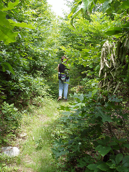
We found this hike to be incredibly challenging to navigate, particularly through the first 1.5 miles of the orange trail past the swimming hole. The trail was non-existent at points, with few markings - most were in the form of orange tape rather than tree marks, and the tape had worn off at points or wasn't visible. Our guess was that the trail was either being sunsetted or simply not maintained. Even the slightly-worn parts were overgrown and difficult to make out. It took us an hour and a half to navigate the woods and make it to the first switchback, at which point the trail unfolded as described in the directions.
The last turnoff on the purple trail goes directly up and over the mountain, and proved challenging to climb and then descend, as other reviewers have noted. Overall, we would return to Fridley Gap but more to enjoy the swimming hole and the several campsites along the water. The hike did not feel like it was worth repeating or trying to navigate again, unless the trail maintenance improved.
By:John
Rating:
Date of Hike: Tuesday, April 16, 2019
A mixed bag...
We found the 1st 5 miles of this hike to be one of our favorites. The hike up Mountain Run (past the swimming hole) was great . Due to recent heavy rains, the water was really flowing. The 1st crossing of Fridley Run was an adventure (with an big assist to a fallen log across the run). The hike up 4th Mountain on the Massanutten Trail was a bit of a slog albeit a fairly consistent grade. The overlook was an excellent place for an early lunch stop.
The second crossing of Fridley Run was far less adventuresome and we breezed up the 1st ascent of 3rd Mountain to reach the purple-blazed Fridley Gap Trail. That trail (road) was pleasant enough until we reached the junction of the blue-blazed Martin Bottom Trail, 1.5 miles from home. From there, you ascend 3rd Mountain again and then descend back to the Massanutten Trail to close the loop.
That 1.5 miles was tough: The 2nd ascent of 3rd Mountain was no picnic - steep and rocky. But it was a tiptoe thru the tulips compared to the descent. It was steep, rocky and rather unpleasant. Good place to turn an ankle. We were glad to reach the bottom.
All in all, a 4-star hike right up to the final 1.5 miles The terrain beyond that point, perhaps impacted a bit by runoff from the earlier rains, lowered our overall rating to a 3-star. All of the trails were well-blazed and the HU map (and descriptions) were spot on. Glad we did the hike as the positives certainly outweigh the negatives. Just save your energy for that 1.5 mile home stretch!
By:John
Rating:
Date of Hike: Saturday, December 1, 2018
Awesome hike. Hiked up to the top of orange trail and stayed their overnight. The campsite is right next to a decent overlook. Would recommend for backpacking.
By:Kris
Rating:
Date of Hike: Friday, June 15, 2018
We were searching for a hike near New Market that would not take too long as we were short on time. We started out at the entrance off Airey Road and LOVED the hike along the water. So many beautiful waterfall pictures especially since we've had a lot of rain and the water was really flowing. The trail was very well marked and we followed the directions from this site and had no problems staying on the trail. It got rather strenuous after crossing the water and heading up the mountain. Just had to take breaks to let the heart rate come down now and then. But we were determined to make it to the lookout. And we did! It was worth it. We sat up on the rock and had our lunch. Amazing! We decided to hike back down the same way we came as we had someplace to be and didn't think we had enough time to do the whole loop. Next time we will do the whole thing. The downhill is hard on the toes and knees. We ended up doing just under 5 miles with different cutoffs for pictures, etc. We saw a total of 5 other people on the trail which is a nice change from some of the other populated trails in the area. Just be careful on all the big rocks - very easy to twist an ankle. Hiking boots and a stick would be beneficial.
By:Mac
Rating:
Date of Hike: Saturday, October 21, 2017
We did this hike as directed in about 4.5 hours, with some longish breaks at the little overlook spur and other spots. The blazes are clear and you shouldn't go wrong if you're paying attention. The parking lot was pretty full but I think that was for the camping spots near the swimming hole, which was really low for this time of year. Past all that we didn't see anyone until we came back down. Speaking of coming down: a heavy crop of acorns plus several inches of dry leaves makes for some very tricky footing... the descent is pretty tough on the knees. My Runtastic app mapped this at 8 miles.
By:Chris Smith
Rating:
Date of Hike: Saturday, June 3, 2017
Reading the previous reviews, intimidated me. "Had to stay over night after getting lost...." While we did the whole trail in about 6 hours, I have to say, this one kicked my rear. After the watering hole, we initially turned right and followed the stream/creek to a dead end. We went back to the watering hole intersection and went the opposite direction. Holy heck, i was not ready for the vertical hike. It felt like I was on a stair master for hours. I wish I had looked at the topo map prior to this outing. I'd have mentally prepared myself. I'm still rehabing an ACL reconstruction and the verticals were harsh but routine stops to reset my heart and breathing. It's beautiful country.
I won't bore you with the whole trek after that first ascent. Several times we thought we were approaching the "3rd ascent" and we were wrong. On the descent, I fell behind the group and wound up going downhill for 30-45 minutes and I kept telling me self, "why am I not hearing the water flowing yet!" There are some great views of the valley. The hike (after that first ascent) was wonderful. The overlook view was gorgeous. I'm definitely glad I went on this hike.
Point of clarification. if you turn right after the watering hole, the trail takes a steep descent on the "right" side of the creek. You should cross the stream/creek immediatetly after turning right at the intersection. Do not following the stream. That is where my group went wrong.
By:Justin Abel
Rating:
Date of Hike: Thursday, November 17, 2016
This hikes is one of my favorites close to Harrisonburg. Some of the turn can be a little tricky but if you follow the maps and pay attention to the color of the blazes you will be fine. If you hike often and are in pretty decent shape you can knock this one out in about two hours.
By:Benji
Rating:
Date of Hike: Saturday, September 10, 2016
Awesome hike! This hike is pretty steep, mostly just on the purple part. I would recommend hiking the whole trail in two days. I camped with two others at the swimming hole and that was very nice. Locals will frequent the swimming hole from an easy access route that doesn't require much hiking so take note that you'll likely run into a handful of other hikers at the swimming hole.
CAMPING: There are 4 or 5 small cleared camping spots along the orange marked trail. They are in decent spots but the only cleared camping spots with easy water access are at the swimming hole. The swimming hole is a great spot to camp, however you will see other hikers there. The orange portion of the trail has fewer hikers and is pretty secluded. Also on the orange part you could stray a few hundred feet from the trail and find a ton of great spots to make your own campsite. The purple portion of the trail is likely too steep to camp comfortably (unless that's what you're in to). GETTING TO THE TRAIL (it's a little confusing): You'll see the sign for Washington National Forest at a gravel road. You can park at the very first intersection but make sure you don't block any direction. Best bet is to parallel park on the gravel road somewhere. You can take Boone Trail to begin. Or you can drive (or walk) up the gravel road to the next trail head. From what I understand, you have to start using one of these other trails.
Message/email me with questions!
By:Roger
Rating:
Date of Hike: Wednesday, August 24, 2016
Hope somebody checks in and reads this to help me out. I "accidentally" ended up spending the night in the park (unplanned as it got too dark for me to continue) and when I was picked up I was told I was near or at Fridley Gap. Now what I'm gonna say next will be hard for most to believe - but I started this trek at the Overlook at Massanutten, just out for a short jog I thought. I had never hiked there or on the Massanutten trails, so I got REALLY off those trails. Anyhow, I know there must be quite a few ways to get onto the trails, so I'm going to do the best I can to describe my last approx. half mile and see if anyone recognizes this and can tell me if it was Fridley Gap/Cub Run. This last portion of my trek was pretty much all a path that followed and was next to a nice stream/creek. At one point the trail even seemed to be right on the creek itself as I had to walk over and on the rocks within the creek for at least I would say 20-25 yards before the path was back on solid ground. Another part of this path split to the left or right - following to the let kept me by the creek, going to the right would have been up a small hill. (I believe both of these trails ended up in the same place though) Close to the end of the trail were a big group of rocks to climb over and the end of the path ended up on a gravel road. There were gravel parking spots on both sides of this gravel road and the gravel road went downhill. I think I saw a sign at the end of this gravel road that might have said it was a private road, but not so sure about that. There was definitely a sign-but not exactly sure what it said. But there were 2 cars in this parking area - one for a camper that was about 1/2 mile in and camped out by a nice flat spot by the creek. Sooooo, by this description, can you tell me if this sounds like Fridley Gap / Cub Run? Thank you!!


