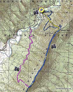
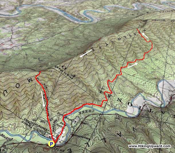
The main attraction of the High Peak hike, located in the George
Washington National Forest, is the unbelievable picnic area
at Elizabeth Furnace. It is huge! Although there aren't many
views and the trail is somewhat rocky it's a great hike to take
with a group in the morning and then picnic afterwards.
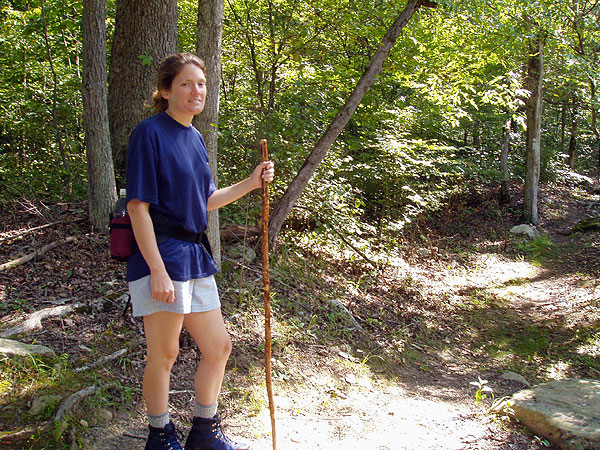
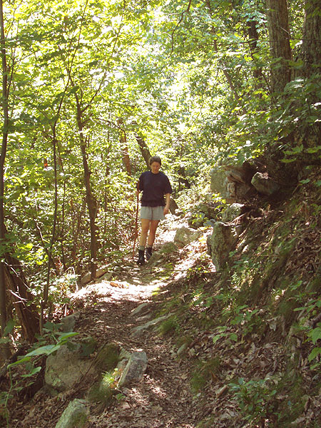
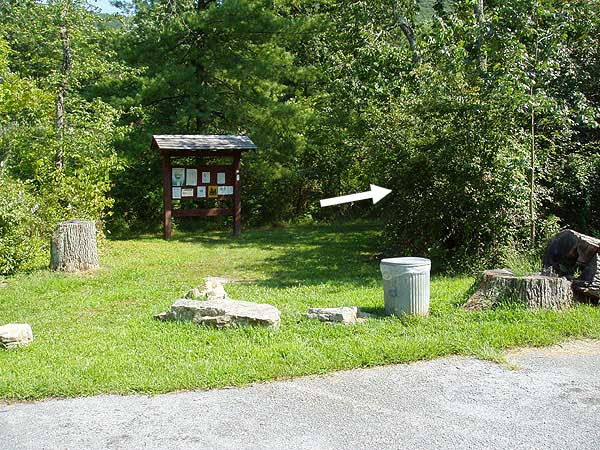
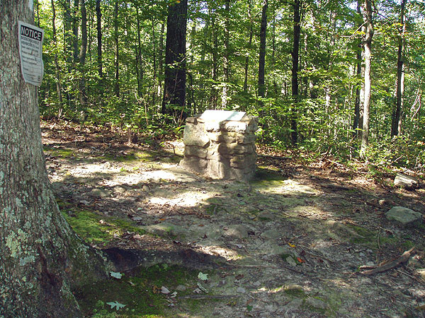
Start on the right of the main parking area where a forestry
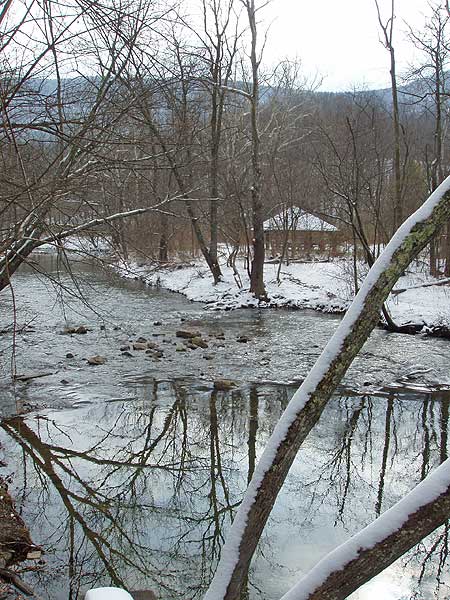
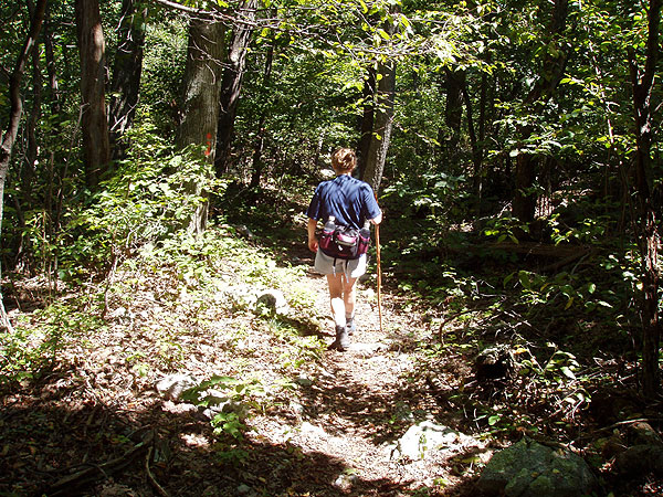
service bulletin board marks the hikes beginning. Follow the white trail markers through the picnic
grounds
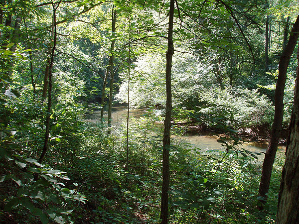
for 0.3 miles until the trail intersects Passage
Creek and turns left uphill following the creek.
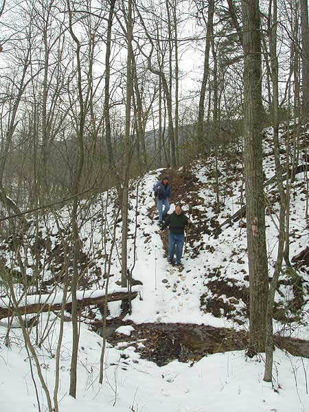
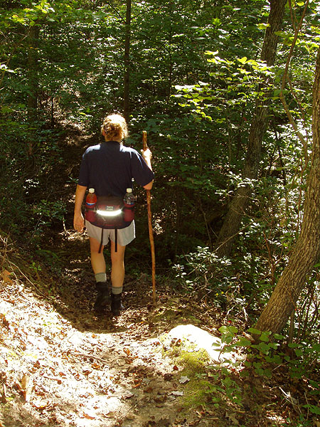
After 0.7 miles the white blazed connector trail intersects the
pink blazed Sherman Gap Trail.
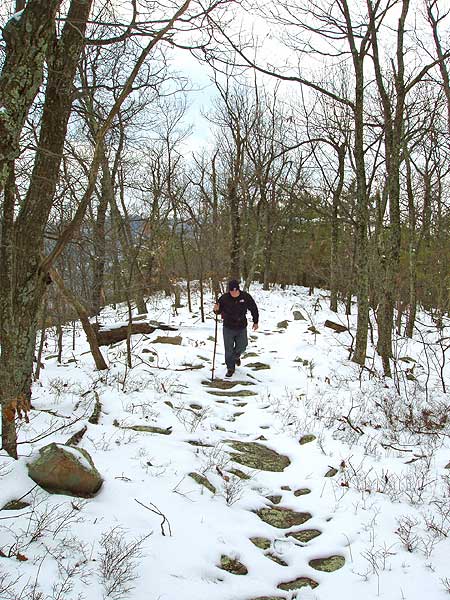
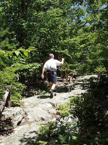
Turn left uphill on the pink blazed trail for 2.5 miles for the steepest
portion of the hike as it traverses
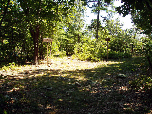
the mountain then ascends steeply before reaching the ridge line intersention of the blue/orange
Tuscarora/Massanutten Trail.
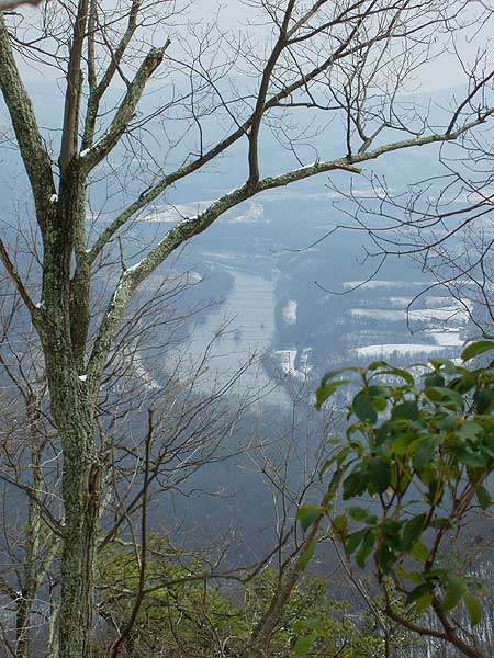
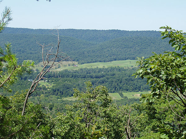
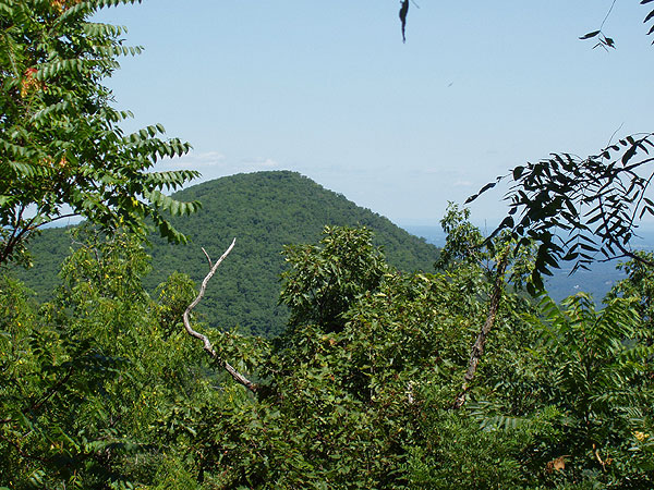
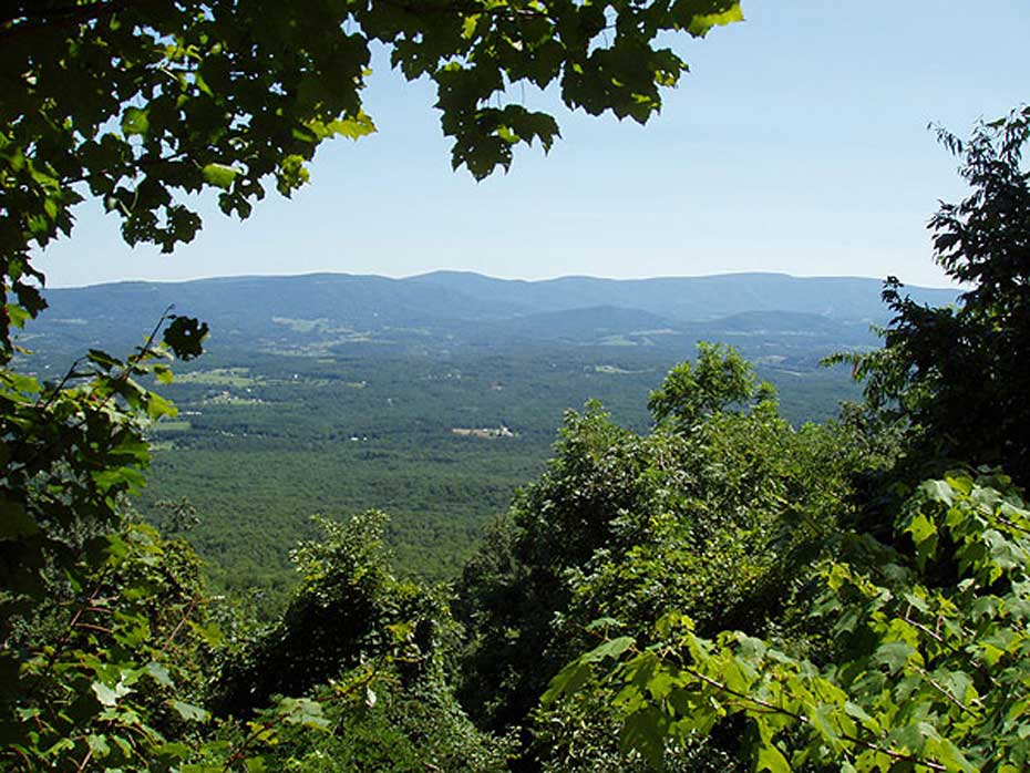
Side hike: If you like views and
don't mind a little more hiking go right/south on the old Massanutten
East trail from it's intersection with Sherman's Gap Trail
(Pink) for maybe 1/2 mile tops. To the left there is a small
rock ledge on a sharp point that juts out into the valley with
some stunted pine trees ... great view of the Valley and River
at the area of the river known as " The Point" for
obvious reasons. Just before this is a bit of a saddle. If
you find yourself hiking there in June you catch the sweet
scent of Fringe Tree (AKA Old Man's Beard). There is a thicket
of them to your left as you head south.
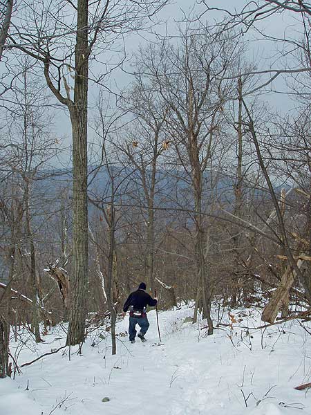
If you did not take the side hike above turn left/north and
follow the orange/blue blazed trail along the ridge for 2.3
miles, traversing High
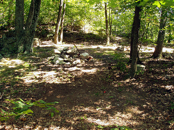
Peak, before passing one of the only
campsites and arriving at a four way intersection where
the blue/orange trail now turns
left downhill.
Either turn left downhill on the blue/orange blazed trail or take the yellow blazed Shawl Gap Trail (opposite the camping area you passed 15 yards back) that is more direct, however this trail is no longer maintained and has many blow downs. Either trail brings you back to the picnic area. Continue straight through the picnic
area, arriving back at the car park.
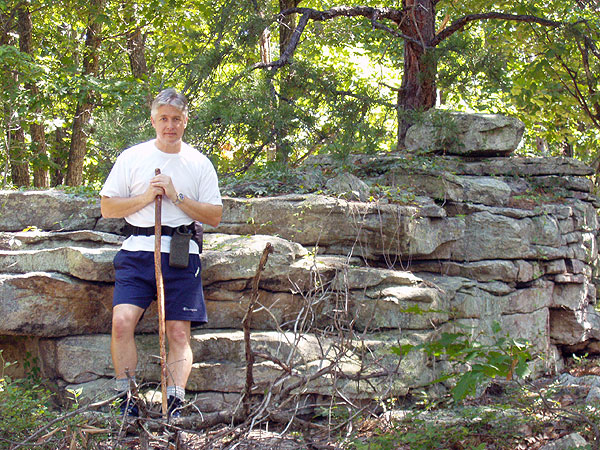
Late February
Late August
High Peak
High Peak Hike Comments
Archived Comments
By:Sean
Rating:
Date of Hike: Wednesday, February 21, 2018
I overdid it taking on this level of hike after being idle for quite a while. I ran out of water, too. (Took one quart, could have used two.) Though I didn't have a great day, that was mainly me -- it's a good, rocky, hike. Good views as there were no leaves -- there won't be many views when the leaves are filled in. Some interesting rock outcroppings. I did not take the side hike given the reviews of others.
Turning downhill back toward the Elizabeth Furnace area you are given two choices -- a straight yellow-blazed trail and a longer, curving orange/blue-blazed trail. I recommend the orange/blue blazed trail. The yellow blazes are no longer present on the shorter trail. You can make out the trailhead opposite of the campsite mentioned in the description, but there are two tree trunks laid down. The feeling is "keep out." Maybe they are trying to prevent erosion as it is a steep, straight shot. I started with the orange/blue trail which intersects the formerly-yellow trail several times. At the first intersection, I was really tired and thirsty and thus started down what remained of the shorter "yellow" trail. Soon, on the left, I found a trickle of a spring (the only one I saw in the hike) to my great relief. I continued down the "yellow" trail to near the end, where I lost it when it intersected an Elizabeth Furnace interpretive trail -- I got on that and it was a short downhill walk back to the parking area. My shortcut wasn't that bad. There were about 10 fallen trees, but the fallen leaves weren't being packed down by hikers and the trail is so steep the leaves are slippery -- I had one fall. Thus, the shorter trail is not recommended but if you are desperate for water you may find some on it about a third of the way down if the spring is flowing that day.
The main picnic area parking lot was closed and signs say it is closed roughly October through April. You can park in an earlier, smaller lot near the road. The trailhead bulletin board referred to in the description is hidden behind trees and brush near the end of the larger parking lot. There are "vault" toilets, one of which is open in the offseason.
By:Ed Matthews
Rating:
Date of Hike: Sunday, February 12, 2017
We set out to hike the Little Crease hike as documented here on this site and the hike we took is the combination of that one and this one. This is a hike that is best done in winter because the absence of leaves leads to much nicer views. Alas for us, Sunday started rainy and the low clouds over all the valleys obscured the views, especially of the river, and left us with blazing sun and wearing shorts above the clouds at elevation and sweating under rain gear in the clouds.
When I looked at the Little Crease hike on the map, I couldn't figure why it would be an out-and-back when you could just as easily go back to Elizabeth Furnace via the Massanutten/Tuscarora to Shawl Gap and then down the hill to the parking lot. So we made a loop of it, roughly 10.5 miles on the day, and I come to discover that this is the hike documented here as the High Peak Hike.
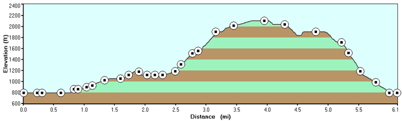
The white-blazed trail along the creek was pretty muddy but the initial climb up after joining the pink-blazed Sherman Gap trail was steady and easy. Then the trail takes a hard left east and starts to really climb. And it's not a level 3 difficulty climb. It's a hard climb more in line with a level 4 difficulty, but not so hard as say the climb up Cedar Run in SNP. Still, even though I hike constantly, it was a heart-pumping climb.
There's a lot of rock too. Along the ridgeline from Sherman Gap to Shawl Gap, the rocks start to remind me more and more of Buzzard Rocks just a bit further north and because of all the rock, it is hard to make time on this trail. And certainly impossible on a rainy day when everything is slippery. I'm not a fast hiker and I'm not a slow hiker, but the four hour estimate listed here is certainly unrealistic. I think you should plan on 5 hours plus a half hour for lunch, and even more time if the weather is wet. Note that this includes time to climb Little Crease and walk the half mile to the Shenandoah River overlook.
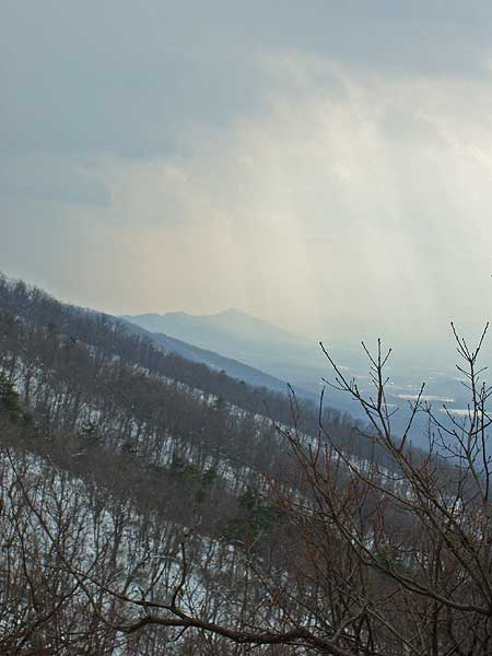
The views on top of Little Crease were really nice (but you wouldn't see much of anything in the summer) especially looking back at High Peak and Buzzard Rocks sticking up out of the clouds. Ditto over at the rock overlook: we couldn't see the river, but the peaks of SNP sticking up out of the clouds were cool. A nice spot for lunch before doing a 180 and heading back.
Coming back via Shawl Gap, the switchbacks on the official trail coming out of the gap are a long, long pain in the butt. You can save a half an hour by heading straight down the jeep road. If I ever hike this again, I won't do the pointless, pointless, long, and endlessly meandering switchbacks.
By:Diego S
Rating:
Date of Hike: Sunday, October 2, 2016
As others have said, there is no real view as is suggested if you head south when you get to the top of the ridge. Don't even bother with it.
This hike didn't have much to offer once we got away from the Elizabeth Furnace recreation area and Little Passage Creek. The last half mile or so on the Sherman Gap (pink) Trail was easily the most strenuous park of the hike. Once upon the ridge line, views of the valley to the east are obscured by the forest. For the last portion back down the mountain, we started out on the blue/orange trail. The Shawl Gap (yellow) trail was not visible, or maybe I didn't look hard enough. At the first crossing of the yellow and blue/orange trails, we switched to the yellow trail. It is no longer maintained and I didn't see any yellow blazes, but it is a clear trail, and a straight shot downhill. We ran into a few blowdowns which were not difficult to get over. Taking this trail instead of the blue/orange definitely saves time.
I would rate the views as a 2 for this time of year. While there are only two campsites (I think) on the trail, there is abundant camping on Fort Valley Road (SR 678).
Our hike was about 7.85 miles if you start the count right from the parking lot.
By:Windy
Rating:
Date of Hike: Friday, July 3, 2015
Rocky path and a long climb up, this is a quite unexpectedly strenuous hike to me.
I attempted to do the side hike but even after having walked more than additional 0.5 miles (one way) I could not find what described in website as 'a small rock ledge on a sharp point that juts out into the valley with some stunted pine trees' so I turned around and continued to the main path.
Also, at the last part of the hike there are two options, turn right to the orange/blue trail which is more maintained but not straight forward, and the yellow trail which is less maintained but more straightforward. I took the orange/blue trail only to find myself regret my choice.. the route was indeed clear but it was a long switch backs. I was already tired and wanted to get back to the parking area so bad, it was frustrating to see the track in my gps that I was almost getting into the starting point direction but then turned away to other directions again and again, basically zigzag-ing down the hill. Luckily, at one point I saw on path 'cutting' the zigzag and instinctively I turned left and follow that path. This path took me to the parking area quickly - so I guess that was the yellow path (no yellow markings though). This path was not bad at all in terms of maintenance, I should have taken it the first time to save energy and time.
I finished the whole trail in 4 hours and 47 minutes, plus some additional breaks in between the climb up. Not so much view, and only met one couple on my way down. There were only 3 cars at the main parking area when I got back.
By:aldikuma
Rating:
Date of Hike: Sunday, October 12, 2014
It was a rainy, cool day but turned out to be nice for hiking. I really look for solitude and views most of all when choosing a hike, and this one delivered on the solitude and somewhat on the views. During the winter the views would be beautiful, and now that the leaves are dropping there are definitely more opportunities for views than in summer.
Finding the trail head was easy, as there's very clear white blazes on the trees next to the bulletin board. If you're facing the bathrooms, go to your right to the end of the parking lot.
The fog rolled in as I reached the ridge, so I didn't see much, but the mist mixed with the colors on the trees was gorgeous. Most of the trails are covered in leaves now and as mentioned, it's rocky, so it was slippery in spots.
The climb up the pink/Sherman Gap trail was a a great workout it would be a good workout clockwise, too! I ran into two people fishing at the beginning along the water and two trail runners on the ridge. I can see this being a crowded trail on a sunny fall day, though. I did the Veach Gap hike last weekend, so it was neat to see the sign at the intersection of Sherman Gap and Tuscarora/Massanutten trails pointing in that direction. I did not take the side hike.
The yellow blazed trail is right across from the campsite and very obvious, taking you straight down the mountain. Though the blazes are visible but very faded, the trail itself is obviously very used, wide, and easy to stay on. If I had time, I would've take the longer blue/orange trail, but it intersects with the yellow trail three times, so the choice is yours all the way down, actually! Once you reach the flatter part of the yellow trail, there's a few trees down across the trail, but easy to get over. Then, there are a couple of trails with historical signs along them, as this area once was used for the production of pig iron. Stop to read the signs on the way back. Any of these trails will take you back to the parking lot.
By:FuzzyLabRat
Rating:
Date of Hike: Friday, September 12, 2014
My primary disappointment with this hike was the lack of views and somewhat inaccurate distance measurement. After reaching the Massanutten/Sherman trail intersection, I ventured southward to locate the side hike mentioned here. The trails crisscross several times here (Massanutten, Tuscarora, and Sherman trails). Looking at my topo, I stayed on the orange-blazed Massanutten trail for approx .45 miles, but never came to a clear 'point'. Also, the trail in this section appeared to be rarely used, had several loose rock slides, and was generally overgrown and narrow. Oh well, nothing risked, nothing gained I suppose... After backtracking, I continued northward on the Orange/Blue blazed trails as described. Regrettably, I never came to any areas with enough clearing to get a view to the east or west. 3 miles on the ridge with barely a peek of what lay in the valley was disappointing. I prefer not to bushwack, so that may have contributed. Lastly, the final decent back to the start of the hike is pretty steep. The yellow trail was easily located and, most definitely, was abandoned as written. Several tree blow-downs and a lot of wash-out. What I didn't realize is the blue-blazed trail recommended as the indirect route added over 2 miles to this hike! Thankfully it crosses over the yellow trail several times, and I abandoned it for the more direct route on the yellow. My detour south, decent down just part of the blue trail, and 1.5 mile in/out hike to the camp area turned this into a 10+ mile hike, so plan accordingly. I underestimated it for sure.
I may attempt this again in the Fall/Winter when the foilage has dropped -- I could tell there was some great views to be seen, but just blocked by the summer tree-cover. Wouldn't recommend in August for sure.
By:MickeyS
Rating:
Date of Hike: Saturday, December 28, 2013
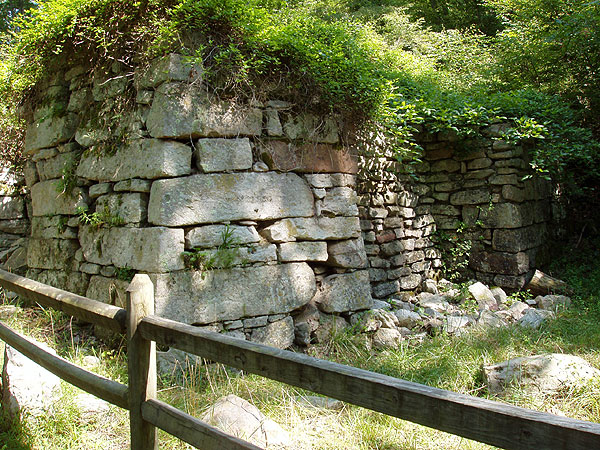
Elizabeth Furnace being among the favorite places my wife and I like to visit, I decided that it was time for me to check out the hiking in the area. Having found High Peak on HikingUpward, I picked a Saturday, loaded my pack and headed for Elizabeth Furnace after dropping my wife at work. I arrived at approximately 7:30 and found my first challenge was finding the Forestry Service bulletin board as it was behind some trees as I approached through the parking area. Silly me, I assumed it would be out in the open and easy to see. Following the white blazed trail (I was later told that it was the Botts trail) for about 3/4 mile I came to the intersection with the pink blazed Sherman Gap trail and turned left. Here the hike begins in earnest as you make your way SSW along the mountain side through the rocky path for a little over two miles. With some wet weather not long ago, I found that myself making about 7 stream crossings, only one of which did not present some well placed rocks for crossing. The last 3 or 4 tenths mile of the pink blazed trail takes you up the hillside and to the ridge. Here it's very steep and rocky. You should keep a good eye out for the pink blazes as you ascend since the trail is not really obvious at times (good advice for the rest of the trail as well). At the top, you'll find the blue/orange blazed Tuscarora/Massanutten as it intersects with the Sherman Gap trail. I choose not to take the hike out to the point as suggested in another review but turned left and followed the ridge north for the 2.3 miles to the four way intersection. Though there were some nice views to be seen along the way they weren't very camera friendly so I didn't bother with any photos on this trip. I did enjoy looking at all the rock formations along the way found a quiet spot for lunch. I was probably out for 4 hours or more before seeing anyone else on the trail so i thought that this hike offered a good deal of solitude. It was quite a workout, even on the decent, as the trail could be narrow and rocky much of the time. I chose to continue down the blue/orange blazed trail back to the picnic area, making my last stream crossing over a foot bridge and past the ruins of Elizabeth Furnace. Having stopped for nearly an hour for lunch and taking my time climbing up the steeper portions of the trail, I finished up around 2:30 in the afternoon making this a 7 hour hike. I highly recommend this hike for anyone seeking a bit of a challenge. It doesn't offer much in the way of views unless you choose to make a side trip or two, but if you stop on the way up Sherman Gap trail and look behind you to the west you will catch glimpses of the valley below. All in all, a hike that would merit 5 stars if the views were better, but I loved the workout so I feel good about a 4 star.
By:J porter
Rating:
Date of Hike: Saturday, November 30, 2013
Great hike until I got to the end of the blue blaze trail and there's a big arrow pointing to a yellow blaze trail. Since it showed yellow on my map, I followed it. Big mistake. After about a mile I realized I was in the wrong place and had to climb back up and over the ridge. Just follow the blue /orange blaze to get to the parking lot.
By:HeatJack
Rating:
Date of Hike: Tuesday, May 14, 2013
I parked in the Elisabeth Furnace parking area, walked towards the right to the camping area where the big bulletin board was and followed the direction given and could not find any white trail markers for The High Peak hike anywhere. While the Pig Iron trail was an interesting distraction, I really wanted to find The High Peak Hike. Could anybody help to tell me what I did wrong?
By:kackeroo
Rating:
Date of Hike: Saturday, October 2, 2010
Some friends and I were camping at Elizabeth Furnace on Friday night. Unfortunately, they had to bail late Saturday morning, so I searched through my trusty hikingupward maps (which I keep in my car) to find a suitable hike for me and the dog. I picked this one since it was shorter, plus it was on the east side of EF, which I had yet to explore north of Veach Gap. The first part of the hike along Passage Creek was nice, only ran into one family that was just wandering up and down the creek portion. Once on the Sherman Gap trail, I had it all to myself. The hike up Sherman Gap trail was pleasant at first, but towards the top it gets very steep and rocky. There is a nice spring near the start of the SG trail. The last part of the climb was very challenging! Some very cool natural rock formations towards the top. At the Sherman Gap/Massanutten intersection, we stopped for lunch. We chose not to do the side hike to The Point, mainly due to time constraints. The hike along the ridgeline was a pleasant relief. The blazes are sometimes hard to spot, especially the blue ones. One advantage of hiking with my dog is she always knows where the trail is, even if I'm not sure. The trail was not well traveled, as we knocked down upteen-skinnie8 spider webs along the way. Saw some fresh (<1 day old) bear scat on the trail, but no bears. Not any great viewing spots on the ridgeline, but still able to see some views through the trees. The trail along the ridge doesn't take you TO High Peak, you actually go just below it on the east side. We turned downhill at the next intersection following the blue/orange trail. We did not see any yellow blazed trail on the upper section, so we followed the orange/blue blazes. There was a HUGE blowdown near the top that was fresh and had to bushwack around. We came to an intersection that was not blazed, but I guessed it was the "yellow" trail mentioned in the directions. It looks like an old fire road. We took it straight down for a while, then picked up the orange/blue trail at the next crossover since my knees were complaining. There is an unmarked trail towards the bottom that goes left at the point where the blue/orange trail turns sharply right, we took it and it links up with the Pig Iron trail. We took the PI trail back to the picnic area. We started the hike at 12:30pm and finished just after 5pm. Overall, it was a good workout, and I'm glad I explored that area, but it was just "eh".


