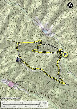
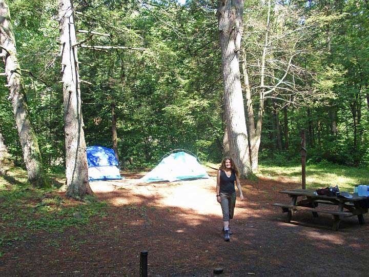
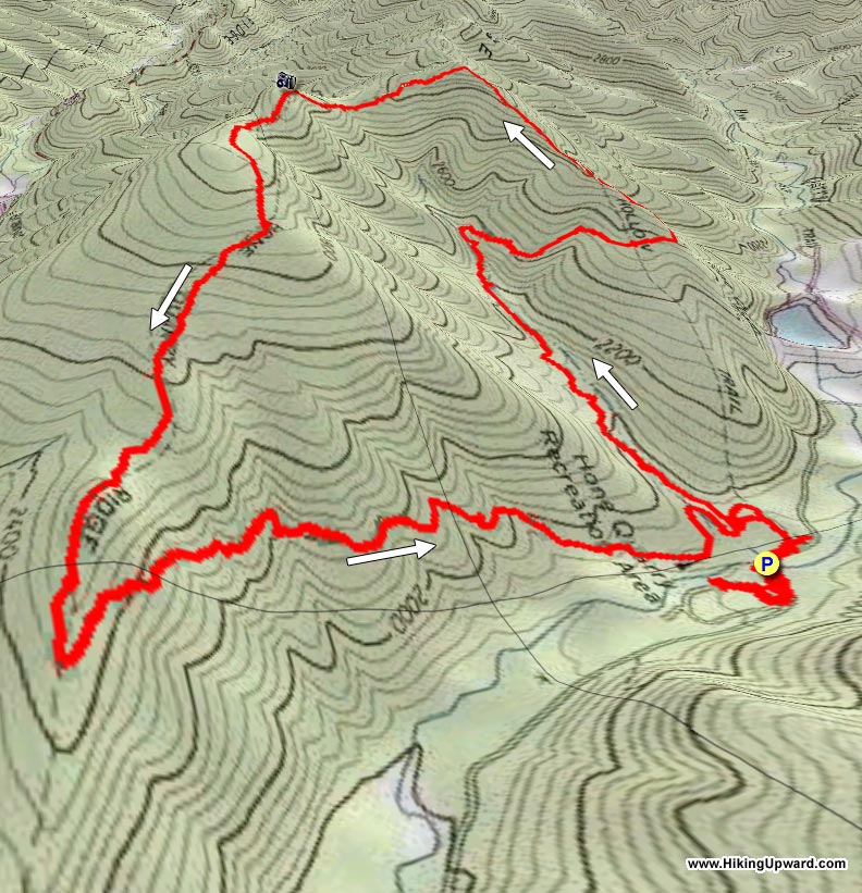
The Hone Quarry area is nestled in a quiet area of the GWNF just west of Harrisonburg VA. With two beautiful loop hikes, one up Oak Knob and Pond Knob with two overlooks, and the other on the opposite Hone Quarry Ridge also with a beautiful vista at the Abbie Point overlook. The valley also has great camping at the Hone Quarry Campground (vid).
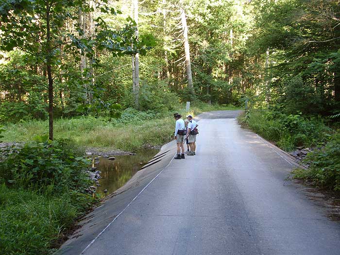
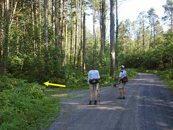
Turn left out of the Hone Quarry Campground on Hone Quarry Rd/FR62 and shortly cross Hone Quarry Run over a spillway. In 200 yards turn left on the yellow blazed Big Hollow/430 trail. In 0.1 miles arrive at the intersection of the Heartbreak/435A trail.
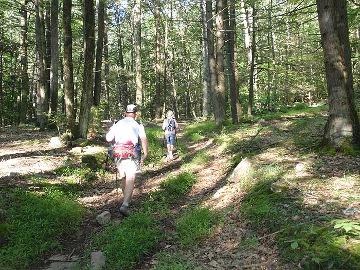
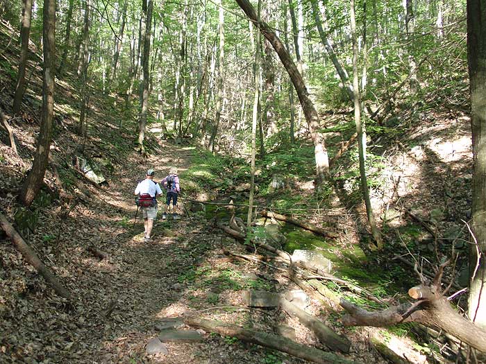
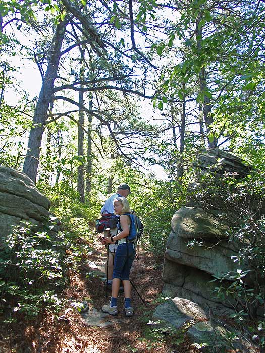
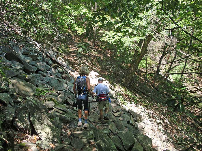
Stay right on the Big Hollow trail as it starts ascending the mountain next to a stream for 0.8 miles before making a switchback to the right. In another 0.3 miles the trail will cross an abandoned fire road, then pass back around a spur before heading uphill and joining the abandoned fire road in another 0.4 miles.
The Big Hollow trail becomes wider where it joins the abandoned fire road, and also steeper without any switchbacks for the remaining 0.7 miles to the ridge, and intersection of the Hone Quarry Mountain/435 trail.
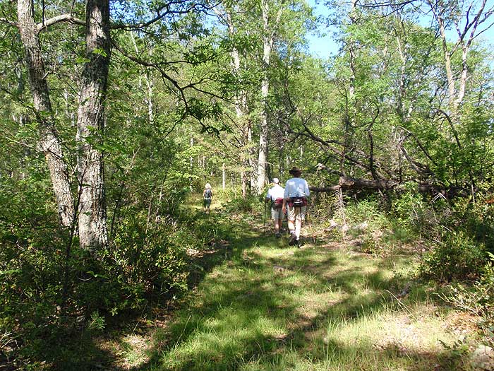
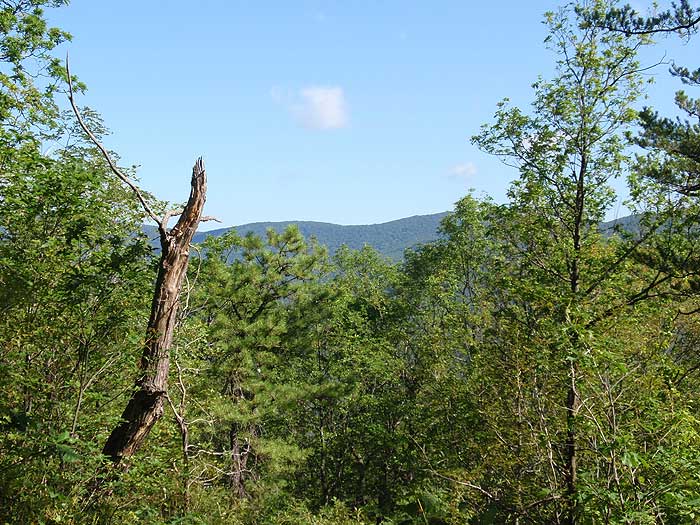
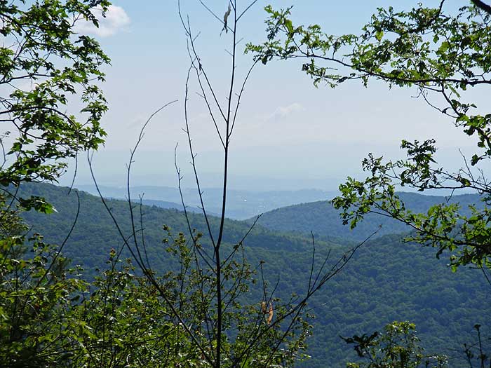
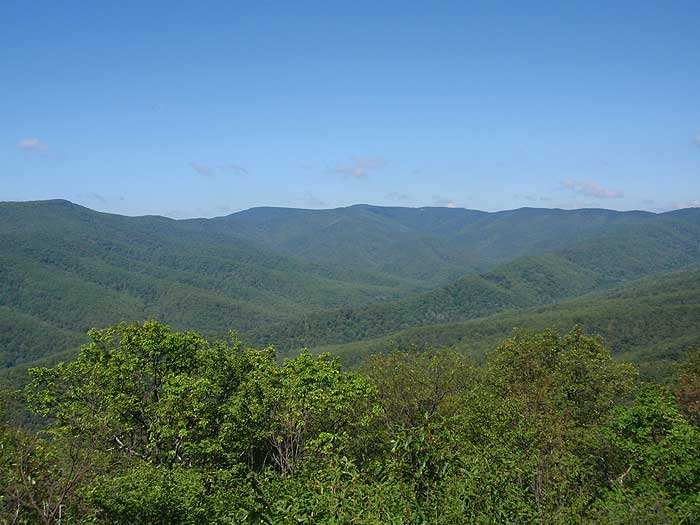
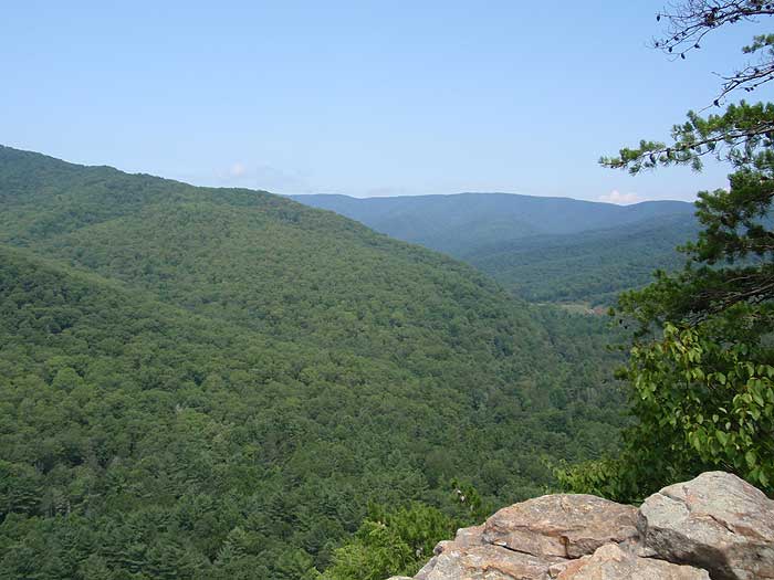
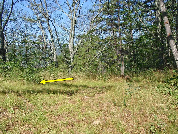
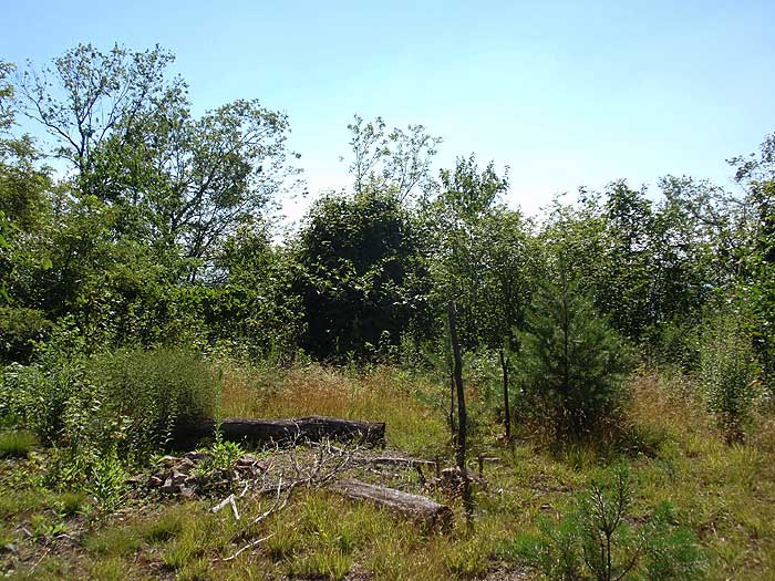
Turn left on the yellow blazed Hone Quarry Mountain trail, immediately passing a campsite, then descending through a saddle and climbing steeply to the best vista on the hike at the Abbie Point overlook in 0.6 miles.
From the overlook continue on the trail as it passes through another saddle, climbs the next knob, again passing through a saddle then arriving at the intersection of the Heartbreak/435A trail. The Hone Quarry Mountain trail is closed from this point.
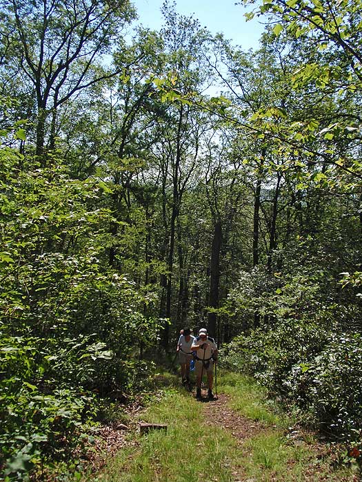
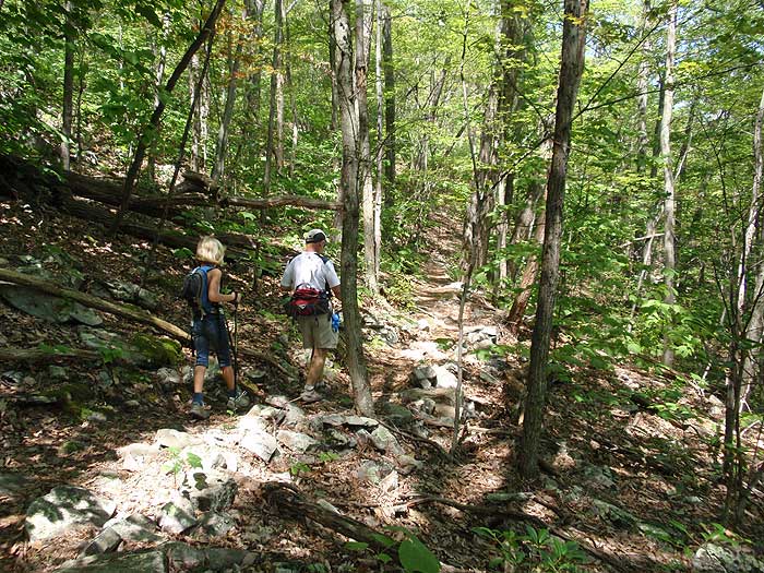
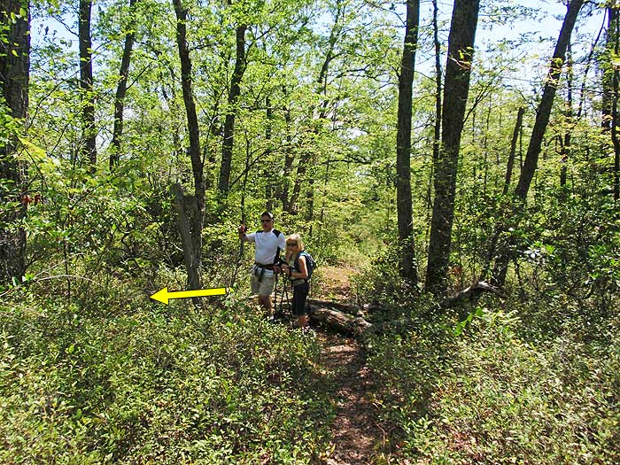
Turn left on the yellow blazed Heartbreak trail as it begins to descend the mountain. Pass several rock slides before the trail begins to level out reaching Hone Quarry Run and the Hone Quarry Run Campground on the opposite bank in 1.0 miles.
The Hone Quarry Run trail will continue for another 0.1 miles back to the intersection Big Hollow trail. Stay right on the Big Hollow trail for 0.1 miles to return to Hone Quarry Rd/FR62.
Stay right on Hone Quarry Rd/FR62 for the remaining 300 yards to the Hone Quarry Campground.
Early
August
Hone Quarry Ridge
Hone Quarry Ridge Hike Comments
Archived Comments
By:Jeff Monroe
Rating:
Date of Hike: Tuesday, November 5, 2019
I didn't have great expectations for this hike given the rash of recent 1 star reviews, but I had some time before meeting my son at JMU for lunch and I'd never hiked most of this loop. I was pleasantly surprised and really enjoyed the hike. The problem is that the Forest Service has done several prescribed burns in this area, and it resulted in a mess of down trees and briars. The PATC's Southern Shenandoah Valley Chapter complained (they signed on in 2019 to maintain this and other nearby trails), and a USFS fire crew went up there with weed eaters and chainsaws. It still isn't perfect (they didn't finish the job), and the time of year may have also had something to do with it (early November), but I observed only a handful of issues - almost all on the ascent on the Big Hollow Trail.
It was worth the trouble because the vistas at the top were wonderful! And it was a great workout. If you go, help the trail club out by moving branches off of the trail. This loop is going to be a lot of work to maintain!
By:Sarah
Rating:
Date of Hike: Tuesday, June 25, 2019
Hiked the loop clockwise yesterday (without reading reviews first unfortunately) and the overgrowth is so bad at this point that I could not find the downward trail to return to my car. Brush was taller than me at times. Given the late evening time, I had to hike onto the fire road along the ridge and get picked up off Brandywine near WVa.
By:Justin
Rating:
Date of Hike: Saturday, June 1, 2019
Mike B's review from 27 May about sums it up. The trail is very overgrown right now. The lower portion (first mile and a half if hiking the loop CCW) is nice, but once you gain some altitude, the grass is knee height. Thorns and plants almost block the path. I pulled 8 ticks off myself and many off my kids. I would avoid in late spring and summer.
By:Mike B
Rating:
Date of Hike: Monday, May 27, 2019
This hike might be decent in the winter, but should be avoided during the late spring / summer for the next decade. A solid 2/3 of this hike is through areas that were burned by the Forest Service several years ago. These portions of the trail are crowded by and in several places completely overgrown with saplings, shrubs, bushes, and grasses taking full advantage of the lack of mature tree canopy to soak up the sun. These conditions are unpleasant and likely to persist for many years until the trees reach a height where a canopy starts forming. My dog was leading the way through the overgrown trail and collected 30+ ticks despite his regular tick/flea repellent treatments.
On top of that, the majority of the Hone Quarry Recreation Area, including this hike, was suffering from swarming gnats/flies over Memorial Day weekend. Not unique to this hike, but certainly didn't help things.
As for the overlooks, the best overlook was actually where the Big Hollow trail loops around the abandoned fire road. The marked overlook - Abbie's Point - was overgrown and was ultimately a limited vantage point over a tumble of boulders.
The silver lining was the stream side hiking for a fair portion of the hike at lower elevations under a mature forest canopy.
Also of note, while hiking the ridge we spotted two young black bears traversing the hillside below us, we also encountered plenty of blackberry along the ridge trail which will keep the bears coming back as the fruit ripens.
By:JLP
Rating:
Date of Hike: Sunday, September 2, 2018
This was a great hike. I could see the remnants of the controlled burn, but the area has really recovered, I wouldn't let that deter anyone anymore. A lot of climbing on this one, it's a good workout. It had everything I like - climbs to views, and some walking by streams (even if really small ones.) If I do this hike again, I'm going up Heartbreak Trail first (clockwise), so that once you hit the intersection with Big Hollow you know it's all downhill from there.
By the way, there really isn't parking at the campground for non-campers. If you keep driving past the campground and over the bridge there is, however, immediately on your right space for two cars to pull in. Or if you've got a jeep you might try parking at the trailhead itself - I wouldn't recommend it for normal cars, however.
By:hopeful
Rating:
Date of Hike: Sunday, April 29, 2018
I would strongly recommend against anyone taking this hike right now. The forest service did a controlled burn that encompasses the entire trail, and there a lot of trees down on the ridge trail which got burned and are very messy to get around with all the soot.
By:Allison
Rating:
Date of Hike: Saturday, October 29, 2016
Nice hike, lots of solitude (the only people we saw were at the campground), and a good workout. Parts of the trail are really overgrown and we were grateful for the parts on a fire road. I would turn left at the fire road instread of crossing and following the spur then meeting back with the fire road after .4 miles. The spur trail was more of a bushwhack and we emerged covered in scrapes and cuts and no less than 20 ticks each. You will get nice views though along the ridge, at least in the fall.
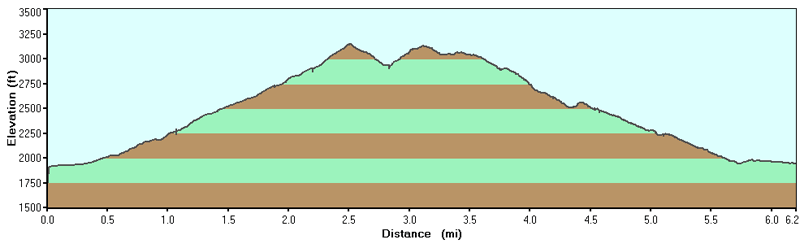
My gps told me we hiked closer to 7 miles and I have seen this trail as over 6 on other websites, so I wonder if we somehow extended it? It took us almost 3hrs 40mins to hike, with 15min for lunch at the overlook. And that is closer to our time for a 7 mile hike. The directions matched, but the distances didn't.
By:Ted J.
Rating:
Date of Hike: Tuesday, July 19, 2016
Started the loop on the Big Hollow Trail. Once I got to the ridge trail conditions changed markedly. Hiked about 1 1/2 miles on the ridge toward the Heart Break Trail, until the overgrowth with blackberry brambles finally became too thick, so I turned around. The ridge trail is no longer maintained, many downed trees to crawl over and thick brambles to push through. Glad I wore long pants, but arms got badly cut up as I was wearing only a t-shirt. Saw more bear scat than I have ever seen in this area, a pile every 20 feet on the ridge trail. But no bears. The only bear I encountered had been in my campsite and tore up my gas can while I was hiking.. I do not recommend this hike, - or at least the section along the ridge.
By:Bridgewaterhikers
Rating:
Date of Hike: Sunday, August 9, 2015
This was a nice hike, particularly if you are looking for a workout with hills. The scenery is nice, the creek bed is beautiful. However, the upper portions of the trail are really overgrown. We never felt like we lost the trail, but we spent a lot of time climbing over branches and trying to get around pricker bushes without getting scratched up too badly. When we arrived at the first intersection with the abandoned fire road, we scouted out the first 200 yards of the trail on the other side. It was so overgrown we decided to just hike right up the fire road instead.
There is a small parking area just on the other side of the slab bridge which is just a few yards from the entrance to the trail. The entrance to the trail looks more like a driveway than a trail and is not marked. We were a little thrown off because a car actually pulled out from it when we were approaching it. The trailhead is just about .1 miles up the "driveway".
By:adt36
Rating:
Date of Hike: Saturday, May 16, 2015
This hike took me ~3 hours, with just a ~10 minute stop at the Abbie Point overlook (no lunch stop). It's a moderately difficult hike overall, with some steep spots for a good workout. As other reviewers have mentioned, this trail is *very* overgrown in parts.
Note - there was *no intersection* between Hone Quarry Mountain/435 trail and Heartbreak/435A trail! The description says you arrive at the intersection of the Hone Quarry and Heartbreak trails, after which the Hone Quarry Mountain trail is closed. This section of the trail is one of the most overgrown, so I was becoming concerned I had somehow missed the intersection and was on the closed Hone Quarry Mountain trail, until it became apparent I was actually on the Heartbreak trail. I think enough time must have passed that the closed part of the Hone Quarry Mountain trail is no longer noticeable and the path just feeds into the Heartbreak trail naturally, with no intersection. Luckily, the rest of the trail description is very detailed and accurate.


