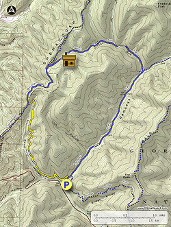
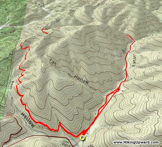
Ramsey’s Draft Wilderness has many hiking and backpacking options, including the Ramsey's Draft circuit at 16.8 miles, and the Shenandoah Mountain circuit at 18.2 miles which is the extended version of this hike. Visitors from the DC area often come here to backpack, but hikers who live closer come out often for day hikes. This is an excellent loop if you want either a day hike or a shorter backpack – it is actually a great place to take young hikers on an early overnight (although there are no facilities). You can get a sense of the wilderness solitude along the stream that runs through the middle of the wilderness, then you climb up to the ridgetop and have wonderful views into Highland County as you loop back to your vehicle. There are many possible campsites along the stream at the beginning of this hike, but if you can, hold off until you get to the old Sexton Cabin site, the single best campsite in this wilderness area.
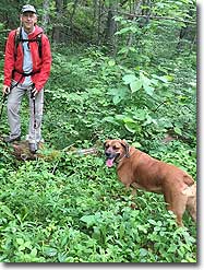
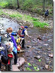
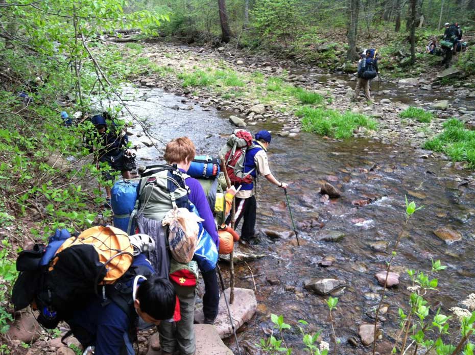
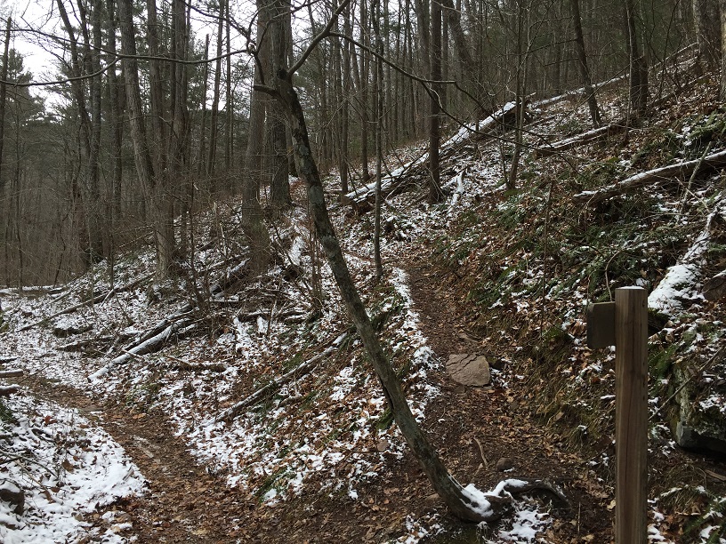
The first part of this hike has multiple stream crossings, so be sure to wear waterproof boots. It is almost impossible to get out of here without dunking a foot into the cold waters! Nevertheless, this hike is better in the colder months, as the views from Shenandoah Mountain are better and Jerry’s Run Trail attracts Stinging Nettle by June. Because the first part of the hike is through a wilderness area, the trail is not blazed, and it may sometimes split with either direction looking equal. They probably are equal, and both will get you there. You are following the stream for the first 2.7 miles until reaching a side trail.
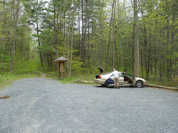
Parking is located by turning at the National Forest’s Mountain House Picnic Area and continuing straight back behind the picnic area, over a bridge, to a small lot that probably holds 10-12 vehicles. (If it is ever full, you can park at the Picnic Area, adding about a quarter mile each way to your hike.)
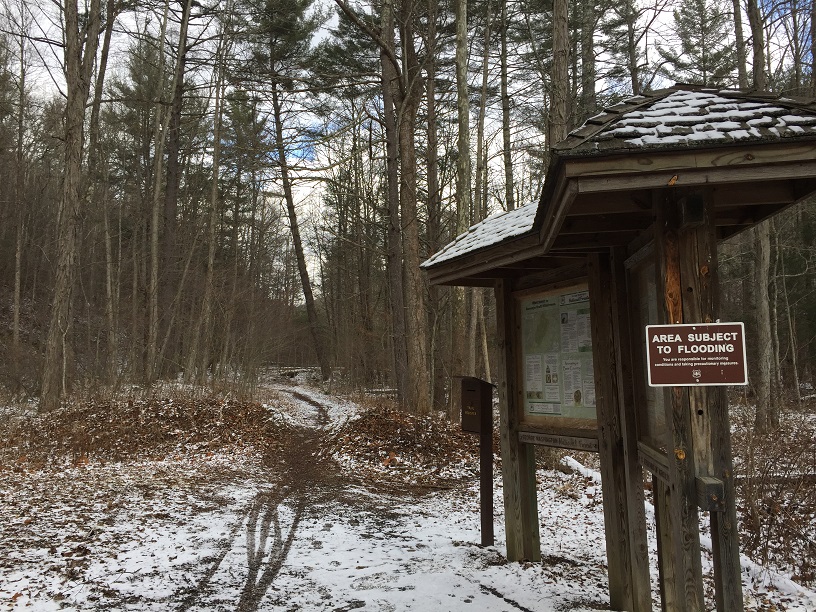
Mile 0.0 – From the parking lot pass information kiosk and trail register. Be sure to add your hike and vehicle information to the register. Continue straight on the Ramsey’s Draft Trail and after about 100 yards pass a sign for Bridge Hollow Trail, heading off to the right. About 25 feet further is a sign for the Road Hollow Trail, heading off to the left. You will come back on the Road Hollow Trail, but stay straight for now on the Ramsey’s Draft Trail.
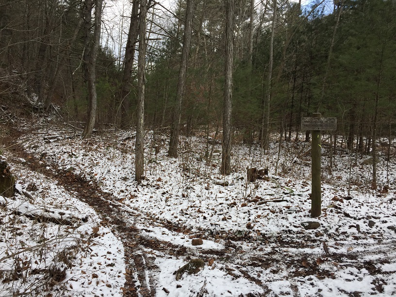
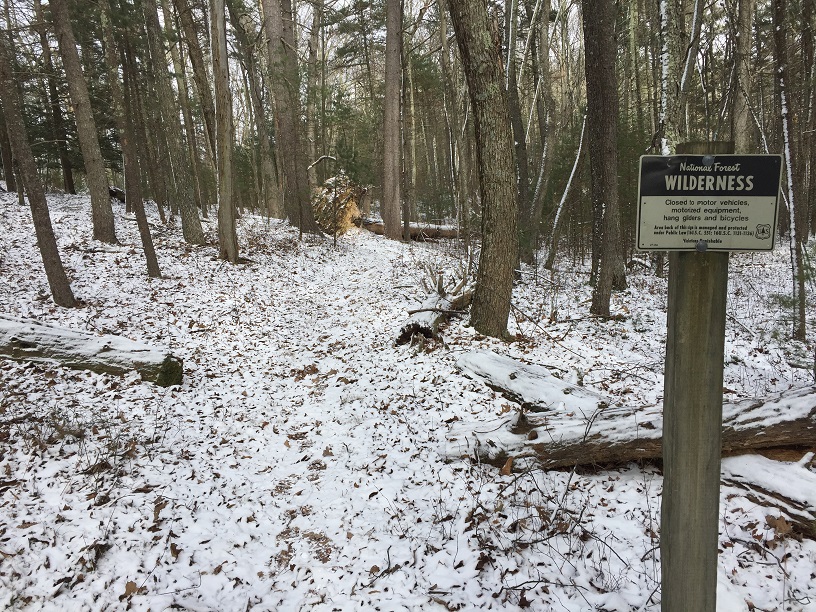
Mile 0.6 – The trail enters the actual wilderness after passing an old green shed on the left and the remains of a gate. There is a wilderness sign ahead on the left – photo op! Mile 0.7 – After following the west (left) side of the stream for a while, you have reached the first of five crossings of Ramsey’s Draft. It may look like you can hike along the ledges to the left and avoid the stream crossing. Don’t get sucked in! You will not avoid a crossing and this is the best spot.
Mile 1.1 – Stream Crossing 2. The Ramsey’s Draft Trail generally follows an old road that was washed out by a 1985 flood. Twenty years ago this area was very different, but an insect known as the Woolly Adelgid has killed off most of the ancient hemlocks that used to inhabit this valley.
Mile 1.4 – Stream Crossing 3.
Mile 2.0 – Stream Crossing 4.
Mile 2.3 – Stream Crossing 5. Are your feet wet yet? If not, congratulations! You have only smaller crossings from here on out.
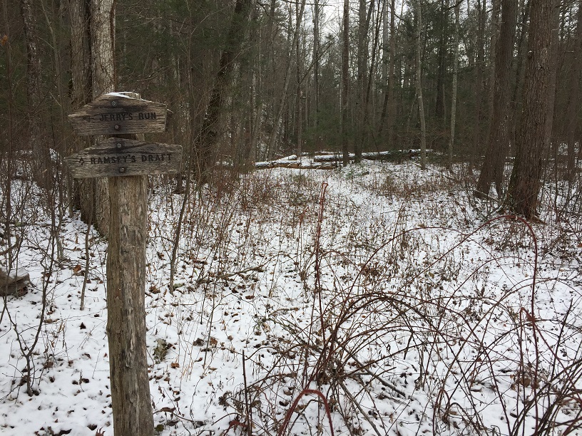
Mile 2.5 – Cross a minor stream then come to the Jerry’s Run Trail, where there is a trail sign. There is also a nice large campsite here, on the right side of the trail. Take Jerry’s Run Trail to the left. I am always a little nervous that I will not come across the trail, but I have never missed it. Both trails are very evident here.
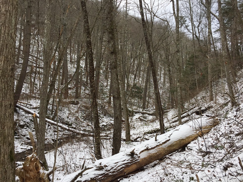
Mile 2.7 – Trail crosses Jerry’s Run, and then crosses back again about 50 feet further up the trail. The Jerry’s Run Trail crosses its namesake stream multiple times as it climbs in elevation through a drainage with steep sides.
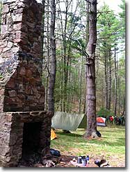
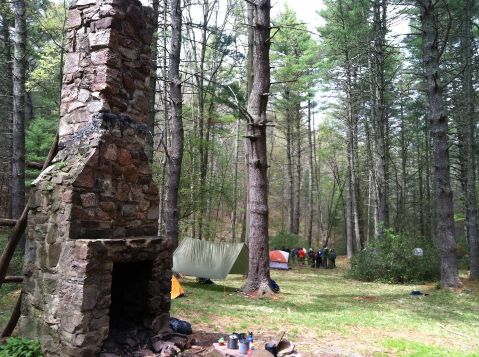
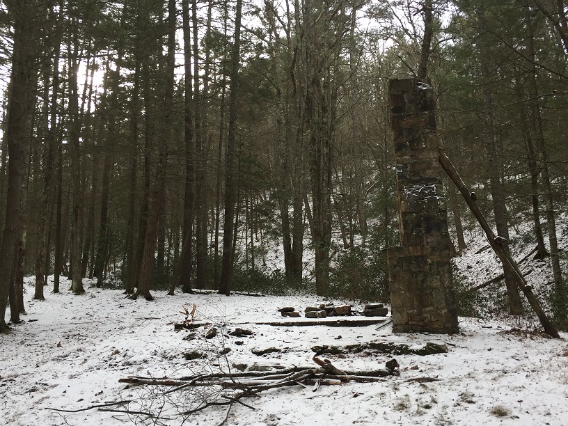
Mile 4.3 – Reach site of the old Sexton Cabin, in a small open area ideal for camping or stopping for lunch. This cabin was built by the Potomac Appalachian Trail Club back in the 1940’s, reportedly because Club President Myron Avery loved this area so much. He used to bus hikers from DC to this area. The cabin burned down in 1967 and was rebuilt before the Forest Service asked the PATC to tear down the cabin, after the area became a federal wilderness area in 1984. The timbers from this cabin are still used today, as part of the PATC’s Mutton Top Cabin. On your way out, be careful. It may appear that you should head to the left of the cabin site. The actual trail heads off to the right, crossing what remains of Jerry’s Run (still strong enough for a camping water source, but easily jumped) to the right of the cabin site as you look uphill. This is your last water source until the end of the hike.
Mile 4.6 – Reach the end of the Jerry’s Run Trail, where it meets the Shenandoah Mountain Trail. To the right, the Shenandoah Mountain Trail heads north through some very secluded country. You want to turn left and head south.
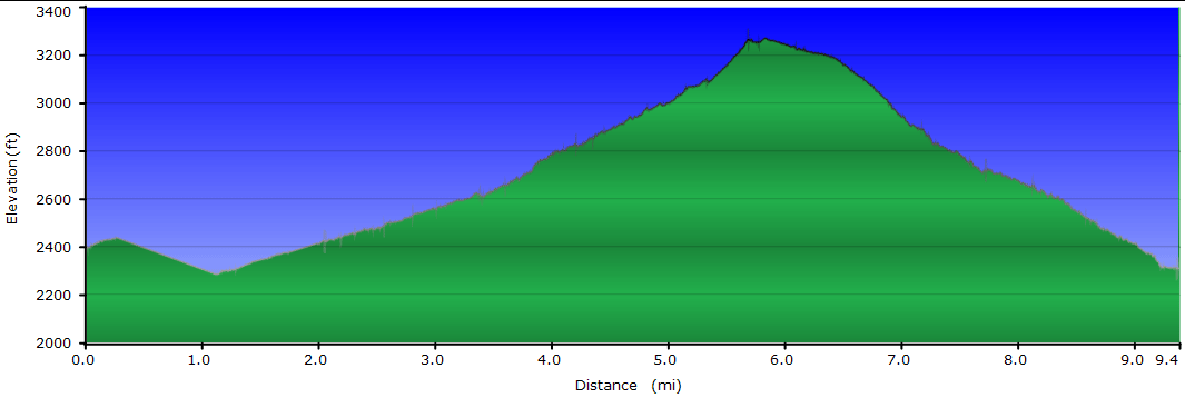
Mile 4.8 – Leave area designated as federal wilderness, marked by small metal sign. Follow Shenandoah Mountain Trail, built during the Depression by federal workers, and one of the most gentle mountain trails you will ever experience. Nice views to your right (west) into Highland County, Virginia.
Mile 5.7 – Road Hollow Trail intersection; take this left, leaving the Shenandoah Mountain Trail. (The Shenandoah Mountain Trail continues south along a ridge to U.S. 250 at Confederate Breastworks.) The Road Hollow Trail, blazed yellow, was built by the Student Conservation Association in the early 1990’s and is now a popular mountain biking trail. Be on the alert for mountain bikes on this trail; they are prohibited from entering in the federally designated wilderness, but this trail is outside of wilderness. The Road Hollow Trail follows the contour of the side of the mountain just above an old road that gave Road Hollow its name and was a longer but easier climb than the present U.S. 250, likely used during the Civil War. As you approach the end of this hike, road noise from U.S. 250 will become increasingly prevalent.
Mile 8.2 – Return to Ramsey’s Draft Trail. Take a sharp right back to your vehicle just before the trail sign, which you probably saw from the trail as you descended the last few feet approaching this intersection.
Mile 8.3 – Return to the parking area.
Photos
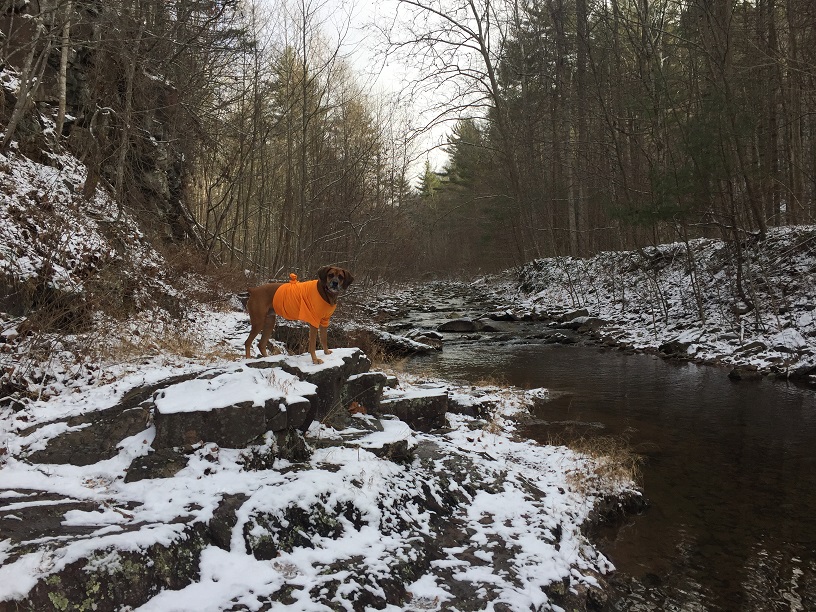
Jerry's Run
Jerry's Run Hike Comments
Archived Comments
By:JLP
Rating:
Date of Hike: Saturday, June 1, 2019
Meh. If you're just looking to get out, this is a nice enough loop, but no major payoffs. The stinging nettles are already high enough to be a nusiance, and parts of the route, especially on Jerry's Run, are really overgrown. Like, momentarily doubting I was still on the trail levels of overgrown. I thought it might almost be easier just to creek walk down Jerry's Run. Shenandoah mountain trail was the best part.
By:Tom R
Rating:
Date of Hike: Saturday, March 9, 2019
Well, we did do a hike this day and it was an adventure. I'll try to make it short. The original plan was to do Brown Mountain/Big Portal, but it was deemed to be too much fording with all the recent rains and the cold weather, so Lewis Peak was scheduled. The afternoon before the hike, we discovered that the Skyline Drive has been closed (since November!!!) because of tree damage from the ice storm. So what did we do? We chose a hike in the GWNF called Jerry's Run, with guess what? Lots of water crossings. After arriving via clear dry roads, we found 2-plus inches of snow on the ground. There must have been 20 stream crossings of varying difficulty to traverse. I started with running shoes to keep my hiking boots dry for later on in the hike. We were in knee-deep water once. Chuck changed in and out of his hiking boots four times. Although there were no blazes in this designated wilderness area, the trail could generally be determined because of the lack of any growth protruding through the virgin snow. Because of the water crossings and snow it was a wild ride!
By:Steve
Rating:
Date of Hike: Sunday, October 28, 2018
Read all the negative reviews about the stinging nettle and was hesitate. However, my son and I took our two dogs and had a blast. Most of the nettle had receded, plus we wore long pants and sleeves. Several fallen logs were quite a challenge, but added to the lure of the hike.Thoroughly enjoyed the stream and crossings. One of my favorites so far.! Planning to do this again as an overnight trip.
By:Jared
Rating:
Date of Hike: Saturday, September 16, 2017
We did this as a 1 night backpack, staying the night at the site of the old cabin. Overall this was an excellent one nighter - despite the short length, it was full of adventure with all the stream crossings and the fields of nettles! I would not recommend this hike if you are looking for an easy, clean hike - expect a lot of nettle dodging and rock hopping! we had a ton of fun with this though, and we just laughed it off every time we got stung - it only hurts for a couple minutes. The campsites at the old cabin site are very nice and plentiful, so I agree with the 5 star camping rating - I think you would almost always be able to find a secluded spot to camp. Lots of huge old growth trees on this hike. We saw no one else the whole time we were there. Day 2 across the ridge is absolutely beautiful, and we will definitely be back to do the full wilderness loop.
By:Shutter
Rating:
Date of Hike: Sunday, August 13, 2017
We did this hike clockwise, RoadHollow -> Jerry's Run -> Ramsey's draft. After reading the trail reports we brought long pants to change into once we got to Jerry's Run the trail, I'm glad we did. Without long pants Jerry's run, and portions of Ramsey's Draft would be an extremely discomforting and at times painful experience. Enjoy the hike, bring long pants to change into once you get to Jerry's Run.
By:Hl12345
Rating:
Date of Hike: Monday, June 12, 2017
I wish I had seen the previous review about the stinger nettle before I went on this hike. It was miserable the entire time. We found jerrys run trail without a problem, but we hiked another 3 miles and never found the campsite. Decided to turn around and endure the misery again on the way back.
By:floppy
Rating:
Date of Hike: Saturday, June 10, 2017
If I could give star ratings on sections of the hike, I would give the creek crossings, the Sexton cabin site, and the remainder of the hike after the cabin site 5 stars. I would give the majority of Jerry's run trail 1 star. This is due to the stinging nettles that line both sides of the trail the majority of the way. They are painful, itchy and unavoidable. If we were wearing thick pairs of pants, we would have been fine. One of us had thin hiking pants on and she was still getting stung some. We had to do a fair amount of bush whacking to keep them off of our legs. We did this hike as an overnight and thank goodness camping at the Sexton cabin site was fantastic. We were all in a foul mood after the previous hours of itchy torture from the stinging nettles. The pleasant campsite was just what we needed. There were several rock circles and a nice grassy area. Room for several groups of campers but we luckily got the whole place to ourselves. There was a good spot at the stream to get water. The second half of the hike along the Shenandoah Mountain trail was lovely. I would recommend this hike in the winter and early spring before the stinging nettles encroach on the trail or wear long pants.
By:mindset
Rating:
Date of Hike: Friday, June 9, 2017
I'll echo the notes on the stinging nettles. With the wet spring the stream crossing are interesting and the paths a little over grown. Long pants and waterproof shoes are highly recommended. With the growth the hike itself is beautiful though.


