The Laurel Run/Stack Rocks circuit has some of the best views
in the area. The panoramic
views along orange
blazed North Mountain Trail and from Gusty Point are spectacular on a clear day.
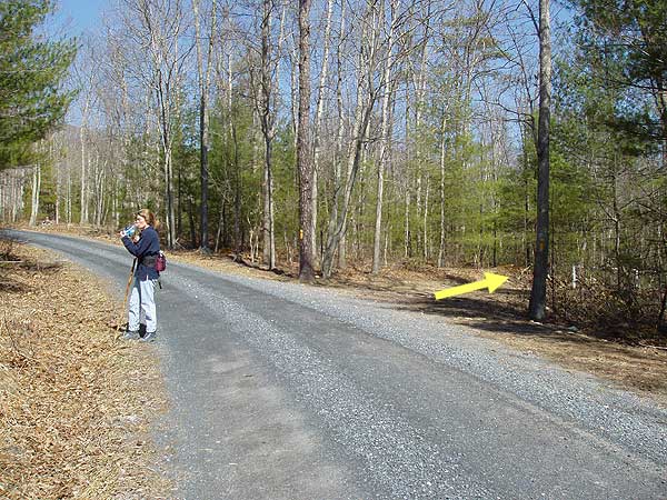
If the first gate is closed just before Laurel Run you
will have to park just before crossing Laurel Run. The hike
will be 8.8 miles long from this point. If the gate is open you
can
avoid the extra out and back on FDR252
by parking 1.1 miles further at the yellow
blazed Laurel Run Trail
entrance reducing the hike to 6.6 miles.
The hike to Gusty Point can also be done as as an easy 1.5 mile out and back hike from the parking area on FR 691, 0.1 miles from the North Mountain trailhead. 38.927119, -78.737627
If you park a the first gate start the hike by walking 1.1 miles
up FDR252 before arriving at the start of the loop where the closed
gate and yellow blazed Laurel Run Trail turns to your right.
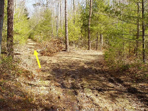
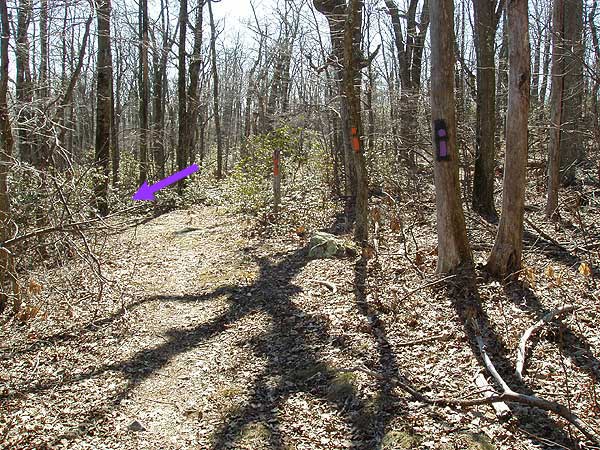
Start
up the yellow blazed trail and in one hundred yards arrive
at a split
in the trail.
Bear left continuing up yellow blazed Laurel Run Trail for 2.1
miles. The trail will pass through two wildlife
clearings before
winding back and
forth becoming steeper as it gets close to the mountain ridge.
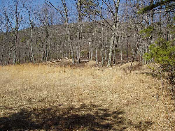
Just before reaching the junction of the North Mountain Trail,
Laurel Run Trail will pass a small pond on your
left.
Arrive at the
junction of the North Mountain Trail and a forestry
service road. Orange blazed North Mountain Trail will turn left.
Take the orange blazed trail for 0.7 miles and look for a white
blazed side trail that will take you to the Gusty Point Overlook.
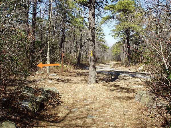
Turn left downhill on the purple blazed Stack Rocks Trail as
it winds steeply downhill for 1.3 miles before arriving at the
junction
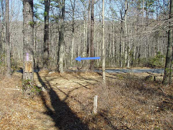
of the blue blazed FDR252 road.
Turn left on blue blazed FDR252 for 0.9 miles as it winds back
around the valley to the starting point of the loop and yellow
blazed Laurel Run Trail on your left.
If you had to park at the lower parking area continue down FDR252
for the remaining 1.1 miles back to the lower parking area.
Mid July
Late April
Gusty Point and North Mountain Ridge
Gusty Point Vista
Laurel Run/Gusty Point Hike Comments
Archived Comments
By:Jakob
Rating:
Date of Hike: Wednesday, January 3, 2018
This was a fantastic hike! I have hiked most trails in this area (Tibbett knob, Little/Big Schloss) and I can say this is probably my favorite. It's not too difficult, so amateur hikers do not need to worry. It's definitely a workout, but it's very doable. First of all, driving to the gates can be intimidating due to the abundant "No Trespassing" signs, but just ignore them. You get onto National Forest land soon enough. Luckily, the first gate was unlocked at the time of my hike. There was a handmade sign saying "Warning: traps ahead" right when I got onto the yellow blazed trail. As I am not an expert trapper, I didn't know what to look for. After a mile of carefully placing my steps, I came to the quite obvious trap: a tepee structure with some fur suspended by a stick above it!
The white blazed overlook trail isn't much of a trail at all, so I can see why some have missed it. It's really just a 20 foot long narrow pathway on your left that goes toward a small rock formation. The overlook had one of the best views in the county and was a perfect place to eat lunch. I hiked in winter, so I had no foliage to worry about. I can see how some that hiked in other seasons had an obstructed view. All turns were very obvious, so it was hard to get lost. Just remember yellow-orange-purple-blue and you'll be fine. I saw absolutely no one on the trail, and barely any wildlife save for a few birds. Absolute solitude and silence.
This hike is definitely a 5, just try to go in winter!
Sidenote: On one of the pictures, there is a label pointing to Massanutten ski area. This is actually Bryce resort Massanutten is much further south, past Harrisonburg.
By:Alex
Rating:
Date of Hike: Monday, September 4, 2017
Overall the hike was fine. It's in the national forest, so it's not a maintained trail. It's nice in that you'll see few other hikers and there are some pretty parts to the hike. But, I'll reiterate what others have said and tell you this does not have panoramic views. In fact, the off-trail views are few, far between, and unimpressive. I'd look elsewhere if you're looking to get up high and get some nice views of the surrounding countryside.
By:Ed Matthews
Rating:
Date of Hike: Sunday, May 14, 2017
This was a hike that I really enjoyed, despite not paying attention and making a wrong turn while jibber-jabbering with my wife, a slight 3-mile oops. Solitude: only us. Views: up top, quite enjoyable views of Great North Mountain to the south and Devil's Hole Mountain to the east. Best hiked when no leaves on the trees. Varied Habitats: wet woodlands, open wildlife management areas, dry upland woods, ridge walk, grassy bald up top, all very interesting. Difficulty: It wasn't. Cons: a considerable road walk in and out.
Photos and trip report: https://mangiabeve.blogspot.com/2017/05/laurel-run-orkney-springs-va.html
By:Todd H
Rating:
Date of Hike: Saturday, August 29, 2015
Overall a pretty blah hike. Definitely doesn't rate the "5" it has for views. You will spend 98% of the hike looking at foliage. First opportunity for an actual view was at Will's Point overlook. Great views from there to the east...to include several logged areas...and to the south/south west. No opportunity to see anything to the west even though you're on top of the ridge line- just way too much foliage. A few more overlooks along the ridge line but the same views as Will's Point. If you're considering doing this hike, do it when the leaves are fallen, then you can probably see a lot more, but I would not recommend this hike when there are so many better options.
By:Lynn
Rating:
Date of Hike: Saturday, May 23, 2015
I hiked it with a group of 7 other casual hikers. It was a great day - 75 and sunny. The mountain laurel just started to bloom and there were Pink Lady Slippers everywhere - a treat we didn't expect. A well maintained trail, the ascent was long and didn't allow you to take in the nature as you watched your footing. The pond was full of tadpoles and made a nice first stop. We enjoyed the ridgeline views even though we missed the white trail to Will's Overlook. We stopped again at the start of the Stacked Rocks before the descent. Overall, a great hike. We finished in 5.5 hours.
By:Jess
Rating:
Date of Hike: Thursday, October 9, 2014
This hike, overall, was beautiful. The foliage was just beginning to change and it was a crisp, cool day. However, be warned the trail is very rocky and with the leaves all over the trail its hard to see what you're stepping on. Also, I completely missed the "side trail" to the outlook so keep a sharp eye out for the white blaze once you hit North Mountain Trail. However, once you do hit North Mountain Trail, it's vista after vista and quite a view. The mountain meadows are also gorgeous. The directions are dead on when they warn that the decent is steep, as well as rocky (I rolled my ankle twice in good hiking boots). However, on our way down we saw a bald eagle which I havent seen in about two years now so that was a great treat. Read more about my experience here: http://appalachianhikinglove.blogspot.com/2014/10/hiking-laurel-run.html
By:Manabouttown
Rating:
Date of Hike: Saturday, September 20, 2014
Hiked the ridgeline portion of this hike this weekend as an overnight out and back with my daughter (4 1/2 years old). We parked on 691 just up from the trail and hiked to just shy of the stacked rocks trail. Found a nice campsite just off the trail (there were a few better closer to 691) and pitched our tent. The views were great breaks for my little one, but would have been amazing all along the trail once the leaves are down off of the trees. As for solitude, we saw one group of four traveling counter clockwise just after we started, but no one else wandered by all night or the next day. It took us hours to go the few miles across the top, but again, the little one is only four, but she had a good time.
By:aldikuma
Rating:
Date of Hike: Saturday, June 7, 2014
This is the second time I've done this hike and both were great (though a month ago there were zero ticks!). First time I went counterclockwise as suggested, and this time I went clockwise. I prefer clockwise, as the workout is better at the beginning. The gate was open both times, so that cut off a mile hiking in. First time, I saw no other hikers and the second I saw two, so if you're looking for solitude and a few BEAUTIFUL views from the top, do this hike. It's one of many great ones in the area (Halfmoon Mountain and Little Schloss are two others). Saw a few ruffed grouse with their chicks - so cute. :) And a month ago, the purple blazed trail was lined with lady slippers. I preferred it in late April compared to now, but it's still a great, nicely maintained trail. The campsite next to the pond on the yellow trail would be a peaceful place to stay a night, but maybe in cooler weather (the bugs are awful, as they are now everywhere!).
By:Steve
Rating:
Date of Hike: Saturday, May 3, 2014
Did this on a perfect day for a hike... ~72 degrees, sunny, slight breeze. Unless you just want a bit of extra (gravel) mileage, I suggest driving to the 2nd parking spot, if the gate is open. You're walking .9 miles back on the road to begin with. Not a ton to see on the way up, so when you do get to an opening, stop and look around and grab a breather. Once you get to the top where it levels off a bit, there is a rocky outcrop on the right, maybe 50 yds off the trail that you may be tempted to check out. Don't bother going over there, there isn't really much of a view. Wait until the two stacked rock pillars on the left, take the path out to the overlook for the best view of the hike, and a great spot for lunch. The only problem is that if there are multiple groups converging there at once, there's not much space out there. Luckily the couple we came across had a dog, and didn't attempt to take him all the way out there. The bugs at the top, especially in the open areas were bad, so I'd imagine they'd be worse in the height of summer. My knees were definitely feeling it on the way back down. Overall...a good workout, great view for lunch, and a nice non-crowded hike. (only saw that couple w/ the dog, and a group of 4 campers that were going the opposite way.
By:Nate
Rating:
Date of Hike: Saturday, June 29, 2013
This was a really nice hike! The Laurel Run trail leading up is absolutely beautiful, and the views along the North Mountain Trail are fantastic. There weren't too many other hikers, I only ran into one fellow on the way up, and a nice couple with their dogs caught up with me along the ridge, but otherwise good for solitude. There isn't enough parking to support many more people than that anyway. Here's some of the mountain laurel that was everywhere along the hike: http://i.imgur.com/faN6wxp.jpg I was also really happy about the abundance of ferns on this trail.
My one caveat would be that once you start along the North Mountain Trail the grass is tall and covers the trail, so you really can't avoid it brushing your legs, so this is definitely a trail to wear pants or gaiters on, and tick repellent is a must. Other than that, this was an absolutely great hike!


