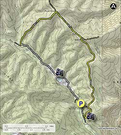
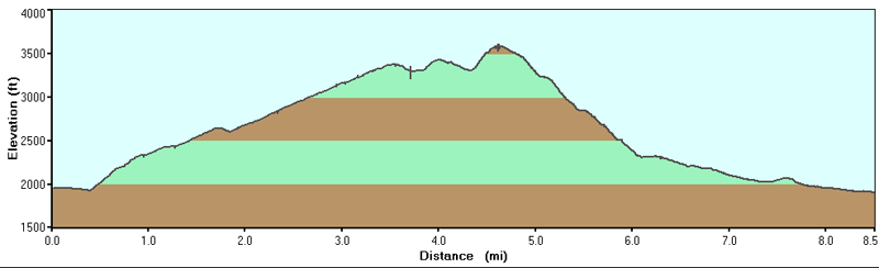
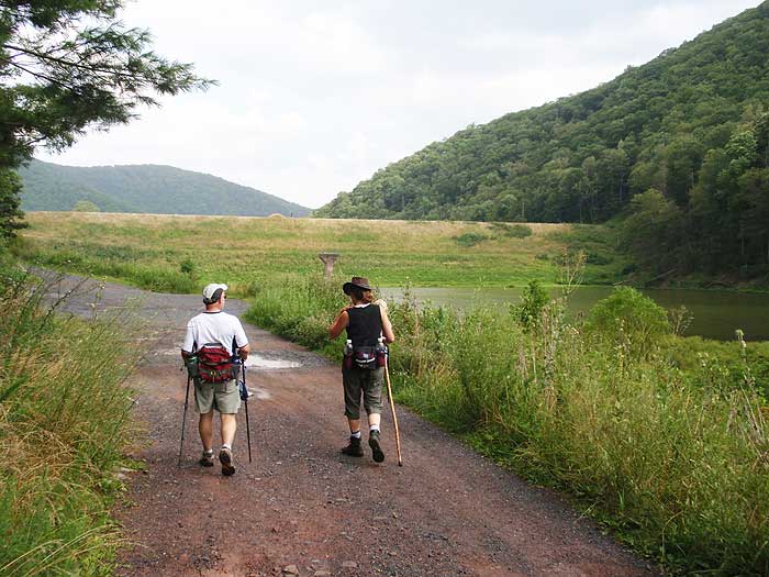
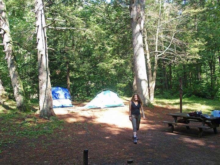
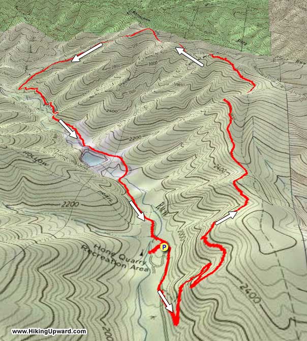
The Hone Quarry area is nestled in a quiet area of the GWNF just west of Harrisonburg VA. With two beautiful loop hikes, one up Oak Knob and Pond Knob with two overlooks, and the other on the opposite Hone Quarry Ridge also with a beautiful vista, makes this a great place to spend the weekend, and camp at the Hone Quarry Campground (vid).
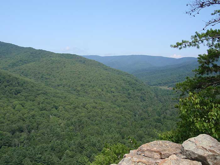
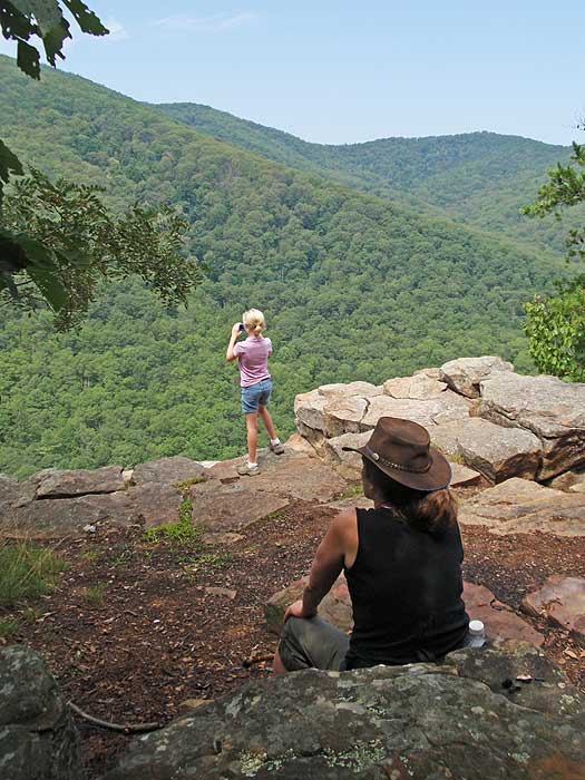
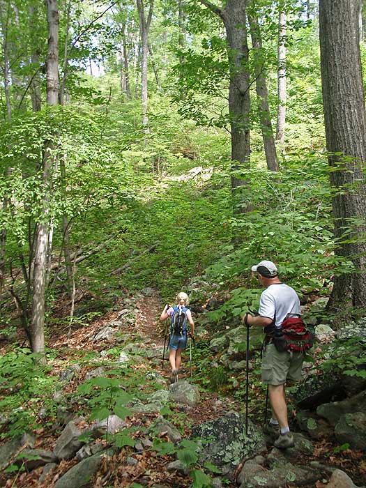
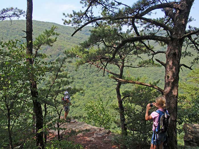
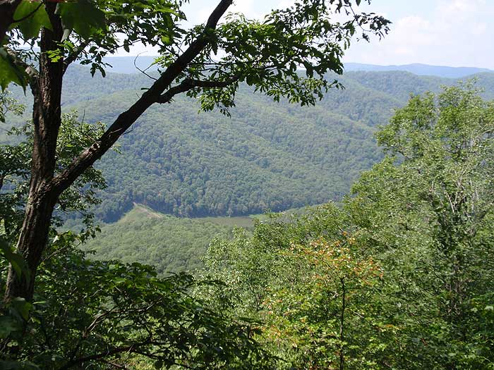
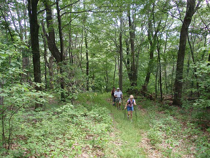
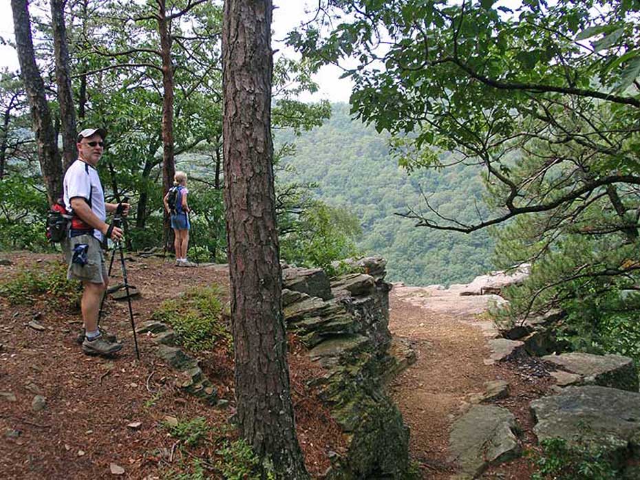
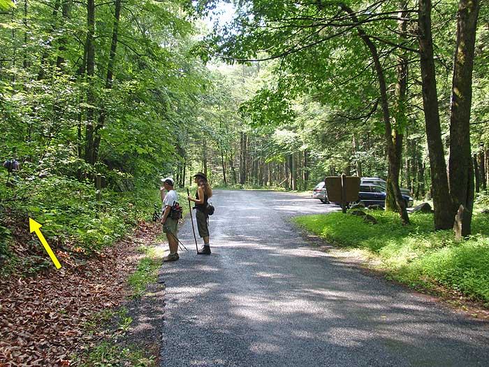
From the campground turn right and walk 0.2 miles down paved Hone Quarry Rd/FR62 to the Cliff Trail/429 trailhead and parking area. Turn left up the yellow blazed Cliff Trail as it ascends the mountain steeply making two switchbacks before arriving at the first valley overlook, then in another 0.3 miles the second overlook.
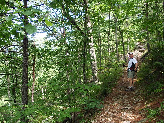
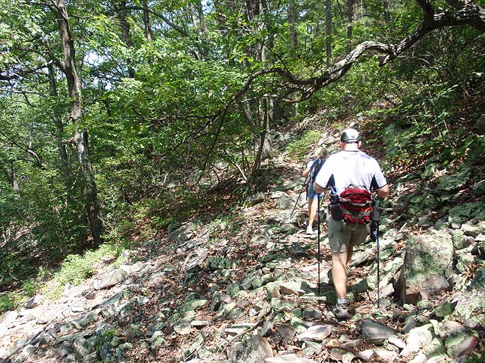
From the second overlook the Cliff Trail will becoming increasingly more rocky. Keep an eye out for Timber Rattlesnakes, especially as you cross the multiple rock slides that pass over the trail, as rocky areas are their favorite sunning spots.
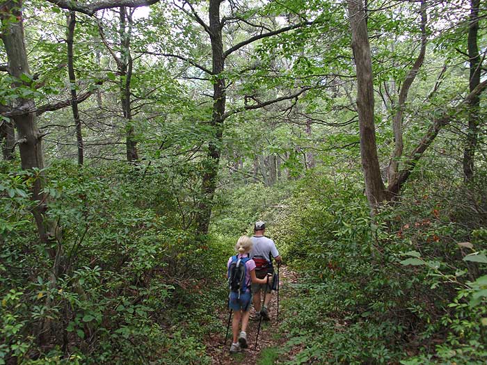
There are also several views of the valley and the Hone Quarry Reservoir along the upper portion of the trail. As you near the ridge, the Cliff Trail will become more obscure, be vigilant to follow the yellow blazes. The Cliff Trail will end at the Meadow Knob Trail just west of Oak Knob, 2.3 miles form the second overlook.
Turn left on the wider yellow blazed Meadow Knob Trail. The trail will descend through the first saddle, then pass over a small knob, descend through another saddle, then climb very steeply to the summit of Pond Knob in 1.0 miles from the Cliff Trail.
At the summit of Pond Knob, turn left down the yellow blazed Pond Knob Trail as it descends very steeply for 1.5 miles where it ends at Hone Quarry Rd/FR 62. The Pond Knob Trail was designed to be a mountain biking trail, and has no switchbacks.
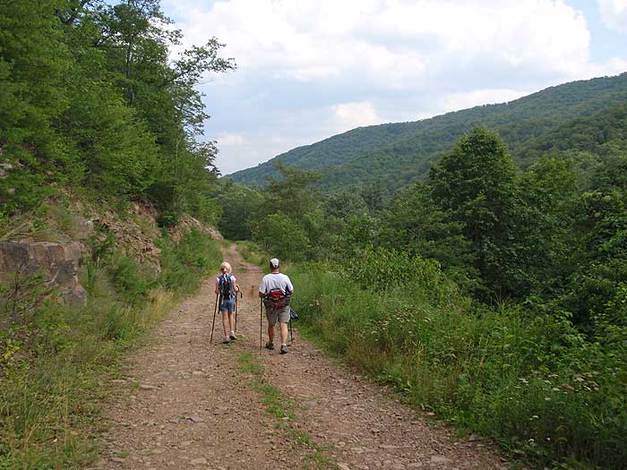
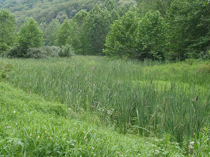
Turn left on gravel Hone Quarry Rd/FR62 and follow it 1.6 miles to the Hone Quarry Reservoir. Continue on Hone Quarry Rd/FR62 past the reservoir where it becomes paved, crosses Hone Quarry Run, then in 0.5 miles crosses the run again before arriving back at the campground.
Early
August
Oak Knob Overlook
Oak Knob Hike Comments
Archived Comments
By:Diego S
Rating:
Date of Hike: Saturday, October 21, 2017
Hiked this clockwise starting from the campground. The walk along the road was easy - about two miles with no shade - but not too bad as the weather was nice this weekend. There is a brown trail marker at the Pond Knob trailhead with the trail number (428) that is pretty noticeable. The pond knob trail is a steep uphill climb, but I preferred to get this out of the way first and leave the views for the end. It looked like there was a natural spring on the right side of the trail about 3/4 of the way up, but I couldn't be sure since the water is low this time of year. The intersection with the Meadow Knob Trail is well marked. This was probably the most dangerous part of the trail as some of the downhill is steep with leaf cover making the footing difficult. The ridge is actually pretty clear of trees, meaning a campsite could be whipped up fairly easily. I did not see the campsite marked in the notes for the trail, or any other along this loop. The rocky portion of the hike is the Cliff Trail. Nothing too difficult, but be careful. The overlook areas were real nice but since it is less than a mile from parking, people will be there.
The previous post mentioned downed trees on the trail. I only recall climbing over three trees on the whole hike and none were difficult to get past. Overall the trails are decently marked, the trail junctions are all marked, and the trail conditions are average. Expect solitude in all areas off the road and the portion of the cliff trail from the parking area to the overlooks.
By:Ed Matthews
Rating:
Date of Hike: Sunday, April 2, 2017
A beautiful day to be out, for sure, but this wasn't one of my favorite hikes.
Plusses. Hone Run is one of the prettiest trout streams I have seen in ages, especially full of whitewater after copious rains this past week. Gorgeous stands of hepatica, bloodroot, and coltsfoot around the Hone Quarry campground. Nice initial views. Solitude, except for the area from the reservoir to the campground, is excellent. Trail was very easy to find and follow and there was no shortage of yellow blazes.
Minuses. In many places, the trail is extremely rocky and crossing seemingly endless rockslides is just not my idea of fun. The trail is very closed in with briers and shrubs in places, and I'm saying this when there are no leaves on anything. We climbed over more downed trees across the path than we have in the last 6 months total. The payoff views all come in the first half hour on the trail. After that, it's just a ridge walk. Until you hit the road walk. Three of the eight miles are roadwalk along a dusty dirt road with enough traffic to keep the dust flying. No bueno. The area around the reservoir is pretty, but despite the solitude on the rest of the walk, very highly trafficked. Lots and lots of people, dogs, canoes, fishermen, etc.
Glad to have seen the area, but this is not on my list of hikes to do again.
Photos and trip report https://mangiabeve.blogspot.com/2017/04/oak-knobhone-quarry-gwnf-dayton-va.html.
By:RedDrgn
Rating:
Date of Hike: Saturday, June 11, 2016
My husband and I hiked this trail with the hope of finding and photographing some timber rattlers. In that endeavor, we failed not a single snake encountered anywhere except for a juvenile northern water snake basking on a rock in the stream near the campgrounds. However, this circuit more than made up for that one omission! We found the first wild American chestnut trees that either of us have ever seen along Cliff and Pond Knob Trails, the mountain laurel (which were abundant) were in full bloom and beautiful (as were a number of other native plants and herbs). We found songbirds nesting, came upon two ruffed grouse hens with chicks, and even a large skunk (who was digging along the side of the trail - we waited that one out). Plenty of raptors and vultures were spotted through the Cliff Trail trees and there are a few areas with limited views along this portion of the loop.
All trails were easy to see and follow. Pond Knob Trail was pretty overgrown with grass, though the only tick (dog tick) we found was picked up early on along Cliff Trail. The Hone Quarry Road portion of the hike was also pretty interesting vegetative-wise, as it's bordered on one side by dry, sandy-silty slopes and on the other side by wetlands. A few deer were spotted in this area along with various dragon and damselflies and butterflies (a few different types of milkweed found along the trails!). The quarry pond itself is a nice place to linger for a bit and watch the fish or just relax with a bit of an open view.
This is definitely a trail that we are going to have to hit a few times at different seasons to see what else we may find!
By:Nunsie
Rating:
Date of Hike: Tuesday, April 19, 2016
Nice hike! It took me about 4 hours, including two snack breaks and a few short water breaks. The only thing being the best views and rocks to hang out on are in the first 0.5 miles. However, Hone Quarry is a nice view towards the end. I enjoyed the hike but probably not one of my top ones for the area. There aren't many water passages, so this one is good one for winter and early spring if other hikes seem to be flooded.
By:Central Virginia Trailblazers
Rating:
Date of Hike: Saturday, January 9, 2016
We hiked the loop this past Saturday starting from the Hone Quarry Picnic Area, which is actually where the trail begins. Thick fog obscured much of the view, and wet leaves and rocks made the hike challenging. Hiking poles saved the day. As others have said, trail markings are sparse, but the trail is easy to follow and the directions provided here are very good. Overall a nice day to be outside.
By:Allison
Rating:
Date of Hike: Saturday, November 21, 2015
First chilly morning (31 degrees at 7am), but clear and perfect. I did the hike in the opposite direction as described here, mostly because I wanted to get the road hike part out of the way. Plus, the two overlooks at the end were a nice payoff. There were some challenging parts, for sure. The thick layer of leaves made for some slippery and tricky footing. But, there are some stunning views, even if you are peeking at times through the trees. This hike gets max stars for solitude (saw no one at all!), almost max stars for views, and almost max stars for difficulty. I got a good workout in for sure. But, not the toughest hike, mostly because almost 2 miles of it are on Hone Quarry Rd, a flat and mostly paved road. For reference, I do a 5-10 mile hike several times a month.
By:Sarah H
Rating:
Date of Hike: Wednesday, December 4, 2013
To be fair, I headed out on this hike expecting it to be the hone quarry trail. Note that that trail starts at the left (south) side past the campground as these are not labeled at the outset except by number. The trail was a workout, with the only clear view near the beginning. You can often see hills in the distance, but they are obscured by the tree line as you never make it to the ridge. I was doing the hike on a 65 degree day in December, so it's not like it was foliage blocking the view. Overall I was really not impressed, except that I did feel like I battled with the hills and their mighty armies of rock slides and steep elevation changes. I'm not sure I won the battle though. Good luck!
By:threehikers
Rating:
Date of Hike: Wednesday, April 28, 2010
A good workout hike with views and varied terrain from rocky areas to straight up and down heart, leg and toe testers! We enjoyed starting early but it was very cold and windy all day (30 that morning at the campground). The early overlooks are nice and some of the views through the budding trees on top were better. The rocky areas are a nice variation and you really have to be careful for loose rocks in several places. Blazes aren't too plentiful but the trail is generally easy to follow. The descent from Pond Knob really tests the fit of your boots s it is steep and straight. The walk along the road back to the campground was just a walk on a road with not much to see until you come to the dam.
By:bennington200
Rating:
Date of Hike: Saturday, April 10, 2010
I hiked this one (in the opposite direction as your hike) as a workout while testing out a new tent at the Hone Quarry Campground. I didn't think this hike would be on your site! Uphill on the Pond Knob Trail was very steep and I cannot imagine a jeep ever taking the Meadow Knob Trail, with its 27% grade. To this loop I added the top of Oak Knob and a stroll down towards Mud Pond Gap to add some mileage. Crossing the rock slide on the Cliff Trail after 8 miles was tough! Those rocks make this loop tougher than the elevation gain alone would indicate. I did not see anyone on this trail other than on the road and at the lowest overlook on the Cliff Trail. Nice hike for some solitude and good views.
By:Brian the Family Man
Rating:
Date of Hike: Saturday, March 20, 2010
Hiked with my wife and dog this morning. Beeoootiful day!. saw one young couple at the second overlook but other than that didn't see anyone till we hit the road. there were some boy scouts camping near the reservoir.
Good hard hike. did it in 3 h. and 15 minutes. ran a bit when the mood struck us--we're going to peru this summer so we wanted to scope this out as a good training for inca trail. will take the kids on it a few times


