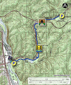
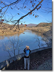
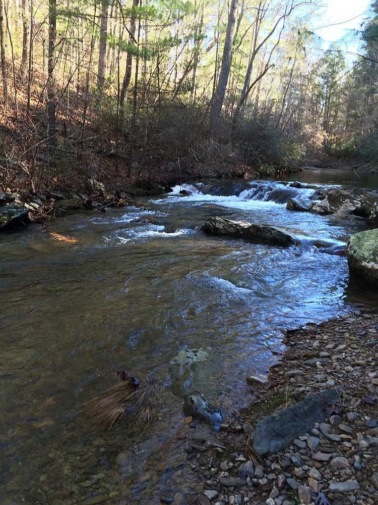
Otter Creek Trail is a nice little out and back that meanders alongside its namesake creek. It is part of the James River/Otter Creek Recreation Area/George Washington National Forest. At the south end of the trail is the James River Visitor Center (BRP MP 64) with some great descriptions of the canal locks on the other side of the James River that made it navigable during the 18th century, a quick walk across the river and you can see some of the restored locks as they would have been in the 18th century.
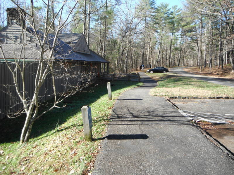
At the north end of the trail is the Otter Creek Campground (BRP MP 61) with 45 tent sites and 24 RV/Trailer sites with facilities. Very rarely does the trail wander out of hearing distance of the Blue Ridge Parkway. The Trail of Trees is included as part of this hike as you will not want to miss some great views of the James River.
Note: Although the hike is rated 'N/A' for trail camping, there is a campground next to the hike trailhead.
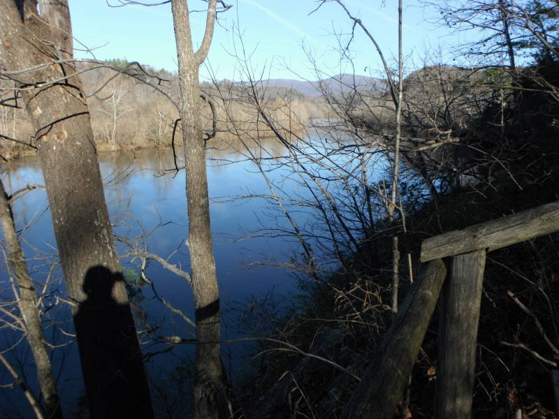
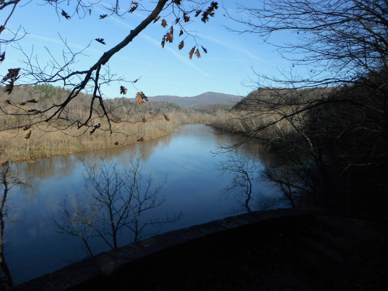
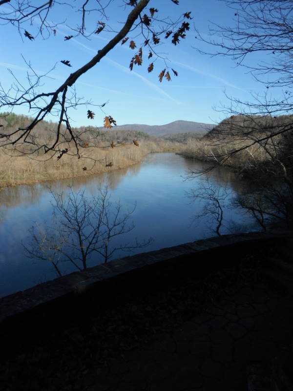
Mile 0.0 – Stay on the path and head under the James River Bridge to walk the short Trail of Trees circuit. Near the first intersection is an overlook for a view of the James River as it works its way through the mountains. Bear right and head up hill, counter-clockwise, keeping your eyes open to see the name plaques of the various trees.
Mile 0.3 – Reach the 2nd overlook of the James River, looking to the west you will see the rock cliffs of Big Rocky Row.
Mile 0.5 – Continue on, completing the circuit, going under the bridge again, heading downhill on the path just before reaching the Visitor Center, toward Otter Creek
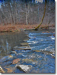
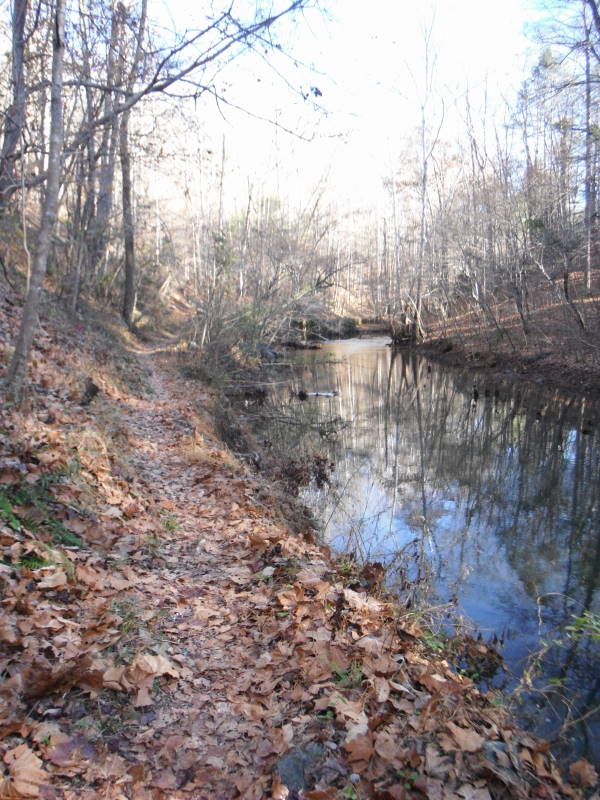
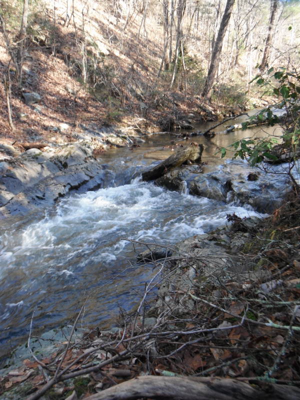
Mile 0.7 – Cross Otter Creek on the concrete round steps. Note: High water may cause problems crossing the creek, use good judgment and detour as necessary.
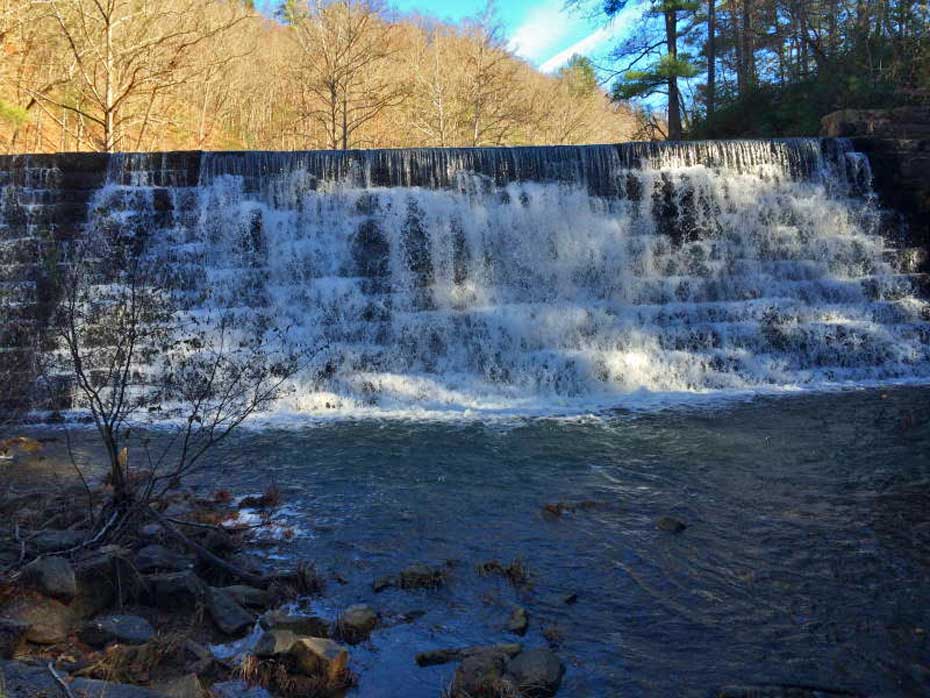
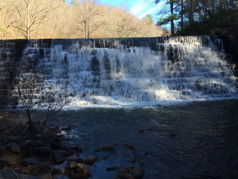
Mile 0.9 – Just before the Otter Lake Dam, cross the creek again. This is also the intersection of the Otter Lake Loop Trail. Note: You could go straight but where it hooks back in to the Otter Creek Trail has been dammed up by some industrious beavers and the trail is virtually impassable.
Mile 1.3 – After crossing the creek, continue up past the dam, walking through the Otter Lake parking area and finally crossing a small bridge to get back on the trail.
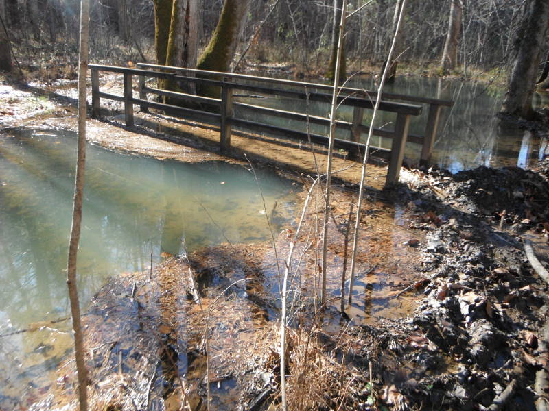
Mile 1.4 – Intersection with the Otter Lake Loop Trail, bear left to stay on the Otter Creek Trail. Note: If you went straight for just a short distance you will see the work of the beavers.
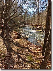
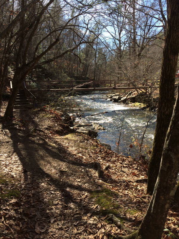
Mile 1.7 – Reach the Lower Otter Creek Overlook parking area, passing over 2 very sturdy bridges.
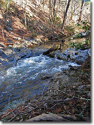
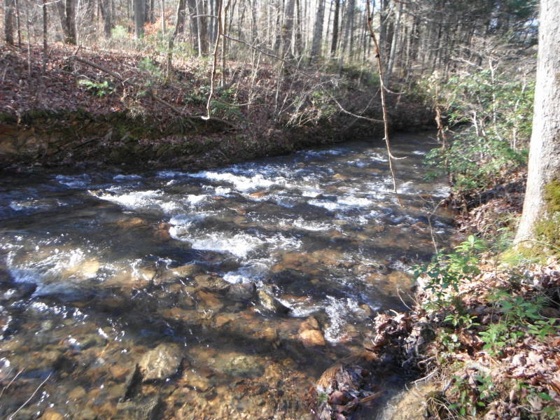
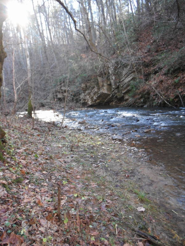
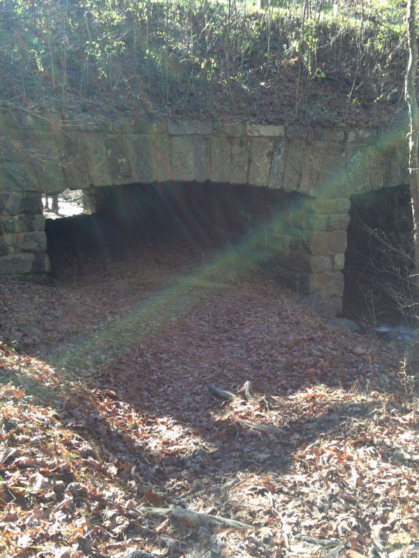
Mile 2.9 – This next section takes you the farthest away from the creek but eventually you will see the creek and will cross it again just before going through 2 tunnels that go under Route 130 and the Blue Ridge Parkway.
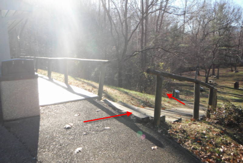
Mile 3.4 – Continue following the beautiful creek and then cross the BRP.
Mile 3.6 – Cross the creek to head towards the Otter Creek Campground Restaurant. Note: There are quite a few of the round concrete crossings and most all of them will get you to the Restaurant.
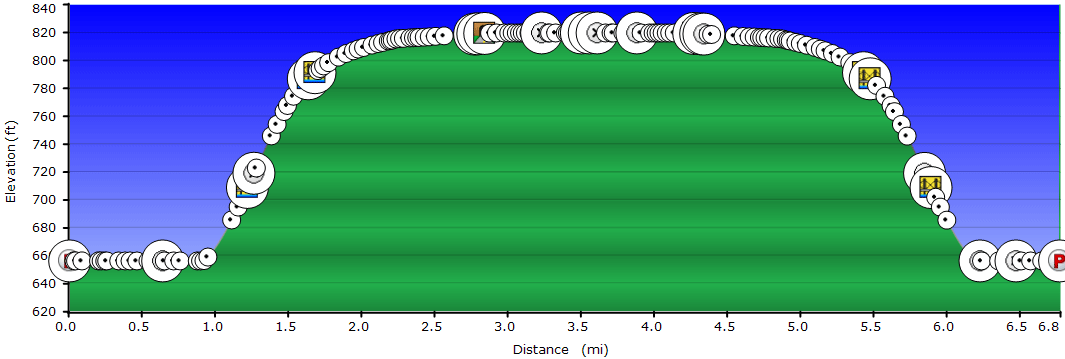
Mile 7.4 - Retrace your steps to the James River Visitor Center to complete the relatively gentle 7.4 mile out and back hike.
Mid November
Otter Creek
Otter Creek Hike Comments
Archived Comments
By:Lisa
Rating:
Date of Hike: Sunday, March 25, 2018
This was an easy, beautiful hike following Otter Creek. (The difficulty rating should be a 2/5 at most in my opinion). We had to modify the hike because the water was too high to cross in a couple places as some of the stepping stones had washed away but it was still worth it. (You probably could have crossed if you don't mind wet feet). Otter Creek is really beautiful! Our 3 dogs loved splashing in the water along the way. There were just a few other people out and about so the solitude was nice too. Just to comment on what one other reviewer said-- you don't actually walk ON the BRP-- there is a path several feet from the road (most of the time it's also on the other side of a parking area so even further from passing cars) for those who bring dogs or kids who might be concerned. It's also just for a very short distance and I found the view of the lake lovely from this path.
By:Snakebit12
Rating:
Date of Hike: Wednesday, September 21, 2016
Hiked Otter Creek yesterday with our Golden Retrievers. All in all, a very pleasant and simple hike - walk out, walk back with little terrain change. Very nice to hear the creek flowing as you hike (and watch our dogs play in it). Found a nice rock formation in the creek (about 3 miles in) which was a great place for lunch.
Opted to take the "Outer" Otter Lake Loop on the way up which takes you east of the lake- adds 0.3 mi to the trip one-way. Came back per the HU map on the "Inner" loop which takes you west of the lake). Preferred the "Outer" Loop as the "Inner" Loop literally has you walking on the BRP. You choose your route when you reach the dam - stay right for the outer loop cross the creek for the inner loop. The two trails converge north of the lake.
The creek crossings were easy (although the water level may have been lower than normal as it has been dry). Ran into numerous volunteers from Natural Bridge who were trimming the trails - thanks to all of them.
It was a nice break from our traditional peak hikes. We'll do it again next year.
By:Robert
Rating:
Date of Hike: Thursday, March 31, 2016
Great writeup and directions here on the site, but I failed to print them off, and my phone got zero service, so I missed the part about the beaver dam. I was able to shimmy across the bridge without too much difficulty, just got a little muddy on either end. Do be prepared to get a little wet on this hike, as it is almost impossible to make it across the all the creek crossings without ending up partially in the water at one or another. Note that the campground is only open May-October, so if you were looking forward to lunch or restrooms in, say, March, you'll be out of luck.


