Shenandoah Mountain, sounds like it should be in Shenandoah National Park (SNP). It is in fact, the sister hike to Ramsey's Draft. It shares the same Draft route but it will take the Shenandoah Mountain Trail to the west as the return route. Friends of Shenandoah Mtn is proposing Shenandoah Mtn as a National Scenic Area with four new Wilderness Areas.
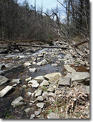
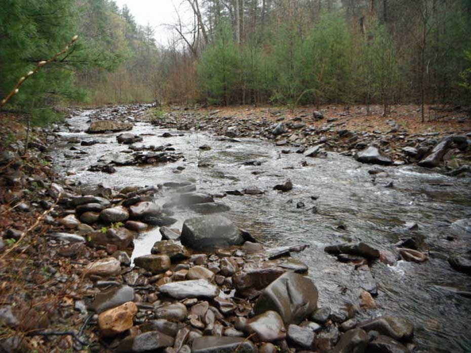
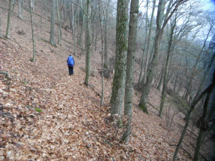
Much of the area we hiked has never been timbered, so many of the trees were huge! You will ford Ramsey's Draft 20+ times and also go through stands of Hemlocks, which have been decimated in SNP. What a great hike but do it as 2 day backpack to really enjoy it.
Also see the Jerry's Run hike for an abbreviated version of this circuit.
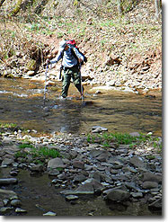
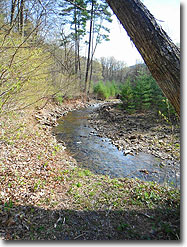
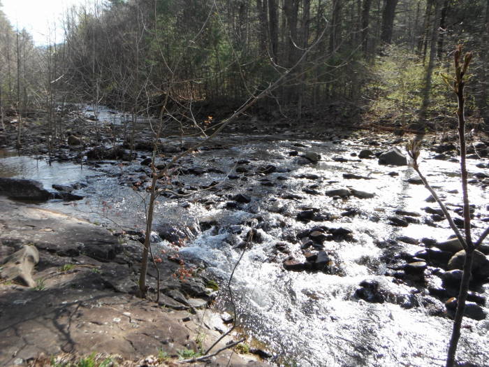
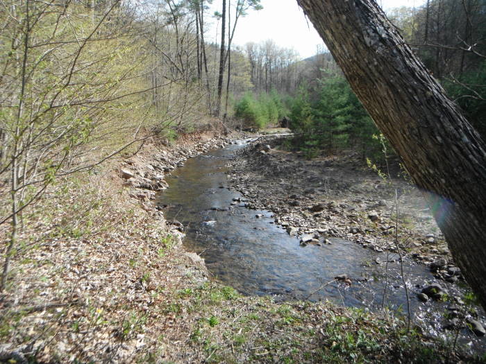
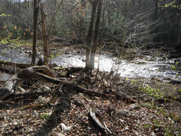
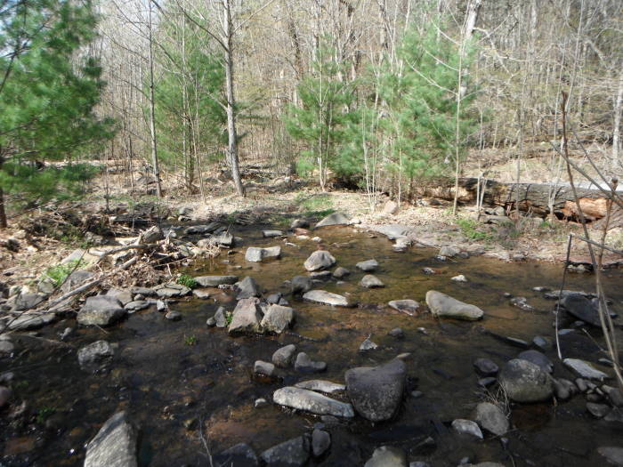
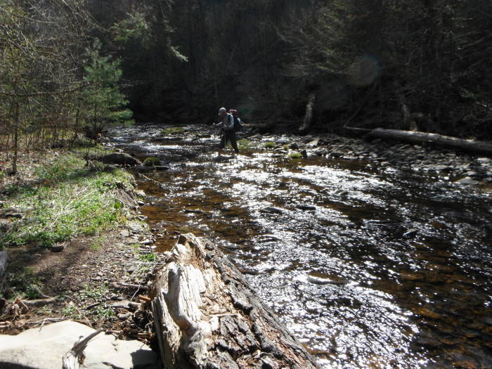
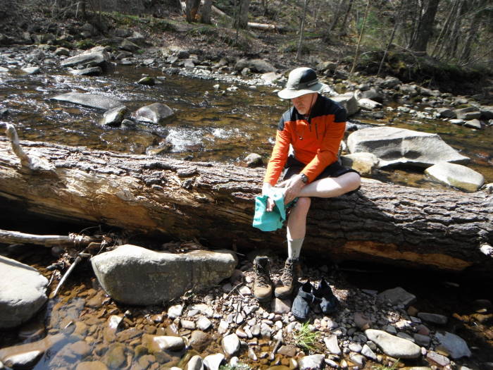
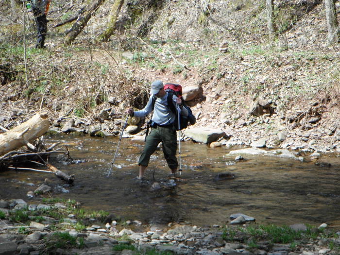
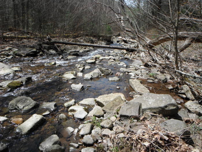
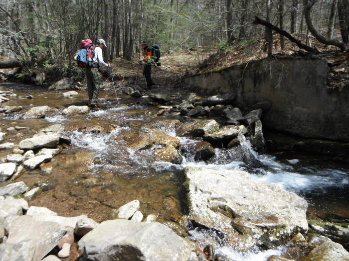
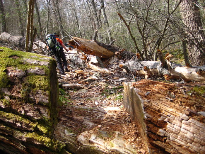
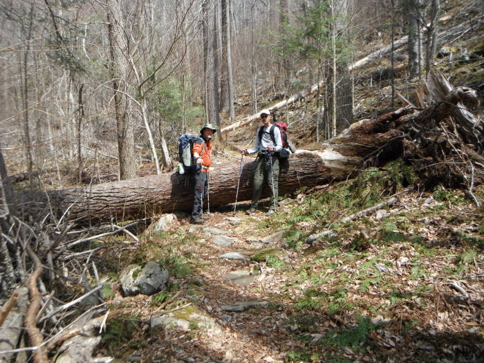
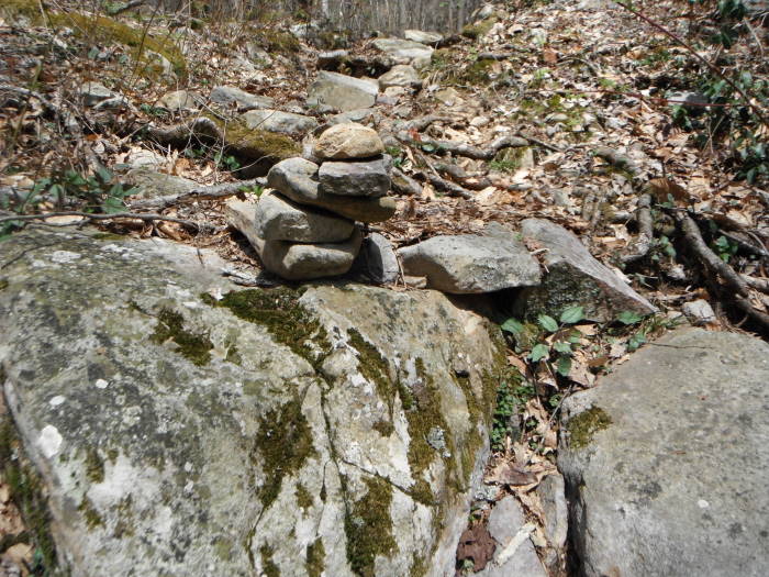
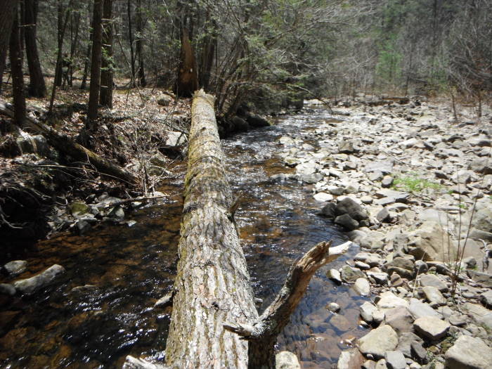
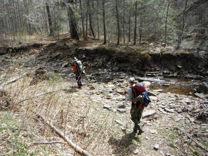
Since there are so many crossings of Ramsey's Draft we will not describe them all, but when you get to a crossing scan the other side for the trail and sometimes there will be a well placed rock cairn marking it. Be aware, the Draft can be deep and flowing after heavy rains, so be careful when crossing and do not cross if it is too dangerous. You can always hike it another day. Be prepared to use river shoes or crocs on many of the crossings, others you may be able to "rock hop" or use a well placed downed tree. Switching out shoes will slow you down, you won't set any records on Day 1. This is a wilderness area and as such the trails are not blazed except for the Road Hollow Trail at the end which is Yellow-blazed.
DAY 1 – 9.5 Miles
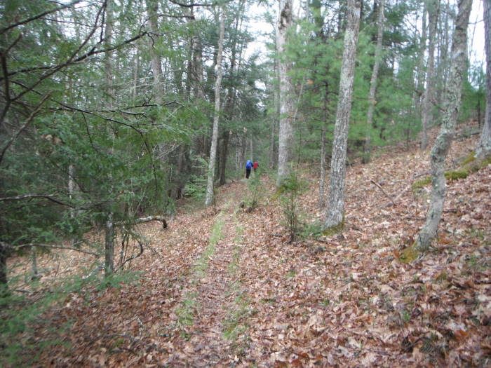
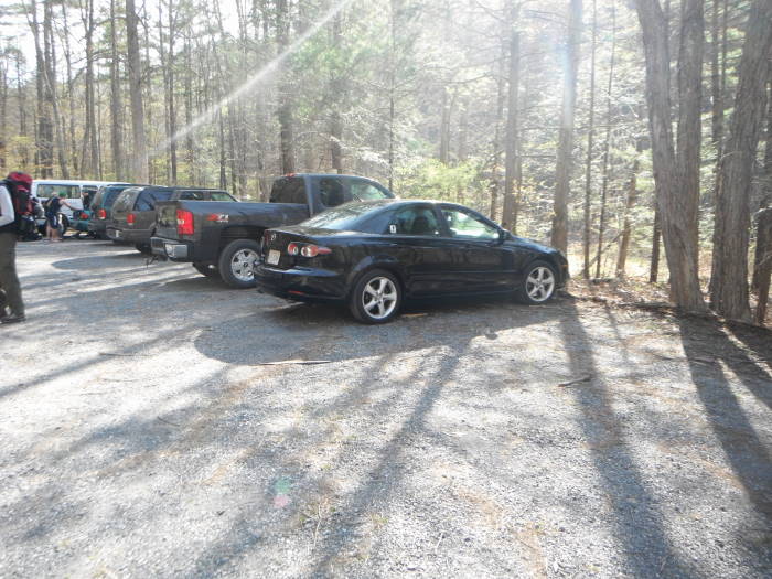
Mile 0.0 – The hike begins at the end of the parking lot just beyond the Information Kiosk. Very quickly you will by-pass the Bridge Hollow Trail on the right and then the Road Hollow Trail on your left, which will be part of your return route. Stay straight and on the left side of the Draft for 0.7 miles, this is the Ramsey's Draft Trail.
Mile 0.7 – The first of many crossings and the only one mentioned, keep your eyes peeled for it on the right as we originally missed it.
Mile 2.8 – Jerry's Run, cross it and then quickly pass Jerry's Run Trail on the left, stay straight on the Ramsey's Draft Trail, more crossings.
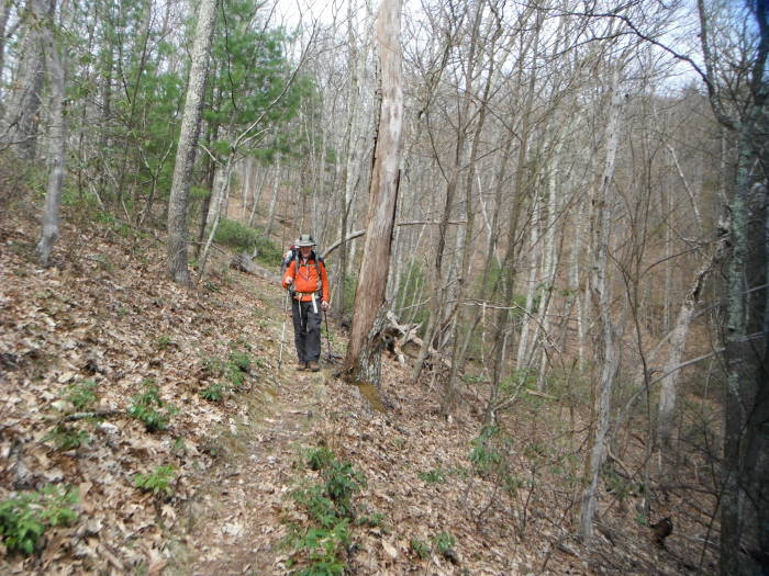
Mile 5.2 – US Geological Survey Marker on the left, says 2914', easy to miss. The elevation gain has been gradual to this point. The climb from this point becomes steeper with quite a few blowdowns prior to the intersection at Hiner Spring. As you approach the intersection, the trail is faint at best, keep heading up with the creek mostly on your left and you will be fine.
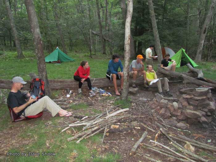
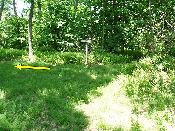
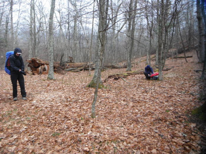
Mile 7.3 – Intersection with Bald Ridge Trail, trail sign was on the ground, continue up the Ramsey's Draft Trail and over the next 0.1 to 0.2 miles there will plenty of great campsites and places to fill up with water. This would be a good place to call it a day and camp for the night. You could then do a side trip to Hardscrabble Knob for one of the few good views on this hike. We pressed on for 2 more miles as it was to rain the next morning.
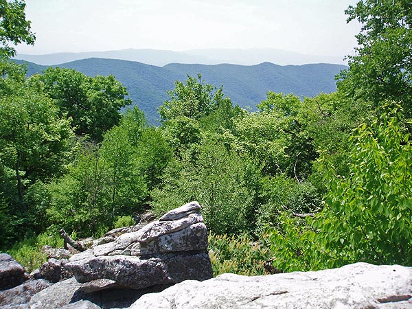
Mile 8.2 – Hardscrabble Knob, abandoned shack, and downed fire tower. You could camp here but no known water source, so fill up at Hiner Spring area prior to making that decision. Fairly decent view from top of Knob: Shenandoah Mtn to the Southwest, Big Bald Knob to the Southeast, Gordons Peak to the South and The Pinnacle to the South.
Mile 8.7 – Return to intersection and bear left onto Ramsey's Draft Trail.
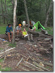
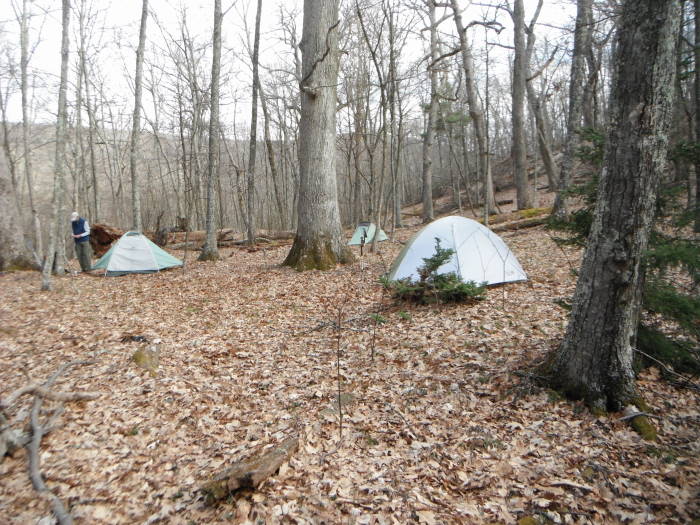
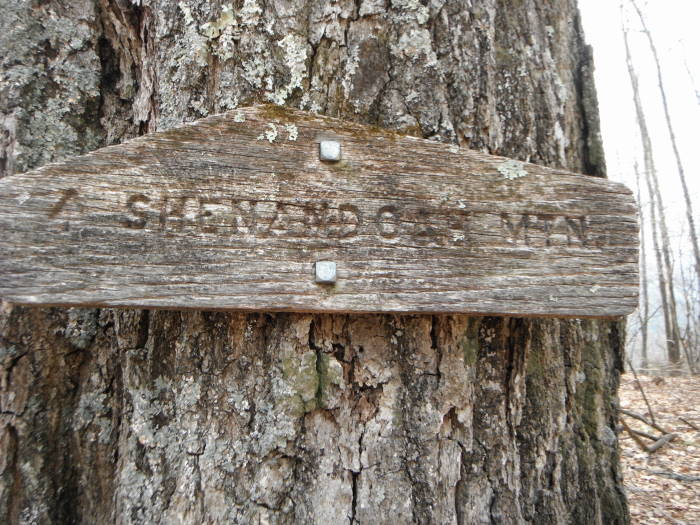
Mile 9.5 – Reach Shenandoah Mtn Trail and bear left. Just off to your left is a great campsite with fire pit. Site is easily big enough for 10-12 tents with a Spring. This is where we camped for the night.
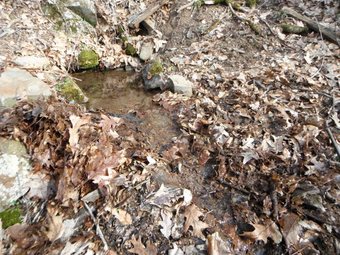
Note: The Spring is located across the trail from the campsite, look for tree with "SHENANDOAH MTN" sign, bear right 90 degrees, go down about 15-20 yards, quite steep. We cleaned out the leaves from an 8” deep pool of water and 20 minutes later the water was very clear and cold. Spring coordinates: N38 22.868 W79 19.600.
DAY 2 – 8.7 Miles
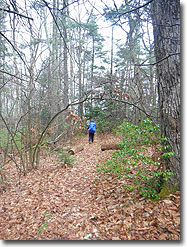
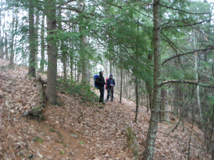
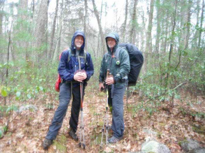
We had a quick breakfast and packed up in light rain. The rain picked up as we hiked out, so we were highly motivated and made good time, 3.5 hours. If it is nice, take your time and enjoy the woods. There are some views through the trees but over all a nice walk on the ridge through some small stands of Hemlocks.
Mile 10.2 – Sinclair Hollow Trail on right, stay straight.
Mile 14.5 – Jerry's Run Trail on left, stay straight.
Mile 15.6 – Bear left onto Road Hollow Trail. You will really start to lose some elevation now.
Mile 18.1 – Reach Ramsey's Draft Trail, bear right towards Parking Lot.
Mile 18.2 – Parking Lot
Late April
Ramseys Draft
Shenandoah Mountain Hike Comments
Archived Comments
By:Schnitzel
Rating:
Date of Hike: Friday, November 30, 2018
Arrived at the trailhead approximately at 10:30 on a Friday with only one other car there. After signing the register with Pennzoil, we promptly started and soon found ourselves at the first creek crossing. Water depth was normally at mid calf with occasionally up to our knees... there were no places to hop from rock to rock with that water flow... and we must have crossed the creek no less than 8 times. Quite the adventure. Shoes stayed on and only after getting into the sleeping bag that night did they warm up. Before beginning more of the uphill route, we elected to camp on the left side of the creek (look down to the right for a fire ring and level area). Note: there are few places to camp along the creek, so if daylight is waining... choose a spot when you can. The largest place to camp was at the top (after the Jerry's Run intersection where there is certainly a good amount of water and tent space -- with lots of widow makers too), yet I recommend you not attempt to get to the top in the dark as the trail is difficult to follow in daylight as you get close to the top. The Spring at the very top was running, although only slightly even though we were within cloud cover most of our backpacking trip with occasional heavier rain.
We continued along the ridge line the next day until the intersection of Jerry's Run where there are several campsites, yet no water source. There is a large hemlock to your left with a fire ring and a good amount of space for several tents / hammocks. The next morning found a stream not more than 1/2 mile further down the trail coming down through the rocks from above and to the left. There are no camping spots for the remaining portion of this hike as the trail hugs the side of the mountain constantly until it finally winds itself down close to the parking lot. Thank you to the trail crews working on cleaning some deadfall off the trail. Their work was impressively done.
One of my favorite hikes due to all the hemlocks and the multiple steam crossings. Not too far at all from the Staunton area / 81 & 64 interstates making this a great opportunity to get away and not have to spend considerable time traveling.
By:SP
Rating:
Date of Hike: Saturday, June 9, 2018
I have done this loop in the past, in winter, and let me say that it is completely different in mid-June. In summer, Ramsey's Draft trail is 5 miles of shoulder-high stinging nettles mixed with poison ivy and thorns. I have never seen such a prolific expanse of nettles pressing in on both sides of the trail. You want to wear pants and gaiters and think about long sleeves. It should go without saying that you treat all clothes will permethrin and cover all skin with deet because you will be in constant contact with the plants and their critter inhabitants looking to hitch a ride. You will be tempted to wear sandals or water shoes for the ~20 water crossings, but consider this carefully because we saw a timber rattlesnake on the trail, coiled up in the nettles. So who knows how many we didn't see since there is such limited visibility. As mentioned already there are many blowdowns to navigate.
On the plus side we had a really nice night camping at Hiner Spring, the spring was going strong and was a good water source. The Shenandoah Mtn Trail was in great condition and the mountain laurel were in full bloom so that half of the hike was great.
Overall I gave this 3 stars because in the winter it is nice, 5 stars but summer conditions I can't imagine a sketchier trail, I would not do the Ramsey's Draft trail in summer again. Did I mention there are no blazes so you basically just follow the nettles to keep your bearings. Wish I could post my picture of these nettles because I don't think my description does them justice. Good luck!
By:scudder
Rating:
Date of Hike: Saturday, April 14, 2018
I went up Ramsay's Draft and down on the Shenandoah Mt trail for an overnighter. Dropped down Jerry's Run to return instead of Road Hollow. Water level was on the low side. As the temps were warm, I just walked thru it. There's a bit of blow down especially the area from Jerry's Run up to Hiner Spring.The springs at Hiner and Shenandoah Mt/Ramsay's Draft intersection were running.Wildflowers are late, but I did see bloodroot, hepatica, and yellow violets. I also had some extended facetime with a young deer. Ticks are active-don't ask me how i know this.
Excellent views as the leaves have not yet obscured them. Be prepared for some climbing over /thru to make your way.
By:WilliN
Rating:
Date of Hike: Saturday, April 14, 2018
Did this as a day hike, did it clockwise, modified it slightly by adding Ramsey's Draft Loop to it, and cutting out the river (Draft) in the middle.
I Thoroughly Enjoyed this hike!
I'm guessing it was scudder I ran into on trail toward the back of the loop, as he was enjoying some awesome face time with a deer in these beautiful woods, when I came walking up. Always an awesome experience, as the look of peace and happiness on his face told. If it was you scudder, Thank You for telling me about the unmarked (un-signed?) trail intersection of Shenandoah Mountain Trail & Ramsey's Draft Trail. Thank you, Thank you Thank you. I would've walked right on past it had you not told me about the piece of metal in the tree.
I did go up Hardscrabble Knob, there's weren't any super amazing views to speak of, but it's cool up there (old shack, fire ring, fallen over metal tower, rock ridge), then headed down into Hiner Sping camp area, where I stopped, ate/drank, and relaxed for a bit. Still great flow from the spring!
Then turned left on Hiner Spring Trail and finished out my hike with that portion of Ramsey's Draft Loop hike. I did the Ramsey's Draft Loop hike the weekend prior, which is also a great hike.
Between Shenandoah Mountain loop hike and Ramsey's Draft loop hike, Ramsey's Draft loop has the better views and is maybe just a bit better marked. The Draft (river) that the two hikes share is, in my opinion, the best part of either of the loops. It is really quite beautiful down there..
Due to scant trail markings, unmarked trail intersections, and disappearing/invisible trail(s) at times, I don't know that I'd recommend this hike for a lone beginner - that's just my own opinion though - That said, I found the above mentioned things to add to, or enhance, the hike personally.
By:Rick D.
Rating:
Date of Hike: Friday, November 24, 2017
Great Hike. We hiked in reverse and camped at Old Sexton Cabin site for the first night. Great open sites for multiple tents. Being Thanksgiving weekend, met hunters using the site as a base camp. The next day proceeded clockwise to the first campsite mentioned and easily found The Spring which was producing water albeit slowly. NOTE: There are no trail markings or signs and the TRAIL JUNCTION is AT THE CAMPSITE being unaware of this, we continued on the obvious trail (which continues straight) which turned out to be Tearjacket Trail and unwittingly added a 4-mile excursion.
The distance between the Tearjacket Trail / Ramsey's Draft Trail campsite and the Hiner Spring campsites is barely over a mile, in the case you need go fetch water at the abundantly producing Hiner Spring.
Fortunately, the water was low at this time of year as we crossed Ramsey' Draft at least 14 times as well as many dry beds. Will come back and do the loop counter-clockwise next time so as to be climbing the 3 to 4 miles of elevation.
Fellow hikers, please leave no trace!
By:Tim D
Rating:
Date of Hike: Friday, November 10, 2017
Because it was so cold this weekend, we actually hiked Shenandoah Mountain, camped at Hiner Spring, and took Bald Ridge to Road Hollow back to the car, skipping Ramsey's altogether. However, wanted to leave this here (and also at the Ramsey's Draft page) as a warning given the leaf cover on the trail.
Overall, fantastic route, and quiet and great views from the Bald Ridge trail. However, there was on tricky spot to look out for. On the USFS topo map there's a hairpin turn about 1/3 the way between The Pinnace and The Peak. We lost the trail in a sloping hardwood forest where the trees were too wide apart to make the trail, and had to backtrack, then bushwhack down to the approximate location of the trail after that turn. Not the worst bushwhack in the world, but save yourself some time if you're going with all the leaves down and just plan on the short bushwhack.
Total for this ridge-based loop was 21.5 miles over two days.
By:John Wendels
Rating:
Date of Hike: Tuesday, August 1, 2017
First, thank you to the Trail Crews. The large blow-downs were significant but nearly all are cleared! Second, sorry to the Trail Crews from all of us that PI/PO about whoever camped just down from Hiner Spring. There was trash at/in the fire pit, an abandoned fuel canister and worse, toilet paper with a used tampon cartridge just yards up and on the trail. Nice. I took some of the trash that I could fit with my space budget but couldn't bring myself to take the hazmat. For my part I could do more and will in the future by bringing a slightly larger trash bag in future. Always learning. On from that though, I enjoyed the challenge of this trail. I agree with the input from the good folks who post and I always take it into account when I'm planning a trip. I have a couple things to add that i haven't seen mentioned. 1. I'm not speedy by any means and actually stop quite often to just sit and look around. This hike, I filled my water bottles while eating lunch at Hiner Spring as well. Even with these stops I made it up to Tearjacket/Ramsey's Draft Trail intersection at 1400. That's just too long(about 6 hours) for me to wait prior to sunset. Winter or with a group would have been different since I could have setup and gathered wood/socialized in a relaxed manner before twilight. 2. This is a bigger deal I think. Fill up on water from the original author's mentioned spring at the 9.5 mile site. There is no apparent spring to pull from until you get all the way back to Ramsey's Draft. I walked on to the campsite to the left just past Jerry's Run intersection and was tarped and settled before the storms set in at 1730. I had a great time on this hike and would do it again in winter to catch the views that are just now there in summer.
By:Robert Cain
Rating:
Date of Hike: Saturday, July 29, 2017
Hiked this trail with 3 other hikers on what was a fairly rainy day. Ramseys Draft Trail is fairly overgrown with stinging nettles and poison ivy, and had it not been so bad, I probably would have rated this hike 5 stars. As others had noted, you do need to pay attention to the trail since it is not marked on Ramseys Draft Trail. It doesn't appear this trail gets much use, which is good and bad. Stream crossings were not difficult, but were plentiful. The stretch of trail from left prong to Hiner Spring gains significant elevation you'll know when you get to that section of the trail. As other reviewers had noted, there are significant blow-downs, but it appeared as though trail maintenance had been performed on many of these, making it easy to pass through. Hiner spring is a good place to refill water bottles before pressing on to the campsite where Tearjacket and Ramseys Trail converge. There is zero visibility of anything from hardscrabble knob, but still worth the hike. The campsite is nice, and provides plenty of space to spread out, as another hiker had noted. You do want to pay attention to overhead branches as these are old growth trees with lots of dead limbs, and you don't want to setup tent under any dead branches. The hike down on Shenandoah Mountain trail has very little to complain about, especially little to no stinging nettles and poison ivy. It is also very clearly marked, which would have been nice on Ramseys Draft Trail. Overall a very nice loop for a weekend backpacking trip.
By:Caroline Steinberg
Rating:
Date of Hike: Sunday, July 9, 2017
Sounds like this mountain and its old growth forest are sadly in the path of the Atlantic Coast Pipeline!
By:Chris N
Rating:
Date of Hike: Sunday, May 28, 2017
We hiked up the Shenandoah Mountain trail and down the Ramsey's Draft trail. The Road Hollow Trail and Shenandoah Trail were real nice and well maintained except for a few missing signs. We only saw a couple of other people. Due to the missing signs, bring a good map or a GPS. We camped at Hiner Springs. On the second morning we took the wrong trail and I think we were on the Bald Ridge Trail. I had done this hike 10 years earlier and had an idea where the trail was but didn't see much that looked like a trail. Fortunately about a 1/2 mile down Bald Ridge we ran into a hiker going the other way who set us straight. To find the trail you need to follow the draft down about 100-200 yards from Hiner springs where it will become apparent. After that we could find the trail, but there were lots of downed trees. This would have been a real sufferfest, had we done the loop going up the draft and down the Shenandoah Trail. The other lesson learned was that over the last three miles there was lots of poison ivy. Since the water was up, I wore shorts for walking across the many crossings. I'm hoping the water washed off the PI. I guess I'll know in a few days. Overall it was a great hike for solitude and beautiful scenery.


