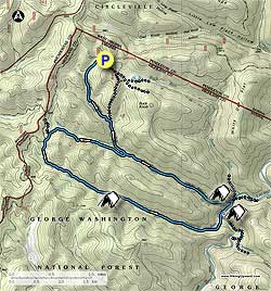
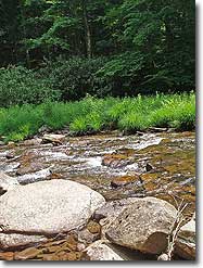
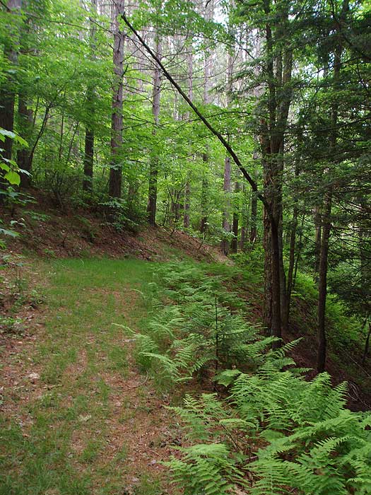
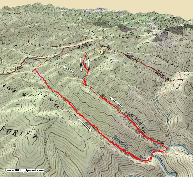
The Slabcamp Run/Locust Spring circuit hike is part of the Laurel Fork wilderness area. Laurel Fork is one of the few very secluded backcountry forests left in Virginia. With high meadows, wetlands, and the fast running Laurel Fork on the valley floor, this has to be one of the best backpacks in the region.
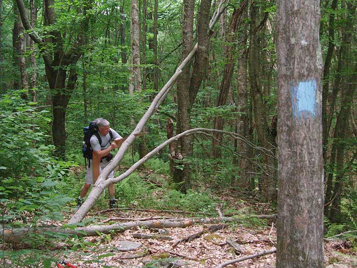
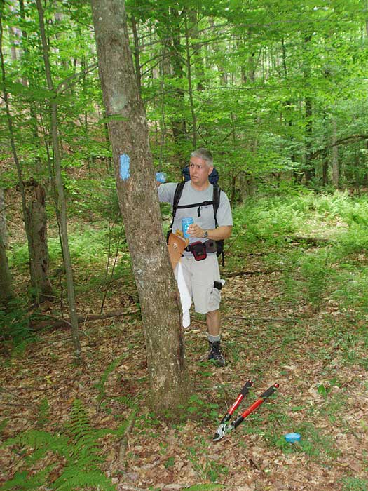
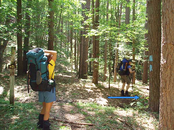
Trail Notes: All trails in the Laurel Fork area are blue blazed. In conjunction with the USDA Forest Service HikingUpward.com reblazed the Locust Spring Run, Locust Spring Run Spur, and Slabcamp Run trails in June 2007.
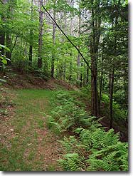
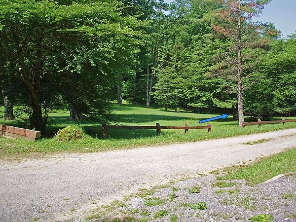
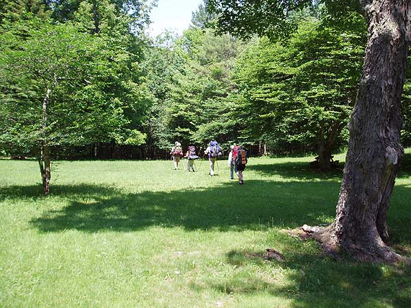
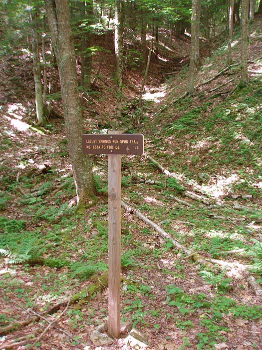
From the right bottom of the picnic areastart down the the Locust Spring Run Trail as it heads through old growth forest for 1.2 miles before arriving at the Buck Run Connecter Trail. Turn right, cross the run, then immediately turn left downhill remaining on the blue blazed Locust Spring Run Trail. Cross over the run two more times before crossing a small side stream and passing an old wooden trail sign in 0.3 miles. In another 0.2 miles cross the run again and arrive at the intersection of the Locust Spring Run Spur Trail.
Turn right very steeply uphill on the Locust Spring Run Spur Trail for 100 yards, then stay right as the trail follows an old forestry road. Pass a beaver dam downhill on the right in 1.1 miles, and in another 0.1 miles turn left uphill following the blues blazes. In 0.1 miles arrive at the ridge, and intersection of the Slabcamp Run Trail and FS106.
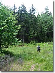
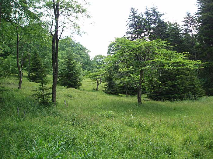
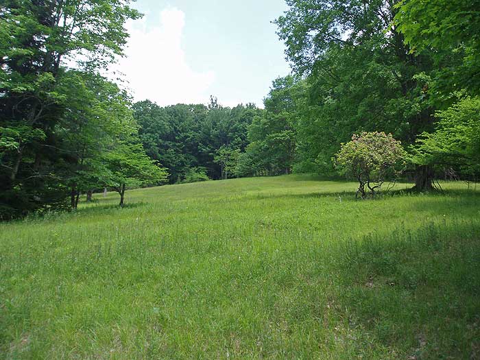
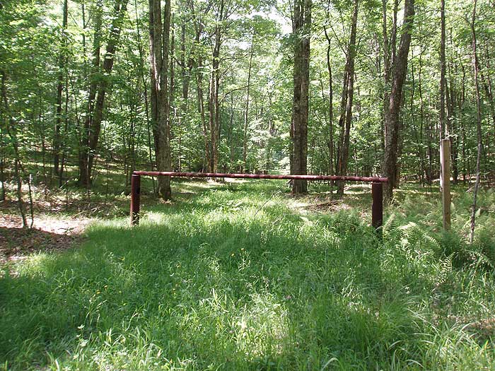
Continue straight, through the closed gate onto the blue blazed Slabcamp Run Trail. The trail is 70 yards wide for the first 0.2 miles as it begins to descend the mountain. In 0.2 miles the trail veers slightly right, and in 0.1 miles arrives at a wetlands area on the right. Continue straight slightly uphill before following the trail on the right side of the clearing.
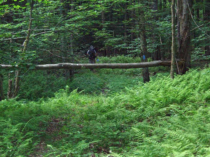
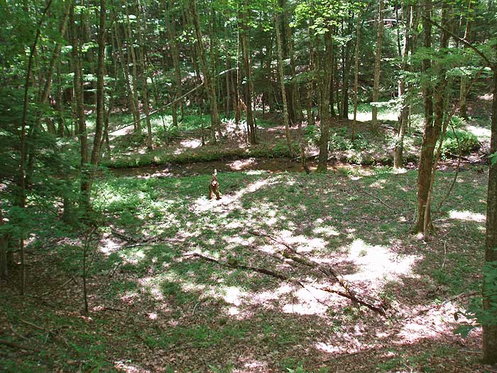
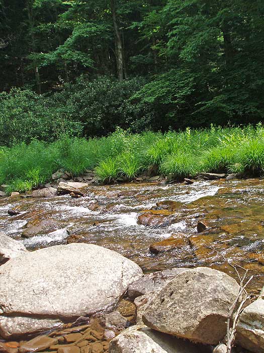
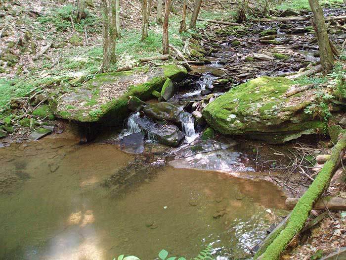
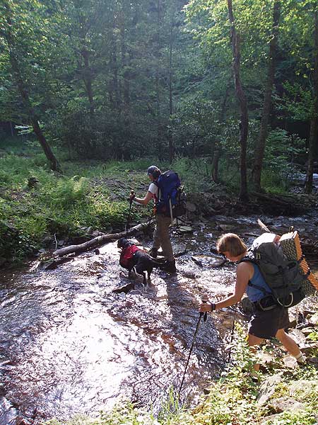
At this point the trail re-enters the forest as it follows Slabcamp Run on the left bank. Continue to follow the blue blazes as the trail descends towards Laurel Fork. In 1.0 miles from the wetlands clearing there is a large flat camping are on the banks of Slabcamp Run, suitable for several tents. As the trail continues towards the valley floor, and Laurel Fork, it will become considerably more rocky and crisscross the run several times. When the terrain levels out near the valley floor, the trail moves to the right bank of the run, then ends at Laurel Fork.
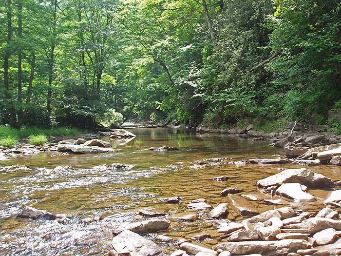
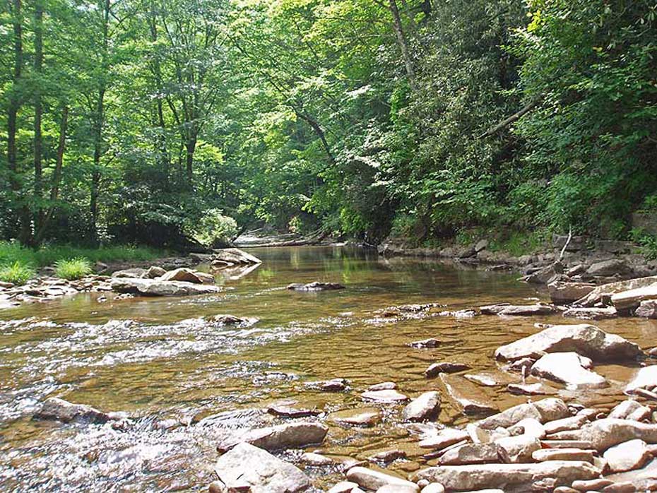
Ford Laurel Fork and in in 200 yards on the Laurel Fork Trail there is a large campsite. 250 yards past the campsite ford Laurel Fork for the last time, and in another 0.1 miles cross Locust Spring Run before arriving at the intersection of the Locust Spring Run Trail and another large camping area.
Turn left uphill on the blue blazed Locust Spring Run Trail as it heads upstream on the right bank of the run. At 1.3 miles the trail crosses the run and follows the left bank before arriving back at the intersection of the Locust Spring Run Spur Trail in another 0.2 miles.
Continue straight on the Locust Spring Run Trail re-crossing the run and retracing your steps back to the intersection of the Buck Run Connector Trail. Turn left staying on the Locust Spring Run Trail for the remaining 1.2 miles back to the Locust Spring Picnic Area.
Mid June
Laurel Fork
Slabcamp Run/Locust Spring Hike Comments
Archived Comments
By:mrshwroberts
Rating:
Date of Hike: Saturday, April 20, 2019
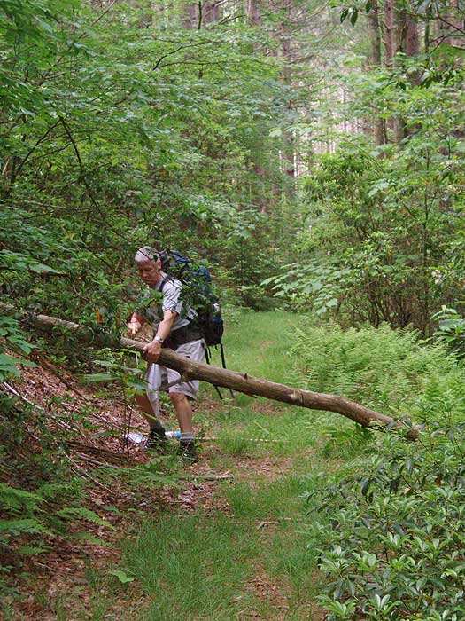
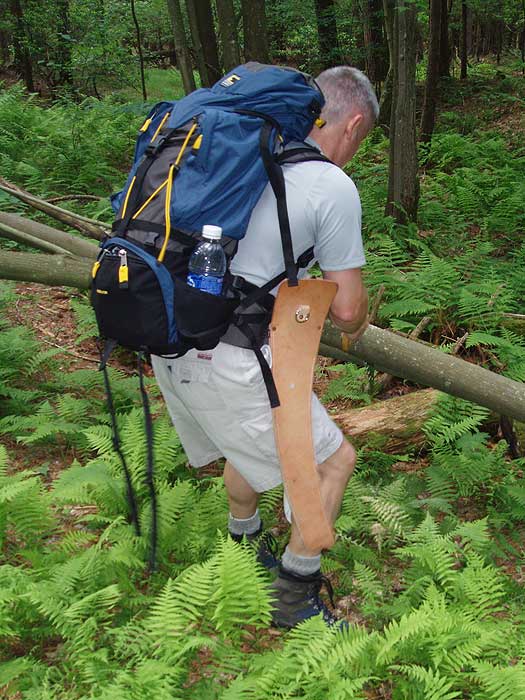
My husband and I chose this hike bc of the solitude rating. We weren't disappointed on that aspect. We only saw 2 people on their way out in the first two miles of the hike. It was a beautiful day and the first three miles or so were amazing with wildflowers blooming everywhere. The trail became difficult to follow once we reached the wetlands. It isn't marked frequently enough for the terrain, some trees with marks have fallen or lost the bark that had the mark, or new growth has covered the marks. Thanks to GPS we were able to get through this section without too much difficulty. The trail was better from that point until we got to where the trail crisscrosses Slabcamp Run. This is a rough section with some spots washed out. We finally made it to Laurel Fork only to discover that it was swollen and rushing. Even though the whole trail is supposed to be six hours, it took us six hours to get to this point. We made camp on that bank at an established camp site. We made the decision to hike up over the mountain to pick up the trail on the other side. It was quite a climb, but we picked up the trail along Locust Spring Run. We didn't have any difficulty on this part of the trail, but there were a lot of trees down across the trail. This trail is difficult bc it isn't used much. We had both GPS and topo maps. Don't do this trail without them. If you want to help with maintenance, take a pair of small limb cutters to cut back some of the pine limbs that have grown out to block the trail marks. We also recommend water shoes. I gave this hike 4 stars bc of the adventure factor!
By:Kevin
Rating:
Date of Hike: Saturday, August 4, 2018
This review deals mainly with Slabcamp Run. We hiked this trail as part of a two-nighter incorporating the Slabcamp/Locust Spring circuit with the Laurel Fork circuit, beginning our Slabcamp ordeal at its confluence with Laurel Fork late afternoon on our second day out. "Ordeal" is the right word. The trail is virtually non-existent. Blazes lower down are few and far between and what's left of the trail is overgrown with stinging nettles and blocked by downed trees. Mostly, we had to guess where the trail was headed and even for a group of five experienced hikers it took us over two and a half grueling hours to find our way up the 1.5 miles to the campsite. The campsite, on the left bank of Slabcamp, is far down off the trail on the stream, with no easy access, but it's a pleasant site. Just be careful getting to it and watch for poison ivy. The hike from the campsite to the Locust Spring trail was not quite as challenging, but we still had to use guess-work to find some of the next blazes. The trail pretty much disappears in the meadows and it takes some careful scouting to find the blazes and the trail, although the trail, while sketchy, at least exists for the most part. This is not a trail to attempt if you want to come away with good memories of this wilderness area. However, Buck Run/Locust Spring/Bearwallow/Laurel Fork are great (however, Laurel Fork between Bearwallow and Slabcamp presents its own challenges).
By:Ken
Rating:
Date of Hike: Saturday, September 17, 2016
The beginning of this hike along Locust Spring Run trail was very good. The trail was recently maintenanced and had easy to follow blue markings. Once you turn onto the Locust Sring Run Spur trail it gets bad. There were many downed trees across the trail and we missed the left turn going up to the intersection of FS 106 and Slabcamp Run Trail because we didn't see the blue trail blazes. Once we ended up on FS 106 we figured out were we were. But it got even worse once we turned onto Slabcamp Run trail. This trail was very overgrown and had many large trees down across it in the first part. Once we got into the clearing it was still hard to follow the trail because the blue markings were very spread out and things were overgrown. Once we reentered the forest, it was still very hard to follow the trail due to overgrowth and not seeing the blue blazes. When we finally got to the part where the trail follows the Slabcamp Run stream, the trail was washed out/missing in many places and was overgrown in Stinging Nettles plants everywhere else. We hiked the rocky stream bed for most of this section, thankfully it was almost dry. Once we got to Laurel Fork and forded it, the trail was in good shape again as you could see it was recently cut back. The camping area at the intersection of Locust Spring Run trail was very nice. I would recommend anyone wanting to hike this to only use the Locust Spring Run trail down to Laurel Fork as it appears to be in good shape right now. We returned to the picnic area on the Buck Run trail and it was in good shape with only a couple trees down blocking the trail.
By:Chandru
Rating:
Date of Hike: Saturday, August 16, 2014
This is a very nice hike. I went hiking/camping on Slabcamp Run trail with a buddy of mine. We did miss the route a few times around the Wetlands as there is Grass on the Slope and Wetlands on the right before the beginning of the SlabCamp Run Trail, just make sure you walk along the edge of Wetlands and Grass to stay on track. The large campsite is just enough for a 2 person tent, the campsites which you will find towards the end of the Slabcamp Run and Laurel Fork are much better.
This is an amazing hike, if you like solitude.
By:Campy
Rating:
Date of Hike: Saturday, May 26, 2012
I hiked this loop with my wife and our dog on Memorial Day weekend 2012. Overall it was a nice hike but with some disappointments. Finding the parking area was easy, and despite it being a holiday weekend, we were able to find a spot. The Locust Spring Run Trail is in great shape and is well blazed. The forestry road section of the Locust Spring Run Spur Trail was easy to follow, but we almost missed the left turn passed the beaver dam as the blazes at the turn were not great. Continuing on to the Slabcamp Run Trail is when things went a bit sour. The start of the trail, as stated in the description, is very wide and the blazes are few and far between. We also found it to be less than comfortable traversing across the sloping fields. Where the trail narrows and begins to follow the run, it is badly in need of maintenance. The trail is very overgrown which made spotting the blazes difficult. Also, many sections of the trail have been washed out by the run, which made hiking tough. The rocky sections and constant crisscrossing were annoying and the stinging nettles were as well. Fording Laurel Fork was relatively easy, but deep enough to soak our boots. The camping areas by the Fork were plentiful and well established with fire pits, etc. After spending the night, we started the hike back to the car along the Locust Spring Run Trail. Compared to the Slabcamp Run Trail, this one was a breeze. It was well marked and well maintained but unfortunately littered with more stinging nettle. Backtracking up the Locust Spring Run Trail, we made it back to our car. Overall a decent hike, but if I were to do it again, I would probably skip the Slabcamp Run section of the hike.
By:bennington200
Rating:
Date of Hike: Saturday, October 15, 2011
Despite the previous reviewer's comments I decided to overnight on this route even though the area had received much rain earlier in the week. The rain's lingering effects did not appear to increase difficulty on the Slabcamp Trail, but made crossing Laurel Run impossible, so this became an out-and-back on Slabcamp, rather than a loop utilizing Locust Spring Run. I camped where Slabcamp met Laurel Run, at a small campsite not marked on this map. There are a few spots on the Slabcamp Run Trail that have deteriorated to the point that detours are necessary, but they really did not deter from the experience. This is a wonderful place, and I had the entire region to myself that night. I plan to come back when the water levels are lower.
By:Bonnie and John
Rating:
Date of Hike: Saturday, September 11, 2010
We hiked just Slab Camp both down and back. The first part of the hike was relatively easy although new growth fir blocked the blazes in two places. Hike to the left of the firs and you'll find the trail again. Once you pass the wetland camp on the right, the difficulty increases. It had been very dry so there was very little water in the run. However there was ample evidence (moss growth and wet ground) that after significant rain or during snow-run-off, much of this part of the path would be very slick and difficult. About halfway between the camp and the Laurel Fork, the path narrows to an 8 inch dirt ledge. This will most likely not survive the next time the run carries significant water. A bit farther on, the path has completely washed out leaving a 5 vertical foot drop to the run and a similar climb back up. There is a walk-around option that involves a very steep up and down of 20 to 25 feet.
Although very difficult it is a beautiful hike that takes you from grassy fields full of wild flowers and blue berries into deep forest. We encountered no other hikers on the trail.
By:Bob Burke
Rating:
Date of Hike: Monday, June 28, 2010
Very good/pretty hike. I did a slightly modified version by hiking down Buck Run to the campground at Laurel Creek and then the entire loop to camp. Trail work is in progress and is making a big improvement. The Buck run Trail is in great shape and is fast. So is the Locust Springs Trail from Laurel Fork all the way to the trail head. That brings me to the Slab Run portion. The trail is in tough shape in spots and is slow. If it had not been blazed so well, it would have been difficult to follow in places. The meadow on the Slab Run portion is very pretty and looked more like a meadow in Idaho or Montana due to the surrounding Pines.
As far as wildlife, I saw a bunny, snake, birds, and tons of bugs (best bug spray you can get is a must this time of year). There was sign of deer, but no sign of bear.
The camp sites at Laurel were both good. I chose spot 2 for the night. The pictures do not do it justice as it is very pretty. The Slab Creek Camp site has the most wood for fuel if you are going to build a fire, but is the least pretty in my opinion.
The only people I saw the entire two days were the trail crew working an upper portion of the the Locust Springs section.


