Wintergreen is known mainly for its ski slopes and resort facilities but did you know that it has over 30 miles of trails? The Wintergreen Nature Foundation maintains the trails and we were very impressed by how well they are maintained. They publish a map of all their trails which can be purchased from the WNF at the Trillium House.
This is actually a series of hikes that create one tough circuit with a ton of elevation change but you will be rewarded with many great overlooks and some beautiful waterfalls on the Upper Shamokin Falls trail a few miles from the end. This is the first really good circuit hike south of Shenandoah National Park. There is no camping allowed on the trail. A big thanks goes to frequent hikingupward.com reviewer BrandonB for the lead on these great trails at Wintergreen.
Some of the trails that make up the perimeter hike are closed from November to the end of March so before you go during that time period call the Wintergreen Nature Foundation (434-325-8169) for trail closings.
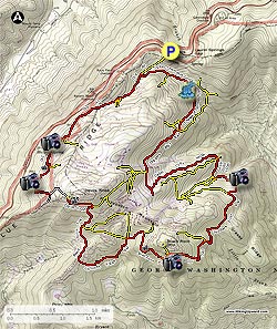
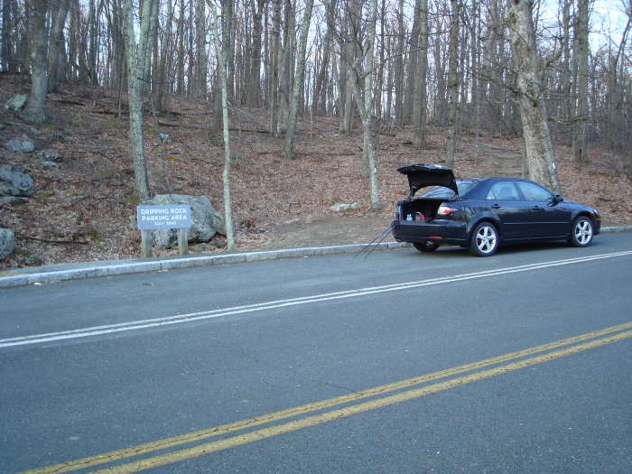
We began the hike at the Dripping Rock parking area on the Blue Ridge Parkway. Head North on the White-blazed A.T for about 150 yards and bear to the right on an unmarked trail (rock cairn). Stay on the trail for 0.1 miles crossing Laurel Springs Drive. On the other side of the road the yellow blazed Old Appalachian Trail begins. You will begin to see some of the Wintergreen homes to the right and left. In 0.3 miles you will pass the Upper Shamokin Gorge Trail on the left, stay on the Old A.T. which at this point becomes red-blazed. You will see and hear Stoney Creek on your left. In 0.4 miles the Nature Preserve Loop will be on your left and in another 0.3 miles you will cross Laurel Springs Drive again.
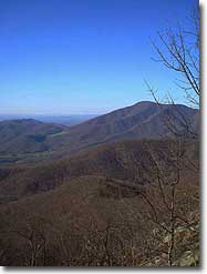
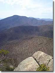
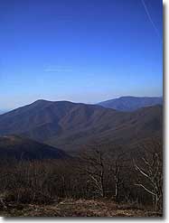
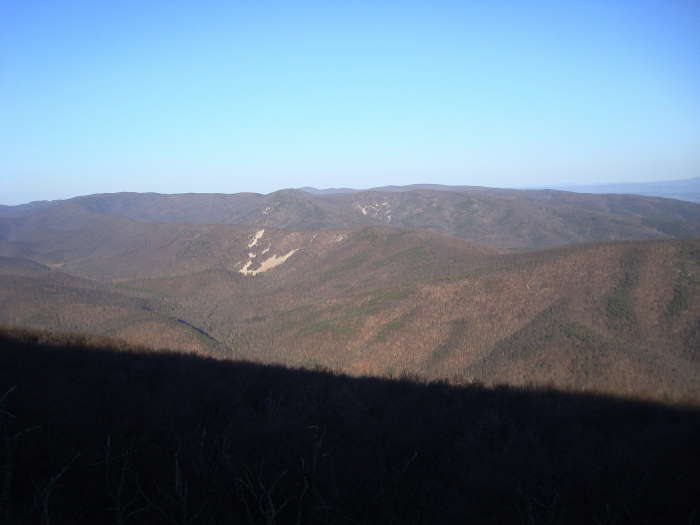
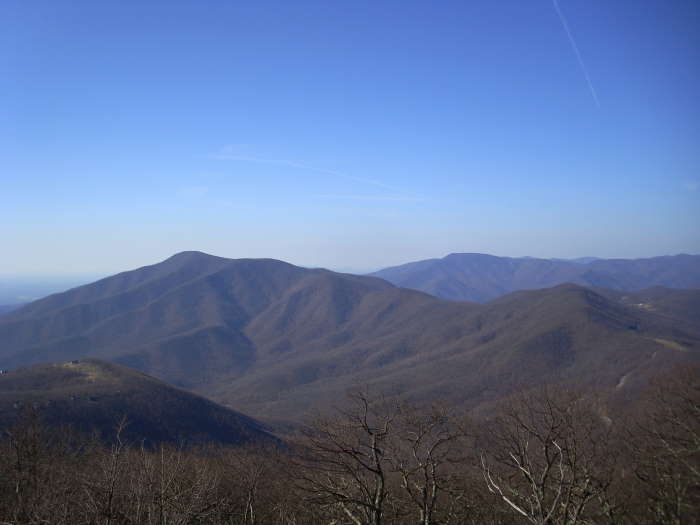
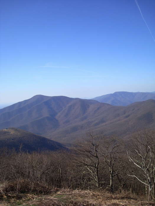
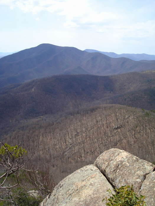
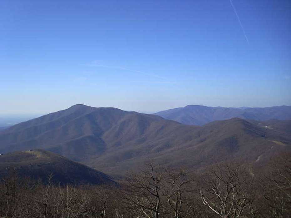
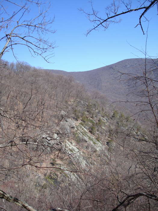
The first of many great views looking west towards Sherando and Torry Ridge will be 0.6 miles after crossing the road. Just after that first view is the Laurel Springs Drive Access Trail on the left. The next 0.7 miles will have multiple views and the Hemlock Drive Access trail on the left, stay on the Old A.T.
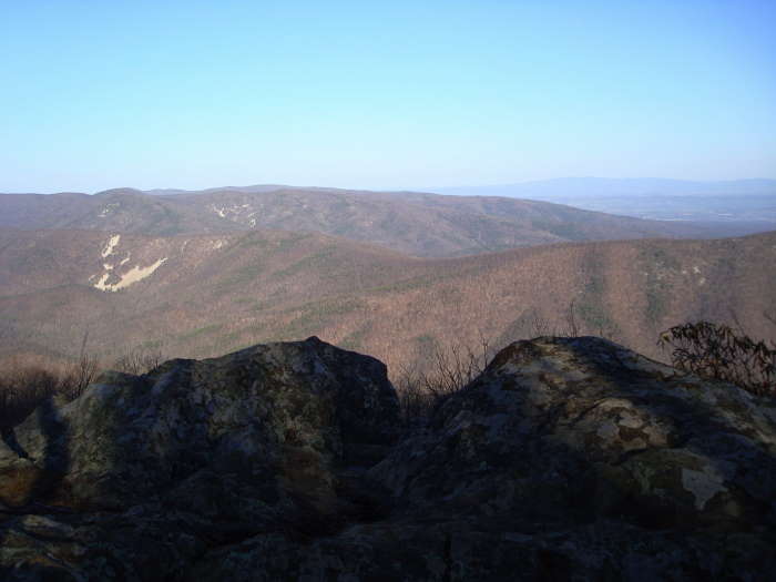
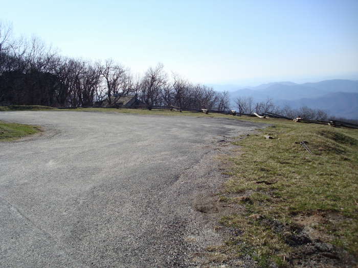
The next 0.5 miles is quite challenging with the Old AT ending at Cedar Road. Take a left onto Cedar Road for 0.1 miles then a right onto Devil's Knob Loop for 0.2 miles, reaching the Blue Ridge Overlook (N37 54.944 W78 57.509) & Parking area. This could be an alternate starting point if you are spending the weekend at Wintergreen. The Devil's Knob Trail (red blazes) begins at the right side of the parking lot and begins the steady descent to Fortunes Ridge. Stay on the Devil's Knob Trail for 0.4 miles to the Pond Hollow Trail intersection, bear right onto the Pond Hollow Trail, red blazed. The next intersection is in 0.4 miles on the left, Pond Hollow Crossover. Stay straight and in 0.5 miles cross over Wintergreen Drive (be very careful) walking on the side of the road for about 100 yards towards Fortunes Ridge Drive. The Fortunes Ridge Trail begins just on the other side of Fortunes Ridge Drive.
The Laurel Ridge Loop intersection is in 0.8 miles, bear to the right staying on the Fortunes Ridge Trail heading to the Three Ridges Overlook/Brimstone Trail intersection which you will reach in 0.5 miles. Bear to the right onto the Brimstone Trail (this section has many great views of Three Ridges) heading to The Plunge trail in 0.7 miles. If you have time, take The Plunge trail (yellow blazes) to see a great overlook, well worth the short side trip. If not, bear right onto the Blackrock Trail for 0.7 miles until the Blackrock Circle access trail, bear right onto the Pedlars Edge Trail. From this point on until the end of the hike there will not be very many views but hang in there because if the water is flowing, the Shamokin Falls will be worth it at the end of the Logger's Alley trail.
On the Pedlar's Edge Trail go 0.3 miles and turn onto a gravel fire road. In 0.2 miles look for a Yellow & Red Arrow sign on the left, turn left onto the trail. You will pass underneath and alongside a Power Line in 0.5 miles and then making a sharp turn to the right in 0.1 miles onto a dirt road, staying on the Pedlar's Edge Trail. Take a left in 0.1 miles continuing on the Pedlar's Edge Trail. In 0.2 miles there is one of the rare views on this part of the trail looking over to Cedar Cliffs. Just after the view and over the next 0.1 miles are a couple of intersection signs, stay on the Pedlar's Edge Trail for both of them. The third sign you come to will lead you across Stony Creek to the Hemlock Springs Trail/Hemlock Springs Loop (one tree has 3 red blazes at this crossing). Stony Creek was flowing pretty well so we had to go downstream a little to find a suitable crossing.
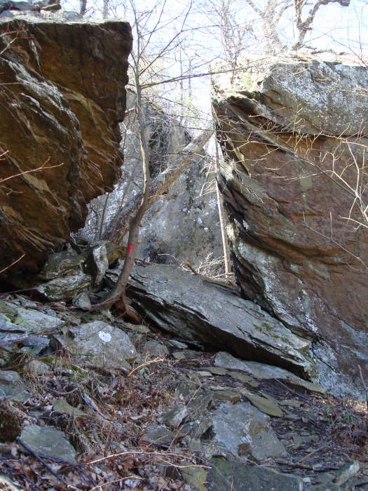
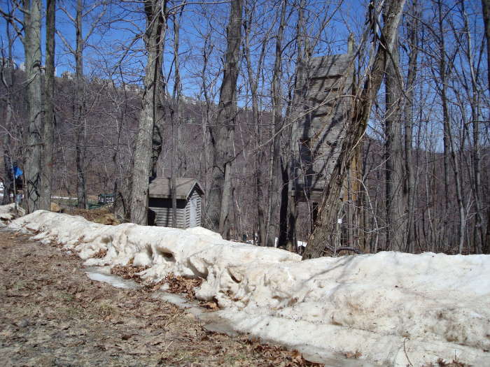
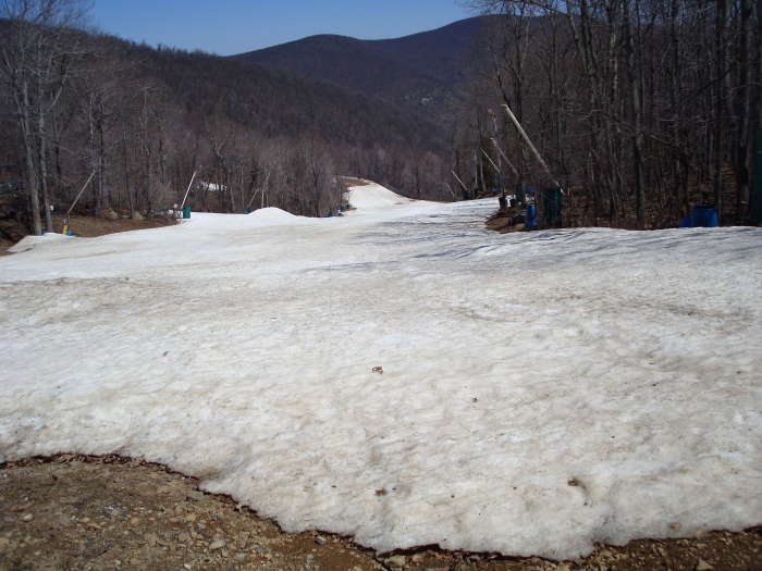
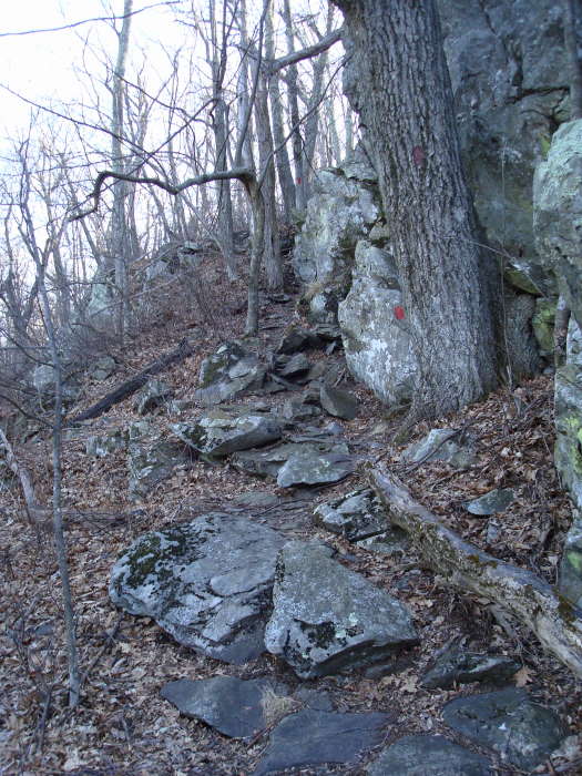
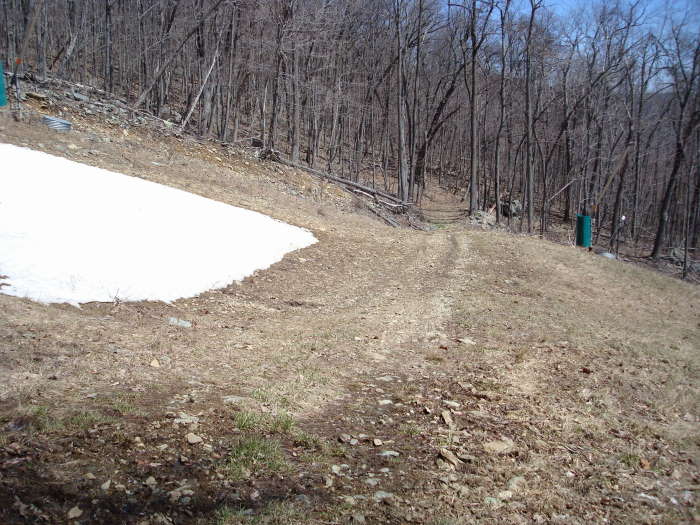
Soon after crossing Stony Creek you will come to the Intersection of the Hemlock Springs Loop, stay straight heading to Cedar Cliffs South. In 0.2 miles turn left onto Cedar Cliffs Main trail (there are misleading trail markings on the back of this sign which you will see first before you turn left, ignore them). Within 100' quickly turn right at the next intersection onto the Cedar Cliffs North trail. This is a very tough part of the trail ending at the Logger's Alley Trail in 1 mile. Turn right onto Logger's Alley Trail just after passing the Outdoors Ropes Course area. There was no sign to turn right as it disappeared over the winter. You will cross 3-4 of Wintergreen's ski slopes which accounts for some of the trail closings in the winter.
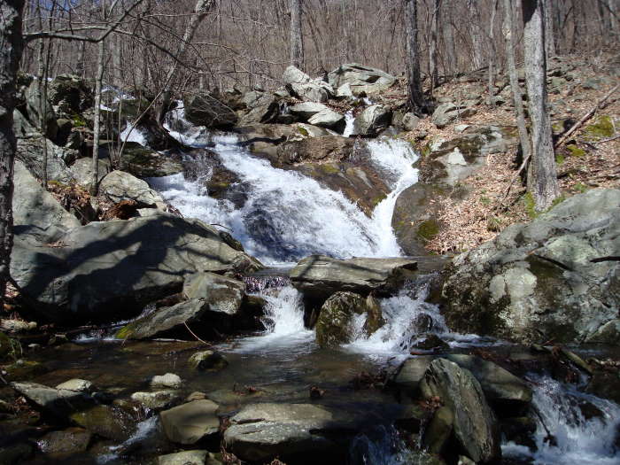
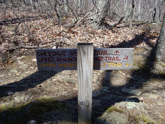
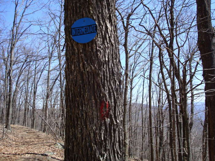
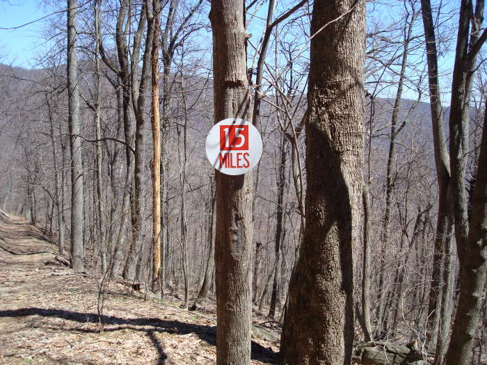
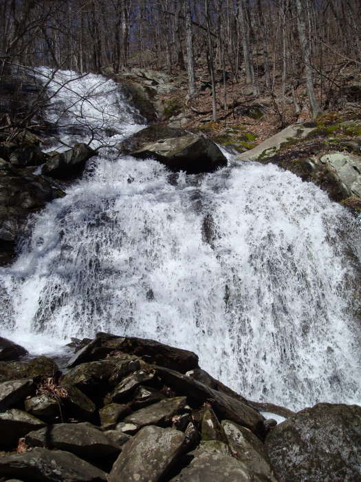
It is about 0.4 miles to cross all the ski slopes and then you will be on an old logging road with very few faded red blazes. Logger's Alley was our least favorite part of the trail. You will also see occasional blue 'Intermediate' signs and 1 mile after crossing the slopes you will see a red and white sign that says '1.5 Miles'. In 0.2 miles after that sign you will be rewarded with the 1st of the Upper Shamokin Falls. It was flowing well in April when we were there. After viewing the Falls return to the intersection sign just before the Falls and head up towards the Upper Shamokin Falls trail and in 0.1 miles you will be see a 2nd set of Falls, this is even better than the first. Continue up the trail heading to the Upper Shamokin Gorge trail. On the right in 0.2 miles will be the Laurel Springs Drive access trail, stay straight heading to the Shamokin Gorge trail. The Chestnut Springs Trail will be on the left in 0.1 miles, stay straight, the sign will point to Laurel Springs Gap Overlook which will be in 0.1 miles. Stay on the Upper Shamokin Gorge Trail arriving at the Old A.T. trail in 0.4 miles, turn right and cross Laurel Springs Drive in 0.3 miles reaching the A.T. intersection in 0.1 miles. Turn left to return to the Dripping Rock Parking Area.
Early
April
Wintergreen
Wintergreen Hike Comments
Archived Comments
By:Justin
Rating:
Date of Hike: Sunday, September 15, 2019
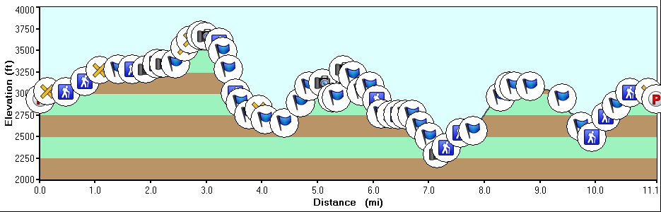
Do not take the difficulty rating lightly! This might be the most difficult circuit I have hiked in this area and I consider myself to be in pretty good shape. I have hiked many of the hikes on this site in 1/2 or 2/3 of the recommended time, but this hike took just about 8 hours as listed. The elevation change on this hike is brutal and wet rocks can make it more challenging. There were some cool sights, but I was too cooked to enjoy them by the end.
As many others have mentioned, it is definitely worth picking up a map of the area before you proceed with the hike. I relied solely on these directions and paid for it with some confusion, as some of these directions may be outdated.
On the Pedlar's trail section, I missed the turn on the gravel fire road and the following red & yellow sign, so I was just on Pedlar's trail until I reached the power line. After you have reached the last sign on Pedlar's trail, be sure to cross the stream and do not follow the road. It is not immediately obvious where one should cross the creek by looking at that sign, but there is another sign on the opposite side of the road.
By:Jay
Rating:
Date of Hike: Thursday, November 22, 2018
I hiked around 9 miles of the circuit on Thanksgiving Day and earned my calories! I was staying at the Mountain Inn so I started at the Logger's Alley section. Instead of turning left at the Chestnut Springs intersection, I stayed on Logger's Alley to the bottom of the Shamokin Springs Falls and then followed the Upper Shamokin Falls trail. While the Logger's Alley section was fairly tame, the journey up the falls is quite steep and rocky. From there I followed the circuit around to mid-way through the Pond Hollow trail. An ice storm the previous week had downed lots of trees on the western portion and it wasn't fun anymore so I used the Laurel Ridge trail to return to the Inn.
All in all, it's a good, challenging hike and I plan to return to it in Spring in hope that the trial is mostly clear of downed trees.
One item of note, it appears that the trail blazes were repainted fairly recently as they were easily spotted. However, some signage is still confusing or easy to miss.
By:Charlie
Rating:
Date of Hike: Friday, June 30, 2017
This is a lovely loop and challenging only really in its length and elevation gain ~(our GPS tracker had us at 15 miles - I think the map he's used has 'straightened the curves' when calculating the distance).
I should warn you though that through a combination of some changes to the signage and the fact that the original guide is pretty unclear at times, its worth mapping this out properly in advance, especially if conditions aren't clear.
There are some scrambling sections but its no way as fierce as some reviewers have suggested and to be fair to the original poster, he has given the trail a 6 out of 5!
There is lovely variety throughout and the mixture of terrain, undulations in the landscape, stunning overlooks and aspects and striking rock formations make this a very rewarding loop. The final couple of miles up the gorge are actually some of the prettiest but unless you're fit you won't be in much shape to enjoy it.
We did it in around seven hours with a couple of short breaks as we were chasing the light after a late start but I'd recommend getting on the trail pretty early and taking plenty of food and drink and enjoying it at a slower pace.
I wish I'd taken a notepad to make detailed corrections to the original guide that I could re-post as there are now several errors and much of the guide could use a refresh.
We even met a bear!
Enjoy.
By:H. Diddly
Rating:
Date of Hike: Sunday, April 16, 2017
We were looking for something short to do after driving our truck around half the trails on this loop as part of an off-roading group. Thanks to the previous reviewers for the sanity check. Bought the map and ended up doing a 1.25 mile loop from Laurel court to hemlock on the old Appalachian. 3 great Western viewpoints on a sunny morning. Lots of wildflowers. Saw the falls while out driving already so that would be my choice of 5-6 mile dayhike: park closer to or in the resort, loop from the OAT to upper shamokin and back, then drive down to the breweries on the East of the mountain and reward yourself by calling it a day. Another quick out and back from near the mountain inn at Wintergreen would be cabin cliff, 1.5 miles total. For challenging hikes with an actual view it seems like you'd want to go to Crabtree falls or three ridges instead of this loop, even with the $3 map. I'll try to get an image of it up.
By:Ray D
Rating:
Date of Hike: Saturday, November 26, 2016
I echo what the previous reviewers have written here about this hike. Despite the directions and proximity to houses along the way this is a hike that you will need to be mentally and physically prepared for. Give yourself 8 hours to allow for three 1/2 hour breaks - you'll need them.
I'm amazed that Wintergreen doesn't monitor or warn about the hazards of this trail. Not to be overly dramatic but one wrong move on parts of this trail would be disastrous.
I did this trail on Nov 26. Temp in the low 40's but a north wind made it tough until the trail turned. I definitely made some costly mistakes such as not reading these reviews prior to going, getting "lost" a few times wasting time and energy back tracking, and racing the sunlight. I didn't complete this hike and I figured out later that I only had about 1 1/4 mile to go, which I could've done.
I will go at it again now that I know where the most confusing parts of the directions are. And I will give myself more daylight. I had ample food and water so that was not an issue. And yes, the views are outstanding.
By:Don Mac
Rating:
Date of Hike: Monday, June 13, 2016
My wife and I did this hike today and were not really excited about what we found. The old appalachian trail was well marked and well maintained, this was the best part. Once we left the old trail directions became very hard to understand. The old trail intersects a road where it ends but there is no signage indicating where to go from there. We had the map from this site but it is vague. Once we found the trailhead to continue, we found that the trail was quite over grown and not very well kept up. Also, few signs again made the trip difficult and what signs we found again were vague. We ended our trip at 5.1 miles out and returned the same path we took to get to that point. Maybe we should have bought the map that Wintergreen offers, but that would not have cleaned up the part of the trail we walked after leaving the old AT. On a positive note, there were great views from the old AT.
By:Jason Viper
Rating:
Date of Hike: Sunday, August 2, 2015
I did the hike as prescribed above. I was a bit hesitant about attempting to follow all the twists and turns described, so I stopped by the Mountain Inn front desk and purchased the trail map. The directions here were actually for the most part spot on, and not nearly as complicated as they may sound. Having the map though gave those directions context and allowed you to get your general bearings with the directions filling in the details. I ran across a few sets of hikers who had either gotten turned around, or cut their hikes short so as not to get lost. So moral of the story, stop in at the front desk (or the nature center if they're open, and drop the $3 to get that map!). IF not, this is a perimeter trail hike...so once you get off the Old AT, just keeping following the red blazes for the next 13 miles until you intersect the Old AT again.
As for the hike itself, it was a tough one! I'd rate it a 5 in terms of overall difficulty. I'm pretty fit and thought I could knock it out in 5 hours or less. Boy was I wrong. Let's try 7 on the dot. The stretch at Brimstone and Blackrock had some brutal ascents that were as tough as any I've faced and were for me the toughest park of the hike. However, the difficulty in this hike comes from 1) the distance and 2) spending nearly the entire trek stepping on, over, or around rocks. It eventually begins to wear on you and by the end my feet were screaming UNCLE!
I only saw other hikers within about a mile from the start/end of the hike, and the parkway was bustling this day. The rest of the time, I was in complete solitude. I was a bit nervous with all the stories of bears and rattlesnakes people see up in this area, but aside from birds, the only other wildlife I saw all day was a chipmunk....and I'm good with that (until I get my bear spray). I did make it a habit to clap or say something if I was approaching a blind turn or ascent. Paranoid I guess, but I don't like the thought of not being at the top of the food chain.
It might not hurt to contact the Nature Center and ask about any trail closings ahead of time. I noticed at the start that the Upper Shamokin Gorge trail was closed due to "hornets". As it turns out, my planned detour at the end of the hike to avoid the Upper Shamokin didn't go as planned and I ended up on it anyway (hey, a guy's gotta get home and there was no way I was backtracking). Luckily, no hornets encountered.
Last word of advice, with this being such a tough hike, bring plenty of fluids. I went through 5 liters of fluid. I thought there was no way I'd even come close to drinking it all, but I am so glad I brought the extra. It wasn't even that hot with temps at Wintergreen being much cooler than down in the valley. Please don't be one of those people that brings a 20oz in one hand. Lots of this hike is remote and you could get into trouble quick if you get dehydrated.
I do recommend this hike, and thank the fellow who wrote it up. Just know ahead of time what you're getting into. Plan to spend considerable time on the trail, and prepare to have your legs/knees and feet beat to shreds. Finishing is a very rewarding feeling though.
Oh yeah, some amazing views! It's pretty up there.
By:Nick & Leigh
Rating:
Date of Hike: Sunday, August 10, 2014
We have hiked many of the hikes posted on this site and try to get out every other weekend. We figured this one would be a challenge but nothing we couldn't handle. This hike is definitely extremely challenging and has several sections that are borderline insane. The hike in August has everything that you could possibly want: flowers, views, waterfalls, streams and wildlife. The number of areas of rock scrambling, the ridiculous amount of roller coaster type inclines followed by the steep declines, makes you forget that you are out there to enjoy yourself. By the time we got to the waterfalls at the end of the hike, we basically just looked at them out of principle, not because we cared anymore. This is the only hike I have ever been looking forward to just getting to the end during the trip. I will only suggest this hike to people I don't like or for the once in a lifetime experience. Its re-hike value is 1 out of 10. Enjoy.
By:Keith
Rating:
Date of Hike: Saturday, August 2, 2014
I thought that I would hike this trail in preparation for the Spartan Super obstacle race due to it's good distance of 13.2 miles and a similar elevation gain of 4,000 feet. The first couple of miles were relatively easy and well maintained. However, as I gained in elevation the trail became rougher. Much of the next few miles required extensive rock scaling on all fours. This is not a trail that I would recommend to the casual hiker. Your fitness level should be good. The rocks are very slippery and I would consider some of this trail to be hazardous. It was so rocky and slippery that I thought it was much easer to go up than hike downhill. During the hike I was so grateful when the trail became dirt or gravel as I was exhausted from the all the rock crawling. Also, this hike is a little confusing as it consist of a series of trails. I would not recommend this hike or will ever attempt it again.
By:Brandon B
Rating:
Date of Hike: Tuesday, April 14, 2009
Great review of the hike! I'd just like to add a few notes. The solitude rating for this trail is "3", but I would say it's lower than this, depending on which section you hike. The fact is, you are hiking in a resort, you are crossing paved roads, and you can see many houses through the trees along a lot of the trail. However, don't let this be a deterrent. The views and overlooks along this trail definitely make it worth it. Also, as the review mentions, this is one of the first good circuit hikes south of SNP.
The Logger's Alley trail doubles as a mountain biking trail. Depending on what time of year you go, you might have to watch out for bikers zooming past you on this section of the trail (which is wide, and is an old logging road). This explains the blue "Intermediate" and red "1.5 miles" signs mentioned in the review : they are for the mountain bikers.
There are more trails in the area too. I highly recommend buying the trail map from the Wintergreen Nature Foundation (available at the Trillium House for $3). In addition to descriptions of the red and yellow blazed trails described here, they have descriptions of the blue-blazed "valley trails." These include the Lower Shamokin Falls, which is accessed off Route 151 via Old Stoney Creek Road (VA-751). It's a beautiful waterfall, about 5 miles out-and-back. Another great hike is Paul's Creek waterslides, reached through the Rhodes Farm subdivision (off 151 turn onto VA-613, then left onto Rhodes Valley Drive, then left onto Crawford's Climb, then look for the "waterslides" sign pointing you to a cul-de-sac on the right you can park in). It's a short hike to some beautiful waterfalls and natural waterslides into deep pools of water. The official trail map has more detailed instructions for reaching these.


