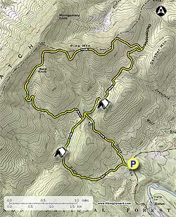
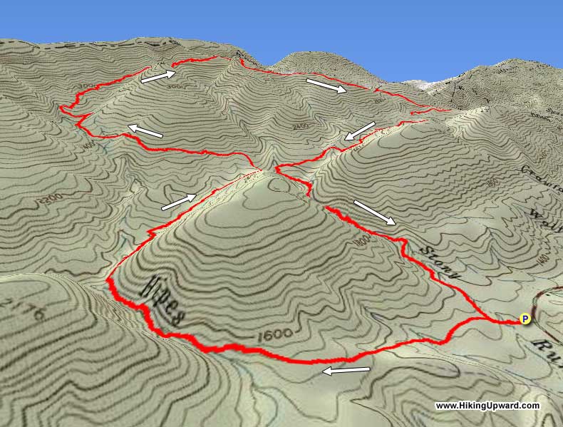
Hoop Hole is located about 30 miles west of Lexington VA. on the eastern side of Pine Mountain. The Hoop Hole circuit is actually two loops, the lower 3.8 mile loop follows two streams and is the more scenic with rhododendron and small swimming holes, and can be combined with the upper loop to make a 9.7 mile circuit.
The Hoop Hole circuit can also be accessed from the Roaring Run Recreation Area by taking the out/back Iron Ore trail. This will add 4.8 miles and make a total circuit hike of 14.5 miles from Roaring Run.
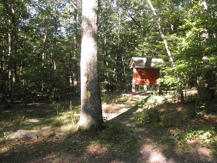
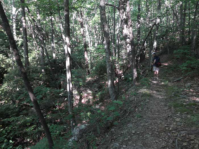
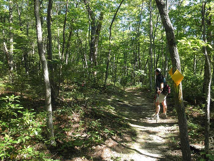
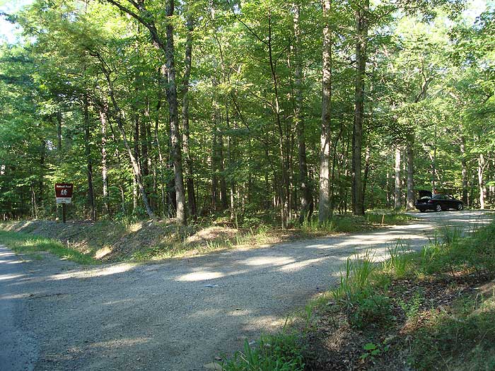
The hiking directions on this page are for the 9.7 mile circuit starting at VA615/Craig Creek Rd. The yellow blazed Hoop Hole trail starts from the left of the parking area passing the informational kiosk, and in 250 yards reaches the intersection for the lower loop.
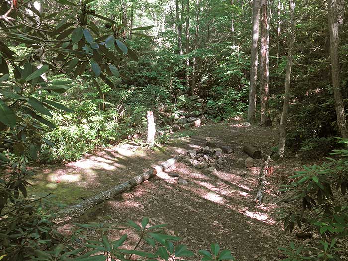
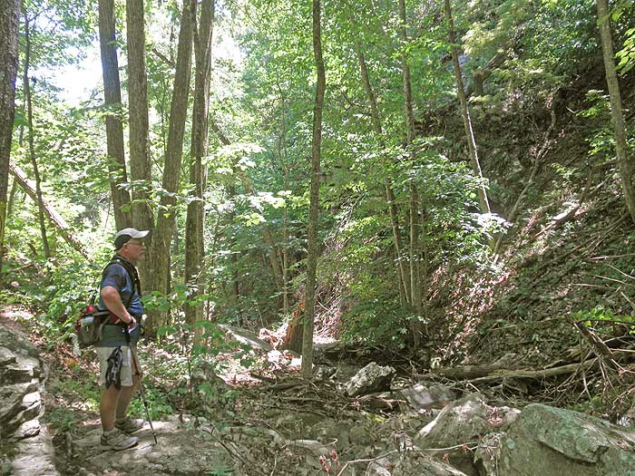
Turn left as the trail heads uphill and begins to follow Hipes Branch Creek. In 1.3 miles from the intersection arrive at the best camping spot on the circuit on the banks of Hipes Branch Creek. Continue uphill for 0.7 miles and arrive at the intersection of the upper loop and cut over trail.
NOTE. As of July 2010 the upper section of the trail, before arriving at the ridge, has a significant amount of Stinging Nettles. Long pants are highly recommended.
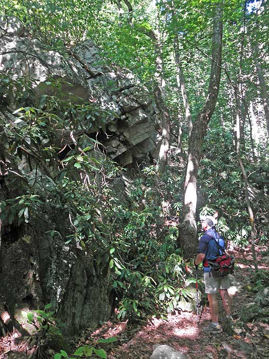
Turn left uphill on the upper loop as it winds up the valley. As you get near the top there will be a small saddle between Bald Knob and Pine Mountain. Stay to the left to remain on the yellow blazed upper loop trail.
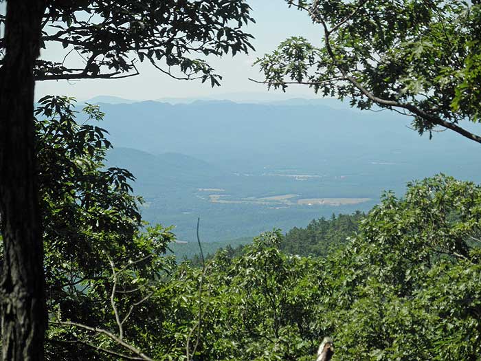
After arriving at the ridge follow the trail to the right where there are several views through the trees to the east. The trail will follow the ridge for 1.2 miles before beginning the descent on the eastern side of Pine Mountain. In 0.5 miles after stating the decent reach the yellow blazed Iron Ore Trail that leads to Roaring Run in 2.4 miles.
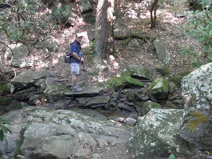
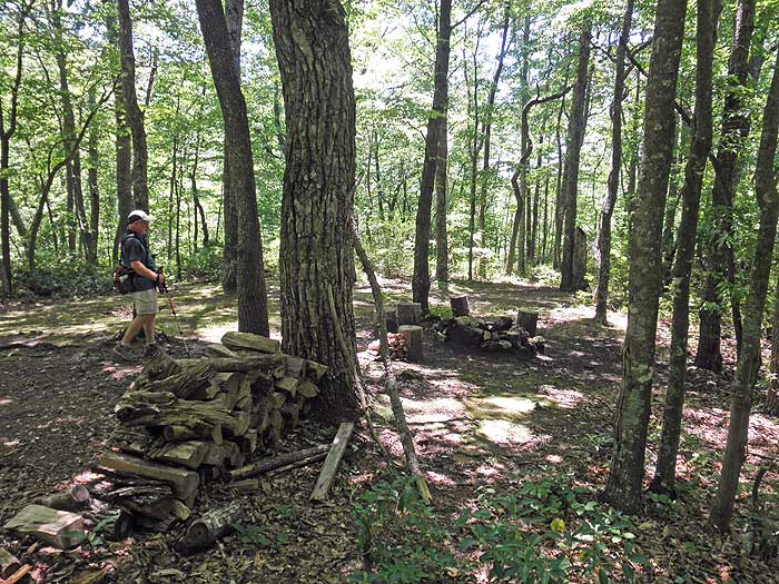
Turn right remaining on the upper loop trail and continue descending for 1.5 miles to a large group campsite situated on a spur. In another 0.4 miles reach the intersection of the lower and cut over trails. Stay left downhill as the lower loop trail crosses over Stony Run several times then returns to the beginning of the loop in 1.2 miles. Turn left and return to the parking area in 250 yards.
Early July
Hoop Hole
Hoop Hole Hike Comments
Archived Comments
By:Troop478
Rating:
Date of Hike: Saturday, October 26, 2019
We took our Girl Scout troop for their first ever backpacking trip to the lower loop and spent the night at the recommended site. This was a great hike to introduce the kids to backpacking long enough to be a challenge, but not so hard as to be discouraging. There are numerous stream crossings, but the trail is well maintained and well blazed.
By:Steve O.
Rating:
Date of Hike: Friday, August 7, 2015
We backpacked the lower loop only in a one-night mini trip, going in on Friday and completing the 3.8 mile circuit on Saturday. Total solitude. We did not see another human on either day. The campsite this site recommended was outstanding. The woods are beautiful with tall trees and not a lot of underbrush, except for the rhododendron along the creeks. I thought the trail was well-maintained and well-blazed. We were in the area on business so it worked out for us to do this excursion hike and explore the area. Water levels were relatively low, making the stream crossings easy. For solitude, peace and natural beauty, this hike is a winner, especially if your time is limited or if you don't want to tackle a lot of miles.
By:Doc Faw
Rating:
Date of Hike: Friday, July 4, 2014
Lower loop was fantastic on July 3rd. Upper loop was great until the boulder fields with the stinging nettles which occupied 3 sections totaling at least 3/4 mile. Left parking lot at 9:15 am. Returned at 5:30 pm. The trail could have followed the crest of Pine Mountain and circumvented the nettles.
By:Jan hammer
Rating:
Date of Hike: Sunday, June 29, 2014
Like the last reviewer - never again! We tried to do the upper loop today. It started out fine but then we got into the shoulder high stinging nettles. It covers the trail making it very hard to navigate. There were enough tree markers but since you cannot see the trail - it was hard. We finally gave up and turned around. Miserable hike. The lower loop was fine but nothing special.
By:Kevin Amy
Rating:
Date of Hike: Tuesday, September 3, 2013
We have hiked the lower loop 40 some times in all weather it is wonderful always changing with the seasons . We just hiked the upper loop today. Never again this trail was torture the stinging nettles are very pain full and abundant. No views to see either. We will stick to the lower loop from now on.
By:steve
Rating:
Date of Hike: Saturday, October 23, 2010
We hiked the Hoop Hole Trail in combination with the Iron Ore Trail which starts at the base of Roaring Run Furnace to create an approximate 14 mile loop The Hoop Hole section was in decent condition and we had no trouble following the blazes and staying on the trail, except for a few places along the ridge and boulder field crossings. I was disappointed with the views- mostly through trees with no good rock outcroppings- but that was the only downside. We even bushwhacked our way up to the top of Pine Mountain to catch some views, but were again at a loss to find them. The upper loop is remote and feels wild. We saw only two other hikers on the entire trip. We also observed a family of black bear from a distance frolic in the woods and pass by us unaware. As for the lower portion, it was lush, green, and thick with Rhododendron. There were a number of stream crossings which were beautiful. For an added bonus, the Roaring Run Rec Area is a well-maintained park with an enormous pre civil war stone furnace to explore, along with a short, scenic walk to a large waterfall and numerous rock slides and swimming holes. I definitely plan on coming back to this spot again with family to swim when it's warmer. Overall, there are more interesting trails out there, but this one had most of what we were looking for. Far added interest, start at Roaring Run Rec Area a few miles north of the listed trailhead and access the loop from there.
By:Tom Young
Rating:
Date of Hike: Friday, April 9, 2010
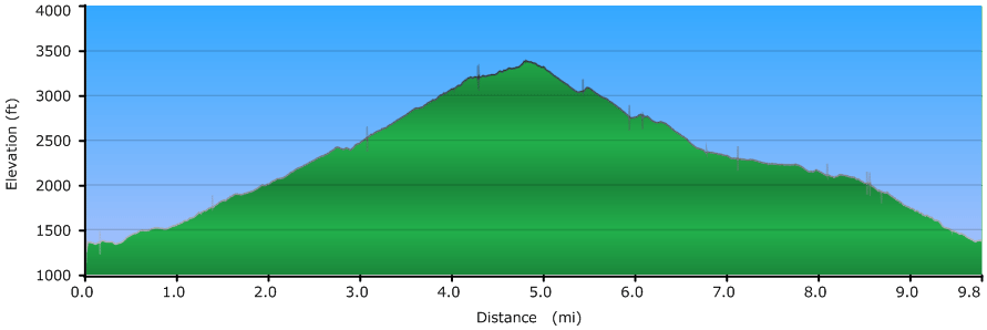
We hiked the 9.7 mile Hoop Hole trail in the spring of 2010. It was a family hike with our two sons ages 15 and 13. We started in the early morning around 8 am and finished around 6 pm. We stopped on the up hill climb for maybe 30 minutes so the boys could play in the cold mountain stream and then stopped for 45-60 minute for lunch at the top of Pine Mountain. Otherwise, other than short breaks on the trail, we were on the move. As others have noted the lower section is absolutely beautiful. When we started the mountain was shrouded in a heavy fog which we hiked through for several hours. This hike has an elevation gain in the first 4 miles of roughly 2,400 feet and most of this gain, around 1,700 feet, occurs over miles 3 and 4. As others mentioned,the fourth mile takes you through some fairly rugged, boulder strewn, terrain as you approach the top of Pine Mountain. This section is neither well marked nor heavily traveled. So, finding and staying on the trail takes some effort. We hiked the trail in early April. So, the stinging nettles were not a problem. However, we spent considerable time and effort climbing over and under a number of fallen trees that blocked the trail. The upside of an April hike was that we had some glorious views both ascending and descending the mountain. We selected the hike for the elevation gain and so had anticipated some rough going. With this said, I still under estimated the difficulty of the hike. We ran short on water even though we were carrying at least 2.5 liters per person (10 Nalgenes). The take away. Always carry some iodine tabs or a water filter, if preferred. The hike wore us all out. But was a good learning experience and the views in April were rather amazing. How you rate a hike is a function of expectations and goals. I'd like to do the hike again. Perhaps with an overnight stay up on the mountain. The average hiker will want to avoid the upper loop. But if your looking for something different. Go for it.


