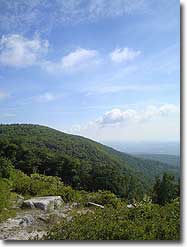
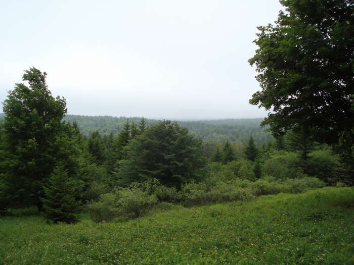
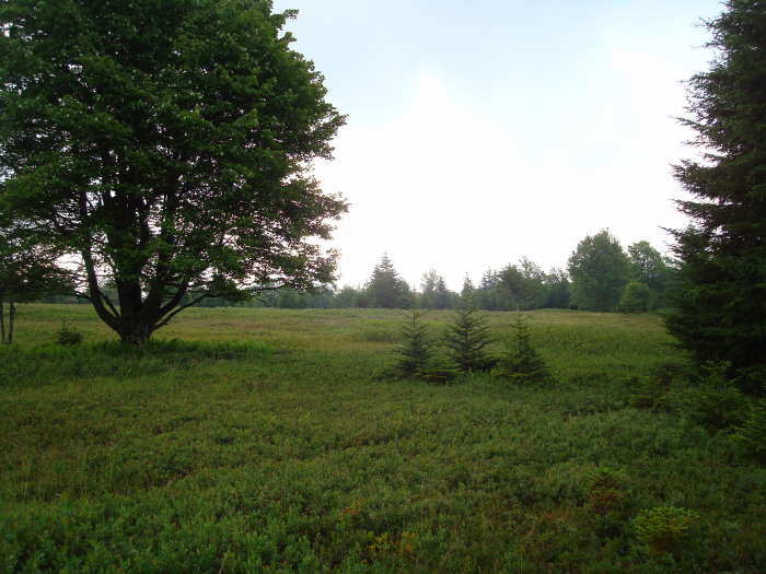
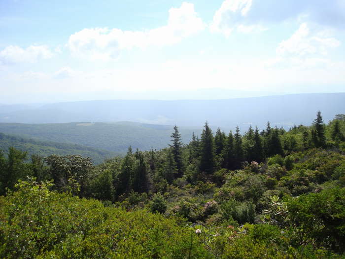
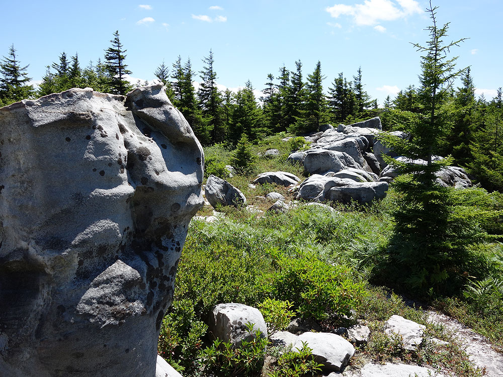
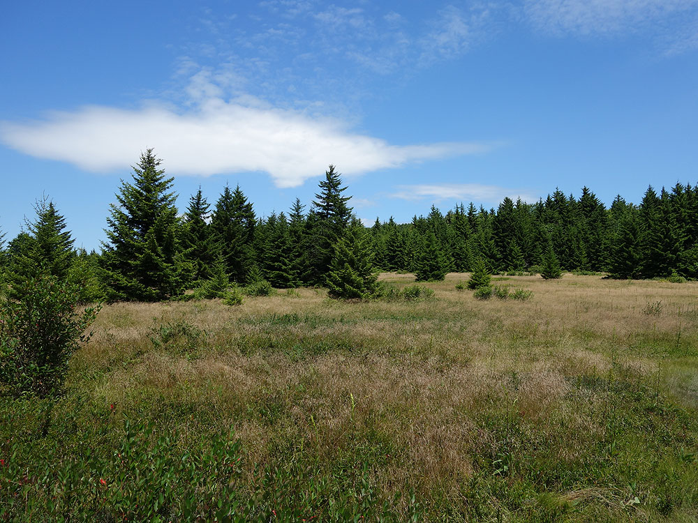
Arguably one of the most unique, and beautiful hiking areas on the East Coast. The high plateaus of Dolly Sods are made up of wind carved sand stone, stunted red spruce, grassy meadows, and sphagnum bogs. The characteristic meadows are the result of logging that took place from 1899 to 1924. During the Second World War the U.S. Army used the area for artillery and mortar training, and at the trailheads the Army Corp of Engineers still displays signs warning hikers that there may be unexploded ordinance in the area.
The name Dolly Sods derives from a combination of Dahles, a local 18th century family, and Sods, meaning an open mountain top or meadow. After WWII the area fell into neglect, and was threatened by multiple construction and mining project proposals. Then in the early 1970’s concerned environmentalists, along with The Nature Conservancy, began purchasing the land for preservation and recreational use. Today the Dolly Sods Wilderness Area comprises 17,371 acres.
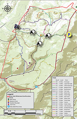
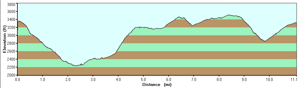
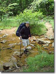
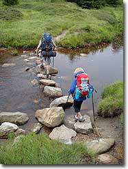
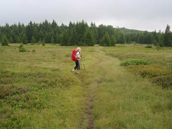
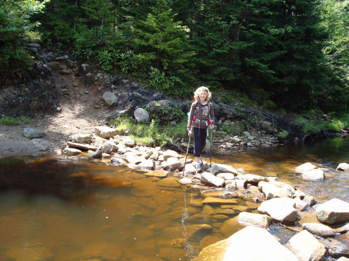
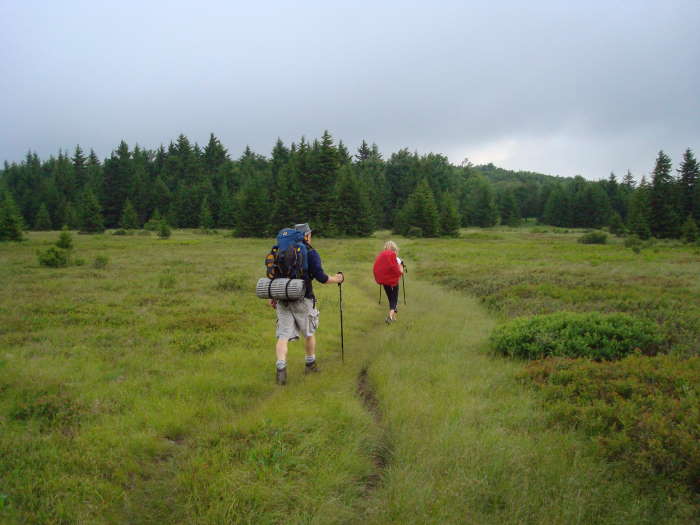
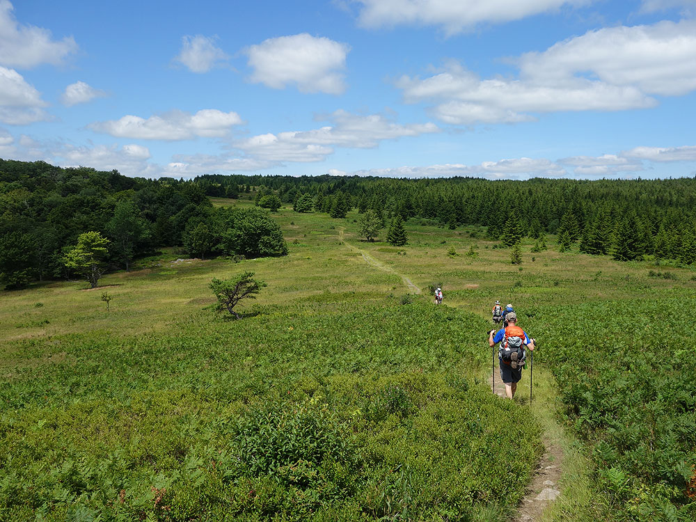
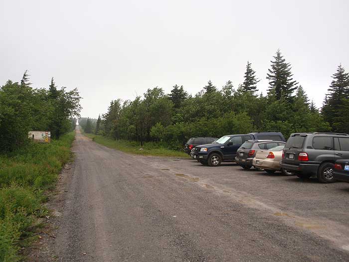
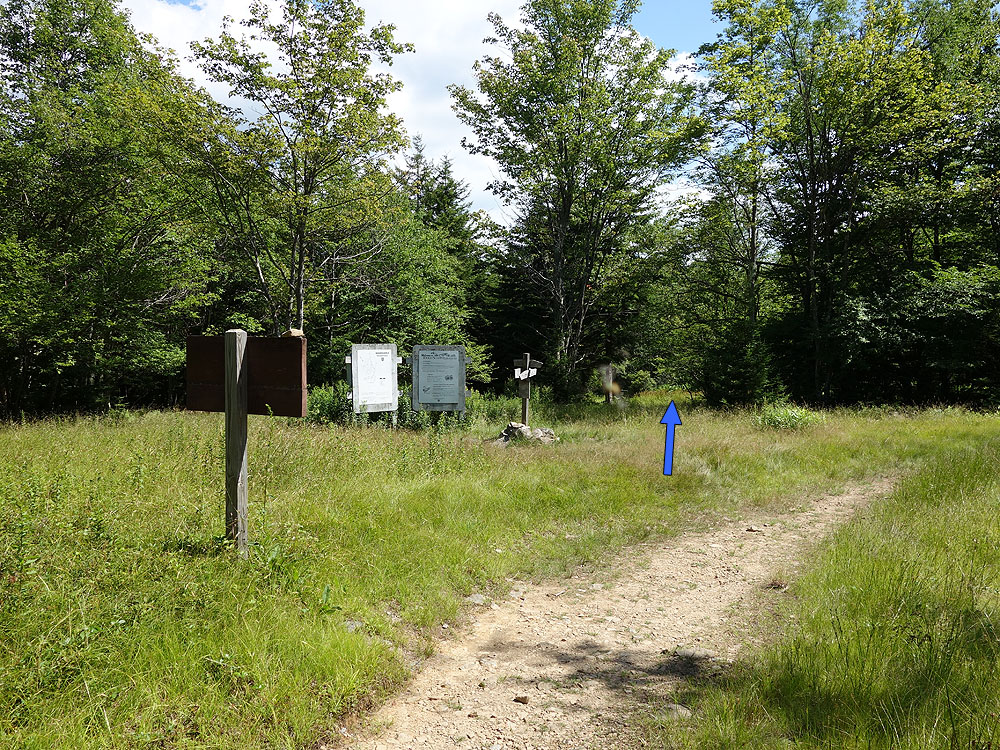
Mile 0.0 - From the parking area, just past the Red Creek Campground, start the hike on the wooden walkway at the beginning of the Blackbird Knob Trail TR511, and shortly enter a wooded area thick with spruce. In 0.3 miles leave the wooded area and get your first glimpse of the majestic plains in Dolly Sods. Continue down to the first creek crossing in 0.7 miles. After crossing the creek, it will be another 0.7 miles to Red Creek. Pass a side crossing to a small island, and in 50 yards arrive at the Red Creek crossing.
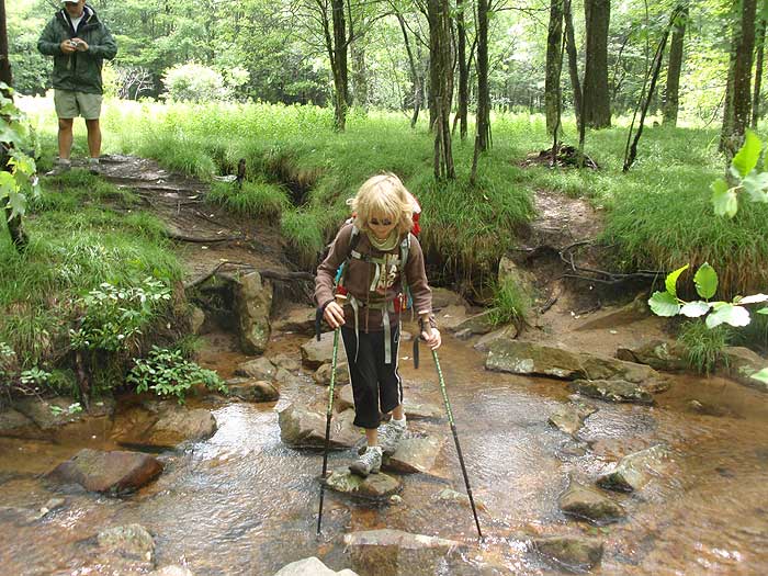
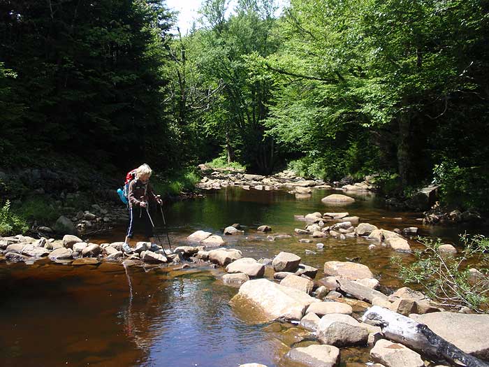
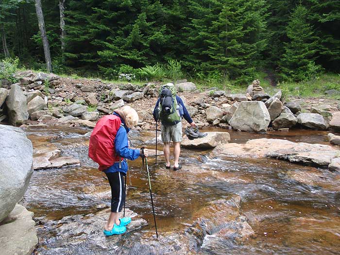
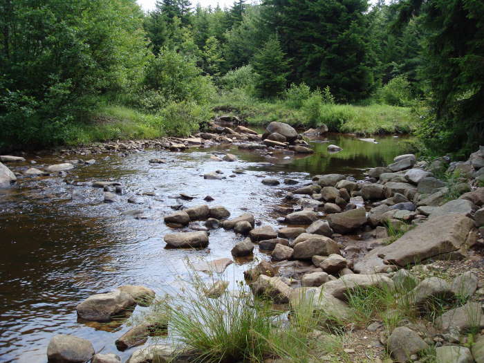
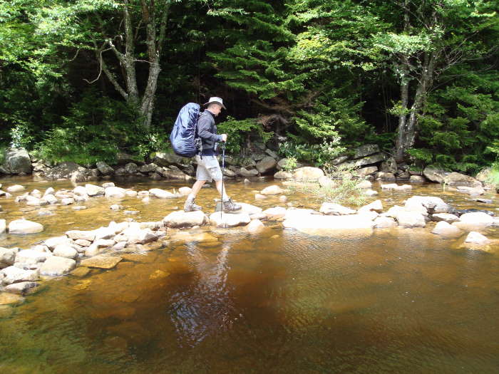
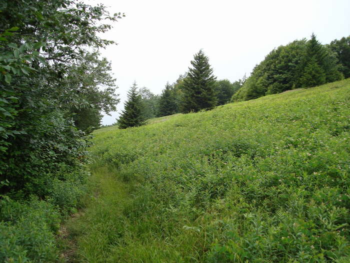
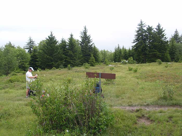
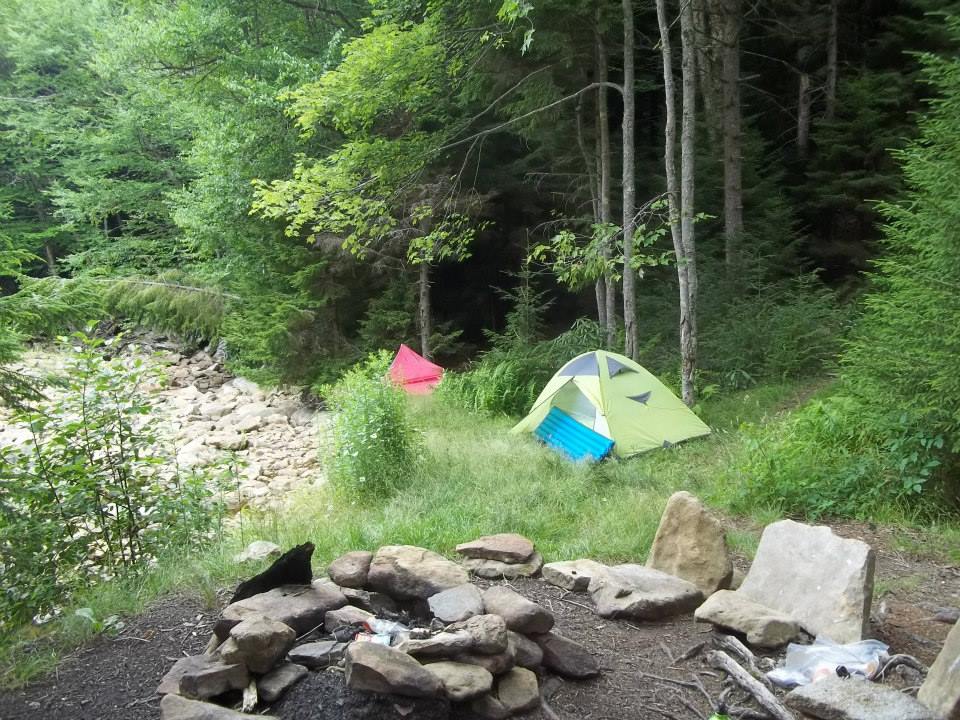
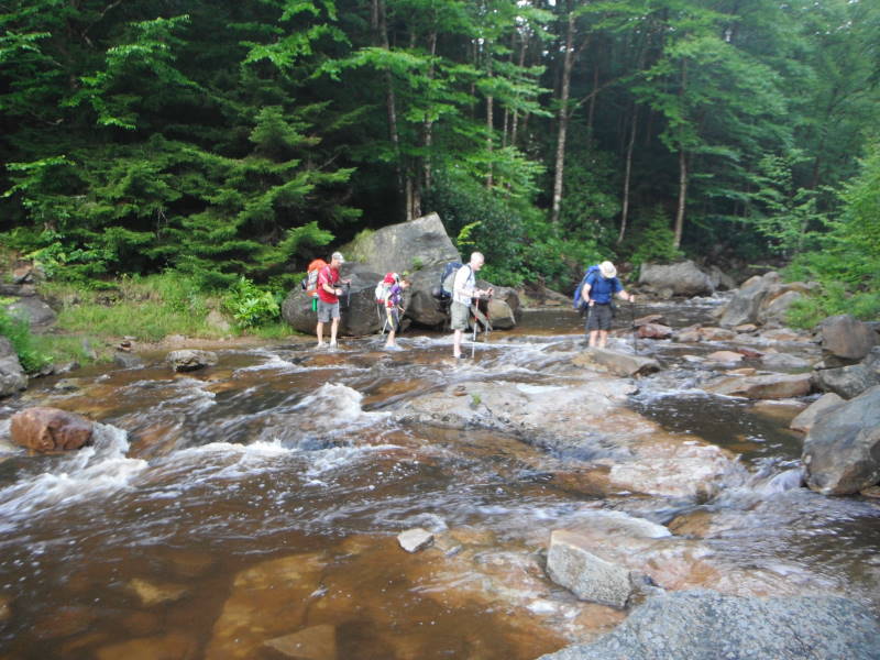
Mile 1.7 - Cross Red Creek. Note that Red Creek can run high and require fording instead of rock hopping, so make sure to bring river shoes. After crossing Red Creek there are several camping sites on the right. Climb through a small gully then enter the first of many meadows and reach the intersection of the Upper Red Creek Trail TR509.
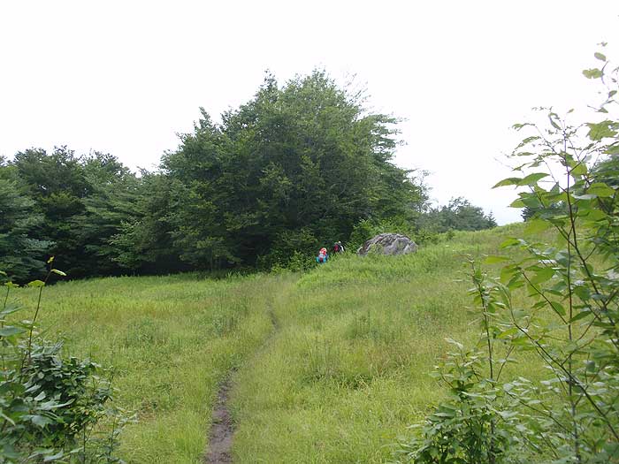
Mile 1.9 - Stay straight on the Blackbird Knob Trail TR511 passing through a wooded area, then arriving at the intersection of the Red Creek Trail TR514 on the left in another 0.4 miles.
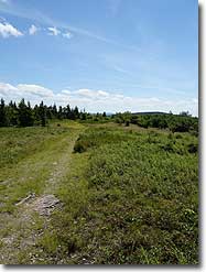
Mile 2.3 Continue straight on the Blackbird Knob Trail TR511 through another meadow, crossing a stream, then climb to the intersection of the Harman Trail TR525.
Mile 3.2 - Stay left continuing on the Blackbird Knob Trail TR511 for another 1.2 miles then veer left, and in 0.1 miles reach the terminus of the Rocky Ridge Trail TR524.
Mile 4.5 - Stay on the Blackbird Knob Trail TR511 continuing downward for 0.2 miles to the 4 way intersection of the Breathed Mountain Trail TR553, Big Stonecoal Trail TR513, and Forestry Road that leads down to Canaan Valley.
Mile 4.7 - Turn left on the Breathed Mountain Trail TR553 and pass through a wooded area before the trail becomes boggy, passes through a meadow, then descends steeply to the Red Creek Trail TR514 in 2.6 miles.
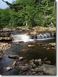
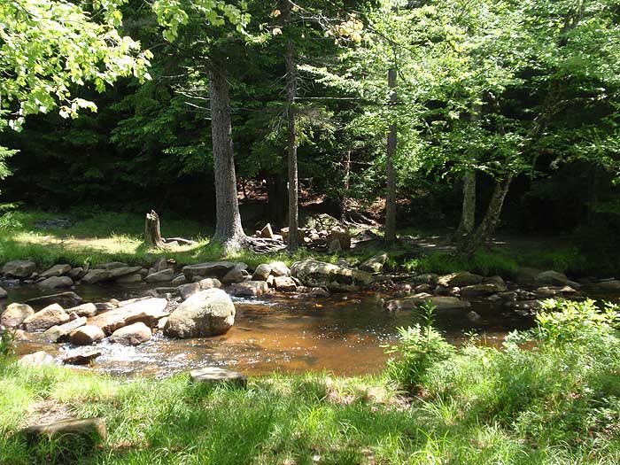
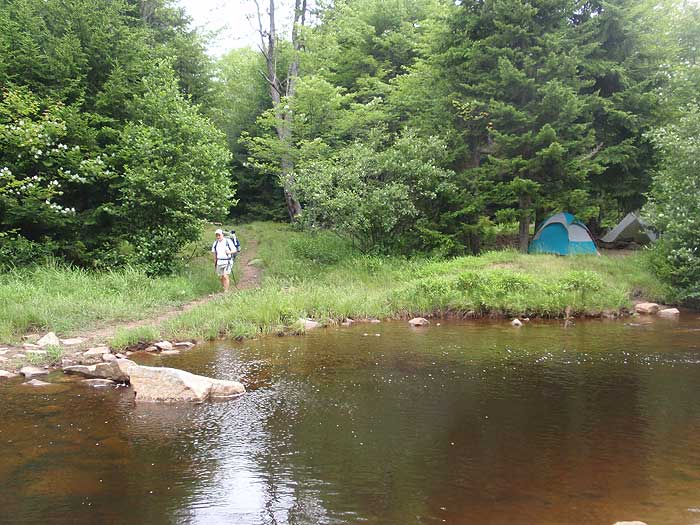
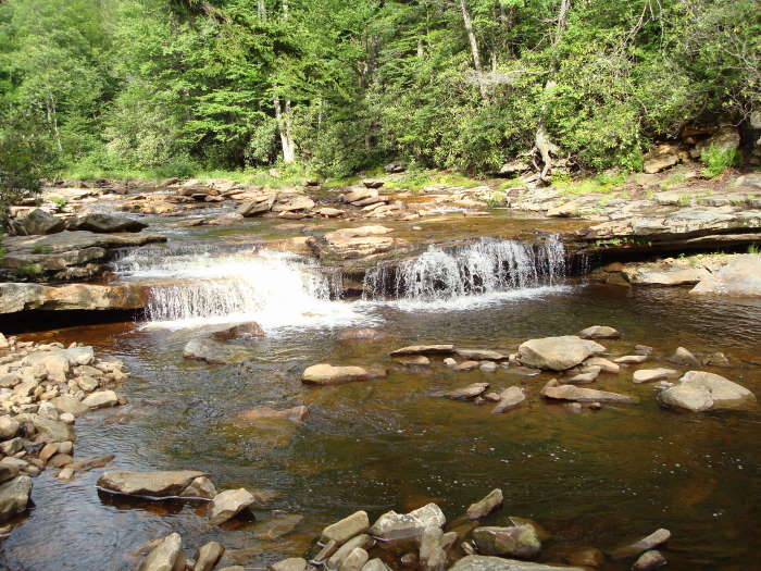
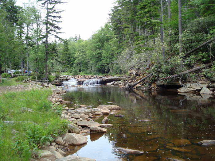
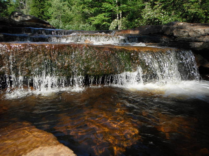
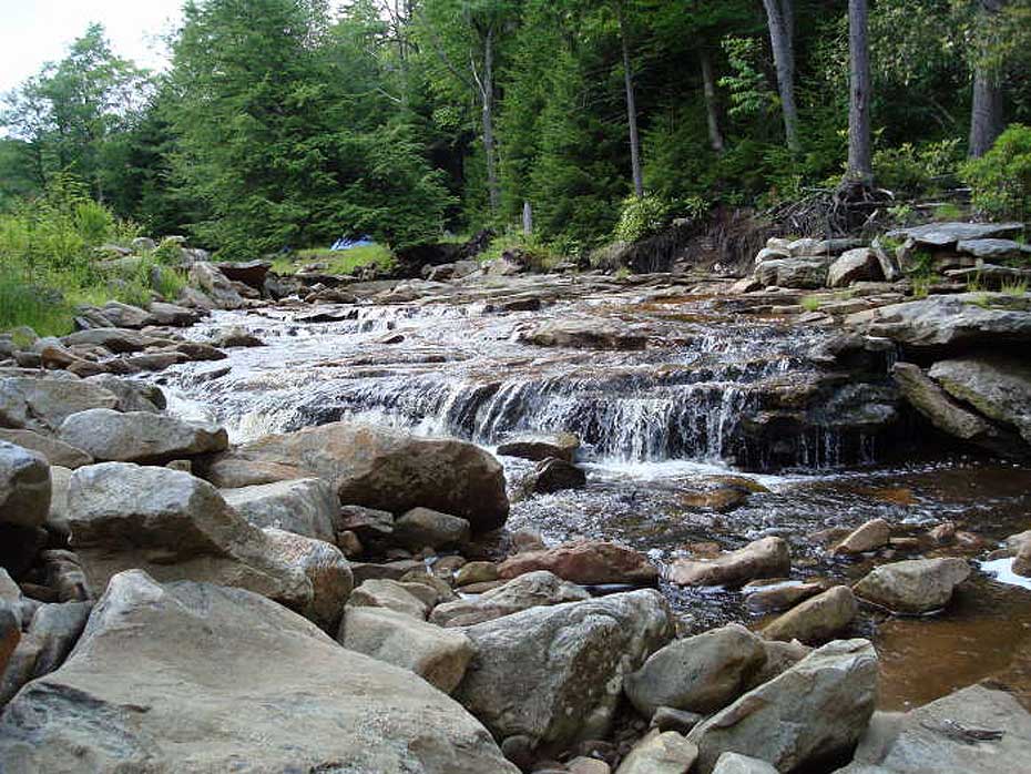
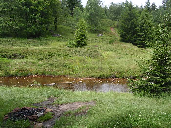
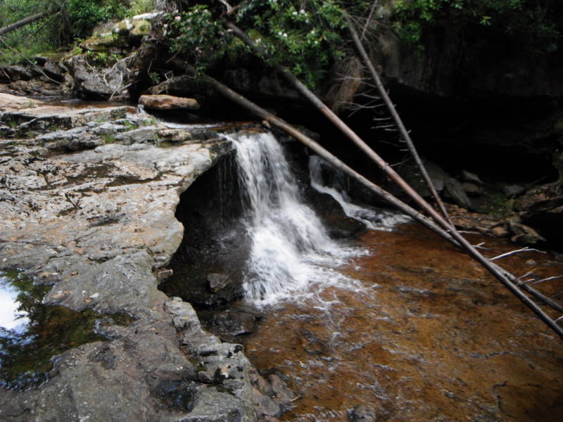
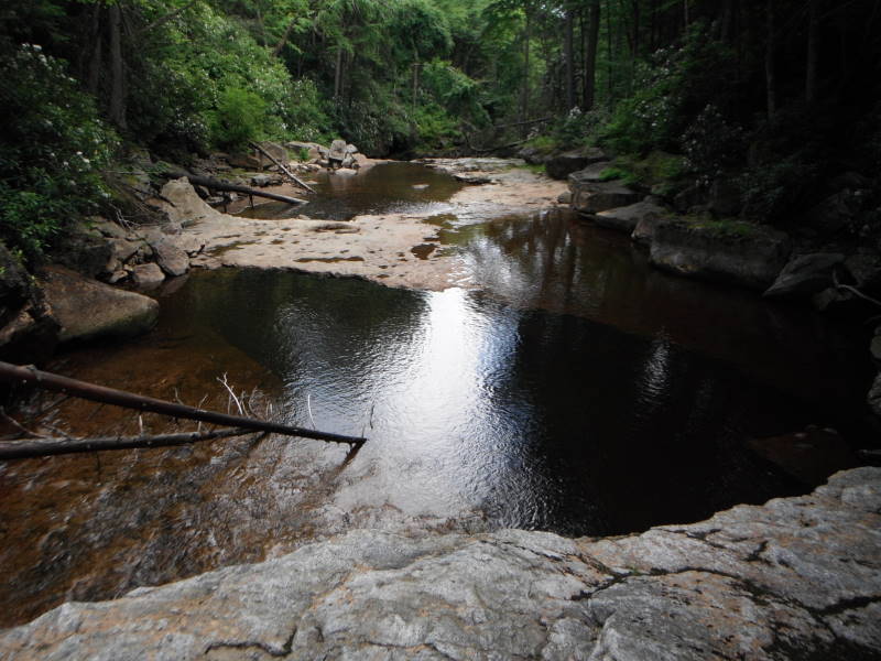
Mile 7.3 - Turn left on the Red Creek Trail TR514 and arrive at the Forks of Red Creek in 0.1 miles. There are numerous campsites at ‘The Forks’ but note that this area is an extremely popular camping area, especially with the college set. Explore many small waterfalls and swimming holes.
Mile 7.4 - Cross the Left Fork of Red Creek and stay to your left as the Red Creek Trail TR514 passes through a camping area then re-enters the woods on the left. From this point the Red Creek Trail TR514 becomes steeper until it enters the first of two large meadows. After passing through the second meadow the trail re-enters the woods and ends at the intersection of the Blackbird Knob Trail TR511.
Mile 8.3 - Turn right on the Blackbird Knob Trail TR511 retracing your route, passing the Upper Red Creek Trail TR509, re-crossing Red Creek, then hiking the back to FR75 and the parking area.
Mile 10.6 - Arrive back at FR75 and the parking area.
Early July
Forks of Red Creek
Forks of Red Creek Hike Comments
Archived Comments
By:Courtlyn McHale
Rating:
Date of Hike: Saturday, October 12, 2019
My son and I hiked this last weekend (Oct 12th-14th), the weather was beautiful and there were more people on the trail that I expected to see. We were worried that we wouldn't find a camp site on the first night, but after you hit the creeks there are a good number of sites with stone chairs and fire pits along side the streams. Thanks for the GPS route, without the hike would have been twice as long at least!. I'll second the other reviews, you need a GPS. Even with one we managed to get off trail once in one of the stands of spruce. Another thing to careful of is the weather, it changes quickly and often. The temps dropped down into the 30's at night and ranged between 50-70 during the days.
By:Rich
Rating:
Date of Hike: Friday, September 23, 2016
A really tough experience for me. The trail is not marked at all and is very very difficult to follow. I lost the trail 4 times in the first 2 miles. Finally as I started to run out of daylight, I made the miserable decision to turn around and head for the car. The trail is extremely narrow but quite clear for the first .5 miles. Then, as it nears the spruce stands, there is no undergrowth to border the trail which makes things very difficult without markings or blazes. Even when the trail is well defined, its unpleasantly narrow. I would suggest pants, a companion, and a really good GPS device which I did not have with me.
My apologies to aldikuma. I read their prior review and assumed they did not have much experience. I am no the most experienced but have definitely logged a couple hundred miles each year for the last few years. Generally I can keep to a trail but this one was unpleasantly challenging and eventually won out over me! Big bummer.
By:Adam and Grace
Rating:
Date of Hike: Saturday, June 13, 2015
This hike provided some of the most unique scenery we have seen while hiking on the East Coast. We caught the Mountain Laurel in full bloom, so the hillsides were covered in pink. Red creek is dynamic and beautiful. Camping spots are plentiful and if you search you can find some that are isolated. We hiked through some showers and the trails were full of muddy, boggy areas, which kept hiking in those spots to a pace of about 2 miles per hour. In other spots the trail is a streambed, which also makes finding a footpath a slower process. Foot traffic was moderate- we crossed many other hikers during our trip and there were about 10 other tents set up by Red Creek. The parking area was full so we parked along the road (they ask you not to park in the adjacent campsite). Overall, a worthwhile experience and we plan on returning soon to hike other trails in the area.
By:Hans ( und Heidi )
Rating:
Date of Hike: Friday, October 3, 2014
We hiked the Dolly Sods North the day before. The timing for fall colors was almost perfect, but late by a week. See the review for that hike. This Hike is our least favorite in the Dolly Sods. The hike up the Red Creek from the Laneville Hamlet is of different character , with the steep valleys of rhododendron forest and Maine like mossy - ness. do that instead of the central Sods,( as a day hike)
After 6 trips here, this is what we think of this unique place
.
Camp sites are plentiful, and very nice ones . These are found everywhere . Best Place ever for campsites !
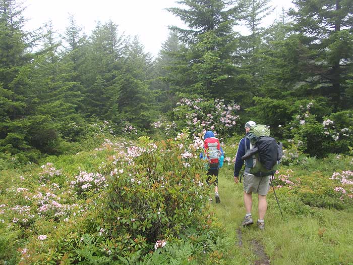
In the Spring, Either the rhododendrons or the Mountain Laurel will be in bloom. Rhodos are in the South Sods, Laurels in the North. Laurels bloom earlier than the Rhodos. The abundance is beyond belief.
In the Fall, if you time it right, the North is a sight unlike anywhere in the world. Earlier is better. We think last of September, but watch the weather there on the internets,
Be prepared for wind, Colder than you expect, like the steppes. The trees grow sideway here , like Patagonia !
H und H
By:aldikuma
Rating:
Date of Hike: Friday, July 4, 2014
If getting lost on this network of trails is part of the experience, then we got the full experience! My husband and I decided to hike this as a day hike from the Red Creek Campground on the 4th of July. His sprained knee was still healing, so no extra weight, which is why we decided to use the pay/drive up campground and leave our overnight stuff we always hike way in and camp for the night, so this was a little different for us. Since we wanted to get a move on as it was already 13:30 (mistake #1), we paid for the campground and left a couple of things there to show it was occupied, but didn't pitch a tent (mistake #2). First, this network of trails is amazing, and I'm itching to return. BUT although there are signs now, they can be a little confusing, and there are no flashes. So you really have to pay attention to the map provided, trail names and numbers, and stay alert. At the intersection of TR511/TR553/TR513, we ended up going on TR513, not TR553 (mistake #3). The signs had been knocked down and put back up with rocks, but didn't quite point in the correct direction. So 10 miles became 16 miles! Also, if you find yourself where TR514 meets TR510, the TR510 is there -- you just have to go left after the stream crossing and find the trail going sharply uphill. The trail seems to disappear a few times, but just follow the many cairns that kind hikers have left. There's many trails around leading to campgrounds and off in different directions and we got turned around a bit. That actually goes for most of the other trails we were on, too. But, there are signs, so just watch for them. We made it back to camp as the sun was setting to find that someone had taken our site, but there's no way to know if someone has paid and since we didn't pitch a tent, well we will know for next time! We ended up camping out of our truck, which was fine since it was in the 40s that night. For solitude, a 3 is accurate, and the trails are not difficult -- a little muddy and rocky, so wear your waterproof boots as suggested by HU! Zero ticks, not many bugs, nice and cool up there, and WOW, gorgeous scenery and views. Most of the hikers we came across had also gotten lost, so we didn't feel so bad haha (we are both experienced hikers). Many, many great campsites along the trails, but every site was filled along the creek (maybe the holiday weekend ), and apparently, every site at Red Creek Campground is usually taken, but sleeping in your car is an option. :)
By:Murray Capanelli
Rating:
Date of Hike: Sunday, December 23, 2012
We hiked in from the Fisher Spring Run trailhead on Sunday, Dec.23 and hiked out to the Red Creek/FR19 trailhead on Friday, Dec. 28. The hike in was an extremely tough and grueling one due to the trails being completely snow covered and very hard to follow in addition to a large number of downed trees. A winter storm hit us, on the 26th and 27th, dumping an additional 14" of snow with 60+ mph winds causing upwards of five foot snow drifts. We had snow shoes but our 50+lb. packs made the going very slow and tiresome. Once to the 514/FR19 trailhead, we attempted to snowshoe the 6.3 miles back to our vehicle. We made it to the Wildlife trailhead and had to turn back due to the depth of the snow and no chance of retrieving our vehicle. Luckily we ran into some people coming out for a day hike and they gave us a ride off the mountain. We were very fortunate. The gates are closed as of Jan. 2 and there is NO ACCESS to the mountain! We cannot wait until Spring to complete our mission of seeing all of the waterfalls and cascades along this beautiful trail! Happy New Year!
By:Hokie Hiker
Rating:
Date of Hike: Friday, October 19, 2012
This was a GREAT Hike- probably my favorite scenic hike since I was in Alaska- high meadows/plains, pine forests, creek crossings, boggy areas to transverse.
Two notes on the hike:
#1- it appears that there are now signs where there were previously not signs, marking trail intersections so you know where you are. This was a relief to know you were still on the right trail.
#2- If you go a day after a large rain- you might not be able to complete the hike as described. It rained heavy on Thursday night, and as I got to the end of TR511 and began looking for the side trail- the main trail turned into a small trickle of water- and eventually into a creek/stream with about 2-3 inches of water.
I can't wait to go back and do this again- it'd be great to do with snow on the ground BUT- the signs indicate that FR75 (on top of the mountain)is closed Jan-April.
By:JKels
Rating:
Date of Hike: Saturday, August 18, 2012
We love Dolly Sods. The wilderness area is full of every eco-system imaginable. One minute you're hiking through a tall-pine forest, the next through golden spruce, and then suddenly in a giant mountain meadow with views for miles.
We took a slightly different route than the one described here, but the beauty of Dolly Sods is you can mix and match the trails. There are plenty of camping sites in each of the river gorges (Red Creek and Big Stonecoal), as well as on top of Breathed Mountain, so creating your own route is fairly easy.
That said, there are a limited number of sites available at the official Red Creek campground, so if you plan on arriving late, you should anticipate some night hiking.
Our route was Blackbird Knob Harman Big Stonecoal Rocky Ridge Red Creek back to Blackbird Knob. We camped on top of Breathed Mntn, which was absolutely beautiful. If you plan to do this, though, be sure to fill up on water before climbing up there because there isn't any to be found on top.
Can't wait to go back and check out Dolly Sods North!
By:Hans ( und Heidi )
Rating:
Date of Hike: Monday, April 2, 2012
We give the Dolly Sods Wilderness 5 stars. This trail we could not get to on this date as the FR75 was gated 7 miles from the trail head. We hiked the Red Creek trail up from Laneville for an out and back of 4 hours. The day before we hiked Dolly Sods North area and I wrote a review of it. The South area is not the same as the North " High Plain Bog", but we give it 5 stars for the scenery (before leaf flush), and plan to come back when the forests of Rhododendrum bloom, which should be same time as the millions of Mountain Laurel in the North Area.
By:Cabin Jim
Rating:
Date of Hike: Saturday, September 11, 2010
Everything that you read about Dolly Sods Wilderness describes a beautiful, remote, and challenging terrain. The articles refer to the year-round bogginess, the unblazed trails...and unexploded WW2 ordnance. Still, my hiking group was itching to take on something more aggressive than our typical SNP and GWNF hikes have been, possibly including a hike-in overnighter, and we began to think about the logistics involved, including the 3 to 4 hour drive out to West Virginia from our Northern Virginia base, the gear wed need, and other issues.
We agreed to try the Forks of Red Creek while we were still talking about the potential of camping in the Wilderness. Even though we changed our plans about camping &ndash the combination of the distance and the fact that I don&rsquot have the equipment weighed against this, so we stayed at the State Park lodge in Davis, WV, a 30 minute drive &ndash the choice of trail was an excellent decision because of the wide range of scenery we passed through.
As far as the hike itself goes, possible due to a long dry spell in the summer of 2010, the bogs we were warned about didn&rsquot trouble us. There were signs of them, and for sure they would be challenging if the weather had been wetter than it was. Due to the dryness, the trails were clear and we had few problems orienteering, mostly because of well-placed signs at intersections &ndash supplemented by using a compass at some of them when the way wasn&rsquot clear (I kept my Casio Pathfinder alternating between compass and altimeter modes for the duration of the hike).
We encountered plenty of camp sites, which were mostly occupied by the afternoon &ndash early in the day most of the plum locations weren&rsquot taken. Since we may eventually go back and try our first overnighter here, we kept an eye on the locations for future reference. There are plenty of great camp sites, many of them have benefited from the inventiveness of past hikers&hellipat approximately 1.5 miles into the hike, just before the first major Red Creek crossing, we noticed a series of stepping stones set into the creek, and took a short break to explore the detour. This turned out to be a little island or peninsula, and the campsites were quite elaborate, sometimes even using rocks from the area to create fire pit seating areas!
Continuing on down into the canyon, there were more great campsites &ndash the reviews on this site state that these areas can be quite crowded, and it&rsquos easy to understand why after you experience the natural beauty of the place and consider how lovely a summer evening beside this little stream could be. A few of these sites were taken already by midday, but I think those folks had gotten in early or were doing a multi-day expedition.
We had a great time on this hike, and our experience was pretty much what the Hiking Upward guidelines say &ndash time, distance, stream crossings, etc. We met a few folks on the trail that were having the same great time we did: a couple that had spent four days out there camping, two guys fly fishing in the creek and camping overnight, and one guy letting his golden retriever take a dip in the stream. It&rsquos definitely a trip we&rsquoll make again.
I want to add a few words about this part of West Virginia. On Sunday we figured we&rsquod be pretty tired from the hike and need a partial recovery day before heading back to Northern Virginia. Two easy sightseeing side trips are within easy reach of the Wilderness: Blackwater Falls and the Seneca Rocks.
At Blackwater Falls, the water is colored by tannins from the upstream evergreen forests, and the cascade tumbles over copper-colored sandstone to fall 62 feet into Blackwater Canyon. There is a rock abutment that divides the falls into two horizontal sections &ndash we could see that during our visit, but apparently it&rsquos more dramatic during times of higher water flow. This is a state park, and they&rsquove built an extensive wooden staircase down to several viewpoints in the canyon.
Also, Seneca Rocks is a half hour south of the area. This formation is one of a series of &ldquorazorback ridges&rdquo in West Virginia, and it is the furthest south on the chain of peaks it terminates. In fact, this ridge borders the north fork of the Potomac River, which may place it in the western reaches of the original Fairfax land grant. There is a great information center here operated by the Forest Service, and there is also a little monument to the 10th Mountain Division, which trained here before deploying to Europe, where they would fight in Italy.
I have a fuller review of the Forks of Red Creek hike with phone cam photos on my Hawksbill Cabin blog, at this URL: http://hawksbillcabin.blogspot.com/search/label/Dolly%20Sods%20Wilderness
Between the hike and the two side trips, we had a great weekend in West Virginia. Dolly Sods was every bit the great experience we expected it to be, and my hiking team is thinking of a repeat visit.


