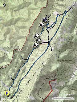
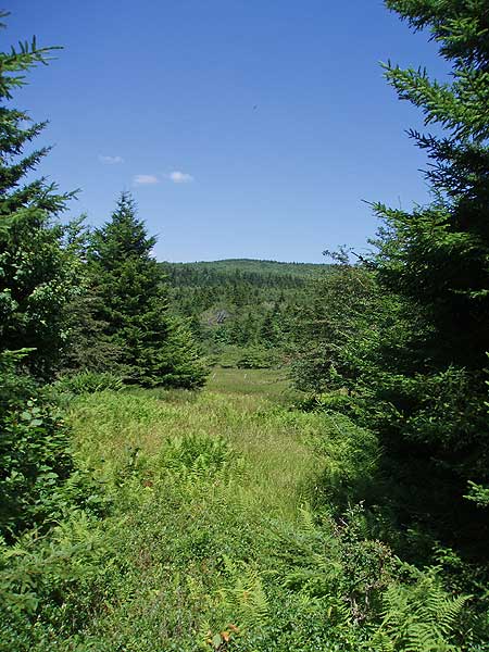
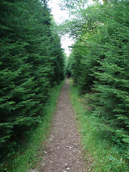
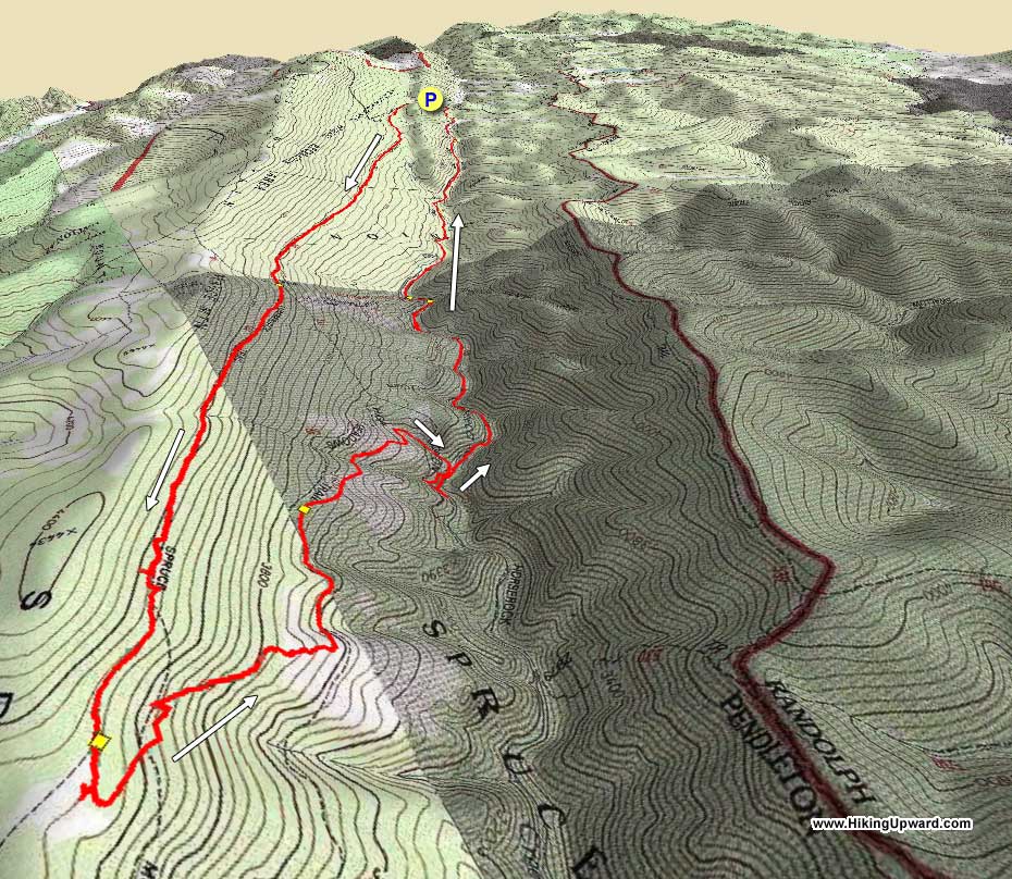
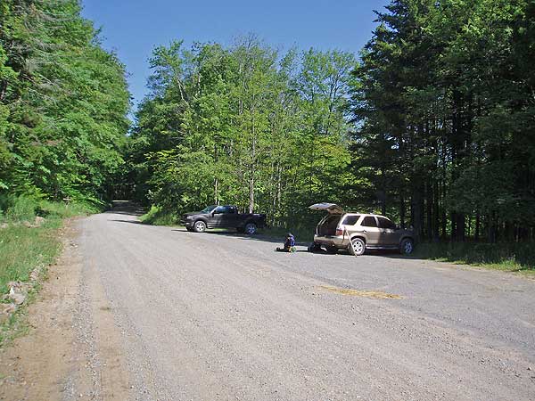
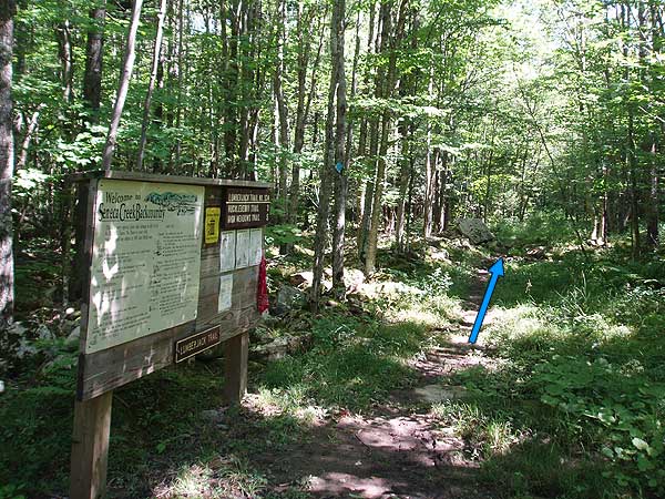
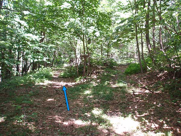
The Lumberjack Trail is very boggy, even in dryer weather. If there has been any rainfall within the past week be prepared to take extra time on the the Lumberjack Trail. Follow the Lumberjack Trail for 3.6 miles and arrive at the intersection of the Huckleberry Trail (TR533). Continue straight on the Lumberjack Trail for another 2.0 miles, passing through a small clearing, then arriving at the High Meadows Trail junction.
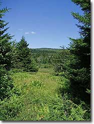
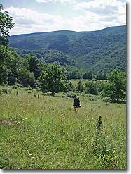
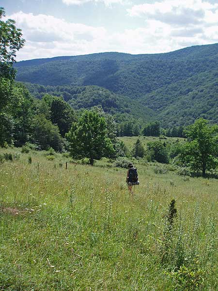
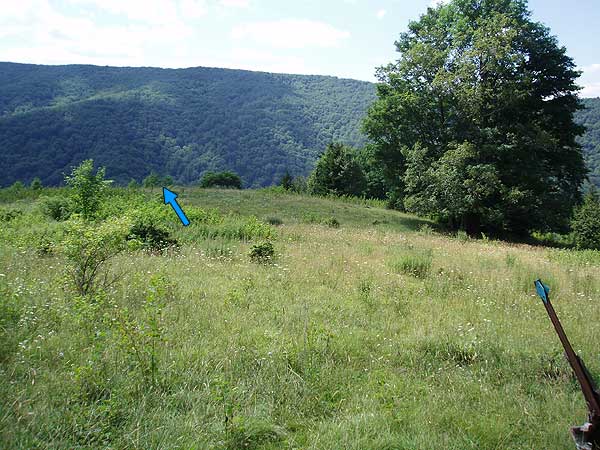
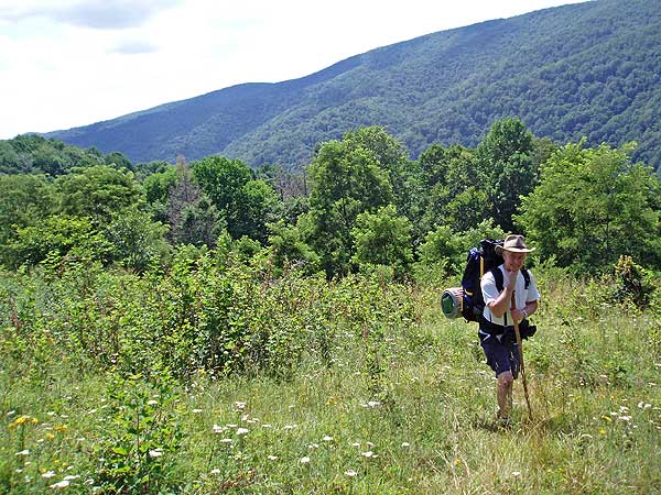
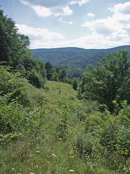
At this point the High Meadows Trail passes through a rocky area in the forest, and is hard to follow for the next 200 yards before entering the next set of meadows. Follow the blue diamond trail markers through the meadows as it descends to the left for another 0.4 miles before heading more directly downward, then turning more uphill to the left.
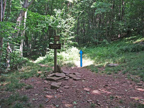
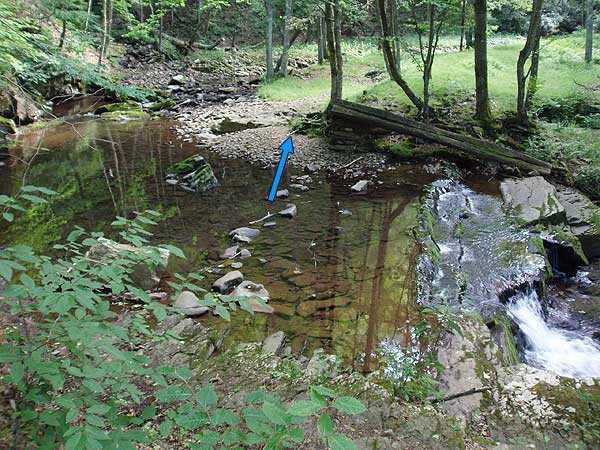
As you enter the forest cross a small stream, and arrive at the next intersection. Turn right downward towards Seneca Creek (the arrow has been scrapped off the sign), and in 0.2 miles reach Seneca Creek at which point the trail turns right downstream. Continue for 0.1 miles, turn left crossing a small gully, and in 150 yards turn sharply down to the junction of the Seneca Creek Trail (TR515).
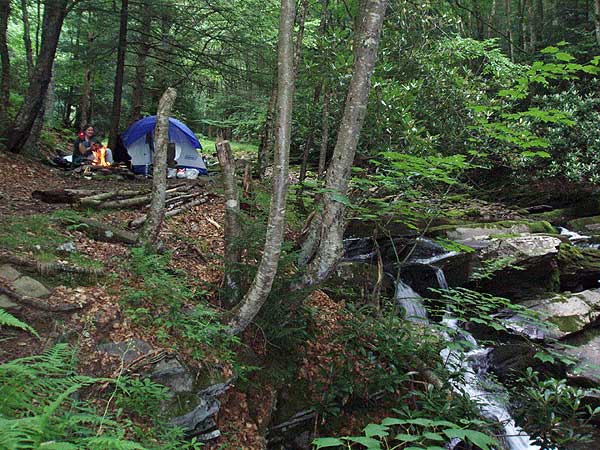
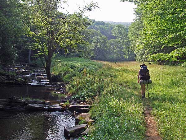
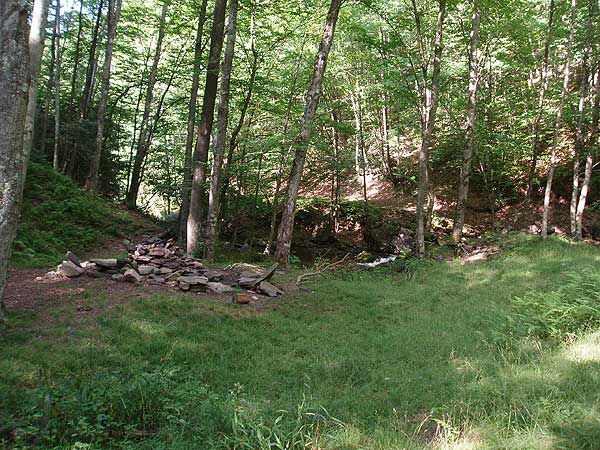
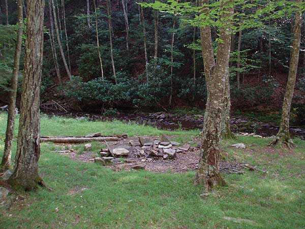
In 0.1 miles pass the intersection of the Bear Hunter Trail on the right before arriving at the Judy Springs campground. Pass through the campground, and continue past the Judy Springs Trail (TR512) on the left, DO NOT cross the footbridge. In 0.5 miles cross Seneca Creek for the last time where the trail becomes easier to follow for the remainder of the hike. Pass the Swallow Rock Trail in another 0.5 miles, and the Tom Lick Trail 1.4 miles further on. 1.0 miles past the Tom Lick Trail arrive back at the Seneca Creek parking area.
Early August
Video
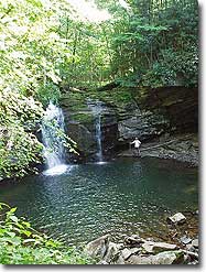
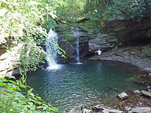
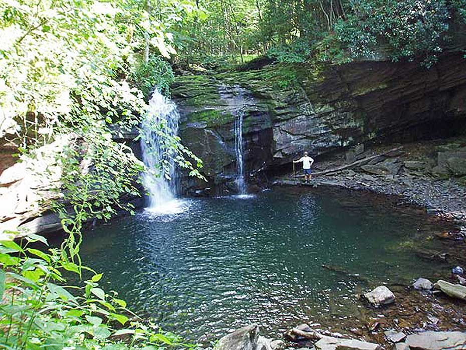
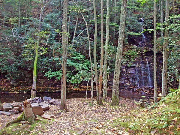
Seneca Falls
High Meadows/Seneca Creek Hike Comments
Archived Comments
By:Craig
Rating:
Date of Hike: Saturday, March 23, 2019
Nice hike. It was 19 degrees and 6 inches of snow when we arrived at the parking lot. Our group included people between 10 and 40. We did the hike backwards and hiked down the creek to the first campsite after the falls. The second day we hiked out on Lumberjack, taking the short cut of Horton trail which cuts several miles off the trip. Caught several night Brook trout, and one fellow in the group took a swim in the pool beneath the waterfall. The snow made the trail between Judy Campground and the falls pretty muddy, and as the description said Lumberjack trail was very muddy. If you do this hike be prepared for multiple creek crossings. The worst is at the falls, you cannot rock hop your way across and with high water we all either just got wet shoes, or took off our shoes and waded.
By:Ben
Rating:
Date of Hike: Tuesday, August 28, 2018
This is really a great Hike. I did this with my 12 year old son and we both wanted to see the piper PA-23 crash site which was really worth checking out. One thing I would like to say is that all the reviews seem to be a little negative about the Lumberjack trail and for this reason I have always been reluctant to try this hike. But I don't think it was that bad of a trail, just wear long pants because there are a lot of Nettles along the way. The High Meadows Trail Had some Very Awesome Views But I would like to give a word of Caution Watch out for Rattlesnakes!! I was admiring the Views and not watching my feet and almost stepped on a Big Timber Rattlesnake on the trail, actually thank God I did not step on it because my Son who was behind me spotted it and I had just walked over it.
After getting my heart rate back under control We continued on down to Seneca Creek, be prepared to cross Stream 3 times before Judy Springs which is where we set up camp. The fishing was amazing on Seneca creek If you are into catching native Brook trout. The hike from Judy springs to the Trail head is I think the Best section of the Seneca Creek trail. So enjoy it and Be Safe.
By:Kat V.
Rating:
Date of Hike: Friday, August 26, 2016
Great hike and challenging if done backwards. We arrived a bit late on the first day to go the recommended way up Lumberjack to High Meadows and decided to do the hike backwards to take advantage of the multiple pre-existing campsites along the Seneca Creek. We were literally the only ones out on the trail (only 2 cars in the parking lot) and ended up about a mile and a half south of Seneca Falls. The next day we continued our backwards hike to Seneca Falls (gorgeous) and then up to the High Meadows trail. This part was a killer and I would rate it as a 5 out of 6 on difficulty for the steep incline. We then went down Lumberjack to Horton trail to join Judy Springs to get back to Seneca Creek trail. We saw no bears and only saw one bear scat the whole time (which we were very happy about). We also visited the airplane crash site on Lumberjack, which was very sobering. We saw about 10 people on the trail on Saturday and when we left Saturday night the parking lot was full. If we had to do it again we would set up camp on Friday night right at Seneca Falls and just do an out and back along that creek.
By:Kevin A.
Rating:
Date of Hike: Saturday, May 28, 2016
Great creek hike with some great campsites - if it's not too busy. We decided to do this hike backwards, starting at the Seneca Creek trailhead, along the creek to the falls, and back along the Lumberjack Trail, but everyone we talked to on the trail said that Lumberjack was nothing but rocks and muck, so we stuck to an out-and-back on Seneca Creek.
This was on the Saturday of Memorial Day weekend, so pretty much every established campsite was taken, though there were enough flat spots along the trail for us and the other "overflow" hikers to get a decent night's sleep. The sites near the falls were nice, but the ones near the Judy Springs trail intersection seemed nicest because of the little field there. (I've always liked camping on the edge of the woods instead of in the woods, though.)
The repeated stream crossings were slightly annoying, but it was easy to make it across all of them without getting any water over the top of my boots. (NOTE: wear waterproof boots!) We hiked up to the high meadows before we turned back to the car, and they're pretty nice - would be really great in the fall. We're planning to return in fall or winter, so I'll add second opinions after that future trip.
By:reswob10
Rating:
Date of Hike: Saturday, October 24, 2015
Great Hike! Just as beautiful as everyone says. Great for beginner hikers.
Only word of warning, don't use the tool above to get directions to the parking lot/trail head (the blank entry that asks you to put in your starting point). It puts you on FR112 just south of Seneca Knob campground.
By:mrandmrshwroberts
Rating:
Date of Hike: Sunday, September 6, 2015
The Seneca Creek parking area was packed!! Most of the people were just there for the day though. We got started about 1 pm and considered parking at the Lumberjack trail head, but decided it would be best to do that uphill on the forest road 1st rather than last. Lumberjack is boggy, but I think we went on one of the better days because of the drought conditions we have been having. If you have hiked in Dolly Sods, then you can handle these bogs. You pretty much walk straight onto the High Meadows Trail, so don't feel like you've missed it. Every intersection is marked with a wooden sign. When we reached Seneca Falls, it was breathtaking!! We could not have asked for a better camping experience or spot!! We had the whole area to ourselves!! The next day, we did the 5+ miles back out to the parking area. There were a lot of people camping around the Judy Springs area. I would have to say that this hike is a 'low' 3 as far as difficulty is concerned. I (mrs roberts) carried a 25-28 lb backpack, and did about seven miles with a blister on my heel.
By:FMatt
Rating:
Date of Hike: Saturday, August 8, 2015
Great hike with diverse scenery! The only strenuous part was the descent starting at High Meadows - it's the last leg of the first day and was difficult.
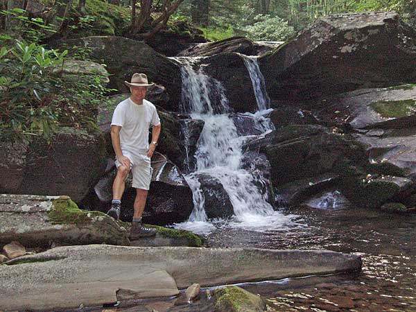
The directions, as stated in other comments, are a bit off, though it's pretty straightforward.. Once you hit High Meadows Trail (which was our favorite part), you'll keep going through three large meadows. After the third meadow, you'll come to a creek crossing - it's a small waterfall with water running over smooth rocks and then falls down some small levels. Be careful crossing - it's an easy one to slip on and seriously hurt yourself.
After this crossing, the trail winds for a half mile down hill, with campsites on your right as you defend. There's no clear signs, but once you get to the bottom and the creek is right in front of you, you have two options. Go left, you'll immediately come to a creek crossing that's at least 20 feet long. Go right, and you'll follow the creek and pass by the falls and a lot of camp sites. If you camp, you'll need to cross the stream (this is the start of the Seneca Creek trail). There's also a few campsites on this side of the stream. We came out on the seneca creek trail as we didn't want to do all the uphill and re-hike the huckleberry (but also had a car parked there...you wouldn't be able to walk back to your car at Huckleberry trailhead from Seneca trailhead without a ride). There are at least 4 creek crossings on the full Seneca Trail which vary, but you should be ready to take off your boots at least once or twice.
By:Kellygirl
Rating:
Date of Hike: Saturday, June 14, 2014
Beautiful, beautiful and more beautiful...love the feel of this forest. Completed some trails in this area as a day hike. I'm going back! Cool air, less buggy than SNP and great scenery...this area has it all...
By:Brian B.
Rating:
Date of Hike: Saturday, August 24, 2013
Overall, an excellent hike (done as overnight backpack). But note that no one is kidding about the boggy conditions - I think there was quite a bit of recent rain, so the entire first day was pretty soggy, and as for some of the Lumberjack trail. . .I've literally seen drier rainforests, with several boot-sucking sections to cross. Camped at the falls (three excellent sites on your left just past the overloook) I pitched my tent maybe 50 yards away. The high meadows are indeed nice no blueberries yet but some ripe rasberries, and the hike up Seneca Creek is fanstastic. Saw a number of folks (two other groups camped at the falls, and maybe 3-4 others on the way out). BTW, don't miss the spur road to the top of Spruce Knob. . .well worth a small detour.
By:Paul
Rating:
Date of Hike: Saturday, August 3, 2013
Set out on the Lumberjack Trail knowing that rain is imminent...one word...
mud...
and one other word...mud...
Six miles in..the fun starts...
Downhill descent...especially with a backpack...through excellent views through the meadows...slipped a couple of times through the...
mud...
Blackberries two to three weeks away...will be plentiful...
Seneca Cactii?
Purple fuzzy flowers...
Seneca Falls...Awesome...I loved it...Boy Scout Camp for the weekend...
Half a mile down before you cross the Seneca Creek..home...
Weather cloudy...cool...chance of rain...imminent...
Tent up...FIre going...cooking ribeyes over the flames...
Awesome...
Saw those classy campsites upstream...
Stunning place!
One word defines the overnight backpack...
Mud...
One word defines the experience...AWESOME!


