
|
| Length |
Difficulty |
Streams |
Views |
Solitude |
Camping |
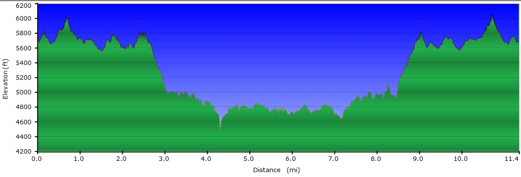
| 4.8 mls |
 |
N/A |
 |
 |
N/A |
Hiking
Time:
Elev. Gain:
|
Blackrock Mountain
2 hours and 45 minutes with 30 minutes of breaks
1,565 ft |
| 11.3 mls |
 |
N/A |
 |
|
N/A |
Hiking
Time:
Elev. Gain:
|
Blackrock Mountain and The Pinnacle
6 hours and 50 minutes with 2 hours and 15 minutes of breaks
3,324 ft |
| Resources: |
 Topo Hike Trails Map (PDF) Topo Hike Trails Map (PDF)
Balsam Gap, NC Weather Forecast
Garmin (GDB), Gaia/Trails App (GPX) (What's
this?)
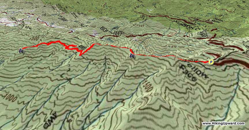
3D View of Route |
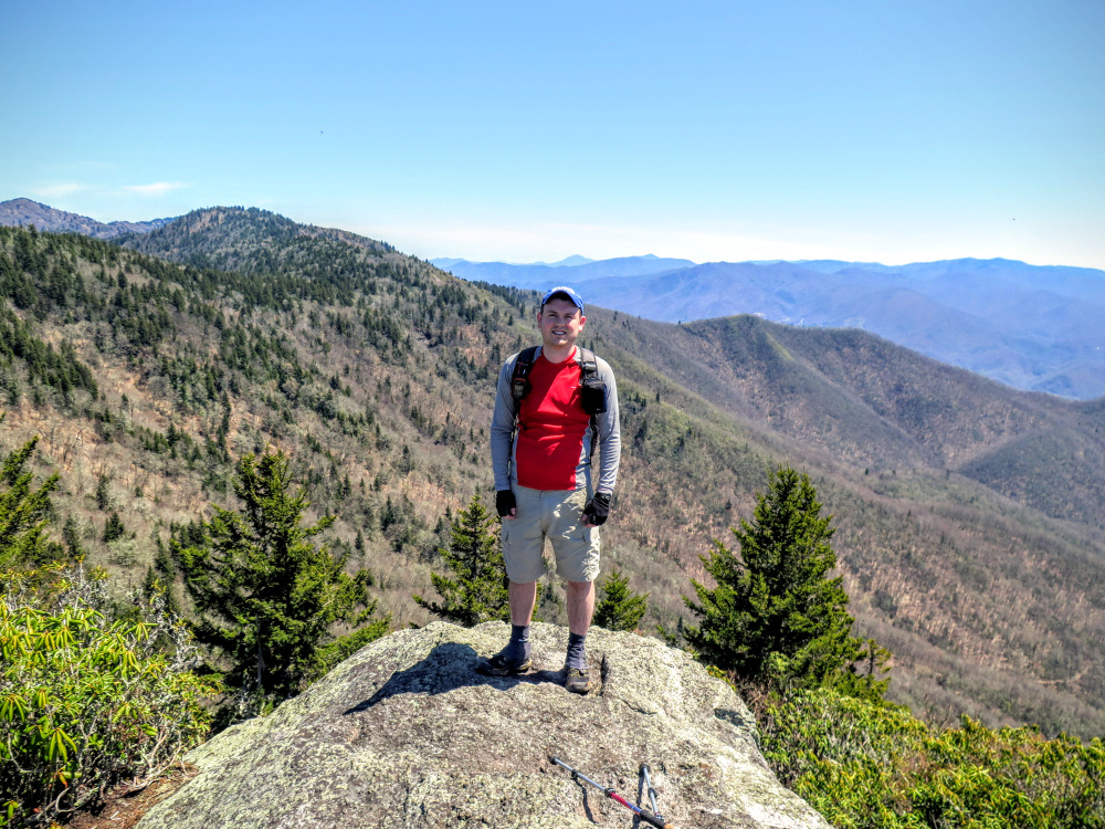
 By Trail Contributor: Zach Robbins (Contact Zach) By Trail Contributor: Zach Robbins (Contact Zach)
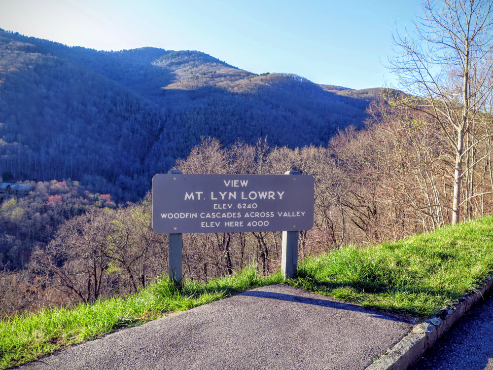
Sandwiched between the immensely popular Great Balsam Mountains and Great Smoky Mountains to the east and west, the Plott Balsam Mountains are frequently overlooked as a hiking destination in western North Carolina. However, this small range of 5,000-6,000 footers has a network of trails offering fantastic views without the droves of hikers seen in neighboring locations. The drive to the hike from the east is almost as impressive. The Blue Ridge Parkway climbs nearly 3,000 feet from Balsam Gap to the crest of the Plott Balsams offering a startling change of scenery from the valley to sheer cliffs and spruce forests. Make sure to stop at the Mt. Lyn Lowry View at Mile 445.2 for a great view of the 2nd tallest peak in the Plott Balsams and the high Woodfin Cascades which flows under the parkway onto private land. A stop at Yellow Face View at Mile 450.2 will give you a preview of the first leg of the hike.
Most of the traffic, which is relatively minor, visits this area to experience grand views from the Waterrock Knob Visitors Center and hike the short summit trail to Waterrock Knob, the highest peak in the range. Instead you’ll embark on a journey along the western crest of the Plott Balsams to the outstanding summit of Blackrock Mountain. This lofty perch offers incredible views of the Plott Balsams, Great Balsams, Cowee Mountains, and the Great Smokies. You’ll have a choice to make on Blackrock, turn around for a moderate 4.8-mile day or descend steeply into Pinnacle Park. The highlight of Pinnacle Park is The Pinnacle, the tip of a ridge extending from Pinnacle Bald with arguably better views than Blackrock Mountain. The only catch is the 11.3-mile journey features an agonizingly steep return climb to the top of Blackrock. Luckily most will be satisfied with the view from Blackrock Mountain, but strong hikers can tackle the full trail described here.
New Trail Segment Update - In 2019 a new trail segment opened between the summit of Blackrock Mountain at Mile 2.4 and the forest road junction at Mile 3.0. The trail now avoids the steep descent from Blackrock Mountain to Pinnacle Park, adding switchbacks to reduce erosion. The mileage is longer with the new segment but it should make the hike easier. We have not hiked this trail since it has been opened, so the GPS and mileage directions do not accurately reflect this addition.
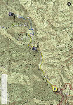
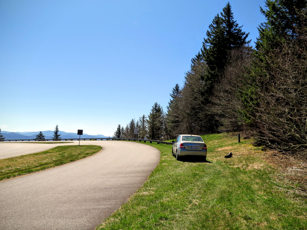
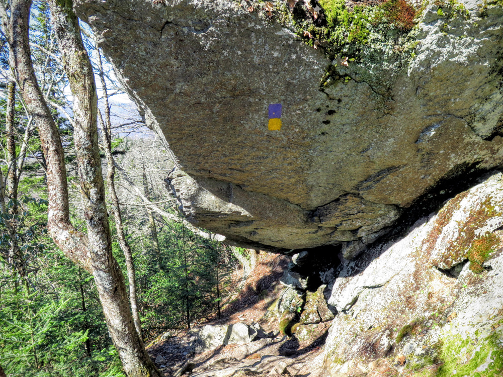
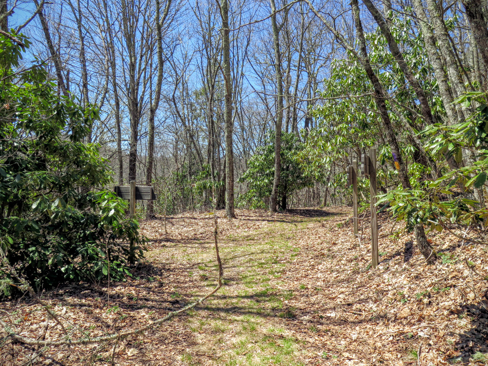
- Mile 0.0 – On the Blue Ridge Parkway at Mile 451.2 is a T-intersection with Waterrock Knob Road. The parkway makes a wide curve at this junction splitting around a grassy median. The trail head for the Blackrock Trail (purple and yellow blazes) is opposite Waterrock Knob Road and is marked by a small, wooden hikers signpost. Park anywhere along the shoulder and begin hiking southwest.
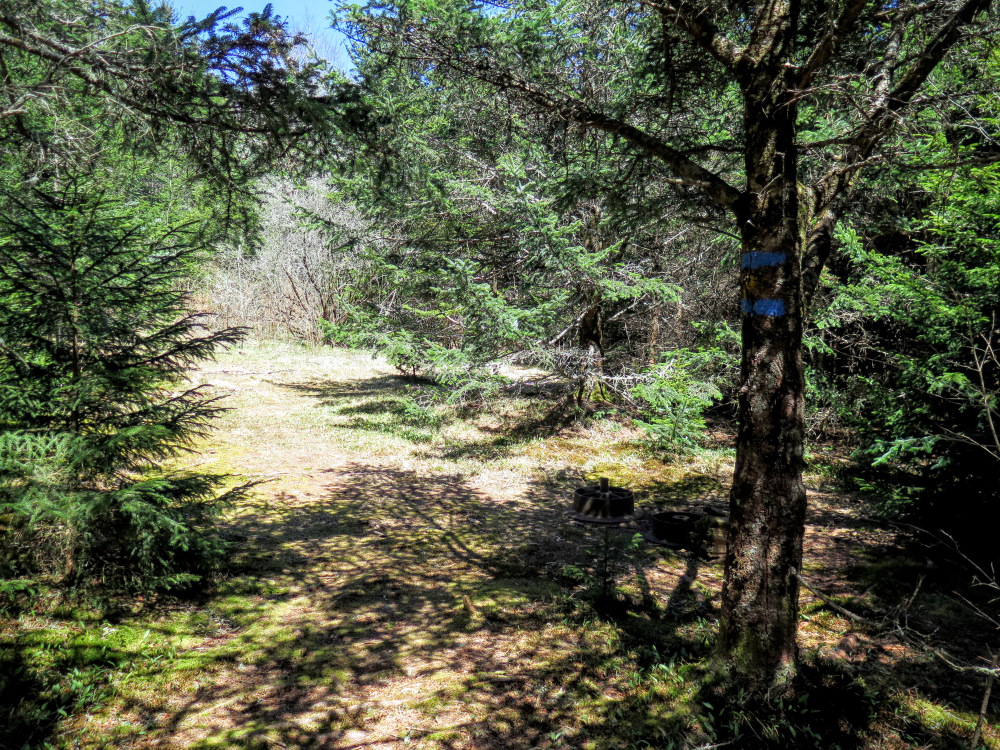
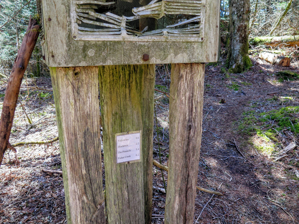
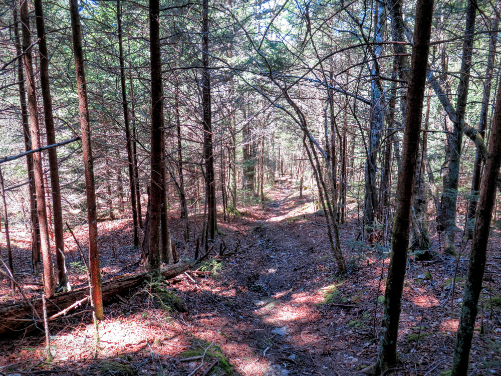
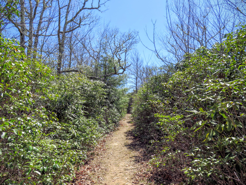
Once you enter the forest there is an old information board with mileage postings to various landmarks. Although not an official trail managed by the Blue Ridge Parkway or Nantahala National Forest, this trail is maintained by volunteers in the area and is in good shape. Infrequent blazes are purple and yellow after the colors of Western Carolina University but the trail is easy to follow.
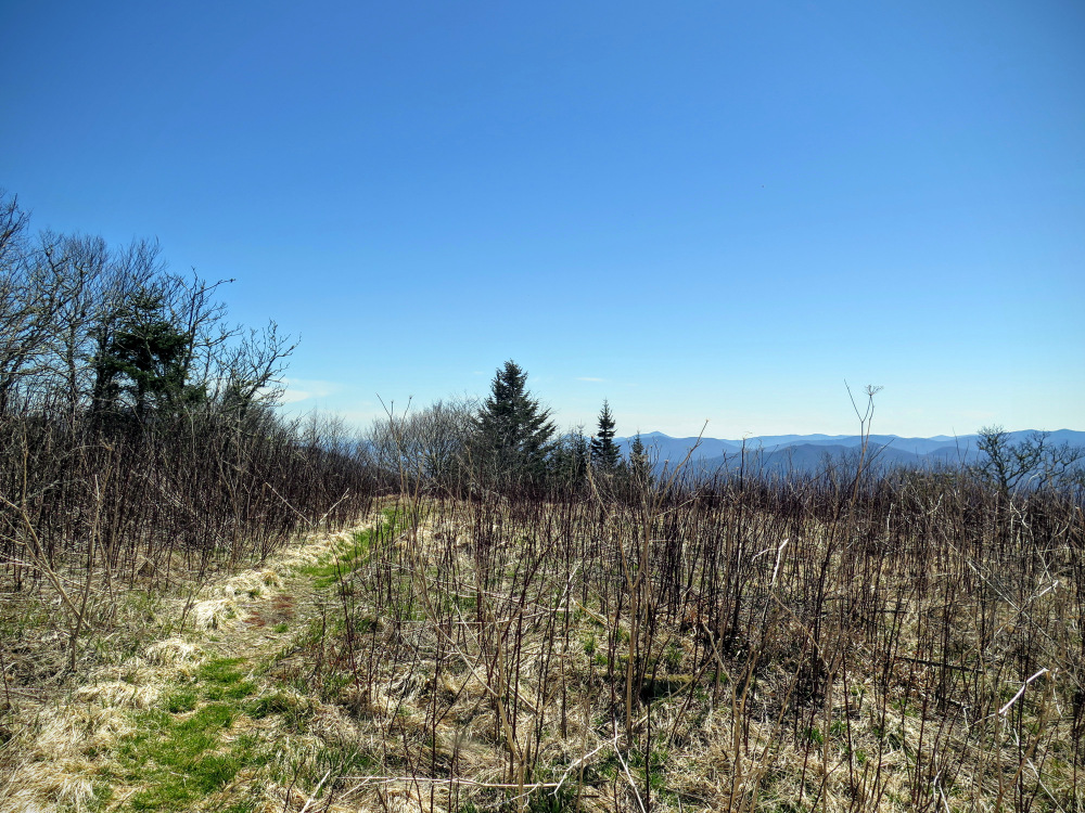
- Mile 0.2 – The trail leaves the conifer forest offering an open view of Yellow Face and the southeastern horizon before dropping into a saddle.
- Mile 0.5 – On the left side of the trail is a good view southeast.
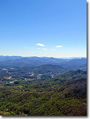
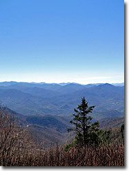
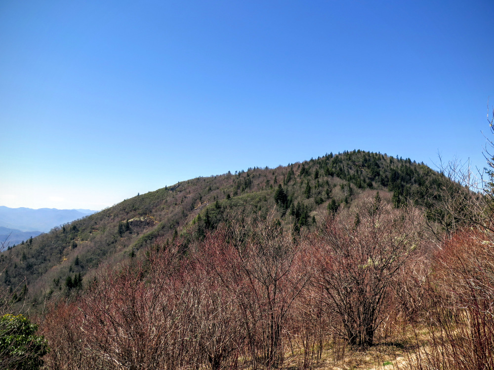
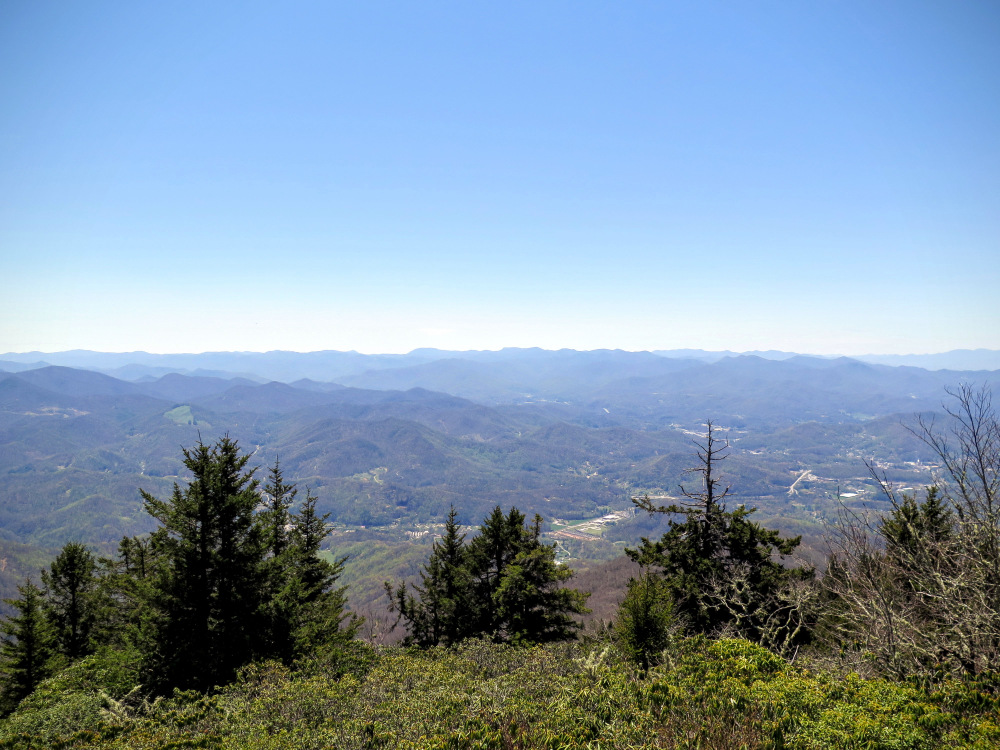
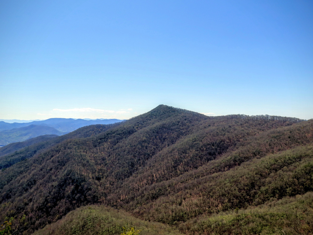
- Mile 0.7 – Reach the summit of Yellow Face. At 6,032 feet this is one of the five 6,000 footers in the Plott Balsams and the only 6K peak you’ll cross on this hike. The airy summit is a partial heath bald with open views above the tree line to the east and south. The trail descends gradually from the summit through a small patch of spruce-fir forest.
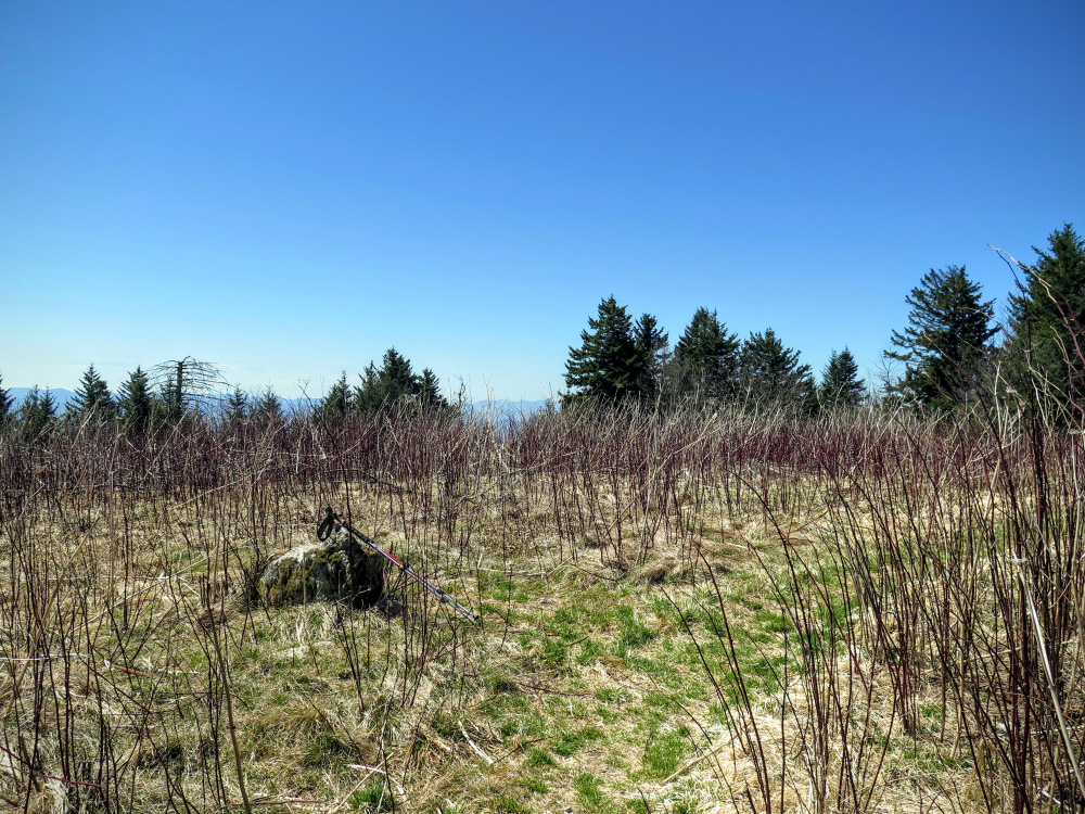
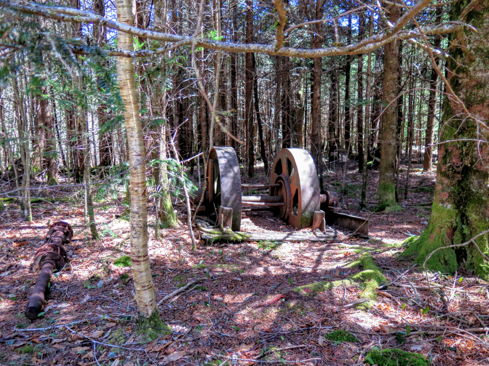
- Mile 1.4 – At the saddle between Yellow Face and Blackrock Mountain is a grass field with campsites and old vehicle parts.
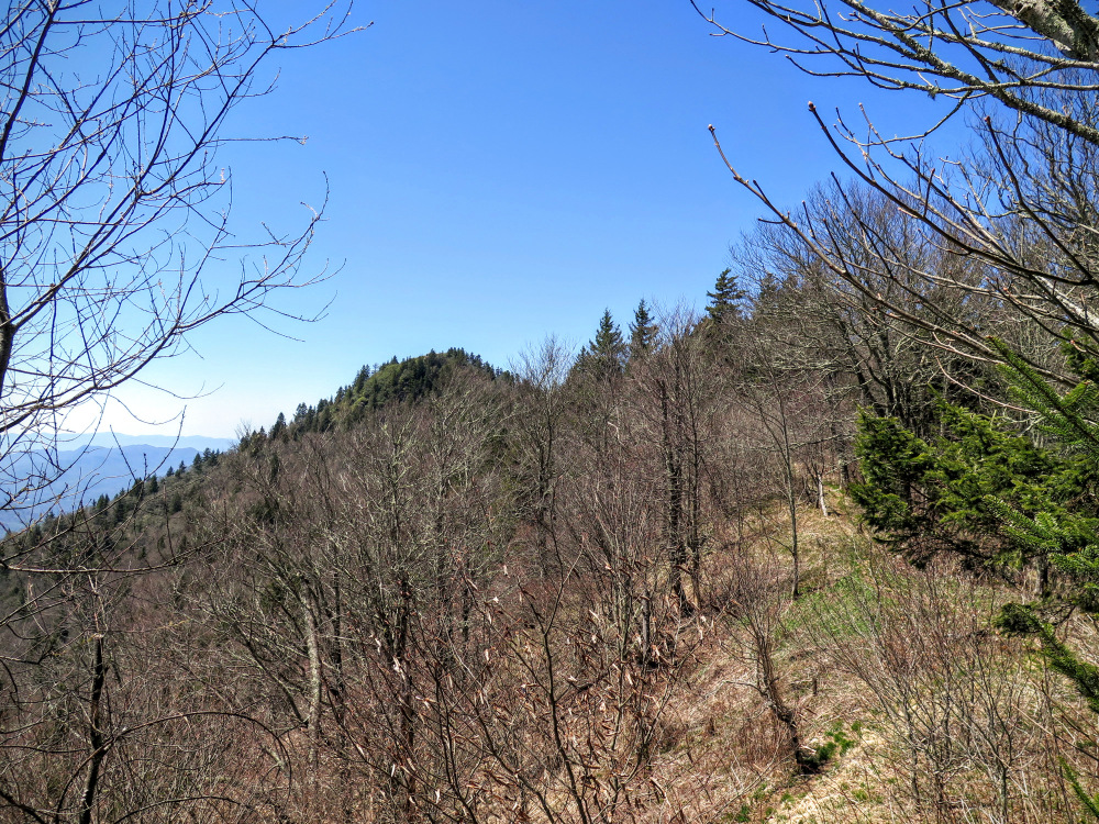
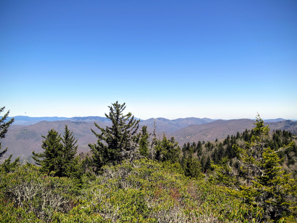
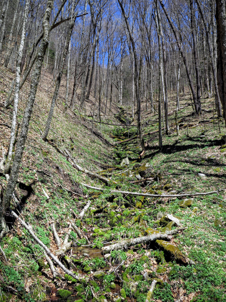
- Mile 1.8 – The trail follows a very narrow ridgeline for the next half-mile, sometimes less than 10 feet wide. You will pass enormous boulders, pockets of spruce-fir forests, and have occasional views of Blackrock Mountain. As you near the summit you will face a steep climb up roots and rocks requiring hands and feet. Ignore any possible side path on the right and go straight up.
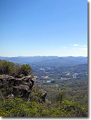
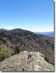
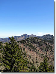
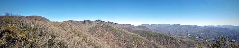
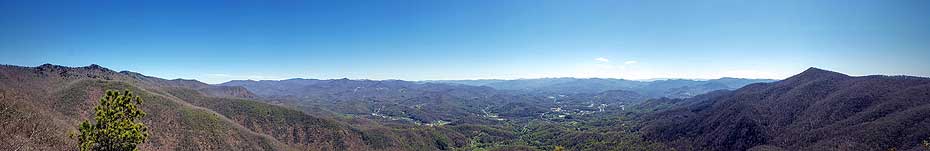
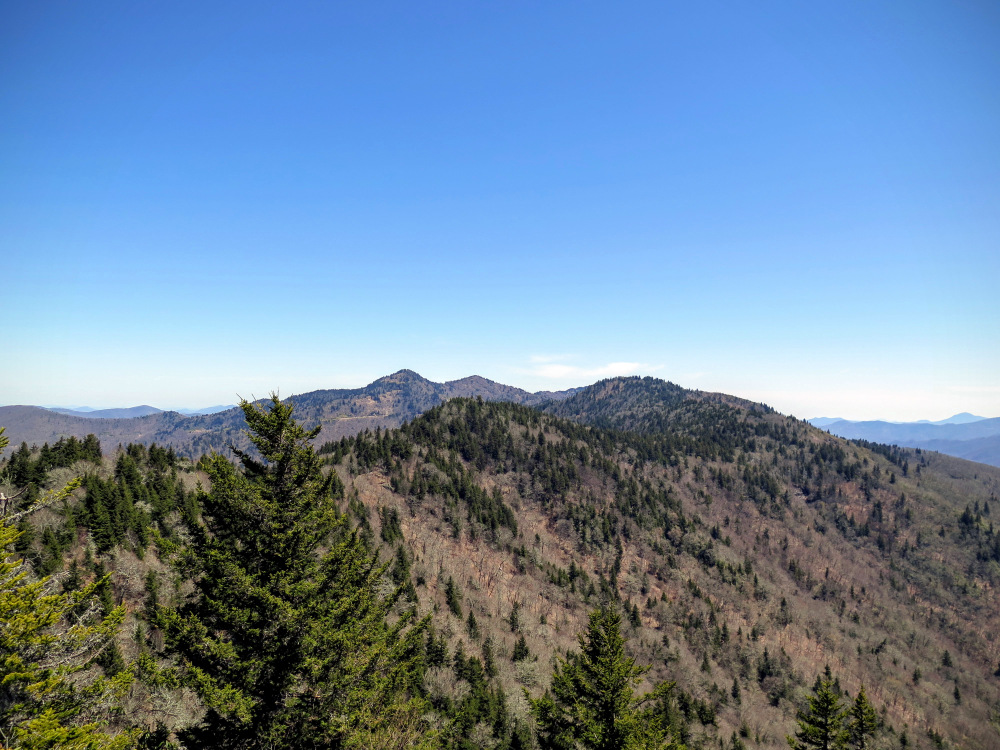
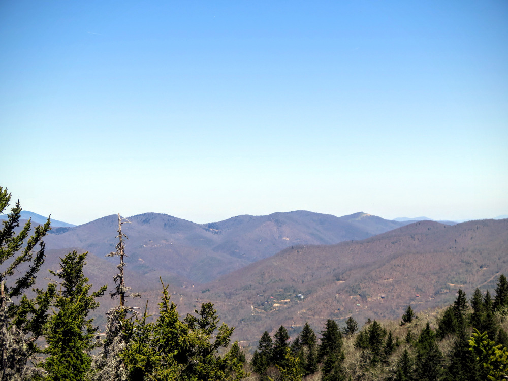
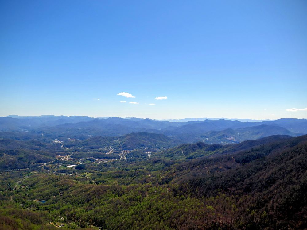
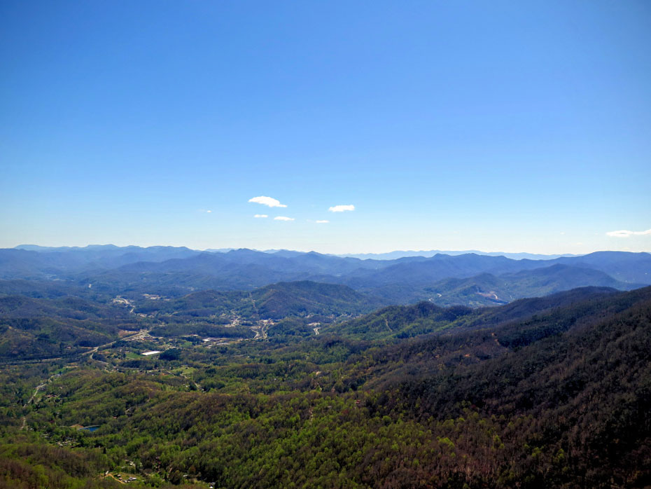
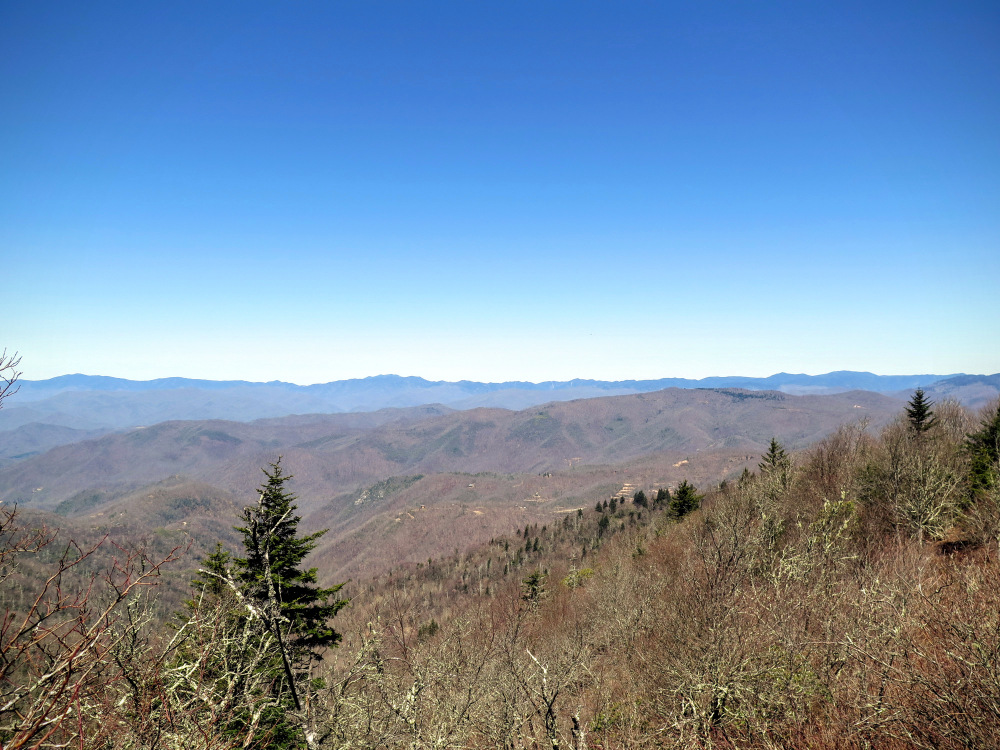
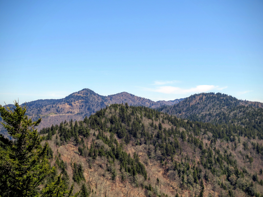
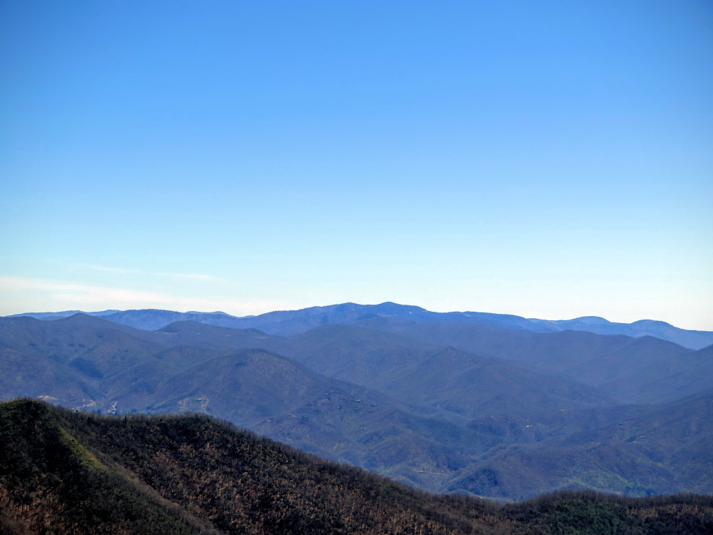
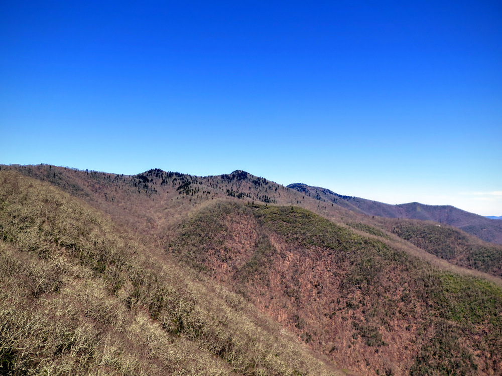
- Mile 2.4 – Through a tunnel of rhododendrons the trail reaches the bare rock summit of Blackrock Mountain (5,810 feet). Bask in the panoramic views of some of the tallest mountains in the south. There probably isn’t a finer view of the Plott Balsams to the north. Waterrock Knob is the highest pyramidal peak in view. The Great Balsam Mountains spread out before you from the east to the southeast. The two tall distant conical peaks in the east are Mt. Pisgah and Cold Mountain, while the massive, sloped, blackish appearing peak farther south is Richland Balsam, the tallest mountain in the Great Balsams. Due south the Cowee Mountains rise above the small town of Sylva. The Great Smokies lie to the west and northwest. The closest peaks of the Great Smokies can be seen northwest to the left of the Plott Balsams. The long, barren ridge is Cataloochee Divide, with Hemphill Bald on the far right. Behind that to the left is the dark green Hyatt Ridge with Big Cataloochee Mountain looming on the right.
After enjoying the views from Blackrock Mountain you have a decision to make. Either turn around and head back to the Blue Ridge Parkway for a 4.8-mile hike, or descend down the southwest side of the mountain on the Blackrock Trail in order to do the full 11.3-mile hike. If you thought the initial 2.4 miles to Blackrock Mountain was moderate-to-strenuous it is advisable to skip the full hike and turn around here. The Blackrock Trail descends over 800 feet to connect with the trail system in Pinnacle Park. First the trail drops steeply off the summit under gigantic boulders before switchbacking downhill between Blackrock Mountain and Pinnacle Bald.
**New Trail Segment begins at Mile 2.8 with an improved Blackrock Trail with added switchbacks from Blackrock Mountain to Pinnacle Park. When you meet the trail junction described in Mile 3.0 the actual mileage will be longer than listed by about 0.75-mi.
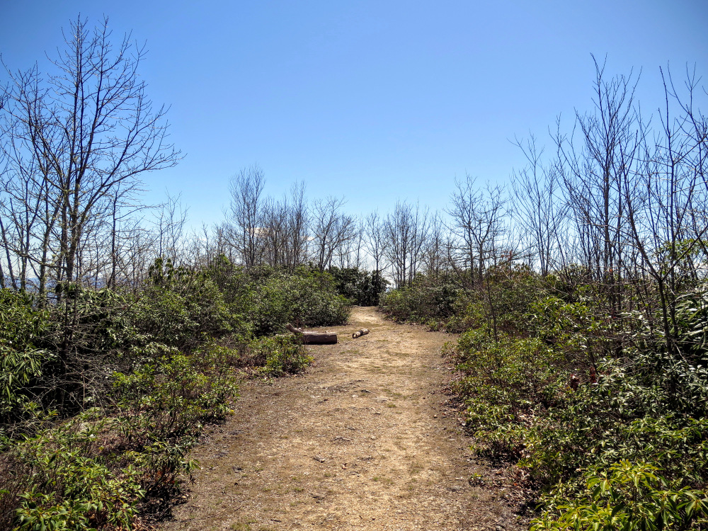
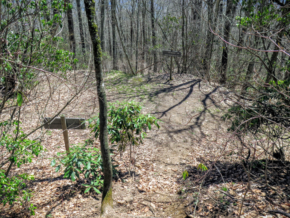
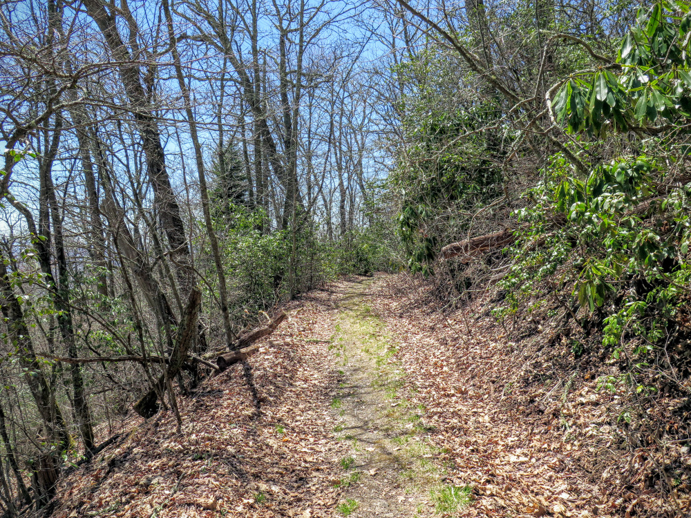
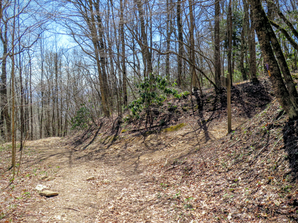
- Mile 3.0 – The descent ends at T-junction with a forest road grade in Pinnacle Park. Pinnacle Park is a small public park previously used as Sylva’s watershed, protecting Fisher Creek. Although the trails aren’t blazed, every intersection is well-marked with mileage and directions to notable features. The trails follow very gentle forest roads with few rocks.
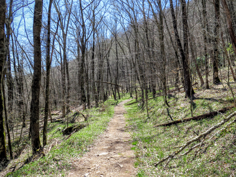
- Mile 3.7 – Blackrock Trail ends at T-junction with the East Fork Trail and the West Fork Trail. Continue straight on the West Fork Trail.
- Mile 3.9 – West Fork Trail passes over West Fork Fisher Creek.
- Mile 4.3 – T-junction with the Pinnacle Trail. Turn right onto the Pinnacle Trail. The trail continues to follow a pleasant forest road grade.
- Mile 4.9 – Campsite #3 on right side of trail.
- Mile 5.6 - After the campsite a brief climb leads to the end of the forest road along a narrow trail through thick shrubs before seemingly ending at a sandy flat. At the far end of the flat look for a narrow trail through the shrubs on the left side.
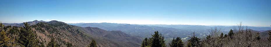
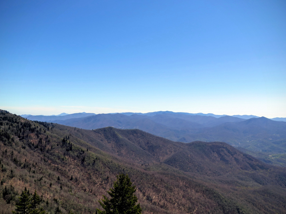
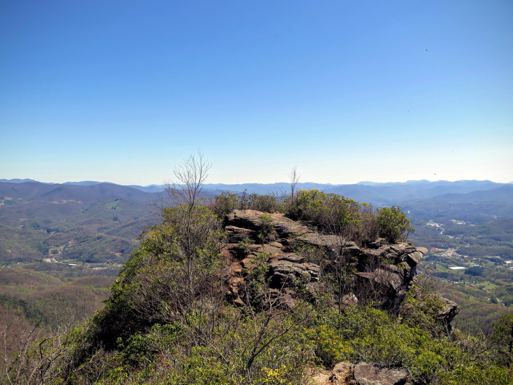
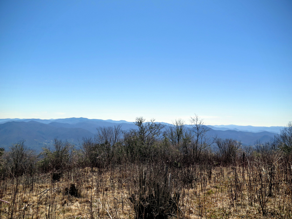
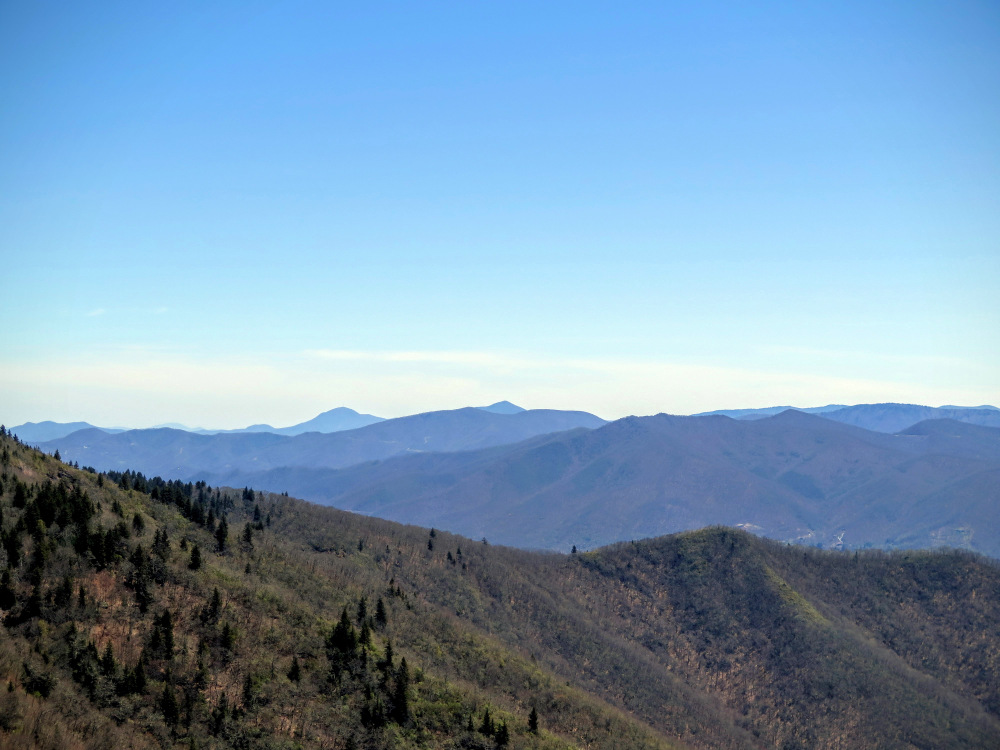
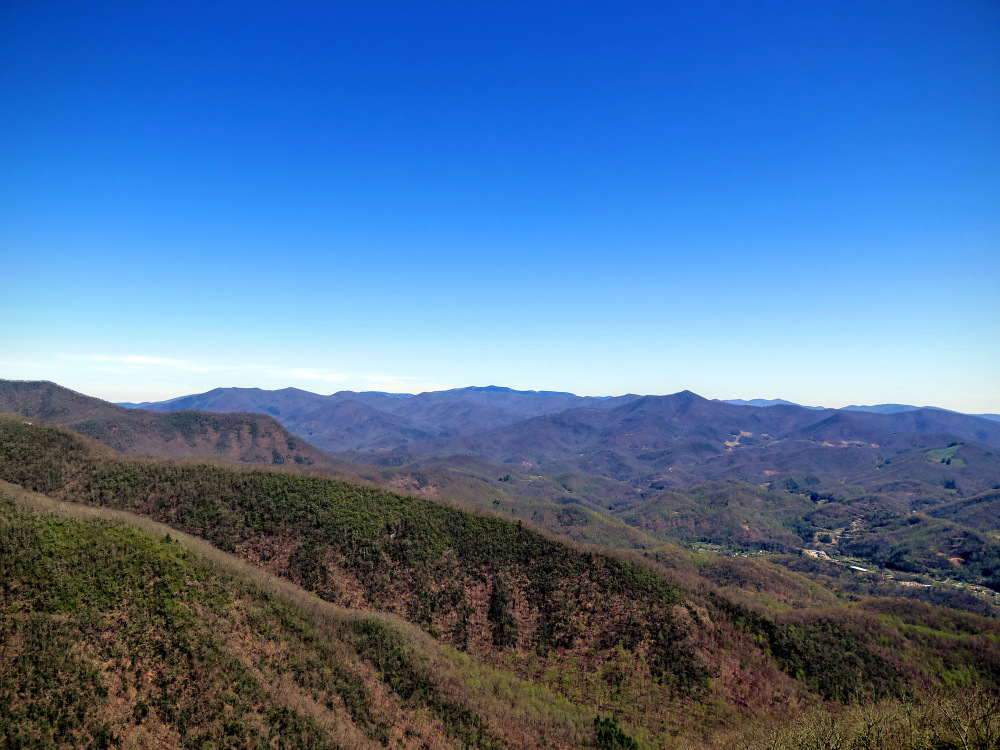
- Mile 5.7 – Pinnacle Trail ends at The Pinnacle, the tip of a narrow ridge extending south from Pinnacle Bald. The trail peters out amongst multiple rock outcrops ending in a cliff that prominently sits nearly 2,500 feet above the town of Sylva to the south with the Cowee Mountains rising behind. The difference in elevation is striking as you get panoramic views of the Plott Balsams, Great Balsams, and Cowees. To your right is the conical Perry Top. Behind you Pinnacle Bald and most notably Blackrock Mountain towers above. Most of your hike along the crest from Yellow Face to Blackrock is in view. You can follow the U.S. 74 corridor northeast along the Scott Creek watershed to Balsam Gap which divides the Plott Balsams and tall Great Balsam Mountains. Since The Pinnacle is long and open with steep drop-offs on three sides there are many opportunities for unique photos. When you’re ready turn around and head back towards Blackrock Mountain.
- Mile 8.5 – Forest road grade ends at the border of Pinnacle Park. Begin the steep climb back up Blackrock Mountain.
- Mile 11.3 – Hike ends at the Blue Ridge Parkway.
|


