|
 |
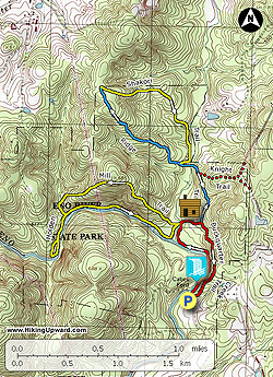
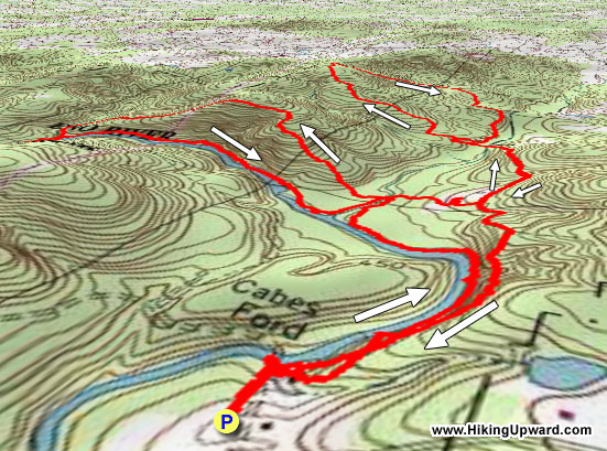
Topo Hike Trails Map |
 |
All Hikes Map |
 |
Click for location shots |
 |
Click for location shots |
 |
Click for location shots |
 |
Click for Parking/Start location |
 |
Hike trail blazed colors |
 |
Other trail |
|
 By Trail Contributor: Zach Robbins (Contact Zach) By Trail Contributor: Zach Robbins (Contact Zach)
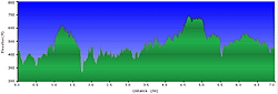
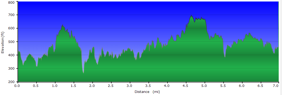
Eno River State Park is the best destination in the Triangle for hiking. With 28 miles of trails in 3 sections of the state park along the Eno River, this is a convenient retreat away from the cities in the region. The west section of the state park is the best spot, with multiple options for loop trails to have a nice 3-mile stroll or a strenuous half-day outing.
This hike starts at Few’s Ford and includes 3 loops on the east side of the river to make a 3-leaf clover hike. Along the way you’ll pass by two 19th century homesteads, mill remnants, and many rocky spots along the river to enjoy the rapids. The Ridge-Shakori loop offers little in the way of scenery, skip this loop unless you want a longer hike. The Buckquarter Creek-Holden Mill loop is the best 2 hour hike in the area so take time to enjoy this wonderful river.
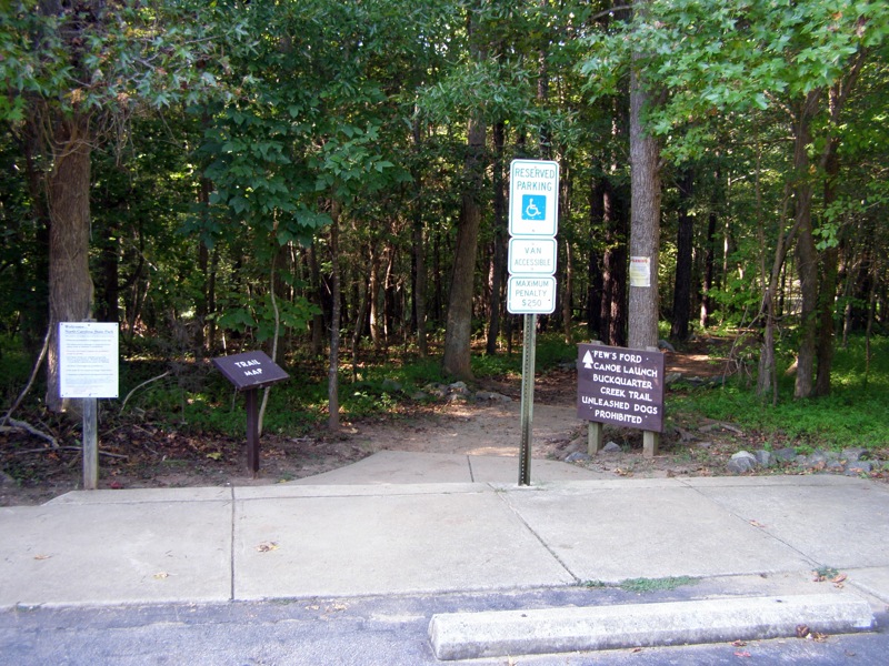
At exit 170 on I-85 go right on US-70 west and take an immediate right at the stoplight for Pleasant Green Rd. After 2.2 miles look for a left turn on Cole Mill Road which enters Eno River State Park. In 0.8-mi just past the visitor’s center there will be a large parking lot for Few’s Ford and Piper-Cox House on the right. The trail starts on the right site near the parking lot entrance.
- Mile 0.0 – Start the hike at the parking area for Few’s Ford access and the Piper-Cox House. A short trail leads down to Eno River from the right side of the lot.
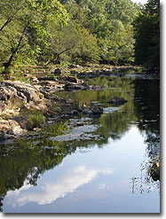
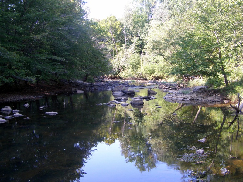
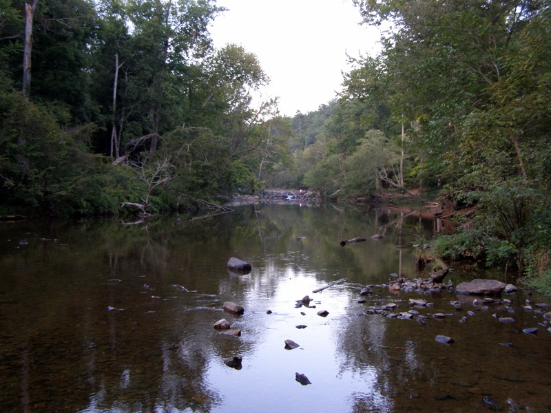
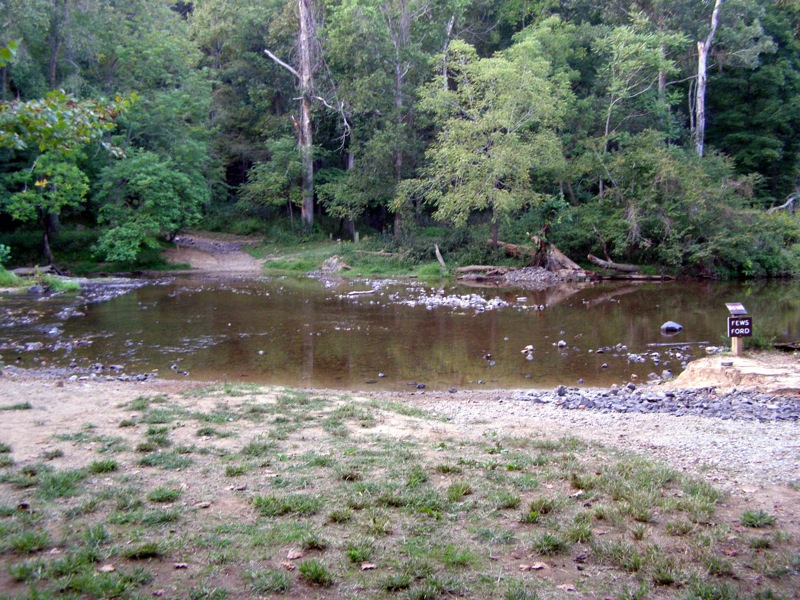
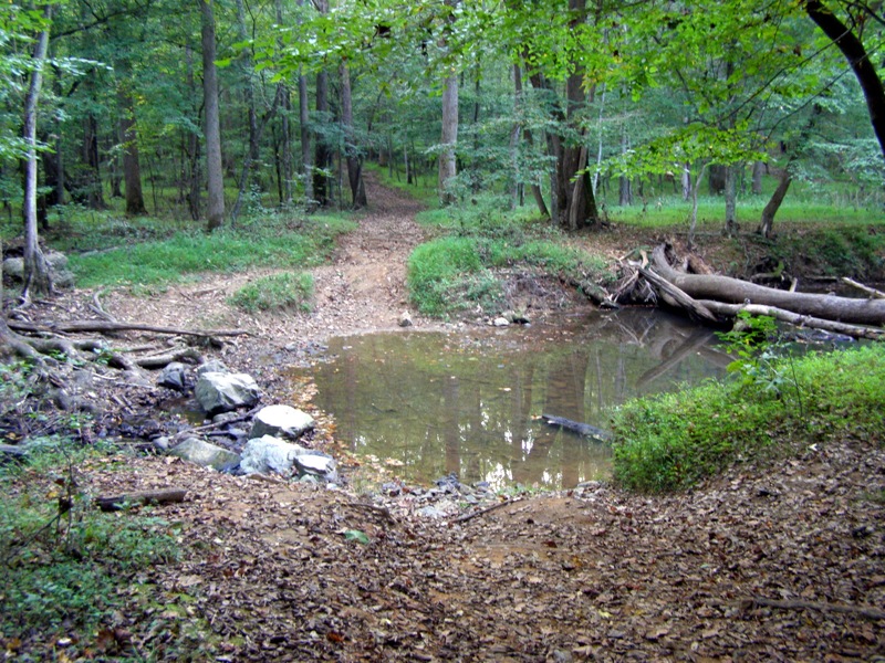
- Mile 0.05 – Reach Few’s Ford, a wide shallow area of Eno River. The Buckquarter Creek Trail (red blaze) starts on the right. At an unsigned but obvious split, stay left along the river.
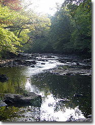
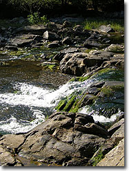
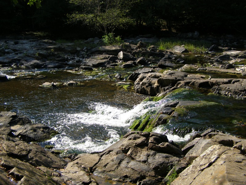
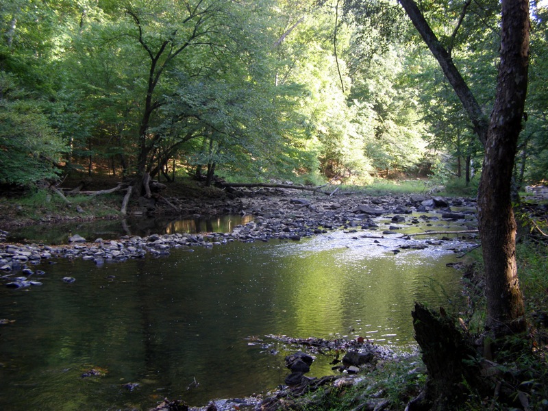
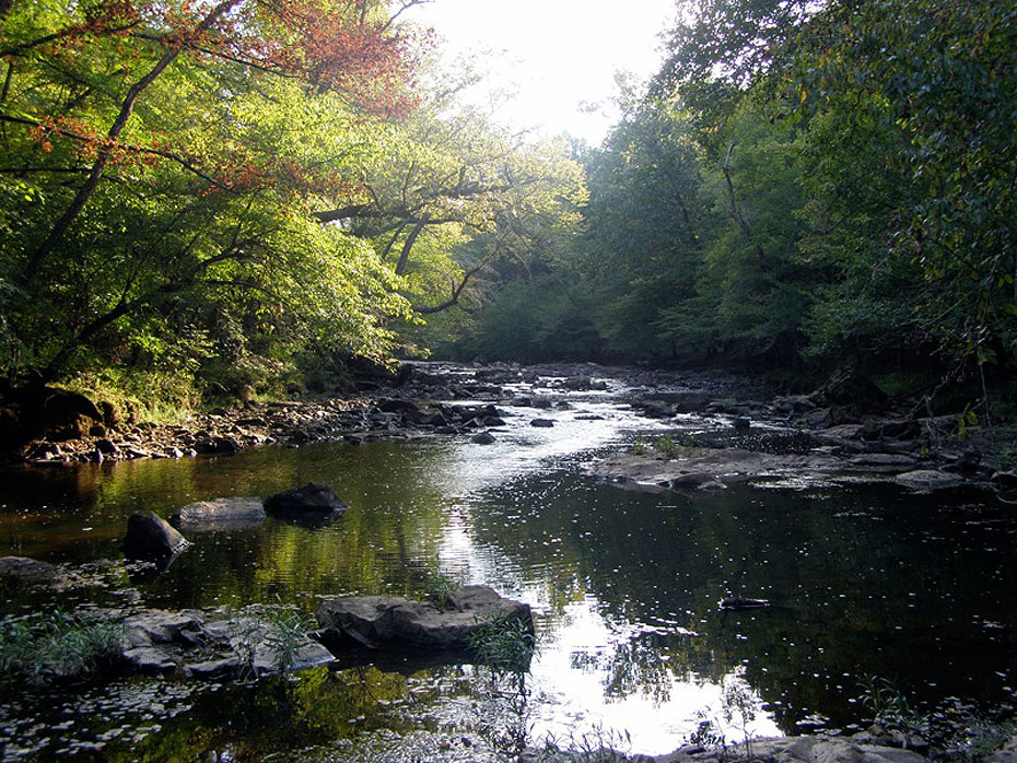
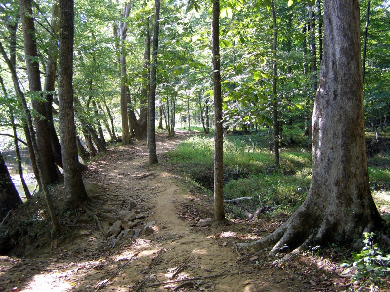
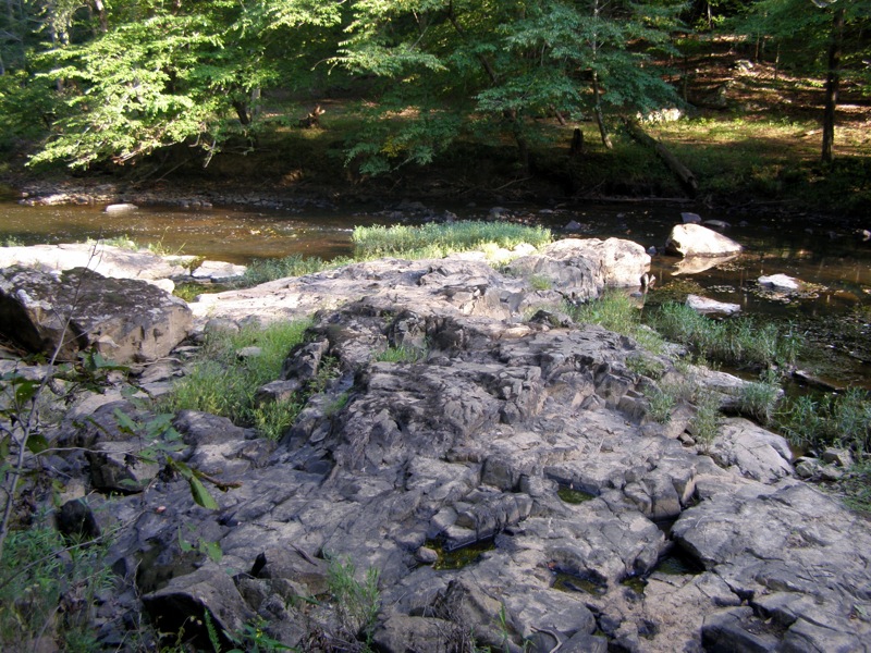
- Mile 0.1 – Pass by numerous cascades and huge boulders along the river for the next 0.2-mi.
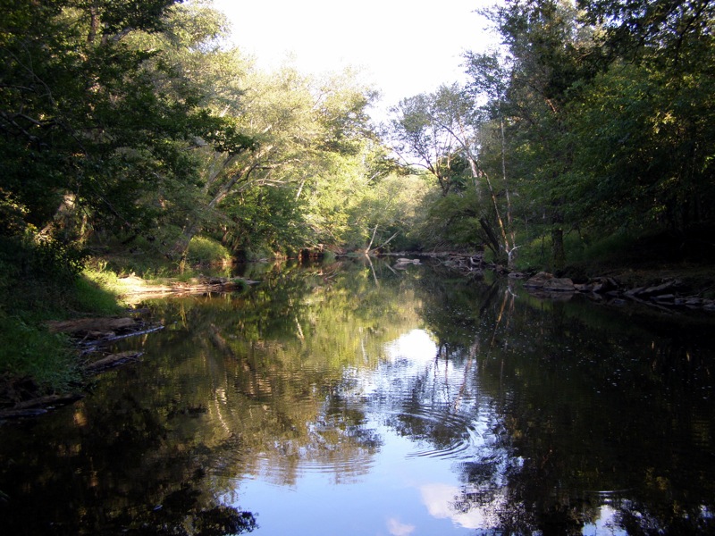
- Mile 0.4 – The river becomes calmer and less rock as the trail levels out in a flat stretch of forest.
- Mile 0.6 – The trail turns right away from the river, an unmarked trail continues straight.
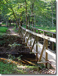
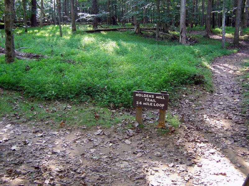
- Mile 0.8 – Intersection with Holden Mill Trail (yellow blaze) at a bridge crossing. The Buckquarter Creek Trail turns right and heads back towards Few’s Ford. Cross the bridge over Buckquarter Creek and begin the Holden Mill Trail loop going right uphill.
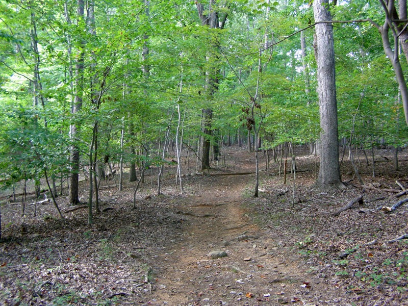
- Mile 0.9 – There is a steady uphill climb through mature forest for the next 0.4-mi.
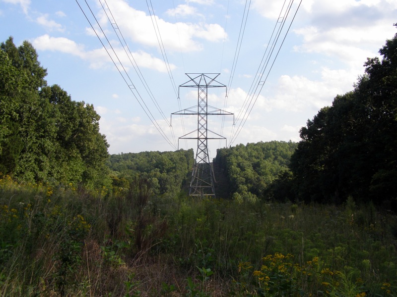
- Mile 1.4 – The trail passes through a large power line clearing with a view towards Cox Mountain then descends towards a small stream.
- Mile 1.8 – Intersection with an out-and-back lollipop spur trail to Holden Mill. Go right towards the mill. There is no sign but the spur trail is obvious.
- Mile 1.9 – The trail splits into a small loop, go right.
- Mile 2.1 – The trail turns left at the park boundary at a large bend in the river.
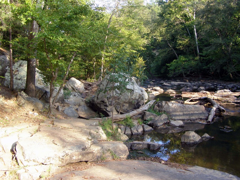
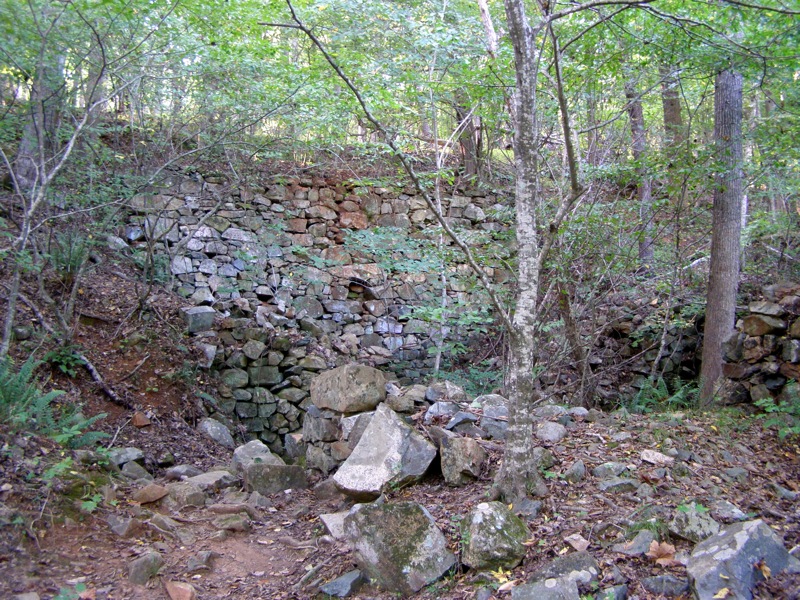
- Mile 2.2 – Stone remnants of Holden Mill can be seen built into the hillside beside the trail.
- Mile 2.4 – Return to the spur trail intersection and complete the Holden Mill loop by going right along the river.
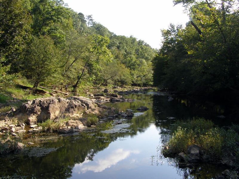
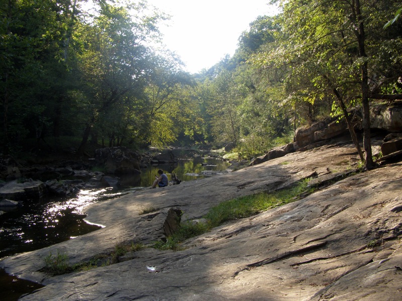
- Mile 2.5 – For the next 0.6-mi the Eno River is very rocky and the trail sometimes climbs over rocks jutting into the river.
- Mile 3.2 – The trail turns left as it approaches Buckquarter Creek.
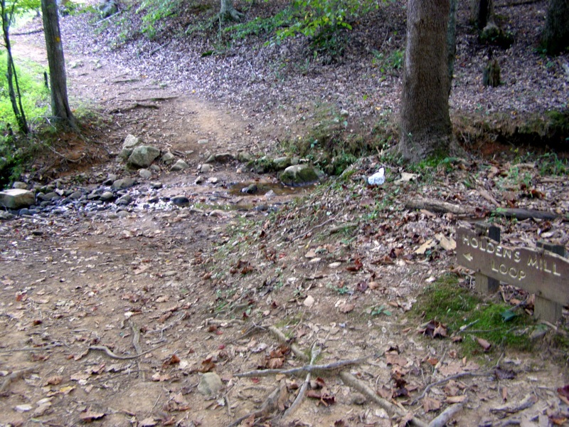
- Mile 3.3 – Cross the bridge over Buckquarter Creek and go left on the loop trail (red blaze).
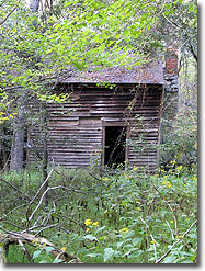
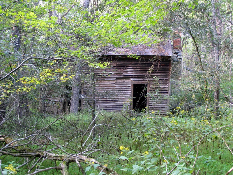
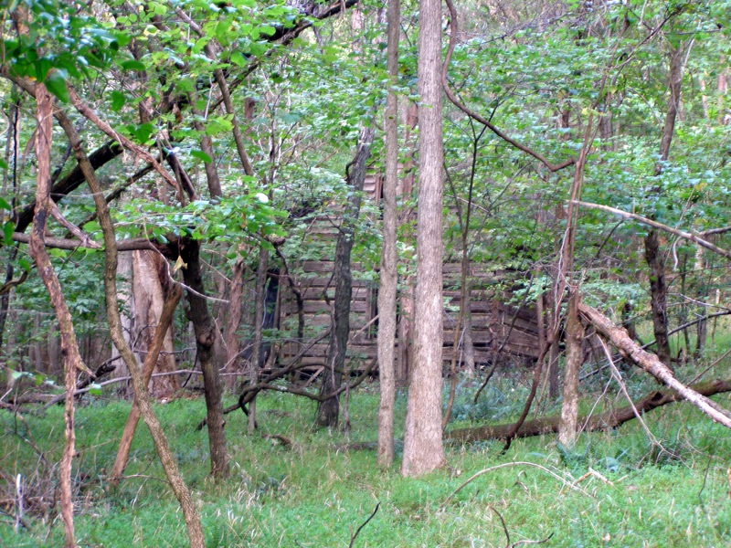
- Mile 3.4 – There is a 19th century homestead through the trees in a clearing on the left. There is no official trail but it is easily seen 100 yards from the trail. Beware: since the park doesn’t maintain this clearing in warm months this area is littered with insects and spiders and probably snakes.
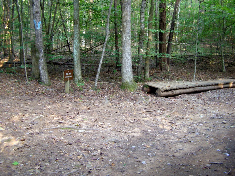
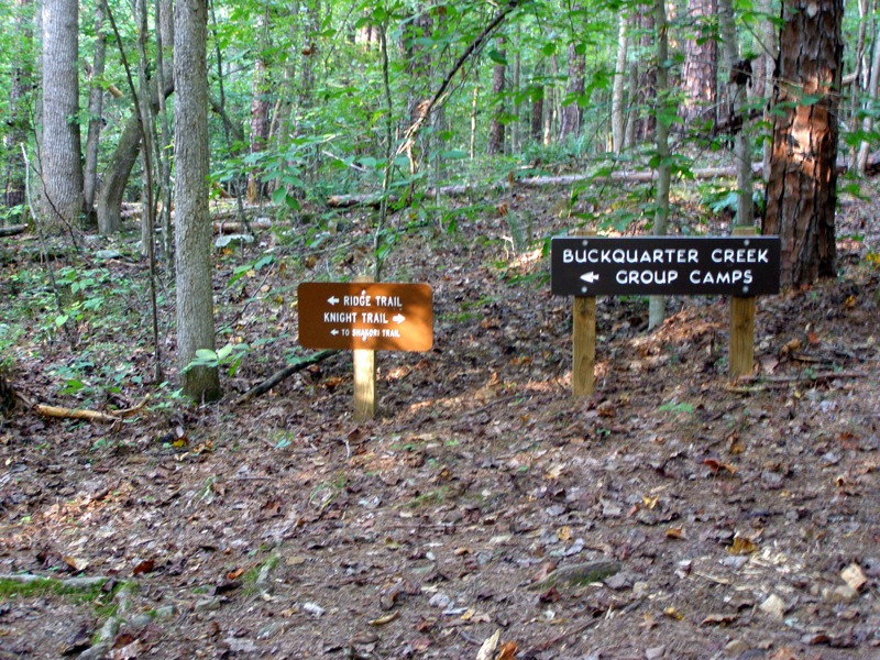
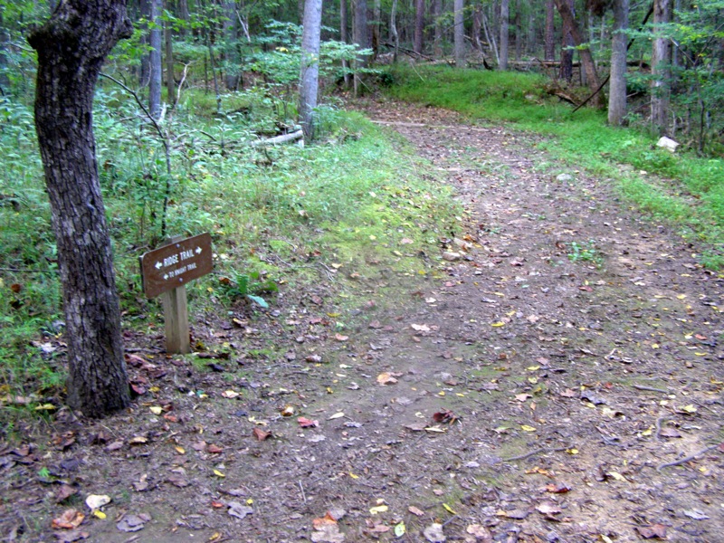
- Mile 3.5 – Intersection with Ridge Trail (blue U blaze) just after the old cabin. Go left on the Ridge Trail (blue U blaze).
- Mile 3.7 – There is a second, smaller cabin on the right of the trail in another dense clearing.
- Mile 3.9 – Intersection with the Knight Trail, primarily used for residential access. Stay left on Ridge Trail. In a few hundred feet there is a rock crossing over Buckquarter Creek.
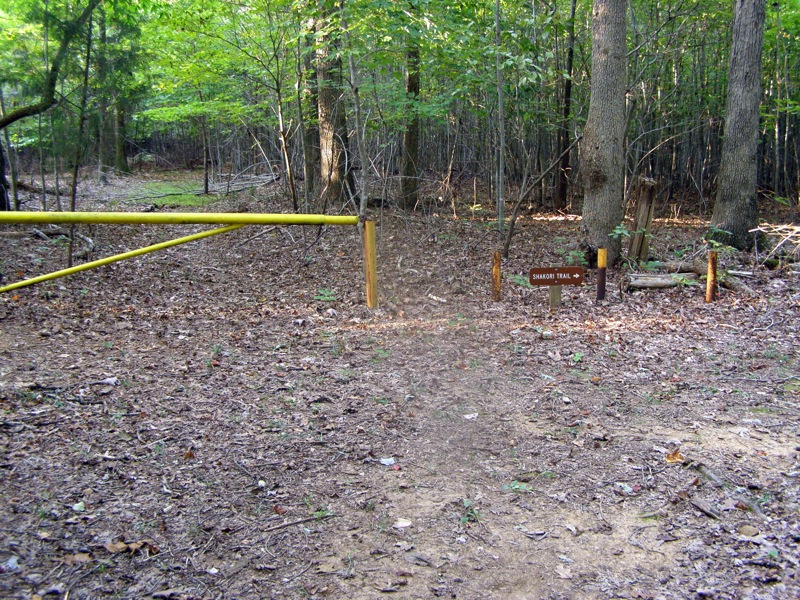
- Mile 4.0 – Intersection with the Shakori Trail (yellow U blaze) which is the return route.
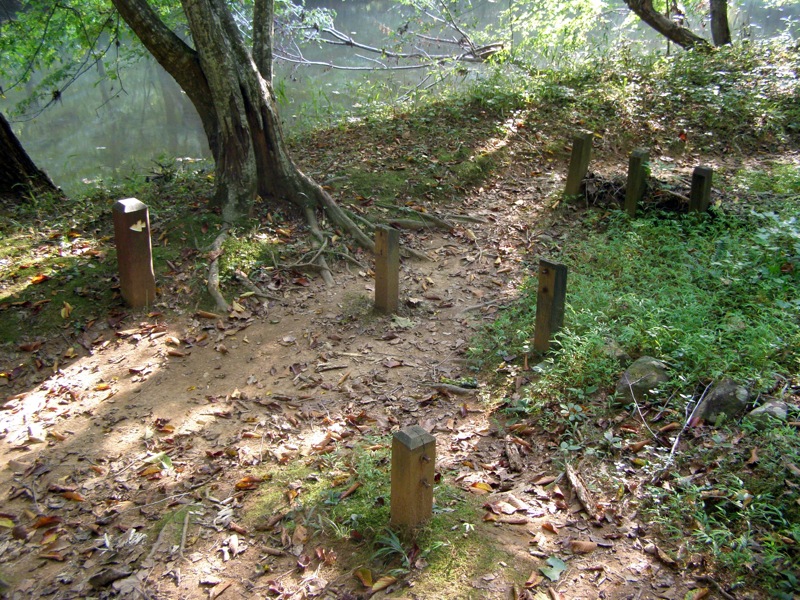
- Mile 4.1 – Pass by the backcountry campsite on the left which has a pit toilet, picnic tables, and tent platforms.
- Mile 4.8 – Ridge Trail ends at park boundary and Shakori Trail (yellow U blaze) goes right.
- Mile 5.8 – Shakori Trail ends at Ridge Trail (blue U blaze), go left to return to Buckquarter Creek Trail.
- Mile 6.3 – Reach Buckquarter Creek Trail (red blaze) and go left towards Few’s Ford.
- Mile 6.5 – The trail straddles a ridge 60-100 feet above the Eno River for the next 0.3-mi. You will have nice views of the river only in cold seasons when the leaves are gone. The views are somewhat akin to a river in the mountains.
- Mile 6.9 – Loop trail ends at Few’s Ford.
- Mile 7.0 – Hike ends at the parking lot.
|


