|
| Length |
Difficulty |
Streams |
Views |
Solitude |
Camping |
| 2.7 mls |
 |
 |
N/A |
 |
N/A |
Hiking
Time:
Elev. Gain:
Links:
Resources: |
1 hour 45 minutes, including 20 minutes for breaks.
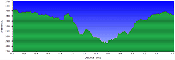
735 ft
 Annie Cannon Gardens Annie Cannon Gardens
Topo Hike Trails Map (PDF)
Blowing Rock Weather Forecast
Current Weather Radar
Garmin (GDB), Gaia/Trails App (GPX) (What's
this?) |
 By Trail Contributor: Zach Robbins (Contact Zach) By Trail Contributor: Zach Robbins (Contact Zach)
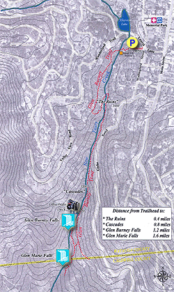
Situated only a few block away from downtown Blowing Rock, the Glen Burney Trail in Annie Cannon Park travels deep into the New Years Creek Gorge to visit 3 waterfalls. From downtown Blowing Rock turn on Laurel Lane and in 0.1-mi look for a parking area on the left for the Glen Burney Trail. A small lake in Annie Cannon Park on the right side of Laurel Lane feeds New Years Creek.
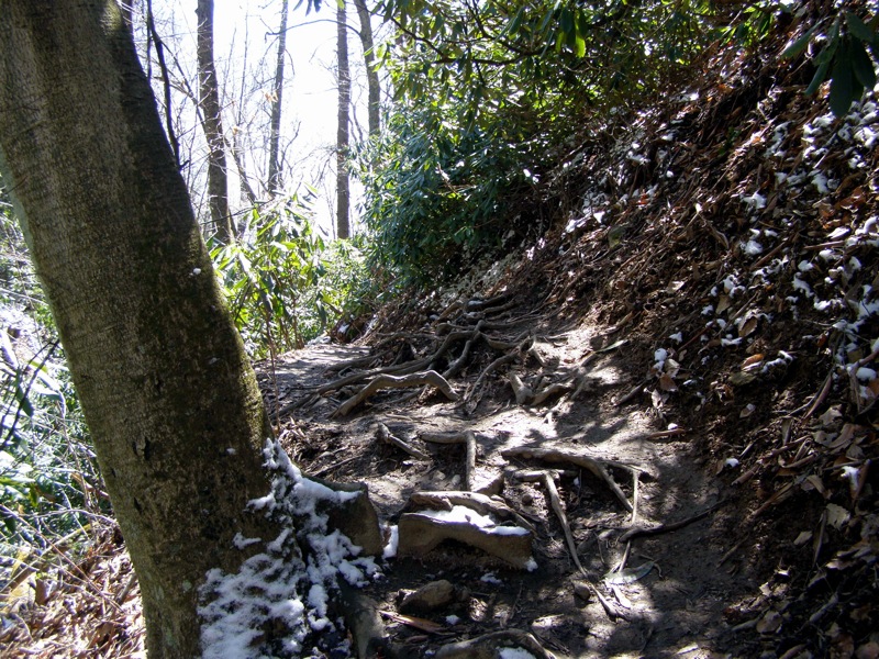
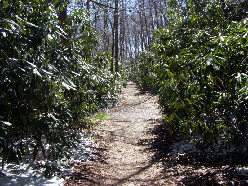
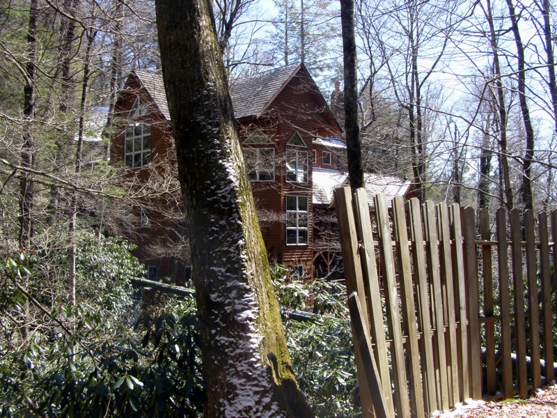
At first the trail follows a wide gravel road as you pass by resort houses situated on the precipice of the gorge. After signs of civilization end, the trail drops steeply and allows intimate access to The Cascades, Glen Burney Falls, and Glen Marie Falls on a short but demanding 2.7 mile hike. Depending on your preference, the highlight may be the placid, sloped Glen Burney Falls or the tall, dramatic Glen Marie Falls.
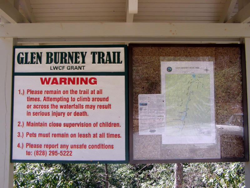
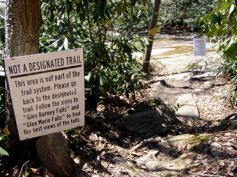
Caution – The trail passes by the top of all 3 waterfalls allowing easy access. Several people have been seriously injured or died falling from the top of these waterfalls, so take caution especially if the bedrock is wet.
- Mile 0.0 – Hike begins at the parking lot for the Glen Burney Trail (no blaze). The trail begins downhill to the left of New Years Creek on a wide gravel path. For the initial stretch you will pass by resort houses lining the gorge.
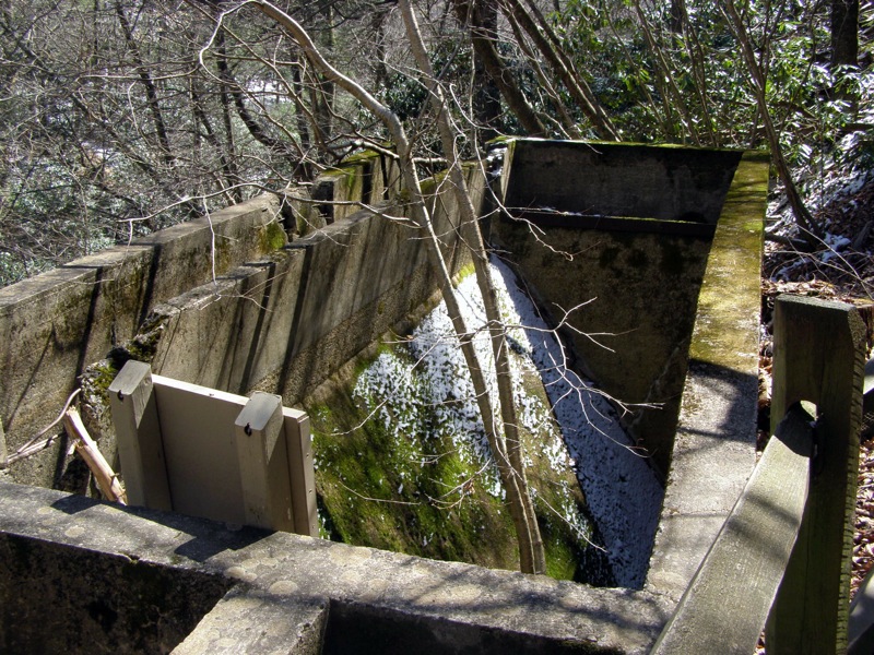
- Mile 0.4 – After a short descent the trail winds around a structure known as “The Ruins” – one of the first modern sewage treatment systems in the mountains from the 1920s.
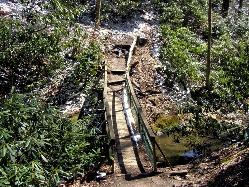
- Mile 0.5 – Cross a wood bridge over New Years Creek.
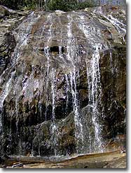
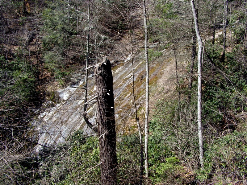
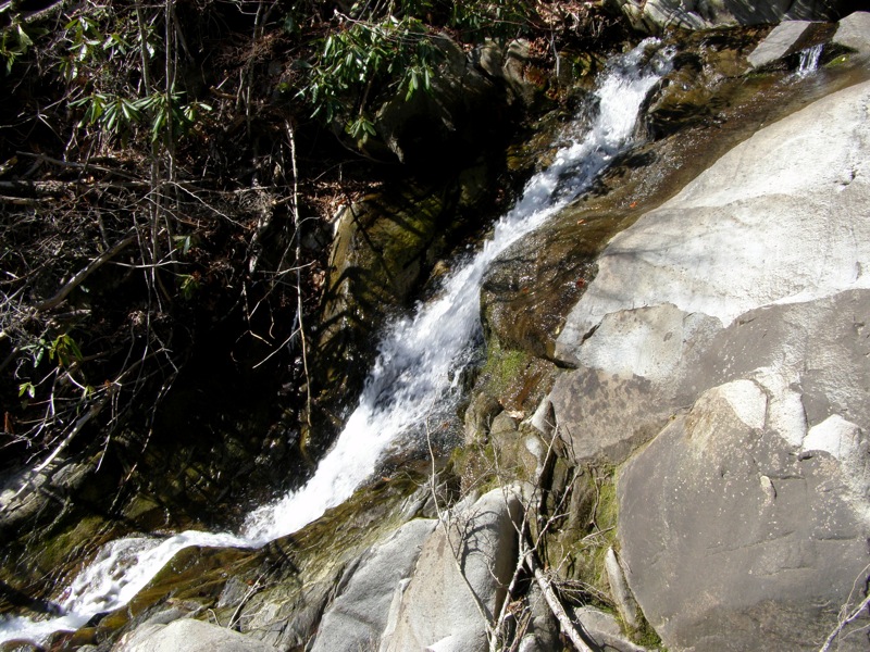
- Mile 0.7 – Pass by the first waterfall named The Cascades. The creek slides approximately 30 feet over a rock ledge, however the setting is marred by huge deadfall. There are no clear views of the waterfall through the fallen trees.
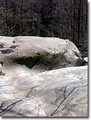
- Mile 0.9 – A side trail on the right leads to a picnic table and an area at the top of Glen Burney Falls marked with warning signs. This overlook is closed and people have died here looking for a view.
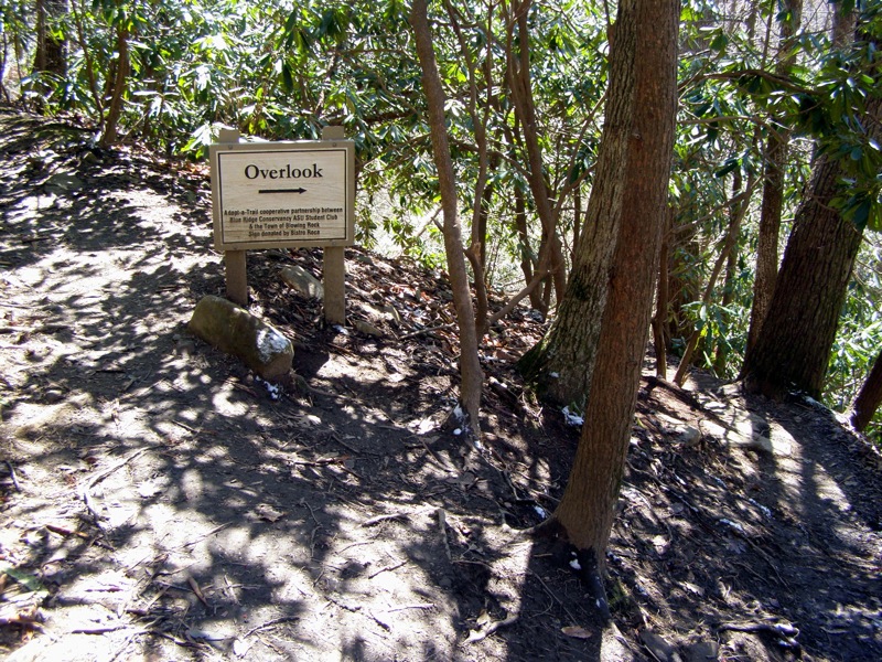
- Mile 1.0 – A sign points to an overlook on the right. A rock outcrop offers views of Glen Burney Falls through the trees.
- Mile 1.1 – An unmarked access trail from Johns River Road comes in from the left <0594>. Stay right heading downhill towards the waterfall. In 150 feet you will reach the side trail to Glen Burney Falls. Go right to see the waterfall.
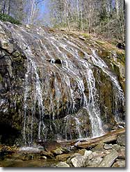
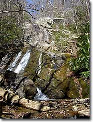
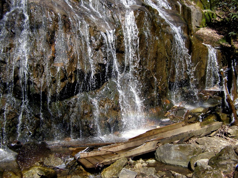
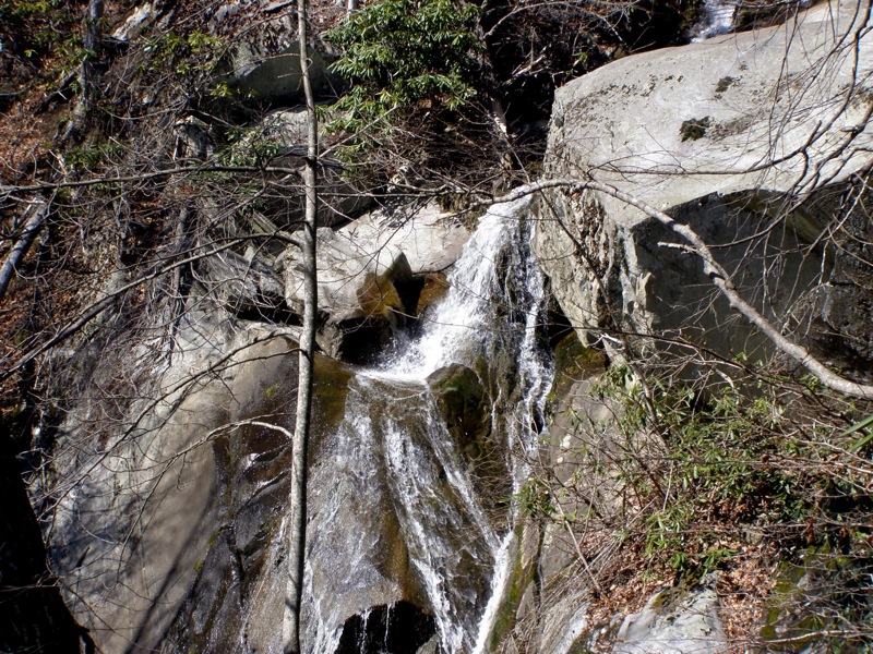
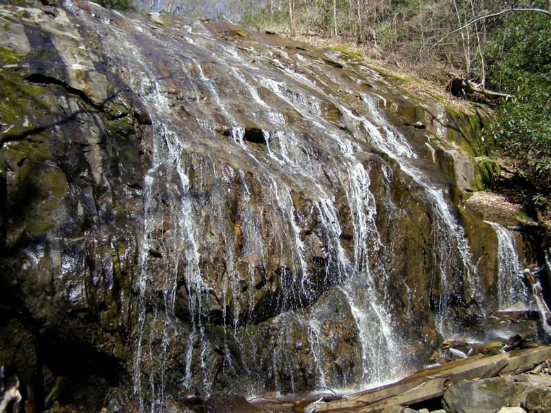
- Mile 1.2 – Reach the base of Glen Burney Falls, a ~50 foot slide waterfall. New Years Creek flows over a wide rock face that splits the flow into many small rivulets. The water then free falls the last 8 feet. You cannot see the top of the waterfall from this angle but you can easily explore the base.
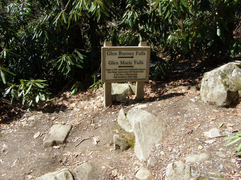
- Mile 1.3 – At the trail intersection continue straight towards Glen Marie Falls.
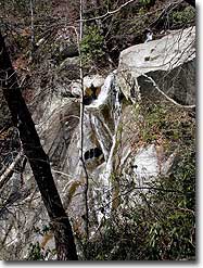
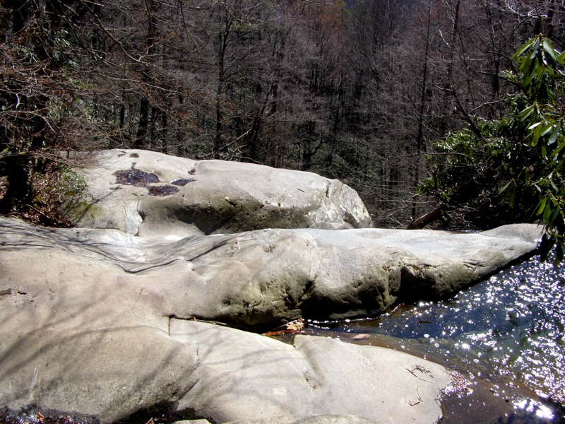
- Mile 1.4 – The trail passes by the top of Glen Marie Falls. The creek funnels into a narrow channel on the opposite side of the trail before plummeting over a cliff. Continue on the trail below the top of the cliff and you will get a good view of the second drop through the trees.
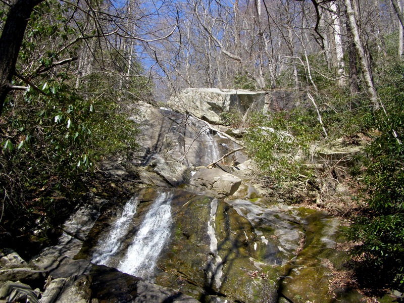
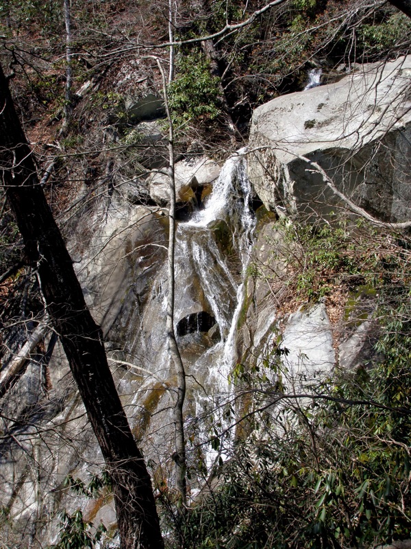
- Mile 1.5 – Reach the base of Glen Marie Falls. The setting is arguably more impressive than the waterfall itself. This is a 3-tiered cascade and although the waterfall is 75 feet high the upper sections aren’t visible from the base. The first section can be seen from the top but is shielded from below. The water then cuts diagonally across the cliff face which can be viewed from an outcrop on the trail. Only the lower section, a 20 foot slide over the cliff, is clearly visible from the base.
- Mile 2.7 – Hike ends at parking lot.
|


