A hike along the crest of Grandfather Mountain should be on everyone’s bucket list if they live in the Southeast. The crest trail is readily identified as one of the most rugged in the East and some may consider this the “Old Rag of North Carolina.” While not quite as rugged and technical as the nicknames suggest, Grandfather Mountain offers miles of exciting rock scrambles, ladders, cables, huge cliffs, exposed rocky summits, 16 distinct ecosystems, and views in every direction of tallest mountains in the Appalachian chain.
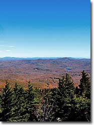
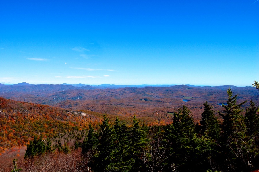
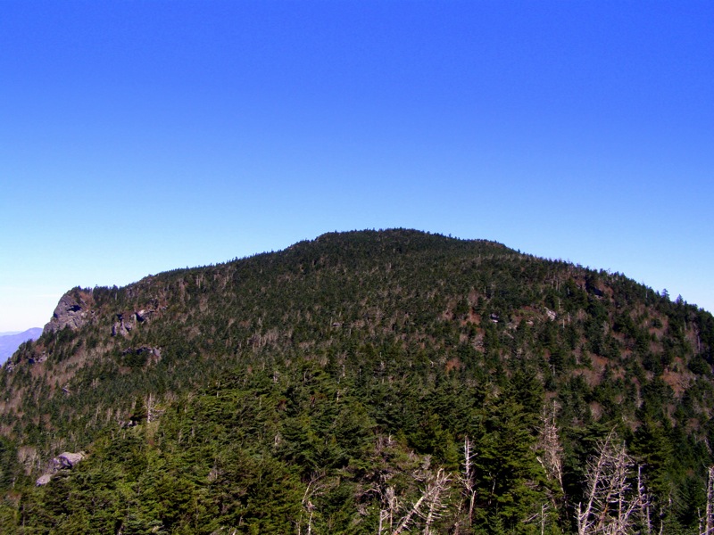
As an international biosphere some flock to the mountain for a huge variety of plant life which is vibrant in the Fall and Spring seasons. The real attractions are the 4 named summits on the mountain massif – Linville, MacRae, Attic Window, and Calloway peaks. Topping out at 5,946 feet this mountain dominates the surrounding valleys by nearly 2,000 feet.
There are 3 ways to access the crest trail. Two of them require difficult ascents from the valleys below and are part of the state park system. The third option is part of the private tourist attraction that existed prior to the state’s purchase of the land in 2008 to create a new state park. This attraction operates independently from the state park and costs $20/adult person to enter. The advantage is you can drive all the way to the ridge between Linville Peak and MacRae Peak. Click here for more information about the tourist attraction area of the mountain
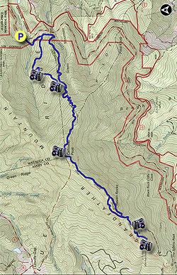
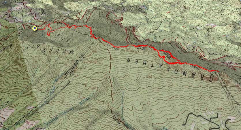
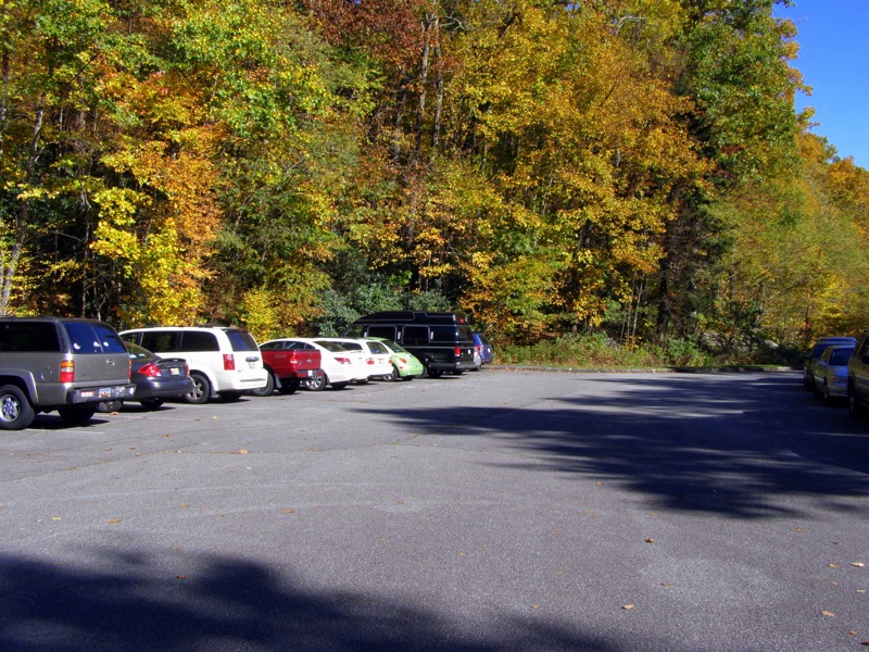
The disadvantage is the cost and you will be amidst the crowds flocking to the bridge. The best way to experience the mountain is to start at the bottom, and hike the full crest across all 4 peaks. This can be achieved starting with trails on the east or west side of the mountain. The full-day hike described here starts at the Boone Fork parking area (mile 299.9) on the Blue Ridge Parkway to access the Daniel Boone Scout Trail.
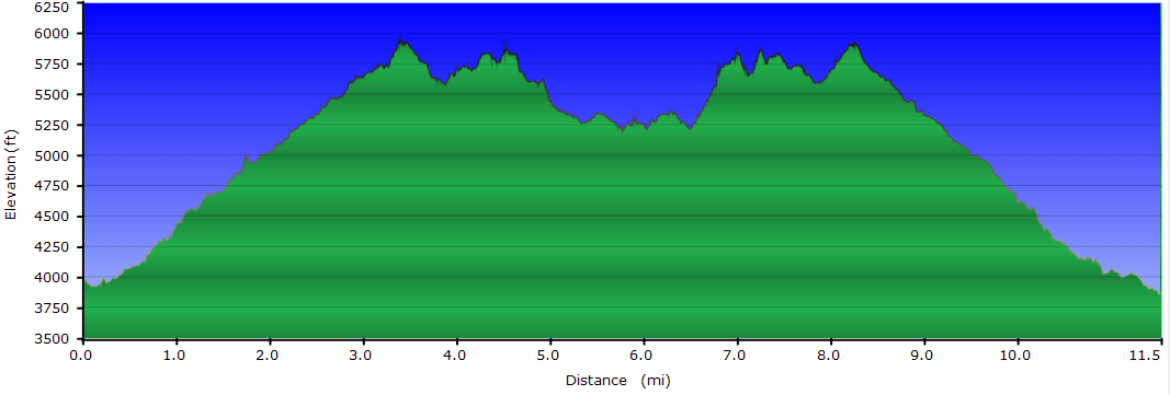
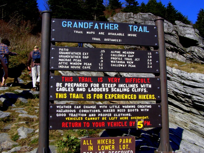
**The full length hike is for fit hikers only because of the mileage, elevation gain, and technical ascents/descents over rock faces. Allot 6-7 hours minimum. For less-experienced hikers any of the 3 peaks (Calloway, Attic Window, MacRae) make great turnaround points for a shorter hike.
Winter Parking – The Blue Ridge Parkway closes during the winter depending on weather and this section is usually closed. The Asutsi Trail (white blaze) is a short access trail (0.4-mi) that connects to the Boone Fork parking area from a parking lot across from Serenity Farm on U.S. 221.
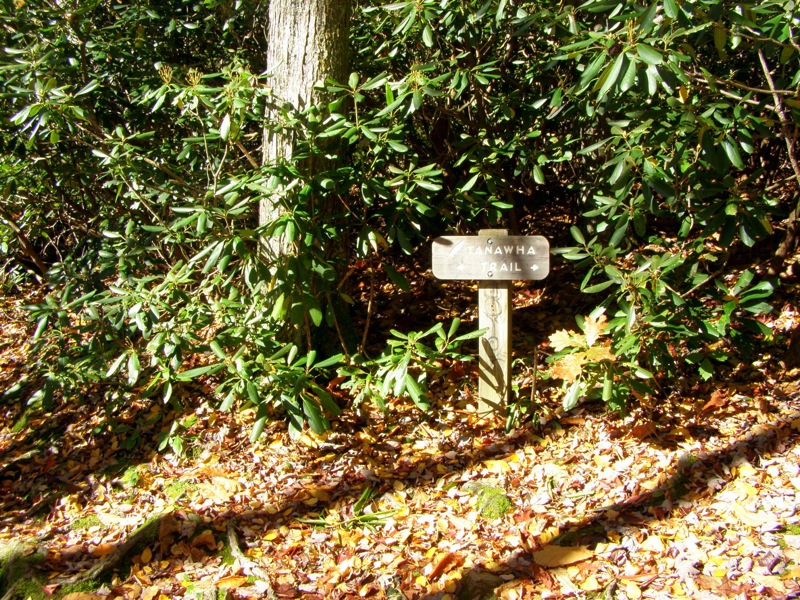
Mile 0.0 – Start the hike on a short connector trail from Boone Fork parking area to the Tanawha Trail.
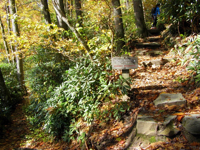
Mile 0.2 – Enter the Grandfather Mountain State Park boundary and fill out a free permit at the information board which contains trail info and maps.
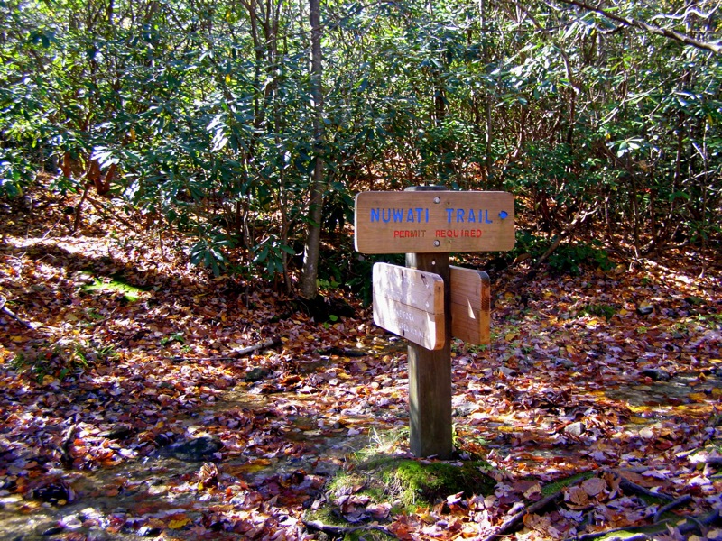
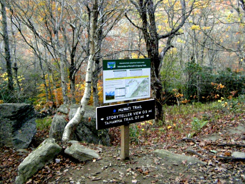
Mile 0.4 – Intersection with the Nuwati Trail(blue circle blaze) which is your return route. Stay straight on Tanawha Trail (white blaze).
Mile 0.6 – Take a right on Daniel Boone Scout Trail(white diamond blaze) leaving the Blue Ridge Parkway. The Daniel Boone Scout Trail switchbacks up the mountain for the next 1.1-mi through multiple types of forest. Grandfather Mountain is a designated international biosphere and contains 16 distinct ecological zones.
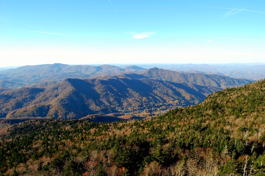
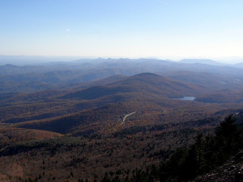
Mile 1.7 – Intersection with the Cragway Trail(orange circle blaze) at Flat Rock View. Flat Rock is on the right and provides a good view north of the Boone Fork Bowl. The Daniel Boone Scout Trail continues its moderately steep ascent up the mountain for the next 1.1-mi.
Mile 2.8 – The trail climbs diagonally up a large rock face and enters a thick conifer forest near the crest of the mountain. There are multiple side trails to campsites and views, skip these if you wish to finish the full hike in a day.
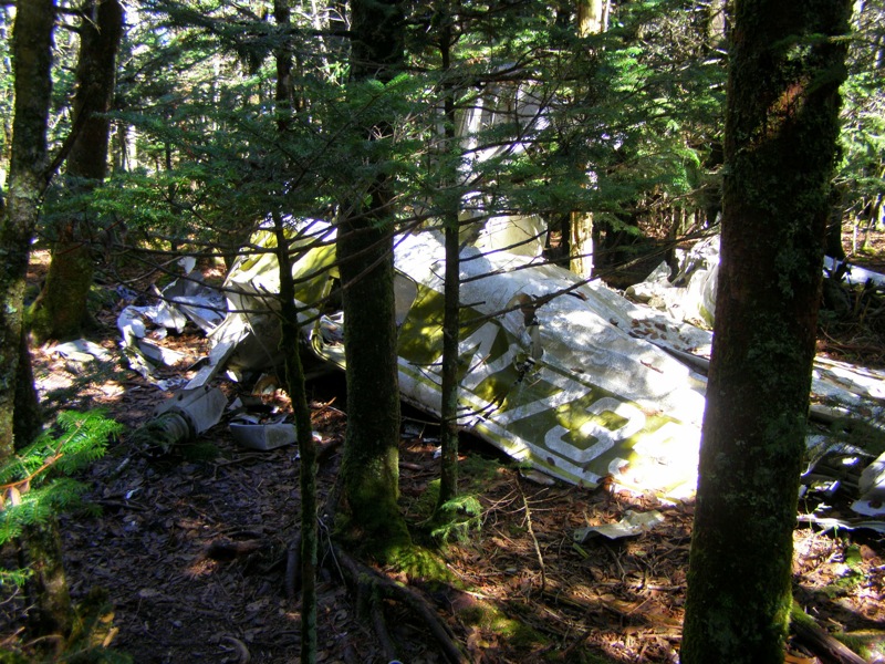
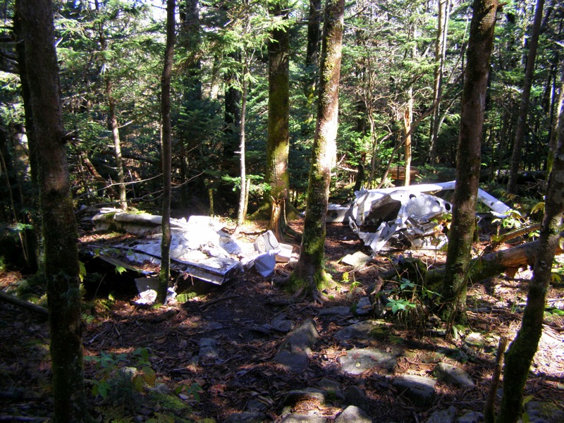
Mile 3.1 – On the north/right side of the trail there is a plane crash through the trees. A single engine plane crashed here in the 1980s.
Mile 3.2 – A second section of the plane crash on the north/right side of the trail where you can see the wing.
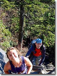
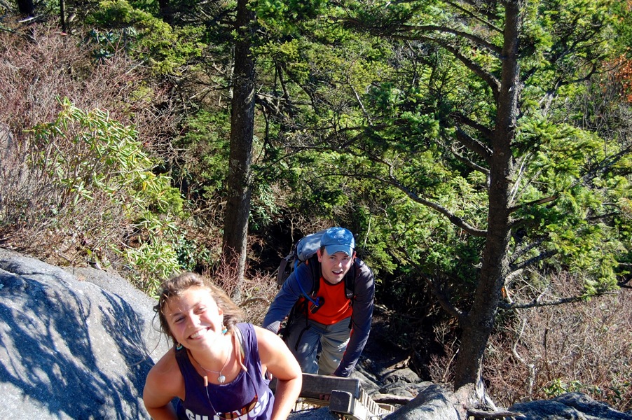
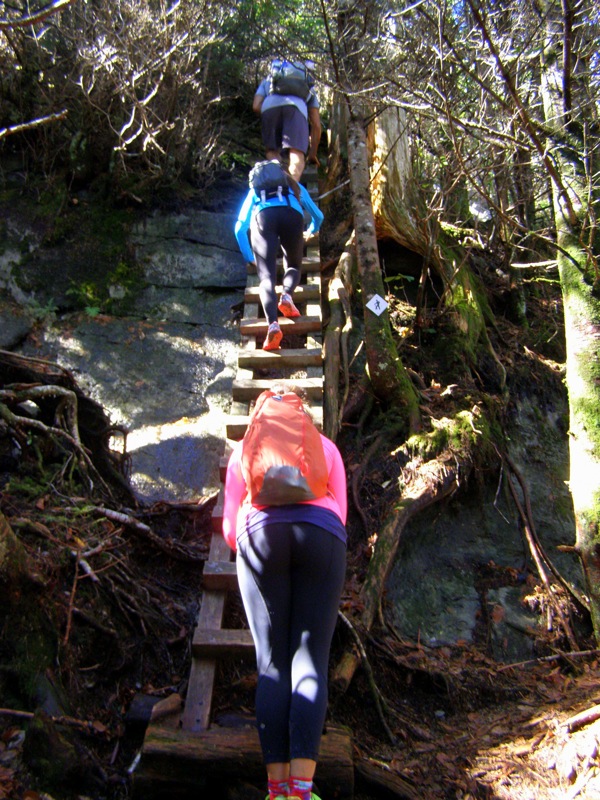
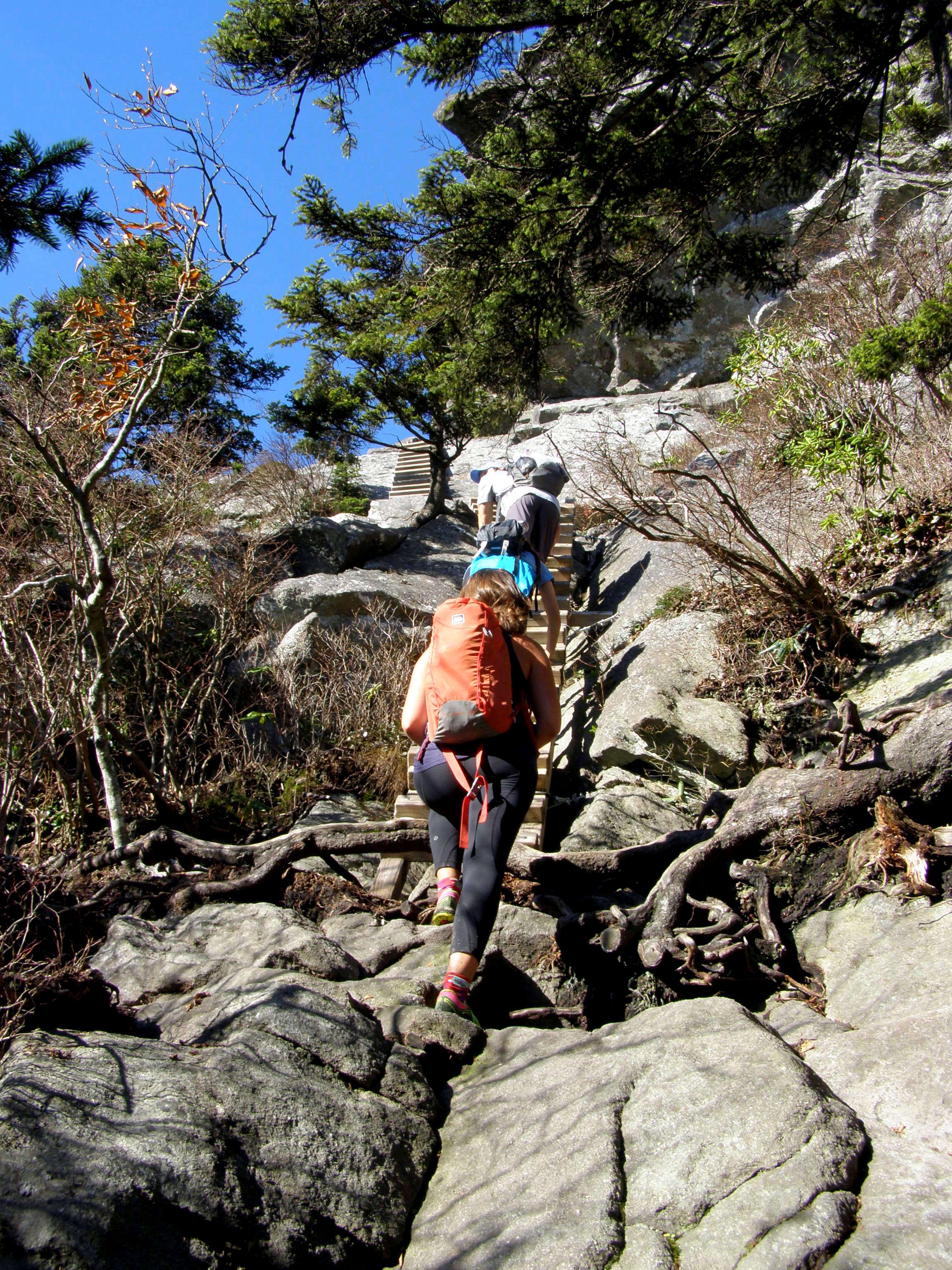
Mile 3.3 – Begin the first series of ladders and cables you will encounter during this hike. There is a tall ladder up a rock face followed by a steel cable section, then another ladder and steel cable section.
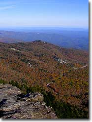
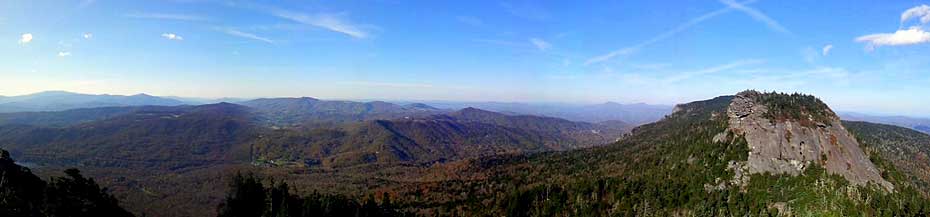
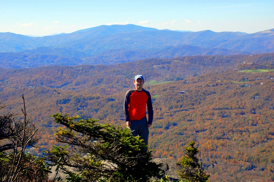
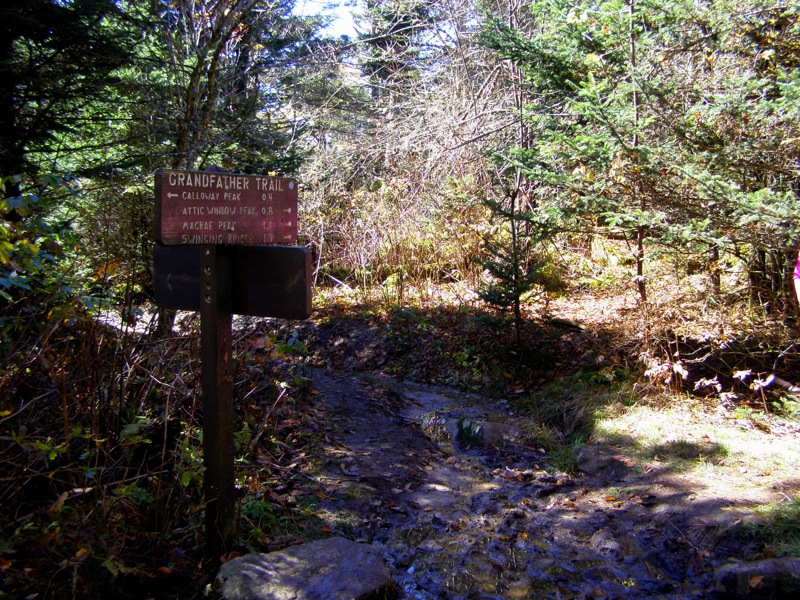
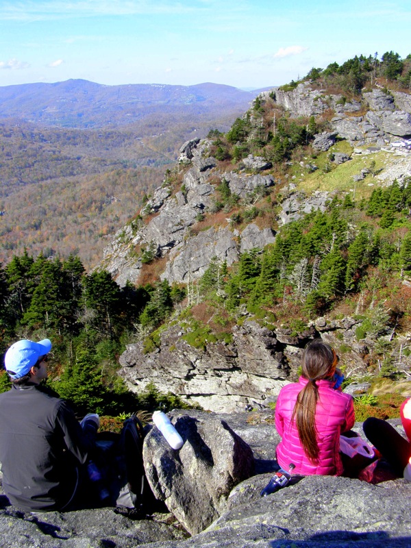
Mile 3.4 – Reach the summit of Calloway Peak (5,946 feet), the tallest peak on the Grandfather Mountain massif. The southern view includes the ridge to Attic Window Peak plus the Blue Ridge Parkway & Linville Gorge, and the Black Mountains. Beyond the summit the Daniel Boone Scout Trail officially ends and becomes the Grandfather Trail (blue diamond blaze) for the next 2.4-mi. There is a quick descent on 2 small ladders and a couple downclimbs on rock faces.
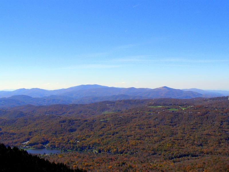
Mile 3.5 – A short spur trail on north/right side to Watauga View. This view encompasses the Watauga Valley and Amphibolite Range which cannot be seen from Calloway Peak. Begin a steep 300 feet descent in 0.3-mi to Calloway Gap.
Mile 3.8 – The Grandfather Trail intersects with Profile Trail (orange diamond blaze) at Calloway Gap. The Profile Trail is an alternative ascent trail on the west side of the mountain which has great views of the “Grandfather Profile” rock face. Continue south on the Grandfather Trail (blue diamond blaze).
Mile 4.0 – The next stretch of trail is a series of steep ascents and descents along the rocky spine of Grandfather Mountain. Begin a steep ascent up sheer rock faces with no cable or ladder assistance. The blazes are painted on rocks. Beware the cliffs on the west side of the trail especially in wet/icy conditions.
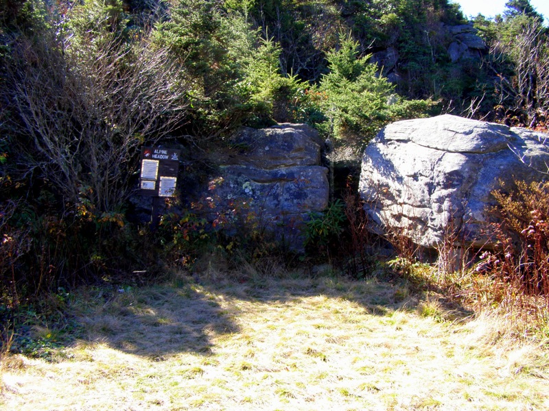
Mile 4.2 – Pass by Alpine Meadow, a small meadow and campsite situated in a shallow gap between a knob and Attic Window Peak.
Mile 4.4 – A spur trail on east side of the trail to Indian House Cave.
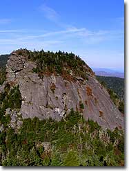
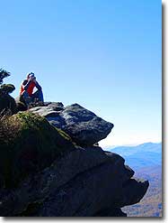
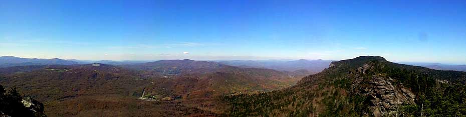
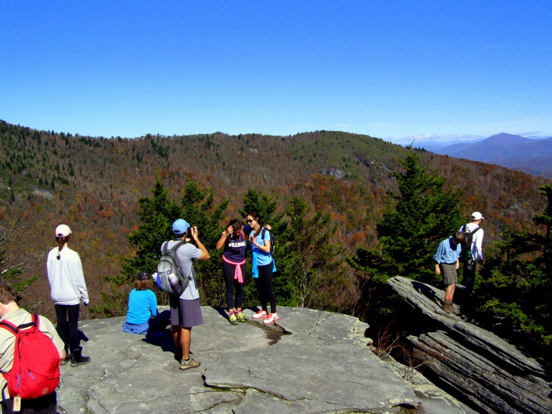
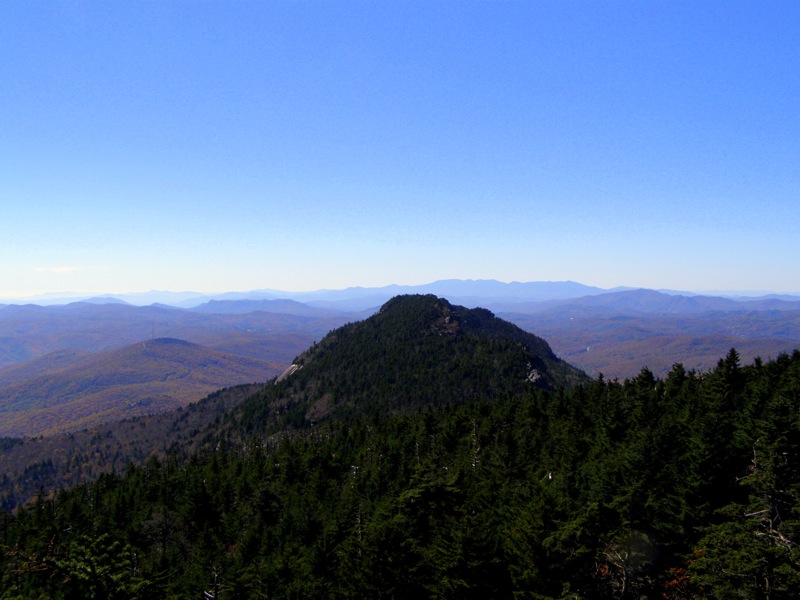
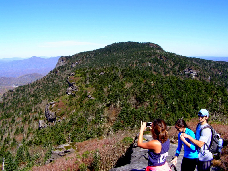
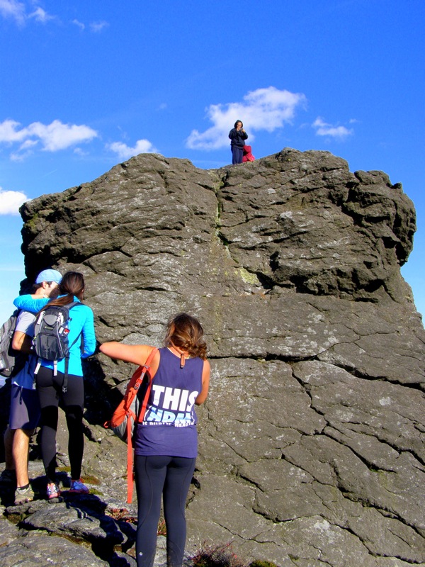
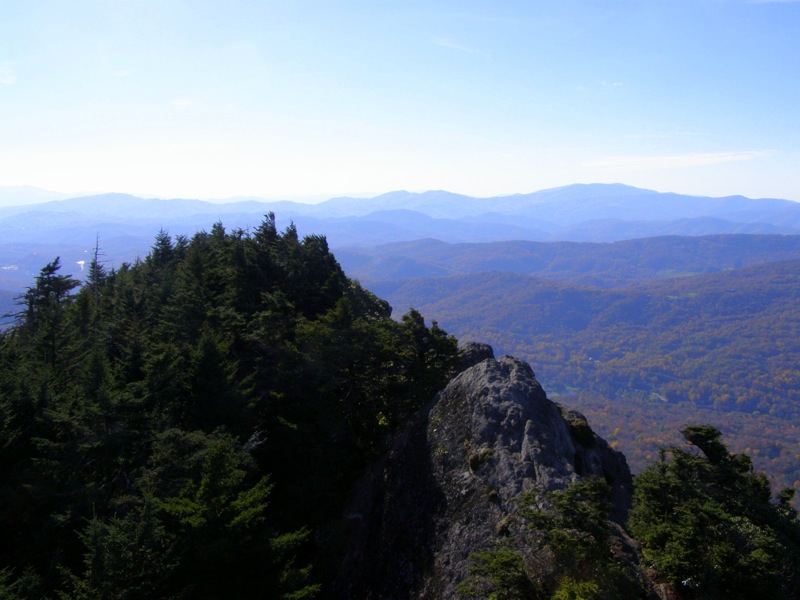
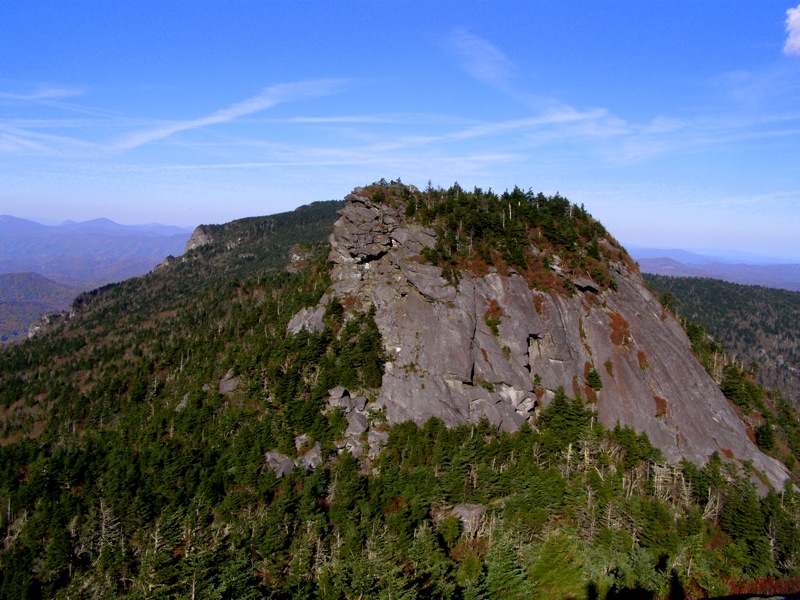
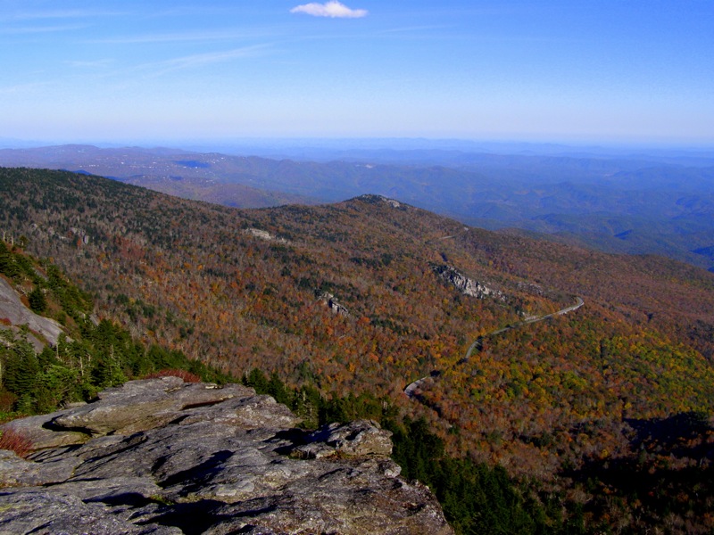
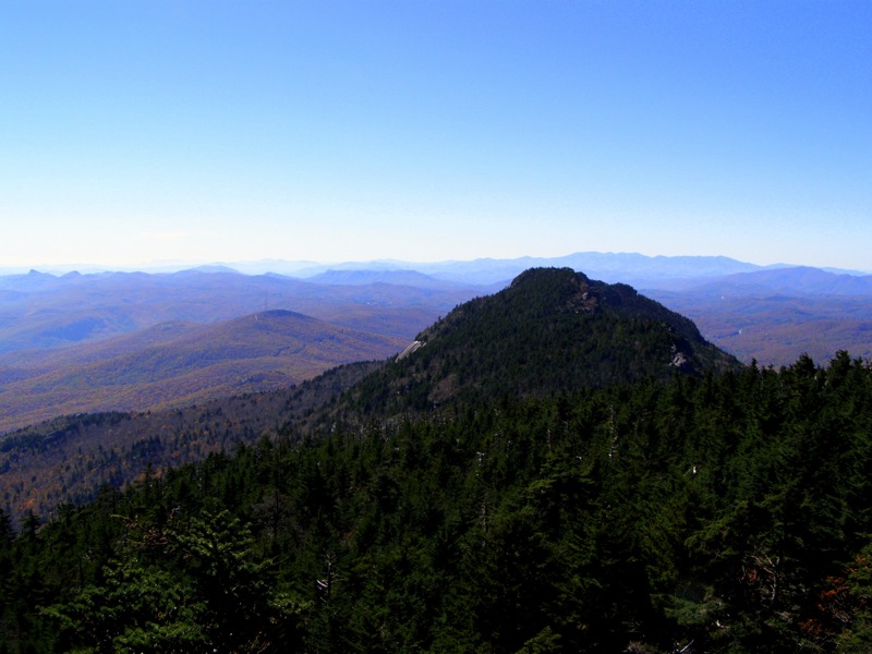
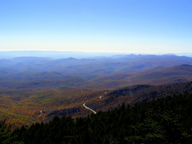
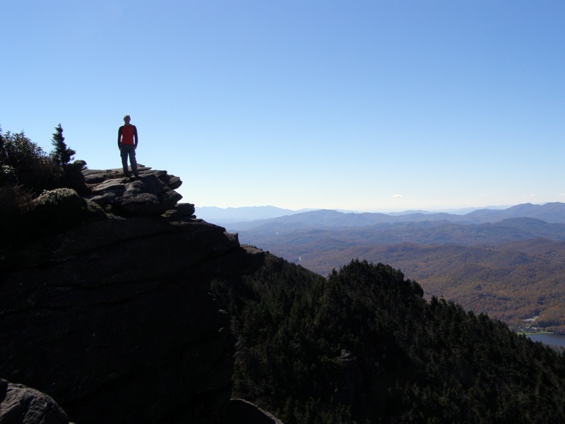
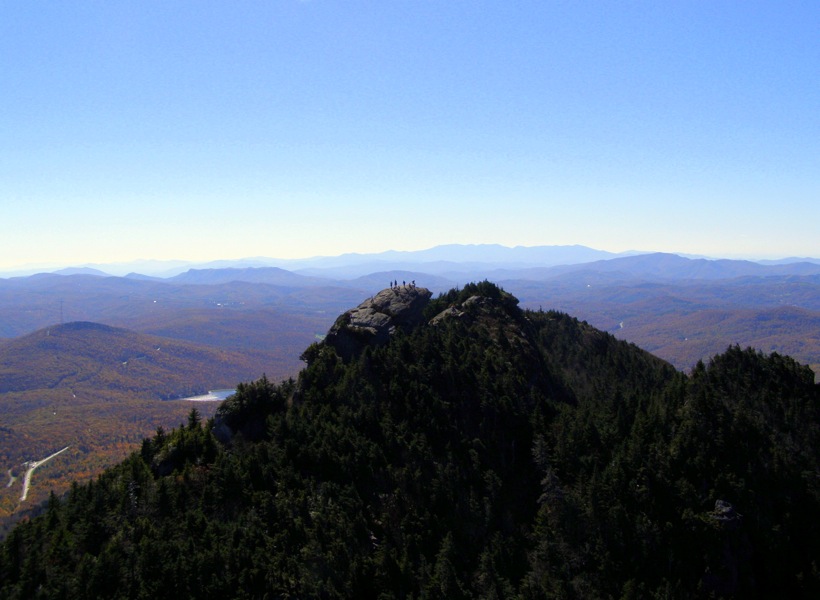
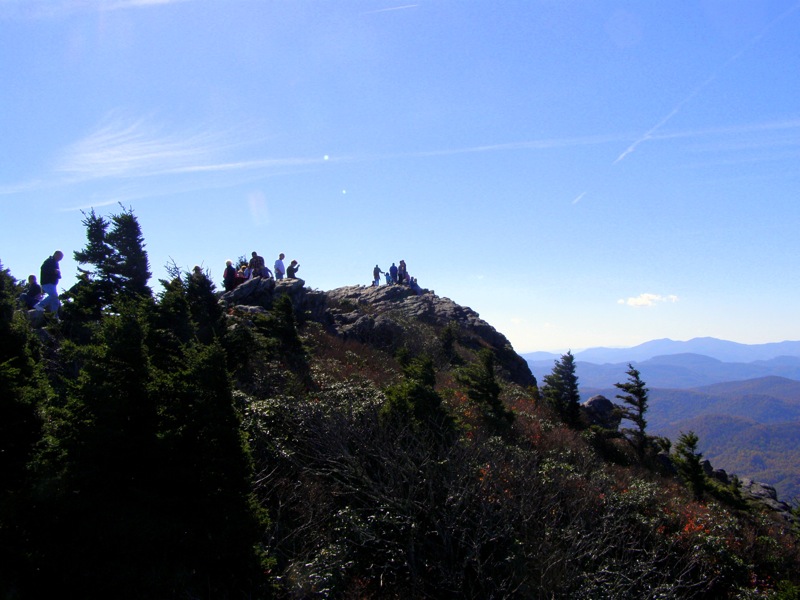
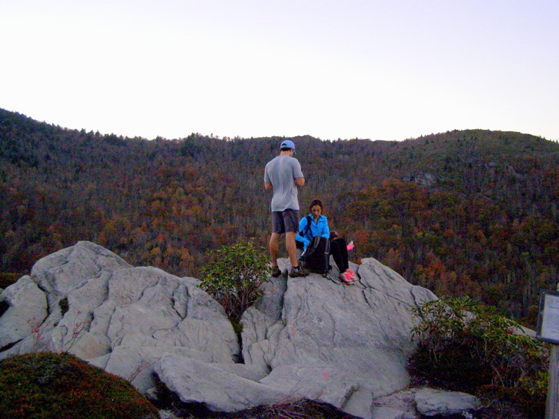
Mile 4.5 – Reach the summit of Attic Window Peak (5,880 feet). The views from this peak are 360° and provide birds eye views of the rocky ridgeline leading towards Calloway Peak and the massive dome of MacRae Peak. There are many cliffs and rock outcrops on this large peak to take a break and soak in the views. Notice the people climbing up MacRae Peak on ladders. You will also have outstanding views of Linville Gorge and the Black Mountains to the southeast, plus great views of Roan Highlands due west. The large open summit of Grassy Ridge Bald is prominent.
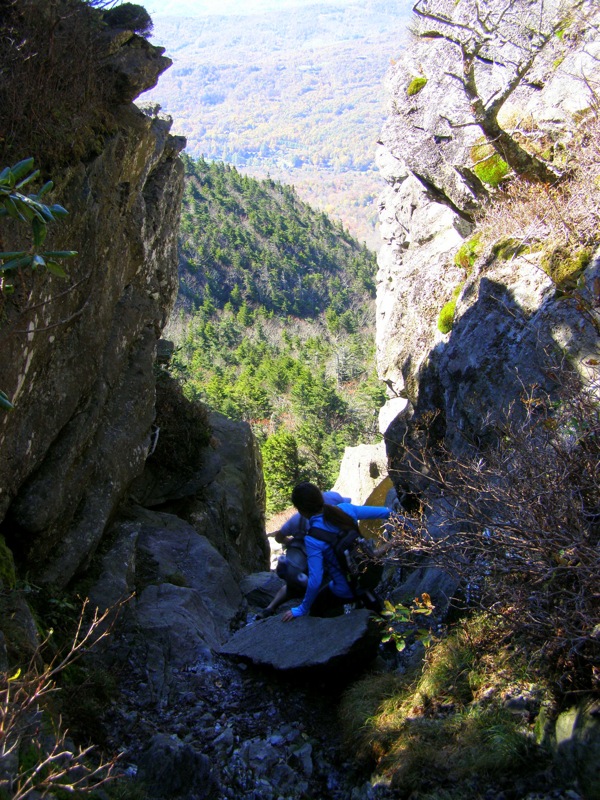
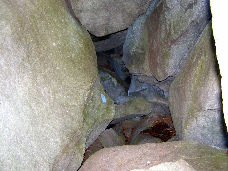
Beyond Attic Window Peak there is a spur trail to the left to a picnic area while the Grandfather Trail goes right and seemingly disappears. You will be looking at a giant cleft in the mountain which gives Attic Window Peak its name. The trail drops precipitously down this cleft via class 2/3 scrambling. Then the trail takes a sharp left turn and descends ladders under boulders through fallen rocks and caves. This descent is 200 ft in 0.1-mi and requires both hands and sure footing. If it is icy do not attempt this descent without proper equipment.
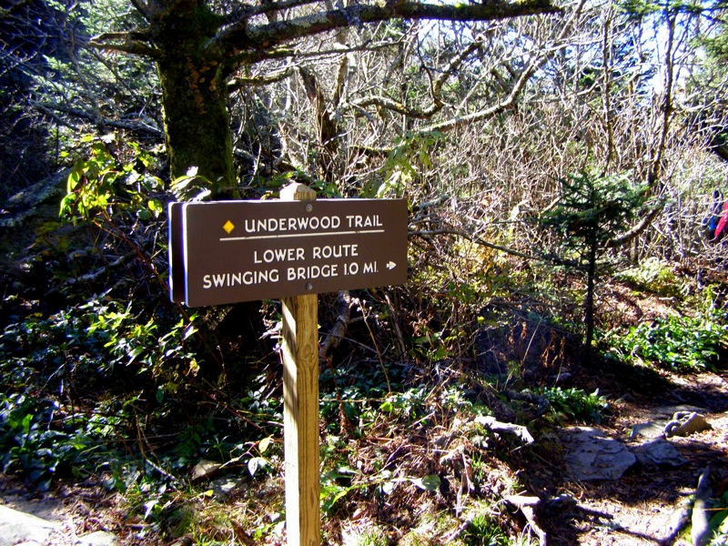
Mile 4.7 – At MacRae Gap the Grandfather Trail goes left climbing MacRae Peak. Go right on the Underwood Trail to skirt around the peak on the west shoulder. If you are ahead of schedule go left to climb MacRae Peak. Summiting MacPeak twice is a far more enjoyable option than hiking the Underwood Trail but requires ascents and descents up exposed ladders on cliffs.
Mile 4.9 – Begin a tough descent on the Underwood Trail over roots and small boulders around the west side of MacRae Peak under the Raven Rock Cliffs.
Mile 5.2 – The Underwood Trail meets the Grandfather Trail again at Grandfather Gap (forgot to take picture here). Continue south on the Grandfather Trail heading towards the tourist area.
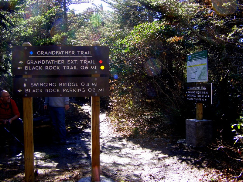
Mile 5.4 – Intersection with the Grandfather Trail Extension which leads to the Black Rock Trail and lower parking lot for hikers visiting the tourist attraction. Stay straight on the Grandfather Trail.
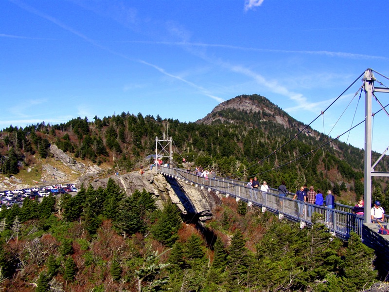
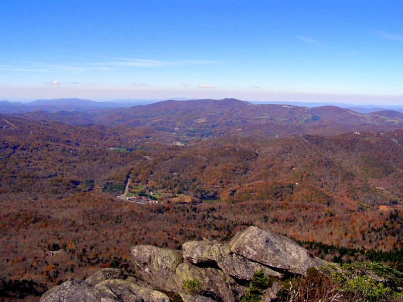
Mile 5.7 – Grandfather Trail ends at the upper parking lot of the tourist attraction. This area of the mountain is still independently operated as a private attraction and has the Top Shop below the Mile High Swinging Bridge. It costs $20 per adult to visit this section of the park by car. You will find nice bathrooms in the Top Shop as well as snacks, refreshments, and ice cream. Beside the shop is the staircase to the Mile High Swinging Bridge. This bridge is an extremely crowded attraction with lines to walk across. The bridge is at an exact elevation of 5,280 feet, or 1 mile. However the bridge is only 80 feet above the gap between the parking lot and Linville Peak.
Mile 5.9 – Across the Mile High Swinging Bridge is the 4th named peak on Grandfather Mountain – Linville Peak (5,295 feet). This is the shortest peak on the mountain but provides fantastic views south and west from the cliffs. The best view is looking north at the bridge and the massive dome of MacRae Peak rising above the parking lot. Turn around and head across the parking lot back to the Grandfather Trail (blue diamond blaze).
Mile 6.6 – At the Underwood Trail (yellow diamond blaze) and Grandfather Trail intersection, head right on Grandfather Trail (blue diamond blaze) to ascend MacRae Peak. Immediately you will encounter large boulders, and a couple ladders through a rock overhang. Summiting this peak requires a steep ascent up rock faces using ladders, cables, and sometimes just your hands. If you are afraid of heights and exposure it is suggested to avoid this part.
Mile 6.8 – Begin a series of 4 ladders and cables up sheer cliffs. This section can be quite unnerving to anyone afraid of heights. At the top of the last ladder is a spectacular view from a cliff of the swinging bridge.
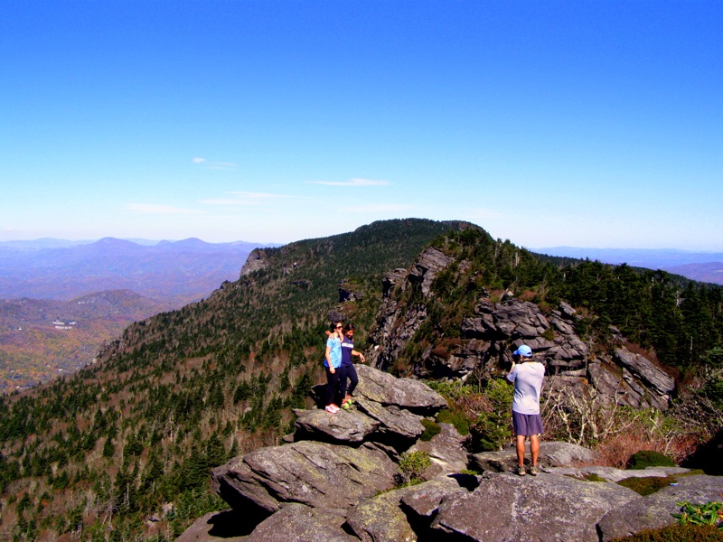
Mile 7.0 – Crossing an open rock face you will see the rounded summit of MacRae Peak jutting above where you stand. A tall ladder allows you to climb up close to the top. MacRae Peak (5,844 feet) is a small, rocky dome completely exposed to the elements. The best view is directly north, allowing an entirely new perspective of Attic Window Peak and its massive cliffs. You will also have outstanding views west and southeast, although the tourist area is blocked from view. You can see the Blue Ridge Parkway far below and almost spot out the area where you parked.
Mile 7.1 – A steep descent on the north side of MacRae Peak via a ladder and long rock face with cable guideline. This is the most difficult cable section of the hike. At MacRae Gap stay straight on the Grandfather Trail and begin the steep ascent up Attic Window Peak. The ascent is easier than the descent.
Mile 7.9 – Reach Calloway Gap. The next 0.4-mile is the last steep ascent of the hike.
Mile 8.3 – Cross the summit of Calloway Peak where the Grandfather Trail officially ends and turns into the Daniel Boone Scout Trail (white diamond blaze).
Mile 9.7 – At Flat Rock View go straight on Cragway Trail – an alternative scenic return to the parking area. The Cragway Trail (orange circle blaze) begins with a moderately steep 0.4-mi descent through a rhododendron tunnel.
Mile 10.1 – Reach Top Crag, a series of large rock outcroppings with fantastic views of the Boone Fork Bowl and a northwest view of Calloway Peak. The Cragway Trail continues descending north passing by a series of rock outcroppings.
Mile 10.5 – Cragway Trail ends at Nuwati Trail. Turn right on the Nuwati Trail (blue circle blaze) which is a straight, flat roadbed high above the clearly audible Boone Fork.
Mile 11.2 – Nuwati Trail ends at the Tanawha Trail (white blaze). Turn left to head back towards the parking area.
Mile 11.5 – Hike ends at the Boone Fork parking area.
Mid October
Grandfather Mountain/Daniel Boone Hike Comments
Archived Comments
By:Vik
Rating:
Date of Hike: Saturday, October 7, 2017
This hike was my present to my 10 year old son. We did it only one way because of the rainy weather and hitchhiked from the Swinging Bridge back to our car.
By:4 Girls and a Dad
Rating:
Date of Hike: Monday, July 11, 2016
We pretty much followed this exact route up and back down the Dan Boone Trail. Our party included a moderately in shape 44 year old man and three athletic girls aged 17, 14, and 11. This hike certainly measures up on the difficulty scale if only on length and effort expended. The number of vistas and interesting things to see is pretty unsurpassed in the mid-Atlantic and thus worth the trip for that alone. We left the Blue Ridge Parkway at 8AM on Monday morning and didn't see a soul until we reached Calloway Gap when we ran into a father and son duo hiking up from the Profile Trail. As we worked our way toward the Attic Window we ran into increasing numbers of "hikers" coming up from the swinging bridge - most without day packs and a few shockingly unprepared in Chacos or other ill advised equipment and no water. The visitor center at the swinging bridge is a double edge sword as you can buy a cold soda - what a treat after 6 grueling miles - but you have to fight off the hordes of non-hikers scrambling around. This was a flashback experience for me to climbing Mt. Washington in New Hampshire with my father when I was 11 and finding a train a highway and about 100 people milling around the top. On the return trip we descended the cragway trail and you shouldn't miss the crag overlook - a great view of the mountain you just hiked. This view is eerily similar and reminiscent of Mt. Katahdin from Chimney pond - but with trees. We got back to our car around 7pm. The total hike was about 9 hours with 2 additional hours of stoppage time for lunch and poking around the tourist trap at the top. We had one quick 20 minute rain shower around 2pm and the temperatures were in the low 70s.
The ladders and cables were an interesting addition for this hike and made for an easier ascent in most cases, but they also created some bottlenecks and were clearly not needed in all cases. Some reviewers dissed Old Rag in comparison to Grandfather, but I hesitate. Yes, Grandfather is longer and has many more views and climbs over a three mile stretch (six round trip) making it more challenging than Old Rag, but the puzzles on Old Rag to navigate the scramble are tougher and really fun. I also highly recommend doing this hike on a weekday if possible to avoid as many non-hikers as you can.
By:Zachary Robbins
Rating:
Date of Hike: Tuesday, March 22, 2016
I hiked a version of this yesterday, a different approach trail but the crest trail portion is the exact same. I'll have a future writeup for tackling the mountain in this direction, which is tougher and rockier in my opinion. I did hike this alone unlike last time, so my pace was faster but I needed frequent breaks to rest and take care of my feet. The weather was absolutely perfect, sunny, clear, mild wind, and mid-50s. In the shade it was low-40s with frequent ice and snow but microspikes were not necessary.
There's a huge benefit to hiking this in the shoulder seasons and during the week. Other than the section from MacRae Peak to Swinging Bridge, which is closest to the fee parking area, I think I encountered less than 30 people. That may seem like a lot, but that number is in the hundreds in the summer. The gift shop and swinging bridge probably had 75 people at any one time, remarkably low numbers. If you have been eyeing this hike I recommend going midweek, or doing it now before May, or after October. It is easily one of my favorite hikes in the South.
By:Alex
Rating:
Date of Hike: Monday, November 16, 2015
I took Profile Trail to The Bridge two years ago, but always wanted explore the east side of the massive, so hiked Daniel Boone Scout Trail to Calloway Peak this morning. Had a trail all to myself until about half way going back- if you're looking for a solitude on this hike, choosing a weekday makes a big difference. Took Cragway Trail on the way up- terrific views of Boone Fork bowl from the crags. From Calloway Peak great views west to Attic Window and Black Mountains beyond. Would like to do the same hike in June, when rhododendrons, which line up most of the trails on this hike, are in bloom.
By:Jason Viper
Rating:
Date of Hike: Saturday, August 8, 2015
What an awesome hike! Did the full route as prescribed on this site. I would rate it as the most challenging hike I've done so far, but also the most fun, and providing the best views. The variety you get on this hike makes it so memorable, from the rock scrambling, ladders, cables, bridge, summits, etc... The only negative I'd give this hike are the crowds you encounter the closer you get to the visitor center. They will slow you down a bit. Though we did go on a gorgeous Saturday in August, so I guess that was to be expected. Just some really unique features to this hike that you have to experience for yourself. My favorite was the Attic Window scrambling section. I've done Old Rag, and I think another reviewer may have alluded to it, but I can't think of Old Rag the same anymore. You would do Old Rag, in preparation for, Grandfather Mountain! So get out there and give this one a shot. Don't take the easy way and do the touristy thing like the other 99%. Put in your work and it will make it that much more memorable. In addition, there are alot of things to do in the area before/after your hike. It's pretty country down there. Take a visit to Linville Falls too! Difficulty: 5.7 (still looking for that a$$-kicking, I never want to come back 6. But this was tougher than Wintergreen.) Views: 5* Solitude: 1
By:Jimmy
Rating:
Date of Hike: Thursday, July 2, 2015
I'll start off by saying that I chose this hike as one I could do on the way down to celebrate the Fourth with my family in Greenville, SC. I left to drive down from Arlington, VA at 4:30am and arrived at the trailhead at 12:00 and signed in at the Grandfather Mountain boundary at 12:10. This was my first hike with a difficulty rating of "6". I've done some fairly challenging hikes in VA and like to think that i'm in fairly good shape. I also wanted to get the most bang for my buck for the ride down, and this seemed like the best option.
This hike definitely earns it's rating of "6" in difficulty. Do not underestimate this hike or it will crush you physically and all your hiking dreams. The trail is full of rocks and tree roots, so sturdy foot wear is a must. I would not recommend this hike to anyone that has an issue with heights. The ladders and cable descents can be a little unnerving at times. The scrambling on this trail blows Old Rag out of the water.
The day I hiked it, it was misting and overcast so the trail wasn't very crowded at all. Sadly though the fog/clouds early in the day obstructed many of the views but they were still amazing and by far worth every bit of the effort.
Even though this was the most physically and technically demanding hikes i've ever been on, I would definitely do it again. I would love to come back on a dry day, most of the rocks were wet and slick so that's never fun. I would also love to come back and do this as a two day trip. There are many GREAT campsites all along the trail. Also, if you are planning on camping, the sites are now reservation only as of May 2015. So make sure to plan accordingly.
Finally, I did the trail as prescribed but summited McRae peak twice instead of taking the side trail that goes around it. I also turned around at the Grandfather Extension Trail, cutting off the sky bridge and the final peak. I was running out of time and needed to turn back.
Fantastic hike and the views are incredible! Best I've seen so far!
Happy hiking!
By:Lou
Rating:
Date of Hike: Wednesday, May 13, 2015
While it's been years since I did this hike, I did this twice back in the 90's(I know long time ago). I have done quite a bit of hiking out west in Arizona, Utah, New Mexico, and Colorado and this hike is a hike that really compares with the hiking out west. I started both times from the Mile High Bridge. The first time I did it it was quite unnerving. It's quite surprising to me to see a hike that has this level of danger in the East that is allowed by the park service. Still if you use caution and a slow pace it is not overly dangerous. That's really the aspect that sets this hike apart. The views are amazing and there's so many rewarding spots on this trail. I have always meant to go up here and spend 2 or 3 days hiking but since it's about 5 hours from Atlanta the times I have been here I hike one day and leave the next. I think I would put this hike at a 3 way tie for favorite hikes in the East along with Blood Mt(GA) and Table Rock SP(SC). As far as quick rewards it's easily #1 for the east. You can pay the park fee and drive to the Mile High Bridge then climb from Linville Peak. Within less than a mile you're paid some huge rewards. Put this on your bucket list.
By:Justin M
Rating:
Date of Hike: Thursday, April 9, 2015
***
Those are the extra three stars I would give this hike if they were available to be used in rating. This hike was AWESOME!!!
The views were amazing. The rock scrambles I think were better than Old Rag, and more numerous and spread out along the length of the hike. The mossy undergrowth, the smell of the pine, the quaint rhododendron cover so much of the mountain. This was just an awesome hike!
My son and I drove down from our home in Fredericksburg Wednesday night and stayed in a hotel in Boone and hit the trailhead around 8am. We took our sweet time (my son was getting worn out by the end) and spent almost 11 hours on the 11.5mi. route prescribed here.
My mother and my son and I did Cedar Run/White Oak/Hawksbill peak again today and it was nice, but such a let down compared to Grandfather mountain. And as we drove to Sperryville, I was looking at Old Rag thinking, "Man, I'll never be able to enjoy you as much as I have in the past after hiking the Grandfather ridge trail."
Something about being over a mile high on that ridge, towering over other mountains in the area that you can tell are still big old piles of earth has a special feeling. The views on Old Rag are nice, especially of the valley, but the area around Grandfather Mountain, even though the hills are dotted with houses and resorts...it's so spectacular. I love it. Now all that's left, is Mount Mitchell, the Presidential Traverse and I think it will be time to start thinking about making a trip out west to see some real mountains.


