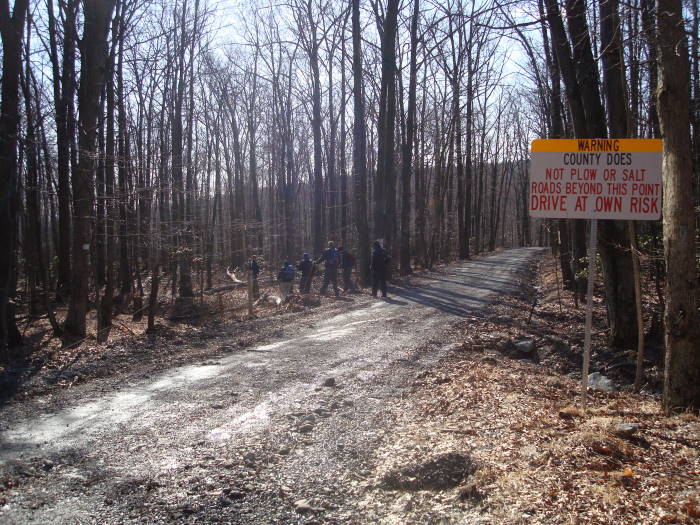
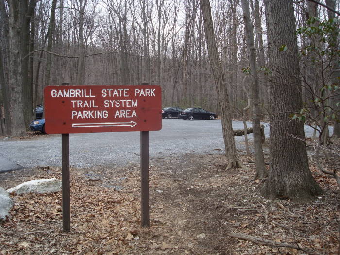
This can be done as a 2 day backpack with camping around mile 16.6 at the Manor Area Campground of Cunningham Falls State Park, reservations suggested. Cars cannot be left at the Gambrill SP Trail System Parking Area overnight. You can park at Gambrill State Park (call them) and take the Red access trail from there to the Trail System Parking Area.
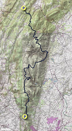
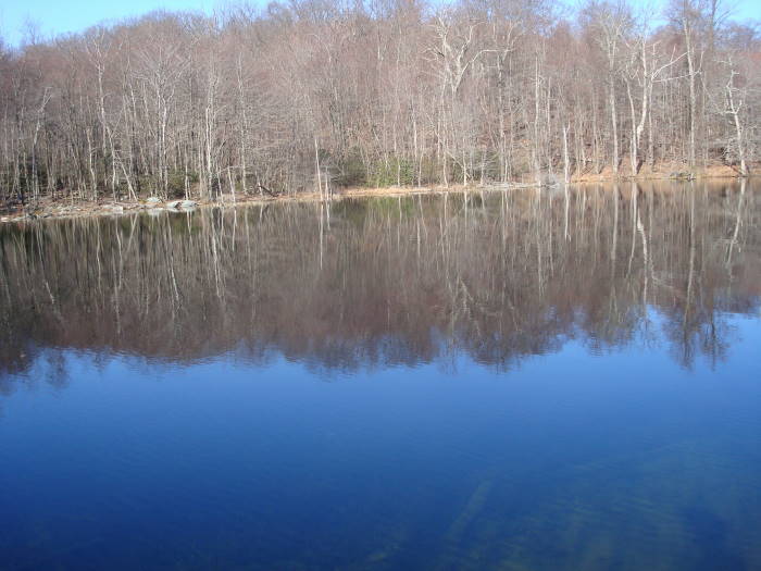
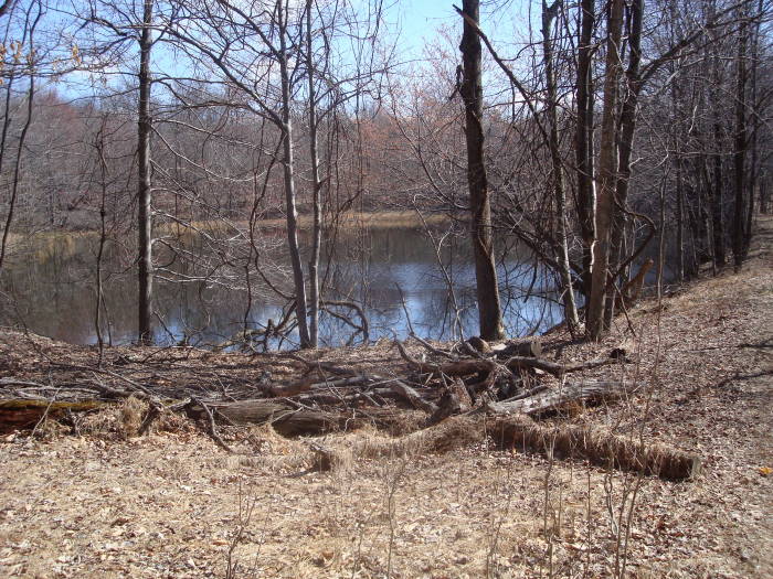
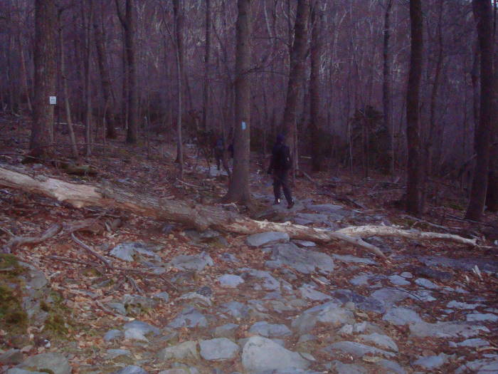
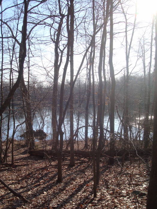
No camping is allowed along the Catoctin Trail. This hike will take you through 2 state parks, a Municipal Forest and a National Park. You will also cross many streams and hike by at least 4 beautiful ponds. Watch out for mountain bikers on much of the trail. The directions are not a mile by mile description but enough information for you to keep your orientation and know how far you have come.
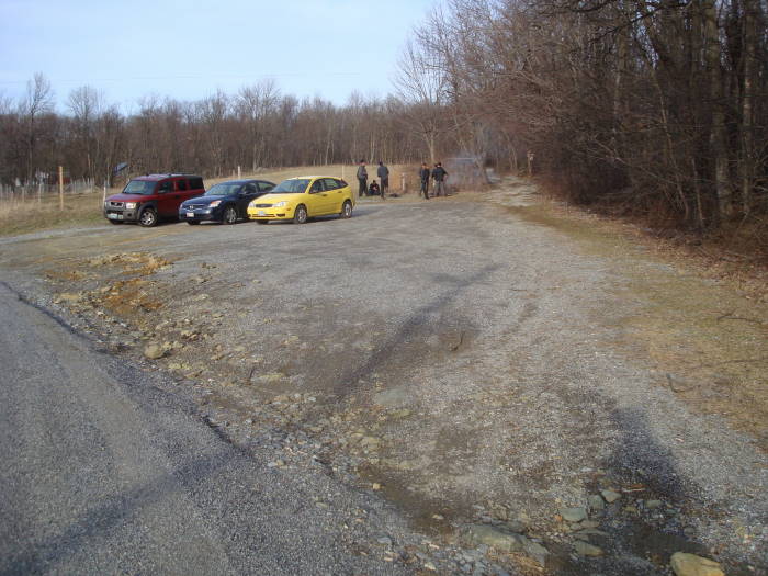
Mile 0.0 – Parking is at the Gambrill State Park Trail System Parking Area. The blue blazed trail begins to the right of the information kiosk. Follow the blue blazes as many trails are multi-blazed. There are sections marked better than others, so pay close attention.
Mile 1.5 – Keep straight on the blue-blazed Catoctin Trail as the green and black blazed trails head uphill on the left.
Mile 5.7 – Reach Hamburg Road. Go straight across road, next section does not have many blazes.
Mile 7.5 – Make a decision to cross the creek straight ahead (cuts out 0.5 miles) or go around the pond. Go right for about 0.2 miles to a fork in the road, bear to the left, go another 0.2 miles and take a left walking on the far side of the pond. Cross Steep Creek and very quickly reach the fire road and take a right, this is mile 8.0.
Mile 9.4 – Delauter Rd, you will pass a shed and house very close to this intersection. At the road take a right and in about 40 yards take a left back onto the trail.
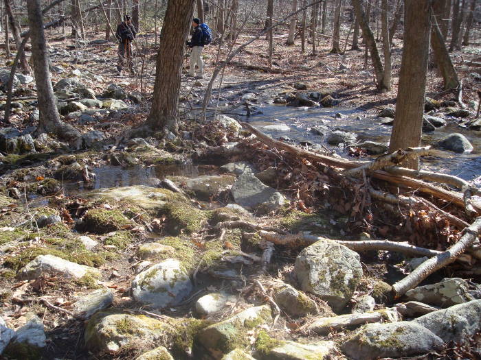
Mile 10.4 – Bear hard right on trail and head downhill towards Steep Creek.
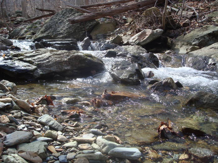
Mile 11.8 – Cross Steep Creek, multiple branches if the water is flowing. In 0.1 miles after crossing creek, the trail bears hard right towards Fishing Creek Rd.
Mile 11.9 – Fishing Creek Rd, bear right then left at the yellow road barrier.
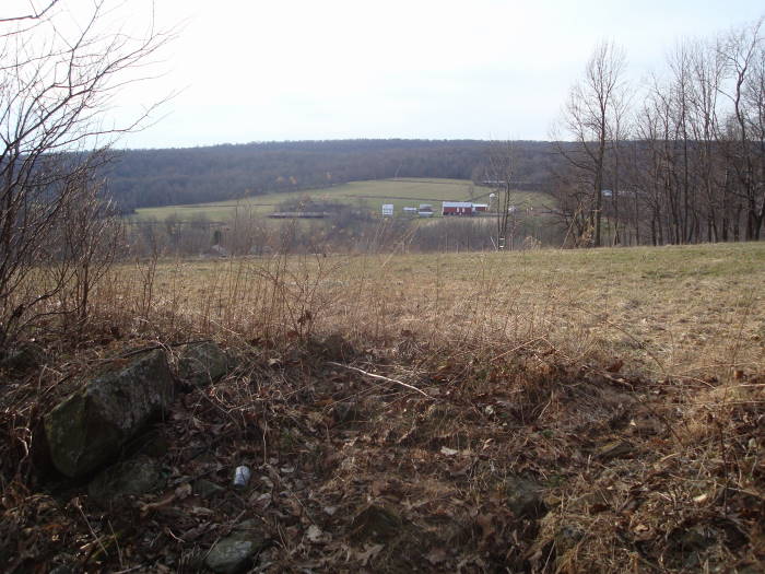
Mile 14.4 – Thurmont Rock Overlook, on the right. It is a steady down to the Manor Area of Cunningham Falls State Park from the overlook
Mile 16.3 – Catoctin Hollow Rd.
Mile 16.5 – Little Hunting Creek. Cross creek and head towards parking area and then up the road to the Visitor Center, we ate lunch here. If water is flowing too high on the creek you may have to hike down to Route 15 and cross there, then head back towards the Visitor Center.
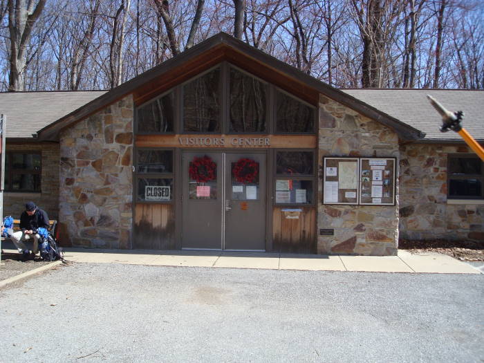
Mile 16.6 – Manor Visitor Center. If doing a 2 day backpack, the camping area is just up the road from the Visitor Center. The white spur trail directly across the road takes you back to the Catoctin Trail and begins the most strenuous climb of the trail
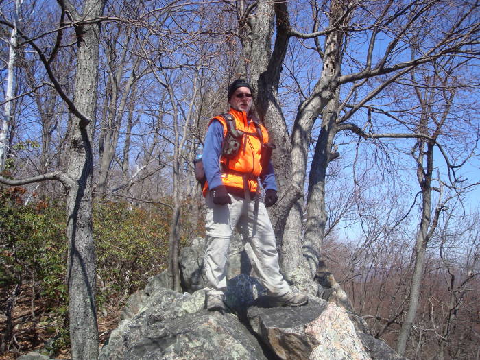
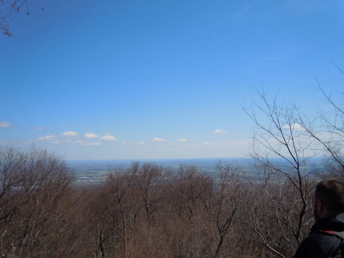
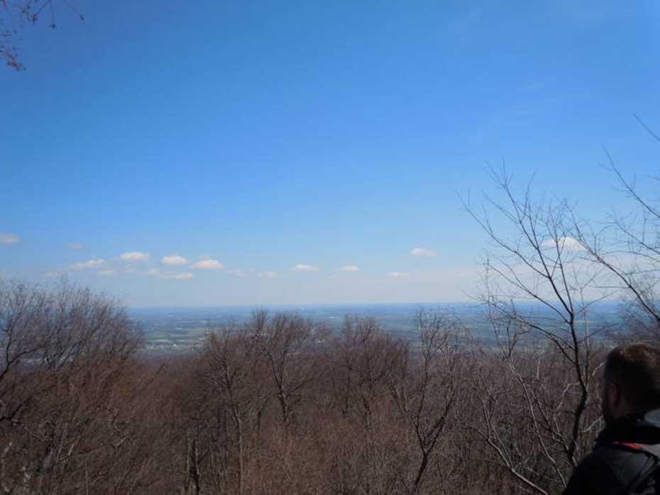
Mile 18.3 – Bob's Hill Overlook intersection. A 1142' climb from the Visitor Center. We took a right to see the view to the east (credit Greg Blair).
Mile 21.5 – Catoctin Hollow Rd, second time you have crossed this. There is an entrance station to the left. Cross the road to continue. Taking a right on the road would lead you to the Entrance to the Houck Camp Area. If the creek is too deep you may have to go that way and then hook back into the trail at the camp area.
Mile 22.1 – Cross Campground Rd, to the left and up the road is the Houck Campground area.
Mile 23.5 – Route 77, take a right and at end of road barrier cross the road into Catoctin Mountain Park to continue on the trail
Mile 24.8 – Park Central Rd, Camp David is about 0.8 miles to the east as the crow flies Mile 25.0 – Manahan Rd. Walk on road for about 0.25 miles then bear left back onto trail. It will parallel the road until you cross an unnamed creek in 0.9 miles
Mile 25.9 – Trail crosses a creek and starts to head away from the road, on the right you will see double metal drainage pipes bringing the creek under the road
Mile 26.2 – Foxville/Deerfield Rd, bear right onto road then turn left towards Owens Creek Campground, cross over Owens Creek Bridge and in about 40 yards turn right onto trail. Begin a steady climb for 1 mile then reaching a T-intersection/Open Field in another 0.6 miles.
Mile 27.8 – T-intersection/Open Field, there are blue blazes to the right at this intersection, ignore them and turn left reaching the Mt Zion Road Parking Area in 0.1 miles
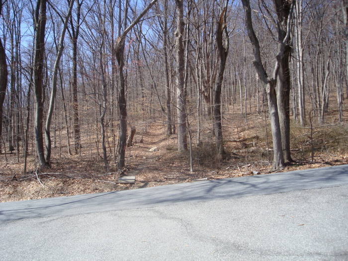
Mile 27.9 – Mt Zion Road Parking Area. Mt Zion United Methodist Church is visible from the parking area (Parking Coordinates 39.6722, -77.4983).
Note: Bypassing Bob's Hill Overlook and the circuit around the pond at Mile 7.5 reduces the trail by about 0.5 miles. Be careful when crossing fast flowing high creeks, don't cross if too dangerous, use an alternate route.
Late March
Bob's Hill Overlook
Catoctin Trail Hike Comments
Archived Comments
By:Carolyn
Rating:
Date of Hike: Saturday, June 3, 2017
Great route for (older) kids getting started in backpacking. Took my 10 yr old son and boyfriend down this trail (we did SOBO and started at Catoctin). We are fortunate to have a family member who lives on the trail just off Catoctin Hollow Rd so we were able to cut this hike almost exactly in half. Great trail! We are planning on doing this again during Spring break.
By:James H
Rating:
Date of Hike: Saturday, April 8, 2017
Myself and two other friends hiked the whole trail from Gambrill State Park to Catoctin Mountain National Park. It was a great hike and this guide does a great job guiding you through it. They really need to put a bridge over Little Hunting Creek right as you cross into Cunningham Falls State Park. The creek was really high and walking to HWY 15 is the last thing you want to do after hiking 16 miles from Gambrill. We were pleasantly surprised with the Manor Campground. Can't wait to go again when there's more leaves on the trees.
By:Zach
Rating:
Date of Hike: Saturday, April 30, 2016
This was my first backpacking experience. I actually did it in 2 nights and days, since I spent Friday night car camping in Gambrill State Park. It was rough, and the weather wasn't the best, but it is a great trail. While it is all walking through a forest, there are lots of variations in scenery and the trail itself. Parts of it are very flat and open, while others are very rocky. There were some pretty ponds and a couple of great views. I strongly recommend checking this out if you want a good backpacking experience. However, you would have to be in amazing shape to try this in one day.
By:Andy D.
Rating:
Date of Hike: Friday, November 20, 2015
Have not hiked the whole trail, but have section-hiked certain sections of the trail. The trail is similar to the Appalachian Trail yet more remote. But, the Catoctin Trail can be combined with other trails in several places to make nice day hikes. Most notably in Gambrill State Park, south or north from the Manor Area to White Rocks or Bob's Hill and Cat Rock both in Cunningham Falls State Park, and combining with the Horse Trail and Deerfield Nature Trail in western Catoctin Mountain Park is nice as well.
Most recently I did the hike to White Rocks from the Manor Area of Cunningham Falls SP. The trail can be accessed southbound from the furtherest parking lot in the Manor Area through the fisherman's access along Little Hunting Creek. Head upstream and you run into the blue blazed stream crossing in less than 100 yards. This avoids the extra distance and going uphill then down again to the stream crossing if you access via Bob's Hill Trail from the upper parking lot. Surprised White Rock/Thurmont Overlook isn't listed as a day hike with Cunningham Falls SP. Its the very southern end of State Park property just before the Catoctin Trail enters Frederick Watershed property.
By:TiggerMD
Rating:
Date of Hike: Monday, September 8, 2014
I hike the Catoctin Trail every year in September since 2010 as a scouting hike for PATC to assess trail conditions and to record and inform the Club of blowdowns to be cleared. It's a nice day hike for a long distance hiker and usually take me around 9 hours.
By:Kevin
Rating:
Date of Hike: Saturday, May 31, 2014
A friend and I hiked the whole trail over 2 days. While the 16 miles didn't seem too bad, the amount of rocks on the trail really tore our feet up. We started at 8:00AM and did the 16 miles in about 9 hours and made it to the Manor camping area with plenty of light left to set up camp and find some fire wood. If you camp at Manor, ask them for site #31 (close to the water, bathrooms and the trail). We slept well and decided to hike on starting at about 10:00 on Sunday morning. We finished the last 12 miles in about 7.5 hours (with plenty of breaks). The 2nd day was certainly tougher, but the actual terrain is a little better - still a lot of rocks, but less inclines. The 'steady incline' for the last mile is more like a hill, it was pretty steep at points.
Overall this hike is enjoyable. There are a few good rest areas with excellent views of the valleys below and plenty of beautiful wooded areas to take in. Be sure to plan ahead, practice hiking and be prepared for lots of rocks. The trail was easy to follow as it is marked well and there are plenty of blue blazes. There were a few points where we didn't see one for 30 minutes or so, but there were no other intersecting trails - best to take a good map too. There are some good maps of the area online which can be printed. We also recommend trekking poles, we split a pair between us which was enough. But without one pole each, we both would have fallen a few times.
HOK on!
By:rudy regner
Rating:
Date of Hike: Thursday, July 4, 2013
this has got to be one of my favorite trails...
By:Rob. A
Rating:
Date of Hike: Sunday, May 19, 2013
I completed the hike today - started at 0530 this morning and ended around 5 this afternoon. The streams are running fast and over flowing so be careful. There are many places were the blazes disappear - make sure you a good map and confident in your skills. Definitely will attempt this hike again and aim for a better completion time.
By:Nate D
Rating:
Date of Hike: Saturday, April 20, 2013
2 friends and I accomplished this hike this past weekend. We camped at Gambrill's Friday evening to get an early start Saturday morning. Our plan was to be hiking by 6am, but we didn't start until 7am. We were carrying about 40lbs on our backs and could have shaved a few pounds in hindsight.
Because the Cunningham Falls Manor camp area was closed due to Hurricane Sandy damage, we had to reach the Houck Camp area instead. This added on about 6miles to our first day. We maintained a 2mph pace for most of the hike. At 7.5 miles, going through the pond wasn't an option and I don't think walking around it really added that much distance. It appeared there was a small path that followed the pond around rather than following the blazes. At 11.9miles, the gate has now been painted red, not yellow.
Crossing Little Hunting Creek at 16.9mi was the most difficult crossing on the trail. The creek was running quickly and fighting time, we attempted to cross over a couple of fallen trees than to walk down to the road and then back up. The hike up to Bob's Overlook was VERY challenging after a long day. We eventually made it up and the view was very rewarding. The downhill seemed to take much longer than it should have and we were fighting daylight. We eventually had to put on headlamps to complete the decent.
We didn't attempt to venture down to Hunting Creek because it was dark at this point and the creek sounded like it was running faster than Little Hunting Creek. We took the road over to the camp area. It is a rather long and steep hike just up to the ranger station/check in. Luckily, we had informed both parks of our plan to do the hike and to camp here for the night, so they were happy to see us and expecting us at 8:30pm that evening. We got a ride to the camp store and to our camp site by the ranger. The staff was so very friendly and we greatly appreciated it. The camp store closes at 9pm by the way. The hike to our camp site would have probably taken at least 30-40min to do by foot at that point.
Sunday morning we got up and set out by 11am. We stayed at the Bear Branch site since it had easy access to the trail by way of a cut through. It might have been a lack of sleep/energy, but when we came to the intersection for Catoctin, we went to the right, when we should have gone LEFT. We lost about 1.5hrs in time after doubling back up the hill to the intersection again. The rest of the hike wasn't too bad. There is another 1mi climb just before the end but it wasn't as bad as Bob's Overlook.
In all, this was a great time. The weather was perfect and I'd do it again.
By:Kumar
Rating:
Date of Hike: Friday, November 23, 2012
Since this is not a circuit hike, I initially planned to do half the trail and back on one day and do the same from the other end on the next. However, the days being so short at this time of year threw a spanner in the works especially as Gambrill Park does not open until quite late in the morning. I hiked from the Mt Zion Rd trailhead to Bob's Hill overlook and back. Must say this portion of the trail was a disappointment: hardly any views (the overlook is an incredible disappointment, truly worthy of being overlooked) and the creeks were no more than trickles. Probably a better experience at a different time of the year. I only saw 2-3 other souls on the trail all day, and only on a brief stretch in Cunningham Falls Park. Good workout, I hope to do the other half of the trail soon if daylight permits. The directions on this page are incredibly detailed!


