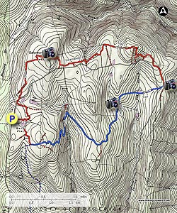
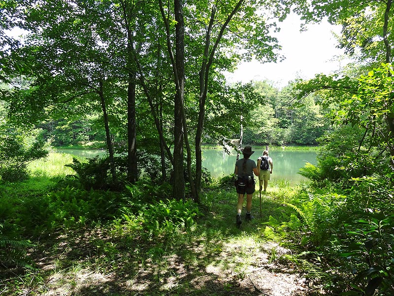
This section of the Frederick Municipal Forest, just north of Gambrill State Park, is a virtual labyrinth of interconnecting trails. This circuit hike combines a section of the blue blazed Catoctin Trail, as well as the the Salamander Trail. The highlights are the two ponds on the Catoctin Trail, and the overlook near the junction of the Salamander Trail.
This area is also very popular with mountain bikers, with the Catoctin Trail having the highest density of our two wheeled friends. A map, and GPS are a must for this hike because of the number of interconnecting trails, especially on the Salamander Trail, where intersections show up every couple of hundred yards in places. Special thanks to Mike with www.midatlantichikes.com for recommending this circuit.
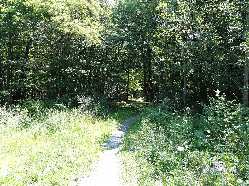
Mile 0.0 – Pass the closed gate and walk through a clearing, then pass a pond on the right and arrive at the first trail intersection.
Mile 0.2 - Turn right and and follow the trail to the next intersection in 0.2 miles.
Mile 0.4 - Stay left and in another 0.2 miles arrive at the intersection of the blue blazed Catoctin Trail.
Mile 0.6 - Turn left following the Catoctin Trail as it passes through several areas of Mountain Laurel and arrives at a four way intersection in another 0.2 miles.
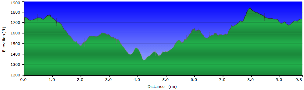
Mile 0.8 - The old Catoctin Trail is to the right and blocked with blowdowns, directly ahead is the new section of the Catoctin Trail, and to the left is an unmarked trail. Stay straight on the new blue blazed Catoctin Trail. The blue blazed trail will switchback down the first ridge, pass through a section of fern, then cross a small stream before arriving at the next intersection in 1.3 miles.
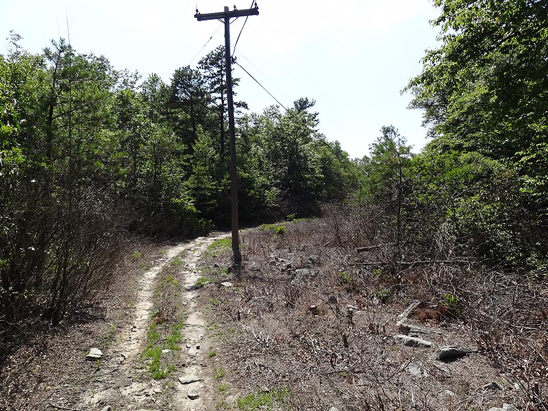
Mile 2.1 - Turn right remaining on the Catoctin Trail and shortly cross a gravel road. Pass through the closed gate on the other side of the road and continue on the blue blazed Catoctin Trail for 0.9 miles to the next intersection.
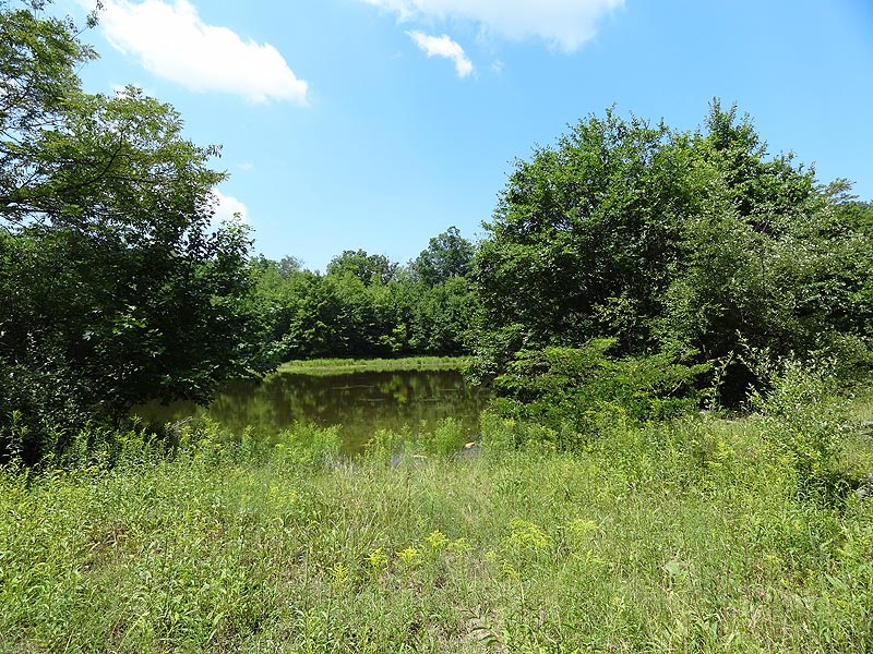
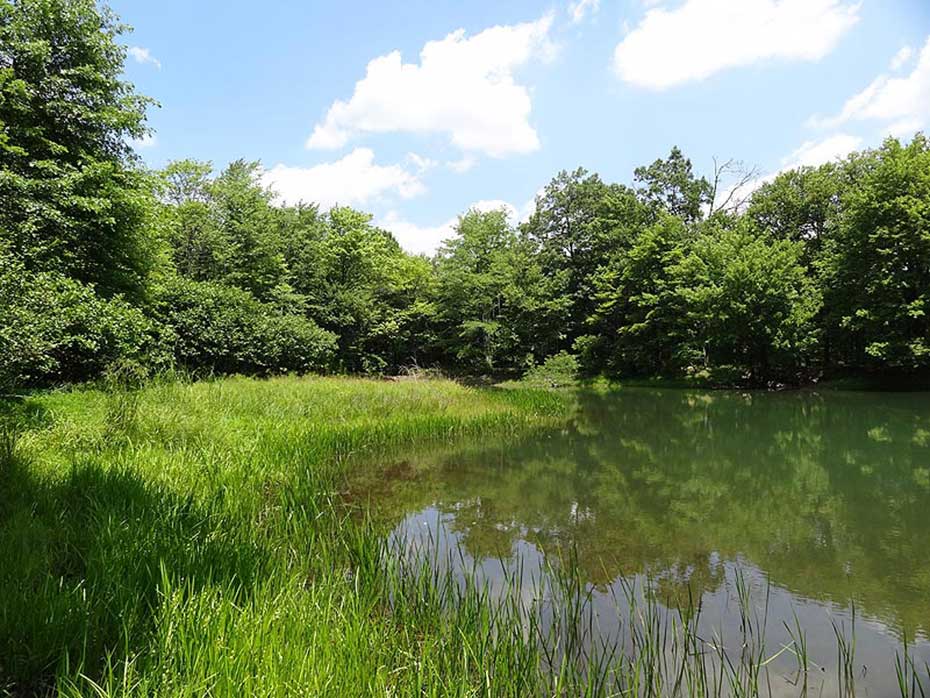
Mile 3.0 - Turn left staying on the Catoctin Trail for 0.8 miles to the first of the two ponds.
Mile 3.8 - In 0.4 miles the the second pond will be on the left of the trail.
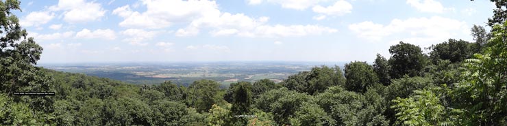
Mile 4.2 - From the second pond it's 0.3 miles to gravel Gambrill Park Rd. Cross the road then in 0.1 miles reach the intersection of the Salamander Trail. For now continue on the Catoctin Trail for 0.1 miles to the best view on the hike. Return to the intersection of the Salamander Trail.
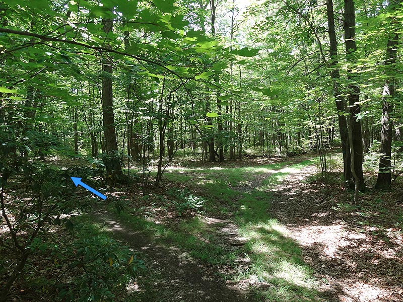
Mile 4.8 - Turn right on the Salamander Trail north (this would have been a left turn on the Salamander Trail when you first past the intersection on the way to the overlook). Follow the Salamander Trail for 0.6 miles to the next intersection. This trail connects on the right and is easy to miss. If you do miss it you'll end up back on Gambrill Park Rd.
Mile 5.4 - Turn right and for the next 0.3 miles pass three more intersections. Use the map and GPS route to navigate. This section of the Salamander Trail is a labyrinth of small interconnecting paths.
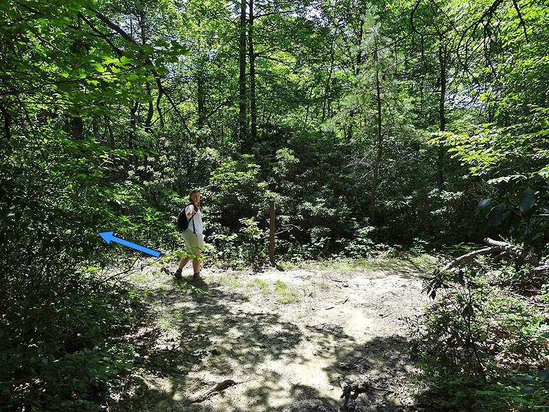
Mile 5.7 - Intersection 12 on the GPS Track - Turn right on the less obvious trail. If you pass the 'Mo's Cut' sign you have missed the turn! In the next 1.6 miles pass 3 more intersections staying straight/right at each.
Mile 7.3 - Intersection 16 on the GPS Track - Turn right as the trail climbs past the Salamander Rock high point and arrives at a old stone house in another 0.3 miles.
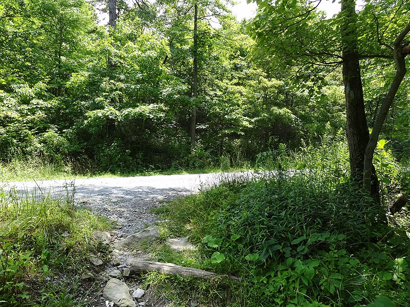
Mile 7.6 - Turn right on the gravel road for 25 yards to the utility clear cut. Turn left down the utility clear cut for 0.2 miles at which point the trail veers left back into the forest. From the the clear cut to the next intersection it is less than 0.1 miles.
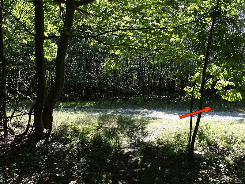
Mile 7.8 - Turn right at the intersection and follow the trail for another 0.7 miles passing two more minor intersections before reaching gravel Gambrill Park Rd.
Mile 8.6 - Turn left off Gambrill Park Rd. passing the closed gate and follow the trail for 0.2 miles to the next intersection. Be on the lookout for this trail intersection as it's easy to miss.
Mile 8.8- Turn right for 0.2 miles to the pond and beginning of the hike loop.
Mile 9.0 - Turn right following the connector trail back to the parking area in 0.2 miles
Mile 9.3 - Parking area.
Mid June
Pond View
Sand Flat/Salamander Trail Hike Comments
Archived Comments
By:Tim C.
Rating:
Date of Hike: Friday, January 18, 2019
Know this area well. Have hiked these trails many many times, thoroughly enjoy these woods. In the pictures there is an image of an old foundation. I'm very curious to know where this is? Is this in the Frederick watershed? If so how do I reach it?
By:Paul
Rating:
Date of Hike: Friday, April 6, 2018
This is the third time I have hiked this hike. I'll emphasize this phrase that appears at the beginning of the description: "A map, and GPS are a must for this hike." I think a GPS is a must and I rely on it primarily. On the last half of the hike, after the overlook, there are no more blazes or trail markers at the many, many intersections. Even with a GPS I still get misrouted a few times, when the trail fades or where there is a fork with the options at a close angle to each other. This is after hiking it three times (I'm getting better). I get back on track by finding a GPS waypoint ahead of me and tracking directly to that which gets me back on the trail. (My "GPS" is an iPhone with the Earthmate app -- I think dedicated GPS device would be more accurate and keep me on track, but the iPhone is good enough for me.) Without a GPS, I think you can follow the map and description, and the blue blazes, to the overlook -- I would then turn back and not proceed if you don't have a GPS. I hope a some point the City of Frederick, the PATC, or someone else puts in a decent system of trail markers and blazes to make it more accessible to those not comfortable using a GPS.
As this is my third time, I like this hike very much. For me it is a good combination of longer distance and signficant, but not too much, elevation change -- my favorite combination. The terrain and trails vary enough to be interesting. The overlook is nice -- it is the only "vista." On all three hikes I have seen no one else on the trails. This time when I arrived a few mountain bikers were returning. I saw mountain bike tracks along the entire hike.
By:Greg & Mary
Rating:
Date of Hike: Sunday, November 12, 2017
An enjoyable hike despite the absence of any trail blaze/markings on the Salamander Portion of this route. The few red tree blazes seemed to denote the boundary of the Frederick Municipal Water Shed rather than the Salamander trail. If we do this one again, we'll carry a can of red spray paint and a salamander stencil with us!
We managed to navigate the route the old fashioned way (sans GPS) and had only one or two minor detours where we had to retrace our steps. FYI, the Moe's Cut sign is still there. We missed that turn by only 20 feet. I think hiking without the summer foliage in place helped us to successfully navigate the route. The only issue with the detailed trail guidance on this site is the following:
Mile 8.6 - Turn left off Gambrill Park Rd. passing the closed gate and follow the trail for 0.2 miles to the next intersection. Be on the lookout for this trail intersection as it's easy to miss.
Mile 8.8- Turn right for 0.2 miles to the pond and beginning of the hike loop.
It is no more than 200 yards past the closed gate to the above referenced intersection and it is tough to spot.
By:George
Rating:
Date of Hike: Saturday, June 10, 2017
We did the loop starting on the blue and finishing on the red. The blue was pretty well marked and when I checked the distances using my fitbit, they were pretty close, so that there were no real concerns about getting lost. We can't say the same thing about the red side, however. The labyrinth area is, as advertised, difficult to stay on the primary trail. We got off on one of the satellite trails that went back to the road, and so ended up hiking the road for a mile or so, looking for the next access trail. We FINALLY found one, not too far from the salamander rock area.
The worst part, however, was when we were nearly back to the parking area. In hindsight, we should have just hiked along the road (which we ended up doing anyway) but instead we figured we'd follow the trail as it goes back away from the road. This is at mile 8.6. I'm still not sure what happened here. the directions said that the turn was hard to find and was at 0.2miles. In hindsight, I think the proper turn was likely much closer to 0.1 miles, but we missed it and ended up by the ponds. From there, we were on a trail but it must not have been the primary one, because we were clearly not going in the right direction. we foolishly tried to go off trail for a while, thinking we could navigate by our phones. But they are probably not accurate enough for this. Maybe a "hiking gps" allows this. At any rate, we abandoned that, got back to the trail, back to the pond, and eventually back to the road at mile 8.6. we just walked the rest of the 0.2 miles on the road back to the starting parking lot. We turned a ~9 mile hike into a 12 mile hike!
It was frustrating, mostly because a $2 can of red spray paint can solve this easily. How about every time another trail pops up, or when a turn is hard to find, you simply put red paint on a tree on the right path? I would ask someone who knows the trail well to do this the next time they are hiking. Many of us will thank you profusely!
By:Where is the zero star option?
Rating:
Date of Hike: Wednesday, April 5, 2017
When we got to the "labyrinth" part, my friend and I got lost using GPS/map on both of our iphones. We ended up in a thicket/forest assuming it was the supposed labyrinth.
We were lost/navigating for two hours alternating between trying to get back onto the main gravel road and trying to backtrack onto the trail we were on before the labyrinth part.
Our phones were at less than 10% when we finally found a red sign. (the second half of this trail - Salamander trail)
Oh, right, the signs. There are none.
Once you reach the labyrinth part there aren't any signs to guide you. It's like.. they thought, hey, what would almost kill them?
We found our way back onto the trail just as the last moments of sun departed and the night's light began to cast over us. We look to our left and there was the gravel path. We raced towards it to find that it was lined with red markers/signs.
So, again, it's as if, hey, why don't we line the straight gravel path with markers so they know that we're capable of setting up markers but not where they will actually need them?
We started on the trail at 1 pm. We left the trail at 9pm.
The second half of the trail in general is not well maintained even on the parts where there are markers present.
Be careful and don't go by yourself.
The view was pretty sweet though.
Also, to the dude that wrote the directions, "take the less obvious trail" when you reach a fork right around the labyrinth part.. do you hate people or something?
By:Steve
Rating:
Date of Hike: Monday, May 9, 2016
I enjoyed this hike. A significant elevation change but over a longer distance so I didn't get as winded as I might otherwise. I kept going and completed it in 4 hours, not including a break for lunch at the beautiful overlook near the 4.2 mile point. There's a diversity of scenery, plants, and terrain, though no sweeping vistas except for the overlook. A beautiful stream early on. I saw deer and wild turkey. I was the only one in the parking lot upon arriving at 9:30. There were two other cars when I returned but I saw no others on the trail. From the tire tracks this is clearly a popular biking trail.
I relied on GPS as suggested and used the downloadable route and waypoint file. I had a map and compass for backup, but am glad I did not have to use them. As the description says, it is a labyrinth of trails. As the topo map shows, there are gravel roads near most of the trail route so one could jump onto them and return if they felt lost.
The biggest problem I had was near the end -- more a surprise than a problem. There had been a lot of rain the last couple weeks and there was a wide area of flooding at waypoint "Intersection 24," with water a couple of inches deep covering an area about 50 feet wide and 200 feet long. I could not immediately find the trail leading to the next waypoint "City Park 53." With boots you could walk through the water following the trail route or a bearing the the next waypoint and eventually meet up with the trail. I had my trail runners on so I went off the trail to higher ground and followed a bearing the the next waypoint. I found dry trail about halfway along that segment.
By:X
Rating:
Date of Hike: Monday, September 8, 2014
This was one of the least worthwhile hikes I've ever done. I was intrigued by "Salamander Rock." I expected the high point of the hike to be a large, impressive boulder with a unique shape. Where is it??? Supposedly the trail climbs past it. I saw nothing that I felt could be Salamander Rock in the summit area. Without that, it's nine miles of blah.
By:Tim B
Rating:
Date of Hike: Sunday, July 27, 2014
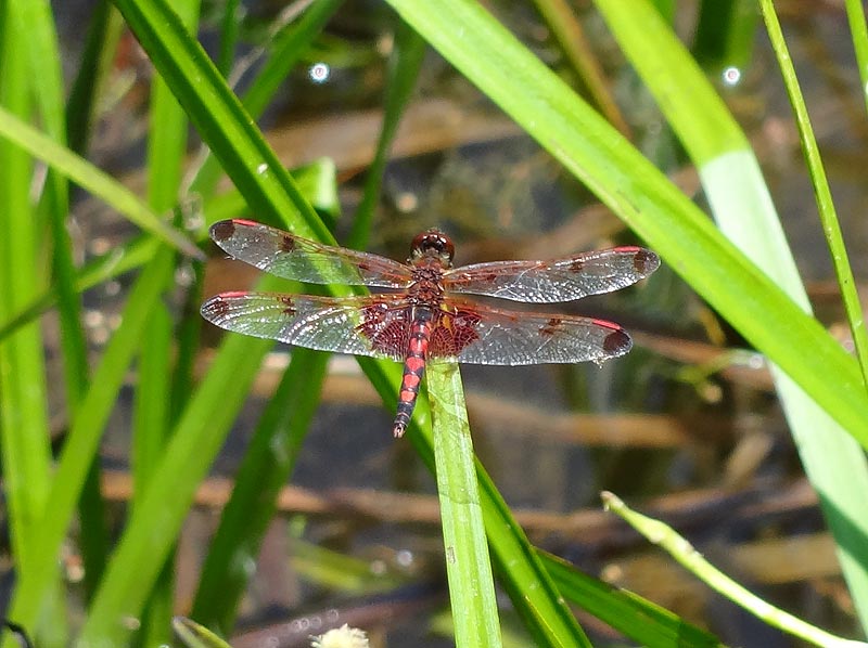
Good hike, nice length without a lot of elevation change. Make sure you take your GPS because the directions can be hard to follow w/out one, and getting the Salamander Trail right was a bit slippery (it is not marked, and nearly overgrown in spots). Did not see any bikers on my trail. Did see (and eat) wild blackberries, and saw (but did not eat) a salamander! Or possibly a newt (red w/small yellow spots down its sides).
By:Dkeg
Rating:
Date of Hike: Saturday, November 2, 2013
Nice hike, I know this area very well so I had no problem navigating. The Gambrill map sold at the park office will not help you. Right now there are no official maps of the area. Ran into a few Mountain bikers, they were very courteous. If you learn the area better or go with someone who knows it, There are some very nice trails up there.
By:ABS
Rating:
Date of Hike: Saturday, August 17, 2013
I took my 10 yo son on this hike today. I have to say that the trails are not very well marked and we made every attempt to use the directions from this site to no avail. I also have to add that I used Map my Run on my phone and we did not use a true GPS. However, we spent much of our day exploring the park and enjoying what God gave us. We ended up hiking 9.7 miles total.


