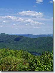
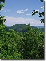
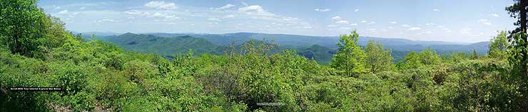
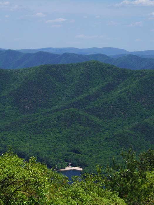
Douthat State Park is one of Virginia's jewels. Voted as one of the nations 10 best, the park has over 43 miles of trails. With Blue Suck Falls/Tuscarora Overlook and the Beards Mountain loops, the park has two beautiful day hike circuits. The vistas and overlooks at the park are some of the best in the Old Dominion.
Although there isn't any camping on the trails in Douthat State Park, there are over 75 campsites in two camping areas near the lake, as well as a large group camp area. Douthat State Park is a great place to either tent or trailer camp for a couple of days, and hike the multiple loops available in the valley.
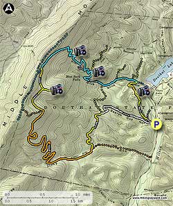
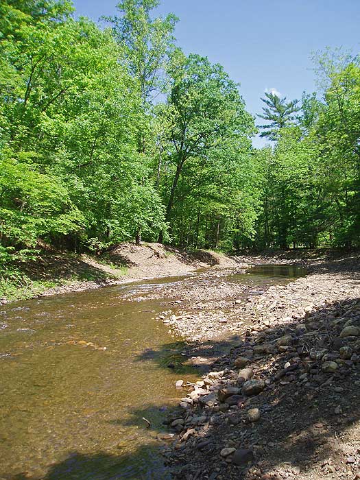
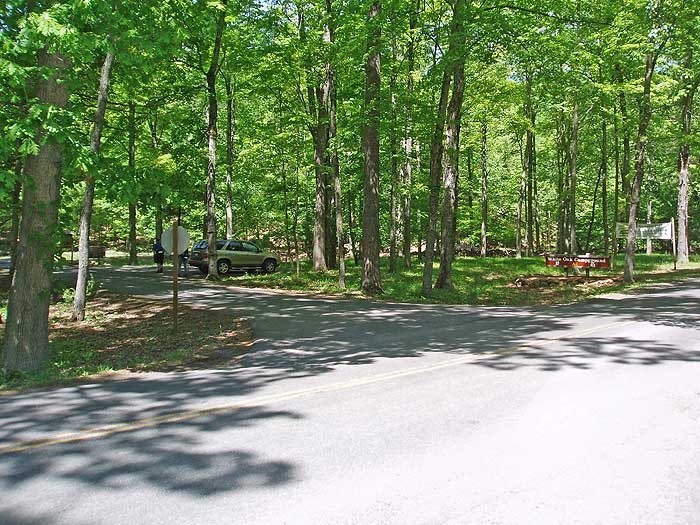
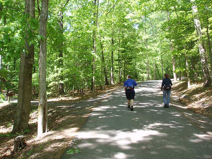
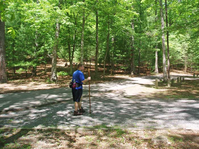
Mile 0.0 - From the parking areacross Wilson Creek on a paved road, then shortly pass the Beards Gap Hollow Trail that will be the return route. Continue up the paved road and in 100 yards enter the main section of the Campground.
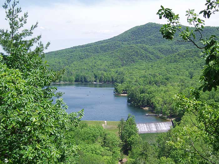
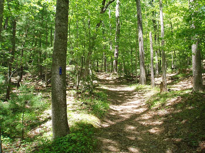
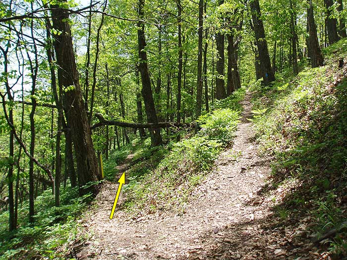
Mile 0.2 - Turn left uphill on the yellow blazed Tobacco Ridge Trail and in 0.5 miles reach the high point of the trail and a overlook of Douthat Lake. Continue along Tobacco Ridge Trail for another 0.5 miles as it descend to the intersection of the blue blazed Blue Suck Falls Trail.
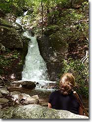
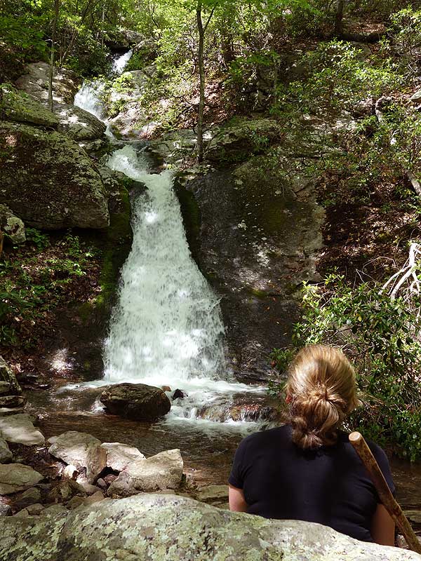
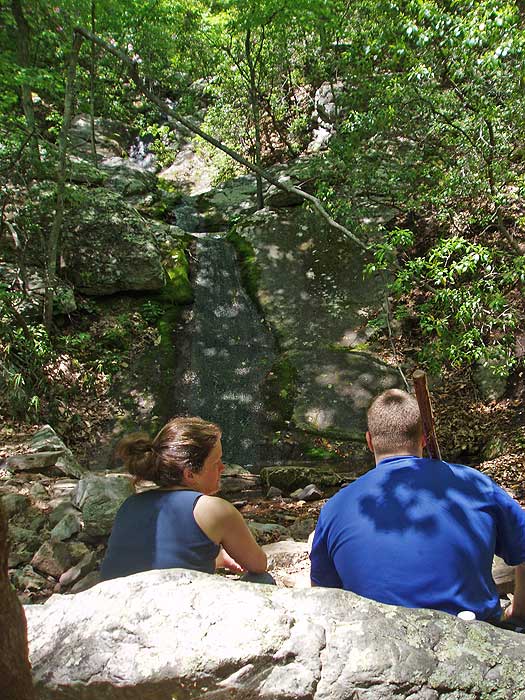
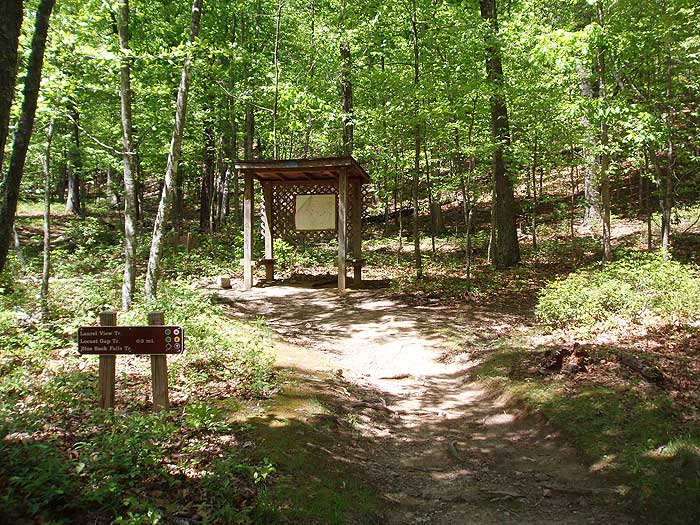
Mile 1.2 - Turn left uphill on the blue blazed Blue Suck Falls trail immediately crossing a stream and in 200 yards pass the green blazed Huffs Trail on the right. 0.2 miles from the Huffs Trail intersection reach the intersection of the Laurel View Trail on the right. Stay left remaining on the blue blazed Blue Suck Falls Trail and in 0.5 miles pass the yellow blazed Locust Gap Trail that comes in from the left. Turn right on the blue blazed Blue Suck Falls trail is it becomes steeper and rockier for the next 0.3 miles before arriving at Blue Suck Falls.
Mile 2.2 - Continue uphill on the Blue Suck Falls Trail for 0.3 miles where the Blue suck Falls Trail turns left uphill, and the yellow blazed Pine Tree Trail continues straight.
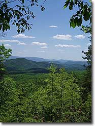
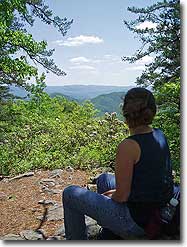
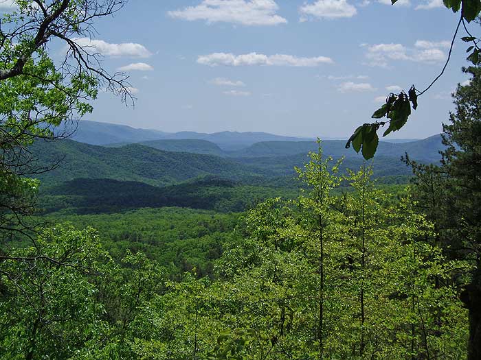
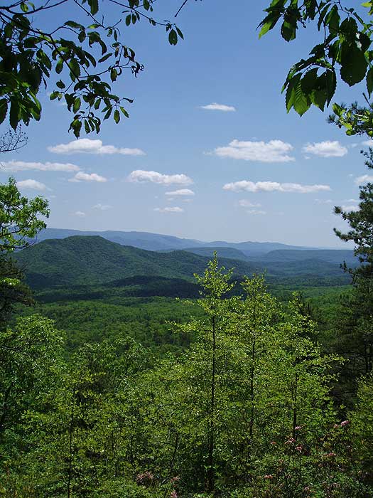
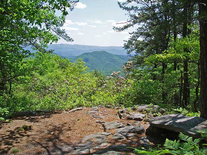
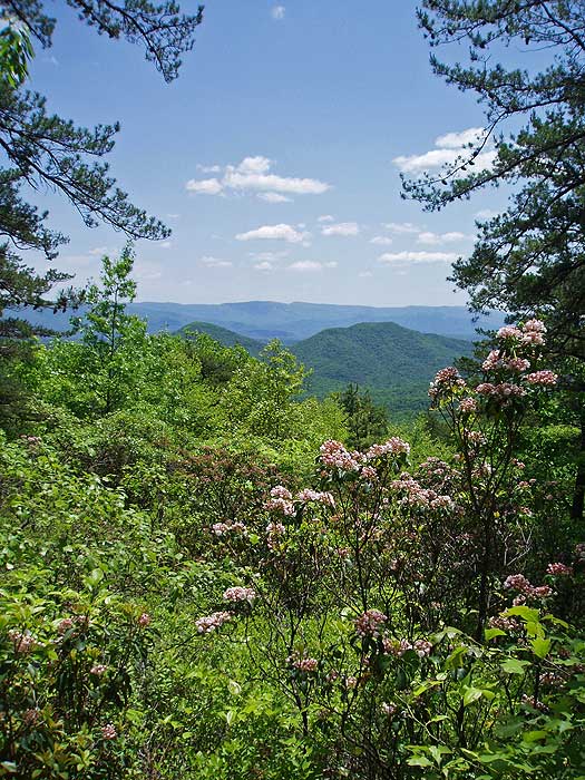
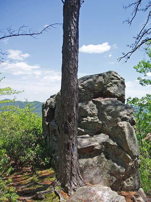
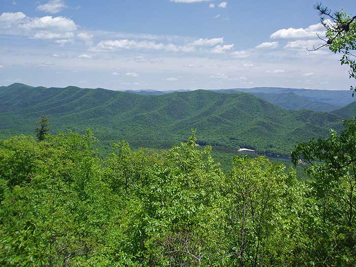
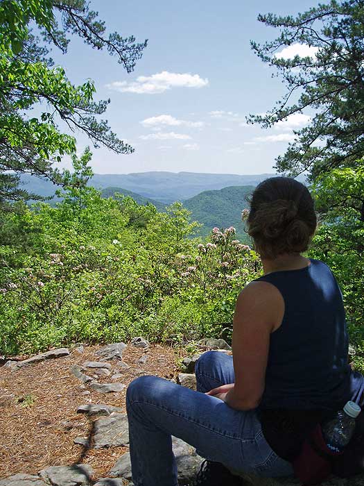
Mile 2.3 - Turn left remaining on the blue blazed trail as it switchbacks steeply up Middle Mountain passing several beautiful overlooks before reaching Overlook Rock, and vista of the valley and Lake Douthat. Continue uphill on the Blue Suck Falls Trail as it switchbacks four more times before arriving at the yellow blazed Tuscarora Overlook Trail in 0.9 miles.
Mile 3.4 - Turn left downhill on the yellow blazed trail passing the intersection of the Tuscarora Overlook Trail continuation in 0.3 miles, and reaching a small cabin at the Tuscarora Overlook in another 0.1 miles.
Mile 3.8 - From Tuscarora Overlook, return back to the last intersection and turn left on the yellow blazed continuation of the Tuscarora Overlook Trail. In 0.5 miles the yellow blazed trail ends at the orange blazed Stony Run Trail.
Mile 4.3 - Turn left downhill on the orange blazed trail as it makes eight sharp switchbacks before passing through a thick area of rhododendron and crossing Stony Run in 2.1 miles.
Mile 6.4 - Continue downward on the Stony Run Trail, passing a blue blazed trail on the right, re-crossing Stony Run and then arriving at the intersection of the yellow blazed Locust Gap Trail.
Mile 7.3 - Turn left slightly uphill on the yellow blazed trail as it winds around the valley reaching the silver blazed Beards Gap Hollow Trail in 1.1 miles.
Mile 8.4 - The yellow blazed Locust Gap Trail turns left uphill, and the silver blazed Beards Gap Hollow Trail turns right downhill. Turn right downhill on the Beards Gap Hollow Trail for 0.9 miles where it veers right onto a gravel road. In 200 yards after joining the gravel road arrive back at the paved road for the Campground. Stay right re-crossing Wilson Creek.
Mile 9.4 - Arrive back at the parking area.
Late May
Blue Suck Falls Hike Comments
Archived Comments
By:Amanda
Rating:
Date of Hike: Friday, July 26, 2019
Lovely hike at Douthat State Park. The ascent and descent were nice and steady - never too steep. The trails and the trail junctions were well marked. Water levels made water crossings really easy. There were a couple of nice overlooks along the loop and the waterfall had a nice stone bench to relax a a little and enjoy the view. We hiked on a Friday and only saw a few other hikers and a couple of mountain bikers. The trail was a little overgrown at points between Blue Suck Falls and the Tuscarora Overlook. We had been warned by a ranger at the guest check-in that 5-6 timber rattlesnakes had taken up residence at the Tuscarora Overlook cabin. We treaded lightly and were vigilant when approaching the cabin. We saw one rattlesnake sunning itself against the front door on the porch of the cabin. We respected his space, snapped a couple of photos at the overlook and moved on. No problems just be careful approaching and around the cabin.
By:Panther
Rating:
Date of Hike: Sunday, April 21, 2019
This is an amazing hike! Don't let the difficulty rating scare you--as another reviewer said, the footbed is relatively easy with a long, gradual descent to the falls. The trail above the falls becomes a bit rockier, but not technical at all. The views above the hike, across the ridge, and the eventual descent are spectacular--some of the best in this area. Definitely take the time to look at the scenery! A word to the wise: the water levels are higher than normal now, and all stream crossings will result in wet feet (water can be up to ankle deep). There are also areas of running water on the trails. Mesh trail runners will dry out faster than waterproof hikers and this could make the hike much more enjoyable. This is one of my favorites, and definitely worth doing again.
By:Mark
Rating:
Date of Hike: Saturday, November 4, 2017
I only did the Blue Suck Falls trail (5.8 mi). Beautiful views and I hiked on a day when the fall foliage was at it's peak. This trail is rated difficult but I think it's because of the long, steep ascend. The trail bed itself is actually pretty easy--long stretches without rocks, boulders, etc. Lots of streams so next time (yes, I'll do it again--but a longer loop) I'll carry less water and use the sawyer. The Falls was nice but nothing dramatic. There was stone viewing bench there (natural)--nice touch and a good spot for a snack or lunch. You arrive at the Falls pretty soon after starting. The views are all beyond it. Incidentally, I wonder why it's called Blue Suck Falls? The topo map I printed from this site (I like to carry a paper copy) was accurate. I checked GPS on my phone at one point and had reception. For day hikes, park in the Carson Picnic Area parking lot to meet the Blue Trail head. Restrooms are nearby, a nice feature. On this day I was the only hiker (late season and it was raining) but quite a few trail bikers. I imagine on good days, peak times, bikers might be quite a presence.
By:BrianJB
Rating:
Date of Hike: Monday, July 24, 2017
Overall a nice, longer day hike with varied terrain and a series of good views. I started from the Lakeside Campground - quite crowded at peak season, mainly RV's/campers. . .but all sites have a great view of the lake and there aren't too many in total and can be reserved ahead (although first-come, first serve among the sites). Don't hike just for Blue Suck falls, which was literally a trickle despite soaking rains the night before. Other than that, good views from a couple of different angles, and don't miss the side trail to the cabin or the brief hike to the second waterfall. Saw a few other hikers and three mountain bikers.
By:Don Mac
Rating:
Date of Hike: Wednesday, July 13, 2016
This hike was fantastic! Kudos to Virginias DCR for well kept and clearly marked trails. It was quite warm when we hiked this but nearly all of the hike was shaded. Do not pass up the views at the Tuscarora overlook and its cabin! It was a long hike as our monitor device indicated 12 miles but whatever it was it was worth it! I would be prepared for deeper water on the stream crossings if you do this during a rainy spell.
By:Jeff
Rating:
Date of Hike: Saturday, July 9, 2016
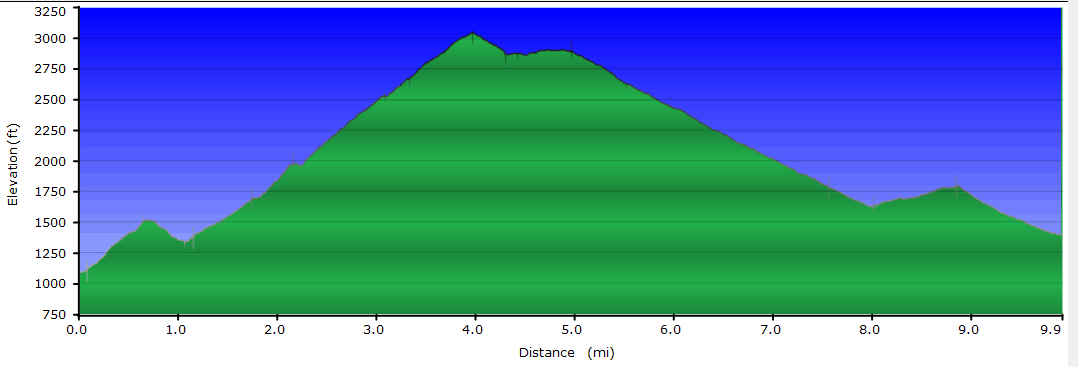
Hiked this on a warmish afternoon, found it to be wonderful. Starts with a half-mile uphill right off the bat, which was difficult for not-yet-warmed up legs, but I was able to settle in before making the climb up to the falls. The quarter-mile of the Blue Suck Falls trail was the steepest pitch of the whole hike, with about 150' directly in the creek bed, and would probably be difficult the day after a big rain. After the falls, the trail climbs a dozen switchbacks up Middle Mountain, with rest benches made of stone on the second and sixth switchback. The Tuscarora trail was in good condition, though close to being overgrown in a couple of spots there was no danger of ever losing the trail.
Descending on the Stony Run trail was a nice cruise down mellow grades. Right after the trail crosses Stony Run Creek in the rhododendron stand, you can bear right 300' on a bandit trail to another pleasant waterfall. Closing the loop is mostly flat hiking with a couple of minor creek crossings. Look to the left after turning onto Beards Gap trail to see a some recently-burned forest.
I saw two families and one solo hiker, and one mountain biker on this trip. Of note, while Blue Suck, Tuscarora, and portions of Stony
Run are closed to horseback travel according to signs on the trail, I saw enough hoofprints and horse apples to make it worth keeping an eye out. Also, the forest canopy was pretty open on some parts of this hike and I caught more sun than I was expecting. Doing this hike on a really hot day would be a challenge between the sun and the climbing.
By:KarenNDkitchen
Rating:
Date of Hike: Tuesday, August 26, 2014
I have to agree with the other reviewers, this is one terrific hike. A little strenuous but many places to stop, rest, and take in the view - esp. Tuscarora Overlook! Blue Suck Falls was barely a trickle, which was a little surprising because it rained for a few days before. The trails are well-maintained, except for a few signs (an arrow pointing straight ahead to get to Blue Suck Falls Trail when in fact the trail turned either left or right. Also confusing signs near Tuscarora Overlook. Don't forget your awesome Hiking Upward Map :) ) We passed only one guy on a mountain bike the whole time.
By:Shawn R.
Rating:
Date of Hike: Tuesday, July 22, 2014
This was the first hike that I've been on and I really enjoyed it. As clearly stated, this is a difficult climb for the first part up to the overlook, but it is well worth it. The directions are clear and the paths are clearly marked. The signs were a little bit unclear heading towards the Tuscarora Overlook (on the recommended route), but if you continue straight on the trail that you were on, then you will end up seeing the cabin and a phenomenal overlooking view. As some other reviews mention, Tuscarora Overlook is definitely the best place to stop for lunch. The hike took about five hours, including the breaks that we took, including about a 15 minute break for lunch. In total we saw one other hiker, which was very nice. I would certainly recommend this hike to others for the great vistas. There was little to no water flowing down the Falls and the other creeks at the time, but the hike was still great.
By:B. Love
Rating:
Date of Hike: Saturday, February 1, 2014
Some parking areas were closed directions to trailhead I thought were confusing. I parked at Camp Malone (childrens playground on site) near lake and the walked through the Discovery Area Center to come up to the trailhead for Blue Suck falls - and started with blue blazed trail up to falls - after that went by directions on this awesome site.
As for the hike wow this was a great winter hike. Did this hike on a beautiful day felt about 40-45 degrees and no wind. Peaceful. The falls didn't have a lot of flow probably because snow and ice still thawing from recent snow and freeze. The vistas were amazing and I would recommend this hike more for the vistas at Overlook Rock and Tuscarora Overlook than the falls - and a few other nice vistas along the way up. I took lunch at Overlook Rock and that was a mistake - still quite a ways up after that to the cabin and best vista on trail. Have lunch there.....when you see the cabin. I took 20 mins. for lunch - spent a few minutes at each vista and did the trail in 5-3/4 hours by myself. I encountered a nice family of 3 (we helped each other find trailhead) - a couple - 2 solo hikers and 1 mountain biker on the trail.
After the vistas the trail is nearly all down. After the first crossing on Stony Creek on descent the trail goes left and right - directions say go down but at that point a little bit hard to figure where down is. Down is left and then after awhile the trail splits up (right) or down (left). Stay left. I guessed right on both occasions - other than that directions were spot on. I came out by the directions at white oak parking and had to hike up on rte. 629 about 1/4 mile back to Camp Malone where I parked.
Trails were well marked - sometimes snowy because of recent snowfall sometimes a little muddy but I never worried about my footing too much.
I recommend starting from the Blue Suck Falls trailhead (at Camp Malone through Discovery Area Center). Less colors to worry about when your first starting the hike.
By:Paul
Rating:
Date of Hike: Sunday, June 9, 2013
Douthat Park is stunning! The Lake is nestled right in the middle of the Alleghany (want to spell 3rd syllable with an "e"...but wrong) Mountains and plenty to do in and around it. Lots of picnic areas and campgrounds. There is even a restaurant as you may have read before on this site.
I have wanted to do this hike for weeks...as the map had been sitting on my desk...impatiently waiting to be utilized.
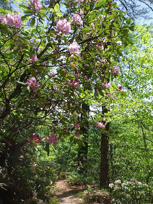
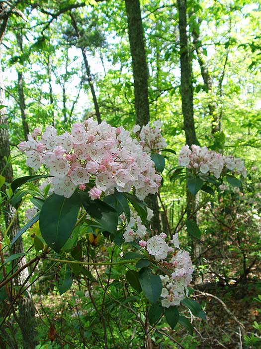
Having read about the Beards Mountain Hike (also in this park)...it recommended early June for the mountain laurel...
This beautiful white/pink flowering specimen almost rivals DC's Cherry Blossoms with its abundance and beauty...the Laurel was pleasantly Everywhere!
I am usually in agreement with the HU.com publishers on the ratings but I do not see how this hike can get only a "2" for streams...(it helps to have benefitted from a tropical storm skirting the area only a day or two prior)...
Naturally it is not Great Falls...but what about the Lake?
Blue Suck Falls was a miniature Crabtree Falls...very nice...
And after the descent...there was Stony Run...a comforting vision and a pleasantly noisy gushing sound after a rather demanding ascent...not to mention Wilson Creek...as soon as you get out of your car! People were fishing and swimming in it!
I would give it at least a 3...if not a 4...for "Streams"
I've seen better vistas...but only because of the vegetation growth which hides a lot of the panorama at Lookout Rock and Tuscarora...however the mountain laurel made up for it..
Altogether a tough...rewarding...lengthy day hike in a State Park nationally rated as Virginia's Best...even with the mountain bikers steeling the trail for what? two seconds? saw a total of four on this Sunday morning...shared Tuscarora Overlook with one...


