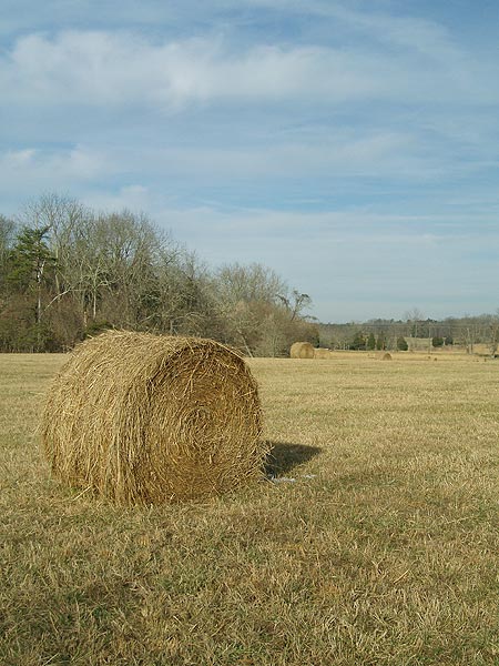
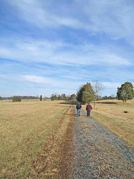
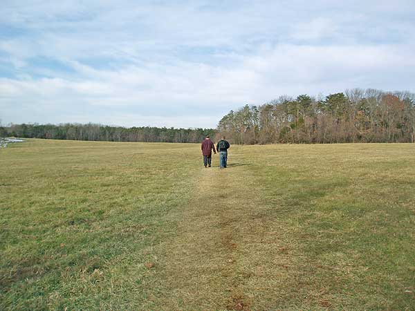
The Manassas Battlefield Park is steeped in history. The site of two major civil war battles the park has two main loops that pass many historic points of interest, including the spot where confederate General Thomas Jackson got his nickname 'Stonewall Jackson'. Within the rolling plains of Virginia the hikes here are appropriate for all ages.
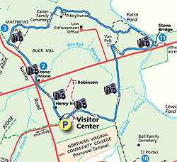
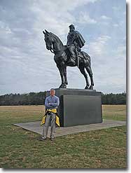
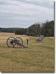
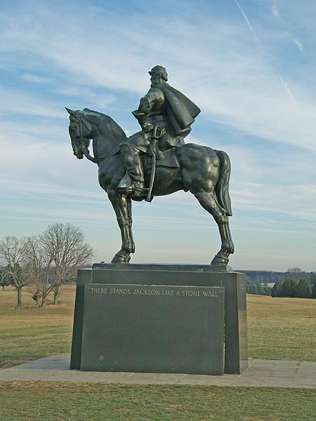
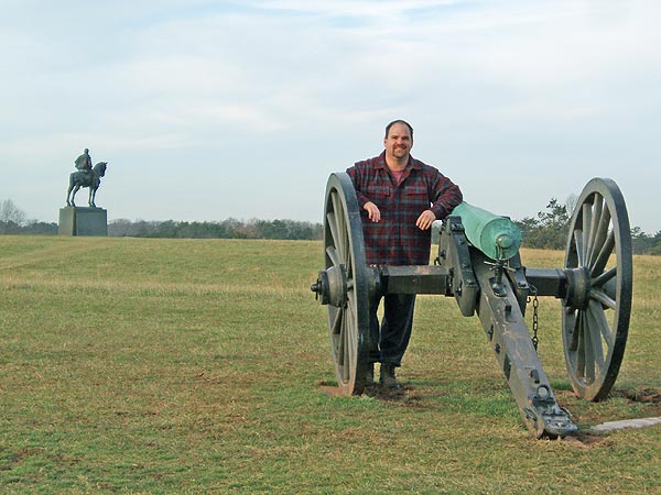
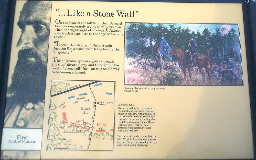
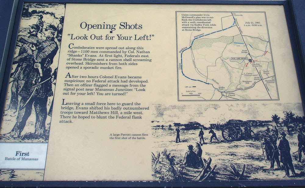
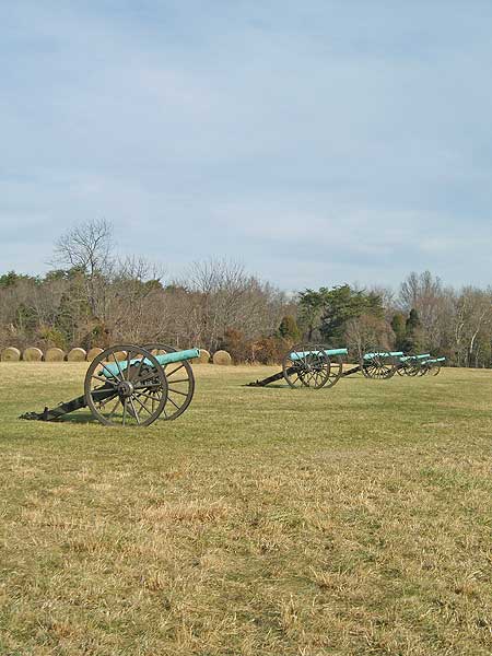
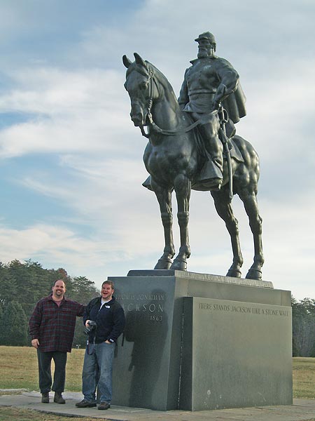
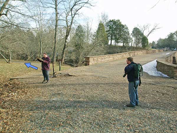
From the visitors center parking area walk over to the statue of General Thomas J. Jackson. This is where Brigadier General Barnard E. Bee, trying to rally his troops, pointed to General Thomas J. Jackson's line where the cannons now stand, and shouted 'There stands Jackson like a stone wall! Rally behind the Virginians!' From this point walk past to the cannons and line of trees where the main section of the blue blazed First Manassas Trail loop starts.
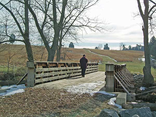
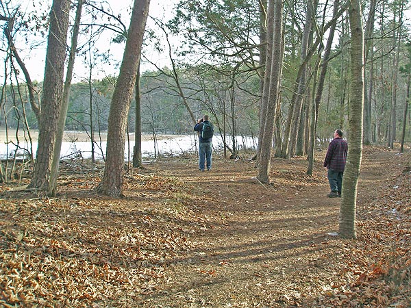
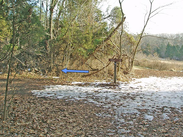
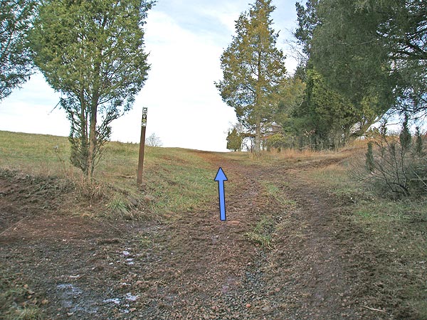
The Manassas Battlefield Park has many side trails, so remember, when you get to an intersection just follow the blue blazed (blue disks on posts) trail. Once entering the tree stand you will pass a clearing on the left in 0.2 miles, cross a wooden footbridge, and arrive at the first intersection in 0.5 miles.
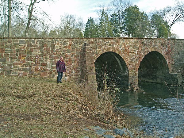
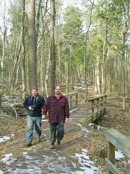
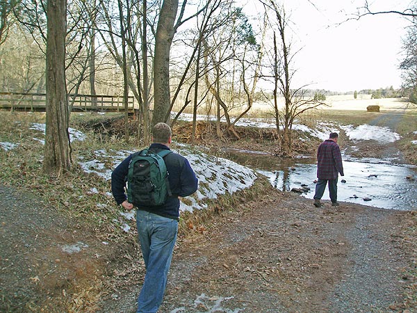
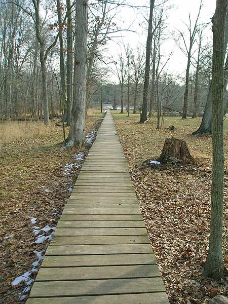
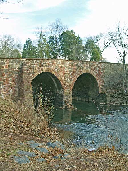
The blue blazed trail will now makes a hairpin turn to the right towards the Stone Bridge. After descending slightly, veering back to the left, then turning to the right again the trail passes through a low lying area and crosses a 0.2 mile wooded foot walk before arriving at the Stone Bridge and Bull Run.
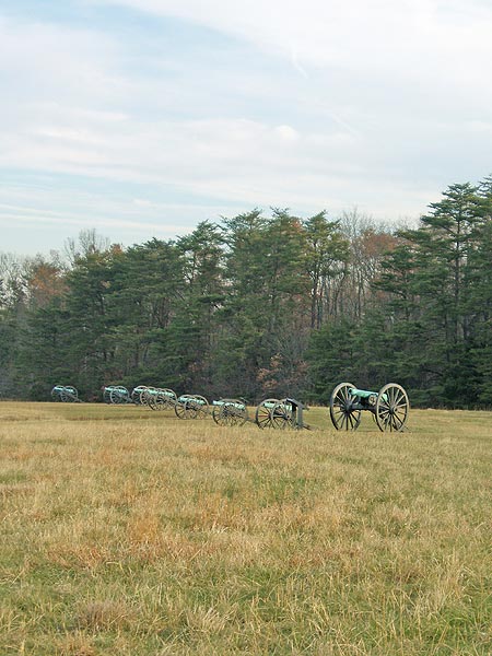
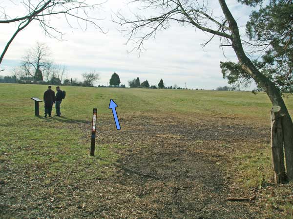
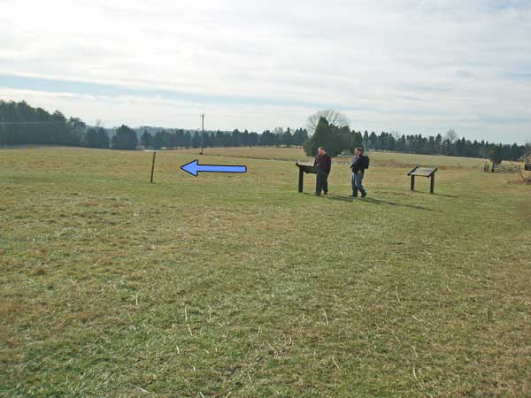
Do not cross the Stone Bridge, but turn left along Bull Run for 0.3 miles before the trail turns left uphill and exiting into another field. Continue to follow the trail as it passes through the field then enters a tree stand again and passing the Carter family cemetery in 0.2 miles. From the cemetery junction continue on the blue trail as it exits into another field in another 0.5 miles. Continue straight to the top of Mathews Hill and line of cannons.
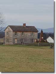
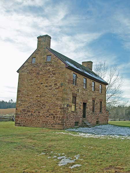
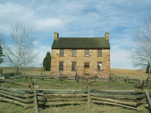
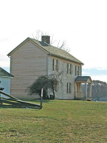
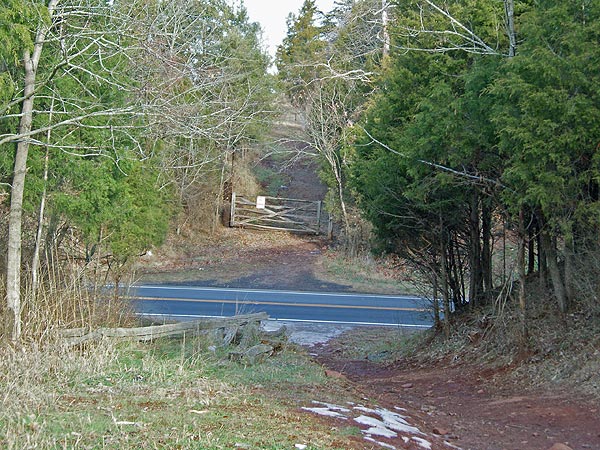
Turn left downhill past the canons through two fields before descending to the intersection of US29, Sudley Road and location of the Stone House which served as a field hospital in both battles fought here.
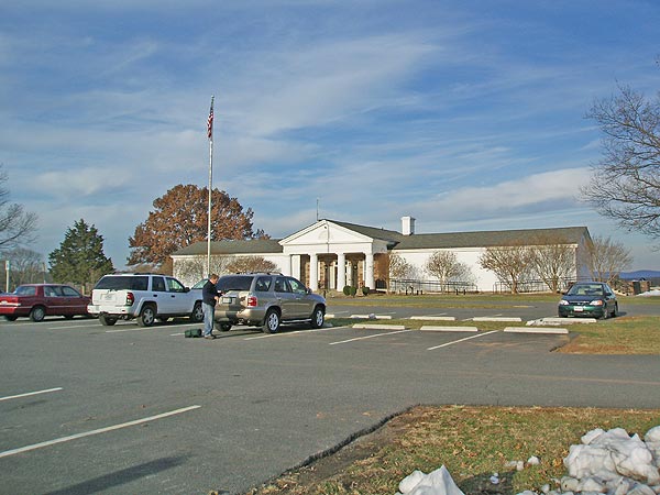
Cross US29 at the intersection following the trail over a wooden footbridge and uphill past the Henry House before arriving back at the National Park Service visitors center.
Late December
Manassas B.F. Bull Run Hike Comments
Archived Comments
By:Steve
Rating:
Date of Hike: Wednesday, May 4, 2016
The trail was in generally good condition, with quite a few muddy spots in the short stretch immediately next to Bull Run.
I read other reviews and see criticism of the trail markings -- I agree it could be confusing. The very first sign at the start of the blue-blazed trail near the cannons needs to be turned about 45 degrees -- I took off in the wrong direction right from the start. I didn't rely on the markers and, as with most of my hikes, made use of the downloadable Hiking Upward .gpx file and an iPhone app. (I use DeLorme Earthmate.) Not as accurate as a dedicated GPS device I think but close enough.
I see complaints about ticks -- saw none of those. The trail is part in the woods and part in open fields -- it's a nice mix. Historical markers along the way -- I learned quite a bit about the battles there. The visitor center was open and has a movie that starts each hour on the hour -- the timing didn't work for me to stick around and see it. The Hiking Upward description says there's a $3 fee, but I paid nothing and no one asked me for money. The nicest restrooms I've seen at any trailhead!
By:Cullen
Rating:
Date of Hike: Sunday, July 26, 2015
I hiked this particular trail of the battlefield many times.
I do agree with some other posts that the trails could use better marking. If you think the trails around First Manassas are bad, check out the trails for Second Manassas!
It does pay to bring a map and to know how to read a map.
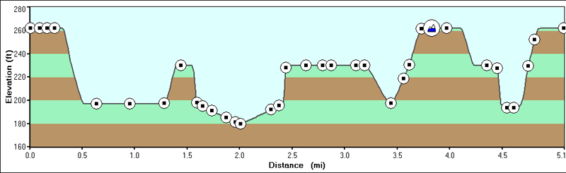
The route in this map is well-maintained and I'd consider it a fairly easy hike. There are some inclines but they are gradual and brief. For most of the trail, you're under tree cover and when you're on the hills, there seems to be a breeze most of the time, which is nice.
The trails are usually wide enough to allow for joggers to pass walkers or hikers, but just be aware that this is a heavily used park.
I would recommend getting there in the morning if you're going on the weekends because Manassas does get a good number of tourists.
Finally, I'll say that this hike is one of the more enjoyable hikes in the area. The terrain is interesting, and you'll get to read history along the way, if you so choose.
By:Margaret
Rating:
Date of Hike: Saturday, June 20, 2015
Oh, those waving wheat meadows. It's really pretty out at Manassas, and lots of birds! The woods are unremarkable but nice, and most visitors weren't venturing far from the historical attractions while I was there, so for a fairly busy park I had a relatively solitary hike.
Here is the thing. The trail markers are so bad it's comical, unless you forgot to bring sunscreen and you accidentally add three miles to your route because of your stubborn refusal to get a map. Get a map. It will still be confusing, but you probably won't get a horrible sunburn like I did. Ah, well. My favorite type of marker, encountered twice, was the type where there was a t intersection with a marker that featured a colored dot with the cute little icons of horse & rider, hiker, and bike, but with no arrow. . Hooray! The trail goes in two of these directions, probably! Good luck figuring out which two!
About halfway through I found a parking area with a map. I took a pic, which I referred to during the second half of my hike, but I still got more lost after that than I had before I had a map at all.
But still, it was gorgeous, and I saw a doe with two fauns and another doe by herself, a big black snake, and about a million larks, thrashers, and other birds.
By:Pendar Deleon
Rating:
Date of Hike: Sunday, May 25, 2014
Ticks, ticks and more ticks. 13 dog ticks and 4 deer ticks so far. I was covered with long pants and long sleeve shirt, rubber bands at the ends and had sprayed Deet on my clothes. Nice hike but you will be taking along hitch hikers.
By:Joshua C
Rating:
Date of Hike: Monday, January 20, 2014
It was good hike. Nice views of the battle field. What brought the hike down was the poor trail markings. I would do this hike again in the spring to see more birds and wild flowers.
By:Susanne
Rating:
Date of Hike: Monday, May 27, 2013
The scenery is really beautiful, but the trail is not marked well at all. We got lost several times and ended up walking back on 29 because we were fed up taking the wrong turns on non-marked intersections.
The ticks couldn't have been worse. We found several on our clothes and on the dog during the hike. When we got home, we searched each other for ticks and found even more. They definitely spoiled the hike!
By:Dave
Rating:
Date of Hike: Saturday, January 5, 2013
This hike is worth doing for the history alone. Pretty surreal to walk amongst the grounds of the first real battle of the Civil War and the place where Stonewall Jackson earned his name. I got there around 8:30 on a Saturday morning and the parking lot was full. If going just for the hiking/solitude the proximity to route 29 and 234 would really sour the experience as you're close to both for a good portion of the loop.
I did this as a trail run and it seems to be a really popular place for runners. For good reason-the trails are really well groomed and a nice mix of dirt and grass trails. If you're going for the first time definitely take a map or take a good look at the map before you start. As I was running I decided to forgo holding onto the map and just follow the blazes which turned out to be a mistake as the loop isn't marked very clearly. Blue blazes are also used for the bull run #2 loop which I mistakenly ended up on but didn't realize it for about a mile.
By:Mike
Rating:
Date of Hike: Saturday, November 3, 2012
I give this 5/5 stars not because of the trail itself, but because of the history and culture that is a part of it. I ran about 6 miles of this trail, and it's was a wonderful run. The workers at the Visitor's Center were extremely friendly and helpful, and described the route to me, and gave me free maps. Be sure to pay the nominal fee -- it's well worth the maintenance of this treasure.
If I had hiked this, I might give it fewer stars, but as a run, it was perfect. It was a nice variety of wooded areas, wide, grassy battlefields, and slightly technical slopes. I had to cross roads twice, but that's inevitable in a populated area. I stopped at a few of the markers to read about the history of the battle, and it was astounding to see the sheer size of the battle and how it covered so much ground and involved various skirmishes. I hadn't visited a Civil War battlefield since I visited Gettysburg 20 years ago, so it put things into perspective and greatly enhanced the running experience. Definitely check it out.
By:Valerie
Rating:
Date of Hike: Sunday, September 30, 2012
The weather was beautiful, there weren't too many people, & we had a wonderful time wandering through the trails in the fields & the woods, cutting through the bridle paths, & stopping at the historic houses, gravestones, & markers. Not totally flat, but quite minor elevation changes. We broke a sweat at times but were only a bit tired by the end. We brought a dog & it had fun too. Highly recommended if you want a real work-out you wouldn't stop so much, but then you'd miss a lot of history.
By:Meghan
Rating:
Date of Hike: Sunday, September 2, 2012
I hiked this trail with my dog this afternoon. We had never done this hike before and I was not sure we would like it. I am happy to say that I was way off. With the map and the abundant trail markings, it was a breeze to navigate. I would have given this an additional star however, I had to take one away because the trail crosses over Rt. 29 - twice. And one of those crossings requires you to run across 29...no light, no crosswalk. That is just an accident waiting to happen. There really should be tunnels under 29.


