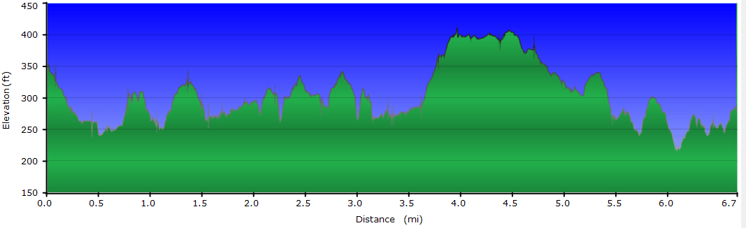
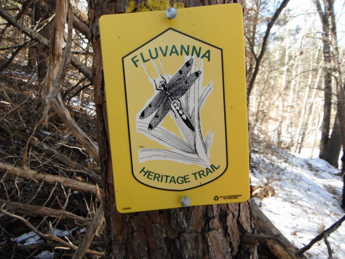
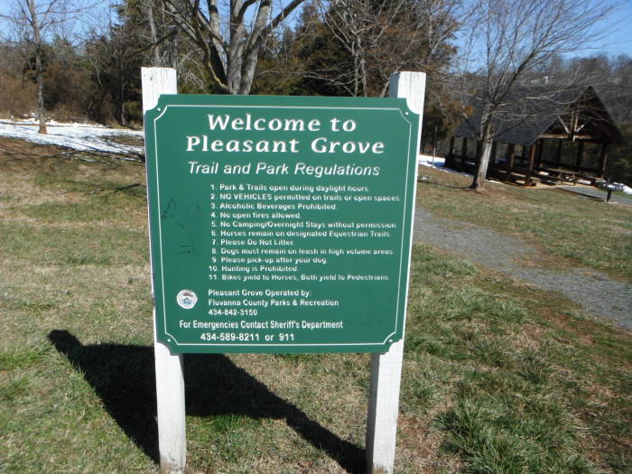
Near Palmyra, VA is Pleasant Grove, a beautiful 969 acre property owned by Fluvanna County with significant involvement by the Fluvanna Heritage Trail Foundation. The property contains miles and miles of hiking and horse trails following creeks and the Rivanna River. The main hiking trail is the Heritage Trail which mostly follows the river.
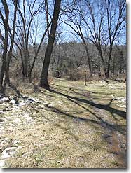
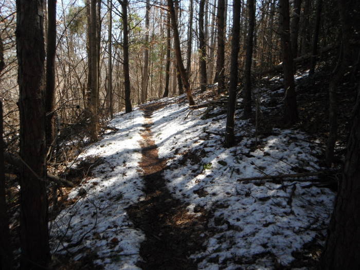
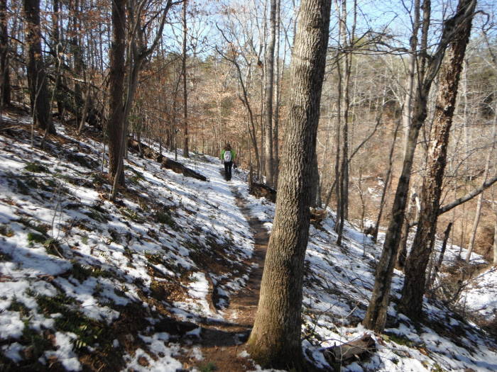
The trails meander through gentle woodlands, fields, creeks and the river. Located about 1 hour from Richmond VA, this is a worthwhile family friendly hike with great picnic facilities at the Eastern trailhead.
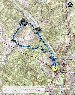
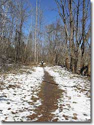
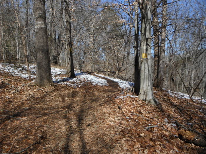
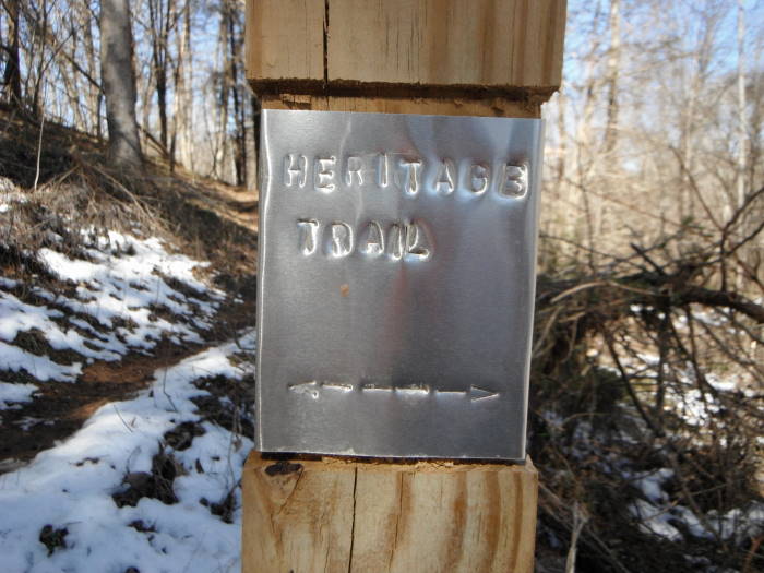
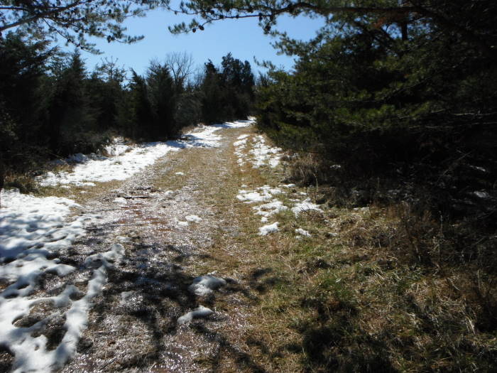
We hiked the Sandy Beach wheel chair accessible trail first which then ties back in with the Heritage Trail. The 4 miles of trail prior to reaching the Pole Barns will have 17+ trail intersections. When in doubt about which way to go, follow the Heritage Trail signs/arrows/yellow blazes.
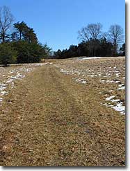
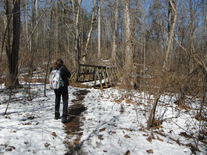
Mile 0.0 – The hike begins near the “Welcome Sign” at the end of the parking lot, very quickly reach Intersection 1, go right towards Sandy Beach.
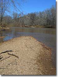
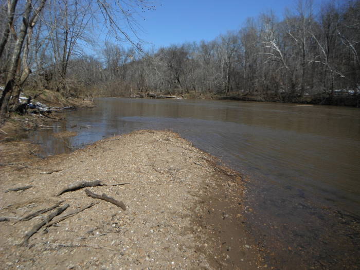
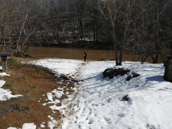
Mile 0.4 – Intersection 2, spur trail to river and beach. Return to intersection and bear right onto the River Bluff Trail. In 0.1 miles trail bears left, heading uphill.
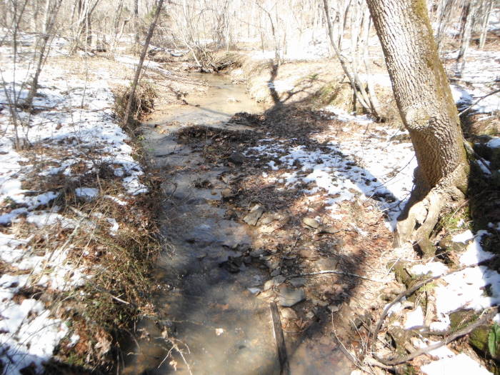
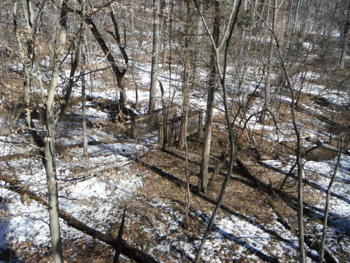
Mile 1.5 – Go through 5 more intersections and 2 bridges, just after the 2nd bridge turn right onto the HT at Intersection 9 (Deep Creek Trail). The loop part of the hike will tie back into this intersection with Deep Creek Trail later in the hike.
Mile 1.6 – Intersection 10 (Center Hill Trail), stay straight on the HT
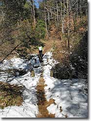
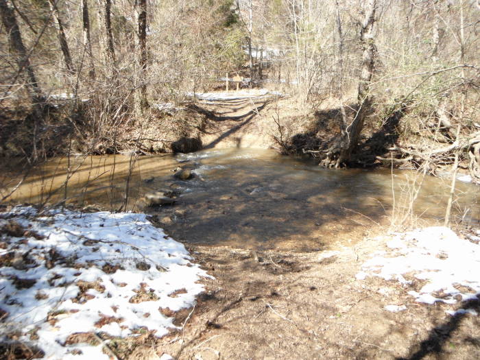
Mile 2.2 – Intersection 11, saw no named signs at this intersection but bear right and head down to creek with a broken bridge. There were “no biking” and “no horses” signs.
Mile 2.3 – Intersection 12 (Fern Hill Trail), stay straight on the HT. Cross 2 small bridges prior to reaching the River Bluff.
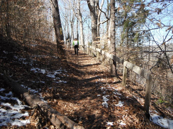
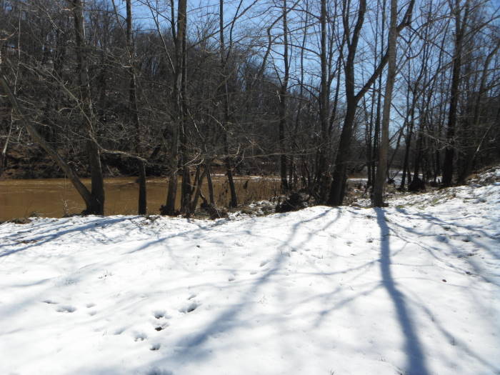
Mile 2.8 – River Bluff fenced area with views of the river.
Mile 3.0 – Intersection 13, bear to the left as indicated by arrow. I don't remember seeing named signs at this intersection.
Mile 3.2 – Intersection 14, bear to the left onto HT, trail is now following Burke Creek. I have a photo of the other trail names here but it turned out blurry so can't read them.
Mile 3.3 – Intersection 15, bear right to “Overlook”, do not head to barns yet. You will very quickly come to an overlook (more a viewing area) of Burke Creek. After going to the creek come back and bear right onto the trail, which is a shared horse trail at this point.
Mile 3.3 – Reach 2nd viewing area of Burke Creek. After viewing the creek bear right and in 100 feet reach Intersection 16, follow HT up to the Barns.
Mile 3.8 – Intersection 17 (Brush Arbor Trail), stay on the HT.
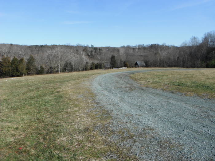
Mile 4.0 – Pole Barns, continue on gravel road through the middle of the barns.
Mile 4.1 – Cool old Chevy Dump Truck at edge of woods on the right.
Mile 4.3 – Fluvanna Heritage Trailhead Museum
Mile 4.4 – Cemetery
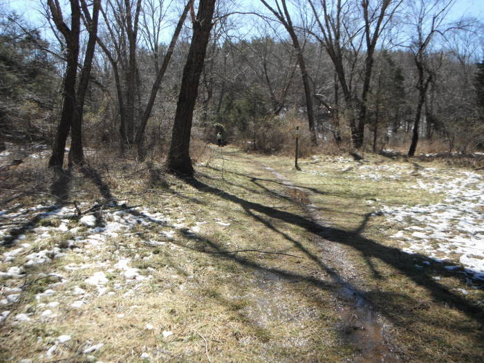
Mile 4.5 – At Paved Road, turn left towards Ballfields.
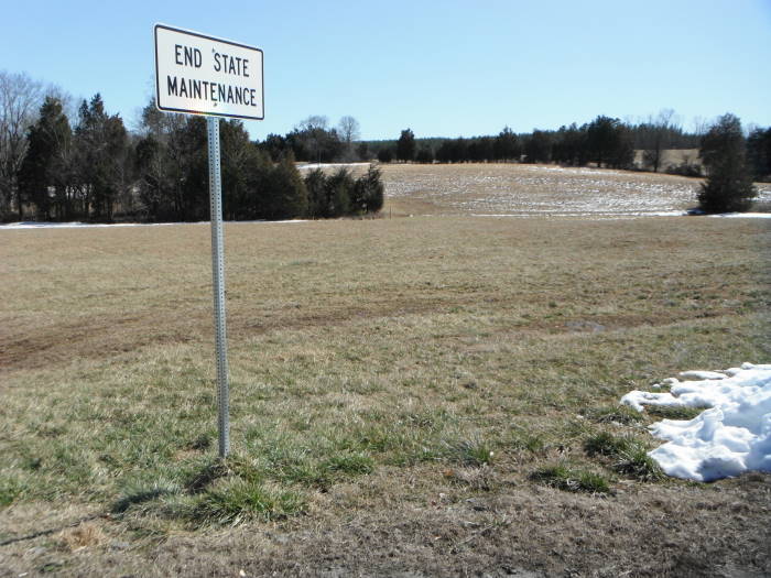
Mile 4.6 – At “End State Maintenance” turn 90 degrees to the right and head to trail post at edge of woods. At trail post for Rock Brook Trail, cross ditch/creek and follow trail along edge of woods
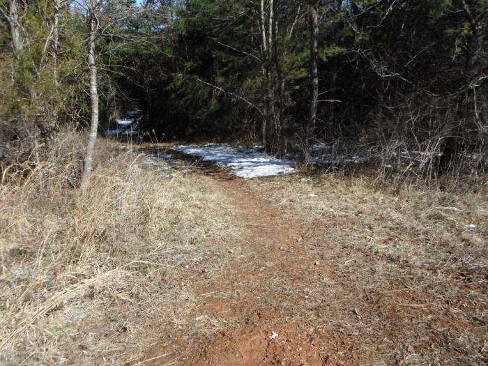
Mile 4.7 – Intersection 18, trail bears left into the woods. No sign here that I remember. Trail follows an unnamed creek.
Mile 5.4 – Intersection 19, bear left onto Beech Grove Trail.
Mile 5.5 – Cross creek and reach Intersection 20, bear right onto Deep Creek Trail.
Mile 5.6 – Intersection 21, bear right staying on Deep Creek Trail.
Mile 5.7 – Intersection 22, on left, bypass and then quickly turn right onto Intersection 09. You are now back on the Heritage Trail.
Mile 5.7 – Intersection 09. You are now back on the Heritage Trail. Stay on the HT until you reach Intersection 03 passing Intersection 08, 07, 06, 05, and 04.
Mile 6.3 – Intersection 03, this is the intersection you came up from earlier when you hiked the Sandy Beach trail. Do not turn left, stay on the HT.
Mile 6.4 – Intersection 23 (Horse Shoe Trail), stay straight on the HT.
Mile 6.6 – Intersection 01, bypass and head to Parking Lot.
Mile 6.7 – Arrive at parking area.
Mid March
Pleasant Grove Hike Comments
Archived Comments
By:hopeful
Rating:
Date of Hike: Thursday, February 15, 2018
We had had a lot of rain, and the trails were very swampy and muddy. We could tell the water had been flowing over the trail in some spots. We thought the walk along the river was beautiful. However, we would recommend starting the trail from the visitor center instead of the dog park so that you can get a trail map. (There may also be maps at the trail head at the dog park--we didn't think to look.) Basically it seemed like the directions were correct as far as which direction to turn. It was just the way they were written that were confusing--making it seem like you were getting off the HT trail when you were supposed to stay on it. The part about the broken bridge no longer applies as it looks like the trail has been rerouted around that spot. There was also one intersection that was not marked along Burke Creek after crossing a bridge. The trail goes straight across a river or left up a hill. It turned out up the hill was the correct one, but there were no trail markings for at least half a mile.
By:Newhiker
Rating:
Date of Hike: Sunday, April 16, 2017
My husband and I went hiking with our 20 year old son. We only saw one other group on the trail the entire time we hiked. Hike was okay not much to see. I didn't think it was very scenic. Good experience but I wouldn't go back to that trail....too many others to try.
By:Suzanne
Rating:
Date of Hike: Saturday, January 28, 2017
Hiked Pleasant Grove today with my over sixty hudsband and my son and his girlfriend (both millennials). We all loved it! Very peaceful and calm by the river, and hiked along the water for most of the hole. Trail is well marked. Muddy in a few spots. Would be beautiful in the Spring.
By:Wanda
Rating:
Date of Hike: Friday, January 27, 2017
The instructions above are no longer valid. Some of the trails are not there any more. Trails are well marked to the overlooks but not so well after that. I recommend getting a trail map from the Fluvanna heritage trailhead museum.
By:Jessie R.
Rating:
Date of Hike: Sunday, September 11, 2016
This is a well maintained trail with very few other hikers. It is not too far off 64 and was well worth the 50 minute drive from Richmond. We took some of the other trails here to make a bigger loop. It ended up being about 10 miles but it was easy terrain so we were able to do it in 4 hours despite being wildly out of shape. There were some good benches along the trail where we were able to stop and take lunch. Saw some nice wildlife, almost stepped on a black snake and later were surprised by two deer that were within 15 feet of us. Came across one group of hikers with off leash dogs, who were able to grab their dogs before they greeted us, then a group of people on horseback. Those were the only groups we saw. I found a few seed ticks on my dog when we got home so watch out for that. Definitely would go back!!
By:Rick & Martha
Rating:
Date of Hike: Saturday, April 23, 2016
My fiancé and I (both in our mid-60s) hiked this easy trail on a beautiful day. There was a little bit if elevation change, but nothing too strenuous. Family-friendly, yes, but instruct your little ones ahead of time about how to identify poison ivy, as there was a ton of it. Especially hard to avoid when the normally wide path narrowed to 12 in some places.
Bring along a printout of the instructions provided above, as the trail is sometimes unmarked at various intersections. There were a couple of places where we were unsure. At mile 3.0 and 3.2, the instructions say bear left, but we turned right because of the Heritage Trail markers. Also, we did not see any pole barns along the gravel path, but we did see cultivated grape vines instead in that spot. It took us 4 hours, 25 minutes, and we only stopped 4 times for a couple of minutes. We were slowed down at a point near the trailhead where several trees had fallen and blocked the path at one point. Navigating this took us an extra 6-7 minutes each way. All that said, we very much enjoyed this hike.
By:Shari R.
Rating:
Date of Hike: Friday, August 21, 2015
I hiked this trail with my boyfriend and this was a pretty nice hike overall. Nothing too difficult, but a great trail to explore on a nice day. We actually ended up trail running parts of it, so if you are interested in trail running, this would be a nice trail for that. The directions were a little confusing to follow and we ended up mainly just following the signs for Heritage Trail. At one point, the hike does open up to some fields, and at this point we had to refer again to the directions to re-orient ourselves with the trail. However, we had a great time and I would recommend this to others if you are looking for something mellow but pretty.
By:Long Beard
Rating:
Date of Hike: Sunday, January 25, 2015
My wife and I chose this hike because #1, it was close to home and #2 she wanted her dad to come along for an introduction to hiking. It is not a challenging hike so it was perfect for him. The trails were well marked early in the hike, starting at the East end. However once you hike past the house /museum (which is a must see to learn a bit of history) the trails are a bit hard to follow across the fields. Print the map from here, it is helpful. The Beech trees were very pretty along the trail. If you are not from the area this hike will leave you with a pretty good idea of what typical central Virginia woods look like.
By:midlodayhikers
Rating:
Date of Hike: Saturday, February 22, 2014
Great trails if you are looking for a place to walk your dog off-leash. The sign at the dog park entrance asks you to leash pet in high volume areas, which we did when we stumbled upon the playground/ball fields. We misread the HU trail directions and got off the Heritage Trail too early. When we got to the ball field we were able to find the trail back towards our starting point, but again took a wrong turn and wound up at library. We walked a short distance on Rt. 15 back to car. Some trails extremely muddy due to recent snow/rain. Lots of unmarked trails that intersect make it easy to get lost. We printed the Fluvanna County Park map, but even it does not show all the trails. Overall, a very enjoyable walk that included a river, woods, creeks, and open fields.
By:Russ
Rating:
Date of Hike: Sunday, October 27, 2013
Today was more like a stroll in the woods, not a hike. Pleasant Grove is an easy hike, perfect for taking your dogs, especially if they like to swim. The trails are well marked. We mostly stuck to the trails blazed for horseback riding. There were very few people in the park so we were by ourselves most of the day and the dogs had plenty of off leash time. No vistas, but the photo opportunities were plentiful.


