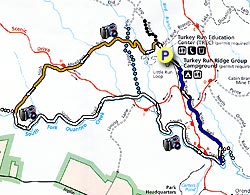
The Prince William Forest Park established in 1936 has 37 miles of trails on it's 15,000+ acres, and is the largest protected natural area in the Washington, D.C., metropolitan region. The circuit hike we have mapped here is just one of many possible combinations in it's vast trail system.
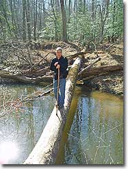
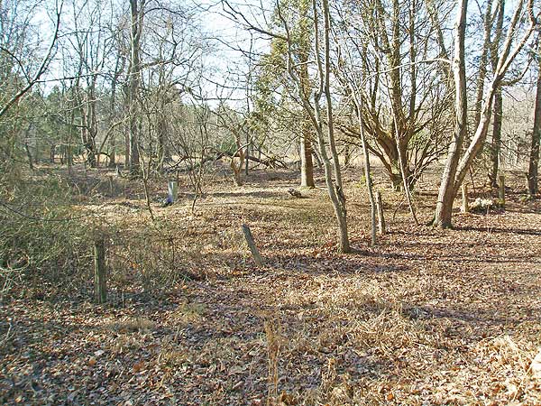
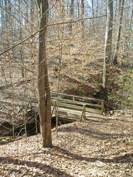
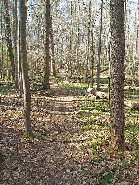
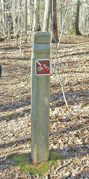
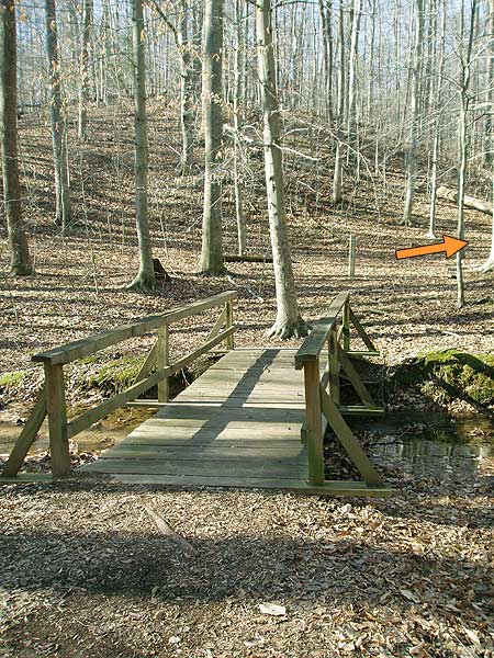
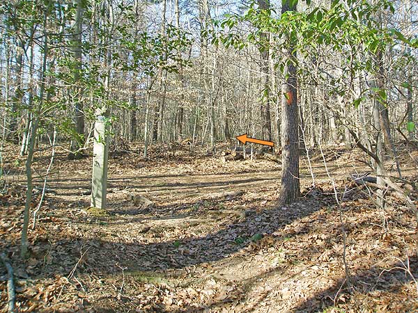
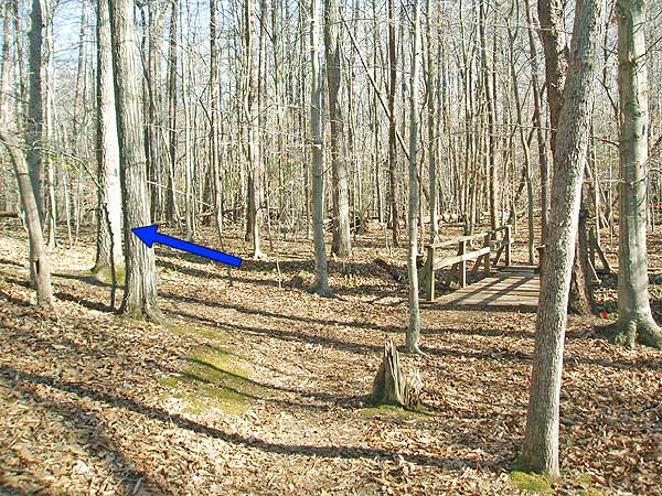
Follow the High Meadows Trail for 0.2 miles before crossing the first of many small streams over a wooden footbridge. Immediately after crossing the footbridge turn right at the concrete post, and trail junction, continuing along the orange blazed High Meadows Trail. In 0.2 miles cross over the blue blazed Taylor Farm Road (path) staying on the orange blazed trail. In 100 yards pass a very small cemetery on your left.
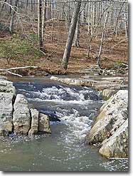
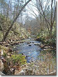
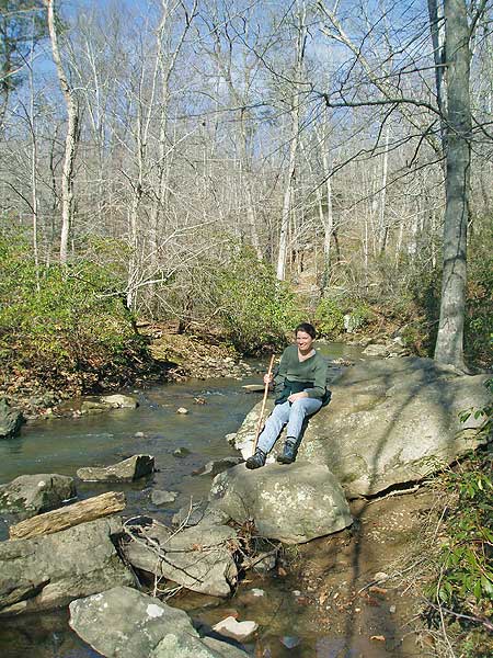
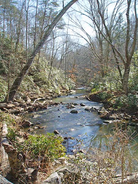
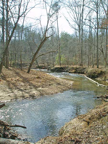
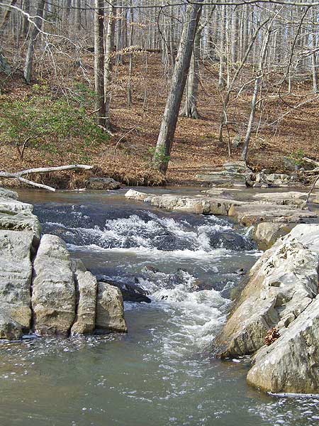
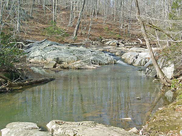
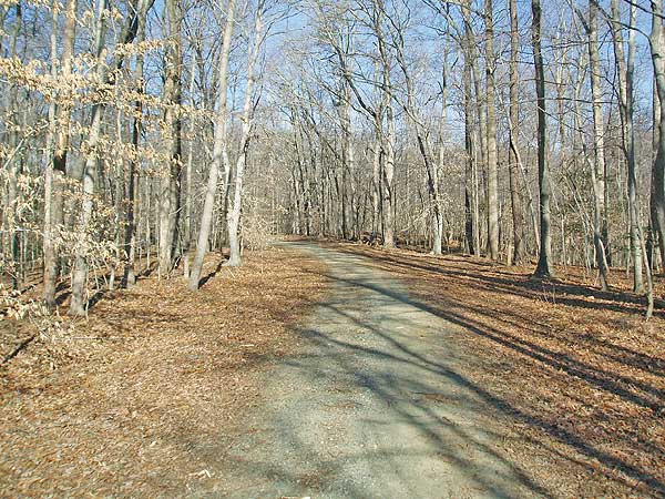
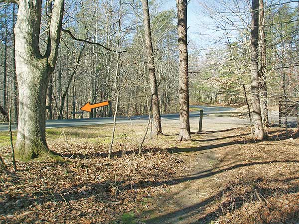
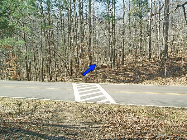
Follow the orange blazed High Meadows Trail for another 1.0 miles and cross Scenic Drive. From the other side of the road the High Meadows Trail continues for 0.8 miles where it ends the junction of the South Valley Trail and south fork of Quantico Creek. The concrete post trail markings at this junction are confusing, just continue straight on the now white blazed South Valley Trail, shortly turning left up wooden stairs then continuing along the left bank of the creek for 1.7 miles before re-crossing Scenic Drive.
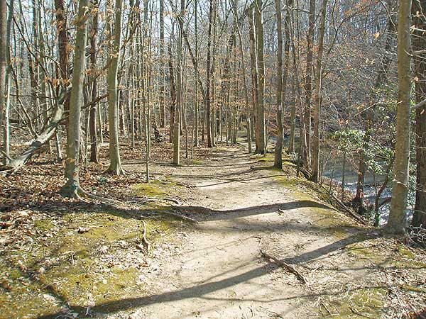
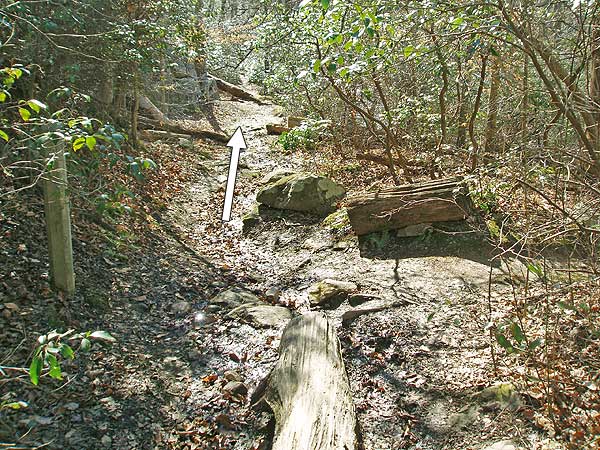
In 0.1 miles past the road pass the Taylor Farm Road Trail on your left, then going underneath Scenic Drive in another 0.2 miles. Continue along the white blazed trail following the stream for 0.3 miles where the trail ascends a small hill for the steepest part of the hike. The remaining section of the white blazed South Valley Trail is the busiest portion of the hike as the trail is easily accessible from three parking areas on Scenic Drive.
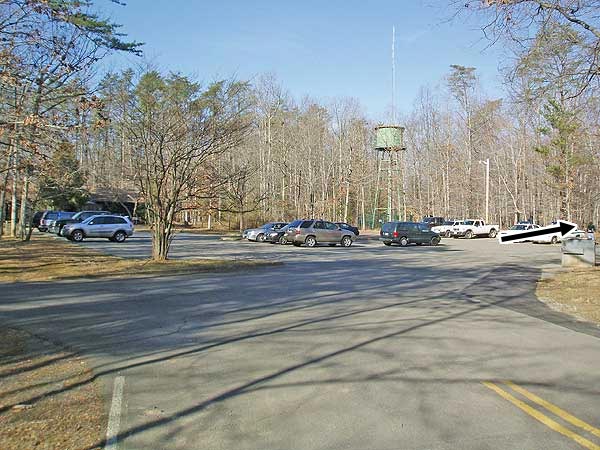
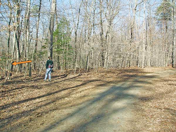
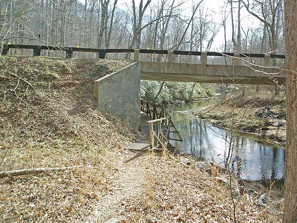
In 0.7 miles the white blazed trail crosses Scenic Drive again, and in 200 yards, and just before a small wooden footbridge, turn left on the blue blazed trail. There is no concrete trail post here. Immediately turn left uphill on the blue blazed Turkey Run Ridge Trail. In 0.6 miles cross Scenic Drive for the last time and follow the blue blazed trail for the remaining 0.7 miles back to the Turkey Run Education Center and parking area.
Late January
Prince William Forest Hike Comments
Archived Comments
By:Stacey
Rating:
Date of Hike: Saturday, November 17, 2018
We did this as a two night hike. We did both North and South valley trails. It was a great trail, but very, very muddy. The South valley trail needed some new blazing. It was only blazed good closer to the visitors center. The trails had some good hills. I will definitely be back.
By:JD
Rating:
Date of Hike: Saturday, October 20, 2018
This is a solid "beginner+" hike. It's more challenging than just a stroll through the woods but not as technically or physically demanding as some of the hikes out in the Shenandoah. We did the whole thing in about 3.5 hours with only brief pauses for water and to enjoy some of the scenery. I would definitely recommend this as a decent training hike for anyone gearing up to tackle some of the more demanding trails in the region.
One quick note regarding the switch from the white to blue blazed trail. It's a little confusing at first glance, because when you make the hard left turn you'll see blue blazes going in two different directions. You want to take the left option heading back up the hill.
By:Bobby
Rating:
Date of Hike: Tuesday, October 24, 2017
I really enjoyed this hike! It was a beautiful day and I only wished that the autumn colors were more vibrant instead of brown or dull but that is because the rainfall has been low. It did rain the night before though which made going over some of the rocks quite slippery. I only saw one other hiker and one fly fisherman which made it seem like you were the only ones there, very nice!
By:Jeremy
Rating:
Date of Hike: Saturday, September 9, 2017
My buddy and I wanted to go on a day hike and we were looking in the Shenandoah because we are very experienced in that area. However, after learning he was on-call this weekend we needed somewhere close to the metro DC area. I was very pleasantly surprised at the quality of this hike. It isn't the most challenging hike, but it is a very beautiful area and definitely more than your average stroll in the park. We wound up making a few changes to our hike path due to time concerns, but the map the rangers provide at the visitors center is very helpful once on trail and we were able to navigate without a problem.
I will say this however: it can be a bit confusing finding parking/the beginning of the trail. The signs around the park do not indicate clearly what buildings are which and landmarks can be hard to find. The trails will also occasionally have wooden poles off the trail that are marked orange and can be confusing where the orange blazed path actually leads. Pay no attention to these posts, the blazes on the trees is all you need to pay attention to.
Otherwise, great hike and I will be returning!
By:DC Hiker
Rating:
Date of Hike: Sunday, June 19, 2016
Great hike in close proximity to DC. Got there mid-day and did the full loop in 3.5 hours (15 min. stop for lunch). We didn't see too many other hikers. Helpful route description. Enjoyed it, and decided to do it again in the fall!
By:Heather & Scott
Rating:
Date of Hike: Saturday, January 16, 2016
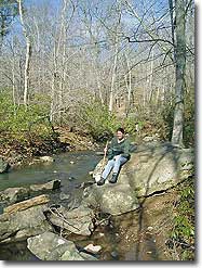
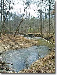
We did this as a trail run on the Saturday of MLK weekend. Even for a holiday weekend, the trail was remarkably empty (except for the small section noted in the description that is near the parking lots). The weather was incredibly warm for January, and, even though it had rained the previous day, the trail was hardly muddy at all. For being so close to the DC area and its suburbs, the Prince William Forest seems both secluded and remote. The forest has some beautiful scenery to look at between the trees, the creeks you must cross, and the little Quantico River. The trail is very well maintained, and thanks for the tip about the confusing signage when switching from the orange to the white trail. We'll definitely be coming back for another run!
By:Mollie
Rating:
Date of Hike: Tuesday, January 12, 2016
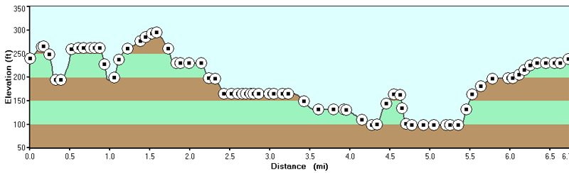
I did this hike as a trail run beginning at parking lot A. From Parking Lot A the trail climbs steadily until it crosses the paved road. After that it becomes more rolling hills until the The High Meadows Trail again crosses the paved road. The run from parking lot H down high Meadows to the junction with The South Valley Trail and along through parking lot I is one of my favorite segments in the park to run. The trail is challenging, moderately technical, and very scenic. Aside from one large hill before the trail to parking lot C the rest of the trail back to parking lot A is mostly flat and easy. My GPS did say that the trail was closer to 8 miles than 7 FYI. Reception is spotty in the park so some variance could occur.
By:NH_Hiker
Rating:
Date of Hike: Saturday, November 14, 2015
Did the variation of this hike found in AMC's "Day Hikes in the Washington, DC Area", where we started the visitor's center and looped back down along Quantico Creek past the Pyrite Mine.Ā It was roughly the same length (8.0 miles or so), so I would recommend that one too.Ā Took around 3.5 hours.Ā I loved PWFP, it was a gorgeous place so close to DC.Ā It was a great half day in the woods, will definitely be back in other seasons (would also like to do trail running there, the trails seem great for that)
By:2 Hikers
Rating:
Date of Hike: Sunday, March 22, 2015
We did this hike today.Ā Weather was a bit cool, but OK.Ā This is a very good hike.Ā Was our first time hiking in PW Forest Park.Ā Enjoyed it a lot.Ā Nice change of pace from the typical mountain hikes in Shenandoah.Ā It's a pretty easy hike, with just a few fairly short steep parts.Ā The rest is either flat, or gently rolling.Ā The trails are well maintained, and mostly smooth (rock free).Ā Saw very few people.
Will do this one again!
By:Donna Adams
Rating:
Date of Hike: Friday, March 13, 2015
Great hike with variety, and surprisingly empty. It seemed we had the entire forest to ourselves. The river was a highlight. Not too strenuous but certainly a good workout. Will definitely go back to explore other areas.


