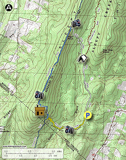
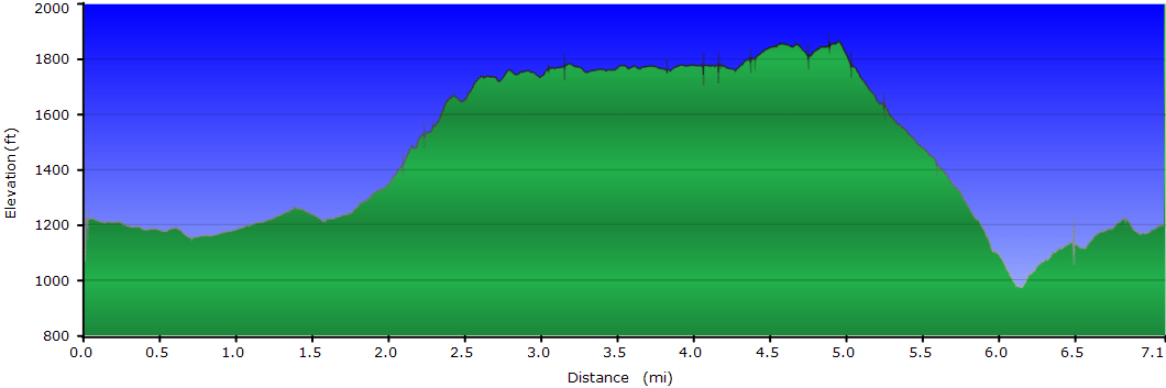
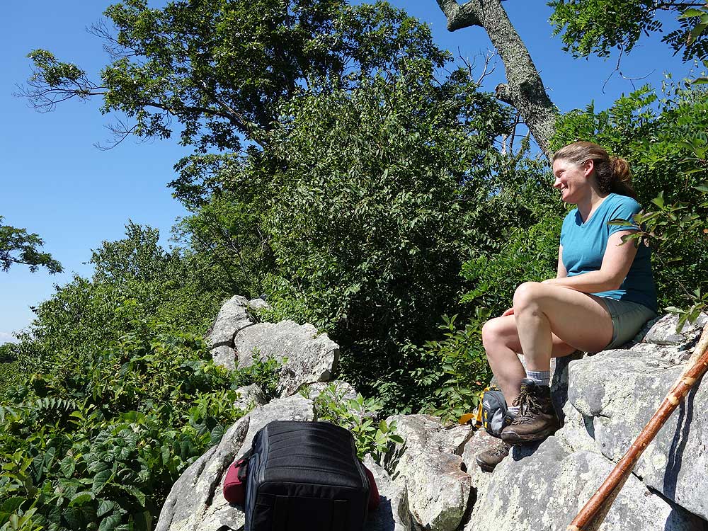
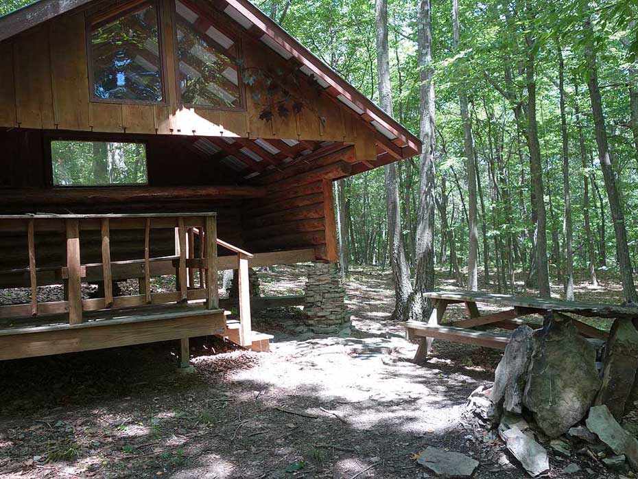
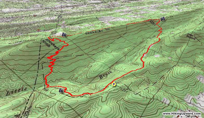
The Sleepy Creek Wildlife Management Area in West Virginia has a robust trail system. This 7 mile circuit passes several highlights of the area, including the High Rock Overlook eastward towards Virginia, as well as a beautiful view to the west from the Tuscarora Trail of Morgan County WV. There are no views from tree covered Shockeys Knob, however it does have one of the best shelters around with a spring close by. The hike also makes for a great backpacking weekend by camping at the shelter.
If you're looking for a shorter hike, the out and back to High Rock Overlook using the white blazed High Rock Trail is a great option. That route is a total of 4.9 miles and 690 feet of elevation gain.
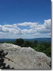
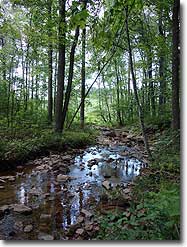
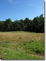
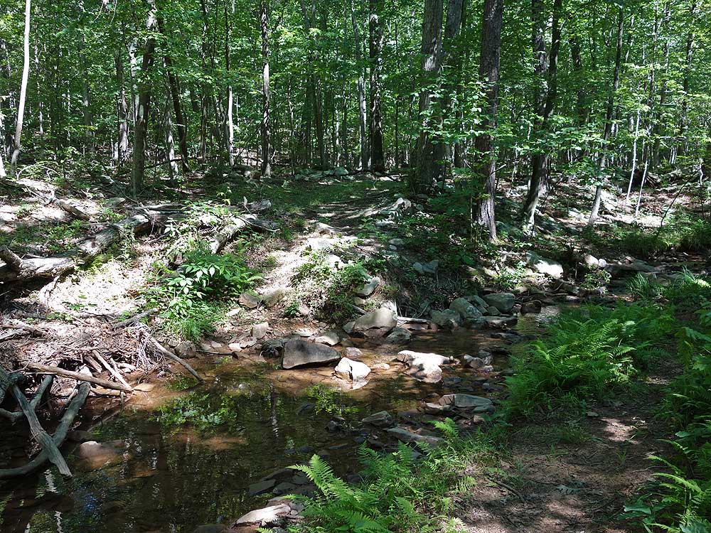
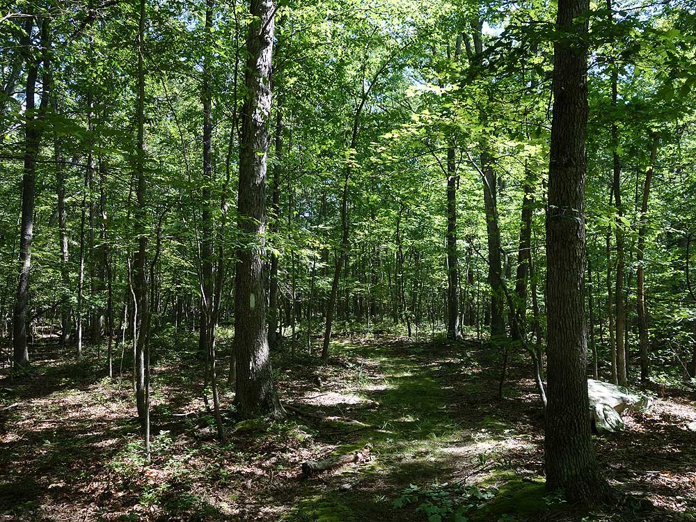
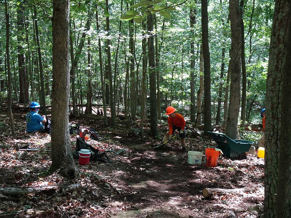
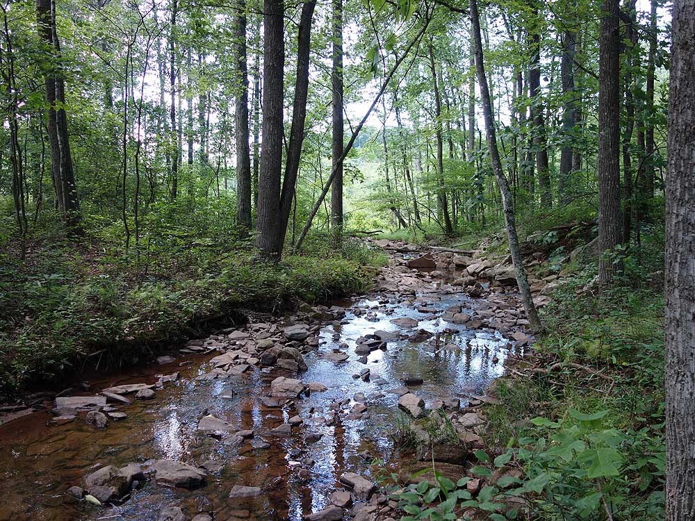
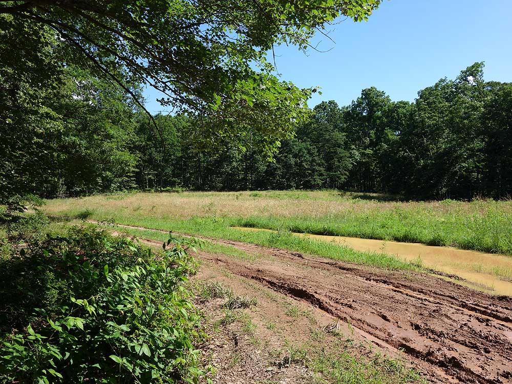
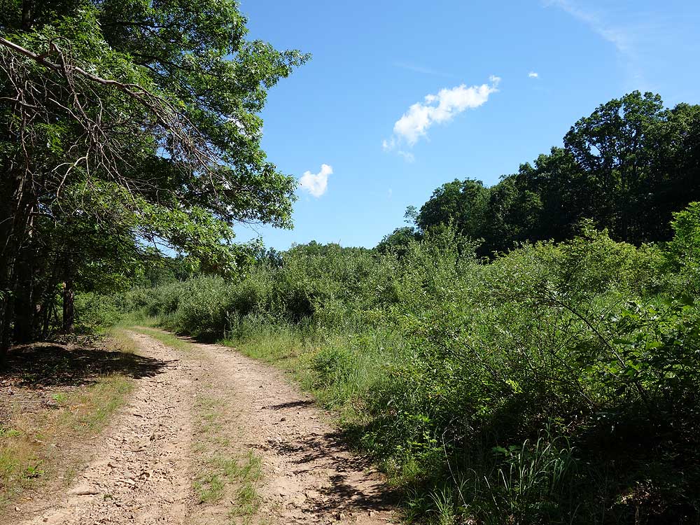
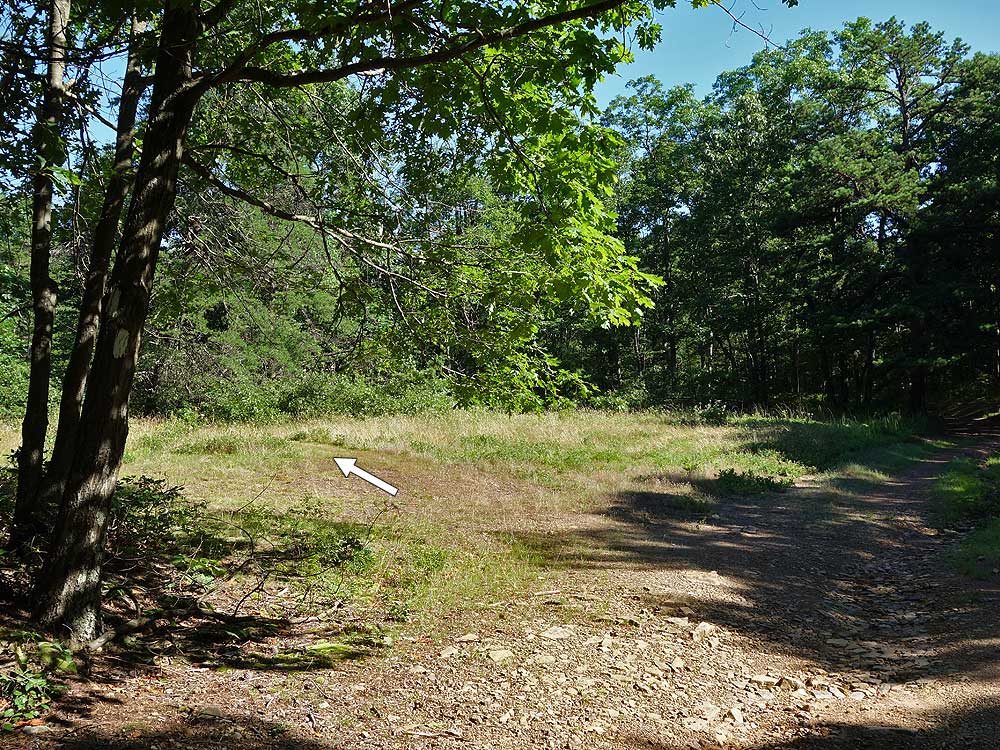
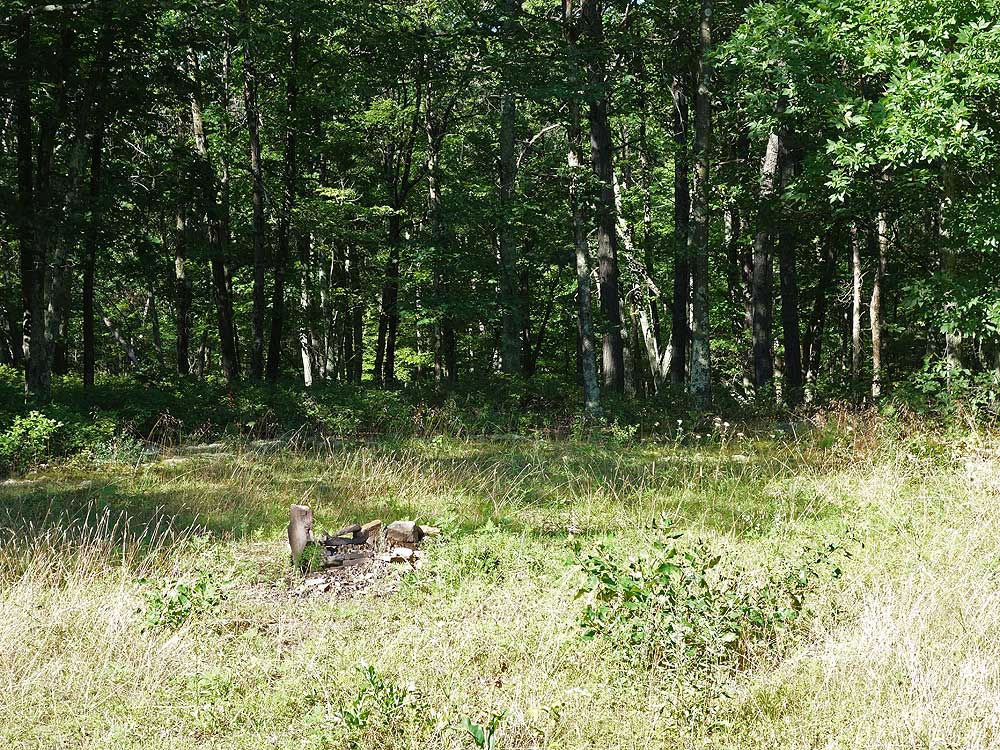
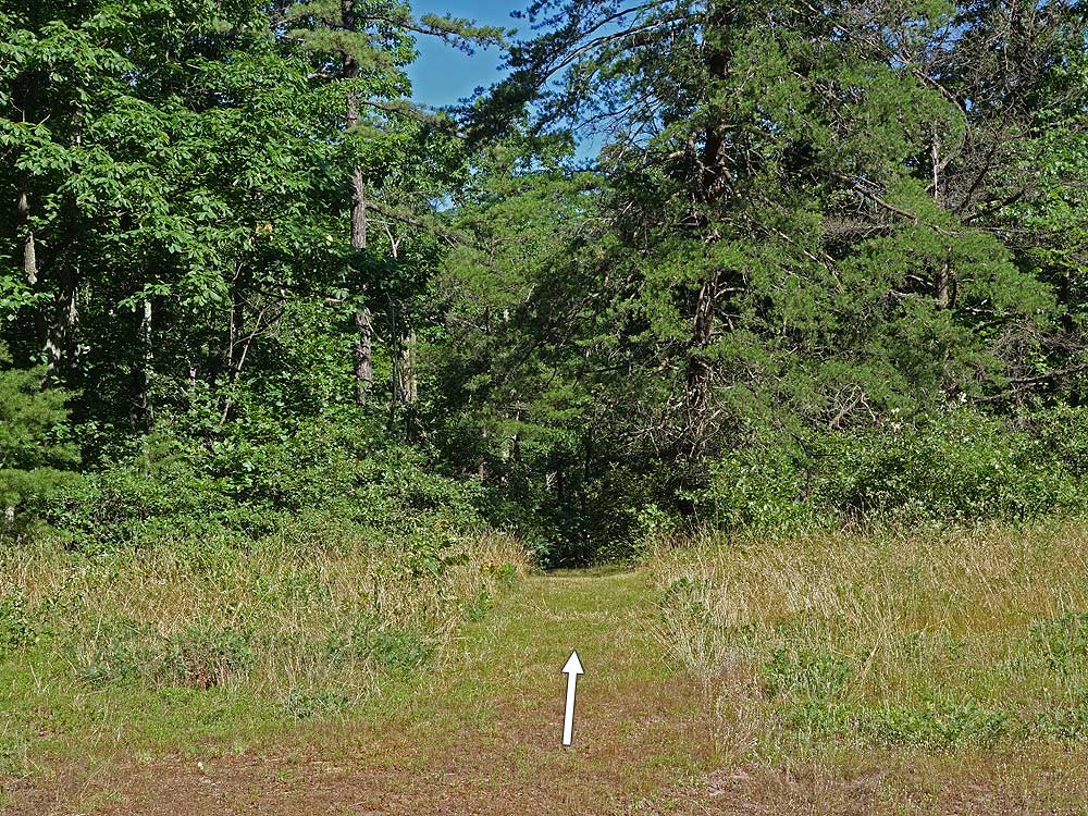
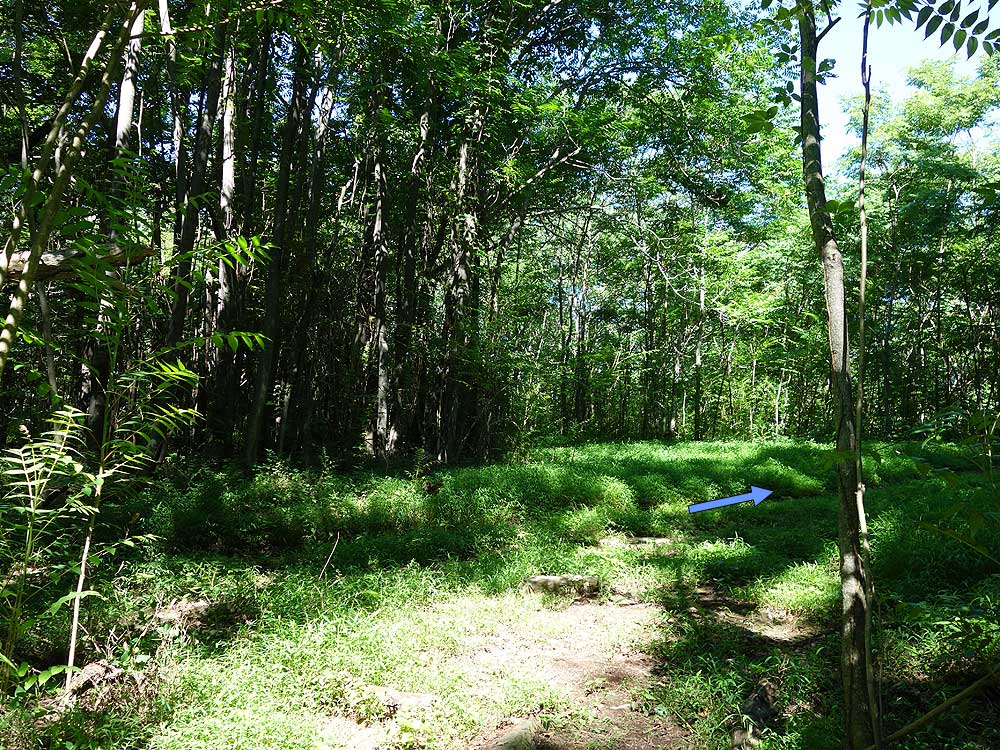
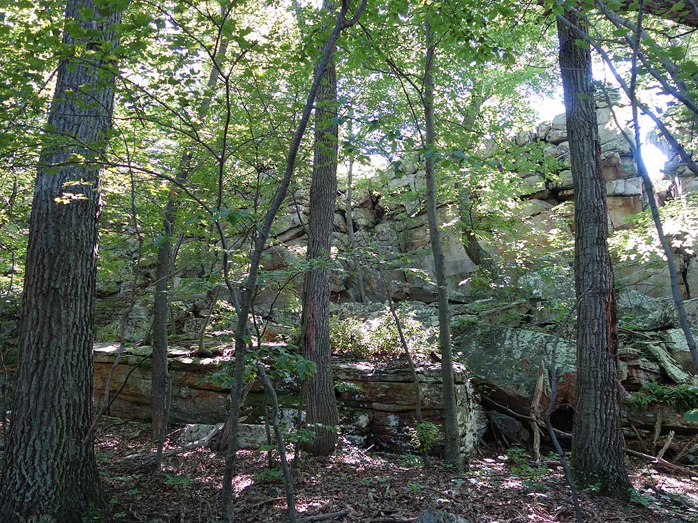
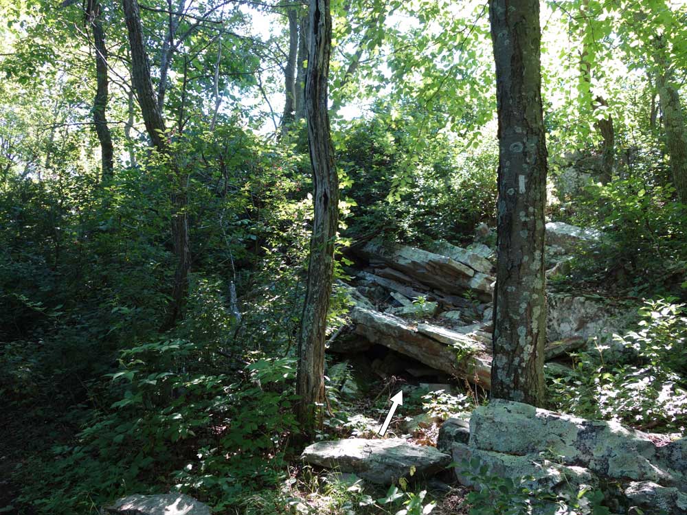
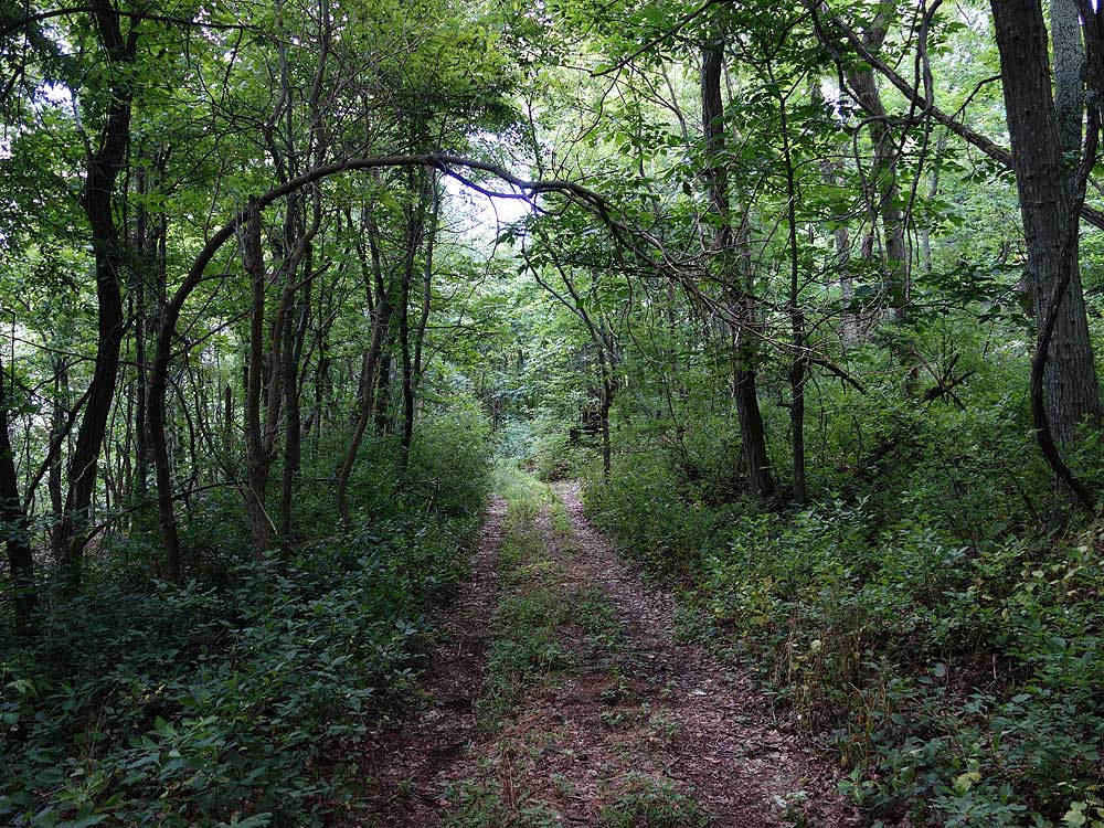
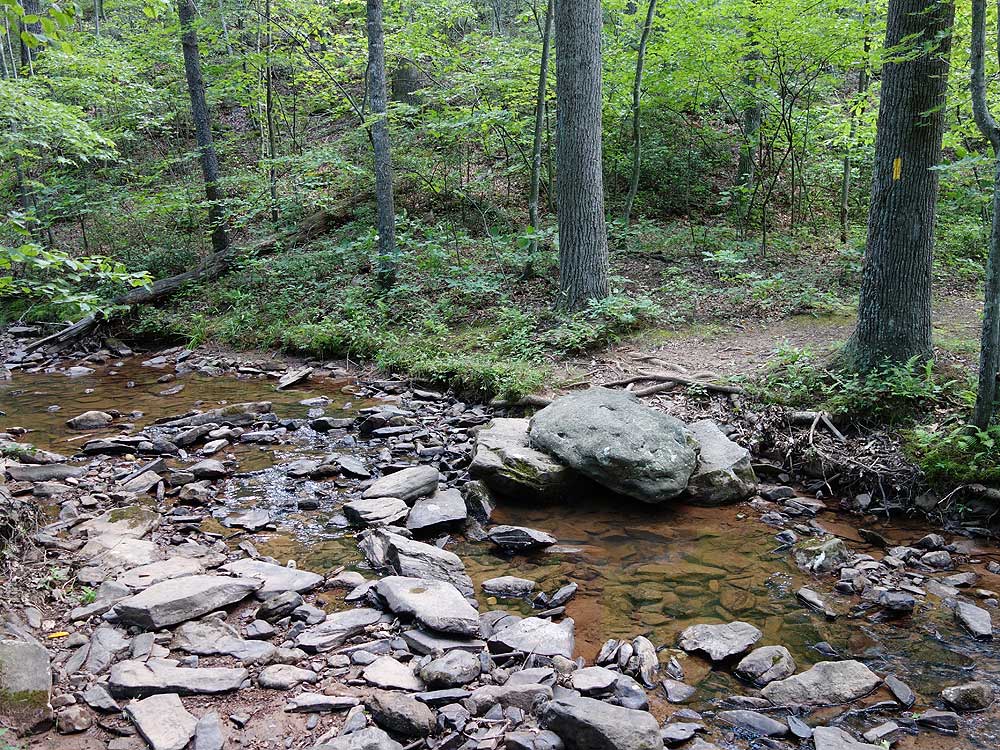
Mile 1.3 - The High Rock Trail passes a small campsite in the clearing before re-entering the forest between a stand of pine trees. The trail descends and crosses Little Brush Creek. Follow the trail through a mossy area where it turns left uphill. This rerouted section of trail was completed by the Cadillac Crew from the Potomac Appalachian Trail Club in June 2017. This new section of trail reroutes what was a very steep section of trail. The High Rock Trail will rejoin the older section at 2.0 miles and become steeper. Continue uphill for another 0.4 miles where the High Rock Trail ends at the ridge and intersection with the Tuscarora Trail.
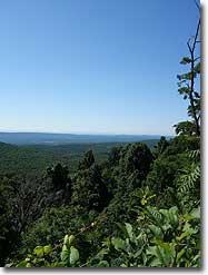
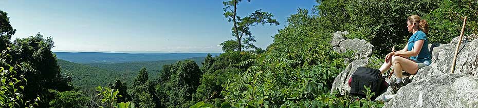
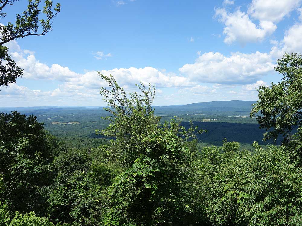
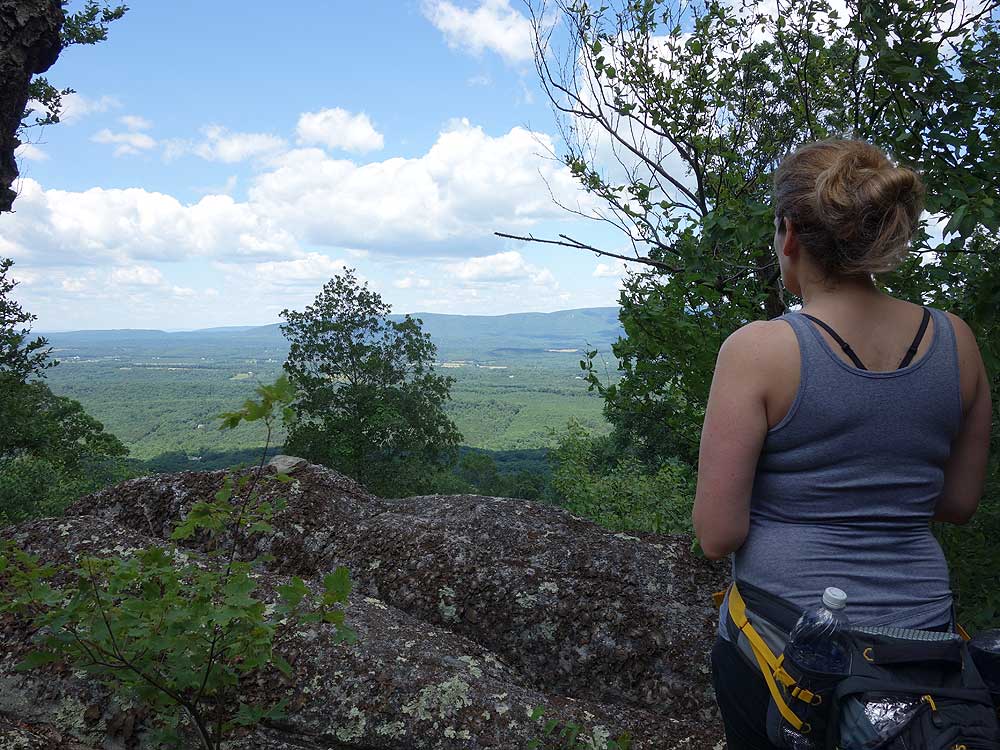
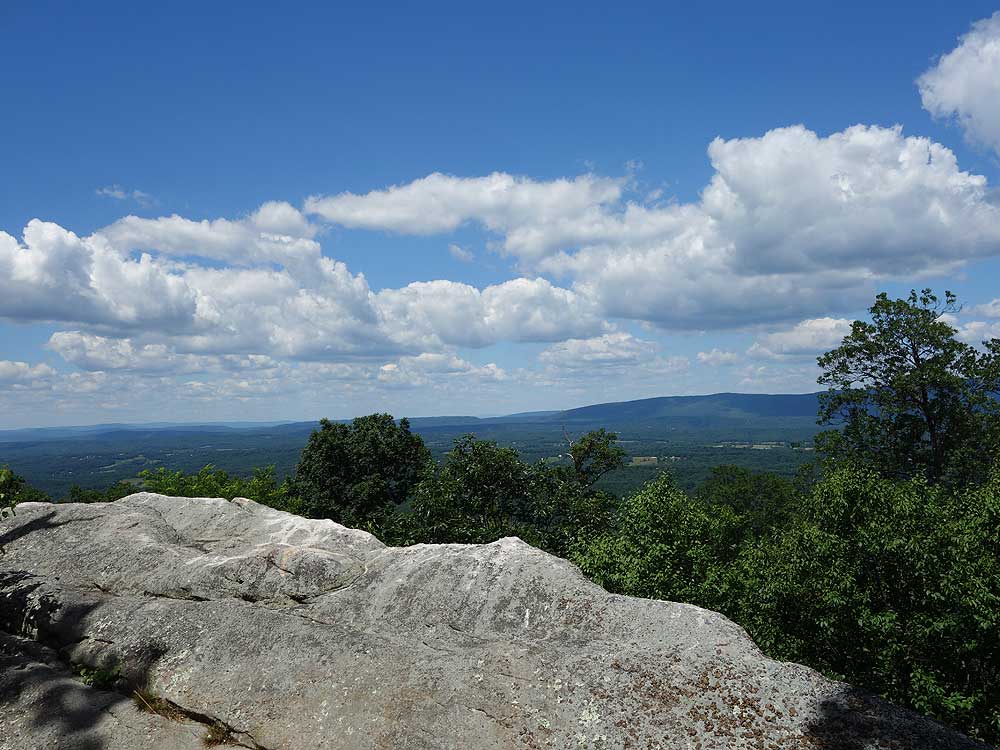
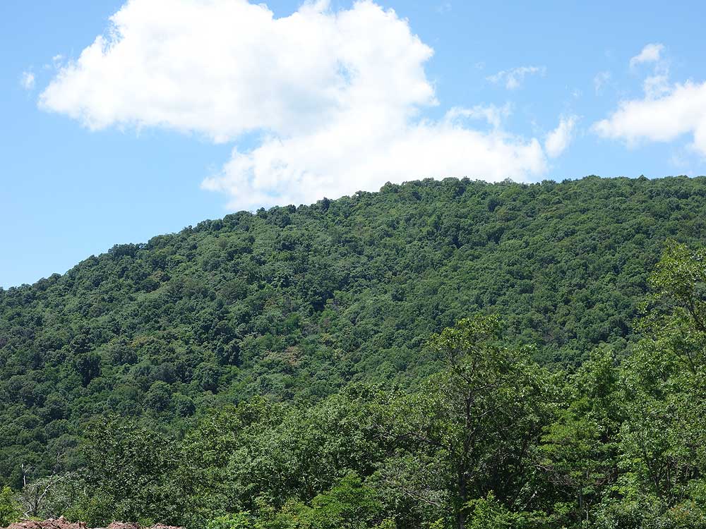
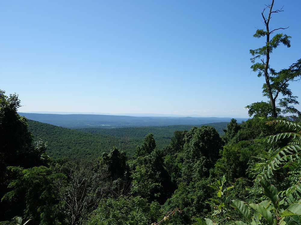
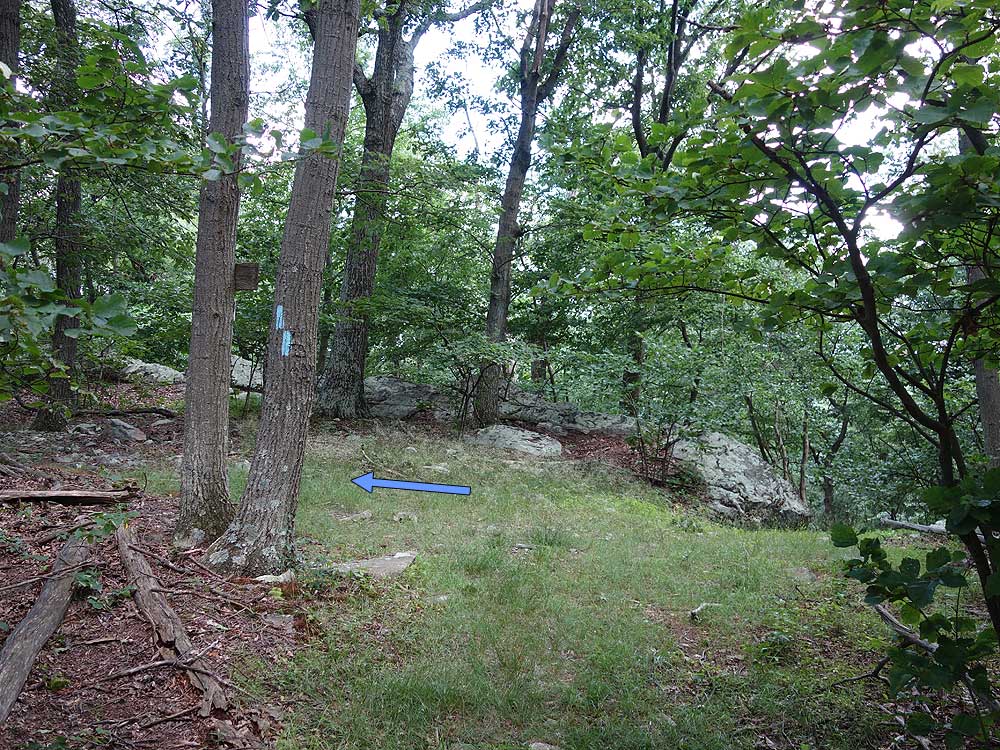
Mile 4.0 - The Tuscarora Trail will veer left remaining on the ridge where it intersects an old forestry road. Continue on the trail another 0.4 miles to a flatter section where the trail passes directly past an overlook westward.
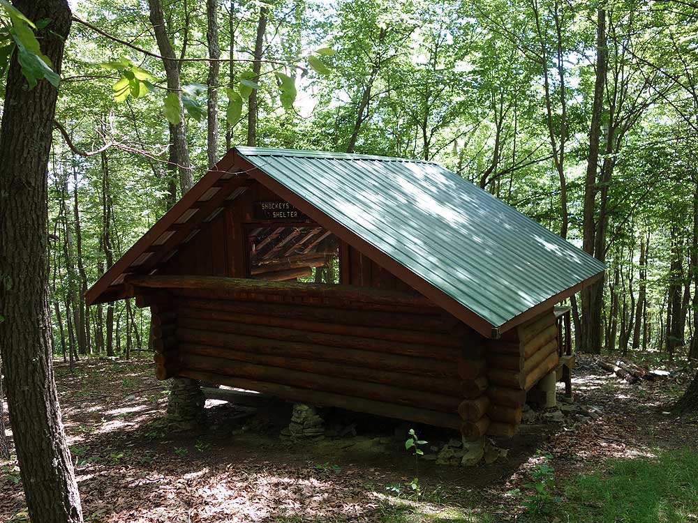
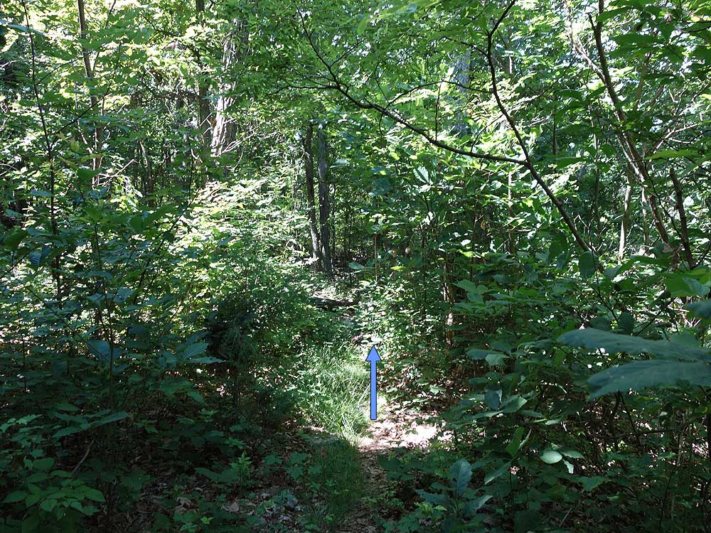
Mile 4.5 - Turn right on the white blazed Shockeys Knob Shelter Trail. Pay attention to the trail blazes as it will soon turn left over the ridge and descend to Shockeys Knob shelter.
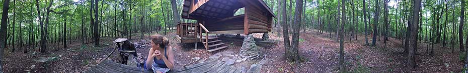
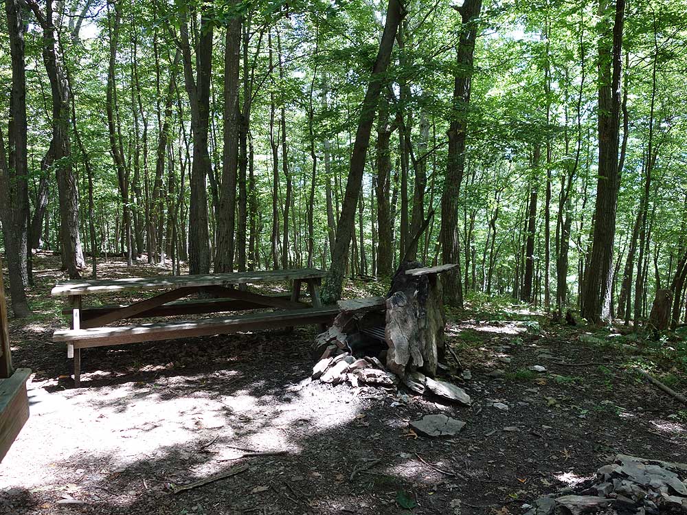
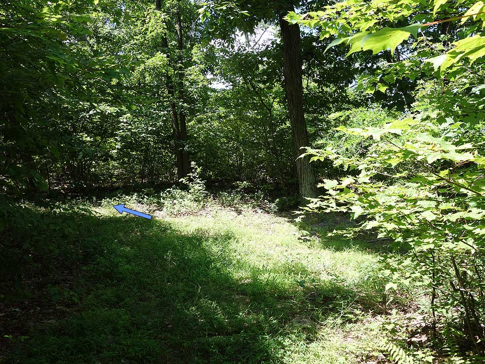
Mile 4.8 - The Shockeys Knob shelter has a upper bunk with large fire pit and separate picnic table. A spring is located just uphill from the shelter. Note that the Shockeys Knob shelter is on a first-come first-serve basis and cannot be reserved. Continue on the white blazed trail loop behind the shelter going to the right and arriving at the Tuscarora Trail in 0.1 miles.
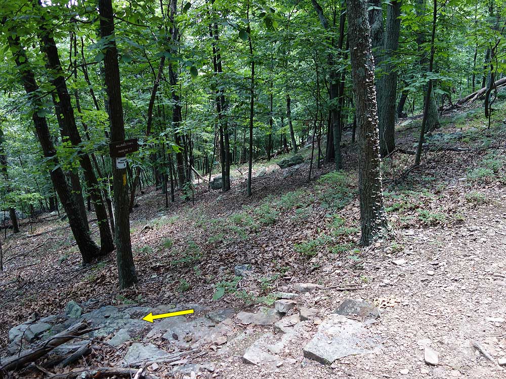
Mile 4.9 - Turn right downhill on the blue blazed Tuscarora Trail as it winds its way to the valley then intersects with the Millrace Trail in 0.7 miles.
I did this hike this past weekend as an overnight backpack and really enjoyed it. The hike was pretty much as described, the shelter was tremendous, the Tuscarora Trail on the ridge was lovely, and the stream crossings were pretty straightforward (although required wet feet for Little Brush Creek, as there had been quite a bit of rain). We did the route counter clockwise and that seemed like a good direction, as the ascent is much mellower in that direction. We saw a coyote up near the ridge as we approached the junction to High Rock Overlook, first one I've seen in the mid-south.
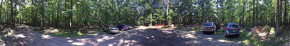
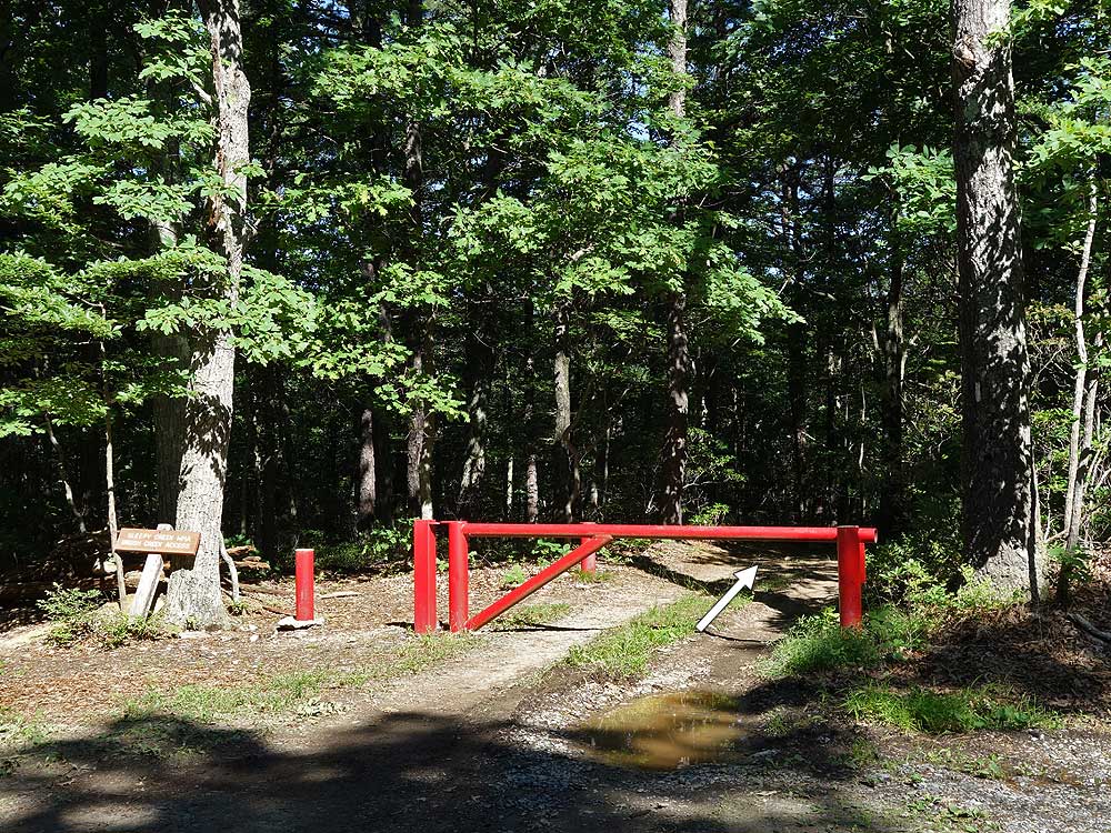
The trail is a little tricky to follow in a few places, and not super well marked once you get on the white blazes to go to the shelter, but not too difficult to figure out. We also had some minor difficulty finding the trailhead parking area, as the directions on this site get you very close but not right to the trailhead. Again, not a big deal as you can figure it out.
A lot of folks had written here and in the shelter logbook (which is totally full, by the way) that they had trouble finding the spring. We never would have found it ourselves without the help of the review by Christoper Robin (below), and would suggest that PATC leave a map in the shelter somewhere. The sign adjacent to the shelter makes it seem like the spring should be close, but it's probably 2/10 of a mile away, or even a little more.
To get to the spring, Christopher Robin's directions are very good. Basically you retrace from the shelter back to the junction with the Tuscarora Trail, and then continue north, past the dead-end trail that goes downhill to the west, and then in ~50 yards you will see a sign on a tree that faces south (you likely won't see the sign if traveling south down the ridge towards the shelter). We took the opportunity to make a detailed map, which we'll leave next time we are there, but no idea when that might be. The spring is in a plastic-lined hole with almost no current/movement, so we'd recommend bringing a filter to get rid of sediment. Happy to email a map to anybody, as well, and will have it at this link for a while: https://www.dropbox.com/s/640ncz2d1qg0qer/Spring.jpg?dl=0
We did hear some gunfire at the adjacent range, but only a minor annoyance as only went on for about 45 minutes or so. Anyway, thanks so much to those that were responsible for the shelter and the trail maintenance. It's a lovely hike and we highly recommend it!
By:christopher robin
Rating:
Date of Hike: Saturday, August 4, 2018
Did an overnighter just as laid out in the trail note. Fun hike. Great shelter. The spring is actually right off the Tuscarora Trail before you get to the shelter trail, if you are going southbound. If you are at the shelter, take the white trail up the hill from the shelter, back to the blue trail and go north a bit. You will drop down a little and the sign is in a tree and the trail is on your right. Follow it down a short way and the spring is in a grassy area to the left.
By:James & Amanda
Rating:
Date of Hike: Saturday, March 3, 2018
Hello-
my girlfriend and I hiked this from 3/3/18-3/4/18. She is not an experienced backpacker so it was a bit of a testing operation. It is generally a very nice hike, but the major ascent in the beginning is very steep! There are few switchbacks, so just be aware.
Also, the directions could be more clear upon arriving on the ridgeline by High Rock. It may be more clear in the spring/summer months, but it was difficult to locate the Tuscarora trail there are a couple of potential old fire/logging roads that lead to no where. We ended up hiking/bushwacking on the western side of the rock ridge for a while and then climbed over in a gap in the rock formation thus finding the Tuscarora (blue blaze) about 75 yards down on the eastern side. It ended up not being a big deal, but if we had a problem, others may too.
We spent the night at the Shockeys knob shelter. The shelter it self was great clean new and well maintained. The issue we had was identifying where the spring was. The sign on the shelter and in the directions here state that the spring is just above the shelter. IT IS NOT!!!! NOR IS IT CLEARLY IDENTIFIED OR MARKED. A very nice backpacker drew a map, to the best of his ability, which we followed. it was pretty difficult to find. The Logbook in the shelter indicated that pretty much everyone had an issue with its location. Just be aware- the directions to water here are incorrect.
The rest was a quick trek down to the parking area.
Thanks!
By:Gary D
Rating:
Date of Hike: Sunday, October 15, 2017
Four of us enjoyed this hike. Saw more Stick Bugs than people. Three Stick Bugs (our last Stick Bug sighting was in ca 2012 along the Sky Line Drive). Only two hikers. One Small Salamander. Small fish in Little Bush Creek. Always good to see living things in the streams. Not always the case.
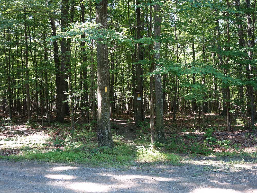
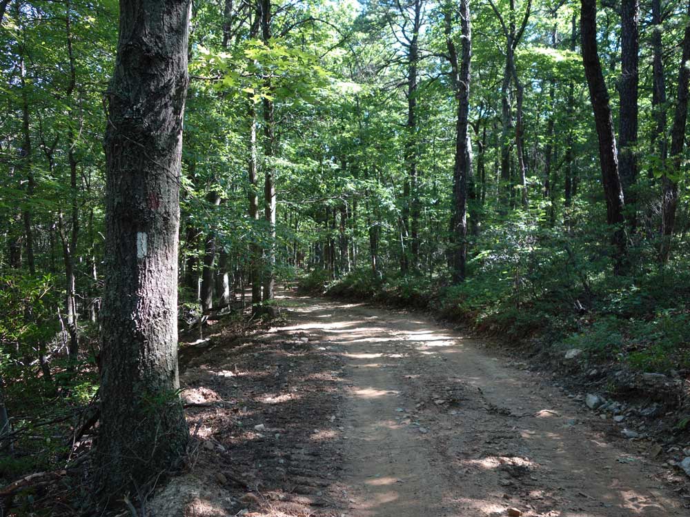
The trail is well blazed which is good because as the leaves fall, some of the trails might not be so easy to follow.
One hiker in our group has a knee that objects to steep descents that slowed the hiking speed. No trouble going up. In our case, hiking it in a clockwise direction rather than counter clockwise would most likely have worked out better.
Take a road map along to help identify landmarks from the overlook. We were not quite sure what we were looking at from the overlook.
By:Sean
Rating:
Date of Hike: Monday, October 2, 2017
A review below from May 2017 expresses concern about nearby shooting range activity. Let me comment on that first, then I'll get to the review of the rest of the hike. I heard shooting range (or informal target practice) activity from two separate locations. (I call it shooting range activity as it was prolonged -- for hours, intermittently. Unlike hunting. I know shooting ranges and I know the sound.) One source was audible on most of the hike. It was distant and muted, and not too concerning. I think this is what the reviewer calls the Peacemaker shooting range in Gerrardstown, WV (according to the post office) or Glengary, WV (according to the range). It features a 1,000 yard range. By my reckoning, it is roughly two miles from the closest point of the hike and not a safety concern. Much more concerning is the VERY close target practice activity I heard along the yellow-blazed Millrace Trail, peaking in intensity where the trail crosses the Little Brush Creek. The park boundary is about 300 feet away there, as is the state line with Virginia. On the trail, you are down low a bit from the boundary, which provides some reassurance, but not a lot. I ultimately felt safe enough to proceed, but it was quite disturbing and disconcerting (i.e., LOUD), and certainly not enjoyable. I would never bring my family there. I have a feeling this close shooting activity is backyard informal stuff -- there doesn't seem anything that would keep someone from entering the park to shoot at some other targets.
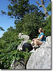
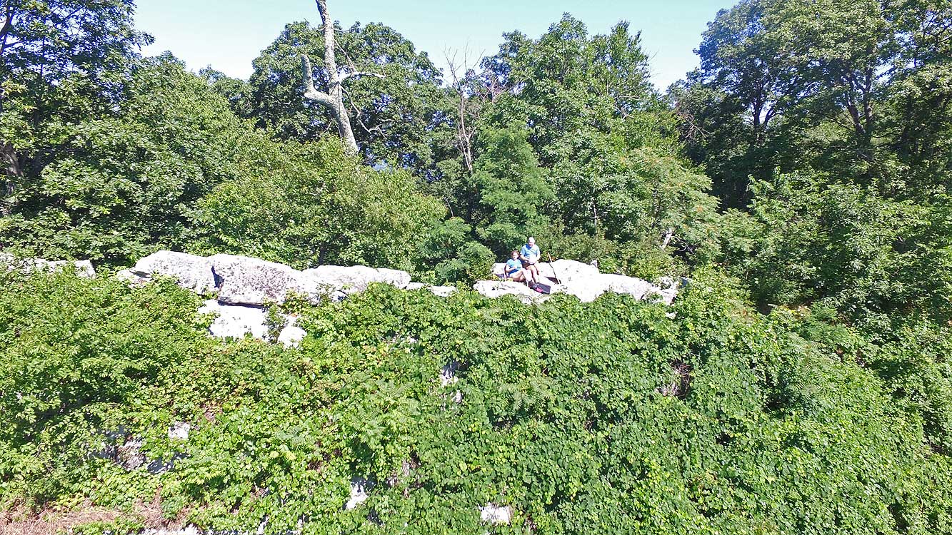
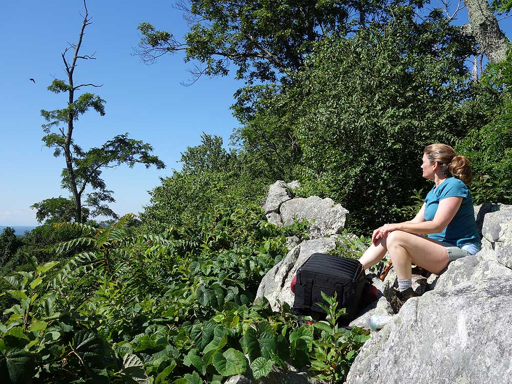
The rest of the hike was enjoyable. Climbing on High Rock is fun with a great view, but be careful. You are on a fin of rock and it is a long drop on either side. The other overlooks on the Tuscarora Trail are nice. The trails were generally well blazed. At several locations trees had fallen with their crowns blocking the trail and taking some exploring on the other side of the crown to find the trail again. Where I didn't see blazes I saw orange ribbons in the trees. I became disoriented on the short white-blazed section around the Shockeys Knob shelter, and relied on my GPS device to get back on track. The description says the trail is "just uphill" from the shelter but I never found it, even following a sign with an arrow. Way uphill from the shelter is a long and low outcropping of rock where I saw some stones arranged as in a basin form, that you might see at a spring. It had not rained for two weeks when I hiked so maybe the spring was dry. Maybe I overlooked the spring, but I would not rely on it for water. Returning to my car, dozens of mosquitos came out of nowhere to swarm around my head -- really weird. They didn't bother my on the trail but you might bring some insect repellent or netting just in case.
By:G. Ratlief
Rating:
Date of Hike: Sunday, July 30, 2017
Great hike! The description and pictures above were very helpful. Most of the white and yellow blazed sections looked to have been recently maintenanced as the path was well marked! Great job by someone! The loop is a good hike for anytime of year, but late fall/winter may be best to see all of the great views. I'm only surprised this trail is not more widely known. I plan to explore more of this area for hiking opportunities.
By:Paul
Rating:
Date of Hike: Sunday, May 7, 2017
This is a good loop. Light traffic, nice view. However there are 2 significant jeep trail sections that get tall grass in the summer. And lots of ticks. The real problem lies in the Peacemaker long distance shooting range situated literally right beside the millrace trail. When the range is open, there is significant shooting and it is VERY VERY LOUD. I'm not an anti gun guy but it is a deal breaker for me. I called the DNR to ask if it was safe. They claim it is. I'm not convinced.


