|
| Length |
Difficulty |
Streams |
Views |
Solitude |
Camping |
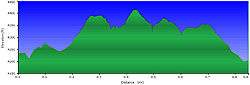
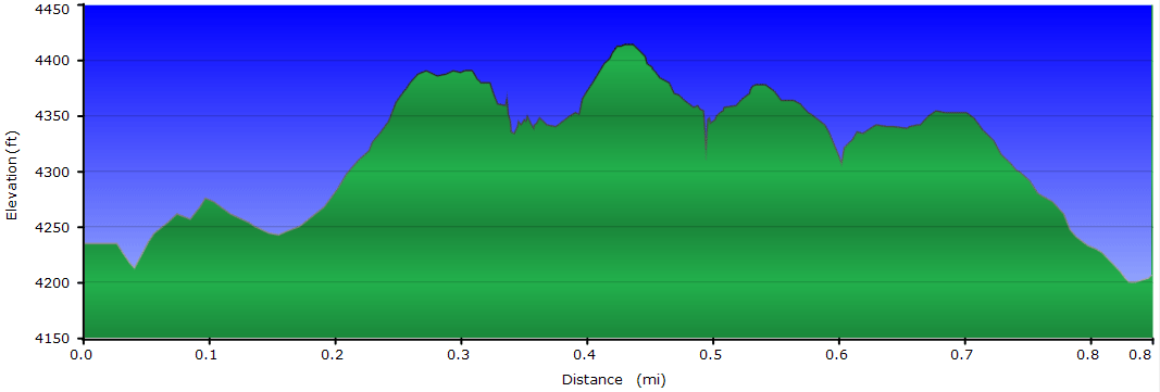
| 0.8 mls |
 |
N/A |
 |
|
N/A |
Hiking
Time:
Elev. Gain:
Links:
Resources: |
45 minutes with 15 minutes of breaks
180 ft
 Pisgah National Forest Pisgah National Forest
Topo Hike Trails Map (PDF)
Linville, NC Weather Forecast
Current Weather Radar
Garmin (GDB), Gaia/Trails App (GPX) (What's
this?) |
 By Trail Contributor: Zach Robbins By Trail Contributor: Zach Robbins
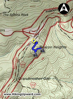
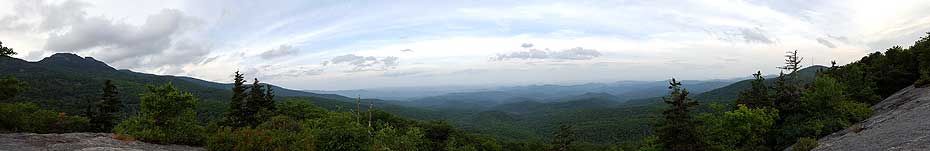
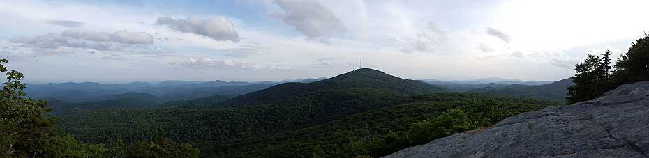
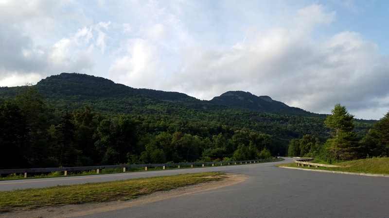
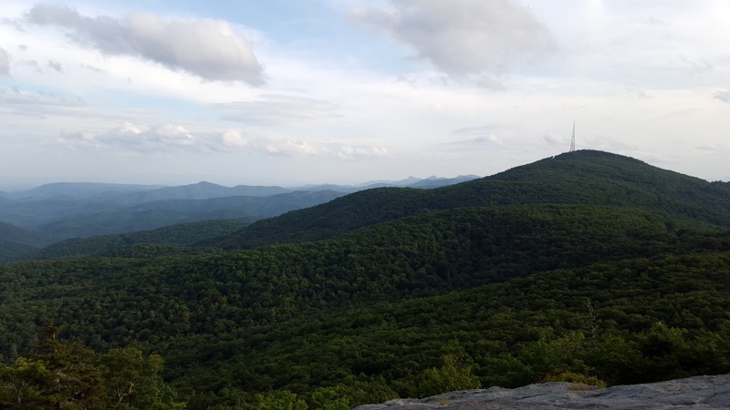
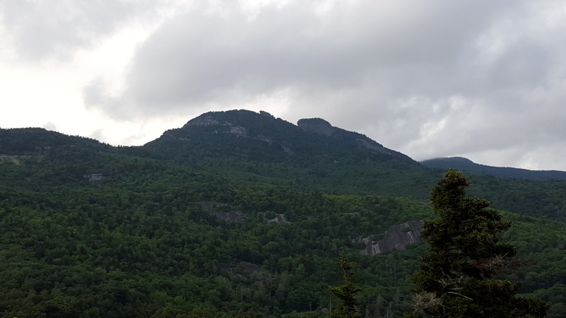
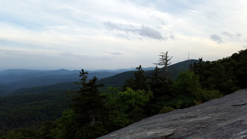
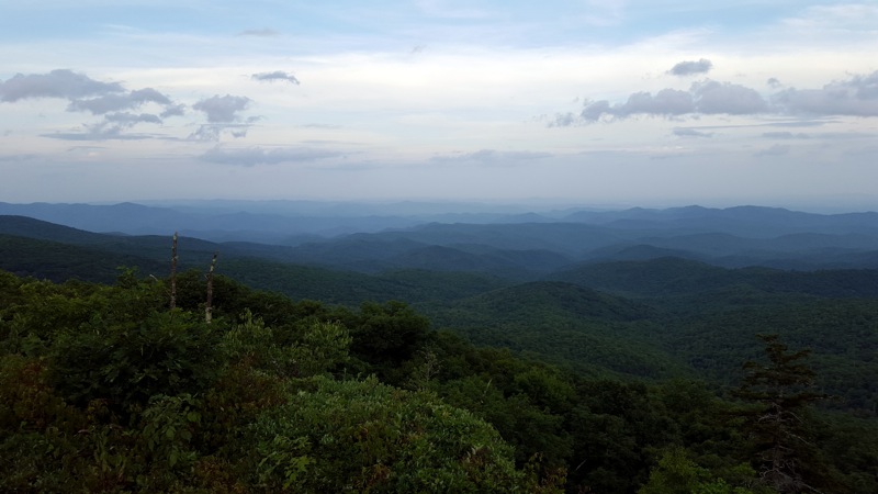
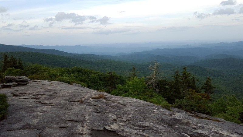
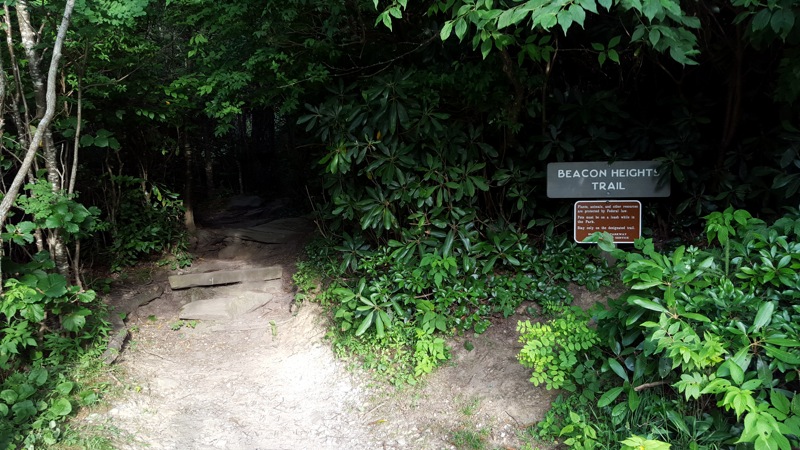
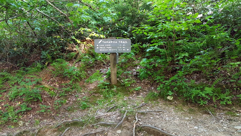
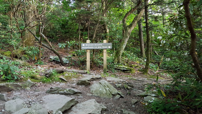
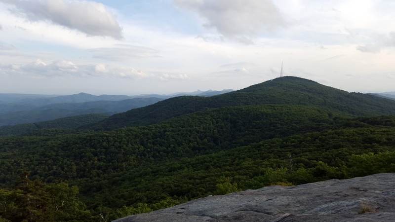
One of the finest slices of the Blue Ridge Parkway is the winding stretch on the east side of Grandfather Mountain. Here the Tanawha Trail runs parallel to the parkway for 13 miles, providing many opportunities for short or moderate hikes. At the southern terminus of the Tanawha Trail lies Beacon Heights, a series of large, east-facing cliffs with outstanding views of Grandfather Mountain, Grandmother Mountain, and the Wilson Creek basin. From the Beacon Heights Overlook the cliffs can be reached by an easy 0.3-mi trail that is a perfect quick stop while traveling on the Blue Ridge Parkway for hikers of all ages and abilities.
|
