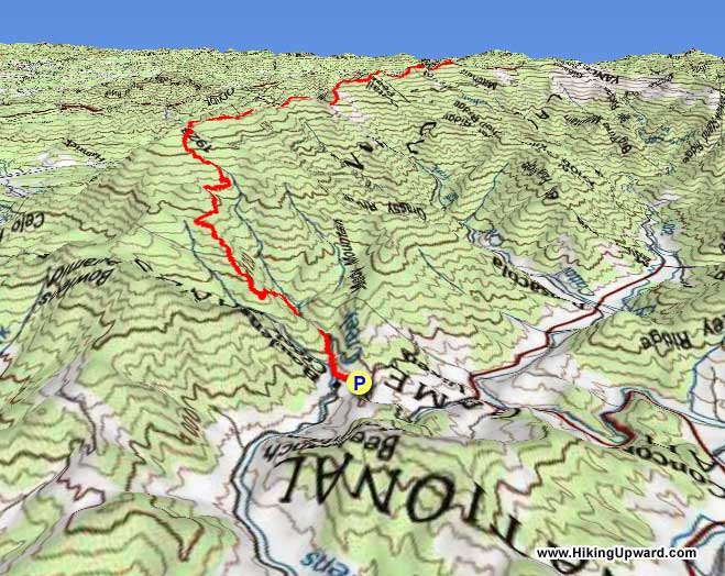
There’s the hard way to ascend Mt. Mitchell, and then there’s the really hard way to ascend Mt. Mitchell. If the challenge of the Mt. Mitchell Trail isn’t enough for you, then tackle the Black Mountain Crest Trail. Oh by the way, you’ll also cross five peaks over 6,000 feet, including the 2nd tallest mountain in the east, Mt. Craig. Lovingly nicknamed the “Death March” by North Carolinians, this hike may be the toughest you’ll encounter in NC for the distance covered. The crest trail may be beautiful and a peakbagger’s dream, but do not underestimate the difficulty of tackling this from the northern trail head at Bowlens Creek.
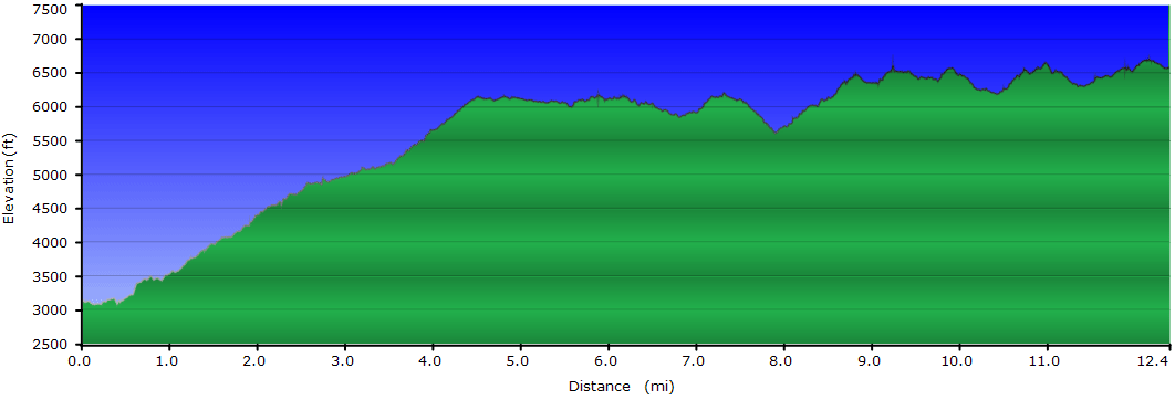
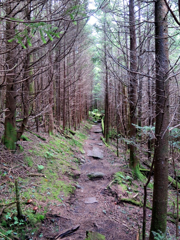
You’ll begin the hike with a lung-busting ascent of 3,000 feet in 4 miles to the shoulder of Celo Knob. The trail will ease up for 1.5 miles as you get big views from the ridgeline before beginning its rollercoaster journey along the Central Blacks for the last 6 miles. While there aren’t any big climbs on the latter half of the trip, the crest trail plows straight up and down into narrow gaps hundreds of feet below the peaks. The trail is rocky, eroded, and always tricky footing. The hike described here is a shuttle in the most difficult direction. If you start at Mt. Mitchell the elevation gain is <3,000 feet.
TRAIL NOTES:
Access to Mt. Mitchell State Park is typically closed all winter. The shuttle hike described here is only feasible Spring-Fall. Otherwise you will have to hike the crest trail both ways for 24.8 miles and roughly 8,000 feet elevation gain. This is ideal for 2-3 days backpacking. A longer shuttle hike is possible during the winter using the Mt. Mitchell Trail. The elevation gain is similar hiking either direction.
Much of this hike is above 6,000 feet elevation and exposed on narrow ridgelines, plan accordingly. During the winter the exposure to the west can be especially harsh. You’ll likely encounter lots of ice beyond Celo Knob, traction devices are recommended. Webcams and current weather of the Black Mountains can be accessed through the NC High Peaks Trail Association website.
There are four good primitive camping areas outside of the state park boundaries in Pisgah National Forest. The first two are directly south of Celo Knob and beside the Woody Ridge Trail junction. The other two sites are on either side of Winter Star Mountain. Deep Gap is the most popular area but also has had bear encounters. A bear canister is recommended.
You can make a reservation to camp in the state park at the 9-site tent campground south of Mt. Mitchell. This campground is open May 1 - October 31.The campground is closed from November 1 - April 30 and camping at the site is considered 2nd degree trespassing.
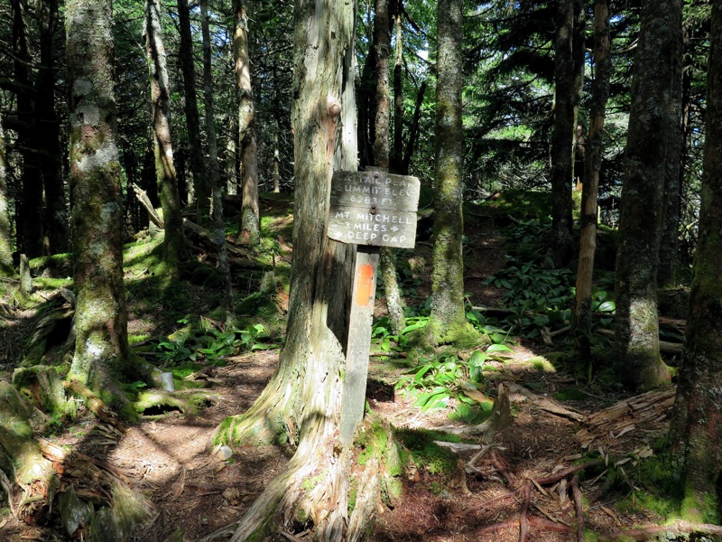
There are two good primitive camping options in Pisgah National Forest that require a significant descent from the Black Mountain Crest Trail. The first option is Maple Camp Bald, which can be accessed by following the Big Tom Gap Trail and then the Buncombe Horse Range Trail east. The second option is Commissary Hill, which can be accessed by following the Mt. Mitchell Trail southeast from the summit. These sites can be included in a longer backpacking loop using the Mt. Mitchell Trail and Buncombe Horse Range Trail.
Water is scarce throughout this hike. There are only 3 reliable locations to fill up. 1) The switchbacks around mile 3.5 below Celo Knob have springs running over the trail. 2) Springs on trails on either side of Deep Gap. 3) Visitors center on Mt. Mitchell (seasonal only).
ALTERNATE PARKING AND SHUTTLE OPTIONS:
The parking space beside Water Shed Rd is small and can only fit 2-3 cars. Before you reach this area there is another parking option. When you turn onto Water Shed Rd from Bolens Creek Rd, follow a gravel driveway named Stanley Trail branching left off Water Shed Rd. A private landowner charges $5 to park on their property. You should see a sign for this parking option on the Bolens Creek Rd sign. We have not parked here before, but understand they are legitimate.
This hike as described requires a shuttle between Bolens Creek Rd and Mount Mitchell State Park summit parking area. The most reliable and affordable option is through the Yancey County Transit Authority. They shuttle hikers all over the Black Mountains and nearby areas for a low fee between $15-30. If you have one car you can arrange a pickup from Mount Mitchell State Park. Please call for a reservation at least 48 hours in advance. You can also leave a car at other trailheads such as the Woody Ridge Trail, the Colbert Ridge Trail, the Buncombe Horse Range Trail, the Black Mountain Campground, the Mountains-to-Sea Trail, or the Big Butt Trail for shorter or longer shuttle hikes.
Mile Summary and Highlights
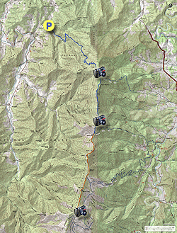
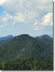
0.0 - Black Mountain Crest Trailhead on Water Shed Road near Bowlens Creek 4.2 - Fantastic views from meadows below Celo Knob 4.7 - Woody Ridge Trail junction 5.9 - Narrow rocky spine provides panoramic veiws 7.0 - Winter Star Mountain summit (6,203 feet) 7.6 - Deep Gap - last campsites before entering Mount Mitchell State Park 8.5 - Potato Hill summit (6,475 feet) 10.0 - Big Tom Gap Trail junction 10.4 - Big Tom summit (6,581 feet) 10.7 - Mount Craig summit (6,647 feet), second tallest peak in the East with western views 11.8 - Mount Mitchell observation tower (6,684 feet), tallest peak in the East
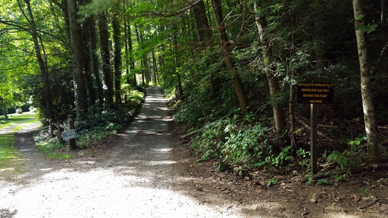
Mile 0.0 – Park on the right side of Water Shed Rd beside a brown national forest sign listing this as a hikers only path. If this space is full refer to the alternate parking option above. Follow the gravel Water Shed Rd to begin the Black Mountain Crest Trail.
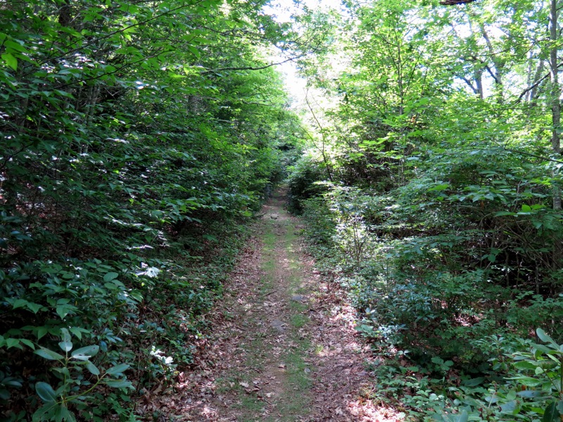
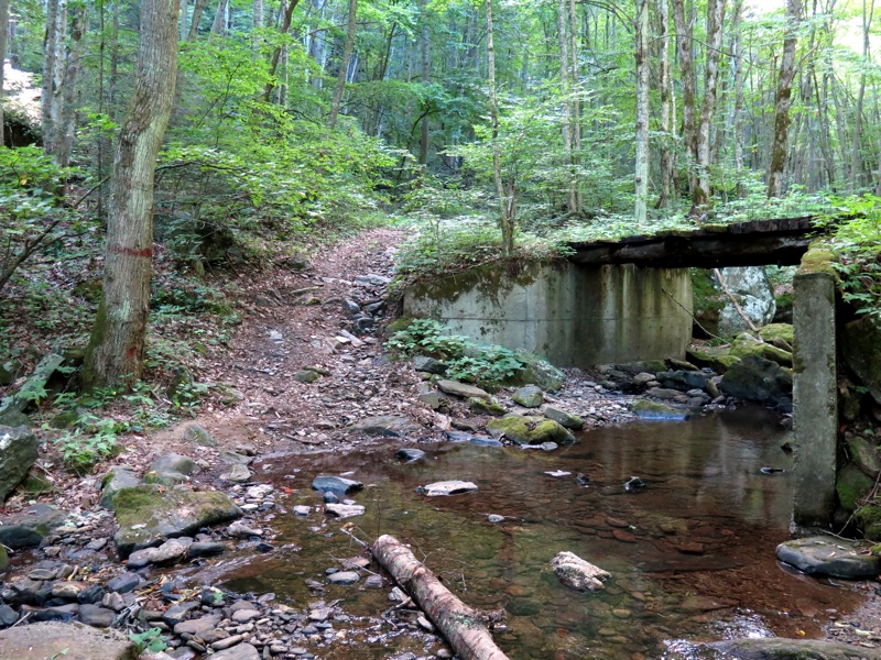
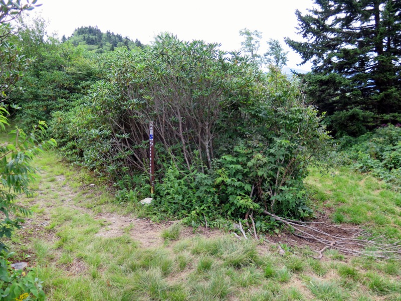
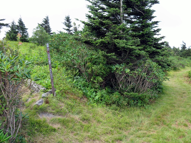
Mile 0.1 – Old bridge or rock hop over Bowlens Creek. The bridge looks to be in poor shape so it is best to avoid it. On the other side of the creek you’ll see the national forest carsonite sign for the Black Mountain Crest Trail [179] (orange or white blazes). For the next 4 miles you will be following the forest road track up the northern flank of Celo Knob gaining nearly 3,000 feet in elevation.
Mile 0.8 – The trail makes a hard left away from Bowlens Creek. The forest road grade moderately ascends a ridge high above Bowlens Creek. Occasionally old forest roads will branch off from the main trail. The crest trail in this section has no noticeable blazes but stick to the most defined road heading uphill.
Mile 3.5 – At a left curve is a side path on the right to Bowlens Creek if you need a good water source.
Mile 3.8 – A good spring on trail. There is one more spring above this, but it is tiny.
Mile 4.0 – Last spring on trail, the origin of Bowlens Creek. This will almost always be a small trickle so it is advisable to fill up on water before this.
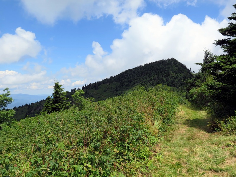
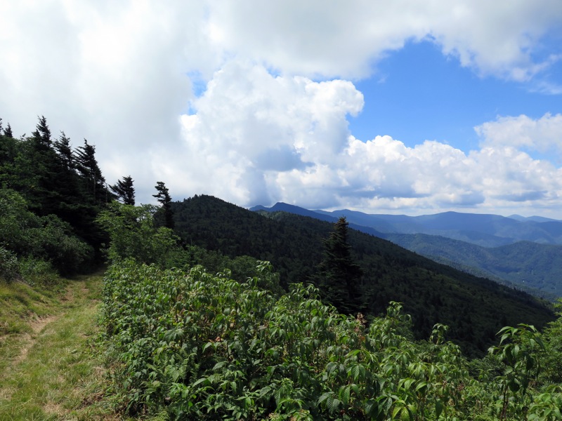
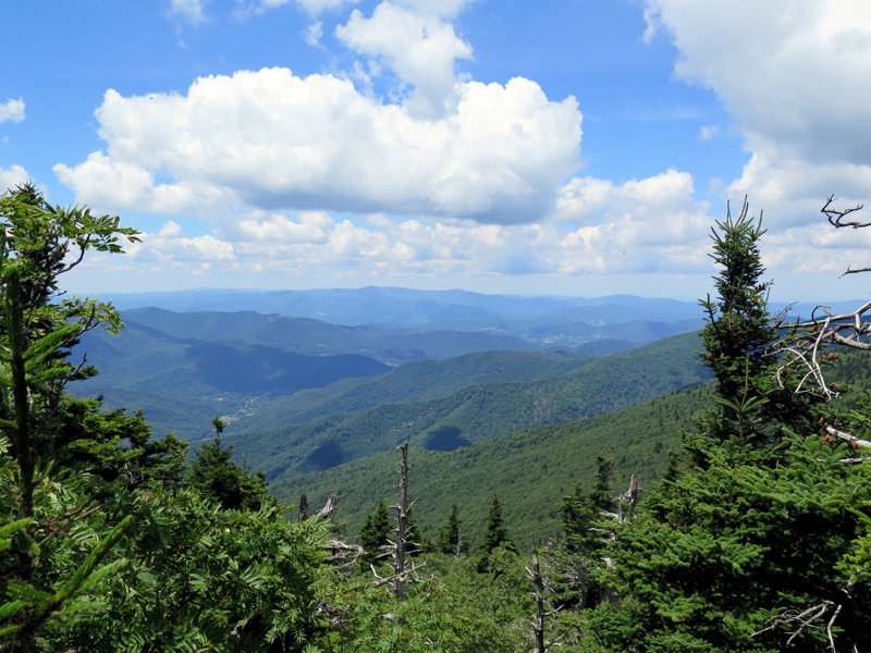
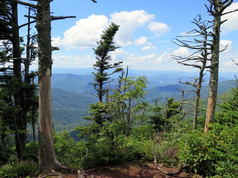
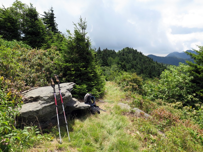
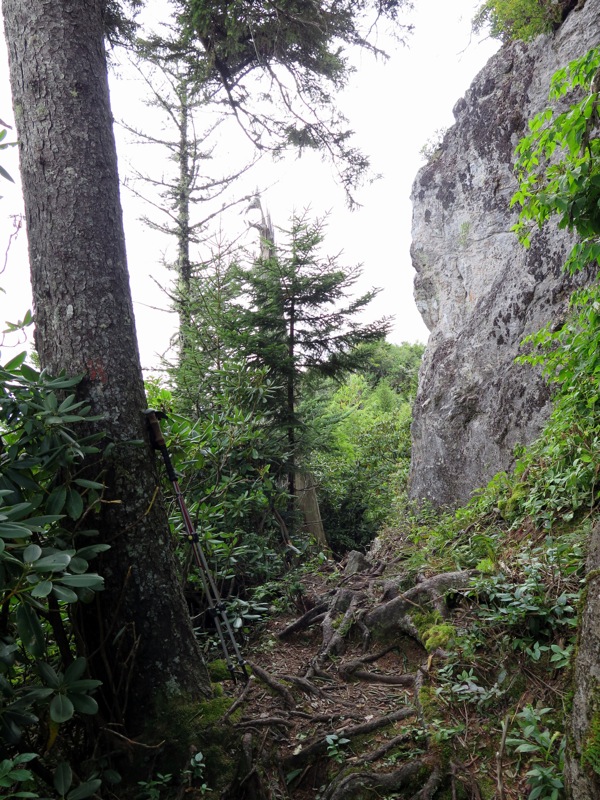
Mile 4.4 – At a right turn there is a side path to a campsite and the Celo Knob scramble trail at a carsonite sign. This scramble is sometimes hard to follow if you’re looking to climb this peak. There are views from two outcrops near the summit. Just beyond the scramble trail junction a forest road splits right at a Y-junction heading downhill. Turn around for a good view of Celo Knob. The crest trail is mostly flat beyond this junction as it heads towards Gibbs Mountain.
Mile 7.5 – T-junction with the Colbert Ridge Trail [178] (yellow blaze) on the left. You can take this trail downhill for ~0.4-mi to find an unreliable spring that is frequently cited as the best water source near Deep Gap. We recommend following the forest road west from Deep Gap noted at Mile 7.6.
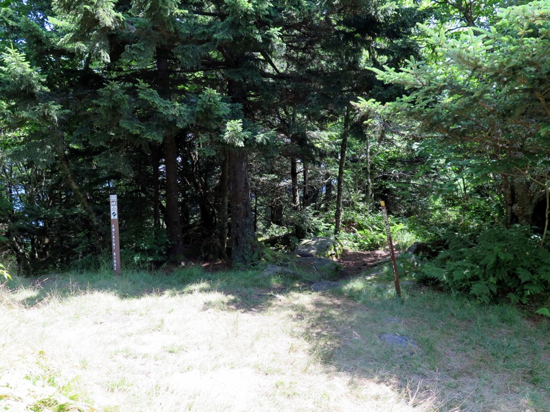
Mile 7.6 – Beyond the Colbert Ridge Trail the crest trail passes through Deep Gap, a large notch in the central Black Mountains. Deep Gap is located at the top of the Colbert Ridge Trail and is also the last place to freely camp outside of the state park, so you’ll likely run into more hikers beyond this point. An old forest road splits to the right just before you enter the state park boundary. There are multiple springs down this forest road. We are unsure of the distance but if the first spring is too low keep going down the road to pass more springs. Beyond Deep Gap the trail is officially designated and blazed as the Deep Gap Trail (orange triangle blaze) by the state park, but is also the Black Mountain Crest Trail.
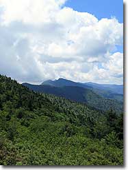
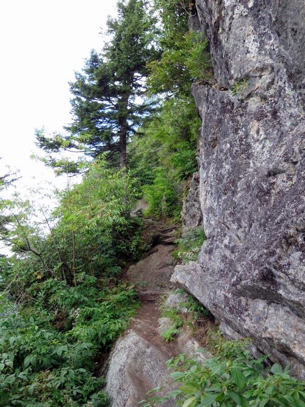
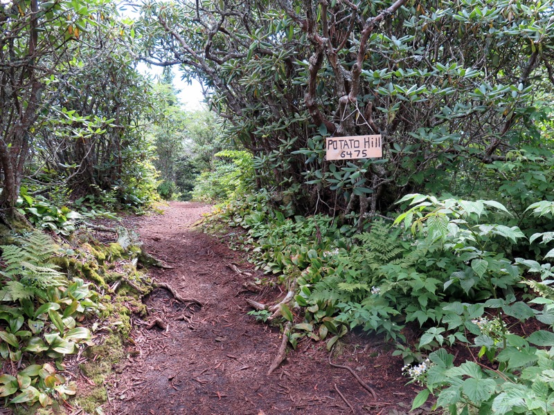
Mile 8.5 – A very short path on the right leads to the summit of Potato Hill (6,475 feet), a subpeak of Cattail Peak. The summit is mostly forested but there is a view to the northwest. Initially the descent from Potato Hill is almost vertical in spots. You’ll have one view during this section south of Balsam Cone and then you’ll pass through a long stretch of southern Appalachian spruce-fir forest.
Mile 9.1 – The trail passes right by a sign indicating Cattail Peak with elevation printed. This is misleading because the trail does not pass over the actual peak and skims the southwest flank. The bushwhack from the trail is easy if you are peakbagging, but there are no clear views at the summit.
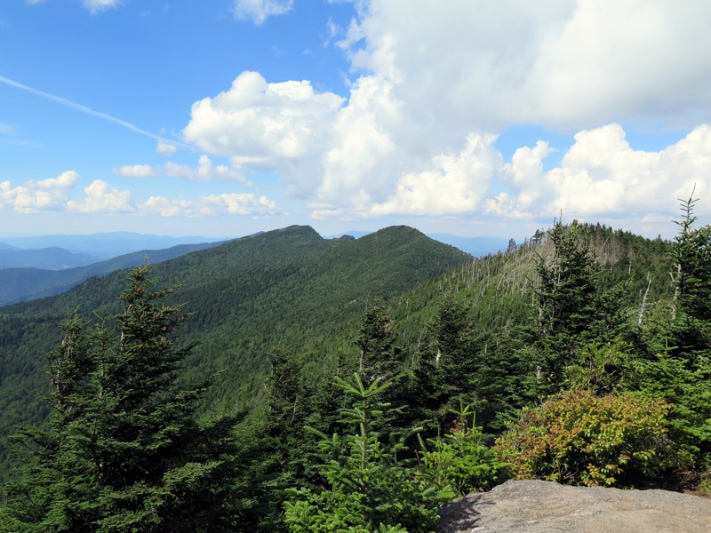
Mile 9.6 – Trail passes over the forested summit of Balsam Cone (6,611 feet) then begins descending to Big Tom Gap.
Mile 10.0 – T-junction with the Big Tom Gap Trail junction shortly before Big Tom Gap. The Big Tom Gap Trail [191A] (blue blaze) leads very steeply down the mountain towards the Buncombe Horse Range Trail and Maple Camp Bald, providing loop alternatives for doing the crest trail both ways. There is also excellent camping at Commissary Hill and Maple Camp Bald.
Mile 10.1 – Pass through Big Tom Gap. From here it is a steep climb to Big Tom with lots of exposed rocks.
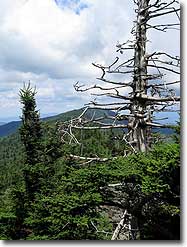
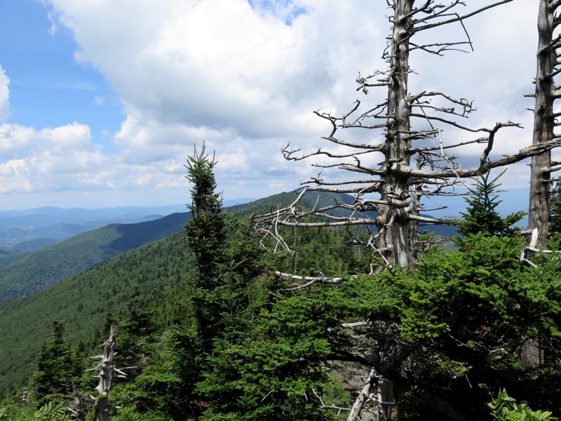
Mile 10.4 – Just below Big Tom there are rock outcrops on the right with good views northwest. Reach the summit of Big Tom (6,581 feet), a subpeak of Mt. Craig. While there are no clear views the summit has one of the largest collections of ghost trees on this hike. Many of the trees around the highest elevations of Black Mountains are adversely affected by extreme winter, pests, and disease.
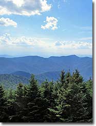
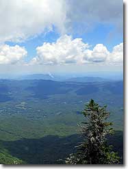
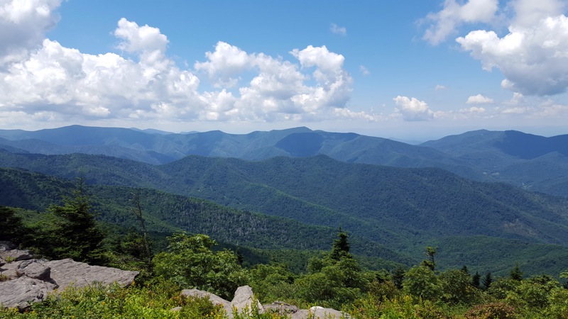
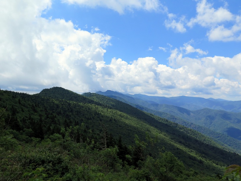
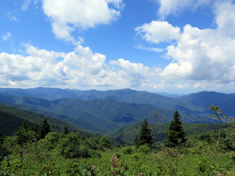
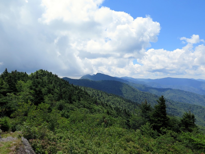
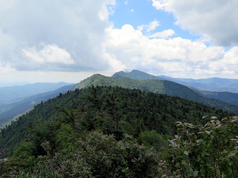
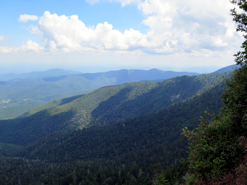
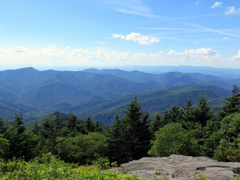
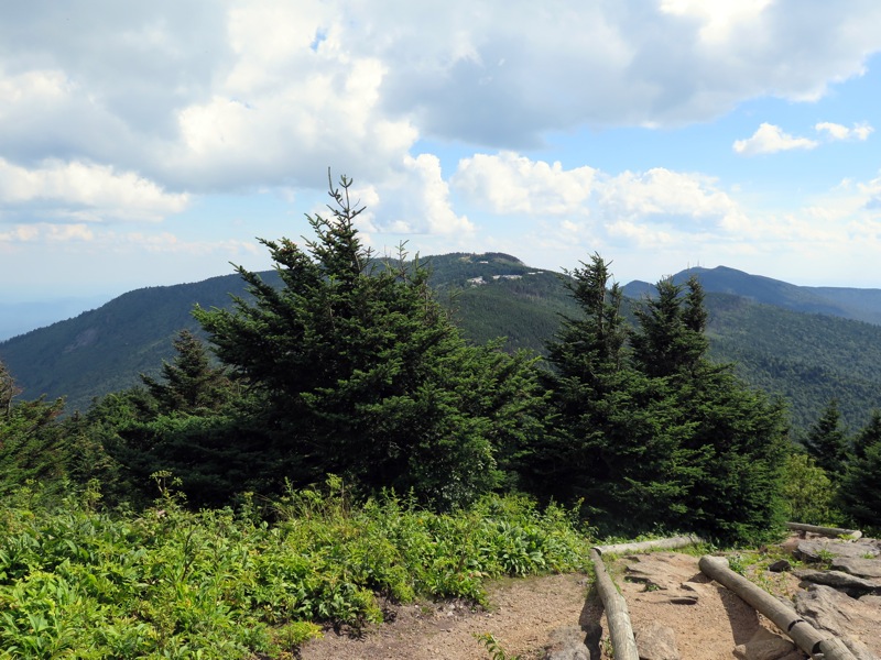
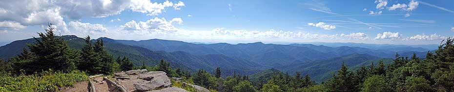
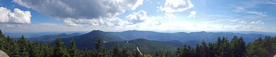
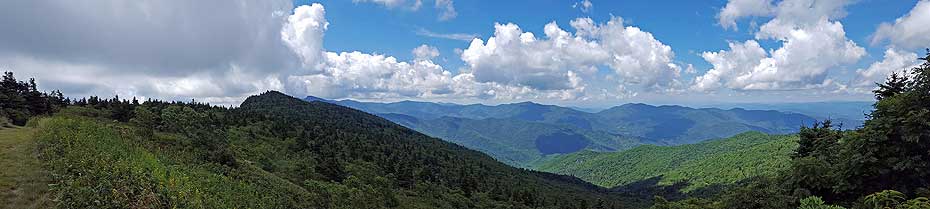
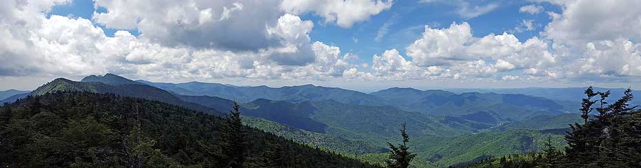
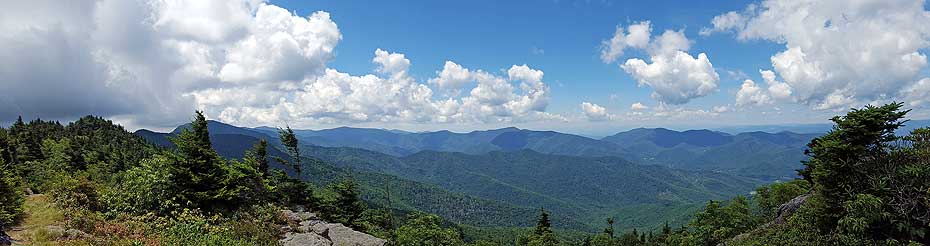
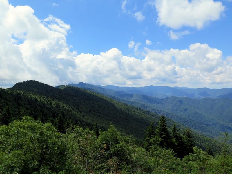
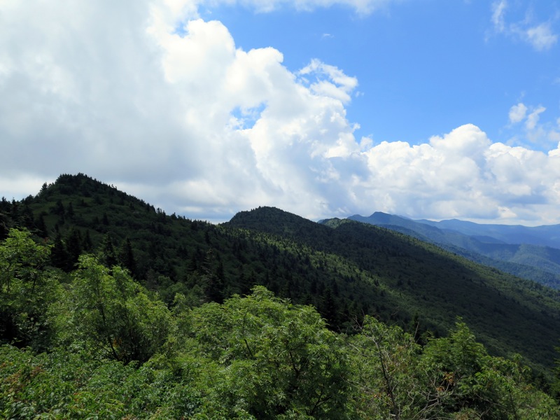
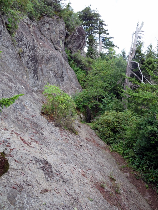
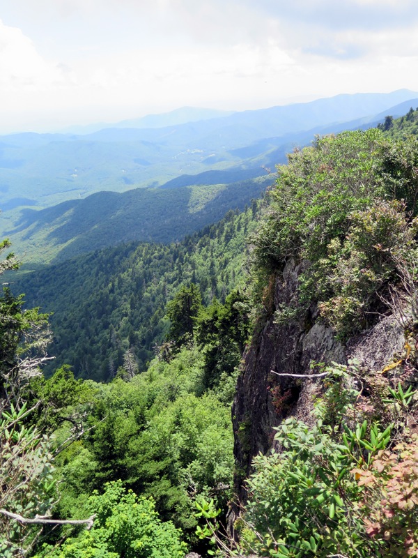
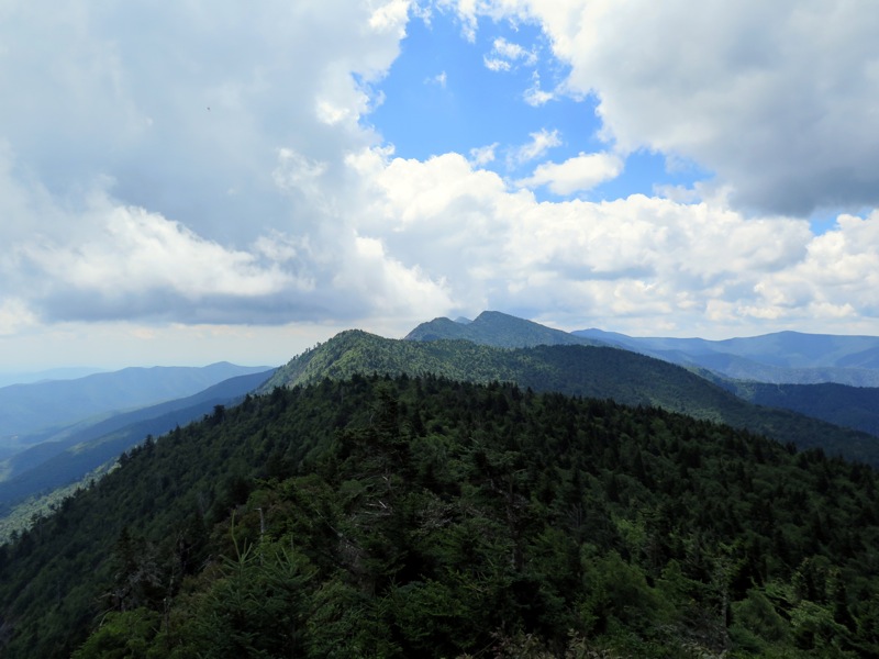
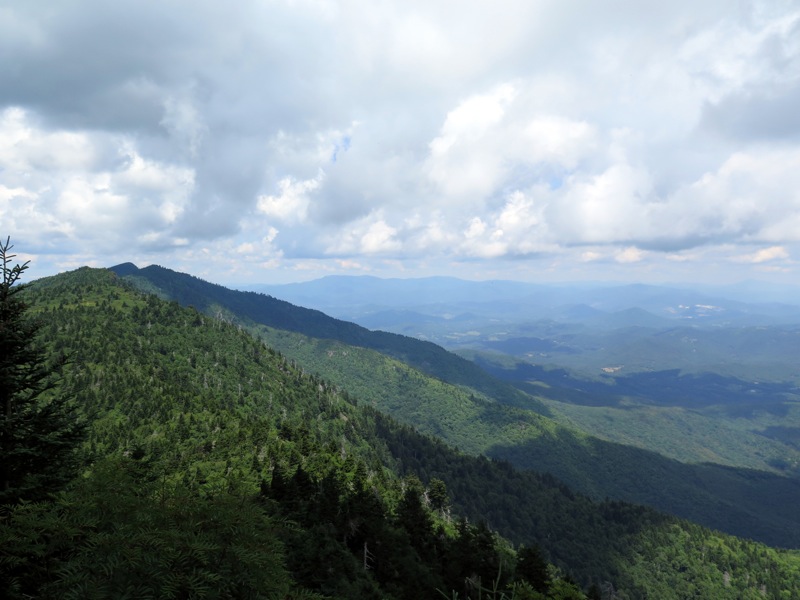
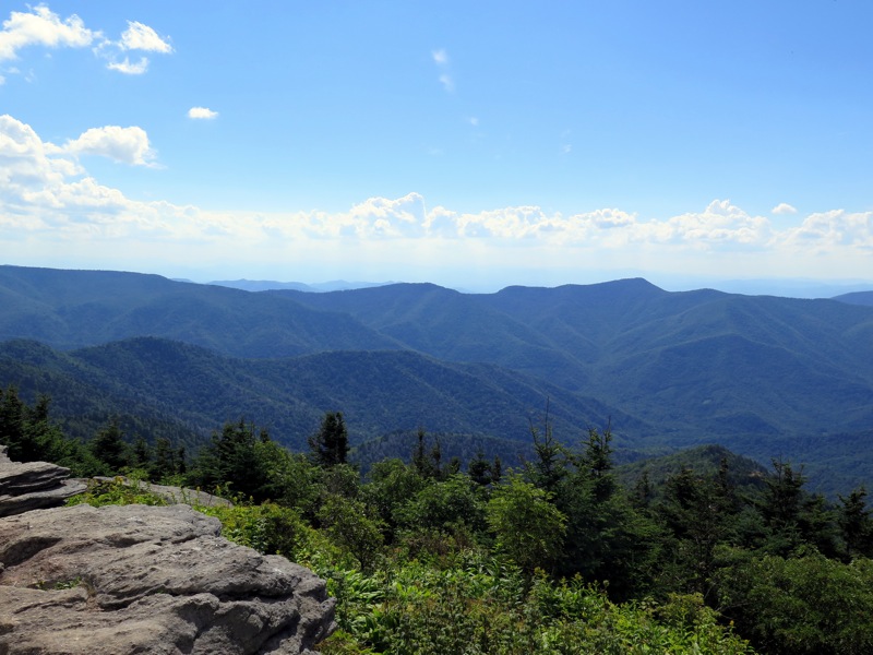
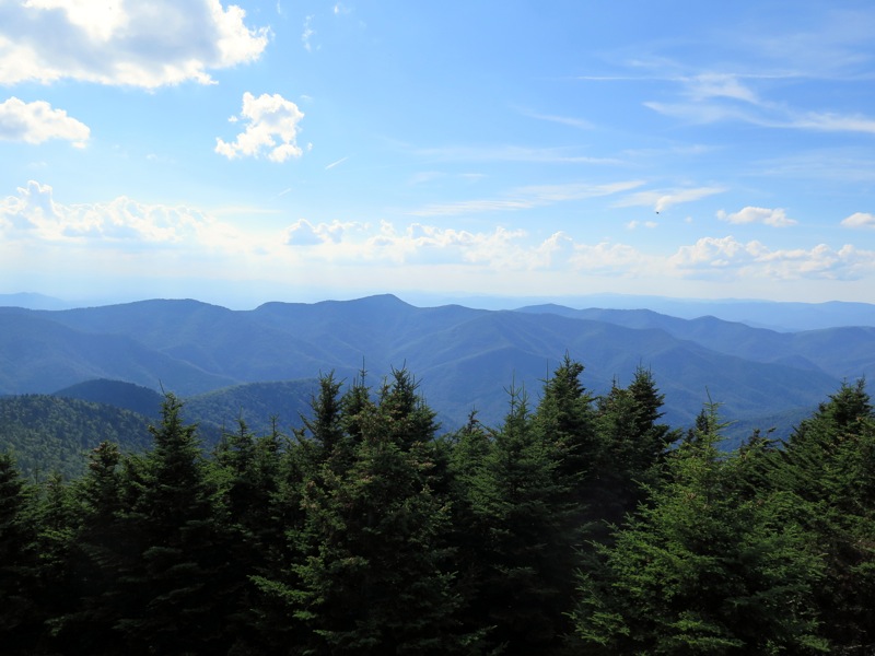
Mile 10.7 – Trail passes over the exposed rock cliffs of Mt. Craig, the 2nd tallest mountain in the east at 6,647 feet. A series of logs line the trail along the cliffs. These logs are not to prevent falling from the cliffs, but to prevent you from leaving the designated trail so rare cliff species can survive. Please stay on the trail. From here you have grand views south to west to north. First look north as you can trace your route up and down the northern Blacks. Due west is the deep Cane River Valley with the western Blacks rising high above. To the south is Mt. Mitchell. The mountain looks unremarkable from here compared to all the development built around the summit.
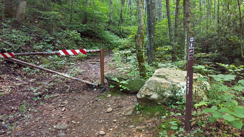
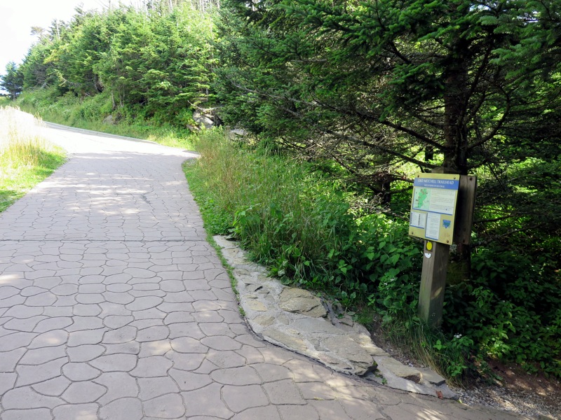
Mile 11.7 – Old Mitchell Trail splits off to the right (yellow circle blaze). This is an option for longer shuttles and for backpackers heading to the tent camping area.
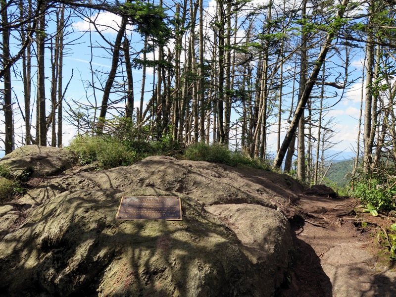
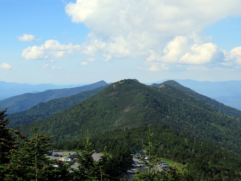
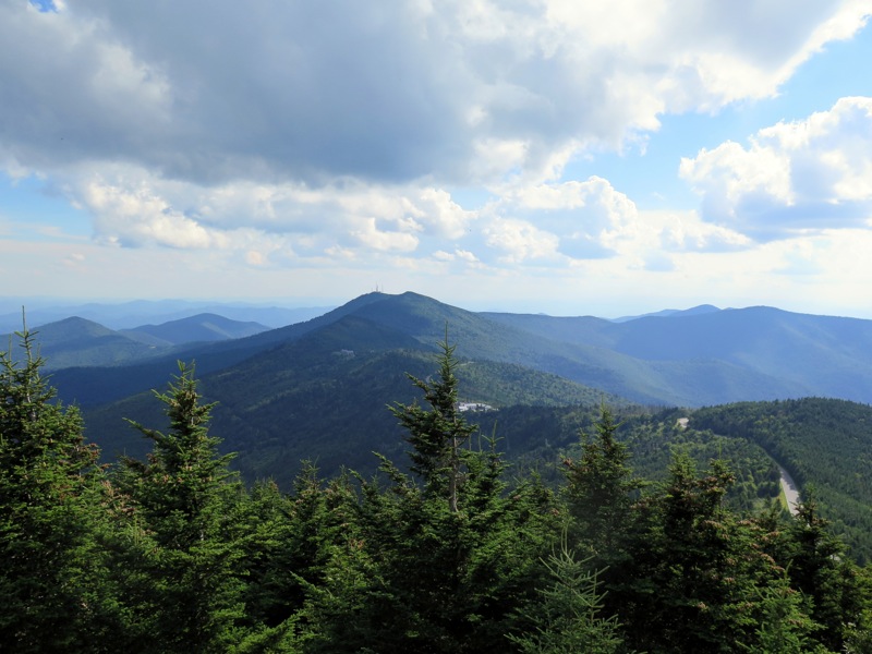
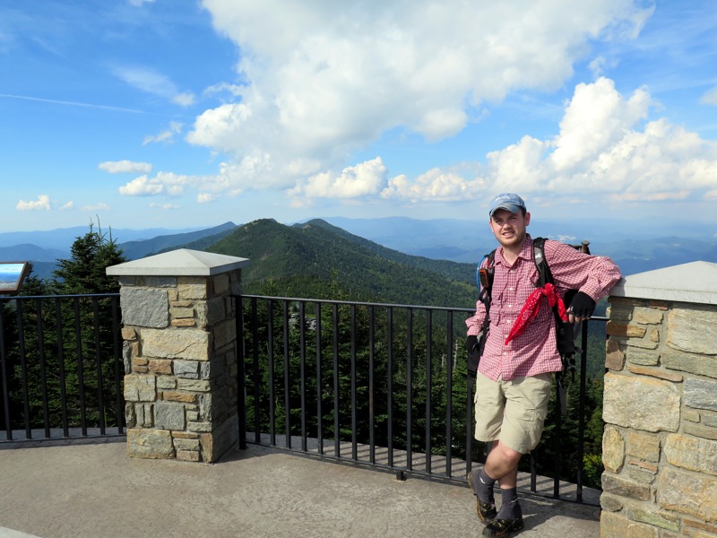
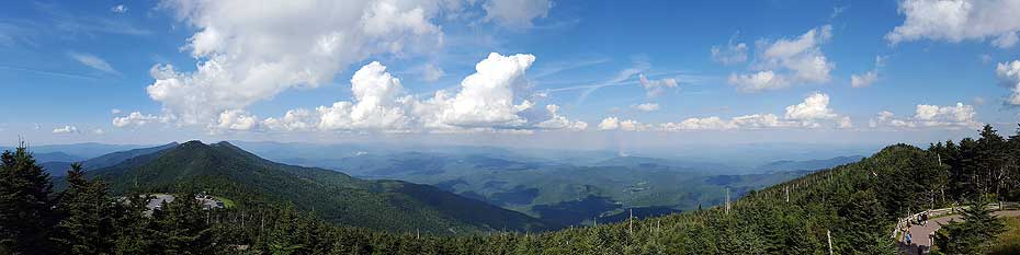
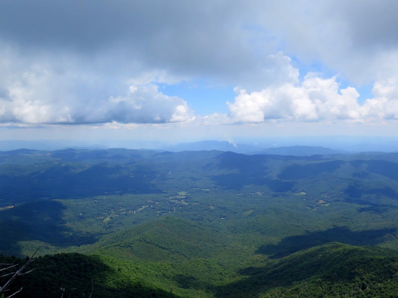
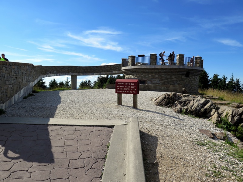
Mile 11.8 – Reach the summit of Mt. Mitchell, the highest mountain in the east at 6,684 feet. The grave site of Dr. Elisha Mitchell is below the observation tower. The observation tower was remodeled in 2008 and provides 360° views complete with interpretive signs in each direction that help you identify all the mountains and land features in view.
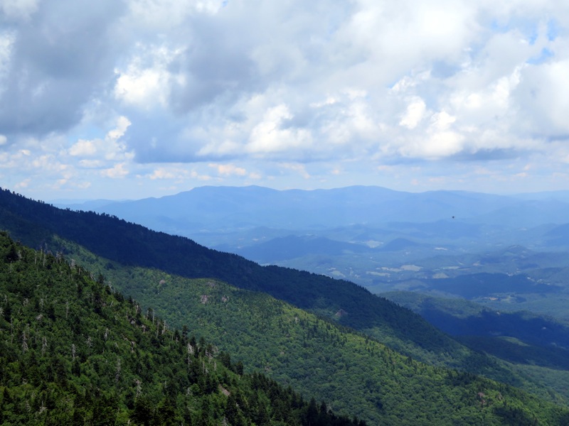
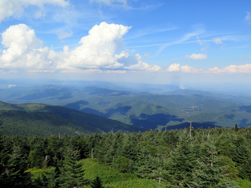
Immediately north Mt. Craig is the closest peak. The northern Black Mountains dominate the skyline as they undulate for miles ending at the conical Celo Knob which you passed earlier. Farther north you can see the tall, gently sloped mountains of the Roan Highlands. In the northeast Grandfather Mountain sticks out as the tallest peak in its immediate area. Linville Gorge and the iconic Table Rock Mountain and Hawksbill Mountain are visible in the east. Due south you can spot Highway 128 curving along the southern Black Mountains, with the radio towers of Clingmans Peak rising beside Mt. Gibbes. Pinnacle is the conical peak to the left of Clingmans Peak. Graybeard Mountain is in between Pinnacle and Clingmans Peak but smaller and more rounded. The Black Mountains are shaped like a J and this is never more readily apparent than atop Mt. Mitchell where you can see the southwestern peaks curve around the Cane River Valley. Due west are the smallest of the Blacks, Point Misery and Big Butt. Towards the southwest Blackstock Knob is the highest peak with a small, rounded summit. Immediately behind and to the left is the distinctive summit of Craggy Dome, the tallest peak in the Great Craggy Mountains. Most of the Great Craggy Mountains are obscured from view by the taller Black Mountains. If you summit on a clear day, you will be able to see tall ridgelines of the Great Balsam Mountains and Great Smoky Mountains running southwest to west.
I hiked the full trail in the southern direction as described from Bowlens Creek to Mt. Mitchell, and much more than that to the detriment of my body. This was the first time I used the shuttle service provided by Yancey County Transit Authority. I requested a shuttle at 6:30 AM from Cane River Gap (Big Butt Trailhead) to Bowlens Creek (Black Mountain Crest Trailhead. The shuttle arrived just after 6:00 AM and patiently waited for me to get ready. The cost of $21.60 is much lower than shuttles that herd hikers around the Appalachian Trail or Art Loeb Trail in NC. I highly recommend them, they'll take you anywhere in the Burnsville vicinity.
The trail is in good condition compared to what it could be without help from the NC High Peaks Trail Association. There were 3 new, unnecessary ropes added to rock slabs between Gibbs Mountain and Winter Star Mountain. Two of them are comically unneeded, I really hope they aren't considered permanent additions like the two ropes below Big Tom. The views were spectacular for the few miles between Celo Knob and Balsam Cone, then the outer bands of Tropical Storm Nestor rolled in. The Black Mountains were covered in a fine mist, and then the wind started to pick up when I reached Mt. Craig. It was 40F, wet, and windy on the summit of Mt. Mitchell, a preview for the rest of the day. A far cry from the pleasant temperatures a few hours earlier. My GPS read 12.5 miles after I summited Mt. Mitchell, and it took me 7 hours to get there. Almost spot on from my hike 4 years ago.
However, I was only halfway done as I was hiking the Black Mountains Marathon circumnavigating the entire range using the MST and Big Butt Trail. The conditions got worse and worse as I followed the MST west above the BRP towards Blackstock Knob. From that summit I hiked the last 8 miles in darkness with cold rain and 30-40 mph gusts on exposed ridgelines above 5,500 feet. At 28.8 miles and 8,100 feet elevation gain it took me 15 hours to finish the entire crest, completing the Black Mountains Hiking Challenge. But word to the wise, don't do this as a day hike unless you have good weather and more daylight. It is the most difficult hike I've ever done made worse by the subtropical conditions passing through the mountains.
By:Scott Mc
Rating:
Date of Hike: Wednesday, June 12, 2019
I pumped myself up big for this hike expecting long steep stretches of up, but that grind never happened. The roots, the trees, the views, the rock scrambles, all of it make this a really fun hike. Starting at Bolens Creek felt like several start from the bottom hikes Ive done in SNP and GWNF.. Its steep but I stuck to my pace till it all leveled out. If your used to hiking that way, youll do fine. The ridgeline to Mount Mitchell was a series of ups, downs, and arounds providing constant array of natural distractions. About halfway through the hike, I leaned over to pick up some trash and bonked my head hard onto a sharp pointy branch. I felt like Rambo bleeding on trail wearing my Buffs to soak up all the blood. There were bear encounter warnings near several campsites along the ridgeline. When I scoped out the fire rings, I discovered some food packages and hygienic trash. Anyway, fun challenging hike, totally worth it. 6 hours total.
By:KelliAnne
Rating:
Date of Hike: Sunday, April 22, 2018
This hike was absolute insanity and we loved it so much were going back in 2 weeks. This guide was so helpful for us the first go-round. We had a shuttle pick us up at the peak and drop us off at Bowlens Creek. Junior warned us about Mt Mitchell, that she was a mean-ol mountain and he genuinely seemed very worried about us. He reluctantly dropped us off and asked if we could give him a ring when we got back to the car. Yep, the first few miles were brutal but we signed up for it. I set my sights on visual goals, sometimes 20 feet apart. Make it to that tree. Now make it to that rock. It was a very helpful mental game. Our plan was to camp in Deep Gap so we packed accordingly and didnt super rush the first half of the trail. We got to Deep Gap and the wind picked up to 20 mph gust. That day it averaged in the low 40s. We set up camp and after 30 minutes decided to push out. HA! We high-tailed it out and finished the last 2 miles in the dark. Spent the night in the car and listened to the rain pelt the windows and was rocked to sleep by the wind wobbling the car. All in all it was a beautiful trek, gorgeous scenery to take in, and the fog made it such a haunting trail. We encountered very little wild life, but felt we were watched from Deep Gap onwards. Quite eerie. Going back for another thru-hike, this time intentionally.
By:Zachary Robbins
Rating:
Date of Hike: Sunday, October 1, 2017
I did a portion of this hike today, from mile 4.5 to mile 7.8. This is also the best portion of the entire BMCT. I was tracking a lollipop that would allow day hikers to enjoy the BMCT without doing the entire trail and needing a shuttle. It is also a winter option when the state park is closed, so hopefully I can post it soon. In my opinion the northern Black Mtns hike is the most scenic in the state, partially due to complete isolation. I only saw 2 groups of 2 all day, and one of those groups was not close to the BMCT. Despite its high difficulty, fit hikers should really put this area on the to-do list.
There have been some trail improvements this year in the stretch around mile 5.5-7. I think the volunteers reoriented some of the trail around rock overhangs where the trail is muddy and eroded. It seemed much better in spots but still had a natural feel with rock and log steps. Also, if you are camping in Deep Gap you might have some trouble with water. I hiked down the Colbert Ridge Trail (a treacherous, rocky descent) and the upper spring was pitiful, and somehow the better, lower spring disappeared. I think a landslide may have covered it. Anyway, I would try that unmarked forest road heading west out of the gap (which I've never hiked), it cannot be worse than Colbert Ridge.
By:Brandon LaBirdo
Rating:
Date of Hike: Tuesday, July 11, 2017
I red several reviews before hiking this trail. Everyone said it was the most strenuous hike in the area. It lives up to its reptuation.
Went backpacking with a buddy and his dog, enough food and water for 2 nights. We ended up finishing in 10 hours total, with only one night spent camping on the trail.
The 1st 4 miles up from Bowlen's Creek are extremely intense. With all the food and water, I found myself taking small steps around mile 3. You turn the corner of a switchback, thinking to yourself, "there's no way this keeps going up," only to find it does. Took us maybe 2 1/2 hours.
However, it's all worth it once you come out into the meadow near the top of Celo Knob. There you are greeted with a full view of the rest of the hike across the ridge, and a gorgeous panoramic view of the western Appalachians to the Roan Highlands and eventually, later in the hike, views of Grandfather, Elk Knob, Table Rock and Hawk's Bill, if it's a clear day. Very far reaching views.
There's some camping spots on the crest before Winter Star in some shady groves that we stayed in. You can tell they've been used by the makeshift firepits and they are right off the trail, quite obvious if one's looking. We did see bear droppings and tracks at lower elevations, especially near the meadow, but where we slept closer to the peak there wasn't an issue. It got very windy come nightfall, but not too bad, I hammocked my buddy slept in a tent without the cover. The sun set around 10 p.m. which was surprising, but understandable due to the elevation. Didn't see any other hikers in the evening time of the 10th, and only 2 or 3 until we hiked past Deep Gap the next day.
After the meadow and right before Winter Star, the trail is pretty flat and straight forward. Then it becomes a roller coaster of ascending and descending. Just when you think you're up, you're down again. Maybe it was trail legs kicking in, or the fact that we ate half our food and water weight, but the 2nd half of the hike was significantly easier than the initial climb. Still, a noticeable and worthy challenge to complete with heavy packs.
Not as many views on the 2nd half until you reach Big Tom and Mount Craig, so be sure to take it in before Winter Star. Be prepared for the ropes approaching Big Tom, especially the second set of ropes after you turn the corner from the first set. The trail always kept us on our toes in regards to climbing and scrambling. The Great Dane with us had no problem bounding boulders, but smaller dogs may need some help.
Lots of people show up on the trail hiking down from Mount Mitchell to Deep Gap. There's no camping allowed after Deep Gap, so be sure to get it in. We also didn't find any water sources after the initial climb. There's rumors of a spring off the forest road trail that careens right after Deep Gap, but we didn't find it nor felt inclined to venture that deep into a thicket off the trail looking for potential water. BE SURE TO PACK PLENTY OF WATER.
Other than that, a deeply rewarding trail and one of the prettier and steeper areas of the NC Appalachians.
By:Zachary Robbins
Rating:
Date of Hike: Sunday, July 9, 2017
I hiked a 3-mile portion of this Sunday, half of it twice, from the Cattail Peak region to Mt. Mitchell. The views were spectacular as always from Mt. Mitchell and Mt. Craig. I'd like to note a few things for other hikers. The Black Mountain Crest Trail is mostly through damp conifer forests that receive a lot of cloud moisture. The ground is almost always wet and chances are you'll deal with slick rocks and roots, and mud. After a few days of rain, the trail mud is a mess. My shoes and lower legs were caked in mud today. If you visit this area after rainfall, either I would wear tall, waterproof leather boots, or wear your crappiest trail running shoes that still have good traction.
Hikers continually ignore the warning sign about fragile cliff environment on Mt. Craig and walk outside of the log guides. This is against park rules, and you are potentially destroying endangered plants if you do this. Please respect the rules, the view really isn't much different from the trail itself.
My hike today perplexed me. It was a beautiful, sunny Sunday the second week of July. I only saw 11 people during 5 hours of hiking the trails around Mt. Mitchell, and only 2 of them were beyond Mt. Craig. Then when I reached the top there were easily 100 people. If you are hiking on the trails less than a mile from Mitchell, the solitude is a 1 or 0. If you hike anywhere further, the solitude is a 5 or 6 depending on location. Don't be scared off by the crowds at the summit, 90% of the people drive to the top and that's it.
By:Jason Viper
Rating:
Date of Hike: Sunday, July 3, 2016
Did this hike as prescribed above from Bowlens Creek to the Mt. Mitchell summit. The climb up Celo Knob is about as tough and unrelenting as I've ever done. I can recall only one small stretch of about 50 yards where it leveled out some, the rest of the climb is up up up. After Celo, you begin your ridge traverse. The climbs and descents are shorter at this point, but still very steep. The terrain also becomes much more technical to slow your pace. I really enjoyed the cooler weather and breeze at altitude. Felt like Autumn at times and was a nice break from the summer heat. The views from the many overlooks were tremendous, though the hike spends much more time under the canopy than I would have preferred. Also, the rock scrambling and variety was not as much as Grandfather Mtn hike provided. My GPS watch had this hike at 13.1 miles with 5600' gain. Surprisingly, there was a steady flow of hikers encountered on the trail throughout the day, and many touristas the closer you got to Mitchell. *We booked a shuttle back to Bowlens creek through Yancey County DOT. Call their office at least 48 hours ahead of time. Cost is $21.60/person. Great service provided by the county and the driver "Junior" was the man! I would do this hike again, but would like to do an out and back in the same day to up the mileage/gain/difficulty. Keep the 6's coming Zach Robbins!


