|
| Length |
Difficulty |
Streams |
Views |
Solitude |
Camping |
| 7.3 mls |
 |
 |
 |
|
 |
Hiking
Time:
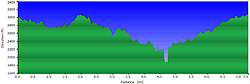
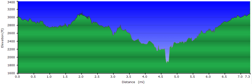
Elev. Gain:
Resources: |
4 hours with 1 hour of breaks
1,200 ft
 Topo Hike Trails Map (PDF) Topo Hike Trails Map (PDF)
Edgemont NC Weather Forecast
Garmin (GDB), Gaia/Trails App (GPX) (What's this?)
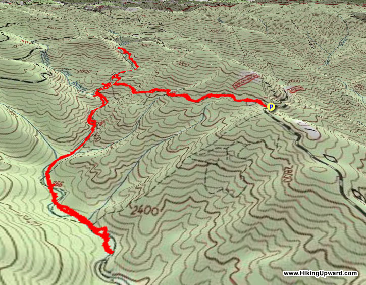
3D View of Route |
 By Trail Contributor: Zach Robbins (Contact Zach) By Trail Contributor: Zach Robbins (Contact Zach)
The Wilson Creek watershed in Pisgah National Forest boasts a number large creeks and impressive waterfalls. One of the most picturesque falls in this region is North Harper Creek Falls, tucked high away from the crowds that normally visit Wilson Creek and Harper Creek Falls during the summer months.
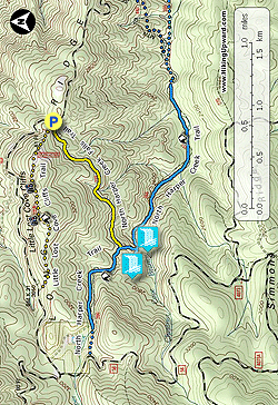
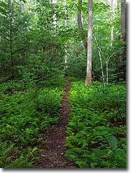
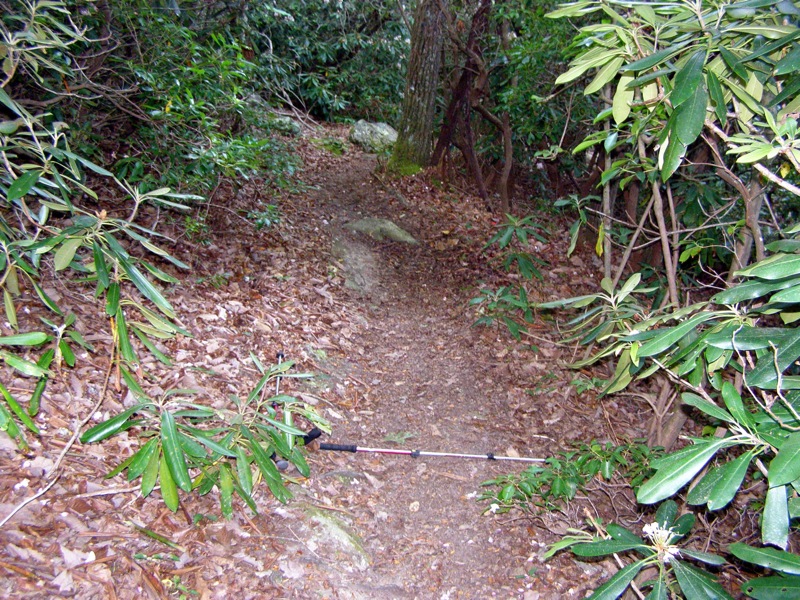
There are multiple ways to access the waterfall, this hike begins with the North Harper Creek Falls Trail [239] on FSR 464. At this trail head you can also hike the short Little Lost Cove Cliffs Trail. From the road, follow the gentle trail through hardwood forest until it meets the North Harper Creek Trail. The North Harper Creek Trail [266] is an old railroad grade that parallels North Harper Creek for over 4 miles, a reminder of the past when this region was heavily logged. Now it is part of the Harper Creek Wilderness Study Area, and in combination with its northern neighbor the Lost Cove Wilderness Study Area, is in line to receive Wilderness or National Recreation Area designation in the near future. At this trail junction first turn right to explore the top of the waterfall and beautiful sections of the creek. There are multiple excellent campsites along this section. The hike then returns to the trail junction to descend to the base of North Harper Creek Falls, passing right by the top of Chestnut Cove Branch Falls.
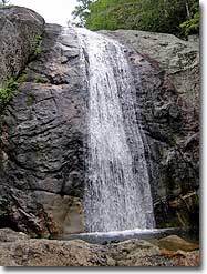
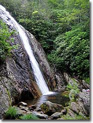
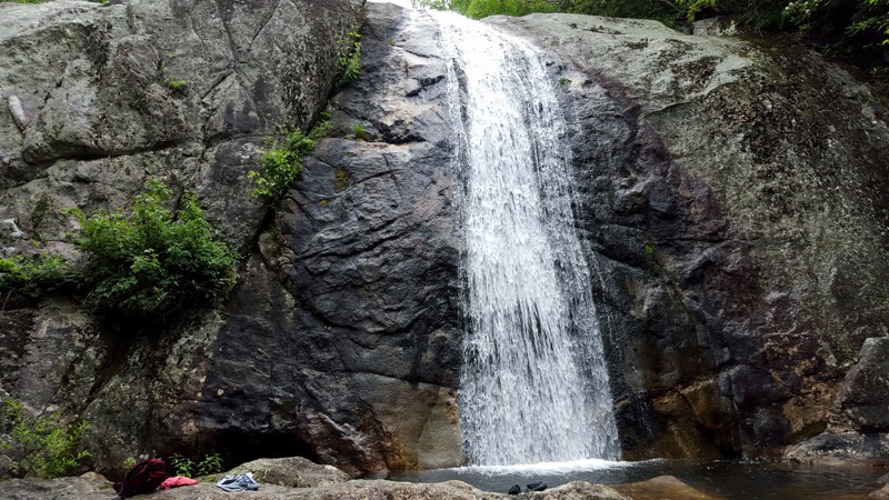
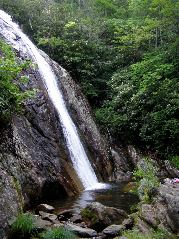
North Harper Creek Falls tumbles hundreds of feet over bare rock before the final 40 foot drop. There is arguably one of the best campsites in North Carolina right beside the base of the falls. You can choose to head back to your car or continue heading east to explore more sections of North Harper Creek and more excellent campsites.
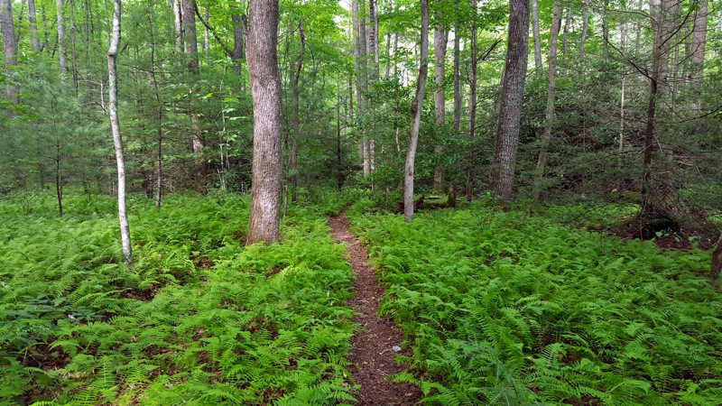
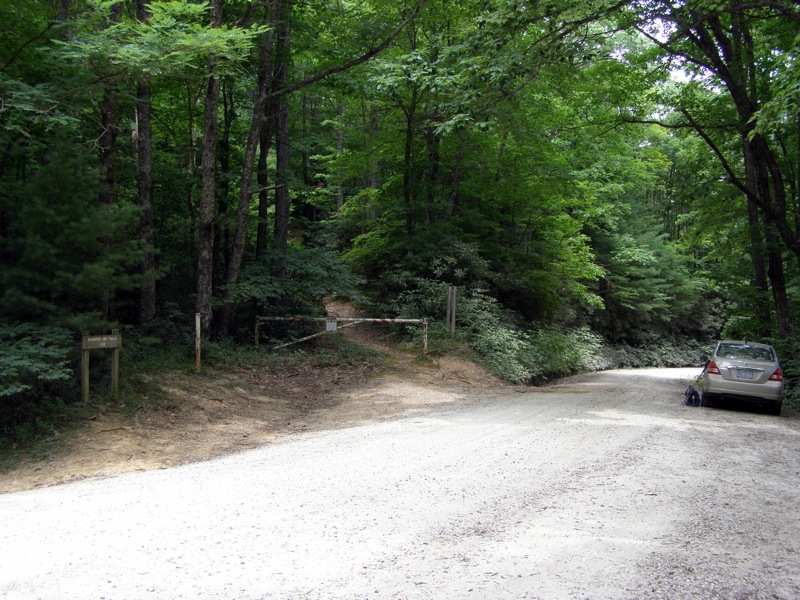
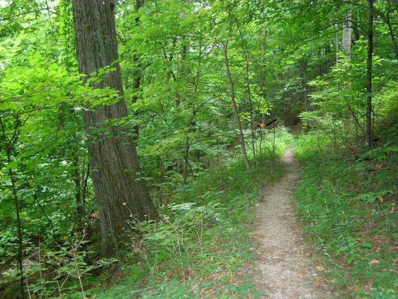
- Mile 0.0 – At the parking area on FSR 464 follow the North Harper Creek Falls Trail [239] south (yellow blaze). The Little Lost Cove Cliffs Trail [271A] (orange blaze) branches right at the trail head. For the next mile the trail is a well-graded track through towering hardwoods where there is sparse undergrowth.
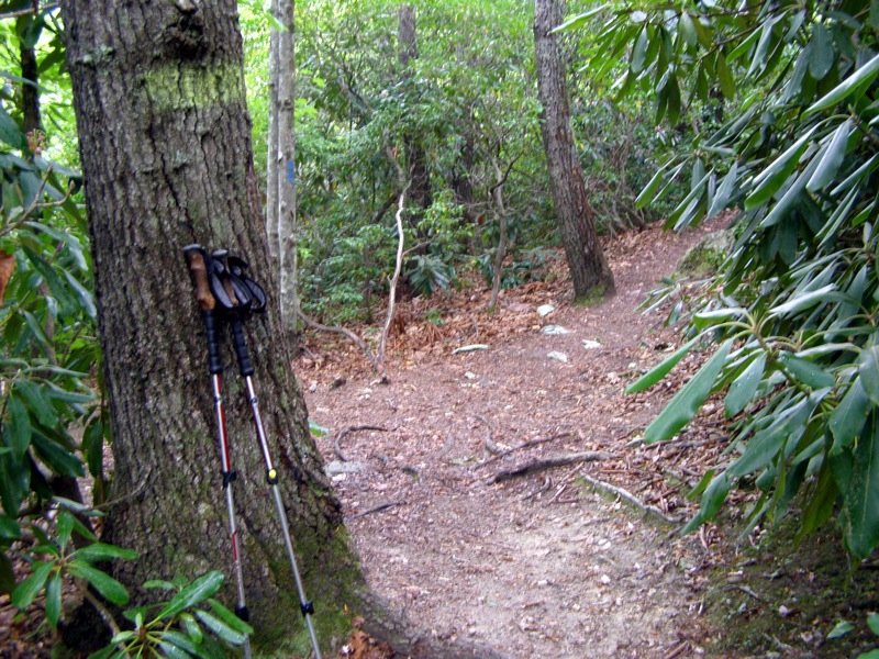
- Mile 1.1 – North Harper Creek Falls Trail ends at curved T-junction with the North Harper Creek Trail [266] (blue blaze). Continue straight/right on the North Harper Creek Trail heading west. You’ll notice three spur trails on the left heading steeply down the ridge. Avoid the first spur which is directly before the trail bends around a wash that may have water.
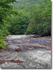
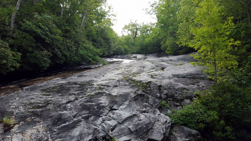
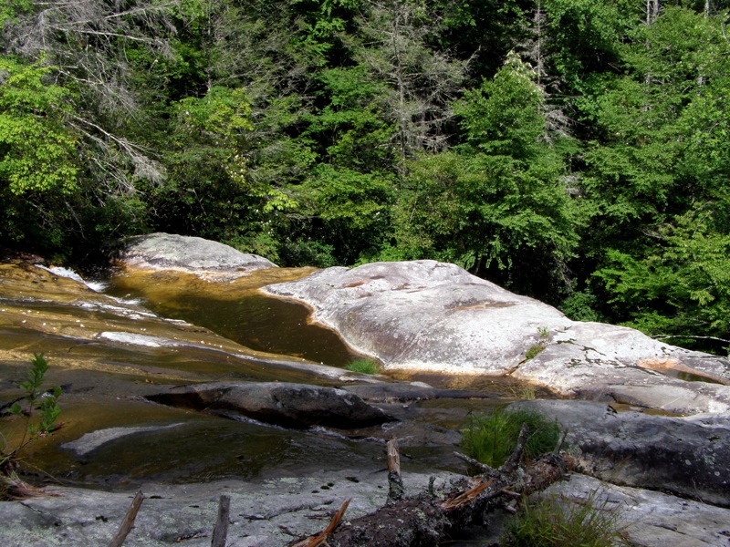
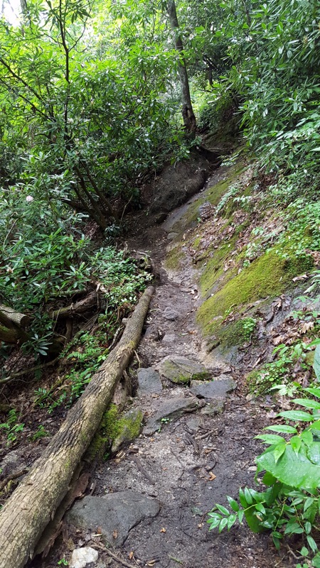
- Mile 1.3 – The second and third spur trails lead to viewpoints along the top of North Harper Creek Falls. The third spur on the left has a nice campsite. From here you can view North Harper Creek at the beginning of the long slide that culminates in the main waterfall. If the rock is wet venturing onto the bare rock could be fatal, there would be nothing to stop you from rolling 200 feet. The old trail crossed the creek here and continued down the south side of the creek to the base of the waterfall.
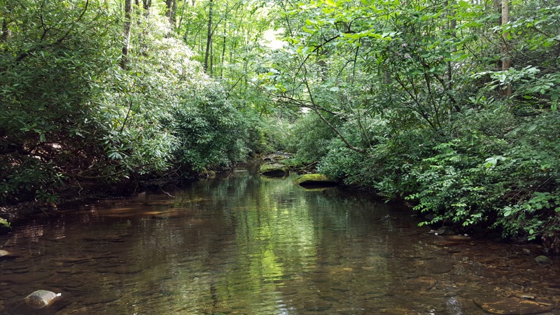
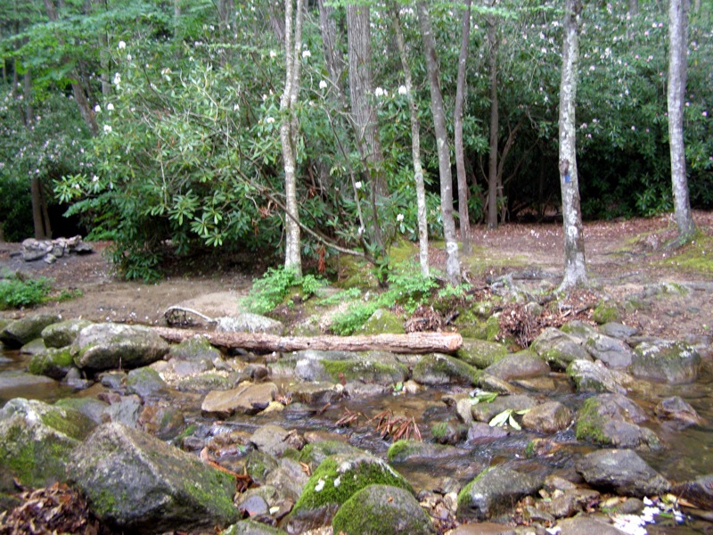
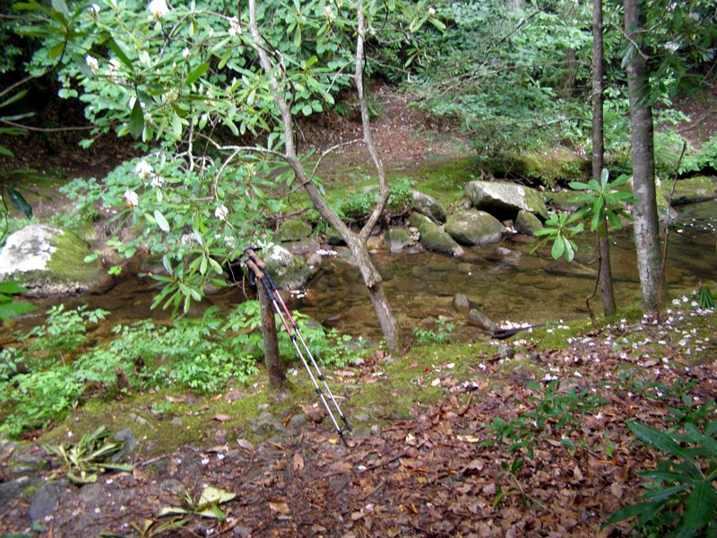
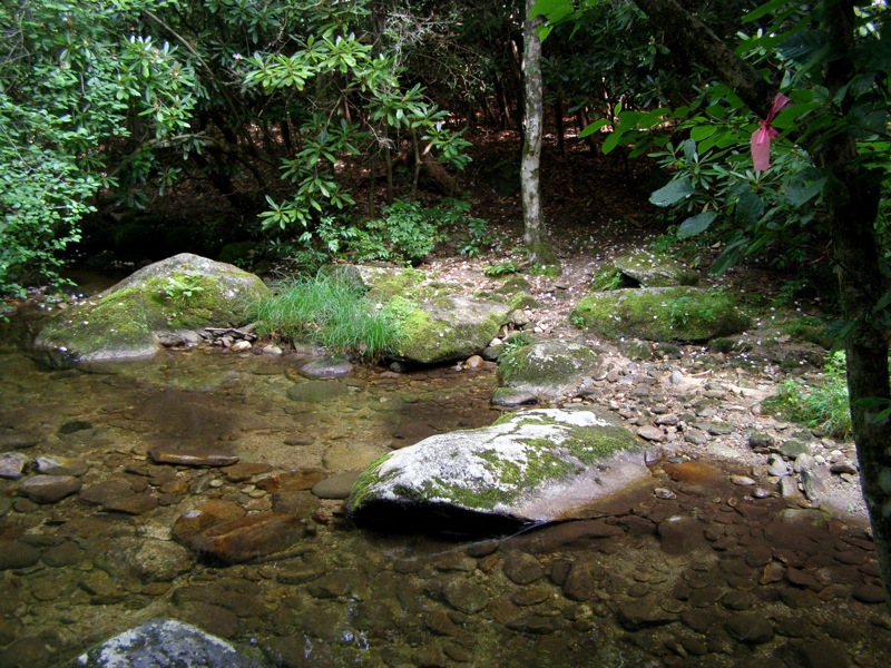
- Mile 1.5 – Continuing west, rock hop across North Harper Creek. There is an excellent, shaded campsite on the other side.
- Mile 1.6 – Second rock hop across North Harper Creek.
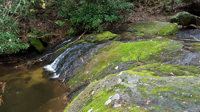
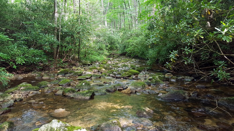
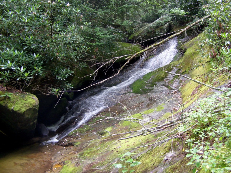
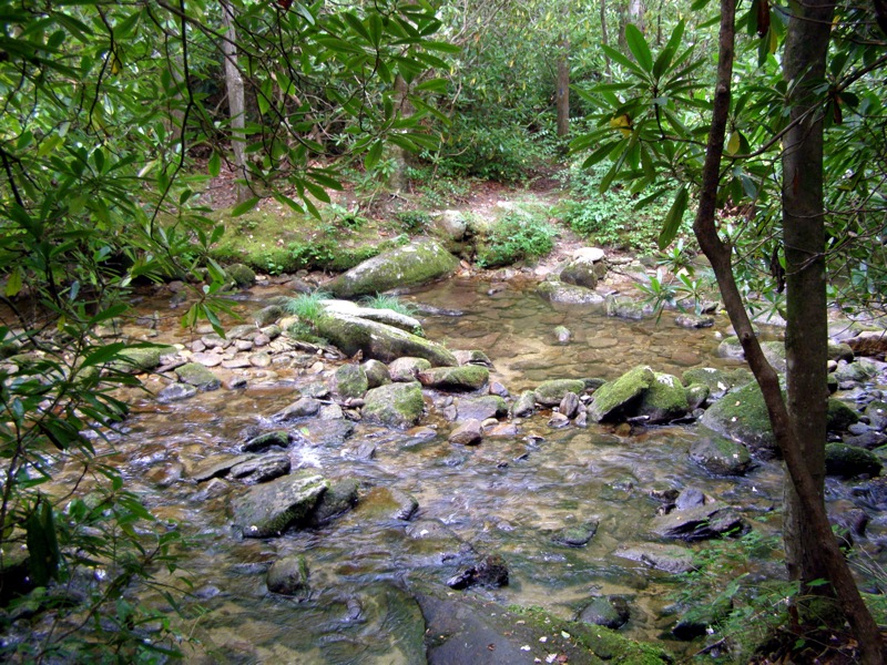
- Mile 1.9 – Along a bank that is supported with a large log there is a scramble path to the base of a small, unnamed 20-foot waterfall.
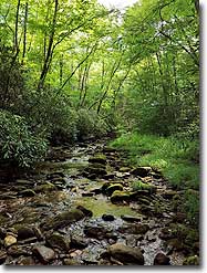
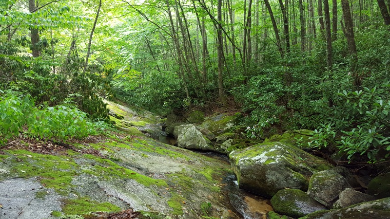
- Mile 2.0 – Come across a beautiful section of creek as it passes through a small V-notch that is covered in moss. This section is before the last rock hop across North Harper Creek. After this crossing the trail leaves the creek and ends at FSR 58. Turn around here and head back towards the waterfall.
- Mile 2.9 – Turn right on the North Harper Creek Trail [266] (blue blaze) at the curved T-junction with North Harper Creek Falls Trail.
- Mile 3.0 – After a quick, steep downhill the trail reaches a T-junction at the creek. The North Harper Creek Trail continues left. (This is actually the top of Chestnut Cove Branch Falls if you want to turn left and explore this first). Turn right on a spur trail to North Harper Creek Falls and almost immediately the trail will cross the creek via rock hop.
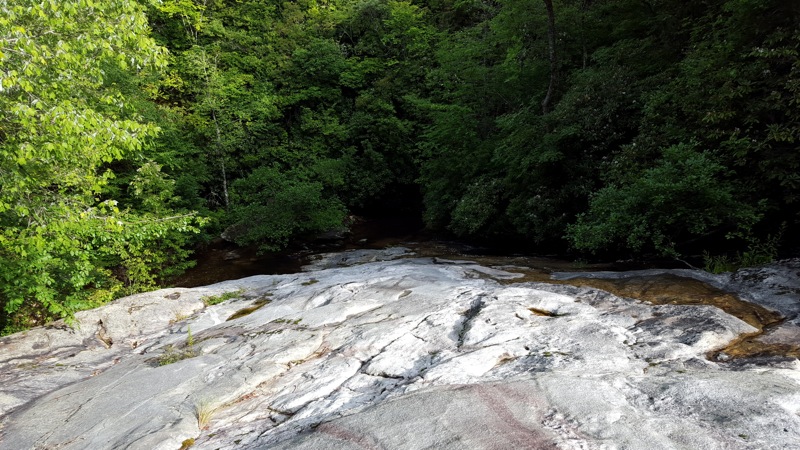
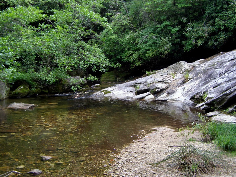
- Mile 3.1 – Pass through a large campsite, which could be considered one of the best camping spots in the region. Just to the right of the campsite is North Harper Creek Falls, a stunningly beautiful waterfall that culminates in a 40-foot drop over a massive cliff. From here it is impossible to see the entire waterfall as it begins its slide over 150 feet above, but the lower drop is the star attraction. The pools around the base are shallow, allowing you to fully explore the area.
- Mile 3.3 – The old trail leads up the left side of the waterfall heading southwest to an old access trail from FSR 58 before turning northwest where it connects to the new trail at the top of the waterfall at mile 1.3. There are a couple of spots to explore the slide part of the waterfall, use caution. Turn around and head back to the North Harper Creek Trail.
- Mile 3.5 – At the junction is the top of Chestnut Cove Branch Falls. Look for two spur trails on the right. The first spur trail leads to a section near the top of the waterfall. The second spur trail leads to the small pool at the base of the waterfall. Unless it is high water most of the waterfall flow is channeled to the left of the bedrock.
- Mile 3.6 – Continue heading east on the North Harper Creek Trail to explore the creek downstream, find excellent campsites, or reach Bard Falls.
- Mile 4.4 – Wet crossing #1 of North Harper Creek. There are huge campsites after this crossing on the left side of the trail.
- Mile 4.5 – Wet crossing #2 of North Harper Creek.
- Mile 4.8 – Wet crossing #3 of North Harper Creek.
- Mile 4.9 – Turn around at wet crossing #4 of North Harper Creek. If you continue down North Harper Creek Trail you’ll inevitably pass by more secluded campsites. This long section between North Harper Creek Falls and the trails leading to Harper Creek Falls and South Harper Creek Falls is rarely traveled. Approximately a mile beyond this turnaround is Bard Falls on North Harper Creek if you have more time to explore.
- Mile 6.2 – Turn right at junction with spur trail to North Harper Creek Falls.
- Mile 6.3 – Turn right onto the North Harper Creek Falls Trail (yellow blaze).
- Mile 7.3 – Hike ends at FSR 464.
|


