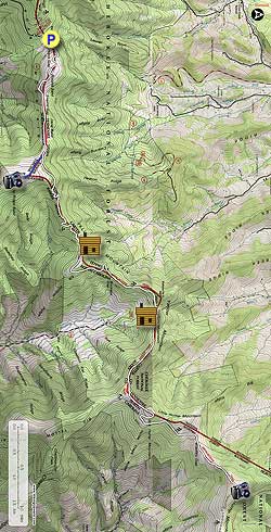
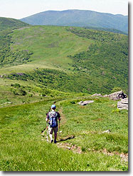
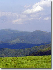
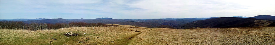
Frequently cited as the most scenic stretch of the Appalachian Trail in the Southeast, the only way to know for sure is to plan a visit to the Roan Highlands. The area derives its name from the Roan Mountain massif and its resemblance to the treeless highlands of Scotland. In addition to being the longest stretch of grassy balds in the Appalachian Mountains, this region also houses stands of southern Appalachian spruce-fir forest and the world’s largest natural rhododendron garden. Starting at Carver’s Gap on the North Carolina-Tennessee border, the Appalachian Trail crosses over massive bald summits for miles with outstanding views of the tallest peaks in North Carolina and Virginia. One could spend an entire day meandering around the three balds closest to the parking lot, but this hike summits five balds including the spectacular and difficult to reach Hump Mountain. Check this hike off your bucket list as soon as you can, because you’ll want to visit more than once.
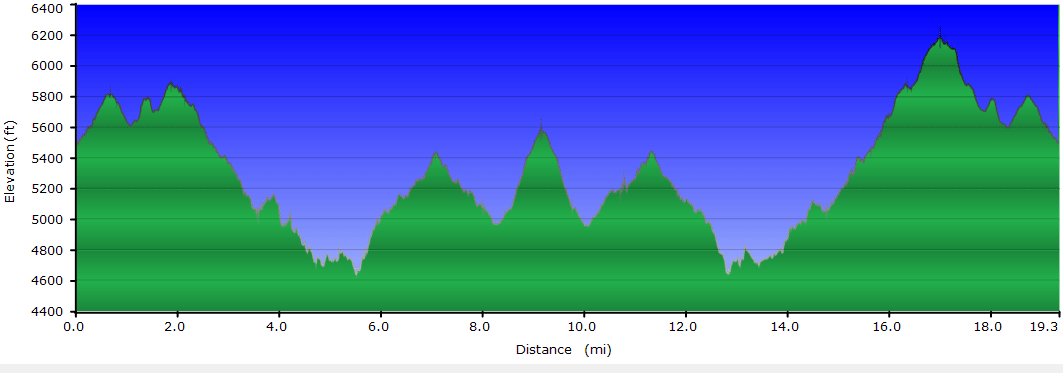
This full hike is long and difficult and is best tackled as a backpacking trip or a shuttle hike between Carver’s Gap (TN-143 and NC-261) and U.S. 19E. For overnight backpacking the best camping areas are near the Stan Murray Shelter or the Overmountain Shelter. A shuttle hike between Carver’s Gap and U.S. 19E is not mapped beyond Hump Mountain but is approximately 15.3 miles including a side trip to Grassy Ridge Bald. The section from Hump Mountain to U.S. 19E is approximately 5 miles of descent. A shuttle hike in reverse starting at U.S. 19E is much more difficult. Mountain Harbour Bed and Breakfast located beside the Appalachian Trail junction with U.S. 19E offers shuttle service to Carver’s Gap for $40. The shorter and more popular option is the relatively easy hike to Grassy Ridge Bald. Expect lots of hikers on this stretch, especially during peak flower blooms in June.
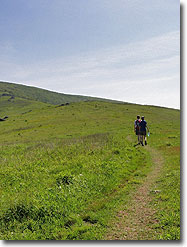
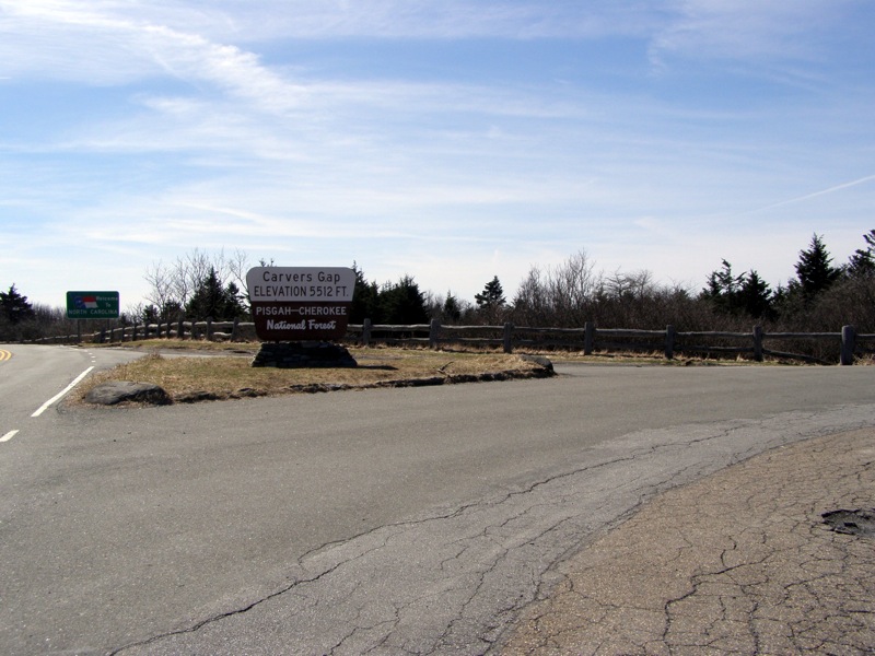
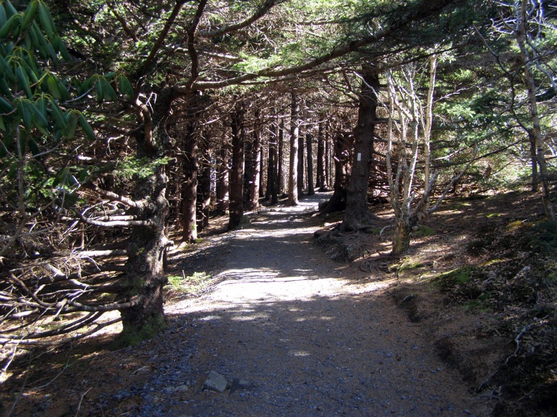
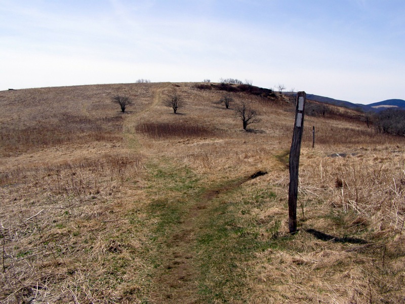
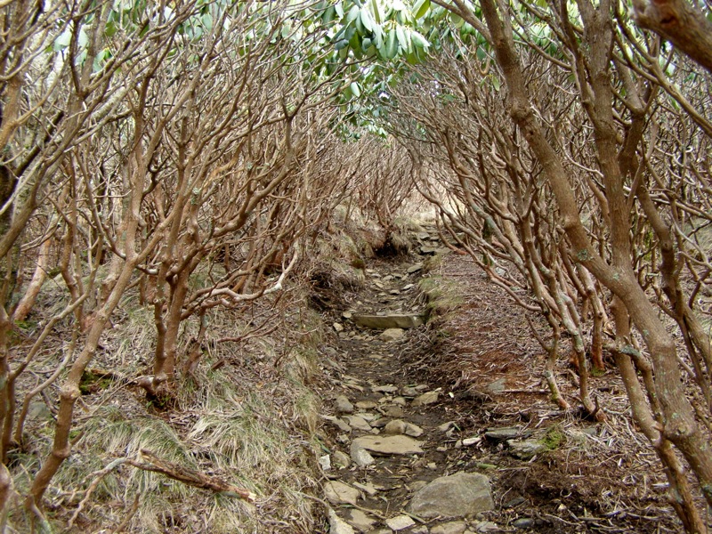
Mile 0.0 – Starting at Carver’s Gap, pass through a wood fence and follow the Appalachian Trail (white blaze) north. Initially you will pass through Catawba rhododendron lining the trail before entering a small stand of southern Appalachian spruce-fir forest. The Appalachian Trail from Carver’s Gap to beyond the summit of Round Bald is mostly gravel and immaculately maintained due to heavy traffic.
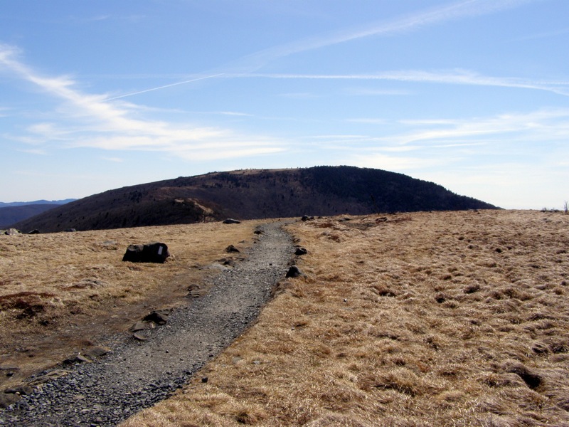
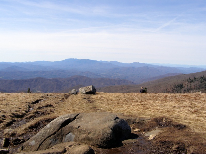
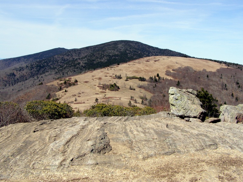
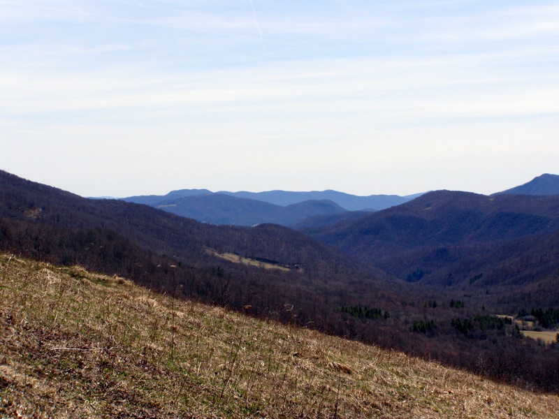
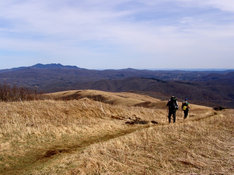
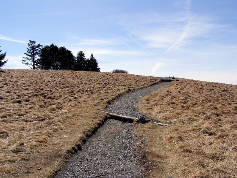
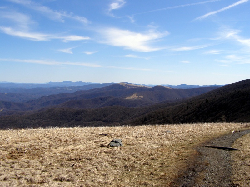
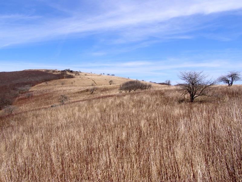
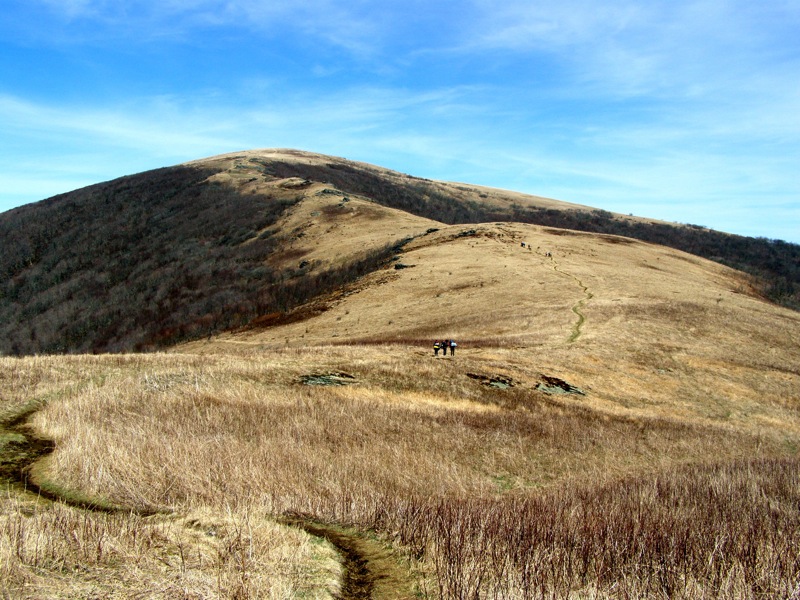
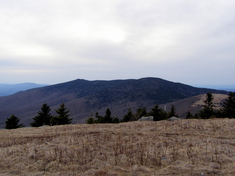
Mile 0.7 – Hike over the summit of Round Bald (5,825 feet), the first of the many impressive balds in the Roan Highlands. From this massive grassy bald you will have 360° views of the North Carolina, Tennessee, and Virginia mountains. Roan High Knob and its expansive spruce-fir forest rises high above Carver’s Gap. You can view the outline of the hike starting with the trail over the ridge towards Jane Bald and Grassy Ridge Bald then ending in the distant northeast. Your destination is the large, round grassy mountain in the distance, Hump Mountan.
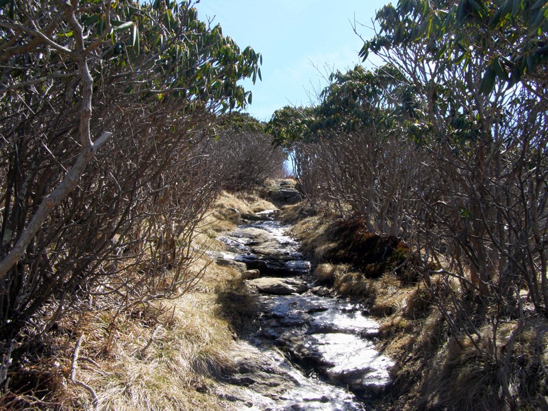
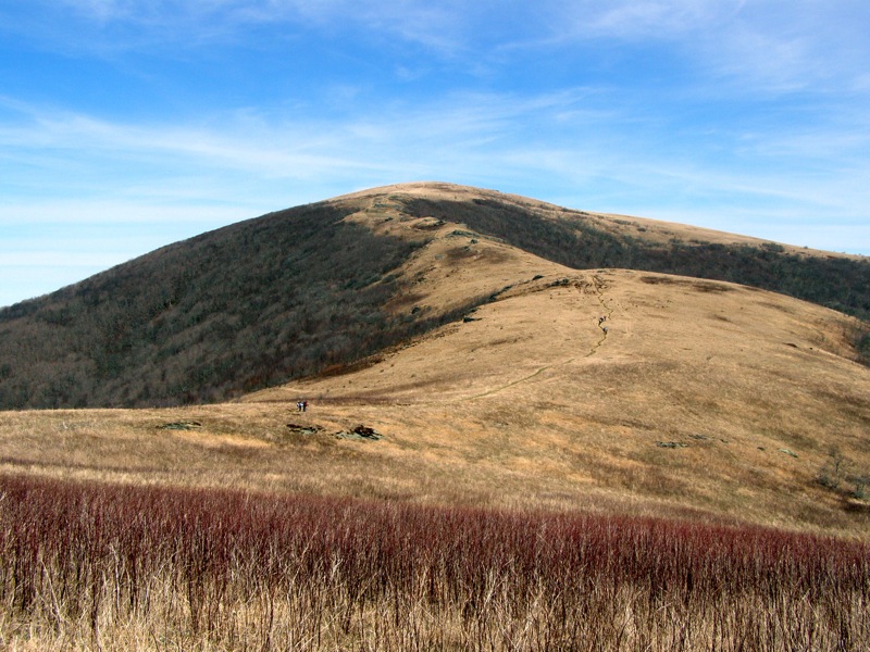
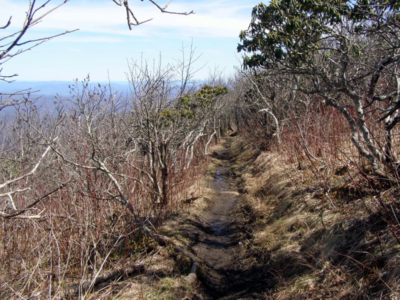
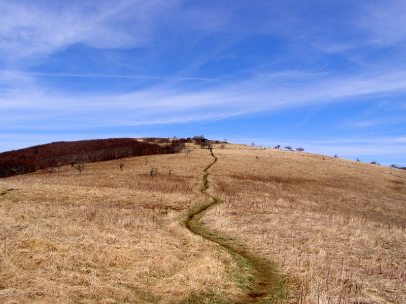
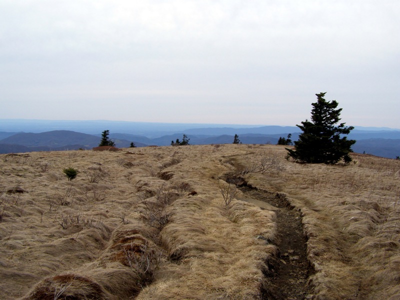
Mile 1.1 – Walk through Engine Gap which lies between Round Bald and Jane Bald. This windswept gap is arguably as scenic as the surrounding summits. The Appalachian Trail transitions from a wide gravel path to a single file dirt path. From Engine Gap the trail climbs through heath shrubs on heavily eroded roots and rock slabs.
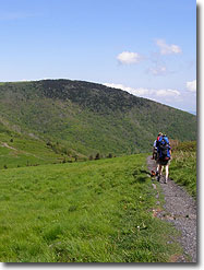
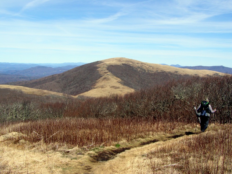
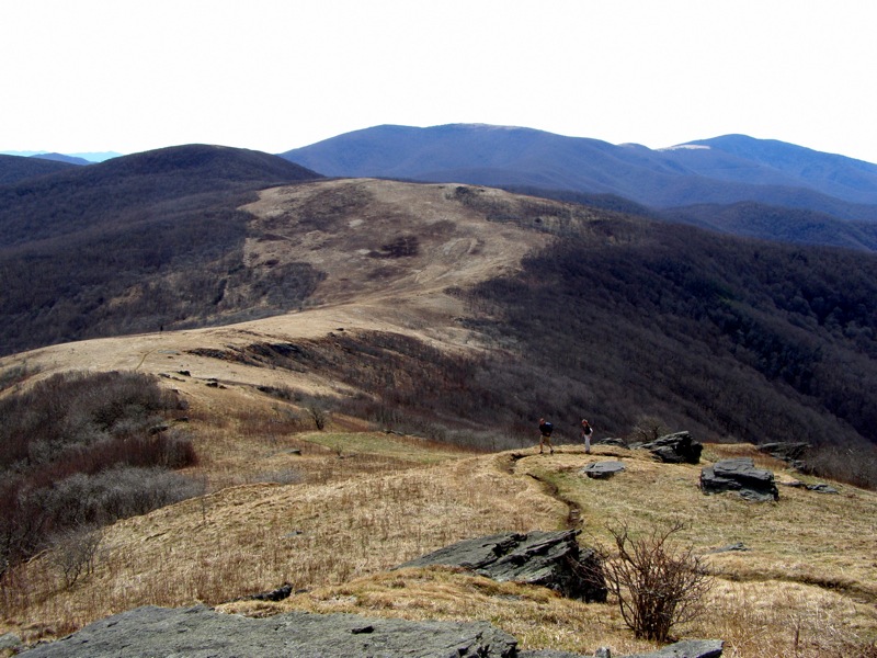
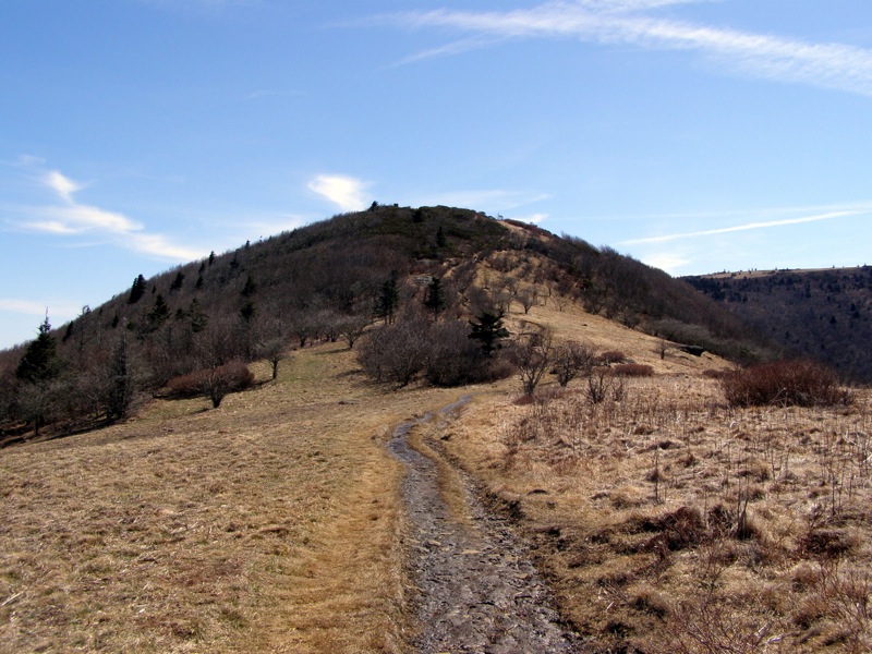
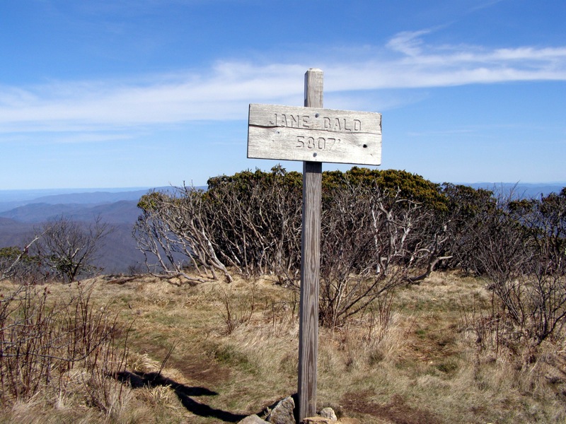
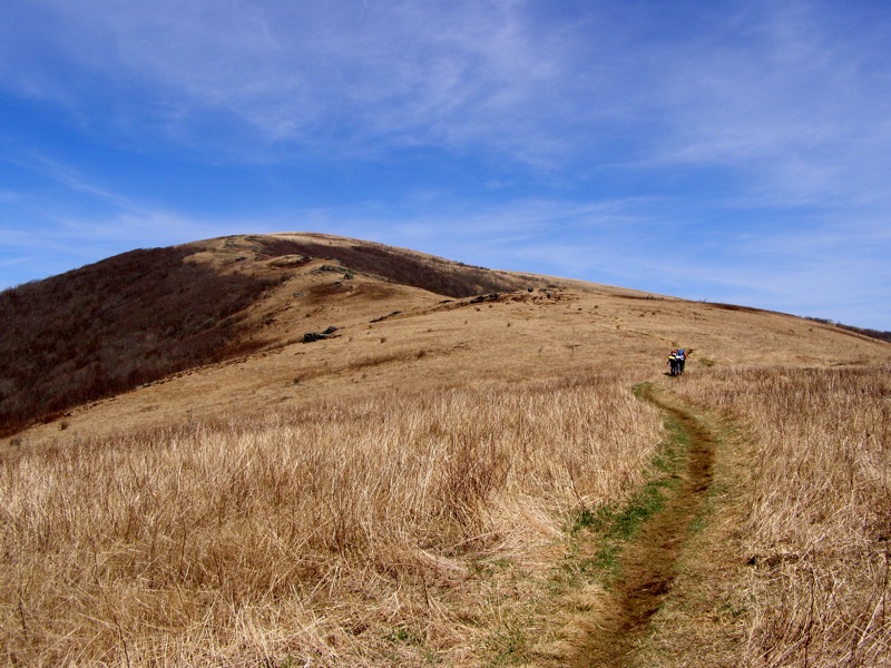
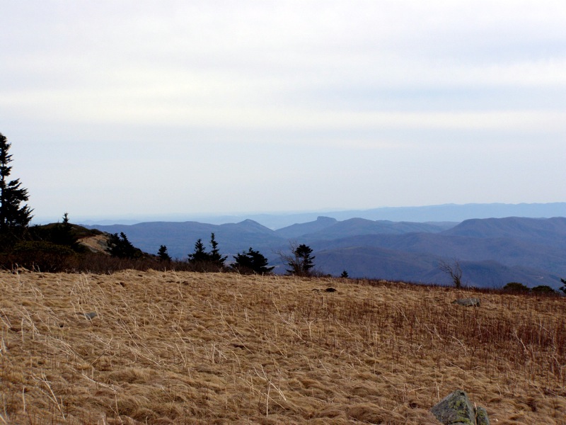
Mile 1.4 – The summit of Jane Bald (5,820 feet) is smaller and less-defined than Round Bald. Heath shrubs are more prominent on this mountain but there are still great views in all directions. A rock on the east side of the summit provides an excellent view of Grassy Ridge Bald. From Jane Bald the trail drops into an unnamed gap below Grassy Ridge Bald then climbs the west ridge with open views throughout.
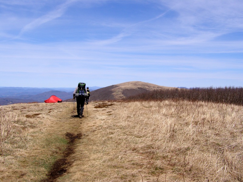
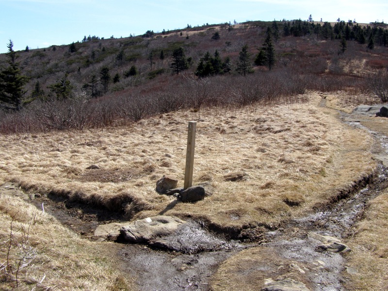
Mile 1.9 – The Grassy Ridge Bald Trail(no blaze) forks off to the right. For the shorter day hike turn right on the spur trail to Grassy Ridge Bald. For the longer day hike, shuttle hike, or backpacking trip continue north on the Appalachian Trail.
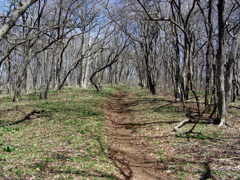
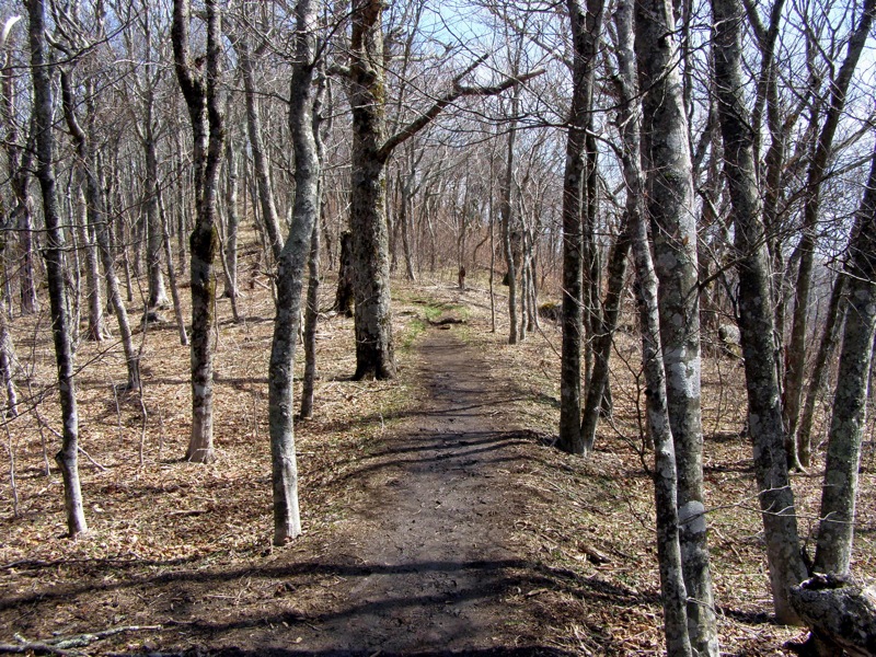
The Appalachian Trail follows the west flank of Grassy Ridge Bald through aspen forest then begins a long switchbacking descent through hardwood forest towards the Stan Murray Shelter. There are multiple campsites beside the trail after the initial descent but no access to water.
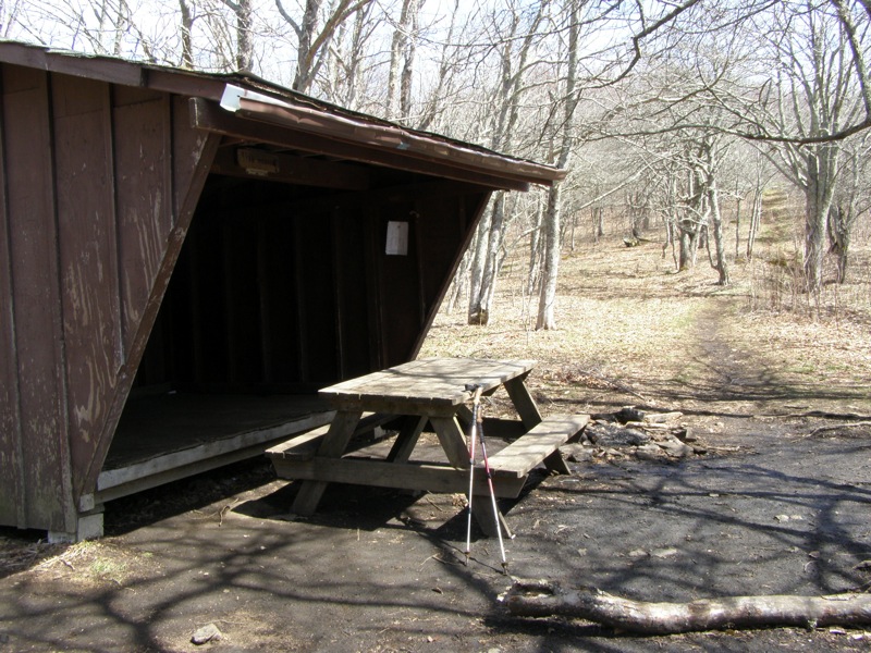
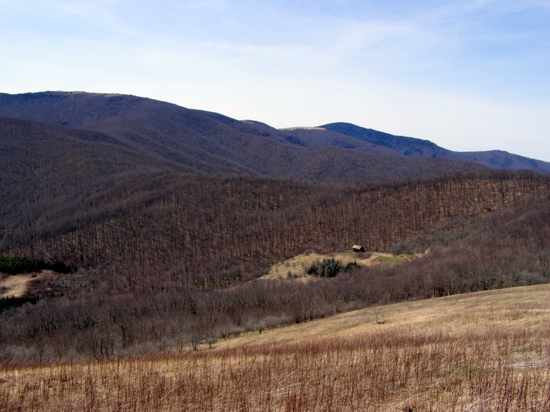
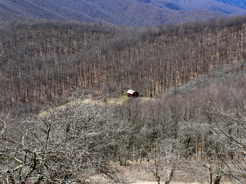
Mile 3.5 – At Low Gap below Elk Hollow Ridge of the Yellow Mountain massif sits the Stan Murray Shelter. This is a small shelter but there are multiple campsites in the surrounding area with good tree cover. On busy weekends this area will offer more solitude for campers than the extremely popular Overmountain Shelter 2.3 miles ahead. A spring is located on the east side of the trail.
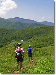
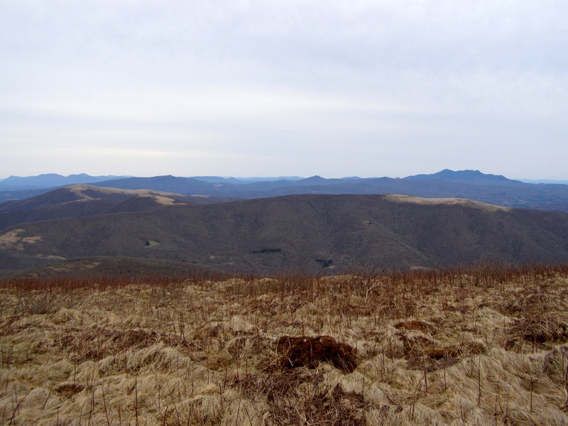
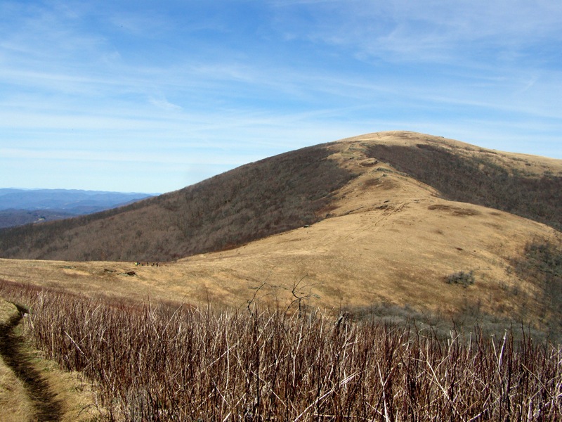
From Low Gap the trail climbs Elk Hollow Ridge with views southwest of Grassy Ridge Bald. The forest along this ridge is surprisingly sparse. Beyond the ridge the trail drops into beautiful woodlands around Buckeye Gap before the final descent to Yellow Mountain Gap.
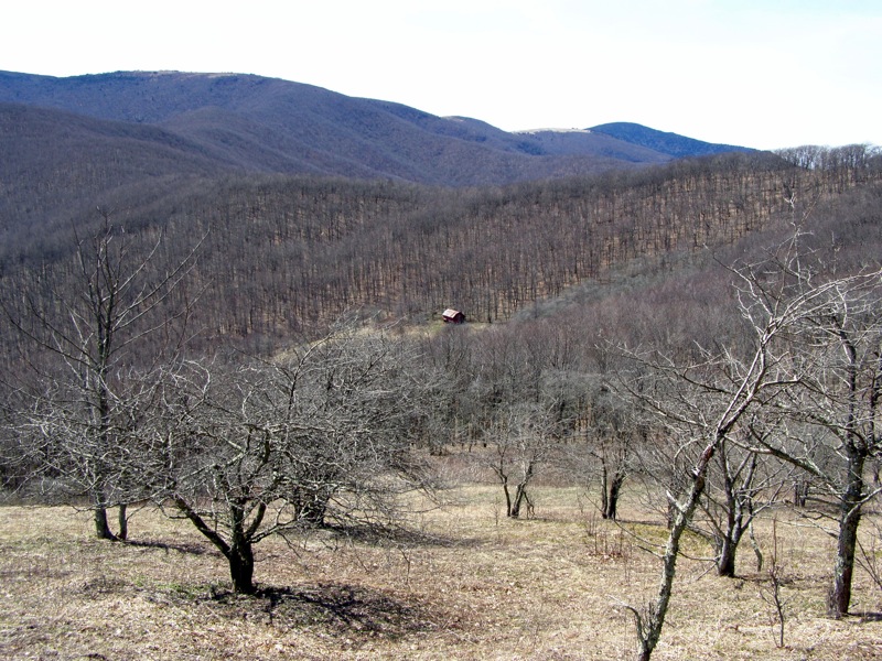
Mile 5.5 – Junction with the Overmountain Victory National Historic Trail (OVHT) (white triangle blaze) at Yellow Mountain Gap. The Overmountain Shelter is 0.3-mi on the east/right side. Before the shelter is a large field that can fit many tents. A spring is located 0.2-mi down the trail as well.
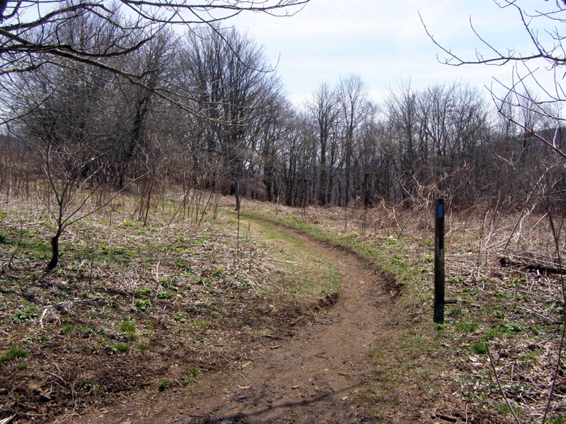
Mile 6.5 – At a Y-split a forest road branches right to campsites and an unmaintained trail to Big Yellow Mountain. Stay left on the Appalachian Trail.
Instead of continuing north the Appalachian Trail abruptly heads south away from the summit before turning north through forest along the east side of Little Hump Mountain. Along this stretch there are multiple forested campsites beside the trail and dependable water sources.
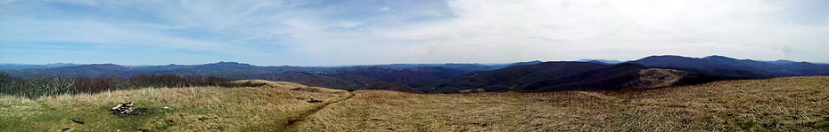
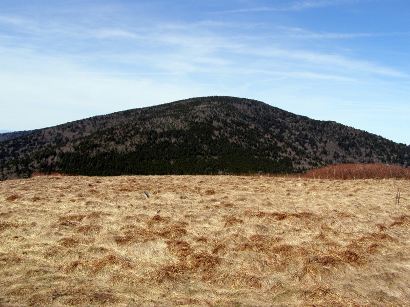
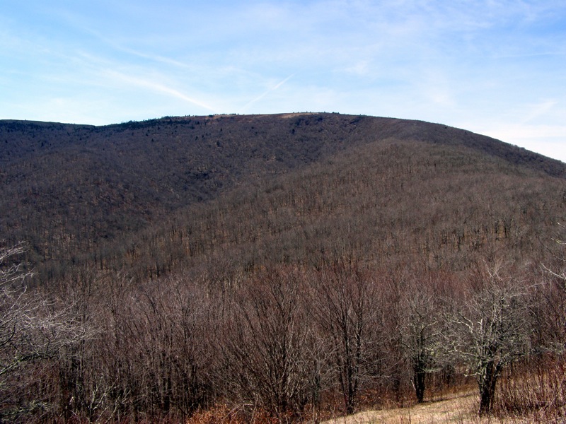
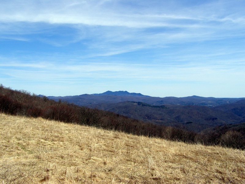
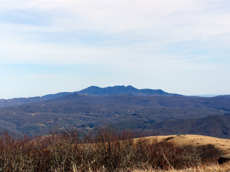
Mile 9.1 – Hump Mountain (5,587 feet) is the turnaround point of this hike and perhaps the finest bald summit in the Southeast. This peak is a minimum 8 mile roundtrip hike from any trailhead and thus less frequently visited than the balds near Carver’s Gap. The 360° views are unparalleled, as you can track your entire hike to this point from Grassy Ridge Bald to the distant Round Bald with murky Roan High Knob rising behind. Mt. Rogers and Whitetop Mountain in Virginia are far to the northeast but the most striking view is due east of the craggy, west face of Grandfather Mountain. The Appalachian Trail descends north from the summit across open meadows. Turn around and head down to Bradley Gap or continue north for the shuttle hike.
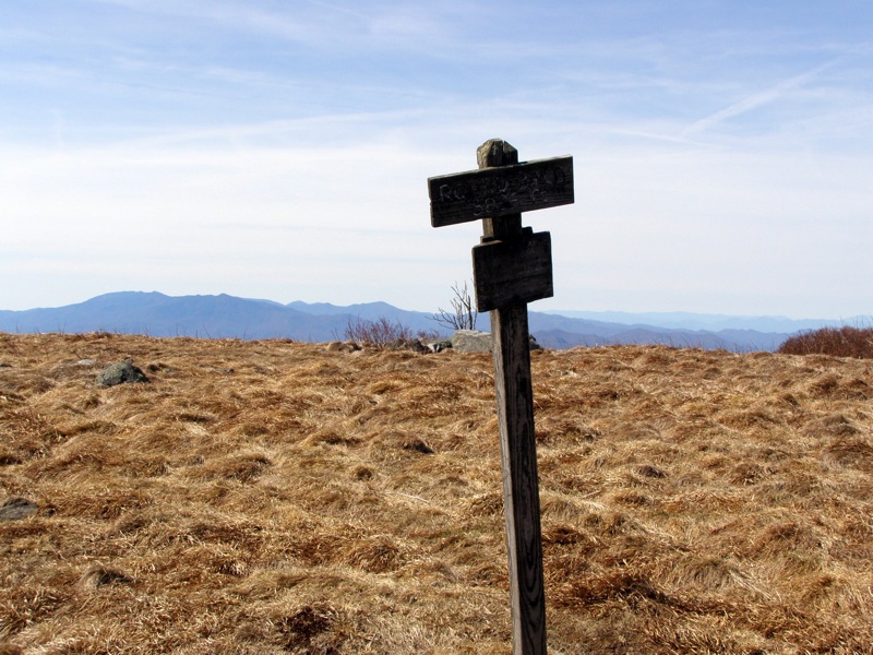
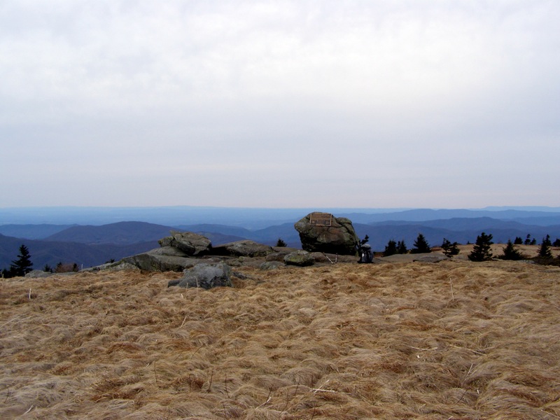
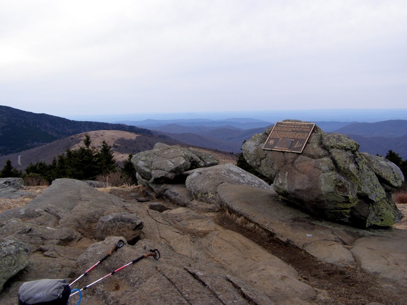
Mile 17.0 – The summit of Grassy Ridge Bald (6,189 feet) is marked by a rock pile with a bronze plaque for Cornelius Rex Peake. You can continue exploring side paths south if you choose along Grassy Ridge. You can spot the distinctive Hawksbill Mt. and Table Rock Mt. of Linville Gorge to the southeast.
Mile 17.6 – Turn left on the Appalachian Trail heading south back to the parking area at Carver’s Gap to finish the hike.
Mile 19.3 – Hike ends at Carver’s Gap.
Mid May
Early April
Roan Highlands Hike Comments
Archived Comments
By:Zachary Robbins
Rating:
Date of Hike: Sunday, April 8, 2018
On Sunday I hiked to Little Hump Mt and Hump Mt from a trailhead that's a first time for me. Since it is the shortest, easiest access to these 2 remote peaks, I really wanted to get out and track it for the site. It so happens that the rain on Saturday turned to snow/ice, and the scenery was absolutely stunning for this hike. All of the grass and trees were covered in 1+ inch of rime ice that remained throughout the day. The views were outstanding, even with the low cloud ceiling. Unfortunately the rain and snow, combined with trail traffic made the Appalachian Trail incredibly muddy for the whole trip. I've hiked this area quite a few times and this was by far the least pleasant experience I've had on the trail. Don't let that deter you, but if it rained recently I'd suggest wearing those shoes and pants that you are ok with getting covered in mud. Otherwise, a beautiful day of hiking. Hump Mountain remains one of my top 5 peaks in the Southeast.
By:Zachary Robbins
Rating:
Date of Hike: Saturday, June 10, 2017
I did a small sliver of this hike 2 weeks ago, tracking a sister hike for the Roan Highlands that I'll eventually post. This is the first time I've hiked here in the summer in many years, and the parking at Carvers Gap was insane. I drove up there at 10:00 AM and the entire area was full with cars spilling over the narrow shoulders of the highway on each side of the gap. I would estimate there were well over 100 cars, and throngs of people. I left and parked in a secluded area many miles away. My suggestion is to get there very early on summer weekends, or be prepared to wait.
Early- to mid-June is the best time for flowers all over the Roan Highlands, one of the reasons why it is so crowded all summer. The Catawba rhododendrons were excellent from Round Bald to Grassy Ridge Bald. The flame azaleas were just beginning to bloom in most locations, these typically bloom 1-2 weeks after Catawbas. Get out there and enjoy it, the views are always spectacular and the flowers are incredible if you pick the right time.
By:Ed Matthews
Rating:
Date of Hike: Wednesday, May 3, 2017
This is a must-do hike. Of all the hundreds of miles of AT that I have hiked, these few are probably the most beautiful. Just put this on your list and go do it. It's a super easy hike with astounding views. My photos do not do the place justice. Bring sunscreen. There's no shade.
We only did Carver's Gap to Grassy Ridge Bald and back. A knee injury kept us from doing Roan High Knob and Roan High Bluff too, on the AT south side of the gap.
Great hike! I just hiked from Carvers Gap to 19E (Mountain Harbour B&B/hostel) for the second time. Created a general guide if anyone would like it (just email me). Strongly recommend paying the $5/night parking at Mountain Harbour B&B - It's safe and the people who run it are incredibly nice, oh and it has shuttle service. There are plenty of campsites, but my personal favorites are atop the balds. Our group likes to start with night-hiking on Friday nights, so we stayed atop Grassy Ridge Bald (highest elevation) and while it was a little difficult finding a spot because of the clouds covering the peak, it was a great area to wake up to. Water sources can be found in most gaps.
Campsites: Round Bald, Jane Bald, Grassy Ridge Bald, Stan Murray Shelter, Overmountain Shelter, Little Hump Mtn, Doll Flats
Water Sources: Carvers Gap, Low Gap, Overmountain Shelter, Little Hump Mtn, Bradley Gap, the trail from Doll Flats to 19E
By:Jason Viper
Rating:
Date of Hike: Friday, March 25, 2016
I had to come back! I was hoping to see everything in full bloom, but I was still a bit early. Nonetheless, the temps were perfect and views still incredible. As before, the further away you get from Carver's Gap, the more solitude you'll find. I encountered nobody from Little Hump onward. As I was making my way back to Carver's Gap, there were ALOT of people setting out for a night of camping. Be aware of the AT/Grassy Ridge Trail fork. I went the wrong way and it took about an hour and 2+ miles to figure out where I went wrong. Looking back, I don't mind the detour at all. Next time I come back I'm planning to camp, and want to go past Hump Mountain all the way to the highway and back. The beauty of this place cannot be overstated.
By:Jason Viper
Rating:
Date of Hike: Sunday, November 1, 2015
Every outdoor enthusiast needs to experience the Roan Highlands at least once, even if you don't do the full hike listed here. The "balds" are such a contrast to your typical hike, and the views I saw that day were absolutely breathtaking. I tackled the full 19.3 miles in 8 hours flat, taking 3.5 out, and 4.5 on the return trip. The march up Hump Mountain is a pretty tough climb, but there was no one section that I would rate as terribly difficult by itself. The difficulty level of this hike comes from the distance IMO. I was drained at 15 miles, so it was slow going up the long ascent at the end to get back to the trailhead. There was alot of activity near the Carver's Gap trailhead, with it tailing off significantly the further away you got. I still spent the better parts of the hike in solitude, which was great. I had originally planned on hiking Mt. Mitchell this day, but one look at the photos of the Roan Highlands and my decision was made!


.jpg)
.jpg)
.jpg)
.jpg)
.jpg)
.jpg)
.jpg)
.jpg)
.jpg)
.jpg)
.jpg)
.jpg)
.jpg)
.jpg)
.jpg)
.jpg)
.jpg)
.jpg)


