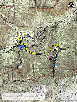
The
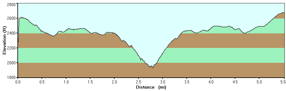
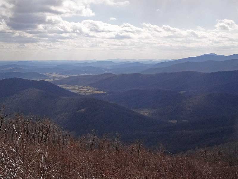
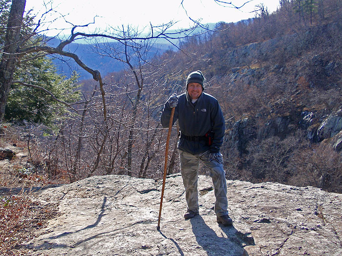
Big Devils Stairs hike is one of the more overlooked scenic gorge hikes in the Shenandoah National Park. With two nice overlooks of the gorge and valley below, this 5.5 mile out and back hike is a nice alternative to the more crowded hikes in the northern section of the SNP.
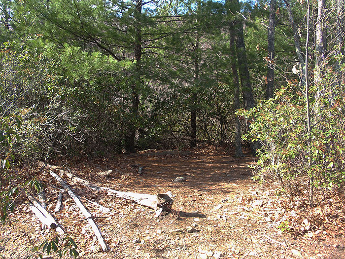
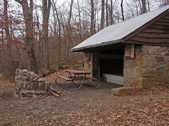
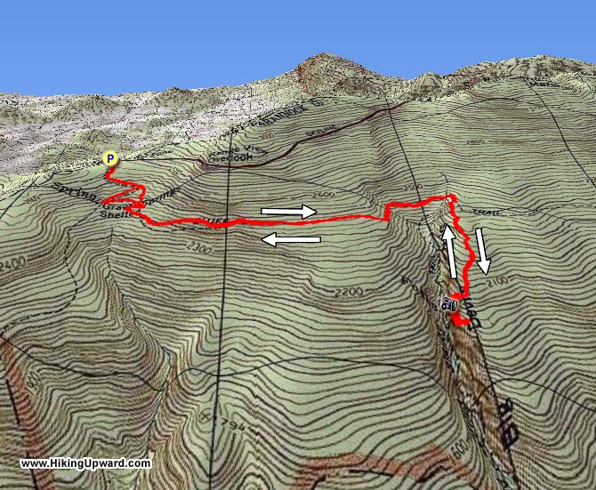
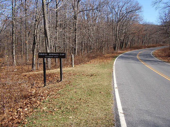
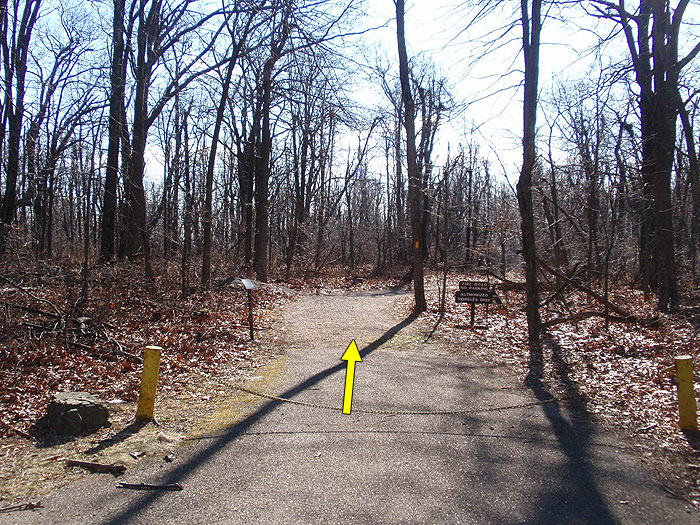
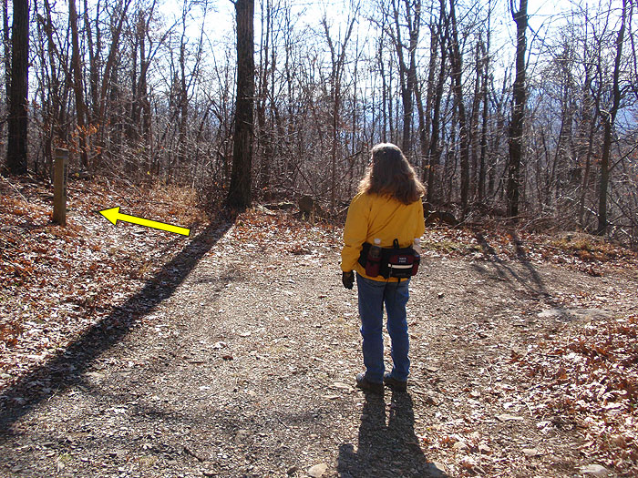
From the parking area at Gravel Springs Gap, pass the chain gate and follow the wide yellow blazed fire road as it heads downhill. The white blazed Appalachian Trail will follow the fire road on the right for the first 200 yards. The fire road will begin to descend more steeply before making a hairpin turn to the right at the first intersection.
Turn left following the narrower yellow blazed horse trail towards Big Devils Stairs (the fire road will now become blue blazed as it heads towards Gravel Springs Shelter). Follow the yellow blazed horse trail for 0.1 miles to the next intersection. Turn left remaining on the yellow blazed trail (again the blue blazed trail to the right goes to the shelter). In 200 yards the yellow blazed trail arrives at the intersection of the yellow blazed Bluff Trail.
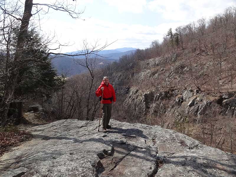
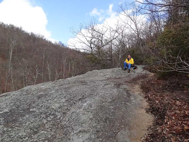
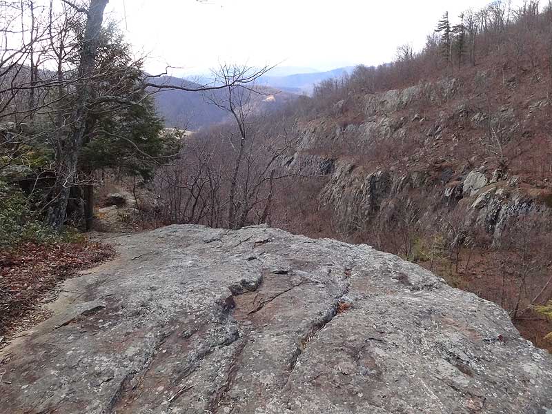
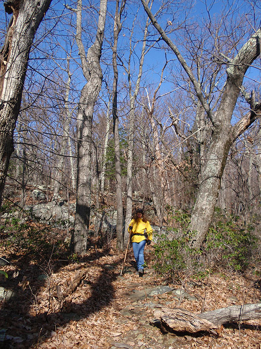
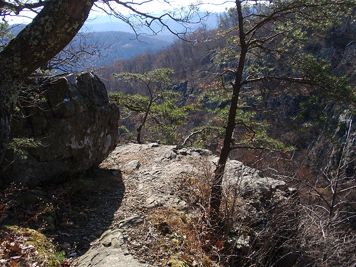
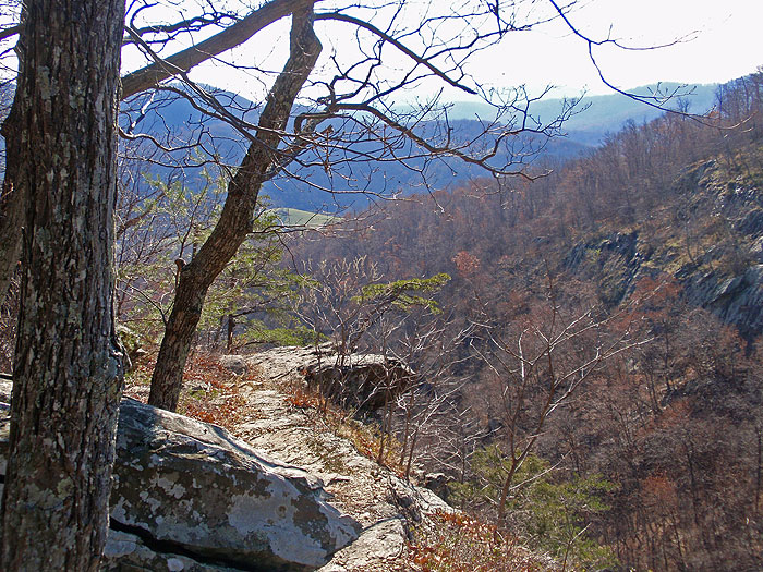
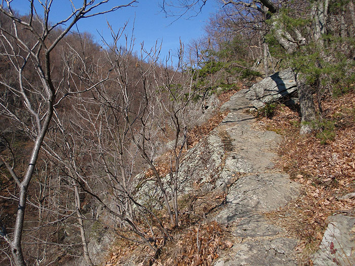
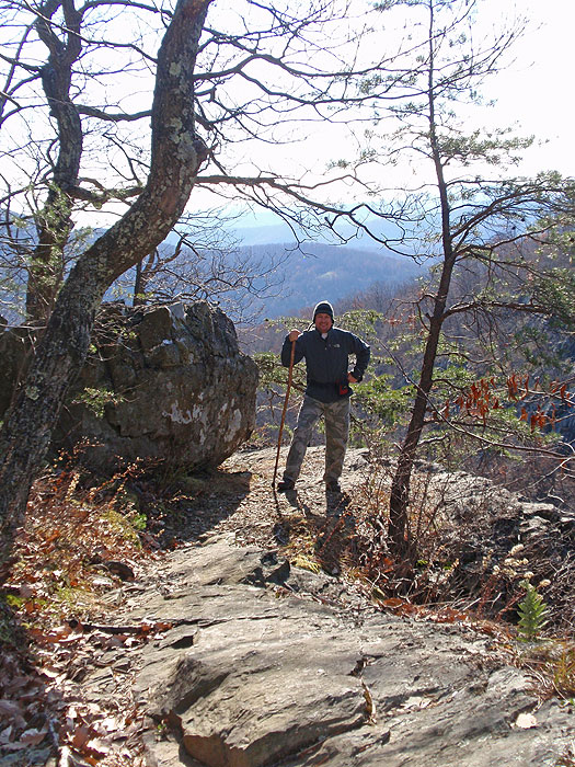
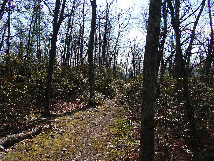
Turn left on the yellow blazed Bluff trail towards Big Devils Stairs, as it heads north around the mountain for 1.4 miles to the intersection of the blue blazed Big Devils Stairs trail.
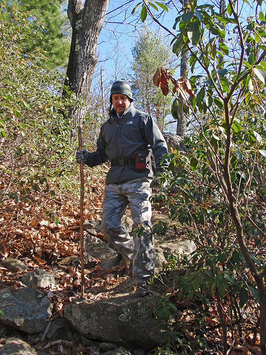
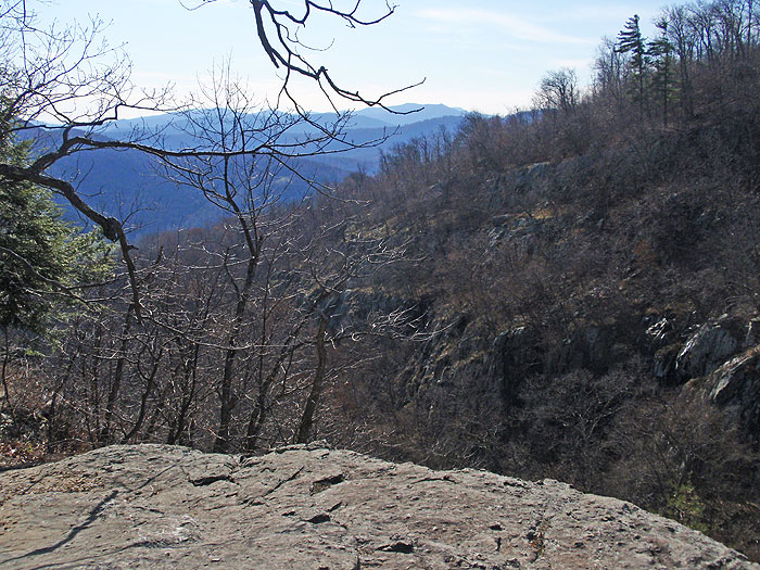
Continue down the trail for another 120 yards to the second overlook. Be cautions to watch your footing as the trail is narrow and passes close to the ledge in this section. The second overlook is the turn around point. From here the trail continues down to the stream and park boundary. There is no public access from the lower section of the trail.
Late
February
Mid November
Big Devils Stairs Hike Comments
Archived Comments
By:Laurie
Rating:
Date of Hike: Saturday, November 9, 2019
The hike was just the right length - the views of the gorge at the end were great! The blazes on the trees could have been better. Just an FYI - the parking lot is 13.8 miles North from the Thornton Gap entrance gate.
By:Jamey
Rating:
Date of Hike: Friday, March 30, 2018
Since it was supposed to rain, I wanted a quick and easy hike, and this fit the bill. The views from the overlooks are certainly nice, but they're not spectacular. The woods here are boring, scraggly, and rocky. I didn't see anybody, but I heard a loud group at Gravel Springs Hut. While it's always nice to be out in the woods, I wasn't expecting much, and this hike is nothing special. In fact, it's one of the least impressive of the dozens of hikes I've done in SNP.
By:nort
Rating:
Date of Hike: Sunday, August 13, 2017
The hike from gravel springs hut is easy and quick. The views from the overlooks are pretty great. The bottom of the trail at the park boundary was kind of boring, so I went back up via the stream bed. It's pretty fun. Once you're almost at the top the stream bed flattens out. I climbed up the rocks on the trail side to where the first overlook is. It was pretty easy and fun. Once up there I knew i just had to walk a short distance to find the trail, and instead I found a yellowjacket nest and got stung a bunch of times. And lost my sunglasses. So if you go that way, watch out for bees. And if you find some Native sunglasses in the middle of the woods near the hive, hit me up, please!
By:Kate
Rating:
Date of Hike: Saturday, August 12, 2017
I enjoyed the hike down, but like shawnm4747 below, I found it a little tame. The viewpoints were spectacular, but the high vegetation and low water meant the stream itself was audible but invisible. So once I'd taken a rest at the bottom near the fence line, I decided to scramble back up the water course. I am strong, fit and light weight, but it was really challenging. Only the fact that I knew I'd never make it going down kept me going up. Like a kitten in a tree, once I'd started I was committed!
I stuck with the stream bed to have a vegetation-free path, which meant being very careful about footing on the wet rocks and a fair amount of moving very carefully on hands and feet together or even hands and knees. Some scrambling over or under or up fallen tree trunks. Wet feet eventually, of course. Then there were a couple of steep overhangs, which would be waterfalls in wetter weather, where I had to leave the path of the stream itself. That meant choosing to go through stinging nettles to try to avoid the poison ivy. Mostly the nettles didn't get me, but the occasional stem would have stingers tough enough to get through my summer-weight hiking pants. Ow! Still waiting to see how successful I was in avoiding the poison ivy...
I don't think I'd try it again, certainly not alone. I slipped a few times - one fall and I could have been stuck for good, hoping against hope my whistle would get someone's attention. I think I was also very lucky it was so dry. There were bits I don't believe I could have got past if there had been any volume of flow, and if it started to rain, the steep-sided gorge full of dead wood and loose rocks would be a very bad place to be. Better to take the same way up as you came down. Maybe I'd have seen the bear who left those piles of scat on the path in the past couple of days...
All that whining aside, I made it all the way up the stream to where it intersects the trail, and I'm glad I did it. The round trip took me from 7 a.m. to about 2 p.m. on a beautiful 80F day. Parts of the stream bed were nothing more than wet, parts were trickles, but the wet rocks were fantastic colors and there were some beautiful pools. I saw crawdads, newts, a salamander, many great big millipedes and lots of amazing fungi. I came away with great memories, good stories and no major injuries!
By:LynnD
Rating:
Date of Hike: Thursday, May 18, 2017
I live in Madison County VA and the Shenandoah is my gym. I hiked Big Devil Stairs with my sister-in-law a few days ago. Once we left Bluff Trail and were on Big Devil, there weren't many blazes. Not a problem as most of the trail was obvious. On the way back we veered off for a short segment but were able to pick the trail back up (mostly because the gorge was to our left, so it had to be to the right). The hike had a nice vista of the gorge and there was a heavily shaded stream at the bottom. The trip up wasn't particularly difficult compared to going up White Oak Canyon, Old Rag, or hiking up from Hoover Camp. But a nice trek upward. Between the gorge and the stream at the bottom there was not a lot of visual interest.
Lynn
By:shawnm4747
Rating:
Date of Hike: Monday, February 20, 2017
The hike down to the overlook on big devil stairs is easy, though somewhat rocky. Hiking down to the overlooks and back is probably a 1 or 2 in difficulty and a 5 in views for the overlook as the canyon is quite unique for SNP.
However, this review is more concerned with the rock scramble/bushwack up the valley. You'll know you reached the end of the big devil stairs trail when you hit the barbed wire (and the rock cairn, though it is more difficult to see). From there, to climb through the valley back up, you need to turn right and generally follow the stream bed. It's almost impossible to get lost, even without a trail and without blazes, because you'll have two steep canyon walls on each side, which will keep you on track. While the bushwack/rock scramble is more difficult than a typical hiking trail, it is not more difficult than the rock scramble on Old Rag. If you can handle Old Rag, you can definitely handle this unmarked hike back up the valley. I'd suggest that if you do this scramble back up the valley, it is best to do it in the winter/early spring/late fall when there is less vegetation. You'd probably be facing heavy brambles, stinging nettles, and poison ivy/oak in the summer time that may have you climbing in areas which are more dangerous.
A few tips/warnings for the way up. First, to pick the best route, you'll probably need to cross the stream on several occasions. I didn't see any way up that would have you consistently on one side. Second, if you find yourself in a precarious situation, you've probably picked the wrong route. You should not find yourself facing any ten foot climbs up a rock face. For the most part, the most dangerous part of the hike will be the loose rocks. Third, I'm not sure if there is a good way to connect to the big devil stairs trail. I had to cut through a lot of thick mountain laurel to get there. It was a bit of a bushwack, but as long as you go right of the stream near the top where the sun starts cutting through, you should be able to easily find the path.
Again, don't do the rock scramble/bushwack with little kids or if you are out of shape/have difficulty on loose rock. However, if you can handle Old Rag and/or are confident going off trail and finding a good route, you should be okay.
By:MarshMudMan
Rating:
Date of Hike: Saturday, October 29, 2016
I did this hike on a beautiful and warm weekend when the fall colors were drawing big crowds to the park. Despite running into quite a few people on the way to the Big Devils Stairs trail (I took the Mt. Marshall and Bluff trails rather than the route described in the hike description), I only saw a few people at the upper end of the Big Devils Stairs trail itself. After getting to the overlooks, I did not see a single other person from the time I arrived in late afternoon Saturday until the time I left the next morning. As others have said, the views from the overlooks are fantastic. I enjoyed the hike down to the bottom of the canyon but it's apparent that the trail after the overlooks doesn't get a lot of traffic: it was largely covered with leaves and some of the blazes were quite faded. I threw down my sleeping pad and bag a little ways off the trail [a ranger at Dickey Ridge emphasized to me that the camping spots mentioned in the hike description are not the required 20 yards off the trail, so I didn't use them], but cooked my dinner and breakfast right on the first overlook and enjoyed watching the sunset and sunrise colors paint the distant mountain ridges. It was also awesome watching the stars and planets (Mars, Venus) appear as it got dark and I even saw a shooting star and the Milky Way itself. It was easy to sit on that overlook for hours and enjoy the view.
By:G-Man
Rating:
Date of Hike: Thursday, April 21, 2016
I have frequented SNP many times in the past however, this is a hike my wife and I have never done. We took advantage of the fee free day during National Park week and did this hike. I would say this is a much better hike when the leaves on the trees have not filled in. If they had been filled in, the majority of the hike wouldn't have had much scenery. With the leaves not filled in, you were able to get some views throughout much of the hike. There were several small stream crossings during the "upper" section. As most trails within SNP the trails are well marked and the trail sign posts were all correct and help guide your path. The only part which could be a little confusing is when you approach the gorge. On the Big Devils Stairs trail, it will make a sharp (90 degree) right turn and you head toward the gorge. You don't go very far and you see the gorge. This is where it was a little confusing. This could be confused with the 1st overlook. It is not. When you reach this area it appears as if the trail ends and this is the look out. It is not. There aren't good markings here. Look to your right and the trail will descend down the rock stairs as mentioned in the trail description. Then you arrive at the 1st overlook which is pretty awesome. The second overlook is just a short distance away. If you are hiking and the trail starts to bear to the left and go up hill towards/through the woods away from the gorge, turn back. You have missed/passed the second overlook.
In all a good hike to take advantage of the National Park fee free day.
By:Robert Godlove
Rating:
Date of Hike: Monday, November 9, 2015
Hiked in and out in about 4 1/2 hrs, quiet and not a bunch of people, 4 of us and our dog Ginger..... Mostly downhill going in, trail was easy to follow, beautiful weather
Nice day hike, views are nice and good overlook to the waterfalls, have fun
By:Neil
Rating:
Date of Hike: Monday, June 1, 2015
A brief review from the wildflower perspective: I've always wanted to do the Big Devil Stair hike when the mountain laurel is in bloom and finally hit it at peak time this year. There are areas where 10-12'mountain laurel lines the trail. I was disappointed to see the blooms were rather sparse (guess I was imagining it would look like mountain laurel growing in someone's well-tended garden). This disappointment was more than offset by the the lush, full mountain laurel in bloom at the first overlook. It was fantastic. For anyone who ever had the fantasy to get married in the park, I would recommend June 1 at Big Devil Stairs first overlook.


