| By:
FrankJ |
Rating: |
 |
Date of Hike: Saturday, May 20, 2017 |
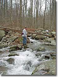
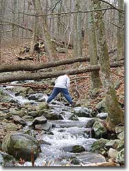
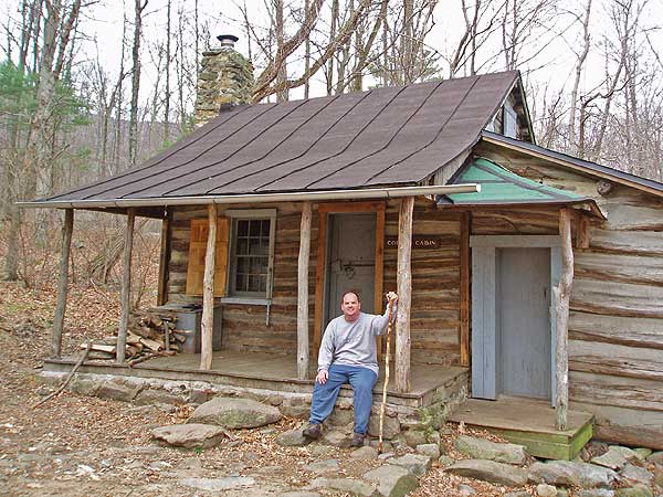
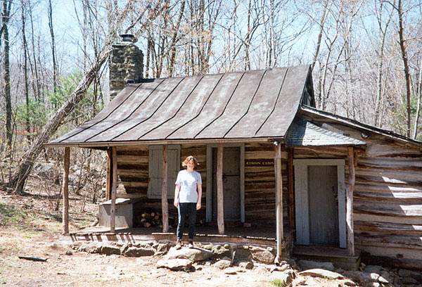
Hiked counterclockwise beginning at 7:50am on a humid morning with temps in the 70s. Rain the previous day and evening brought up the river water levels to a point where some stepping rocks were underwater, so add'l care was needed at most crossings to avoid slipping. Corbin Cabin on the climb was a nice place to take a snack. We hiked at a reasonably good pace and arrived at the cabin at 9:30am. The climb past the cabin to the max elevation was a bit grueling at our pace (for me), but an excellent workout to the ridge. On the other side of the ridge we stopped at the ledge overlook for a quick lunch before the steady downward climb. Unfortunately this is one of those hikes where there is no significantly rewarding destination, such as a waterfall, swimming hole, or mountain peak with grand vistas. Corbin cabin and the ledge overlook are nice stopping points but certainly not grand. Finished in less than five hours including snack and lunch break.
|
|
| By:
Mike G |
Rating: |
|
Date of Hike: Sunday, April 5, 2015 |
Had a pleasant early spring hike with the first bit of warm weather this year to break in some new boots. Lots of people were going up Old Rag but the Corbin Hollow and Indian Run Trails were nearly deserted. Ran into a large herd of deer crossing the Old Rag fire road and descending into Corbin Hollow. Bloodroot flowers were starting to emerge along sections of trail and you could tell that everything was going to erupt with blossoms and greenery in the next week or so. Definitely a nice option for a less strenuous stroll through the woods!
|
|
| By:
Kellygirl |
Rating: |
|
Date of Hike: Saturday, July 19, 2014 |
Completed this loop in the opposite direction as posted. It was cool and overcast day in July! I had to take advantage of that! The hike was not difficult and easier going in the direction I took. I'm glad I didn't do Old Rag..it was full of tourists! This is a good hike for people who want to increase their hiking miles.
|
|
| By:
Ken |
Rating: |
 |
Date of Hike: Friday, June 27, 2014 |
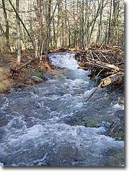
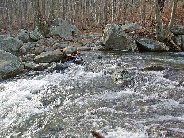
This hike was okay but didn't deliver much in the way of views or water. I think it was more a matter of timing than the trail itself. The walk up to the cabin was pleasant enough and definitely not too challenging. I had lunch at the Cabin before continuing. The Indian Run trail was a good steady climb along a trail that is getting crowded in by the vegetation. There was almost nothing to see but green, and the same conditions applied all the way to the Old Rag Fire Road. The Corbin Hollow Trail started the same way but then opened up into a much clearer trail that was surprisingly steep at times. I could hear Brokenback Run throughout the descent but only caught a couple of glimpses through the trees. While I didn't particularly care for this hike on this day, I bet it would be much more enjoyable in the fall or winter when you can get a better appreciation for the terrain...probably a 4. With all that, this hike did deliver on solitude. I saw absolutely nobody the entire hike until I got to the upper parking lot. and somtimes that's the best way to enjoy a hike.
|
|
| By:
kellygirl |
Rating: |
 |
Date of Hike: Saturday, August 31, 2013 |
Entered the Old Rag parking area and it was full! My goal was to hike this instead! I have done this trail before. This time I hiked Nick. Hollow trail to Skyline Drive. After the cabin, it was a steady climb...and I barley saw a sole
|
|
| By:
Paul |
Rating: |
 |
Date of Hike: Wednesday, July 17, 2013 |
The Shenandoah National Park is a treasure...not only for its stunning mountain vistas but for its fresh water as well...
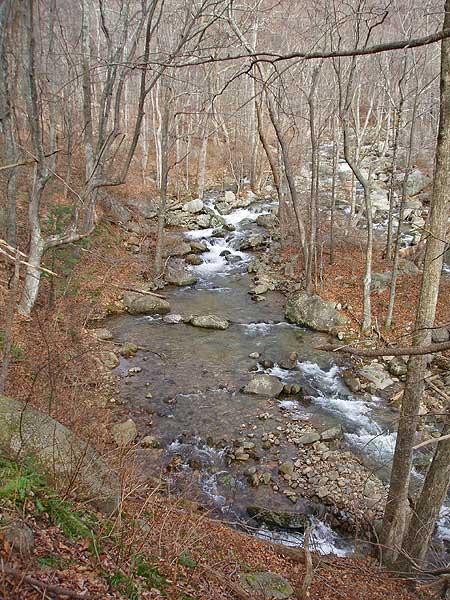
Hiking on one of the hottest days of the year can be pleasant if you choose a well shaded, plenty of water spot...the Nicholson Hollow Trail is just that spot...stunningly cool and beautiful...
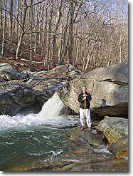
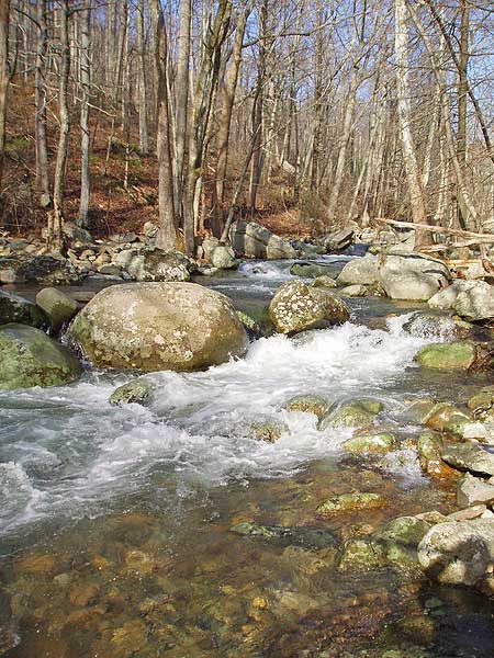
There is a little pool in Corbin Cabin's front yard as you can bathe in cold mountain spring water and fill up your water bottles...you are gonna need it...
If you wish to keep it relatively easy...turn back now and retrace route...otherwise...
Warning...the next two miles is a tough, steep climb over the mountain with plenty of pausing to collect your breath...I will not soon forget the Indian Run Trail!
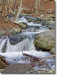
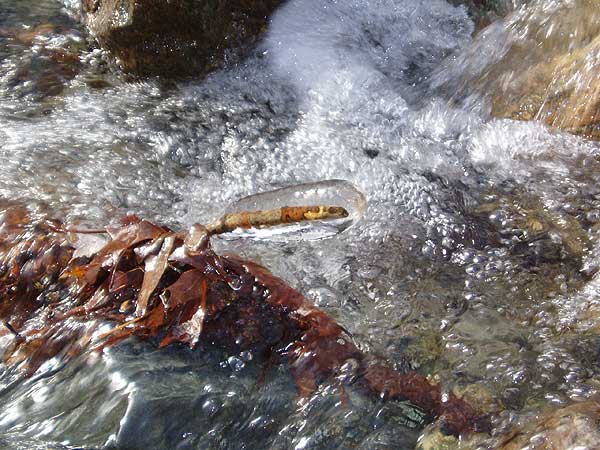
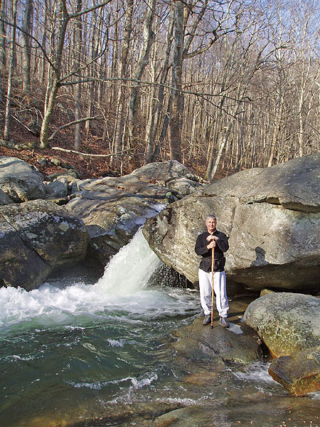
Fairly steep descent in isolated places but relatively calm...ankles were worked out a bit on the Corbin Hollow Trail as it did get quite rocky around Brokenback Run...
Old Rag whispers to you as faint glimpses of the mountain appear through the trees as you wind down the Fire Road...
A long...great day hike with plenty of calories burned on a 97ºF day with high humidity...but not uncomfortable with lots of places to wash and drink...Awesome Workout!
|
|
| By:
Paul |
Rating: |
|
Date of Hike: Wednesday, July 17, 2013 |
The Nicholson Hollow Trail is a most romantic SNP trail...Gorgeous...especially when its 20ºF cooler than at your car...Peaceful and serene the Hughes River flows right beside you all the way to the old mountain home." Enjoy the beauty of the river at the cabin...bathe a bit with lots of water to replenish...if you continue up the mountain then you'll need it...otherwise...you have seen plenty...retrace your route...but...if you'd like a little more of a workout don't worry...it's here! The Indian Run Trail will not soon be forgotten...15% grade up a couple of miles...little relief in between...straight up...
The Corbin Mountain Trail begins the descent but just before you hit the first Fire Road you go up again...then the rocky 16% grade down Corbin Hollow where the beautiful sound of the water returns...Brokenback Run slides on down to the second fire road...where you finish down in the shadows of Old Rag...
Great Summertime Hike...
|
|
| By:
Chip |
Rating: |
|
Date of Hike: Sunday, May 5, 2013 |
I did this hike over the past weekend and found it to be great circuit hike and much less crowded than the Old Rag parking lot would lead one to believe. The hike up was mostly along an old cart path of some sort and not necessarily along the river. I did run into a few backpackers on their way out after fishing there are a few high impact campsites before getting to Corbin Cabin. An NSPS employee must have been in a hurry as I walked down the Old Rag Fire Road, glad I wasn't in the middle of the road as they drove by. I decided to take the Robertson Mountain Trail and was treated to a great view and some solititude after a couple of backpackers left the peak. However, the hike down was steep, about the steepest and loosest trail I have seen in some time. Think from the top of Robertson Mtn. to the Weekley Hollow Fire road the trail drops 1800 feet in about 1.5 miles. The highlight of the down hike was seeing a bear at about 20 yards, think he was coming up the trail.
|
|
| By:
Zach Gildersleeve |
Rating: |
|
Date of Hike: Saturday, May 26, 2012 |
It's amazing there can be 200+ cars in the Old Rag parking area, and not see a single individual on this entire trail until it meets the fire road. Box turtles, scarlet tanagers, and lots of insects. Echoing other comments, be prepared for a climb, and a less-used trail, after Corbin Cabin. Pretty lush (overgrown), if I did it again I'd do a in-and-out along Hughes River, by far the nicest part of the hike.
|
|
| By:
Andrew in DC |
Rating: |
|
Date of Hike: Sunday, July 18, 2010 |
Looking for a good hike, we decided to tackle the Corbin Mountain hike rather the deal with the crowds on Old Rag. We were not disappointed. While this hike does lack the rock scramble and incredible views of Old Rag, it is equally challenging in its length and assent.
As soon as we got to the split where the road heads up to the Old Rag trail head, the crowds thinned out and we did not see any other hikers until we returned to the fire road some 5 hours later. The isolation was splendid. The hike follows a stream for the first third and the climb slowly steepens as you approach the old cabin. The trail is well marked, but as it is not used by as many people it is more of a foot path for long stretches. The only surprise came after stopping for lunch at the cabin, the remaining mile or so of the ascent is much steeper than the trail to this point, so be prepared.
It was on this part of the hike were we spotted 3 black bears (all moving away from us thank goodness).
This is a great hike and a great workout. If you want views you won't get them here, but you will get a lot of solitude and a wonderful woodland experience.
|
|
 View all 14 archived reviews for the Corbin Mountain hike
|


