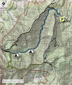
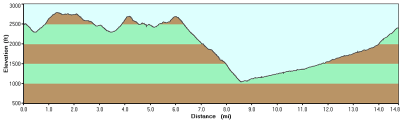
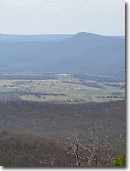
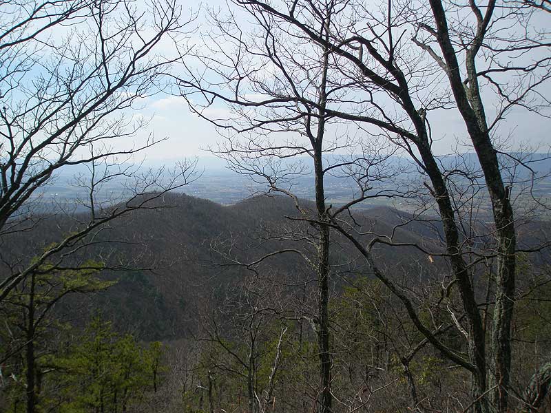
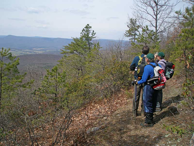
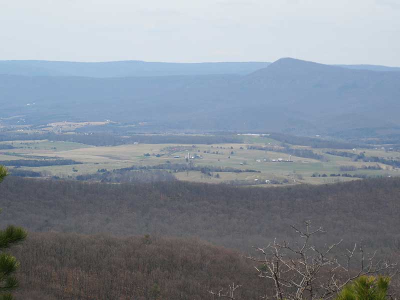
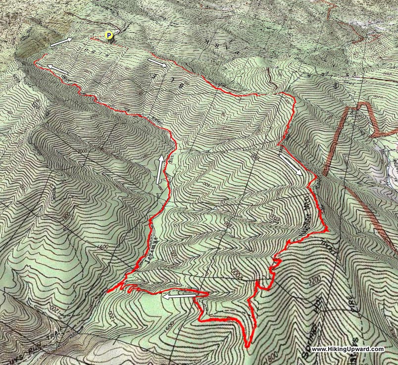
At 14.7 miles the Jeremy's Run loop is one of the longest in the SNP. On the Neighbor Mountain Trail there are several beautiful views to the west of Kennedy Peak, Duncan Knob, and the Three Sisters Ridge just to the south. Also with 14 crossings of Jeremy's Run this hike can be a challenge in the spring when the water is at its highest level.
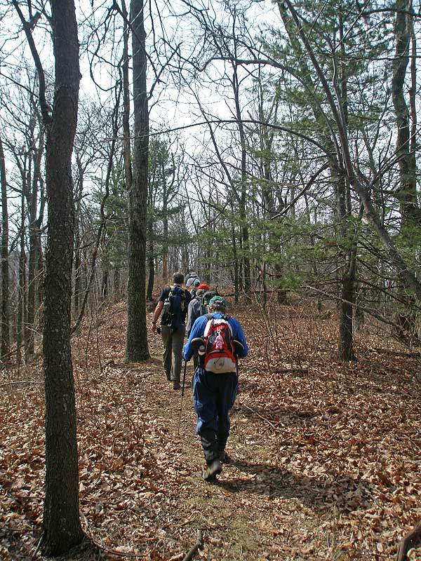
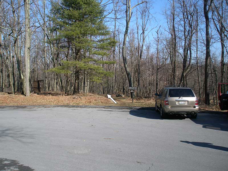
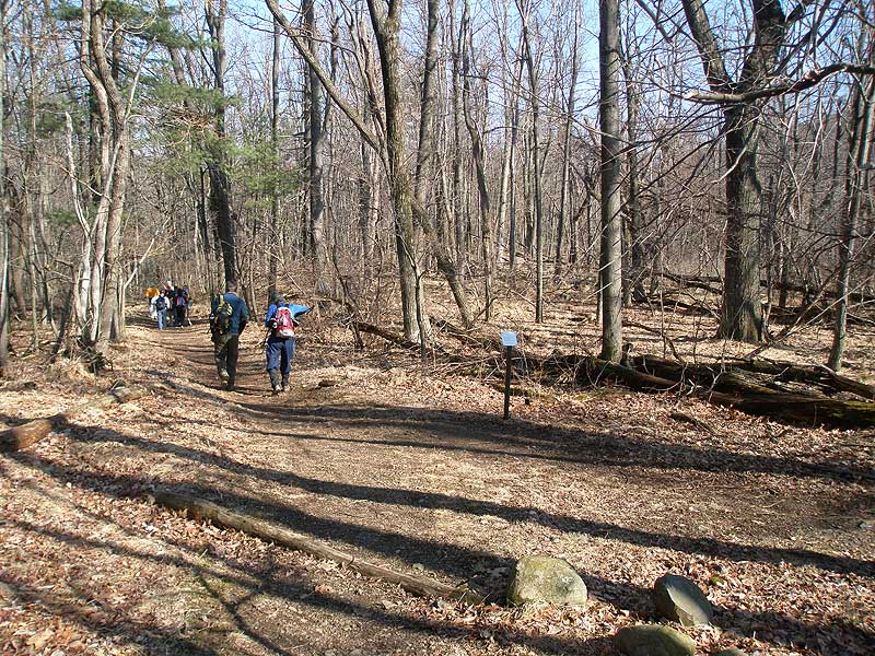
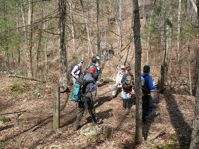
From the parking area start down the connector trail where it shortly joins the white blazed Appalachian Trail (AT). Continue downward on the white blazed AT and in 0.3 miles arrive at the intersection of the blue blazed Jeremy's Run Trail that continues downward.
Turn left remaining on the white blazed AT as it it climbs Blue Ridge. In 2.3 miles from the Jeremy's Run intersection arrive at the Blue Ridge high point, and a trail intersection that leads to the Thorton River Trail. Remain south/straight on the white blazed AT following the ridgeline for another 1.3 miles to the next intersection that leads to a Skyline Drive parking area. Again stay on the AT, and in 0.2 miles reach the four way intersection with the Neighbor Mountain Trail.
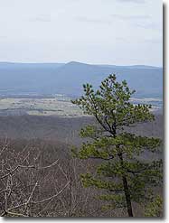
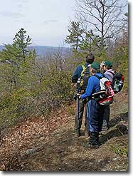
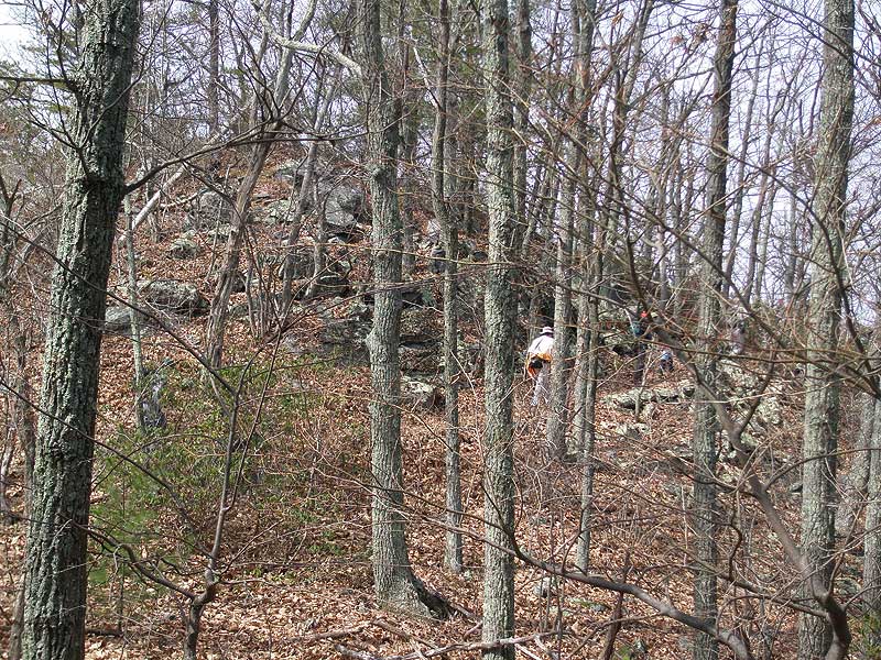
Turn right on the yellow blazed Neighbor Mountain Trail as it begins to gradually descend the Neighbor Mountain ridgeline. In 2.0 miles there are views of Three Sisters Ridge just to the south, then in another 0.9 miles views of Kennedy Peak and Duncan Knob across the valley to the west on the Massanutten Range.
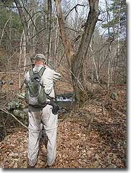
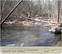
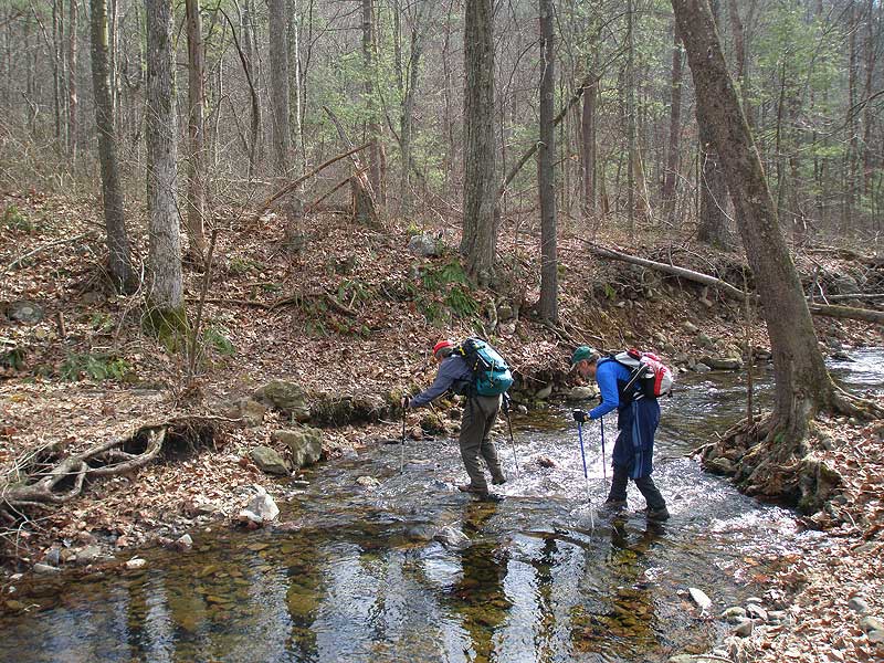
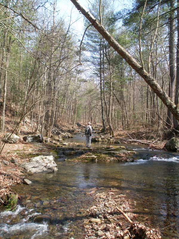
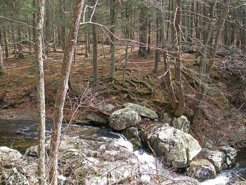
The trail will now descend more steeply, making several switchbacks before arriving at Jeremy's Run in another 1.1 miles. Turn right upstream on the blue blazed Jeremy's Run Trail, and in 0.2 miles make the first of 14 stream crossings.
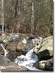
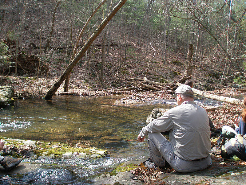
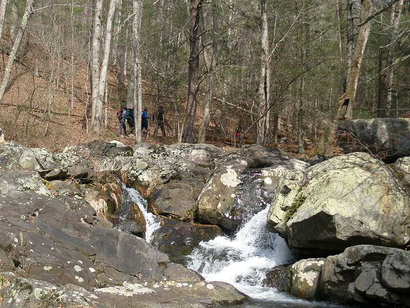
After crossing Jeremy's Run, continue on the blue blazed trail for 0.4 mile to the best waterfall on the hike, and on the opposite bank a large group campsite. Open campfires are not permitted in the SNP, but this is still one great camping spot at the top of a beautiful set of falls.
After passing the falls, the Jeremy's Run Trail will continue for 4.3 miles crossing the stream 13 more times before arriving at the intersection of the Knob Mountain Cutoff Trail. Continue straight on the Jeremy's Run Trail as it now becomes steeper for the 0.8 miles back to the intersection of the white blazed AT, and where the Jeremy's Run Trail ends.
Remain straight/uphill on the now white blazed AT for the remaining 0.3 miles back to the parking area.
Mid March
Jeremy's Run Hike Comments
Archived Comments
By:Morris
Rating:
Date of Hike: Saturday, October 5, 2019
Just completed this hike as an overnight following the same direction as the main article. I won't repeat a complete description of the hike since that has been adequately done. Our hike was in drought conditions (which ended Sunday as rains came just after we finished our hike). Even with limited or no rain for weeks, the water was still running, albeit as a low level. We stayed at the group campsite across from the waterfall. Since the waterfall was running very low, it was very easy to get water from it. The good news is that even under very dry conditions, you can get water on this hike all the way up the run until it starts heading back up to the AT and leaves the watershed. We were able to rock hop every crossing with completely dry feet. While the Fall colors are not out yet, there has been a substantial amount of leaf fall due to drought stress, which actually enhanced the attractiveness of the scenery. Other than the burned down areas after summiting Neighbor Mountain, there are no views, so enhancing the scenery was a good thing. Our only disappointment was no wildlife sightings. Bear scat everywhere, but no bears, deer, squirrels, anything! We of course encountered several deer on Skyline Drive on the way out however. Nice hike, and I recommend doing it clockwise to avoid the 2.6 mile steep climb up to Neighbor Mountain.
By:Chris O.
Rating:
Date of Hike: Friday, September 13, 2019
Completed this hike as a 2 nighter and in the reverse direction as we started late on Friday. This made for an easy 4.5 mile downhill walk to camp (Day 1), but made for an intense 9 mile trek back to the car (Day 3). The hike back to the car was steep after leaving Jeremy's Run but had great views once at the ridge line. Would recommend high socks or pants since there was a lot of overgrowth along the trail.
We stayed in both of the marked campsites mentioned on HikingUpward. The large group campsite is awesome! Plenty of room...we counted 4 or 5 suitable locations for tent set up and even more if you are hammock camping. The waterfall adjacent to the campsite was low flowing but still made for a great hangout spot and and the large pool below contained some sizable trout (6-7 inches) that can be fished according to trail fishing rules. We saw 2 snakes, fish and one black bear so remember to hang your food.
Campsite locations if following the correct loop:
@2Mi - Small cleared/flat campsite can fit 1 to 2 tents
@4Mi - Few cleared areas suited for hammock set up
@8Mi - About .1 miles into Jeremy's Run hike small campsite (1 tent) on left
@9Mi - Large Group Campsite near water fall
@10Mi - Small cleared/flat campsite on right, can fit 2 tents easily
Noted 2 additional small campsites close to the Run but don't recall the mileage.
By:Grand Feather
Rating:
Date of Hike: Saturday, July 27, 2019
I have done this hike in spring, summer and winter. It is best IMHO in spring when the mountain laurel is blooming. There was a fire on Neighbor Mountain several years ago. The area is recovering but due to the fire there is a significant amount of plant diversity for plant lovers and great views. I have also done Neighbor Mountain-Knob Mountain as a loop. This is best in in spring or winter when you can see out. Knob Mountain is along a ridge with nice views in two directions. The hike is strenuous for those that do not hike regularly. The Knob Mountain option adds about 600 additional feet or more of elevation gain. On my last trip I was lucky enough to see two black bears and lots of bear scat on the trail. It is best to wear long pants on this trail as it does not get lots of use and at times is overgrown with raspberries, black berries and poison ivy in spots. I did not see lots of poison ivy but enough to make me cautious and careful in shorts.
By:Taylor
Rating:
Date of Hike: Saturday, June 15, 2019
Just like others who have left reviews before me, I feel like this has the potential to be a great hike in the winter. In the middle of the summer, however, I wouldn't recommend it. The portion of the hike that followed through the AT was nice, but as we approached the Neighbor Mountain trail, the trail grew more and more overgrown until it was impossible to pass without walking straight through poison ivy. After I gave up trying to avoid the poison ivy and just accepted my itchy fate, the hike was fairly enjoyable. My group caught a couple of ticks, which is never fun but inevitable given the amount of brush we walked through. Definitely recommend treating your clothes and shoes with permethrin / taking as many precautions as you can. The weather was perfect and the water wasn't too high so stream crossings were enjoyable. Definitely not a strenuous hike, just a nice, long walk in the woods.
By:Kevin G.
Rating:
Date of Hike: Tuesday, January 8, 2019
A group of us did this hike during the Government shutdown and they are still open, the directions provided were very clear. During the shutdown, the road to the parking lot to Jeremy's parking lot was closed off, so we just parked at the Elkwallow Picnic Grounds parking lot, which was no big deal. We simply just walked to the jeremy's run entrance. The trail was well blazed. While the description noted, "best waterfall on the hike," this served as a reference point for the first campsite, which we missed because of the description "best." I would note the waterfall appeared to be probably no more than 10 ft. I believe we did see the campsite, but were misled with the description of the waterfall. Fortunately, we found the next site shortly after, which was slightly off the trail. Overall, the hike was a good one, the river crossings were quite a challenge. It was certainly fun just counting them. Some of the crossings, you could do hopping on rocks, several others we took off boots or carefully crossed different regions of the crossing. I would recommend hiking poles to help with balanced. They were certainly proven handy at the time. We did this hike in 2 days, majority of the hike on day 1, and the water source was plentiful since it was along the river.
By:Pohick
Rating:
Date of Hike: Saturday, November 10, 2018
A nice overnight hike though it got a little colder than we expected (about 10 degrees colder than the forecast for Front Royal). Good views coming down Neighbor Mountain. With the wet fall and rain the week before, Jeremy's Run was high. All crossings were mid-calf to knee high, it seemed, and there were few or none rock hopping options. After about 5-6 crossings we gave up switching between crocs and boots and just let our boots get wet.
By:John W
Rating:
Date of Hike: Monday, June 25, 2018
Hiked this trail yesterday. This is maybe a great hike in the fall/winter/spring before the vegetation grows too thick. However, once you get about halfway down the Neighbor Mountain Ridge heading toward Jeremy Run, the vegetation along the trail is too thick to hike without wading through it. LOTS OF POISON IVY! Luckly, I saw no ticks (always prepared with permethrin soaked cloths and lemon eucalyptus oil). I had to turn around and double back on the Neighbor Mountain and Appalachian Trail. Great day for a hike (low temps for summer, and a nice mountain breeze). Saw several deer and one black bear (heard another crashing through the forest).
By:Sanjida
Rating:
Date of Hike: Sunday, June 24, 2018
We've been here before and done the hike as described, which is fabulous. It's also a great out and back to descend Neighbor Mtn from Skyline Drive and access the stream that way. I'm writing this note as an FYI because today we tried to access Jeremy's Run from SR 611 in the valley, but we could not. The property where the trail starts was recently bought and the new owners put up signs dating 10/17 that prohibit tresspassing or trail access from the valley. Don't make the mistake we did a and try to drive out this way!
By:nort
Rating:
Date of Hike: Saturday, November 18, 2017
Did the loop as described. With the leaves down there were many good views along the ridge. There are also plenty of places to camp up there before descending. The Run itself was pretty low so the crossings were easy but filtering water was no problem. There are camp sites all along the water. Beautiful hike.
By:Ash
Rating:
Date of Hike: Sunday, October 22, 2017
I just did this hike twice in a little over a month and loved it both times. I first hiked it in early Sept 2017 and really enjoyed the trail variety. You hike under canopy, on ridges with views, next to flowing streams - this loop has a lot to offer. I decided to go back when some color was on the trees and I wasn't disappointed. The Autumn colors make this hike even better. The water is low now due to the lack of rain in the area so all of the stream crossings were very easy. However, there was enough water to hear sounds now and then. I plan to go back in Winter and Spring to see how this route is in the various seasons. I love the length for a day hike I spent 6 hours completing the loop in Sept complete with taking pictures. This time I did it in under 4 hours, albeit I was trail running all the downhill and power hiking the climbs so it's not a typical hiking pace - it definitely wasn't a leisurely pace for me, but it I loved it!.


