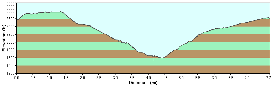
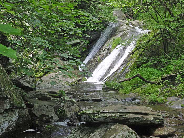
This is one of the most popular waterfall hikes in the southern section of the Shenandoah National Park. There are several falls along Jones Run, plus two large falls on Doyles River. Each has several swimming holes as well. But if you plan to swim, remember that's cold mountain water, even in late summer!
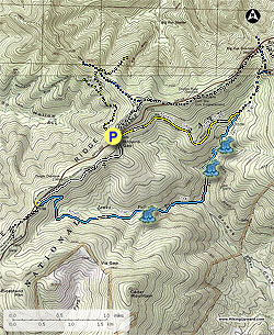
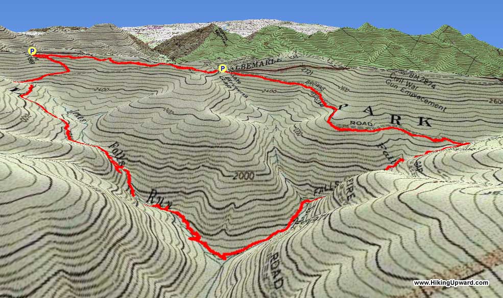
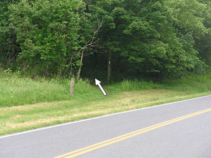
From the Browns Gap parking area cross Skyline Drive and follow the white blazed Appalachian Trail (AT) south along the ridge for 1.4 miles to the intersection of the blue blazed Jones Run Trail, and Jones Run Trail parking area.
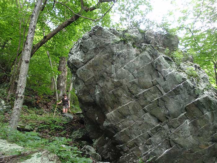
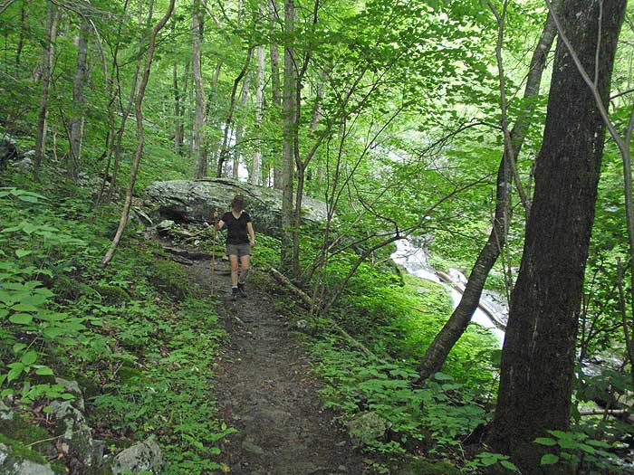
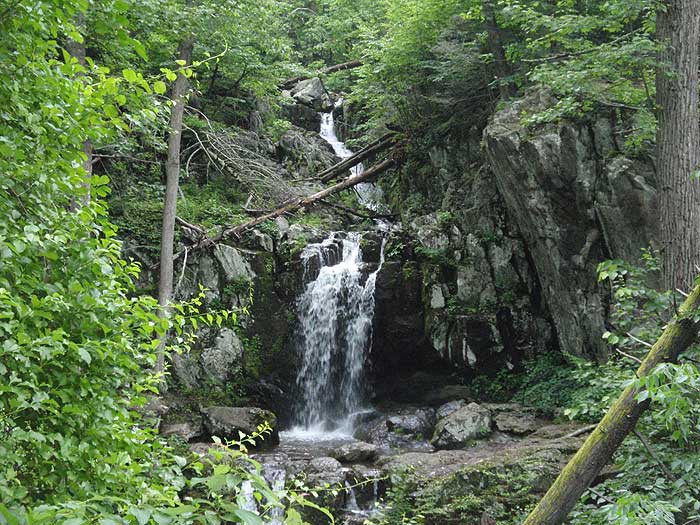
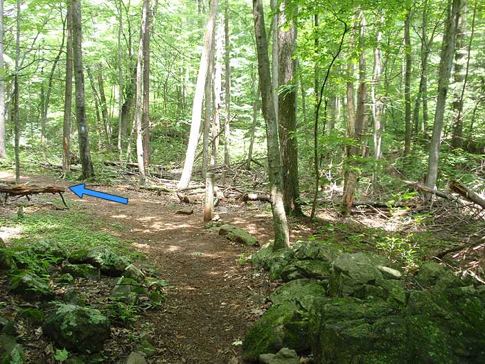
Turn left downhill on the blue blazed Jones Run trail as it makes a switchback, then crossing the top of Jones Run before reaching the top of the first set of falls in 1.6 miles. Continue on the trail for another 0.1 miles where the trail makes another steep switchback and arrives at the base of the main falls. Continue following the trail downstream for 0.5 miles crossing Jones Run, then continuing on the left side of the run for 0.1 miles to the post marking the Doyles River Trail.
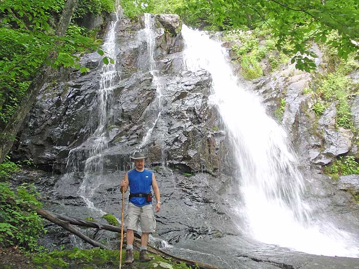
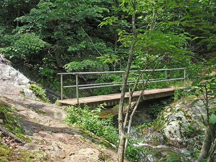
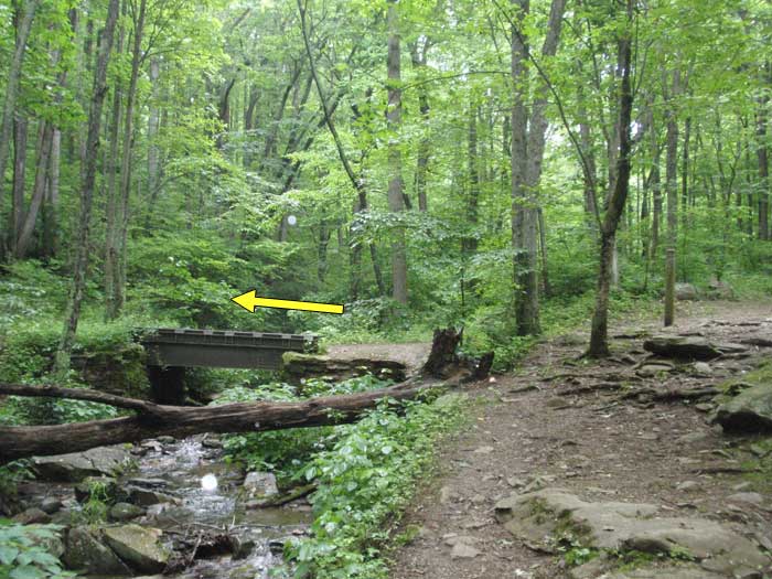
Turn left uphill on the blue blazed Doyles River Trail passing several small pools and falls before crossing a footbridge over a feeder stream. Shortly after crossing the footbridge reach the lower, and largest set of falls, then in another 0.2 miles the upper set of falls. From here the trail becomes less steep before arriving at the intersection of the Browns Gap Fire Road.
Turn left crossing Doyles River on the yellow blazed fire road for the remaining 1.7 miles back to Browns Gap.
Note: Instead of turning left on the fire road off the Doyles River Trail, you can continue on the Doyles River Trail another 0.9 miles to the AT, then turn left/south on the AT for 1.5 miles to return to Brown's Gap making it a 8.5 mile circuit. This is a good option in the summer months when the ticks can be bad in the fire roads long grasses.
Mid June
Jones Run/Doyles River Hike Comments
Archived Comments
By:Erin E.
Rating:
Date of Hike: Saturday, August 25, 2018
My dog and I did this loop in the clockwise direction and had a blast! We had to park at the Dundo picnic area because the Park Service had blocked off all the other parking spots due to crowding on a really nice August day. But it was nice to have access to the bathrooms before/after the hike. We took the full loop, following the AT out to the Doyles River trailhead, and then we we came back up at Jones Run Parking, we walked another half mile on the AT back to Dundo. It was shady and cool, even in August, and my dog was able to drink and play at all the river crossings. It took us about 5 hours with several stops to play in the water, have a snack, etc. Didn't see any wildlife on the trail itself, but driving back down Skyline in the evening, I saw several deer, a hawk, a raccoon, and 2 bears. On the trail itself I saw bear and bobcat scat. Great Saturday hike!
By:Priyanka Prasad
Rating:
Date of Hike: Saturday, August 25, 2018
The loop that is recommended here is a very nice one. It builds up nice and easy with the elevations near the waterfalls, and return by the fire road makes it easy towards the end of the hike. It is fully shaded, and the waterfalls and streams along the way make it perfect for a summer day. There are plenty of swimming holes and even streams to cross along the hike. Many amazing spots right at the foot of the waterfalls to have lunch or rest.
It was well visited but not too crowded. I felt that it just enough traffic to make me comfortable as I don't like hikes which are 1 on solitude.
The highlight of the hike was a bear sighting towards the end of the trail on the fire road. It was about a 100 feet or less from the end of the trail where saw some ruffling in the trees. A bear had slid down the branches, and was just sitting at the foot of the tree as if it had lost it's grip and had fallen. We were terrified the fire road is a narrow path and this happened right by the path with the bear being hardly 5 feet away. We slowly walked by, talking to each other in loud voices and once we crossed it far enough, the walk turned brisk and then into a dash, which we probably shouldn't have done. The bear must have stayed put and dashed off into the woods because a father and son who came right after us did not see it. Definitely made it a memorable one!
Highly recommend this hike!
By:aldikuma
Rating:
Date of Hike: Friday, August 17, 2018
Nice trail on a very hot and muggy August day! The benefit of being close to the waterfalls is having a little bit of nature's air conditioning with the rushing water blowing out cool air. Plenty of places for my dog to drink and play in the water, too. I much prefer the loop as described, with the gradual uphill on the fire road to complete the trip, especially when it is really hot out. The fire road was wide and easy to pick up speed on, and the grass was not that high. We didn't get any ticks, but don't forget the bug spray as the gnats and mosquitoes were awful. Solitude on a Friday was great - only a few people at the main falls and passed four on the trail. Hike was long enough to give you a nice workout.
By:Meg
Rating:
Date of Hike: Sunday, June 3, 2018
One of my favorite hikes. Ive hiked this loop both ways and I think I prefer clockwise so as not to end on the fire road. The pools along Jones Run also seem better to hang out at, so those might be good to have more towards the end of the hike. Just hiked this after some heavy rains and the waterfalls were roaring and beautiful to see. Great hike to take your pups on as there are plenty of streams and creek crossings they can drink at.
By:BrewMoon
Rating:
Date of Hike: Sunday, September 24, 2017
Nice hike. Did it per the directions & also did the extra leg up to the Doyle's River trailhead. Waterfalls were nice and the whole hike wasn't too strenuous. No shortage of people on a Sunday with lots of kids & dogs. This isn't the hike for views though. Saw a couple 4-6 ft black snakes just trying to get some sun. Miles 5 & 6 were the toughest but finished the whole loop right at 3 hrs. Smaller waterfalls but a more pleasant hike than the White Oak Canyon/Cedar Run circuit I did the week before. Lots of shade and water so a good hot weather hike.
By:Bret
Rating:
Date of Hike: Monday, August 21, 2017
I started at the Doyles River parking area and hiked the loop clockwise. The hike along Doyles River and Jones Run was one of the better trails. Despite the late summer low water flow the falls were still enjoyable, and I am planning a return hike in the spring. I only encountered 2 other hikers and 1 bear that was more interested in the stream than me. The solitude of the south district was a welcome change.
By:BrianJB
Rating:
Date of Hike: Wednesday, August 16, 2017
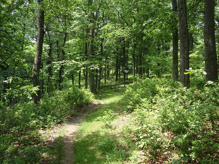
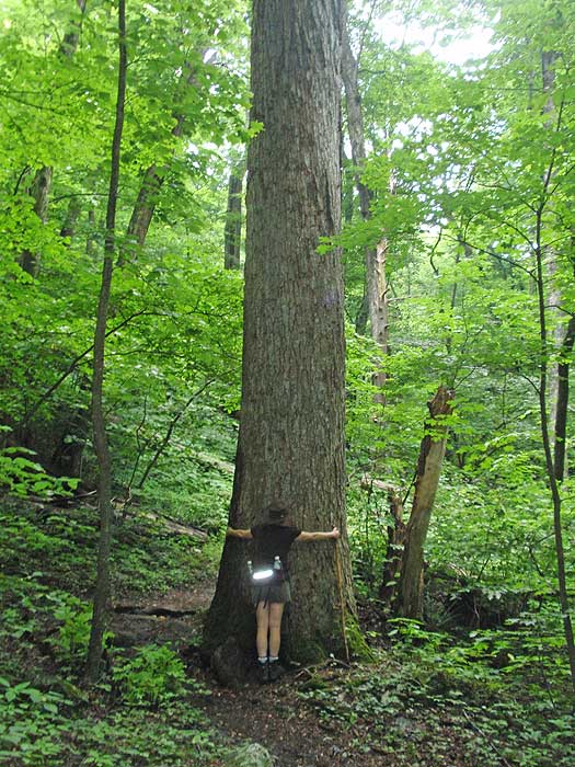
Outstanding hike. . .falls were all going quite well, and it seemed like there was always one more up the trail. A moderate number of other hikers, although a group had set up at the second-to-last falls with a portable speaker, so we skipped that one. Nothing too steep, and what look like some old (original?) growth trees in spots. Did as marked (up the fire road, which was mostly clear).
By:Brian
Rating:
Date of Hike: Sunday, April 30, 2017
Loved this hike! The rains from last weekend/early this week really had the falls running. We didn't regret bringing Tevas to use in crossing the creek in one place. (Nimble folks had no problems rock hopping.). Lots of small wildflowers around as well.
We took the longer route, and it was fine, but the AT marker post said it was 2.2 miles back to Brown's run, not the 1.5 in the write up, and it felt like that.
If you use trekking poles, this is one to remember them.
By:SteveE
Rating:
Date of Hike: Saturday, December 10, 2016
This trail has become my new favorite trail in the SNP or BRP. Without the obstruction of leaves, we had tremendous views of the multiple waterfalls. While it was super cold at the parking lot, once we got out of the wind on the trail, it was quite tolerable - we dressed well though even shedding a layer. The slight rock scrambles were a lot of fun and the climb out of the bottom was not bad at all - especially compared to most waterfall hikes around.
By:Mike H
Rating:
Date of Hike: Saturday, November 19, 2016
This was a very pleasant hike the waterfalls pale in comparison to those along the White Oak Canyon / Cedar Run circuit and aren't as grand as the Overall Run / Beecher Ridge waterfall, but they are still quite beautiful. And unlike those other hikes, the waterfalls along the Jones Run / Doyles River circuit are very accessible. You can get right up next to the base of the falls, and in some locations, climb up alongside them (with caution, of course). I'm not sure that the pools qualify as swimming holes, even if I had done the hike in the heat of summer. The hike itself was not difficult, and I only passed two groups of hikers along the way (I followed the path outlined by HikingUpward, but the other groups were moving in the other direction).


