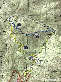
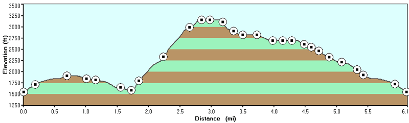
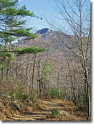
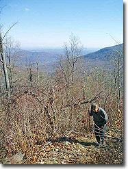
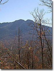
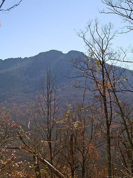
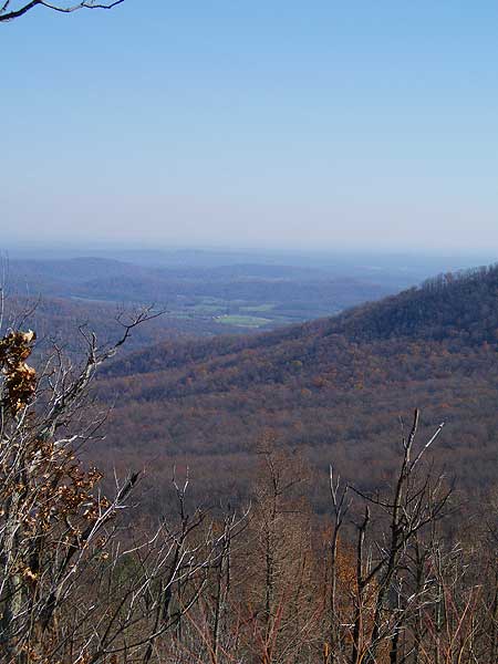
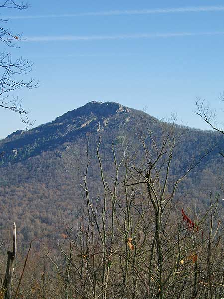
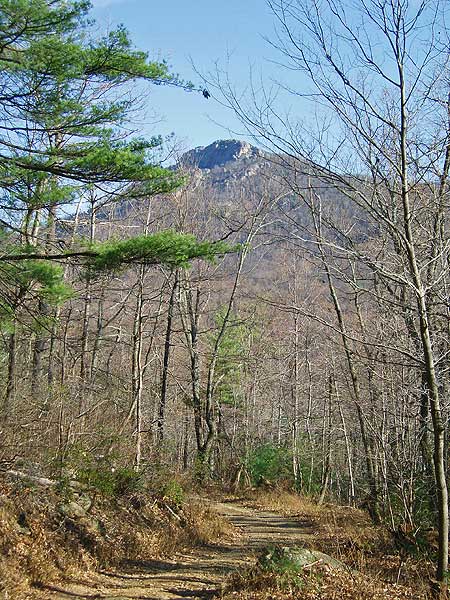
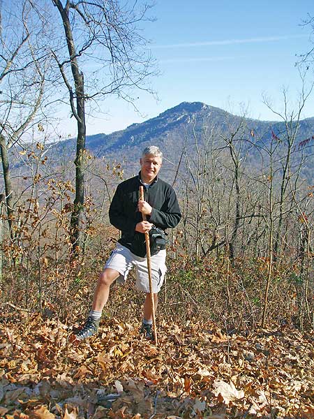
Overlooking Old Rag Mountain, the Robertson Mountain hike has one of the steepest trails in the central section of the Shenandoah National Park, with an elevation gain on the Robertson Mountain Trail of 1,700 feet in just over 1.5 miles. Directly to the west of Old Rag you have excellent views of the mountain, while avoiding all the crowds that flock there. Two sections of this circuit take advantage of fire roads which some may find boring, but after the tough climb up Robertson Mountain it can be a nice reprieve.
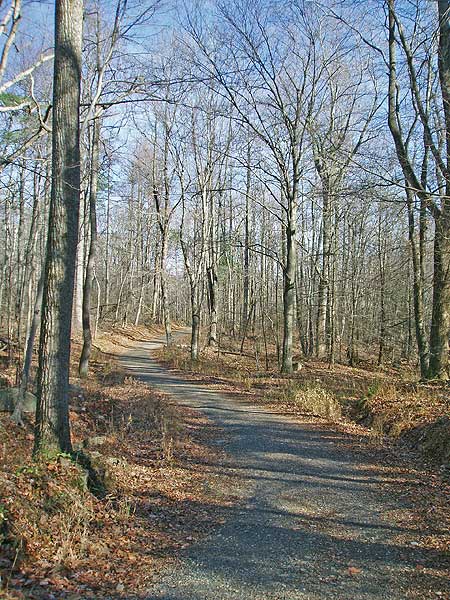
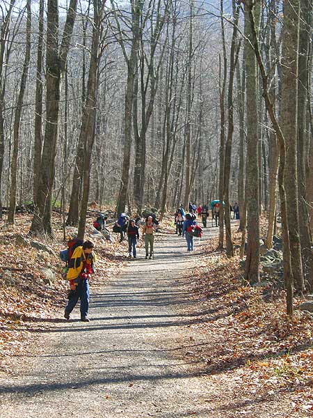
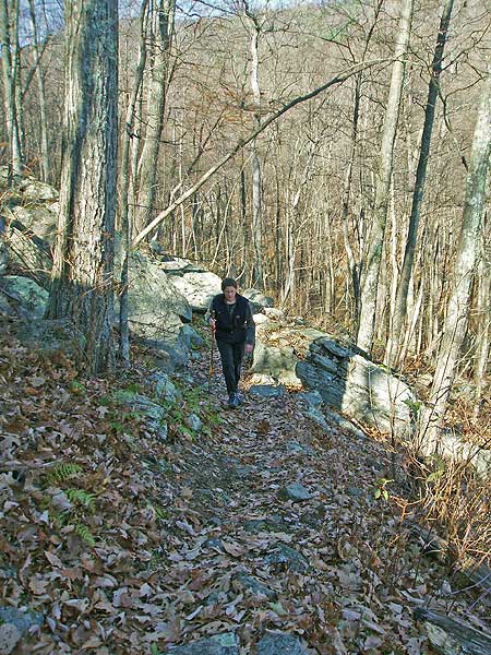
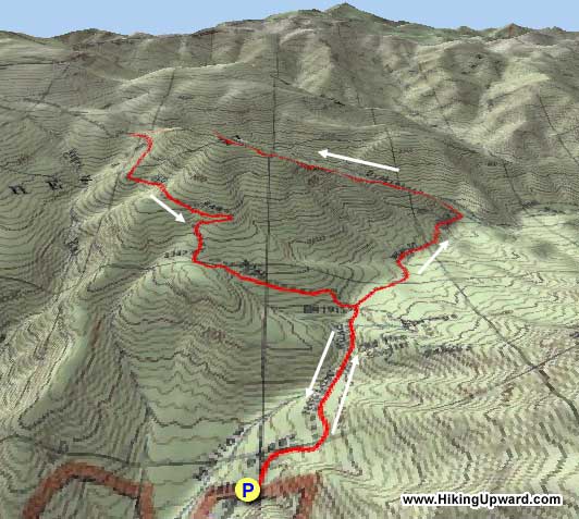
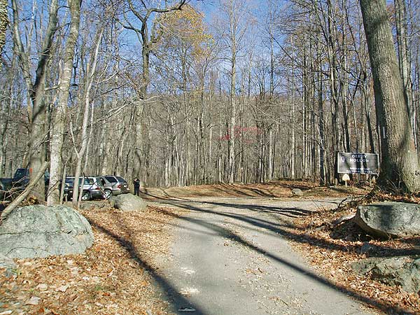
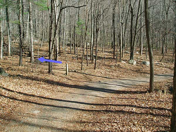
From the parking area, pass the closed gate hiking up the yellow blazed Berry Hollow Fire Road for 0.8 miles. Here you reach the intersection of the Old Rag Fire Road on the left, the Saddle Trail on the right, and Weakley Hollow Fire Road that continues straight.
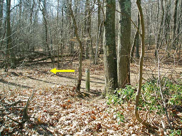
Continue straight on the yellow blazed Weakley Hollow Fire Road (concrete post points towards Old Rag Parking Area) for 1.2 miles and arrive at the Robertson Mountain Trail.
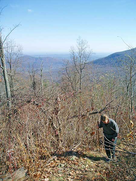
Turn left uphill on the blue blazed Robertson Mountain Trail for the steepest section of the loop, and gain 1,700ft in just over 1.5 miles to the top of Robertson Mountain.
Continue down the other side of Robertson Mountain on the Robertson Mountain Trail where it ends at the junction of the Old Rag Fire Road in another 0.6 miles.
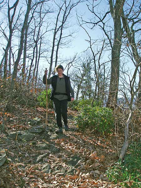
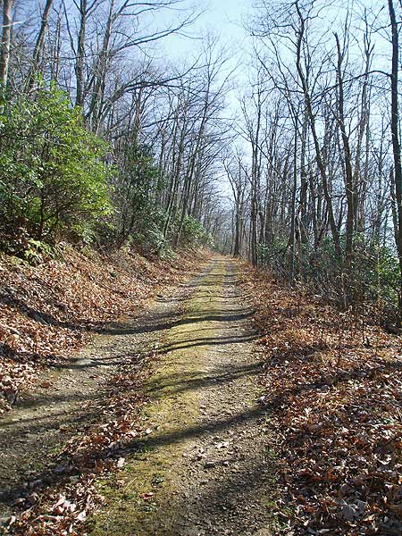
Turn left downhill on the yellow blazed Old Rag Fire Road as it descends for 2.2 miles back to the intersection with the Berry Hollow Fire Road.
Turn right on the Berry Hollow Fire Road for the remaining 0.8 miles back to the parking area.
Mid November
Robertson Mountain Hike Comments
Archived Comments
By:Steve
Rating:
Date of Hike: Monday, October 14, 2019
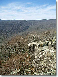
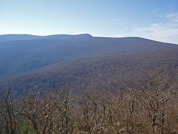
I hiked this as described. I found the fire roads a nice break from the rocky hikes I am usually on, and from the steep trail here. If you are going to hike a steep trail, this is the one to do it on. The trail is rocky but well maintained. There are many rocks and downed trees alongside the trail on which to sit and catch your breath. It's not explicit in the description but there is a short (200 feet or so) side trail to the left (following the suggested route) at the top. It passes a campsite which was in use and ends at a great overlook from which you can see Old Rag and Hawksbill Peak. The parking lot holds about 15 vehicles -- there were five when I arrived at 8 a.m. and it was filled when I returned in the early afternoon. The description says this hike is 6.8 miles but I carried a couple of GPS devices that showed closer to eight miles.
By:Emily
Rating:
Date of Hike: Saturday, August 4, 2018
My husband, daughter, Australian Sheppard and I did this hike today, as a second choice when we learned that dogs can't hike Old Rag. It was a great adventure! We took the Corbin trail on the way back to the fire trail, which was a good way to change it up. The rain over the last week was very heavy, which made the river (creek?) crossings challenging, but still fun! And parts of the trail we were actually hiking in ankle-deep water. We all had a blast! And calculated that we hiked almost 9 miles today! For a 7-year-old, that's pretty awesome!
By:O'Mals
Rating:
Date of Hike: Wednesday, December 21, 2016
This is a great hike. Easy approach on the fire road. Great views through the bare trees along the ascent. Excellent panorama at the summit. Took Corbin Hollow on the way back to mix things up. My only complaint is the $20 parking fee at the Old Rag parking lot, and that's really my own fault for not getting a pass! The hike might not be as popular as its neighbors, but fewer people make for a more enjoyable day.
By:Leigh
Rating:
Date of Hike: Sunday, October 23, 2016
I would say the Robertson Mountain trail was the only real trail part, and it was definitely challenging! Out of the 6.8 miles it says the hike was, only 2.1 was actually a "trail." The rest was just fire roads and I think that is just way too much (~5 miles). I will try the All Trails route next time, as that does the loop north with Corbin Hollow Trail.
I also wish I read a few more reviews, because we didnt realize how un-obvious the trail to the peak would be. There are many times you think you are at the top, and then it curves again. I would say the only thing that made us stop is that this last curve (marked with a blue blaze) was down the hill a little - so we took the unmarked trail to the left and around the corner saw another blue blaze - and there it was.
By:Baygirl
Rating:
Date of Hike: Thursday, March 31, 2016
Like previous poster Alan, I'm embarrassed to say that my boyfriend & I started hiking this thinking it was Old Rag. We should have looked at the map at the upper level parking lot. With that, this hike was pretty intense for me. I'm 38, heavyset & work out 4 times a week but would not consider myself in shape. After making many stops on the ascent, I did make it up. And again like Alan, not realizing we were not on Old Rag (although I started wondering where the rock scramble & all the other people were) we made the walk down without even checking out the summit view. All in all, I'm glad I did this hike.
By:sanjida
Rating:
Date of Hike: Saturday, January 16, 2016
Nice views and great workout on Robertson mountain trail, though the fire road isn't that interesting. The gps coordinates are wrong, this hike starts at the Old Rag parking lot. We somehow also logged over 10 miles following these directions from the main parking lot in about 4 hours.
By:sanjida
Rating:
Date of Hike: Saturday, January 16, 2016
Nice views and great workout on Robertson mountain trail, though the fire road isn't that interesting. We somehow messed up on the driving gps and just started in the main lower Old Rag parking lot on 600. We also logged over 10 miles from the main parking lot in about 4 hours.
By:Tim
Rating:
Date of Hike: Sunday, August 23, 2015
Lovely challenging day when done with Old Rag. Have now done it three ways, but up old rag and down to the start of the steep ascent on Robertson, and descent of Corbin Hollow is probably the best. Up Robertson and then Old Rag puts you on the Old Rag Ridge a bit exhausted, with long waits at the bottlenecks - at least on Sundays!
By:GrumpyOldMan
Rating:
Date of Hike: Saturday, August 15, 2015
My partner and I used this as a training hike to prepare for an up-coming adventure. We've hiked Old Rag a couple of times and we were looking for an alternative rigorous and slightly longer trail. We began from the lower Old Rag parking lot on Nethers Rd, climbed up Weakley Hollow Fire Road to Robertson Mountain Trail to the Old Rag Fire Road to Corbin Mountain Trail to Nicholson Hollow Trail back to the parking lot. Overall distance was 11-12 miles and took 7 hours, including about 30 minutes for breaks and time at the summit of Robertson. The route we took was perfect for us--the ascent of Robertson was intense (great!), but once we reached the summit (about 2.5 hours from start) the rest of the trek was mostly flat or downhill (the Old Rag Fire Road section was uphill but quite moderate).
Likes: NOBODY on the trail! We met a solo hiker and one party of three on Robertson, no one on Corbin Mountain! Great view from the summit of Robertson lovely trail on Corbin (we passed through a section we dubbed "the shire"), and Nicholson follows the Hughes River (beautiful)
Dislikes: With no one on Corbin we encountered spider webs every few feet (a bit frustrating). Please, go hike this trail! We plan to go again a couple more times this fall, so keep the spiders off!
By:RedDrgn
Rating:
Date of Hike: Saturday, August 1, 2015
Being generally familiar with this area and how crowded the fire roads can get in the summer near Old Rag, we did a variation of this hike. From the Old Rag parking area, we hit the Weakley Hollow Fire Road to Robertson Mountain Trail to Old Rag Fire Road to Corbin Mountain Trail to Nicholson Hollow Trail and then back to the parking area. GPS indicated it was 8.61 miles, though it did have some connection data point/connection issues in two deeper forest canopy zones, so I'd estimate a bit over 9 miles would be more accurate. It took us 6hrs, which included about an hour's worth of combined scenery/wildlife photography stops along the way. We hit the trail at 0730.
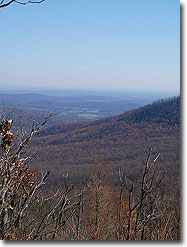
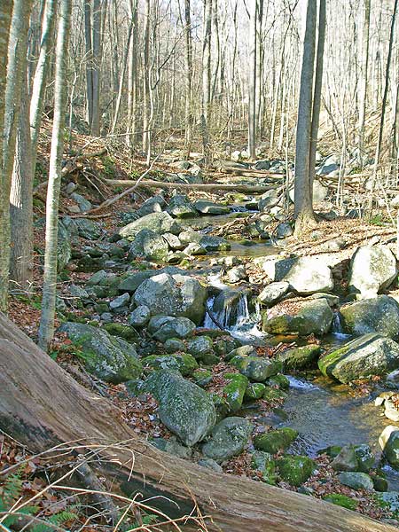
The fire roads are both gradual to moderate inclines, but easy trekking in the shade of the woods. Robertson Mountain Trail does not require any all-fours scrambling, but it is a very steep trail all of the way to the summit (the summit overlooking being a very short side trail that branches to the left at the top). If you have kids along and/or you're not in reasonably good shape, avoid it. Otherwise, go totally worth it! The summit is much smaller and limited in view in the summer compared to Old Rag (which you can catch a glimpse off to the far left from the overlook), but it's worth the haul to see! The hike down the other side to Old Rag Fire Road is not nearly as steep as how you got up there, and no portion of the circuit ahead will come anywhere close in difficulty level. Corbin Mountain Trail varies nicely with a variety of forest surroundings/densities, though it was a little grassy in areas. Once you hit the junction with Nicholson Hollow Trail you've got the Hughes River to accompany you all of the way back to the parking lot, which makes for some nice scenery and a soundtrack (if you like the sound of running water, of course).
We encountered ZERO ticks, three white-tailed deer, one timber rattlesnake (on the trail watch your step), and a ton of different butterflies, moths, arachnids, beetles, caterpillars, and other interesting arthropods along the way. No harm caused by any of them. The ascent to Robertson summit and the first half of Corbin Mountain Trails did have a fair abundance of spider/webs across the trail, but carrying a small stick made moving them easy enough.
We saw 6 people on Weakley Hollow Fire Road after passing the Ridge Trail to Old Rag, and had the misfortune of a group of about 15 hikers that caught up to us while we were enjoying the view on top of Robertson Mountain. Fortunately, they were speed hikers and moved on ahead in a hurry and were never seen by us, again. The only other people encountered were on the final half of Corbin Mountain Trail all 3 of them were lost, having thought they were heading along the Ridge Trail to Old Rag. We donated a map to one and taught the others how to read their map and the trail head/intersection markers if you're not familiar with the area, the trails are well marked on the concrete pillars with the metal bands around the top. The park maps are also pretty helpful and are free at the ranger stations.


