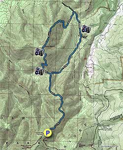
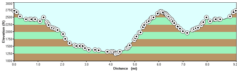
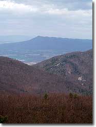
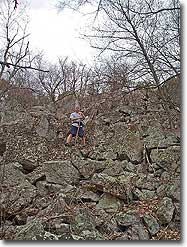
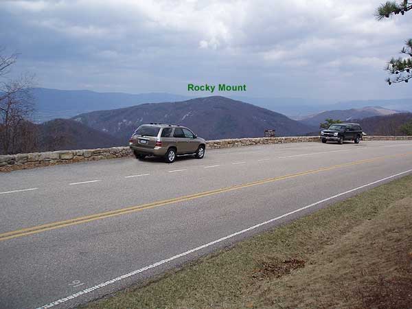
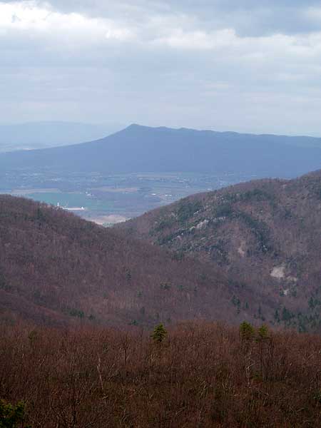
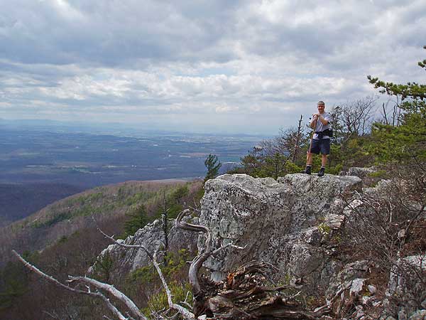
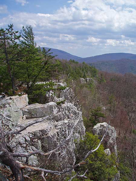
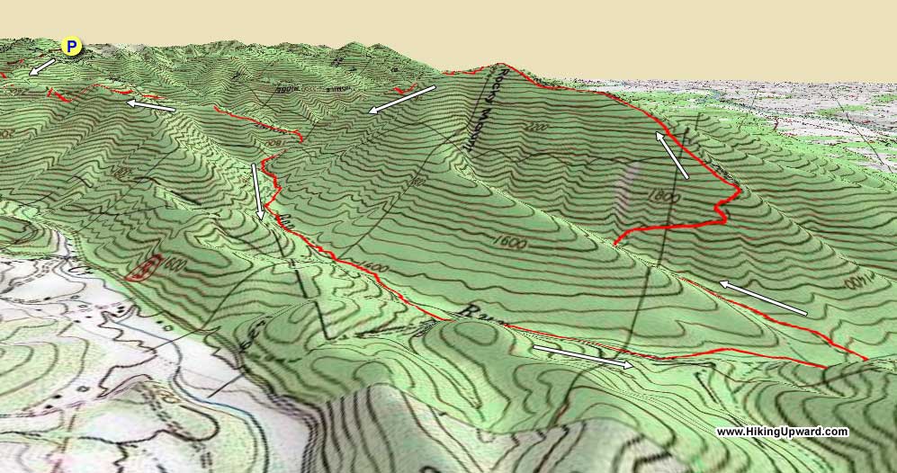
Rocky Mount is one of a few 9+ mile circuit hikes in the southern section of the Shenandoah National Park. With three different ascents, the last being at the end of the hike, this 2,840 foot loop can feel longer and higher than it actually is. The reward is the great panoramic view from the Rocky Mount summit.
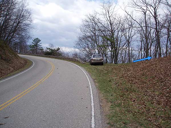
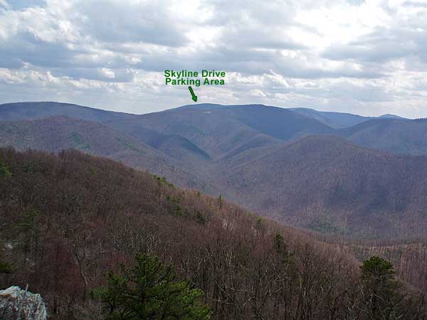
From the concrete post marking the Rocky Mount Trail head on Skyline Drive, 200 yards before Twomile Run Overlook, start down the blue blazed Rocky Mount Trail as it descends along the ridge. Views of Massanutten Peak to the west are visible along this section of the trail. Massanutten Peak marks the southern tip of the 45 mile long Massanutten Range.
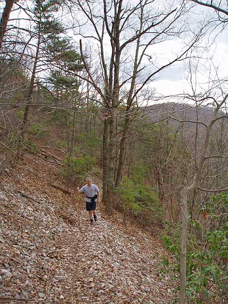
The Rocky Mount Trail will level out, then follow the ridge on its west side, pass through a small gap, then climb on its north side before descending steeply to the intersection of the Gap Run Trail 2.2 miles from Skyline Drive. At this point the Rocky Mount Trail you had been following heads back uphill.
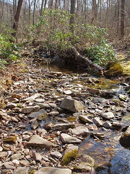
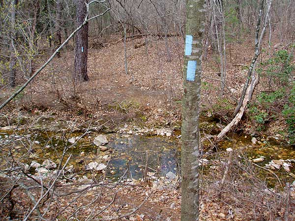
Turn right downhill onto the Gap Run Trail. The trail initially descends steeply before crossing Gap Run in 1.9 miles. In another 0.4 miles arrive at a concrete post trail marker. Turn left remaining on the Gap Run Trail. The overgrown road to the right is private property. In 0.4 miles from the concrete post there is a large camping area on the bank of Gap Run. Continue along the trail for another 0.2 miles and arrive at the Rocky Mount Trail junction.
Turn left onto the blue blazed Rocky Mount Trail, cross Gap Run, and in 0.5 miles the trail makes a switchback to the right. At this point the trail begins the steep climb the 1.6 miles up to the Rocky Mount summit.
In 1.3 miles from the summit arrive back at the junction of the Gap Run Trail you descended earlier. Continue straight on the Rocky Mount Gap Trail, as it now heads uphill, retracing your route the 2.2 miles back to Skyline Drive and hike start point.
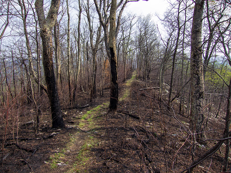
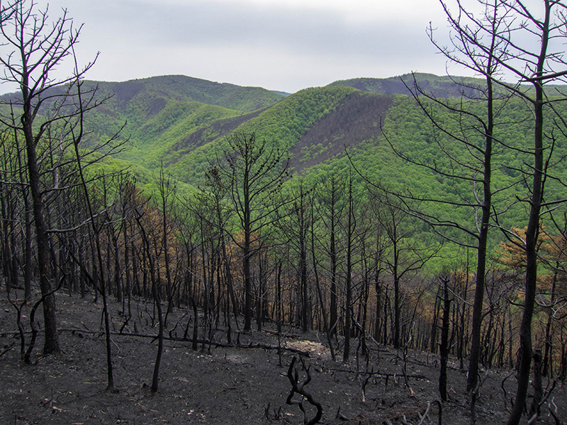
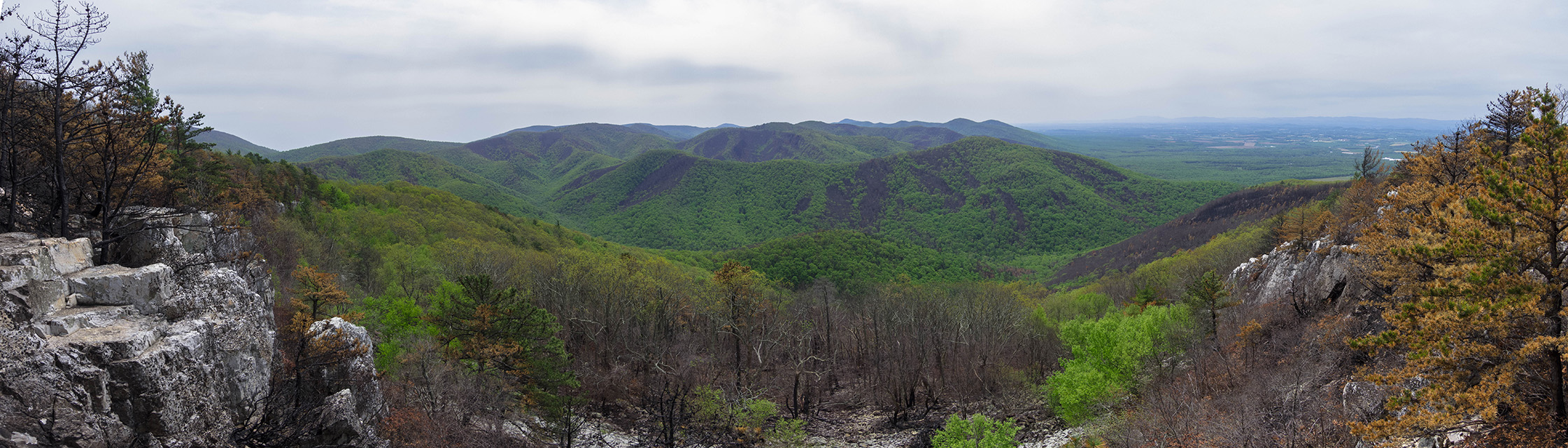
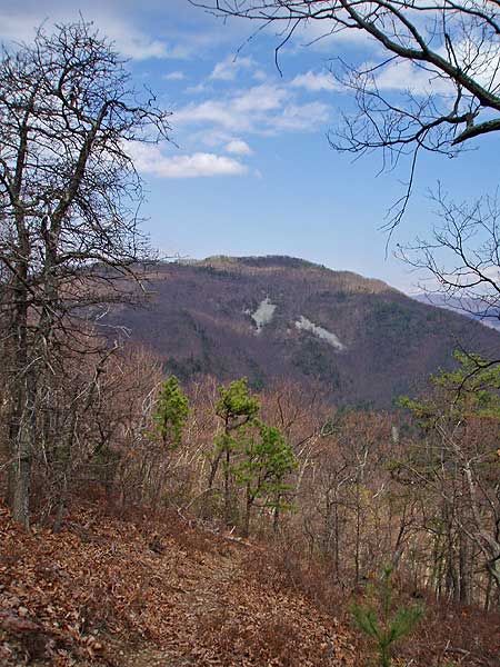
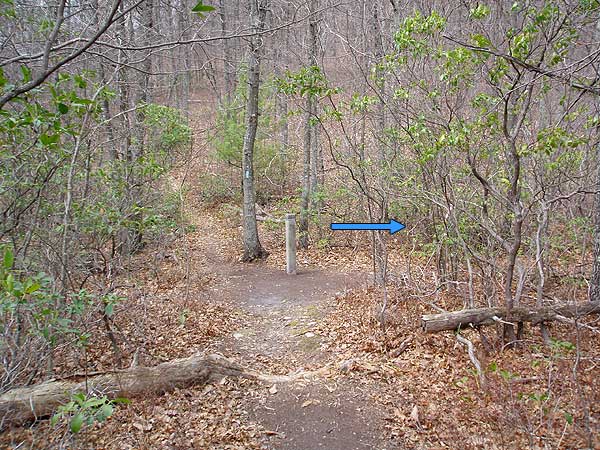
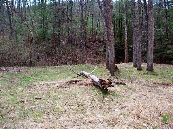
Post May 2016 Fire
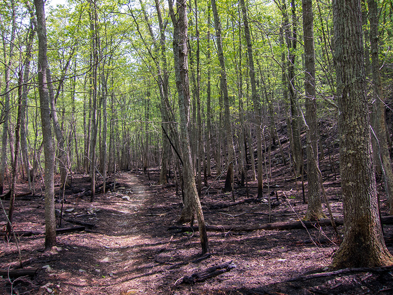
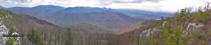
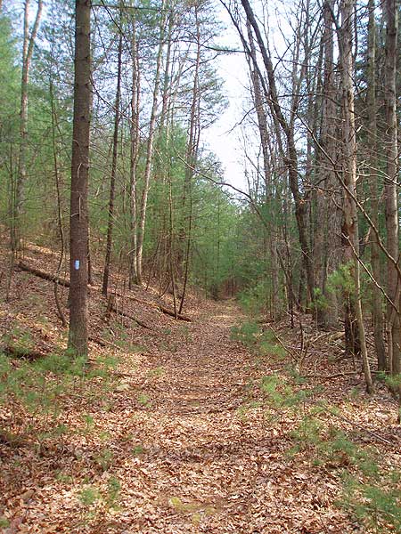
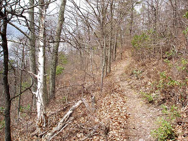
Mid April
Rocky Mount Hike Comments
Archived Comments
By:Emily
Rating:
Date of Hike: Friday, October 25, 2019
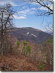
This trail is rough. Not in a "hard climbs" way. Not even in an emotional way. It just looks like something discarded and forgotten about for years. If you like scrambling through downed tree branches, getting swiped at by thorny briars, and having cobwebs tangled up in your eyelashes then this trail is great.
5 stars for solitude. 2 stars for fun. 2 stars for views. 5 stars for just a good piece of Appalachian woods to walk around in.
If you're camping, there is plenty of water halfway through the trail, even in these dry conditions.
By:ANDICONK
Rating:
Date of Hike: Friday, October 18, 2019
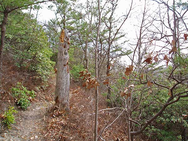
I have hiked this trail at least a few times before, the last time before today was several years ago counterclockwise. Recalling that the portion from the bottom (end of Gap Trail) to the top of Rocky Mount was super steep & challenging the last time, I opted for a clockwise trip today. Due to the fire a few years ago and the ice storm last October there were quite a few obstacles--brambley undergrowth & lots of downed trees. I expected this, so anticipated the extra effort would be needed. Turned out to be a beautiful hike & not another soul the entire hike. Happy encounter with a garter snake.
By:Mark
Rating:
Date of Hike: Saturday, September 21, 2019
This loop is very difficult, partly due to the need for trail maintenance on Gap Run section and back part of Rocky Mount. But the solitude to be found is well worth the effort. This may be one of the most remote hikes in SNP. I do recommend the Gap Run portion for this reason. We hiked the loop counter clockwise and were glad we did because we were fresher when we reached the obstacles. The views on the Rocky Mount are excellent, partly because the area is recovering from a recent fire. The first 0.5 mile has been cleared. Very strenuous and rewarding.
By:Amanda
Rating:
Date of Hike: Saturday, August 3, 2019
The previous reviewer is right on about waiting to do this hike when the weather is cooler. We did the loop as presented and found it to be hot and difficult. We found the Gap Run portion to be really disappointing. There were 25+ blow downs to climb over or around, lots of overgrown vegetation and nothing spectacular to see on Gap Run. The Rocky Mount portion of the trail was in excellent condition compared to a year ago when we attempted this hike. A year ago the first 1/2 mile had pervasive thorny vines that had overtaken the trail making it painful and slow moving to pull long thorny vines back to pass through. Fast forward a year and we found the first 1/2 mile to be in excellent condition. The PATC has been hard at work maintaining the Rocky Mount trail. We actually met the individual responsible for maintaining the Rocky Mount during our hike. He was pruning the first 2.2 miles down to the lollypop portion. RECOMMENDATION: Complete this hike as an out and back to the summit (skip the Gap Run portion) during cooler months October - April.
By:Chris
Rating:
Date of Hike: Friday, July 19, 2019
I did this hike for the first time today, and I could have picked a better day/time to do it. The heat was sweltering: 100 degrees in the lowlands, and ~90 degrees on the trail. I (foolishly) didn't anticipate how much of a factor the heat would be. Although I had more than enough water, I baked for the entire hike. It really sapped my energy and I had to pause multiple times on ascent portions of the trail, which is something I'm not really accustomed to. If you decide to do this hike, please don't be like me. Do it when the weather isn't sizzling.
As far as the trail goes I didn't think it to be so overgrown (as of present) as others have described here. It appeared that there has been recent maintenance to clear a fair bit of the encroaching vegetation, particularly for the first mile or so. However, as others also pointed out, long pants are a must! I am grateful to have heeded this information as one will still brush past plenty of vegetation. I didn't incur any scrapes or cuts with long pants.
Also there are several downed trees on the final ascent up the summit, which will demand skirting around and over dead-fall. This in my opinion, is another factor that adds to the difficulty of the ascent (indeed it is rather strenuous).
The summit, or outcroppings thereof provide stellar views that as another reviewer mentioned, are quite worthwhile. Overall this was a great hike, albeit rather tough given the weather, trail conditions, and pitch.
By:The views are worth the effort
Rating:
Date of Hike: Friday, July 5, 2019
We did an out and back - we stopped near the end, probably where the PATC volunteers stopped their trail clearing.
This was a strenuous hike and the beginning is wooded, so it takes patience to get to the special views. Once you get through to the views, it is stunning. In between you'll pass different fauna in terms of trees and sun exposure. Raspberries, blackberries and even blueberries were in season, which meant delicious surprise snacks along the way.
The down-side is that raspberries have thorns and grow well into the trail at times. This trail has much lighter foot traffic and so the overgrowth is considerable at times
Wear long pants and bring plenty of water. If you like lonesome hikes with stunning views, you'll like this one
By:Anna
Rating:
Date of Hike: Saturday, June 15, 2019
Attempted this hike this past Saturday. I would barely call this a trail, the bushes and thorned trees were so overgrown. It was very hard to walk through. We tried going for a little bit ~0.5 mile but ended so cut up on our legs we turned back and left.
By:TheCerealist
Rating:
Date of Hike: Saturday, June 1, 2019
You can tell that this trail doesn't receive much foot traffic and isn't tended to much. The path was overgrown with enough thorny vines and brush to warrant turning back after about 100 yards. I have a feeling it's probably a good hike, but I won't try this one out until winter when the vines and brush thin out.
By:Mike
Rating:
Date of Hike: Sunday, October 7, 2018
As of 7 Oct, PATC volunteer trail crews have managed to clear the trail out to the Gap Run Trail intersection and part of the way over Rocky Mount and down the Gap Run Trail. The far side of Rocky Mount (approximately between Miles 5 and 6 on this hike) is still uncleared from the blow downs and regrowth following the 2015 fire. The burned out areas are recovering with new saplings coming up from the bases of 'killed' trees, as well as large sections of blackberry brambles. Additionally, 'standing dead' trees that were damaged or killed during the fire continue to create new blow downs across the trail which take time to remove.
Recommend treating this as an out-and-back hike until the far sections are cleared, either up to the overlook on Rocky Mount or down to the bottom of Gap Run.
By:Amanda
Rating:
Date of Hike: Saturday, August 4, 2018
This trail was seriously overgrown and full of brush with thorns. We made it about a half mile in and had to turn back because we were cut up so badly and the trail condition was getting worse and worse. It took us about an hour to do the half mile in and back out. If you are going to do this trail make sure to wear pants and long sleeves.


