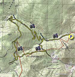
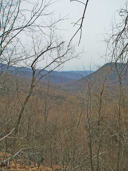
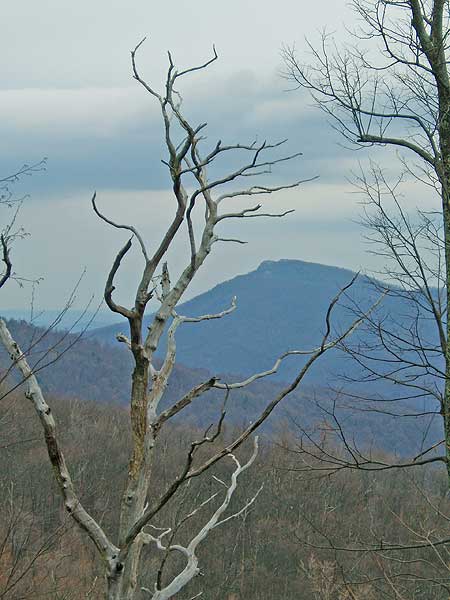
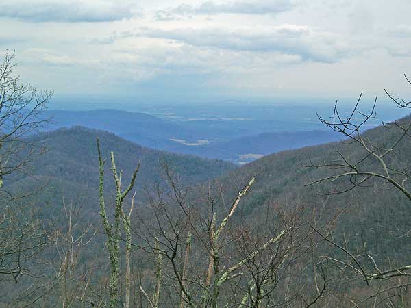
The Stony Mountain circuit is one of the more secluded loops in the SNP. Overshadowed by the more popular Old Rag Mountain and White Oak Canyon hikes just to the north. With great views of the valley from Stony Mountain, and a nice swimming hole on the Rose River, this is one hike worth checking out.
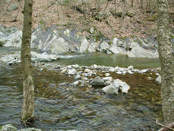
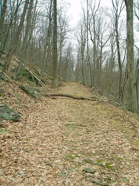
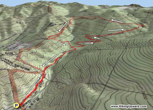
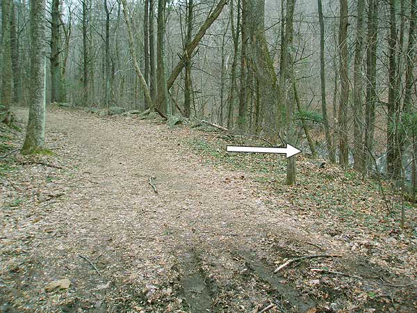
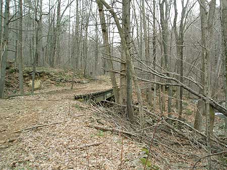
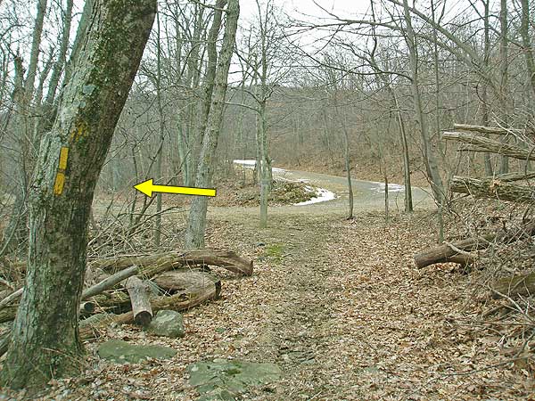
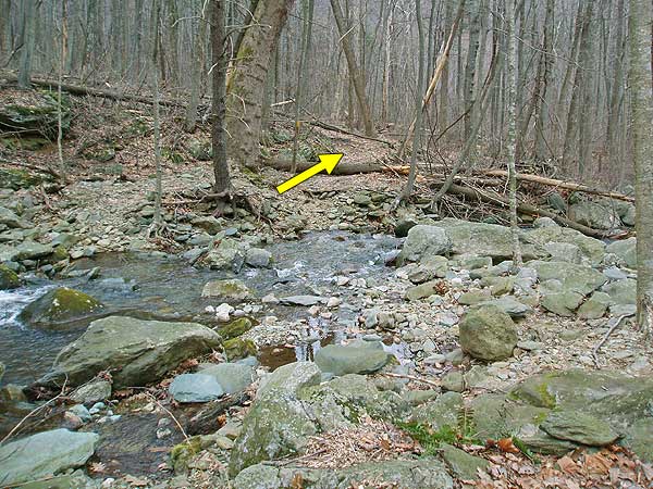
From the parking area head up the yellow blazed Rose River Fire Road passing through a closed gate. Don't be confused by the initial red blazes on the trees, these designate the SNP boundary. Hike up the fire road with Rose River on your right and in 0.5 miles look for a small unmarked trail on your right that leads down to the river and great swimming hole in the summer. In 0.6 miles cross a steel bridge that spans Dark Hollow Creek. Continue up the fire road and pass an unmarked trail on your right.
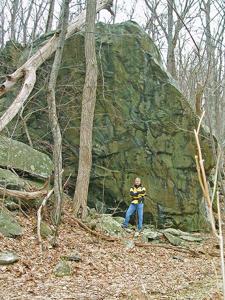
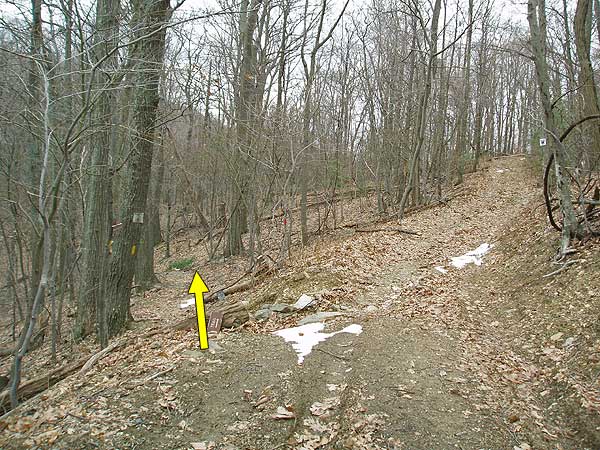
The fire road now turns left and ascends Stony Mountain. At the first switchback pass the Upper Dark Hollow Trail on your left, this will be your return route. Continue on the fire road and in 100 yards, 30 yards off the trail on the right, there is an old cemetery. The cemetery is no longer maintained. It has 30+ graves with the most recent dating to the 1920's, just prior to when the SNP was established in 1935.
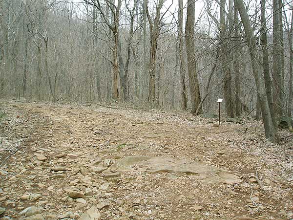
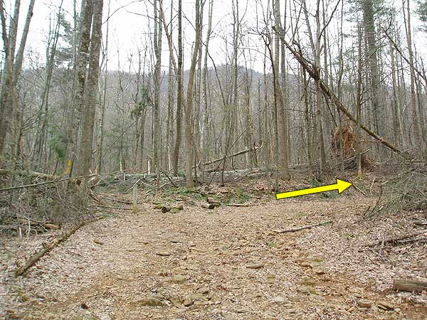
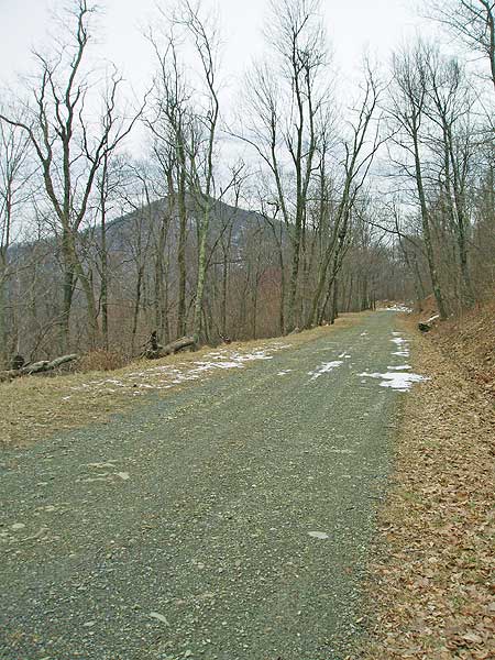
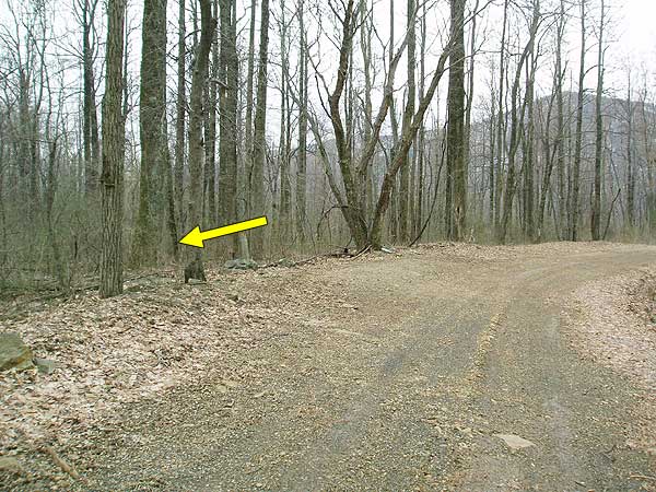
Continue along the yellow blazed fire road as it does four more switchbacks before traversing the mountain and arriving at an unofficial trail and concrete post on the right in 2.3 miles. 0.3 miles further the fire road makes another switchback to the left, then in 0.2 miles arrive at the Stony Mountain Trail junction. Stay straight on the Stony Mountain Trail as the fire road you have been following turns sharply to the right.
Follow the yellow blazed Stony Mountain Trail as it as ascends the mountain. This is the steepest part of the hike and the trail is hard to spot in places. Keep an eye out for the yellow blazes.
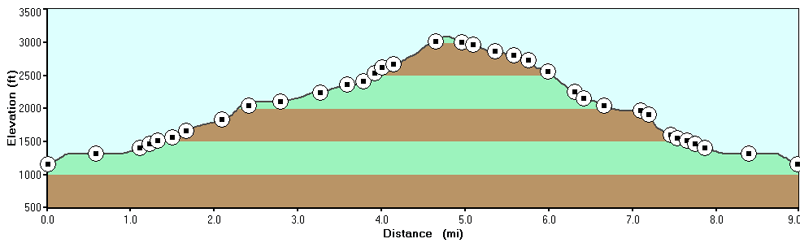
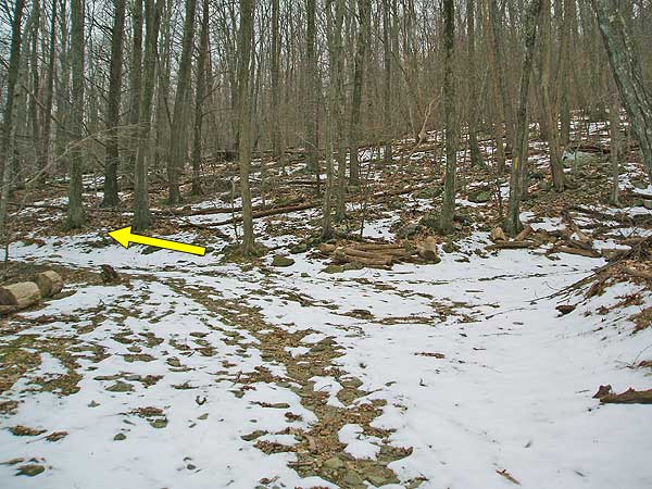
From the high point on the trail gently descend for 0.3 miles and arrive at the intersection of the Rapidan Fire Road where the Stony Mountain Trail ends. Turn left downhill on the fire road and look for a rocky mound on the left in 0.4 miles. Climb the mound for the best view of the hike. Continue downhill another 0.4 miles to the intersection of the Upper Dark Hollow Trail where the fire road now veers to the right.
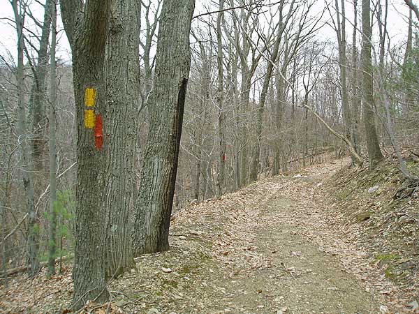
Turn left downhill on the yellow blazed Upper Dark Hollow Trail descending the side of Double Top Mountain. This section of the hike passes through the Rapidan State Wildlife Management Area, and has both red blazes designating the SNP boundary, and yellow blazes for the Upper Dark Hollow Trail. In 1.5 miles the Upper Dark Hollow Trail will turn left downhill. This junction is marked with a 'W' on the right and wooden trail sign on the left. Turn left downhill remaining on the yellow blazed Upper Dark Hollow Trail as it steeply descends for 0.5 miles before crossing Dark Hollow Creek. Continue on the trail for another 0.1 miles where the Upper Dark Hollow Trail ends at the Rose River Fire Road you ascended earlier.
Turn right downhill on the fire road retracing your route over the steel bridge and arriving back at the parking area in 1.1 miles.
Mid February
Stony Mountain Hike Comments
Archived Comments
By:Jamey
Rating:
Date of Hike: Saturday, March 31, 2018
The directions warn that the Stony Mountain Trail is hard to follow. I completely lost the trail, which has never happened to me in decades of hiking, about halfway up. The trail was getting very faint, and after I went around some big windfalls, I lost the trail. I wandered around, looking for yellow blazes, and then I was unable to relocate the trail at all. I considered bushing the rest of the way up the mountain in hopes of running into the Rapidan Fire Road, but I realized that was foolish. I knew that if I bushwhacked down the mountainside I would eventually come to the Rose River Fire Road, so that's what I did. It wasn't fun. It's too bad, because I was really enjoying the hike. The stretch along the river is nice (albeit very rocky in places), and as the fire road gently ascends, the woods are open and beautiful. A couple other points. The random cement post at the four-mile point on the fire road is on the left, not the right, and I saw no unofficial trail near it. Also, both on the way up and on the way down, I couldn't find the unmarked trail to the cemetery. Maybe it just wasn't my day.
By:Ash
Rating:
Date of Hike: Sunday, December 10, 2017
This is a nice hike to do in late fall, winter, and early spring. When the trees are bare you get some decent views. It snowed yesterday and that made this trail fun to do. I saw lots of animal tracks including bears, deer, turkey, rabbits, and I think Bobcat. Since there was new snow even the fire road was fun to walk on. I plan on hiking this again when the trees show green but don't have all of the leaves yet.
By:Steve
Rating:
Date of Hike: Friday, October 20, 2017
Several nice views of the Rose River, which was low as it had been dry. I like fire roads as a change of pace -- this time, though, the leaves covering small rocks on the roads made placing my feet a little harder than on the steeper, rockier trail, where rocks stick out more.
Not much in the way of vistas and views but more interesting rock outcroppings than usual. The description refers to the best view being at a mound along the Rapidan Fire Road, and that's true. Opposite the mound on the other side of the road is a 20-foot cliff that, if you go to either side of it a little, you can find a way to climb up on without too much trouble for an even better view and more privacy than the mound. The cliff slopes downward toward its edge so use caution and keep back from the edge if doing this.
By:Brandon
Rating:
Date of Hike: Sunday, July 12, 2015
Very nice hike especially at the beginning next to the rose river. Allot of great swimming holes. Couldn't really see many great views because off all the trees but still a very beautiful hike.
By:MarshMudMan
Rating:
Date of Hike: Sunday, July 21, 2013
Today I was reminded that I am not a huge fan of hiking on fire roads. Sure, they get you where you're going and can take you to some nice places, but I much prefer hiking a narrow trail than on a road. So, the first 3.4 miles up the Rose River fire road were tolerable but nothing fantastic. I modified this hike by taking the unofficial trail mentioned in the description (the blue dots on the topo map) over to the Rose River trail (not fire road!) and up to Rose River Falls. I had lunch at the base of the lower falls - nice view and the air was noticeably cooler there than up on the trail itself. After lunch, I then turned around and took the Rose River trail up Hogcamp Branch to the base of Dark Hollow Falls. The falls were great and definitely worth checking out. Many other people also wanted to see the falls. I only saw two groups of people on the Stony Mountain loop, but was meeting people every few minutes while walking on the Rose River trail. After seeing Dark Hollow Falls, I headed up the Rose River fire road until I met the Stone Mountain trail. I estimate that the detour to see the falls added an extra ~3 miles to the trip. From here on out, my route followed the Stone Mountain hike trail description. While going over Stony Mountain, I could hear thunder off in the distance. As I turned onto the Upper Dark Hollow Trail, it got really dark. It was only 2:30 pm, but I briefly considered pulling out my headlamp. About 15 minutes later, it started pouring, with thunder and lightning that was right on top of me for a little while. The Upper Dark Hollow Trail and the Rose River fire road had some drainage issues with the heavy rain. There were long stretches where there was so much water rushing downhill that it was just like walking in a creek. Summary: Positives = solitude (except near the waterfalls), I was outside in the woods, I got a good workout. Negatives = lots of hiking on fire roads, no spectacular scenery or views (except near the waterfalls), Stony Mountain and Upper Dark Hollow Trails need some attention
By:Kellygirl
Rating:
Date of Hike: Saturday, May 11, 2013
I decided to do this hike since it was close to my house and this is a new trail for me. I extended this hike to Dark Hollow Falls. The fire road was very rocky and slippy and river like (this is after a long spring rain). This trail is very rocky and if you are not use to hiking on rocky areas then this is not for you. I really enjoyed the fireroad, it allowed me to talk with my friend and enjoy the numerous wildflowers and wildlife. This trail NOT crowded until we got to Dark Hollow Falls. I think the total for my version was about 12 miles or so. Stony Mountain trail is in need of some trail work. (I notified my fellow PATC workers.) The river was beautiful! I am not sure the amount of water in the summer. Overall a nice hike. This would be a good hike for someone who is NOT new to hiking but would like to start expanding the amount of miles. I have many hikes to do on my list, but might return to do the loop listed on the Hikingupward site in the winter months.
By:Doctari
Rating:
Date of Hike: Wednesday, July 7, 2010
After doing Whiteoak and Dark Hollow trails, my spouse and I went on Stony Mountain. Before reaching the top, with my spouse in the lead, we walked up on a timber rattler. Unknowingly my spouse was within a foot of the snake when it sounded. We both paniced and went into a flight mode. My spouse fell on the rocky steap trail in the attempt to run back down and was hurt on both knees seriously. I heard the sudden rattle that was on us and had already retreated before my spouse could scream rattle snake, but I did not see the snake. My spouse said it was coiled and could not determine the length but the mid section was the size of an adult persons wrist. My quess the snake must have been 6 to 8 feet long. I have wondered what would had happened if the rattler struck. We were out of cell phone reception and it was a long way back down. We have learned to be more aware of the dangers in the environment, even on a well traveled trial. This rattler was right on the immediate side of the path in a patch of grass. The differance between a nice hike and a fight for life was only a couple seconds apart.
By:Jayne Hiking Addict
Rating:
Date of Hike: Sunday, July 4, 2010
http://www.meetup.com/hiking-162/photos/976389/16192848/#16192053 It'sw hard to give any hike less than 5 stars. We're outside. We're enjoy the day and the company. But the description of 3 stars fits this hike. I would do it again in the winter when the 1 view doesn't have the tree leaves to bar the view. David did a great job describing the hike below.
Eight of us hiked it, with a stop in the swimming hole in 4.5 hours. It was mostly fire roads which I thought might be disappointing but weren't. They were more like wide trails with lots of rock. We started around 9:10am and only once felt the July 90s heat.....at the pretend summit mentioned above.
By:Dave Shook
Rating:
Date of Hike: Saturday, February 27, 2010
The trail was still covered with quite a lot of snow today. Three of us had a really good hike and enjoyed the fact that on much of the trail, ours were the first prints (other than those of the critters). Two of us hiked with snow shoes and the third used microspikes for the the final descent. The first part of the hike as it runs along the Rose River is quite pretty. There are a few fairly steep sections afterwards that will get your heart pumping. When you reach the highest point of the hike just below Stony Mountain, there is a nice fallen tree a little ways off the to the right of the trail that is perfect to sit on while enjoying a relaxing break and a quick snack. We initially passed the turn where the Upper Dark Hollow Trail turned downhill. We continued straight until we reached the point where several driveways branch out from the end of Rt 648. Realizing our mistake, we retraced our steps and found the turnoff, but still did not see the "'W' on the right and wooden trail sign on the left." From the turnoff, the trail was quite steep as it returned back to the Rose River. From there it was back along the river to the trailhead and the cars.


