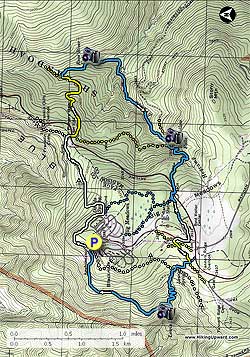
The Three Falls hike is a circuit that passes Rose River Falls, Dark Hollow Falls, and Lewis Spring Falls. These are three of the most beautiful falls in the SNP. There is also an option of shortening the distance, and vertical gain, by opting out of the Lewis Spring Falls section for a total of 6.1 mls and 1530ft gain.
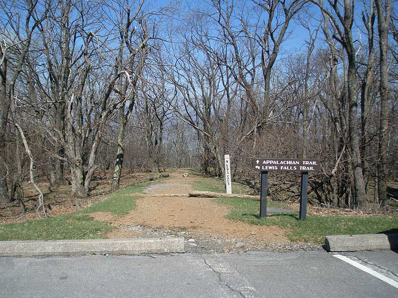
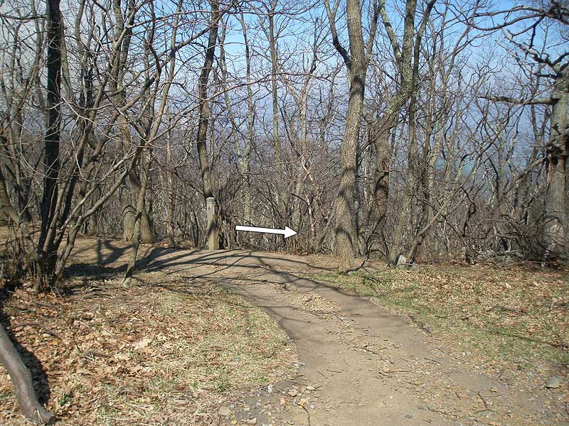
From the trailhead and parking area walk 75 yards down to the intersection of the white blazed Appalachian Trail (AT). Turn right and follow the AT as it initially winds around the campground. There will be several side trails that lead up to the campground, remain left on the white blazed AT.
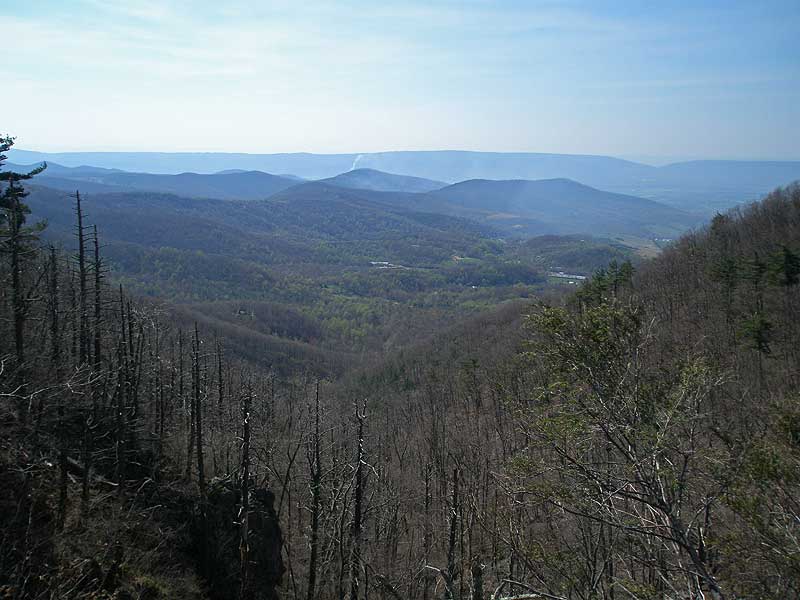
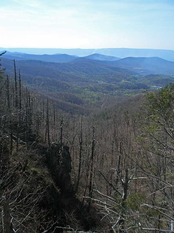
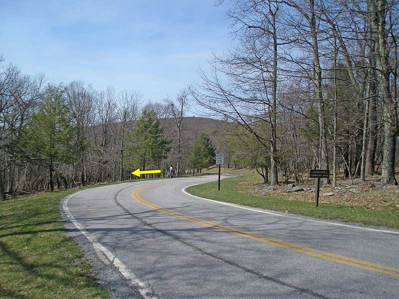
The AT will start descending before arriving at the next trail post just before the Fishers Gap parking area in 1.3 miles. Stay straight on the AT passing below the Fishers Gap overlook, then the AT will cross a fire road. Turn off the AT uphill on the fire road and cross Skyline Drive.
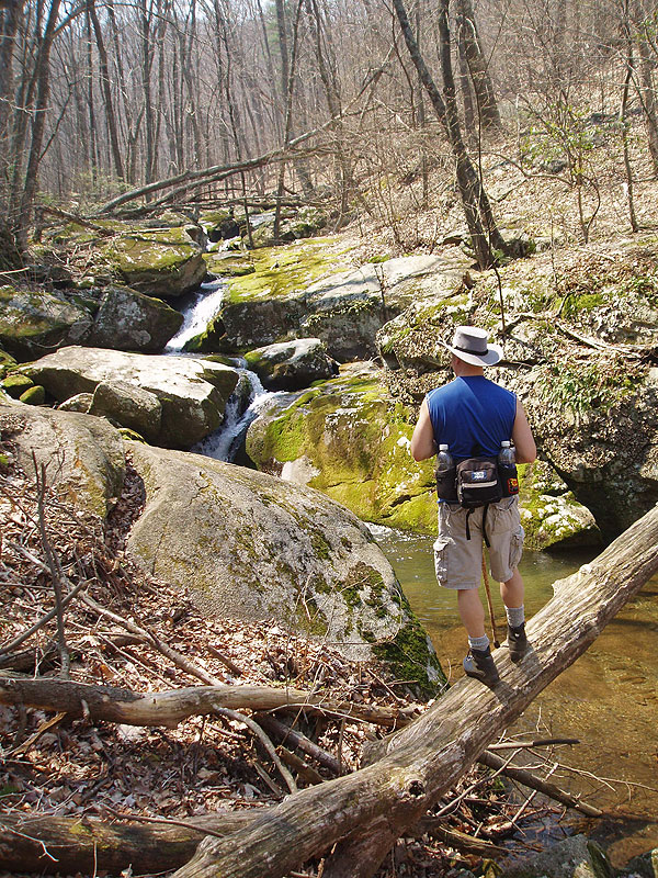
Start down the gravel fire road, then after passing the chain gate immediately turn left onto the yellow blazed Rose River Horse Trail. Follow the yellow blazed trail as it descend and makes several switchbacks before arriving at the blue blazed Rose River Trail intersection in 0.6 miles.
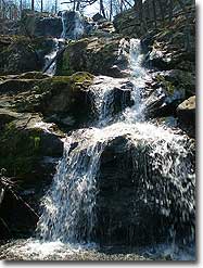
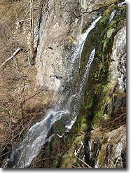
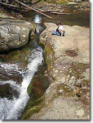
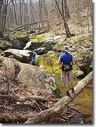
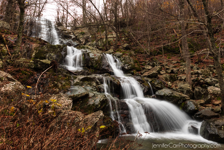
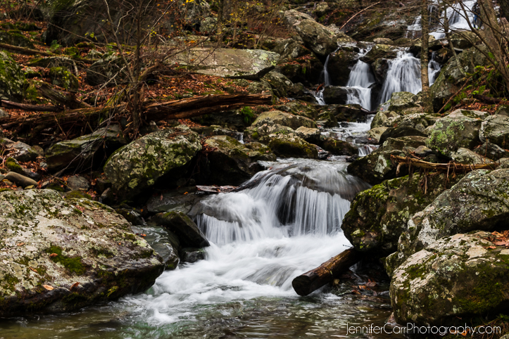
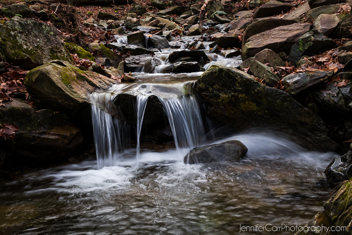
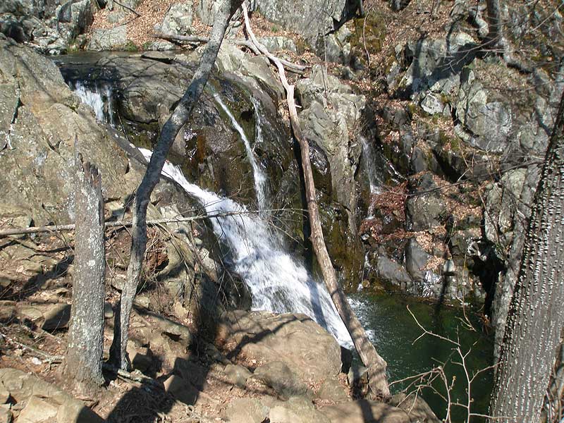
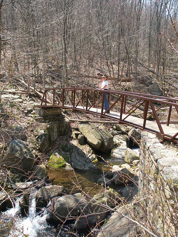
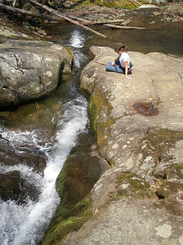
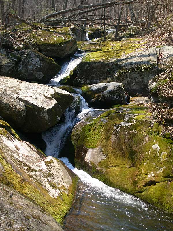
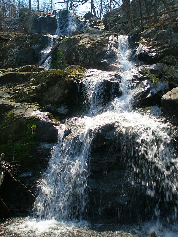
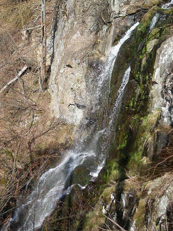
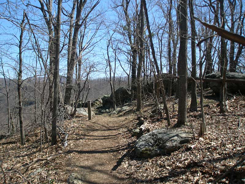
Stay right on the Rose River Trail for 0.8 miles to Rose River Falls, which are a set if two 25ft and 30ft waterfalls. Continue down the blue blazed trail for another 0.3 miles to the hikes lowest point, and where the trail turns right and starts following Hogcamp Branch. Shortly pass the ruins of an old copper mine on the right before crossing Hogcamp Branch on a steel footbridge. Begin climbing up the blue blazed trail as it ascends the valley passing several small falls and pools before reaching the Rose River Fire Road and the bottom of Dark Hollow Falls in another 0.9 miles.
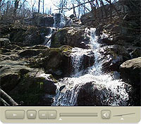
Cross Hogcamp Branch on the fire road, then immediately turn left uphill on the blue blazed Dark Hollow Trail. In 0.1 miles reach the mid-point of the falls where there is a fantastic view of the upper falls. Continue up the blue blazed trail and arrive at the Dark Hollow Falls parking area in 0.7 miles.
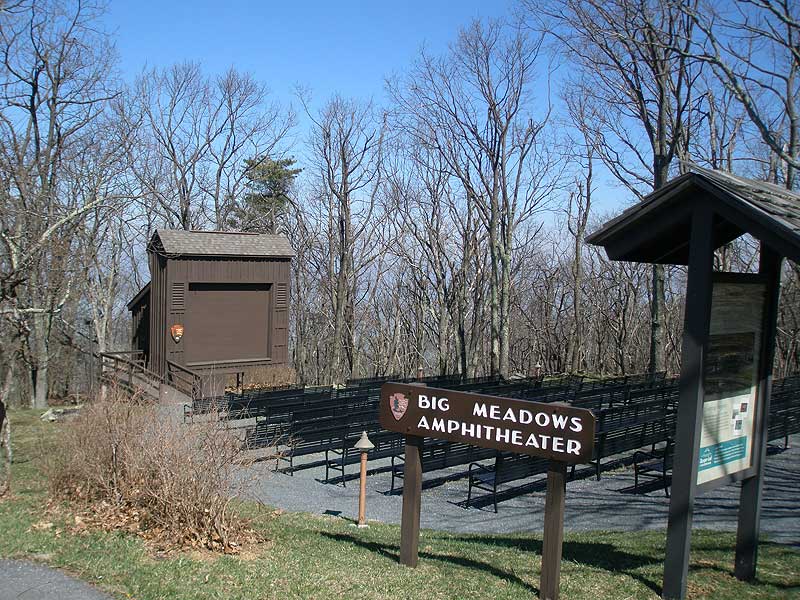
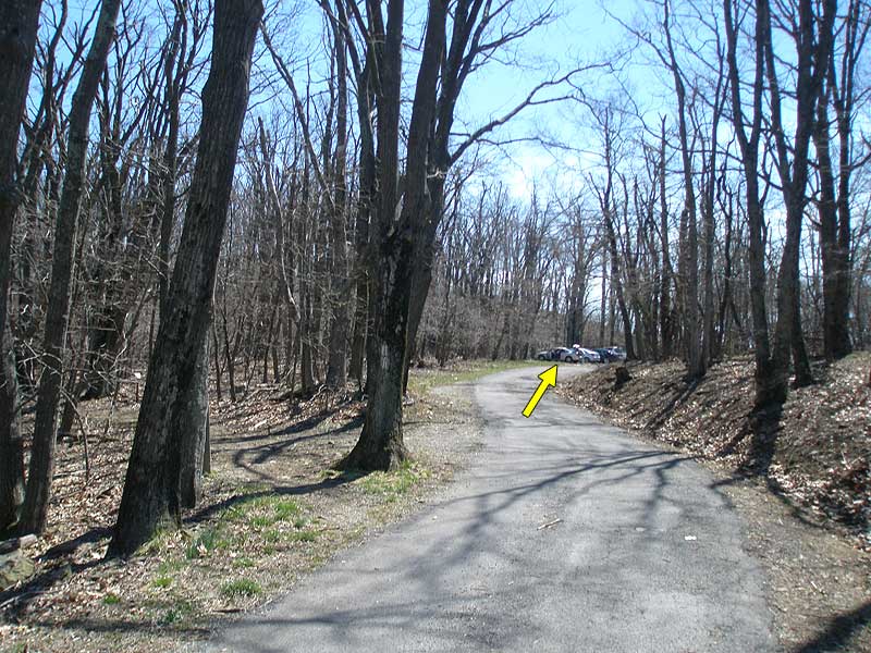
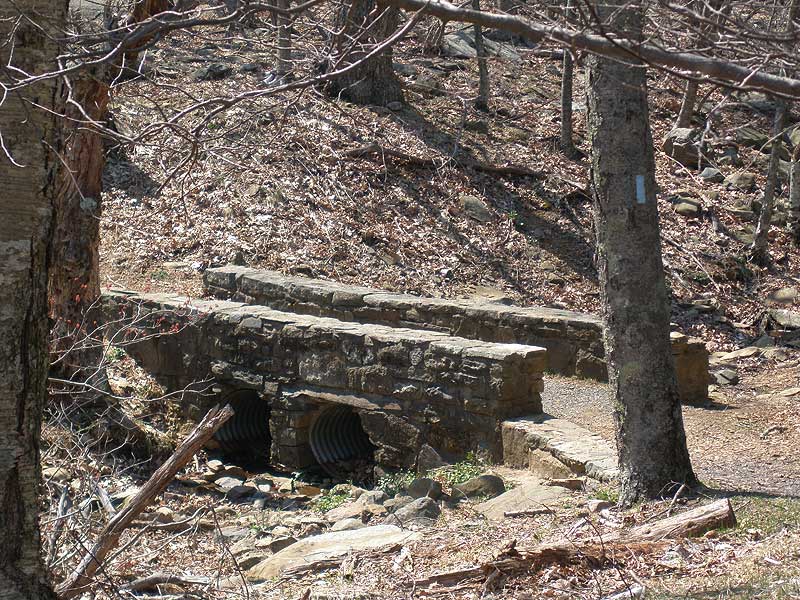
Immediately cross Skyline Drive and start up the paved Nature Trail. In 100 yards turn left at the sign for the Visitor Center crossing a small stone footbridge. In 0.4 miles arrive at the Visitor Center, and just past that a restaurant and gas station..
The next section can be slightly confusing. Across from the restaurant follow the paved path for the Lodge.
For the continuation of the circuit and Lewis Falls section:
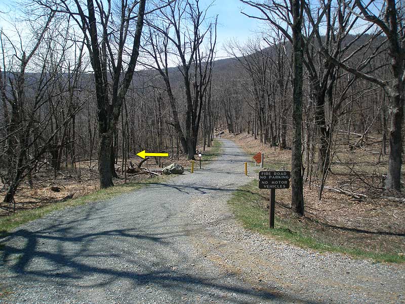
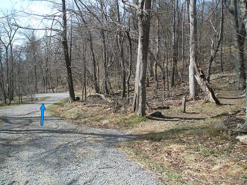
In 0.1 miles there will be a unnamed road on the left, with a sign
' Authorized Vehicles Only'. Turn left down the road for 75 yards then turn left on the yellow blazed Bridle Path Trail. Note there isn't trail signage here.
To shorten the hike and return back to the parking area:
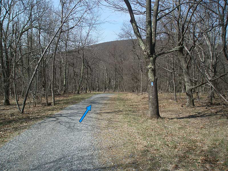
Continue on the paved Lodge path for 0.9 miles following the road to the amphitheater and parking area.
Continuation of the Lewis Falls section:
After turning left on the yellow blazed Bridle Path Trail, cross another yellow blazed trail in 100 yards. Continue to follow the yellow blazed trail to the intersection of the blue blazed gravel fire road in another 0.2 miles.
Turn right downhill on the blue blazed gravel fire road, and in 0.2 miles reach the intersection of the white blazed AT. Continue downward on the fire road for another 150 yards to Lewis Spring. Turn left on the blue blazed Lewis Spring Trail, as it makes several switchbacks then reaches the Overlook Trail intersection in 0.4 miles.
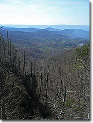
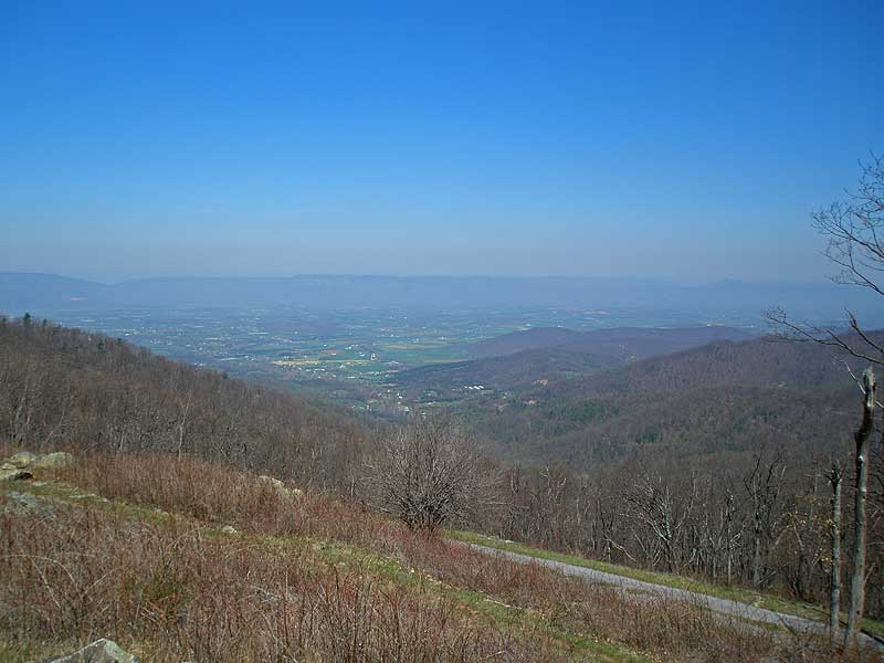
Turn left to go to the valley overlook, and on the other side of the stream is the overlook for Lewis Falls. Return to the Overlook Trail intersection then turn left on the Lewis Spring Falls Trail to continue the hike.
The blue blazed Lewis Spring Trail will descend for another 0.1 miles before turning uphill and arriving at the intersection of the AT in 1.2 miles. Turn left on the AT, and in 50 yards turn right for the remaining 75 yards back to the amphitheater and parking area.
I hiked this as described. I liked the Rose River Falls and the Dark Hollow Falls sections the best. The Lewis Spring Falls section I did not like much for several reasons: 1) much of that trail is much rockier than the Rose River and Dark Hollow Falls sections, 2) the view of Lewis Spring Falls is not very good -- the worst of the three, 3) the additional descent and ascent for that portion of the trail (seen on the elevation profile) had me worn out after the much larger descent and ascent at the beginning (which I handled OK). I suggest eliminating the Lewis Falls section, which is option #2 on the description. I navigated this hike primarily using the GPS GPX file on a smartphone app, so I can't verify the all written directions. There is a "comfort station" in eyesight of where you park -- avoid that at all cost if you want to use a restroom use the one at the Visitor Center at the Big Meadows entrance.
By:Matt Hammond
Rating:
Date of Hike: Tuesday, August 7, 2018
Great moderately difficult loop, but my gps only clicked 8.3 Miles, and that was WITH the extra .3-.4 caused by the which yellow blaze? confusion. So you want to actually take a right on the intersecting yellow blaze trail at that little juncture past the visitor center. Great views, great ascents. Underrated on this site
By:Brian Alexander
Rating:
Date of Hike: Saturday, July 28, 2018
I hiked this circuit on Saturday with a group of nine from Central Virginia Trailblazers. The weather was perfect, and with the recent rains, the falls were gushing. Not too crowded either. There was indeed some confusion when we got around to the bridle trail near the visitors' center. We took the yellow blazed trail off the "authorized vehicles only" road, but it took us back to Skyline Drive. From there we walked a very short distance to the gated fire road and followed that down to Lewis Falls. So we could have gone from the visitors' center directly to Skyline Drive and eliminated the confusion. The hike down to Lewis Falls was tough and rocky, especially with it being near the end of the hike. Some of us grabbed dinner at the Big Meadows taproom after the hike - not much selection but it hit the spot after a long day!
By:Keith
Rating:
Date of Hike: Sunday, October 1, 2017
Falls Galore for sure. Alter the route by parking at Fisher Gap and head down to Rose river falls, up Dark hollow to Big meadow for lunch at the restaurant. down to Lewis falls and up to AT back to Fisher Gap. UP and DOWN for this hike is a great work out. Alter route to avoid walking down with crowd at Dark Hollow.
By:Ed Matthews
Rating:
Date of Hike: Sunday, July 24, 2016
We decided to alter the route a bit. We parked out on Skyline Drive at the Lewis Falls trailhead (4 parking spaces at the trailhead, more across the road at the head of the fire road), walked down to Lewis Falls, back around to the AT and Fisher's Gap, down to Rose River, across to Dark Hollow, back up to Skyline Drive and across to where we left the car. We decided to leave the car at the Lewis Falls trailhead because before we started on the hike proper and before the sun got too terribly hot, we wanted to walk across and through the meadow. We added another mile or so to our hike by walking the meadow.
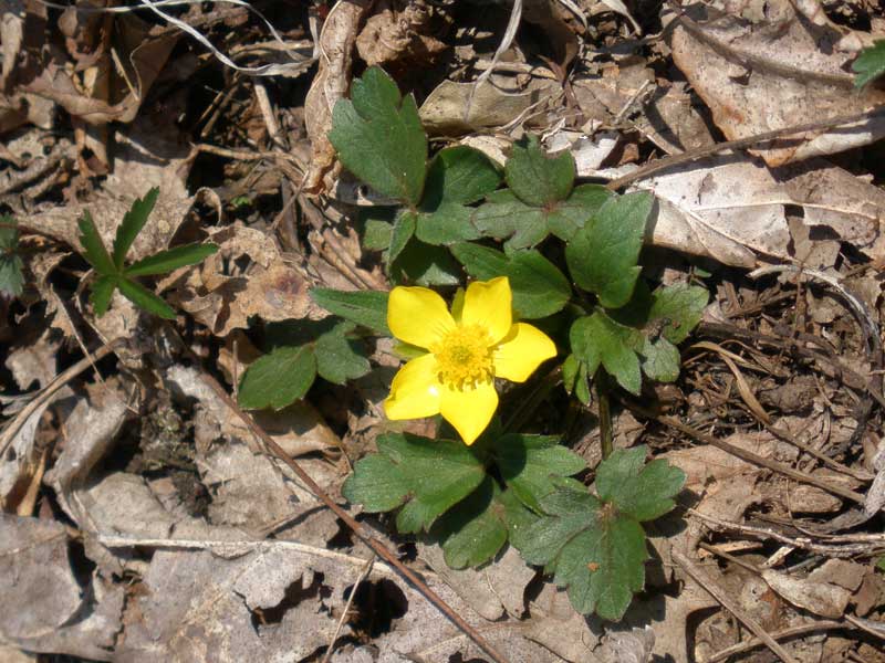
Walking the meadow was worth it for me: lots of wildflowers and we even scared up a hen turkey out of the grass. Of the three falls, we liked Lewis the best. Rose River had the best swimming holes (and the least scenic falls). Dark Hollow was jammed with people. Though it looks fairly tame on the map, there is some really good and constant elevation gain. You'll feel it by the end of the day.
We came upon a bear just off the Rose River trail. We must have scared it a bit for it jumped up on a log 10 yards from us, puffed up, and gave us a really good growl. But then it shuffled off turning over rocks and logs and feasting away nonchalantly. Lots of deer everywhere, does bedded down in the leaves, a curious fawn which came right up to us, many more that I am sure were within feet of us that we did not see.
With the exception of the section of AT that we hiked, these trails were very highly trafficked. You're not going to get any solitude here. That said, the wildflower viewing is the best I've seen this time of year just about anywhere.
By:Patricia
Rating:
Date of Hike: Sunday, July 24, 2016
This hike was mostly downhill and very rocky. The views were better on the hike than at the falls. Barely anything to look at at Rose River Falls and the swimming hole was shallow and small. Dark Hollow Falls was prettier but still not much to look at and nowhere to swim. We did not make it to the third fall because we got too bored and decided to turn around. Would not recommend.
By:John Thomas Fisher
Rating:
Date of Hike: Tuesday, March 15, 2016
It'd be a nice hike in the summertime, but I'd go ahead and take this one later if you want to hike in the winter/springtime. It was sheet of ice after sheet of ice, and a couple of us slipped and slid down way to close to the edge for anyone's comfort. One buddy had to grab me as I went going down. Beautiful at any rate, but too treacherous for the cold parts of the year.
By:TheJames
Rating:
Date of Hike: Thursday, December 31, 2015
Great hike! Beautiful overlook and falls! The only thing I would change is I would take the hike counter clockwise instead of counter clockwise, starting with Rose River Falls and ending at Lewis Spring Falls. Since for Dark Hallow Falls you're walking along the river for a good part of the total loop, this would have you viewing all of the smaller falls as you're walking rather than turning around every few minutes.
The only negative was it was a bit hard finding where one trail would stop sometimes and the next would begin.
By:Jennifer Carr
Rating:
Date of Hike: Saturday, October 31, 2015
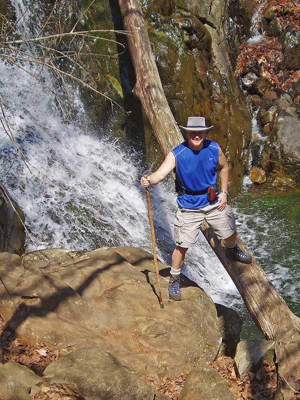
My husband and I are very experienced hikers but were looking for a simple hike to do with my parents. The quick trip to Dark Hollow Falls was a perfect hike for us, despite the steep uphill on the return trip. The hike was flowing fully from rainfall and the trail was packed with hikers. Most of the leaves had fallen and the trees were bare so I plan to return to the hike in the spring to photograph the waterfall surround by lush greenery. My Dad is months away from a likely knee replacement, but he was able to handle the steep grade down by taking breaks and using his walking stick. Great hike for all levels!
By:Mike G
Rating:
Date of Hike: Saturday, August 29, 2015
Boy am I tired. I'm a big guy and I took my girl and her 5 yr old on this hike. To my surprise the 5 yr old made it through 90% of the hike but do not be fooled this hike is not for beginners. It took us roughly 7 hours for the hike but we took a lot of time at the falls and for lunch. The views were beautiful however the falls were kind of dry. This is only my second hike, previously did he river trail at great falls. The climb up from the second two falls was just killer and I didn't think I was gonna make it lol. We saw a bear but it was on the drive home (it walked right across the road)
Overall we followed these directions to a tee and they 110% work. Thank you for showing us a great day and good luck to all who chose to hike it.


