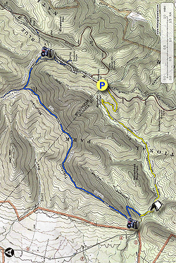
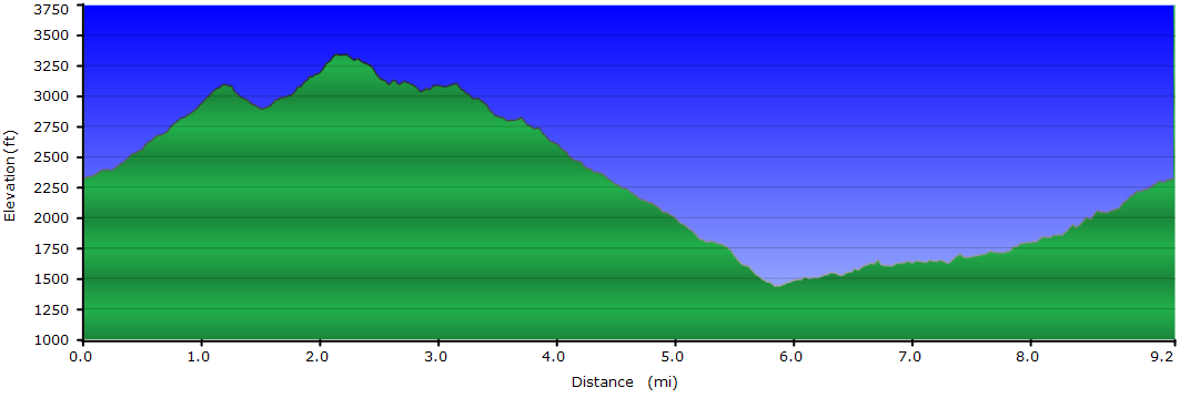
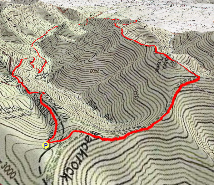
This challenging loop in the southern district of Shenandoah National Park isn’t as well-known as some of its neighboring hikes, but it offers a wonderful variety of scenery. There are two magnificent viewpoints, a beautiful mountain stream to explore, fascinating rock formations, and solitude on some of the park’s less traveled trails. The loop makes a great day-hike, but it’s also an excellent one-night backpacking trip with camping options at two different locations. We suggest hiking the loop counter-clockwise, starting at Blackrock Gap.
Note: Avoid starting the hike in the valley at the Paine Run Trail trailhead on VA340. This area is used as a school bus turn around and should not be used for parking.
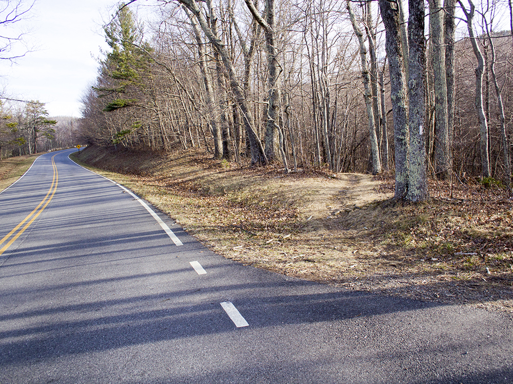
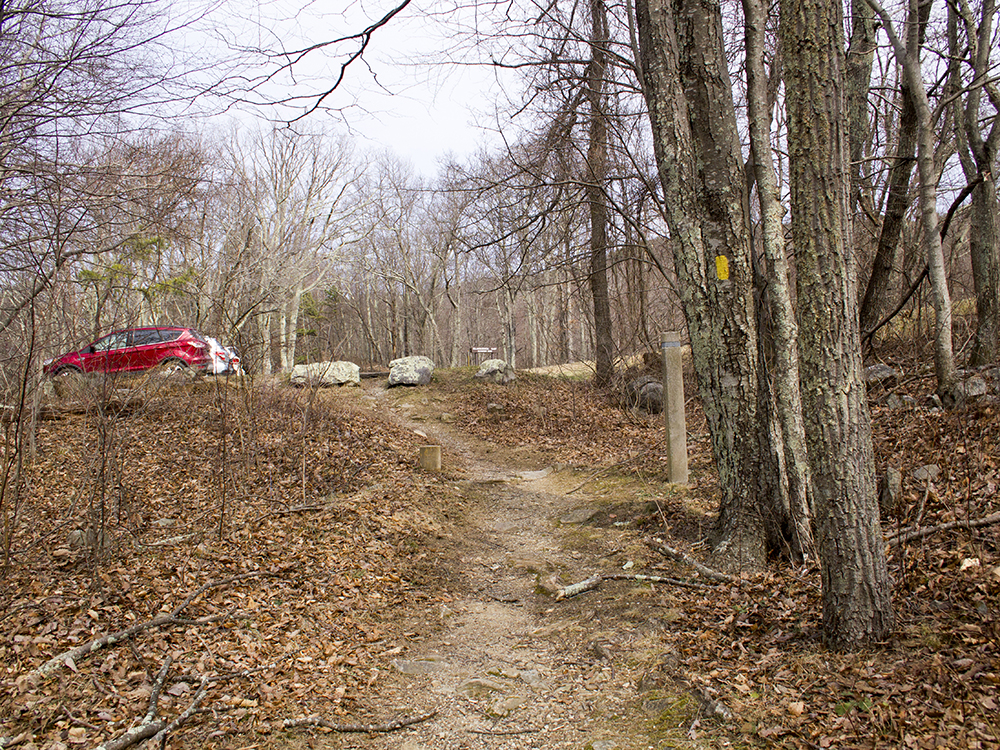
Mile - 0.0 - Park at Blackrock Gap on the western side of Skyline Drive. Immediately cross the drive and pick up the AT headed north. The trail is blazed white and will track parallel to the drive, ascending gently for .2 miles.
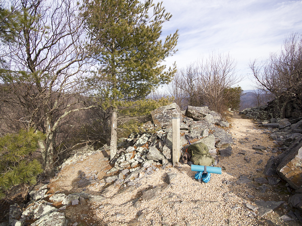
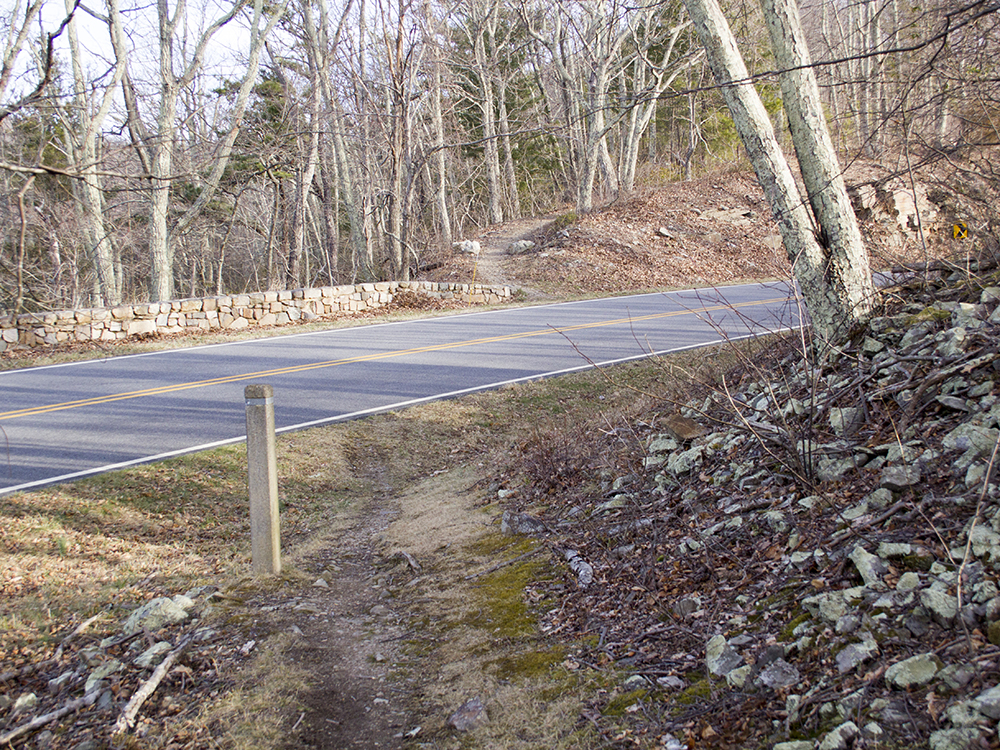
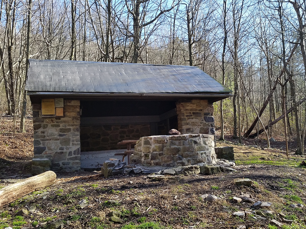
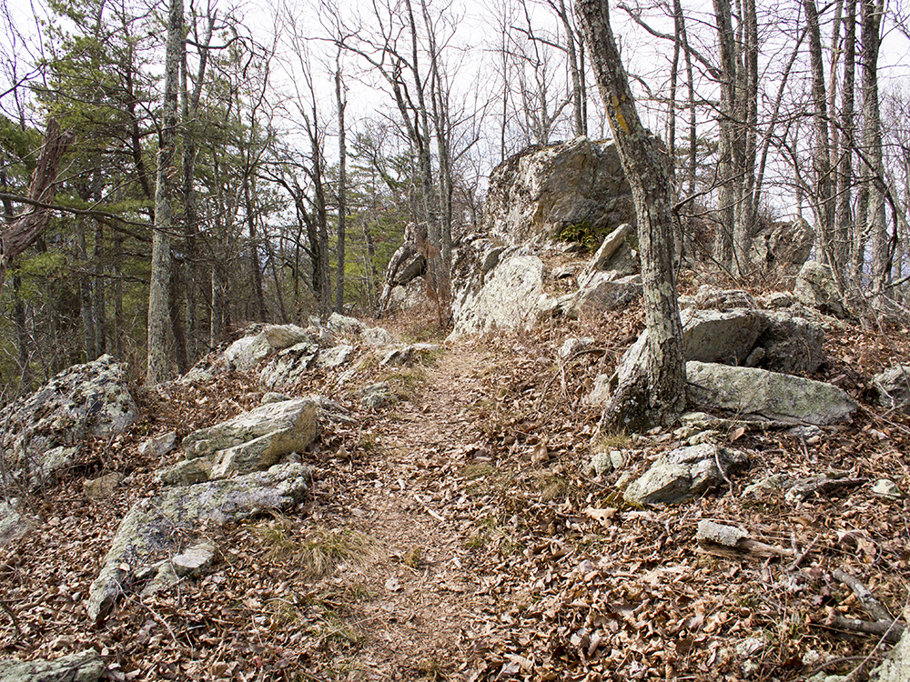
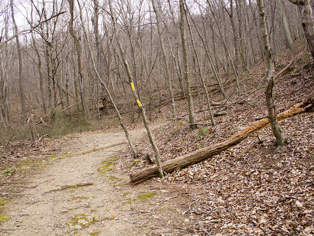
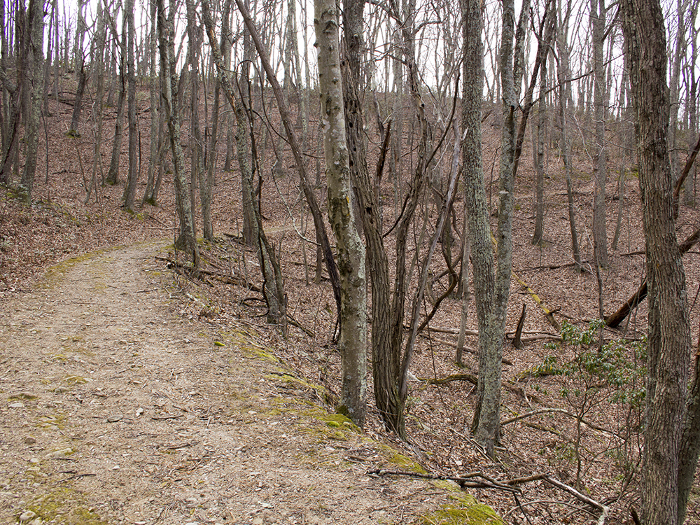
Mile - 0.7 - Reach the junction (trayfootpaine_4.jpg) of the AT and a spur trail to Black Rock Hut. If you choose to explore the hut it will add .4 miles to the total hike distance. This is one of the two camping options along the loop. The site consists of a shelter with a fire pit, several tent sites, a privy, and a spring-fed water source. If you skip the hut, continue ascending north on the AT.
Mile - 1.2 - Reach the junction of the AT, the Trayfoot Mountain Trail, and the Blackrock Trail. Continue straight on AT headed toward Blackrock Summit. Note: Do not take this first turn onto the Trayfoot Mountain trail, or you will miss the best view on the loop. There will be another spur leading to the Trayfoot Mountain trail just ahead.
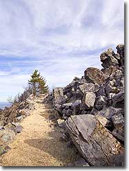
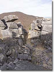
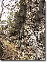
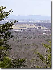
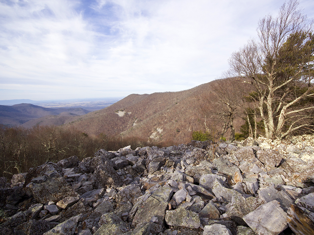
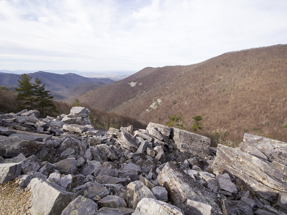
Mile - 1.25Reach Blackrock summit and the junction of the Blackrock Spur Trail down to the Trayfoot Mountain Trail. Explore the amazing view and the rock pile at the summit, then descend via the blue-blazed Blackrock Spur. There are more great views and fun boulder jumbles along the spur trail.
Mile - 1.45 - Reach the junction of the Blackrock Spur and the Trayfoot Mountain Trail. Take a right, continuing on the blue-blazed Trayfoot Mountain Trail. The trail will climb steadily uphill following what appears to be an old road bed.
Mile - 1.95 - Reach the junction of the Trayfoot Mountain Trail and the Furnace Mountain Trail. The Furnace Mountain Trail bears to the right. You will continue uphill, remaining on the Trayfoot Mountain Trail in the direction of Paine Run. This is a short but steep climb.
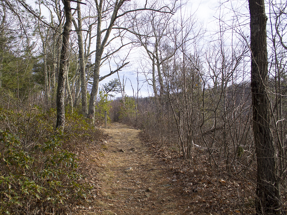
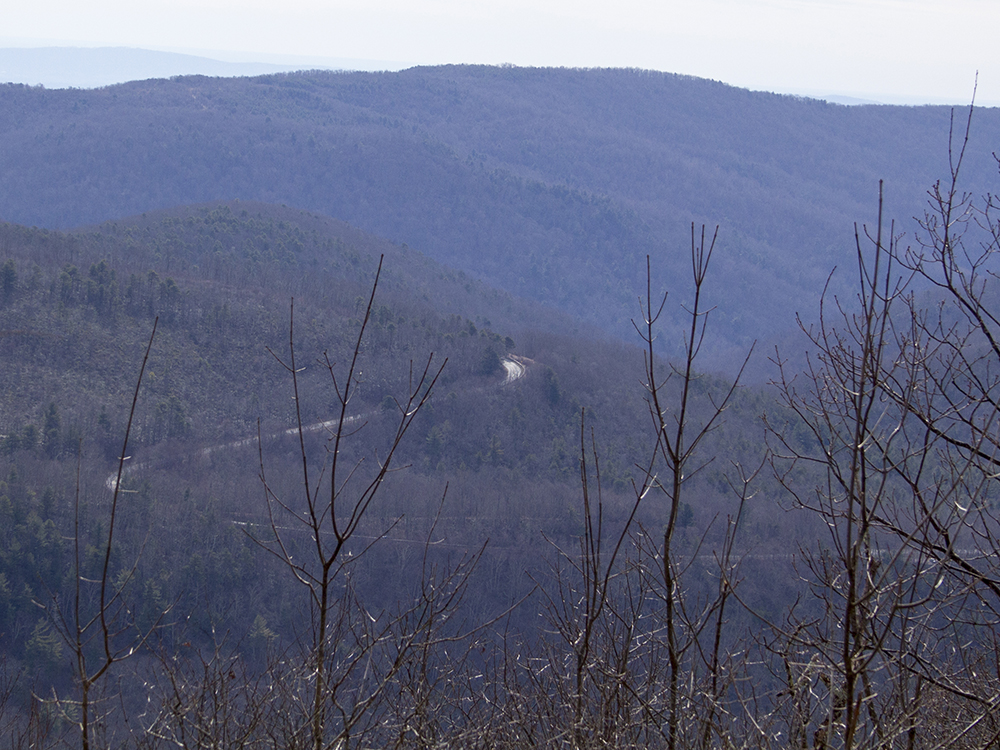
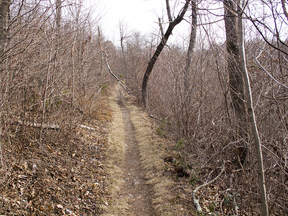
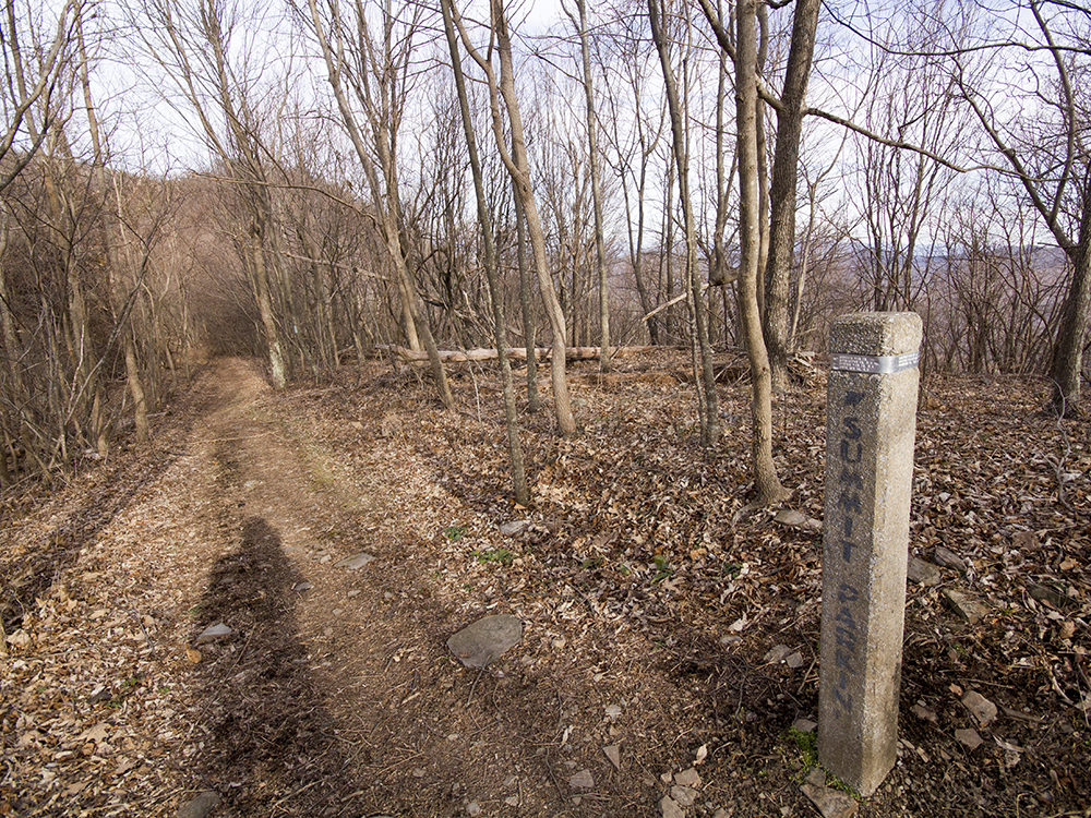
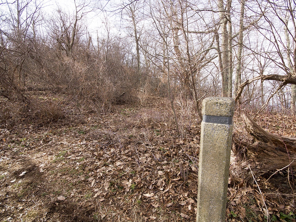
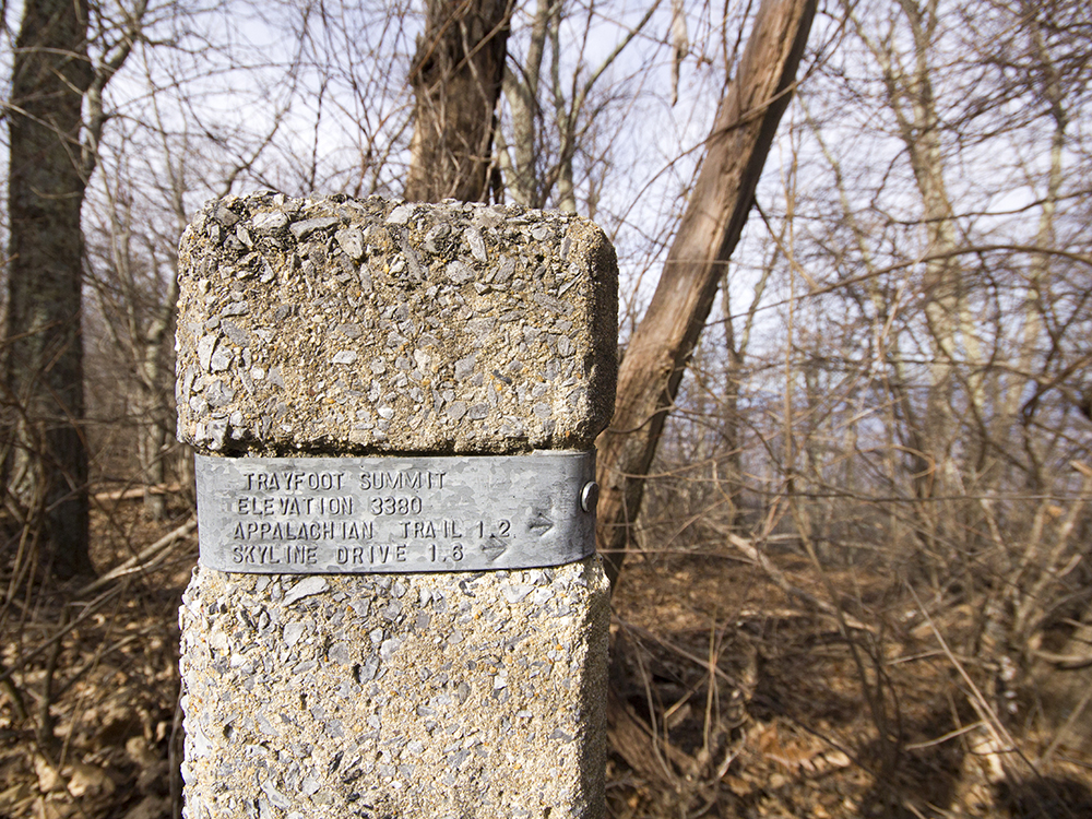
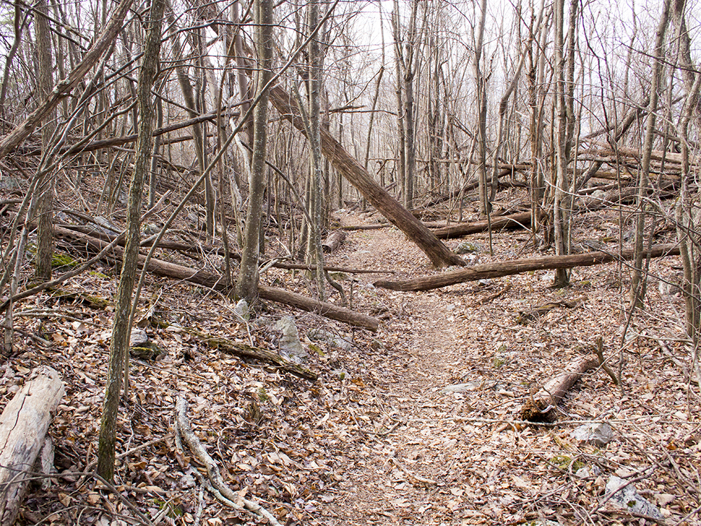
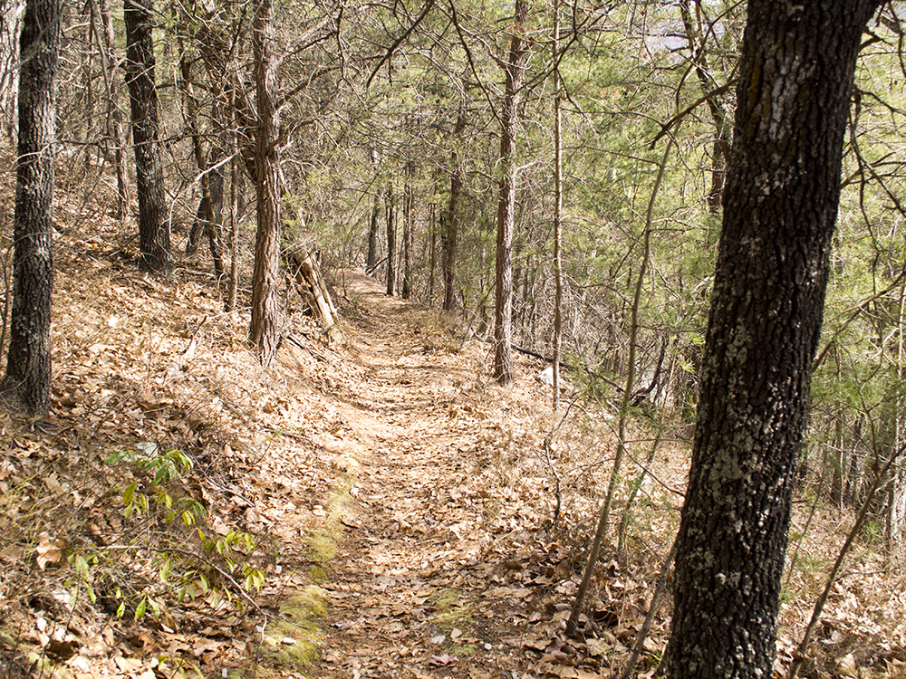
Mile - 2.15 - Reach the viewless summit of Trayfoot Mountain. Follow the rolling terrain along the ridge. You'll get nice views of Skyline Drive to the left and tree-obstructed glimpses of Furnace Mountain to the right. There will be some off-trail viewpoints along this ridge, but they are largely obstructed. The best viewpoint from Trayfoot Mountain lies several miles ahead. This section of trail has typically been lightly maintained. You may encounter blowdowns and overgrowth.
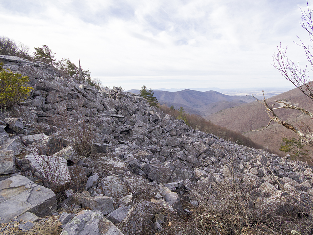
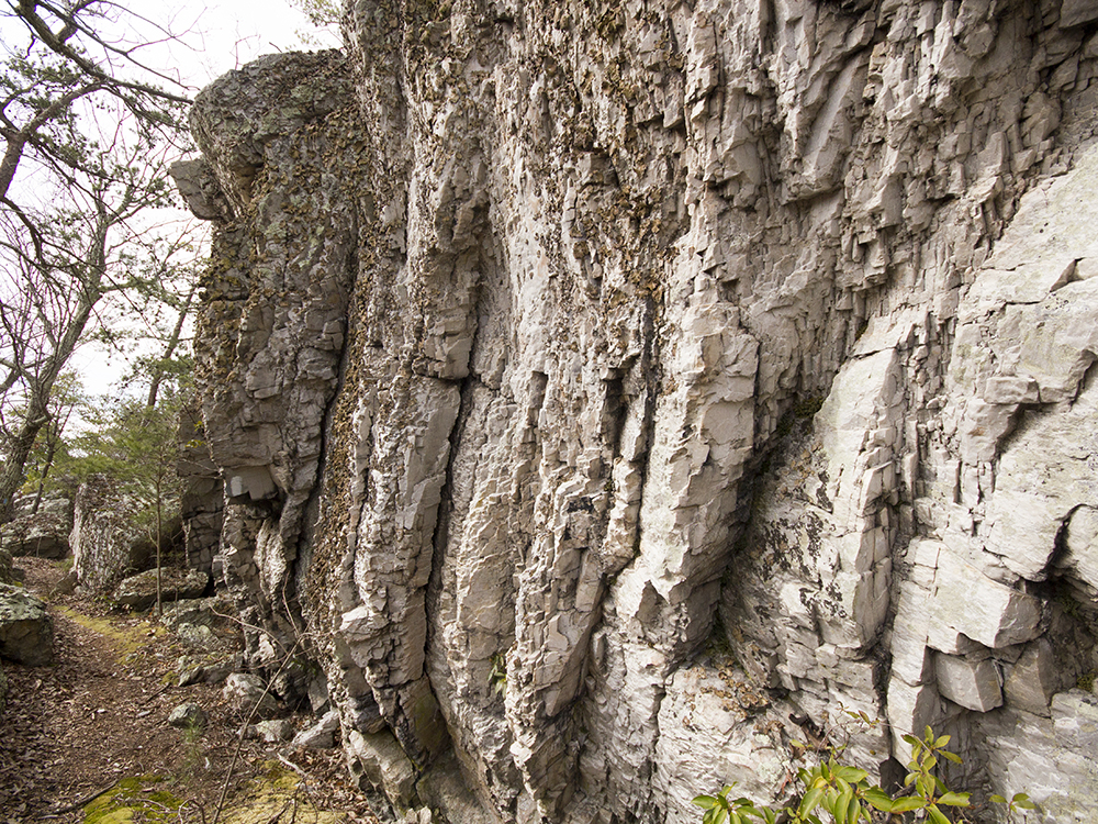
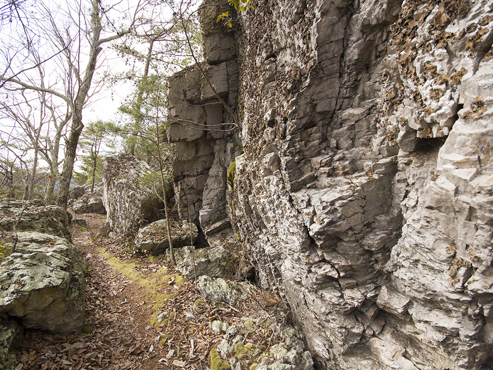
Mile - 4.3 - The trail descends steadily via a couple switchbacks. Look for double blue blazes marking the bends. The trail passes some interesting cliffs and boulder jumbles here.
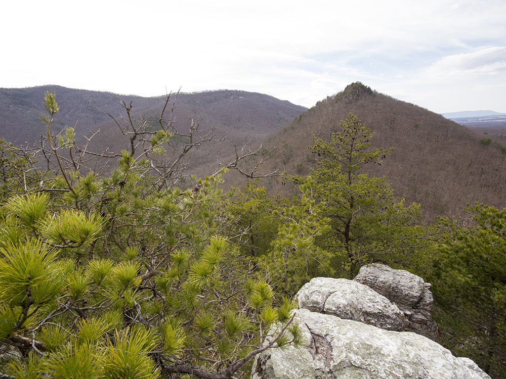
Mile - 5.25 – Reach the viewpoint of pointy, rugged Buzzard Rock and the valley below. The trail veers to the left and heads downhill.
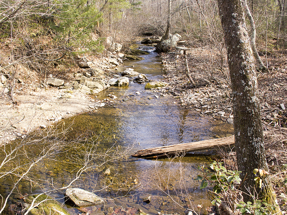
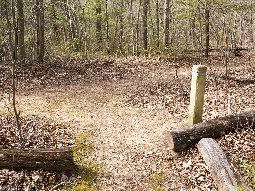
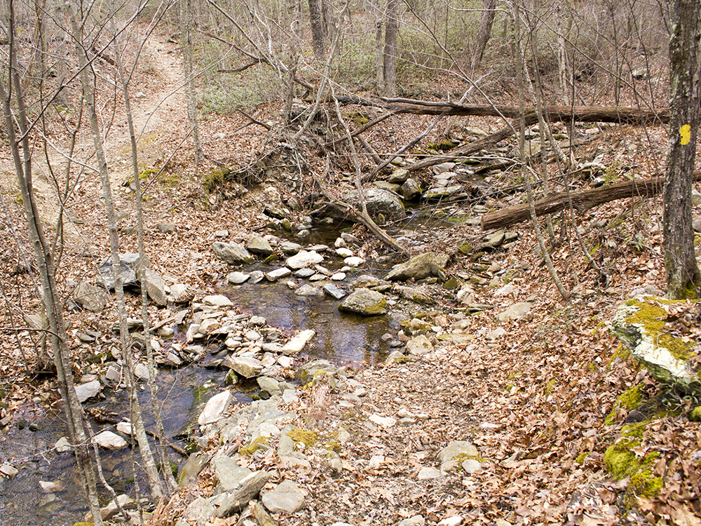
Mile - 5.8 - Reach junction of Trayfoot Mountain Trail and Paine Run Trail. Turn left on yellow blazed Paine Run trail. Cross a small stream in a couple hundred feet. This stream may be seasonally dry.
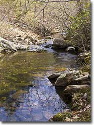
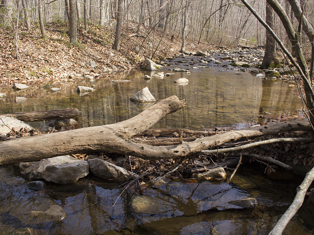
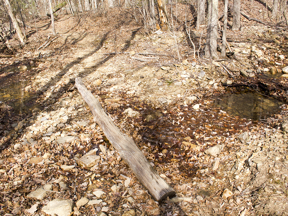
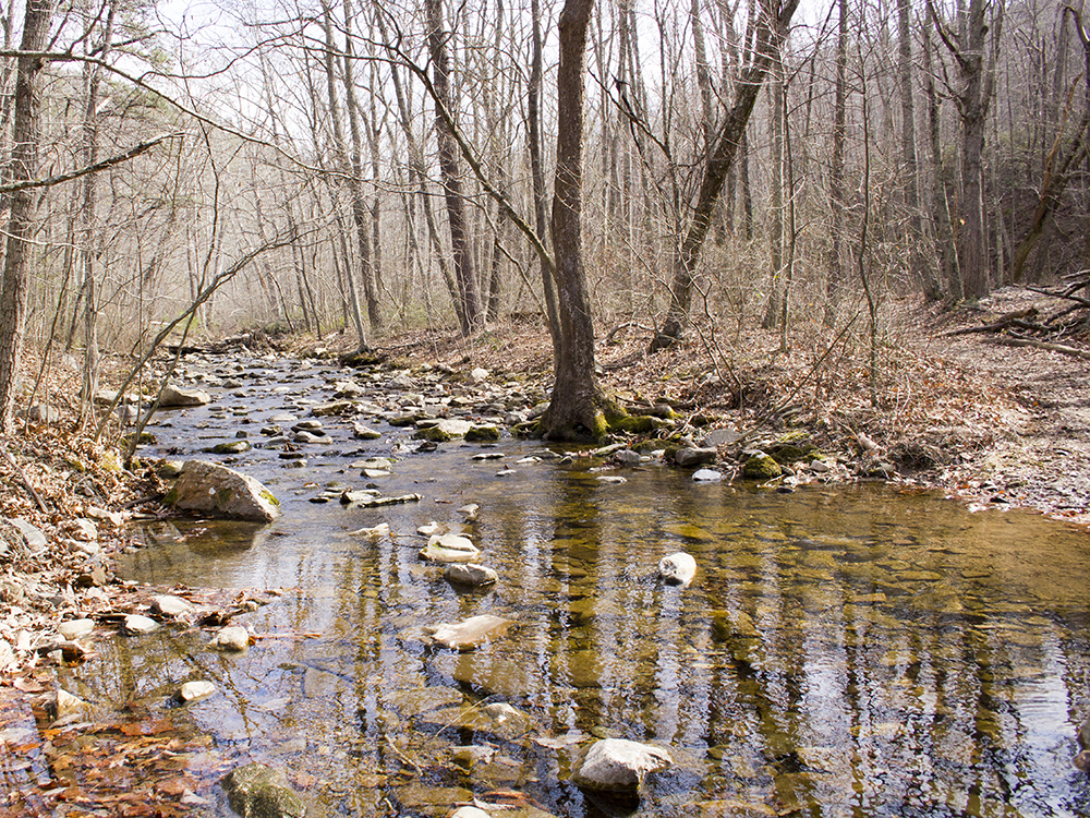
Mile - 6.0 -Cross Paine Run. This crossing is wide and depending on the time of year, it may be easier to ford it than to try and rock hop across. About 50 feet after crossing there is a great campsite with space for several tents. If you camp here, remember that campfires in this part of Shenandoah are illegal. If you see a fire pit, don’t use it!
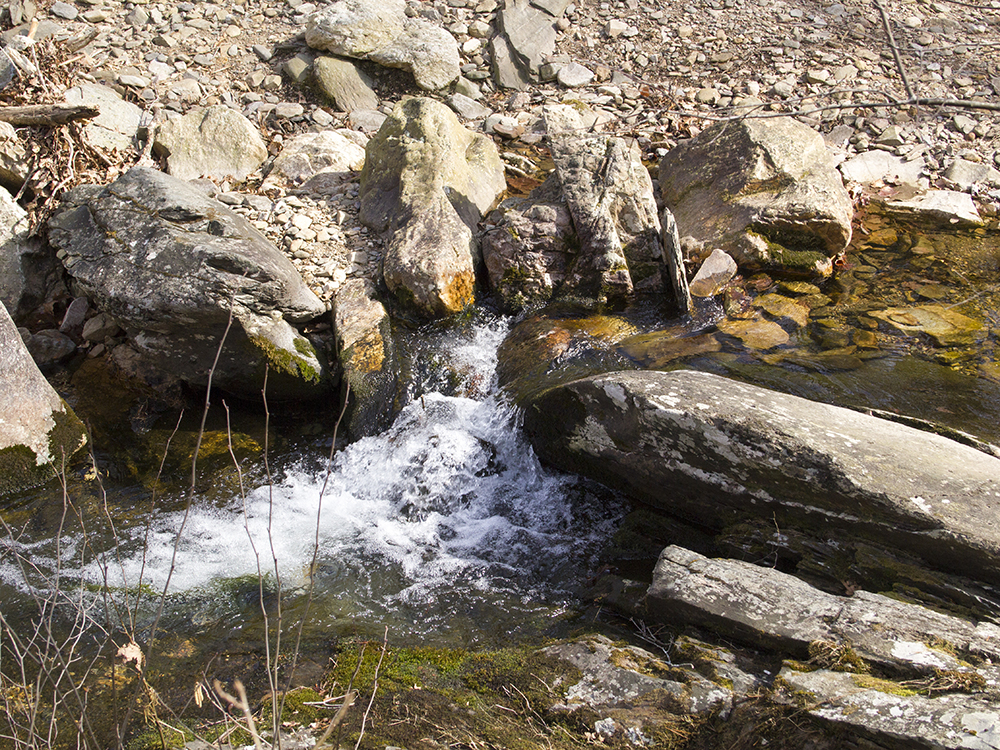
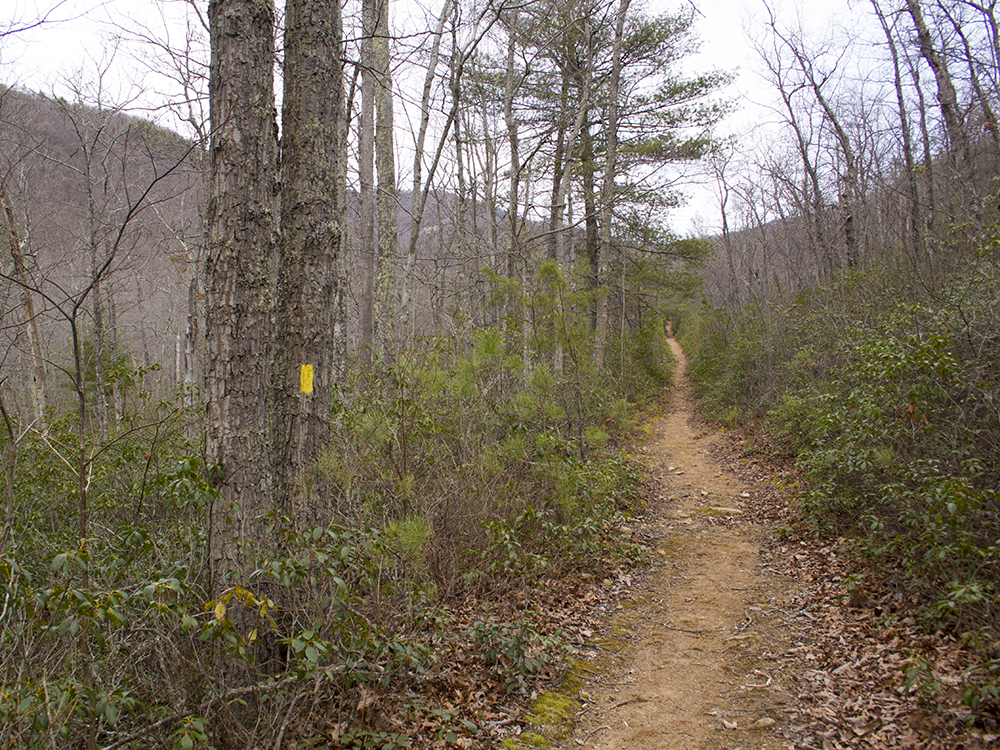
Mile - 6.3 Pass a beautiful series of small waterfalls and swimming holes. As you hike along the wide, yellow-blazed Paine Run Trail , you’ll ascend gently and move away from the stream. The trail will continue to cross many small feeder streams over the next two miles. Many may be seasonally dry. During wetter times, the trail may be muddy in spots
Hiked clockwise, including an overnight at the campsite by Paine Run. Quick 90 minute hike to the campsite. Lots of down trees and limbs had to drag a lot of it away to make room for the tent. Just before dinner we were visited by a very large bear from the ridge to the south. He kept his distance and moved on. We had another bear visit at breakfast this time my dogs barking was enough to turn around a small bear at about 30 yards. Cant hear anything over the hiss of a backpacking stove glad the pup altered us to the bear. I had brought my fly rod and was hoping to find some brook trout in Paine Run but the pools looked empty and the water felt warm for trout. Long uphill hike to Trayfoot Mountain. Several false summits and thick overgrown trail sections. Met a very pleasant gentleman who was maintaining the stretch between Trayfoot & Blackrock, he gave us several great bear stories.
TLDR - came for the trout, found bears.
By:John
Rating:
Date of Hike: Saturday, June 22, 2019
This was a disappointing hike for us. We hiked it counterclockwise. The best views were from Blackrock and the rest was pretty much in the woods. Would recommend just doing Blackrock by itself as side hike. Trayfoot Mountain and ridge was overgrown and Paines Run Trail doesn't really stay next to the stream for it to be interesting. Did see a bear on the last switchback back to the car at the Blackrock gap. Fine hike if you just want to get out into the woods. You can read about our trip report at: https://travel2walk.com/2019/07/07/virginia-hikes-blackrock-trayfoot-mountain-paines-run-loop-june-22-2019/
By:Andrew M.
Rating:
Date of Hike: Saturday, May 25, 2019
First of all, great website! All the reviews I read were spot on. Started early (7:30am) to beat the heat. Took route counter-clockwise. Once I got to top of Trayfoot Mountain, appeared trail maintenance was done for about a half mile (grass trimmed back?) going down toward Paine Run. For the most part, hike is not very steep either up or down hill. Last mile back to Blackrock Gap parking area hardest part (it was getting warm). Note- as I was leaving every parking area was completely filled, so get there early this time of year.
By:Hobanero
Rating:
Date of Hike: Saturday, May 26, 2018
I did this clockwise which I recommend. That way you have Blackrock summit to look forward to towards the end of your hike. Paine was nice and flat and clear of vegetation. Saw quite a few fresh horse tracks which makes me think this trail is well-traveled. Trayfoot, however, was very overgrown in areas with a few downed trees that are tricky to get around. Lots of ticks, poison ivy, and horse flies. The climb to Trayfoot summit followed the ridge line which allowed for a bit of a breeze, but would be much more picturesque when the leaves are off of the trees. Blackrock summit scramble was fun and views were amazing. Really, the only cool feature on this hike apart from some creek crossings. Pro tip: Make the trip down to the hut on a hot day to soak your hat and shirt in the spring.
By:vladdieeeee
Rating:
Date of Hike: Friday, April 20, 2018
We hiked this route backwards as an overnight hike so we could get to the Paine Run campsite before dark. ****We just want to point out that you have to park at the Blackrock Gap Parking lot---NOT the Blackrock Summit lot! We went to the Summit lot and were really confused. If camping by the creek, be aware of cooler temperatures and more humidity---it was pretty dewey when we woke up. The elevation gains hiking this route backwards were tough, but the seclusion and sweeping ridge views in every direction (it is still early spring up in the mountains in mid-April, so minimal foliage) were worth it!
By:Diego S
Rating:
Date of Hike: Sunday, September 17, 2017
Day hike started from the end of Horsehead Road to the west. It's a small cul-de-sac, so not too much room for parking. Only one other car today though. From there to the Paine Run Trail/Trayfoot Mountain Trail intersection is roughly 0.3 miles. At this time of year the water level is lower, so the couple stream crossings were very easy. That also makes the hike along Paine Run slightly less interesting as you don't really hear the stream or get many waterfalls. The trail up to Skyline was easy. After that it got hard with prolonged constant uphill grades on the AT and (blue) Trayfoot Mountain Trail for about two miles. Blackrock is great as everyone has stated. Reminded me a little of the vantage point from Spy Rock, just at a higher elevation. You'll want to take the spur trail right at Blackrock for the fastest route. After reaching The Trayfoot Mountain summit (which was about 7 miles in), it's all downhill. The blue trail was lightly maintained as described but I would still rate it as average trail conditon overall. I liked Buzzard Rock a lot as it is peaceful, small, breezy, and secluded with nice views.
I had this as a 10.9 mile hike. 0.6 of that was added because of where we parked. So had we parked on Skyline drive it would have been roughly 10.3, which is over a mile longer than the description on this site. Difficulty is a 3.5 for me. Only 20% of the hike was uphill and it wasn't that steep of an incline.
By:Jeff
Rating:
Date of Hike: Friday, May 19, 2017
Great hike with some great views. The Trayfoot mountain ridge line is a bit wild and is obviously not as hiked of a trail as the rest of the hike as it is very grown up with grasses and whatnot but there were not too many blow downs across the trail. I did see 3 different bears on this hike all along the ridge line. The view from Blackrock Summit was amazing. The hike up from Paine Run is not bad and the trail is very well maintained. All in all a beautiful hike that I will be doing again soon.
By:Barry
Rating:
Date of Hike: Sunday, April 30, 2017
Great day for a hike in SNP - park was packed but saw only a handful of folks around Blackrock Summit, and none at all on the Trayfoot or Paine Run trails, so a nice quiet day in the woods. Foliage is starting to obscure views from Trayfoot Ridge Trail, in another week or so visibility will probably be totally gone. Also, the trail along Trayfoot Ridge is starting to get a little overgrown. Paine Run was running strong, not so high that getting soaked was inevitable, but we had to pick our spots at a few crossings.
By:Joey B
Rating:
Date of Hike: Sunday, April 2, 2017
I prefer to start hikes at the bottom when possible so I'm not hiking up at the end to return to my car. I parked at the cul de sac at the southern end of Horsehead Road (rte 661) and followed the continuation of the road on foot to a park entrance. I completed this hike counter clockwise.
There are several stream crossing along this hike and most have rocks that allow you to cross without getting wet. At the start of Paine Run Trail, however, there's a wide stream crossing with no rocks or fallen trees to allow for easy crossing. Instead of getting wet at the very beginning of my hike, I went upstream ~200 yards and found a more narrow portion of the stream I was able to cross while staying dry.
The views from Blackrock Summit were amazing. The mountains had the very first signs of spring but the trees were still leafless so the views were still largely unobstructed.
By:moondrunk
Rating:
Date of Hike: Sunday, March 19, 2017
We hiked this as mapped. With the trees not yet leafed out this was a very nice hike, with Blackrock Summmit being a highlight. The solitude quotient was very good (although we started at 7:30 am on a cold, blustery day--on a nice day Blackrock will be filled with people so starting early is always a good idea). The ridge walk is very nice, good views and we had beautiful light this morning. Agree with the previous reviewer that this is a pretty easy hike--more like a 3 than a 4.


