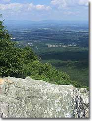
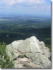
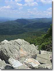
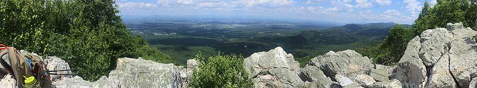
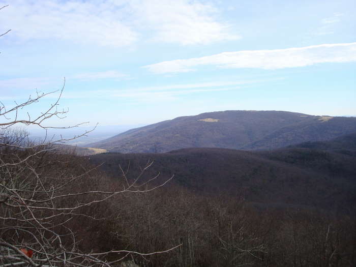
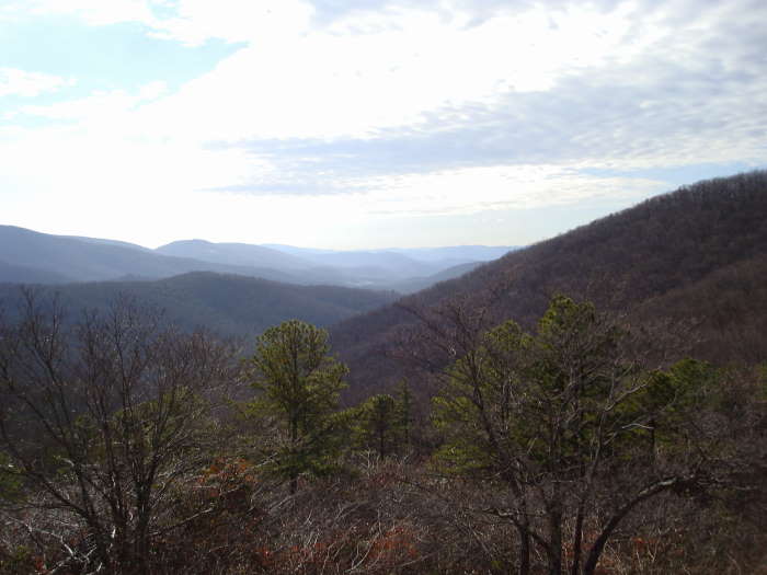
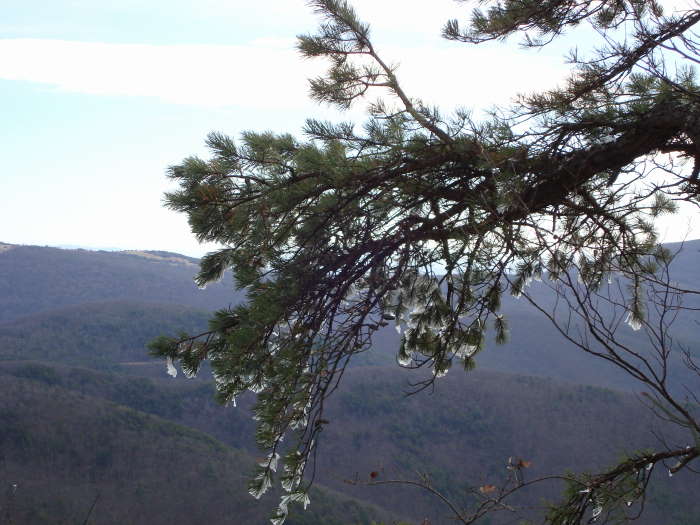
Turk Mountain is a tough hike with about 2400’ of elevation gain, bring plenty of water, especially if hiked in the summer. We hiked it a few days before Christmas and it was quite cold. It's hard to rate the solitude as the temperature was so cold all normal people were at home and not out hiking. The best views are at the top of Turk Mountain, so make sure you do the out/back Blue-blazed Turk Mountain trail.
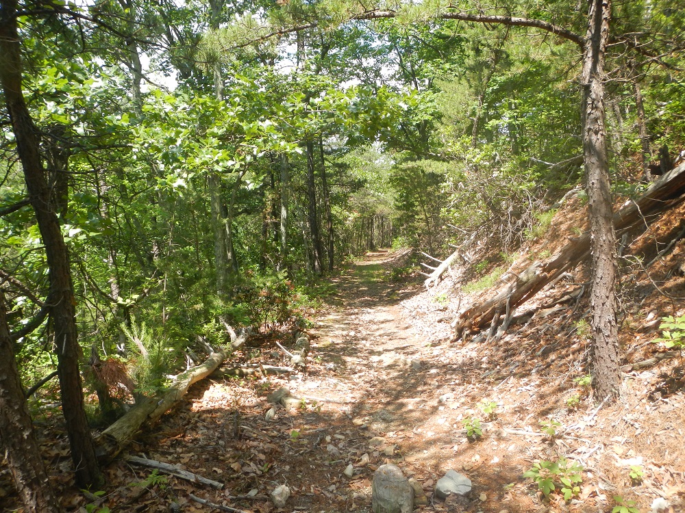
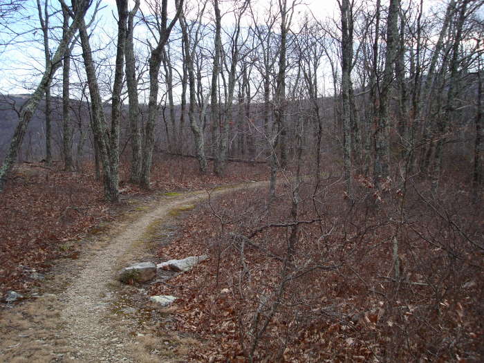
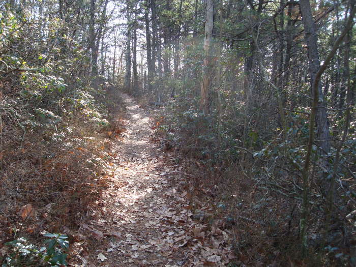
All of the trails for this hike are well maintained. Hiking poles would be advisable for the multiple stream crossings, althought the level will be significantly less in the summer. This hike is the last circuit hike in the southern section of the Shenandoah National Park.
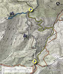
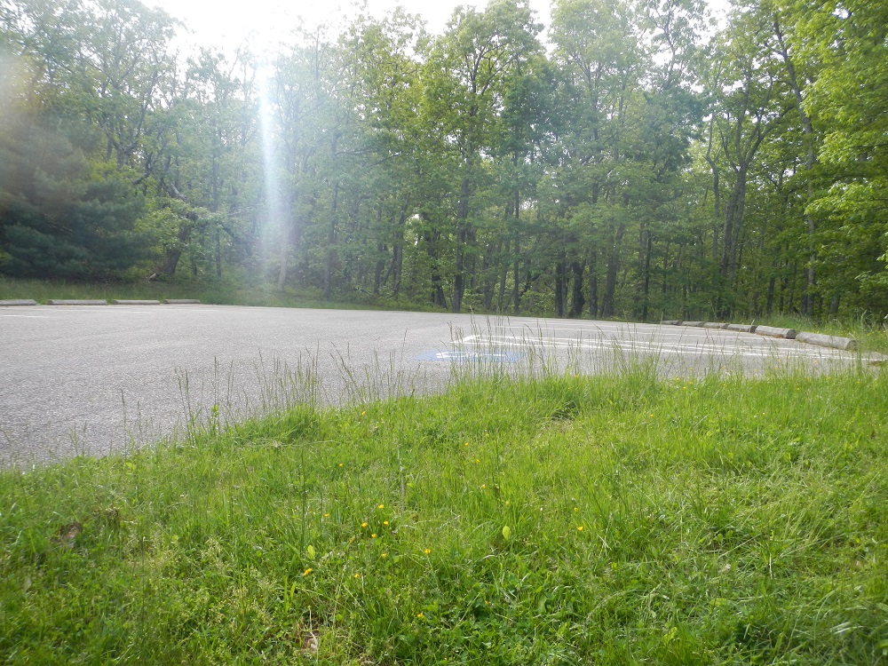
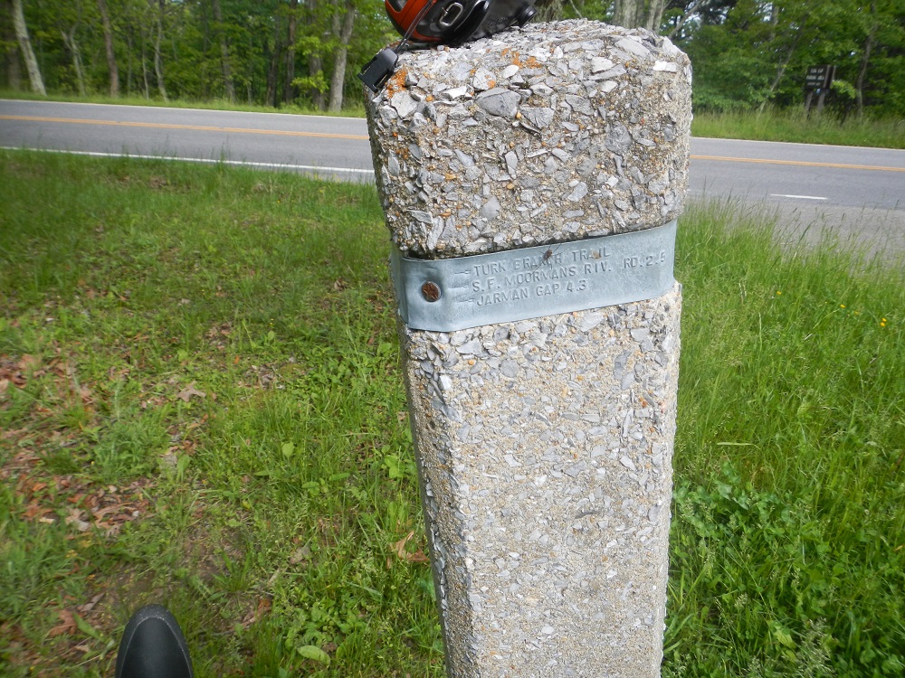
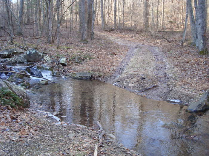
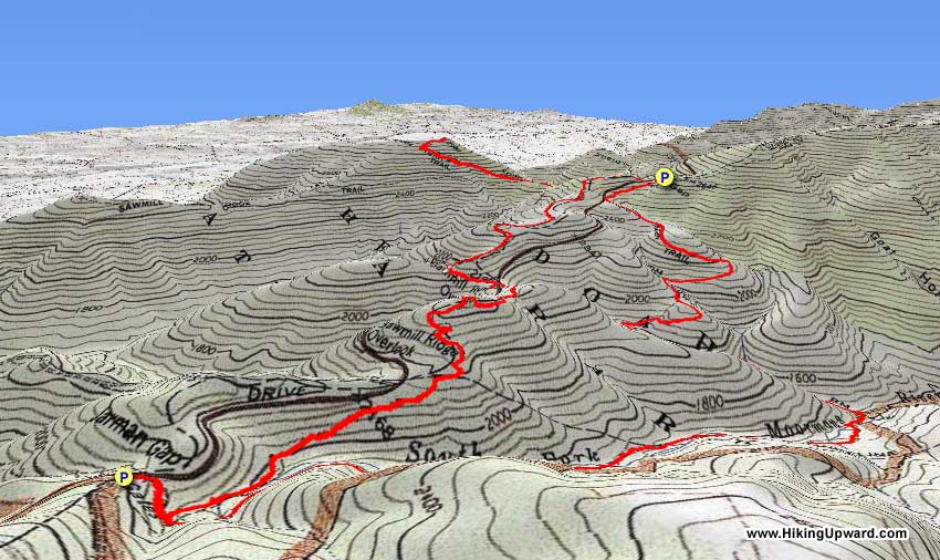
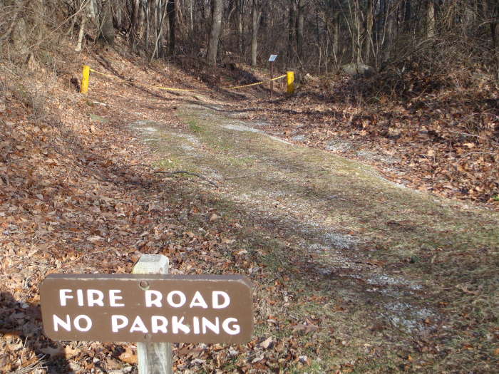
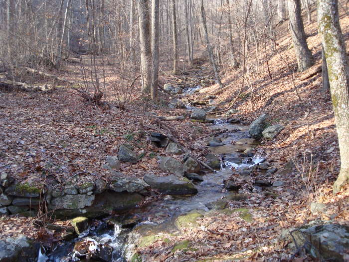
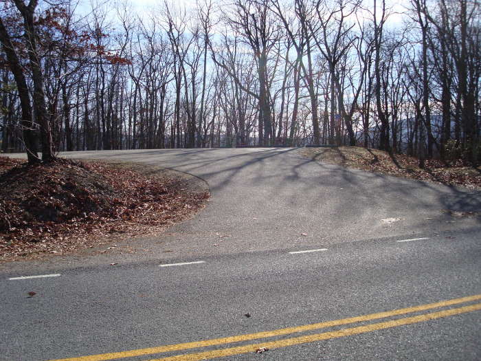
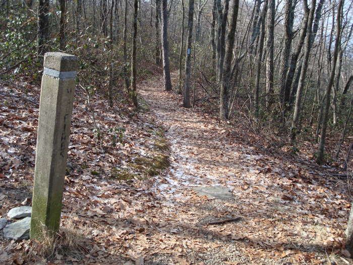
We parked at the Jarman Gap parking area, near MP97. There are two yellow gated barriers, the trail starts on the barrier nearest Skyline Drive and goes downhill. Continue past the barrier hiking on the yellow blazed Moormans River Fire Road. In about 0.2 miles you will come to an intersection of the A.T., continue past this intersection, crossing Moormans River multiple times prior to reaching the intersection of the Turk Branch Trail in 2.0 miles. You will cross the river and immediately take a left after the SNP Stone Marker heading up the yellow blazed Turk Branch trail. Note: The Moormans River Fire Road continues straight at this intersection following the Moormans River, make sure you turn left onto the Turk Branch Trail.
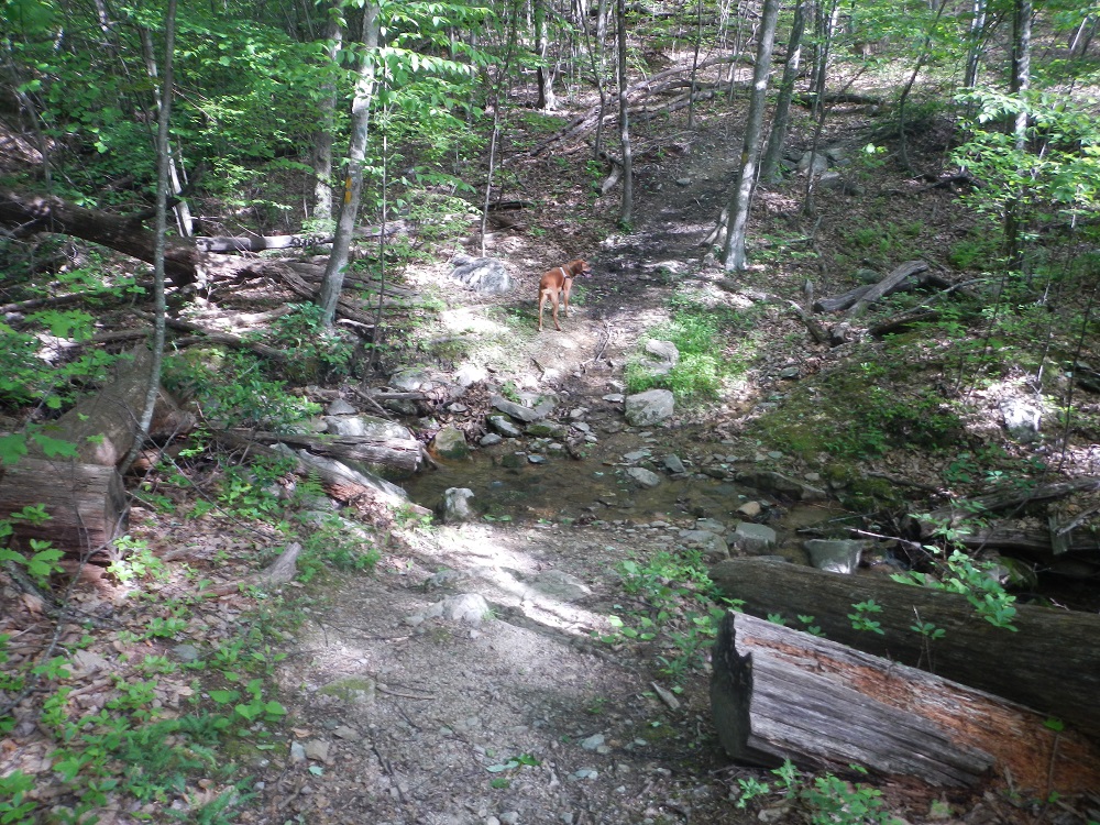
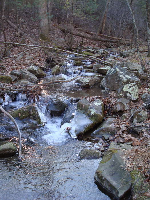
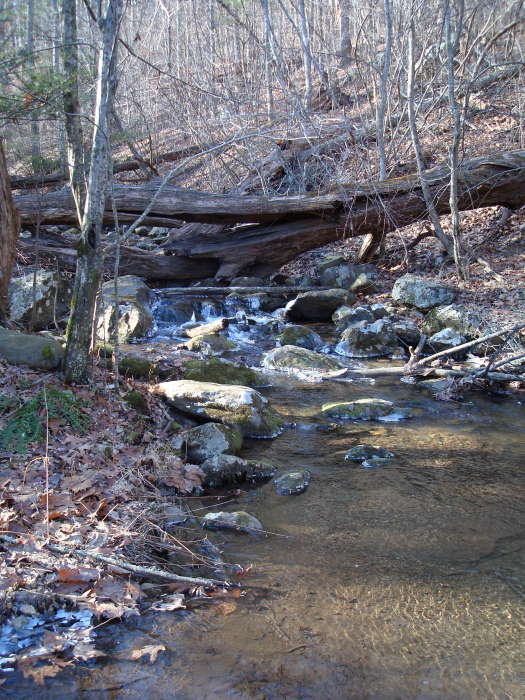
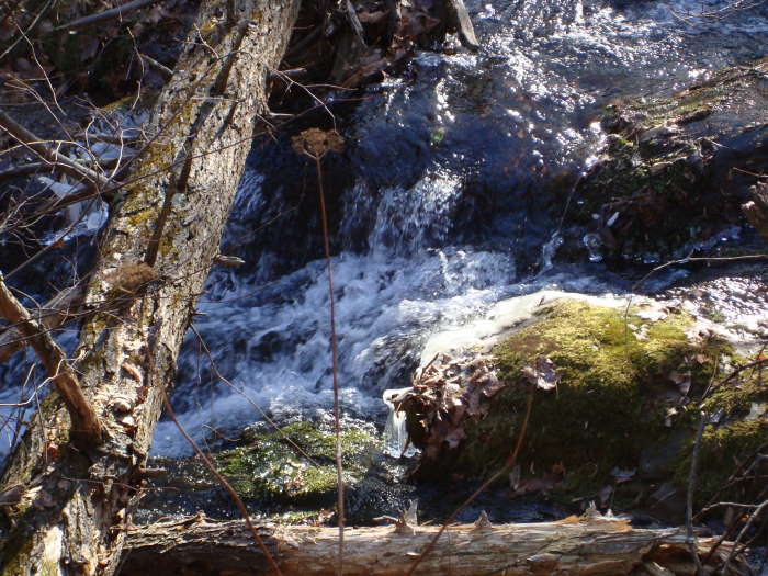
Continue on the Turk Branch Trail, crossing Turk Branch a couple of times, with multiple switchbacks prior to reaching the Turk Gap parking area. This part of the hike is about 2.6 miles long and gains roughly 1200’ feet in elevation. One of the crossings had a nice small waterfall with a few others visible upstream.
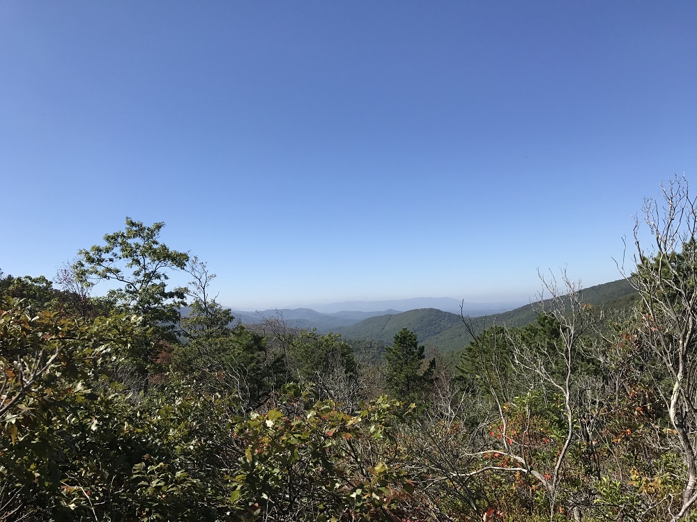
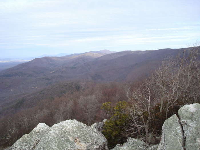
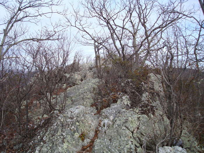
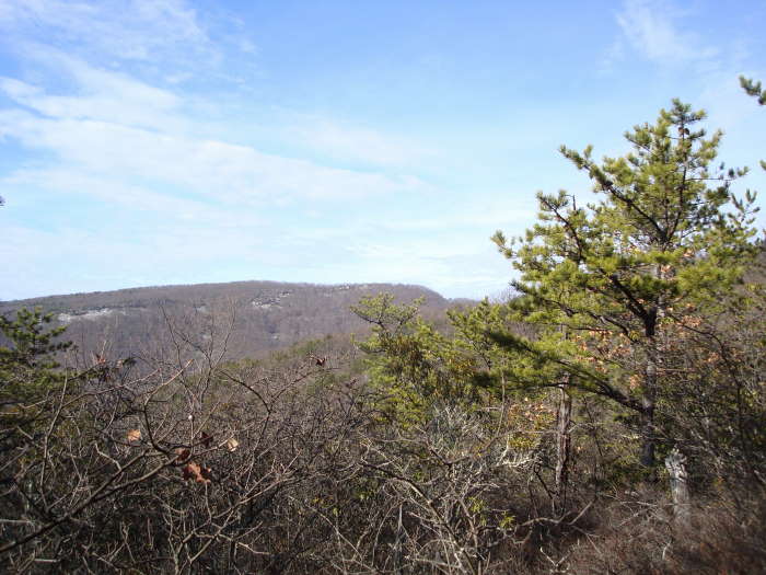
From the Turk Gap parking area, cross Skyline Drive and head to the Stone marker, bearing left onto white blazed AT going South. DO NOT TAKE the yellow blazed continuation of the Turk Gap Trail. Stay on the AT South for 0.3 miles until you reach the intersection of the blue blazed Turk Mountain Trail, take a right. This is an out and back adding 2.0 miles to the hike, but you will see the best views of the day and have a great place to eat lunch. Be sure when you are at the top of Turk Mountain to continue along the rocks past the Stone marker, so that you can also see some great views of the Shenandoah Valley. Retrace your steps to the AT intersection.
Take a right at the AT intersection heading south for about 1.4 miles before crossing Skyline Drive. To the right is the Sawmill Run Overlook which if you have time, has some great views. Once across Skyline Drive there are some good up and downs on this part of the AT but not too bad. Continue on the AT for 1.7 miles reaching the Moormans River Fire Road intersection. Take a right and reach the Jarman Gap Parking area in 0.2 miles to complete the hike.
Summer
Late December
Turk Mountain Hike Comments
Archived Comments
By:Dan Weigand
Rating:
Date of Hike: Saturday, September 29, 2018
Did this hike on Saturday. Have done it once before in the dead of winter so I was excited to get some warmth and sunshine at the summit this go-around. Because of all the rain a couple days before, the eastern portion (first 3-4 miles) were VERY wet. The trail was basically a stream until I got about halfway back up the other side, and I had to cross actual streams and the river over a dozen times. The river crossings were especially difficult, but I managed to find tress and/or rocks up/downstream and stayed mostly dry. If you don't want to be wet, DO NOT do this hike right now.
All that considered, the rest of the hike was warm and dry, and the views from the summit (both eastern and western vista) were fantastic. Lots of low clouds and fog that day and it was neat to be above the clouds at the top as they rolled over the mountains. Lots of wildlife in this area as the vast majority of the hike is not heavily traveled. Saw tons of people on the Turk Gap parking to summit portion (2 miles), though. The remainder of the hike down the AT is pretty steady, but the uphill around mile 9 or so is tough after everything you've done so far. Overall I loved this hike, and would recommend it to anyone looking for a long, challenging day hike.
By:Patrick
Rating:
Date of Hike: Saturday, September 23, 2017
I am going to rate the hike as a four star. The leaves are starting to change in Shenandoah. The only thing keeping this from a 5 star hike is the big yellow jacket nest on the Turk Branch Trail. Be careful out there if you do this hike. I would recommend this hike later in the Fall/Winter when the colder weather ensures that the jacket nest is not an issue.
By:mark
Rating:
Date of Hike: Saturday, March 25, 2017
Overall, a very nice hike. I only scored it a 3 stars because, as someone else noted, there are nicer hikes just a few miles up the road. (e.g. Riprap, Trayfoot, Doyles River) In some ways that is unfair. In 90% of the country, this trail would be famous, but here, it is a second thought. That said, I hiked it as described and believe that is the better direction to hike it, plus after 6 miles and the climb up Turk, I was ready for a lunch break with a very nice view. Trails were in good shape and no problems. Lot of windblown coming up from the Moormans, but the trail was nicely cleared. If hiking in summer, be ready for the sun to beat down on you hiking the AT back to Jarmans Gap. They are right about bringing enough water, it was in the 70s and I drank 1 1/2 liters with no pit stops.
By:John
Rating:
Date of Hike: Saturday, March 18, 2017
Great hike. It's got a little bit of everything. Challenging uphill, pleasant flat ground, nice views. There are even some cool rock walls during the first few miles. There is one very nice view that is a bear to climb to, but it is very nice. I even met a little vole or some sort of vole-like critter. If you like hiking, challenges and a nice view, this is for you!
By:Don Mac
Rating:
Date of Hike: Wednesday, June 29, 2016
My wife and I did this hike today and it was a great hike. The trails were clearly marked and very well kept. It is quite rocky at the summit of Turk Mountain as is the trail to it but nothing that these two old grandparents couldn't handle. The views are spectacular. The streams were overflowing as a lot of rain has fallen in the last several days but no problems getting through them. Overall, it was just a great day!
By:Wrong way
Rating:
Date of Hike: Wednesday, July 1, 2015
Just wanted to second Danny's comment below. I took the wrong fire road too. Pretty bad mistake if you go far enough as its a STEEP walk back. If you start passing private land and peoples homes, turn back! Given that it was raining that day too, I decided to save the loop for another day.
By:joe rogan
Rating:
Date of Hike: Wednesday, June 24, 2015
This is not a great hike compared to what you could do with a little more driving. Theres just not much to see here and no reason to do the 10 miles unless you want the exercise.
Moormans "river" is hardly a stream, very lame. The only view or sight to see on the 10 mile hike is at turk mountain summit.. which isn't the most amazing summit and not at all worth all the extra miles this loop packs on. If you want to see the summit, just do the two mile summit hike from the turk mountain parking area, not jarman.
Theres better hikes not that much further up north. If you're just looking for a short summit hike, drive up to black rock. If you're looking for a longer circuit hike with views, waterfalls, and swimming holes worth hiking a bunch of miles for, do riprap/wildcat. Nothing incredible here to see. It's just walking in the woods for 10 miles with one mediocre summit view. There is a reason the solitude is rated high, haha. To each their own though.
By:Danny
Rating:
Date of Hike: Friday, April 24, 2015
Got on the trail about 9:30 am and went on the wrong fire road at first. Make sure you go down hill, and not up! I have a habit of walking down whatever path I see without thinking about where I am going.
Lots of stream crossings on the fire road. High water. Enjoyed the challenge in navigating a few of these. Some of these crossings will be all dried up come summer. Snuck up on a bear accidentally on the trail section before hitting the turk mountain parking lot and watched it run away. Did not see a single human soul.
On the out and back to the summit I ran into a couple coming the other way. Also ran into two deer hanging about five feet off the path and did not bother moving as a passed by. Had the peak all to myself and ate lunch on rocks overlooking the valley. There was a cold wind blowing on and off, so I did not stick around too long, started to get some chills.
Ran into a few section hikers on the AT. The ascents/descents were manageable compared to climbing Turk Mountain and the smell of the pines was refreshing.
Made it back to the car around 2:30. Great hike. I will for sure be doing this again as it is the closest entering the park from the south.
By:The Real Rooster
Rating:
Date of Hike: Saturday, April 18, 2015
Hiked the full loop yesterday, including the summit, with my girlfriend. Good hike overall, with great views from the top! With the exception of the summit loop, we barely saw anyone else, which was really nice. Some of the creeks were probably a little higher than usual from the rain this week, so keep that in mind - especially if you're taking a heavy pack for training or something. If you look around, there's usually a pretty easy crossing close to the trail proper.
Also, I found some sunglasses on the fire road near a creek crossing. If they're yours, hit me up at this post in the C'ville craigslist lost and found: http://charlottesville.craigslist.org/laf/4986314340.html
By:Melanie
Rating:
Date of Hike: Saturday, April 11, 2015
To really appreciate this hike, I recommend doing the full circuit including the summit. Given there were several days of rain prior to our hike day, the streams and Moormans river were beautifully full and spring was blooming all around us. We set out from Jarman Gap parking lot at 10:30am, hit the summit of Turk Mountain at 1:30, where we ate our lunch in solitude, and then back the AT to Jarman Gap parking lot, ending the hike around 4:15pm! This was our longest hike to date and we found it to be just the right amount of challenge. We encountered an adolescent black bear, spotted in the woods during a water break while we were on the Turk branch trail. Also, spotted what we think was a coyote! Overall, the stream crossings, solitude, and views on this beautiful spring day put this hike in our top favorite hikes to date!


