| By:
Chloe Z |
Rating: |
 |
Date of Hike: Sunday, June 19, 2016 |
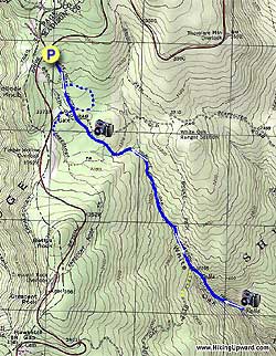
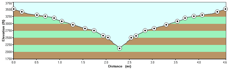
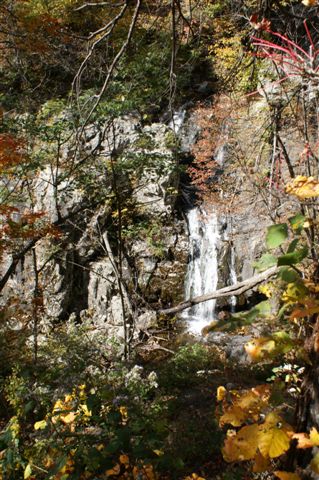
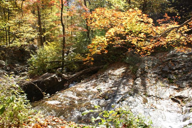
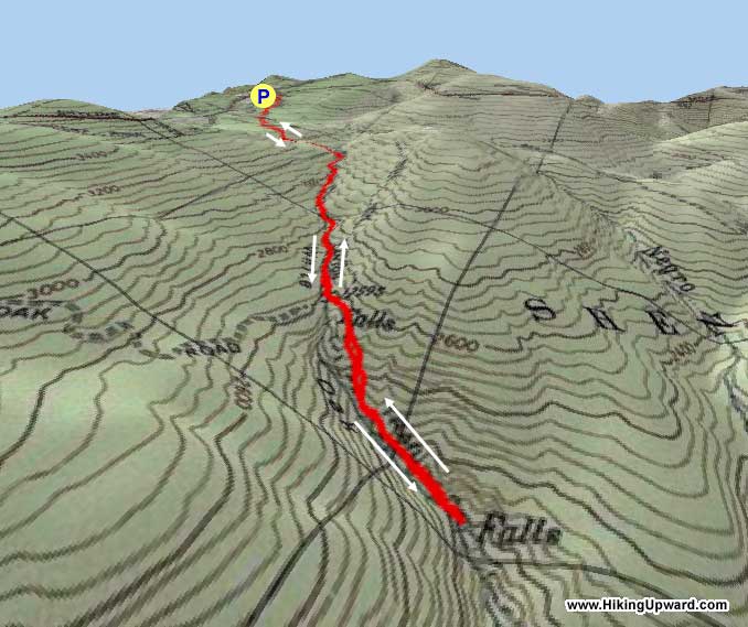
Well worth the effort! We started at the upper lot on Skyline Drive and hiked all the way down to the lowest of the Lower Falls. Keep in mind, it is a pretty strenuous hike to get back up to your car afterwards, especially from the Lower Falls to the Upper Falls (which is not tricky but is very, very steep in places.) If you're up for a challenge, though, I highly recommend it!
It's worth getting all the way to the lowest falls, too, because there's a great swimming hole there which is refreshing enough to boost your on your trip back. It's deep enough to cool you down, but shallow enough to get right under the falls. So much fun!
If you're taking kiddos or you just want to enjoy the swimming hole without as much hiking, I'd recommend parking at the Lower Lot and just going to the lowest falls. The others are lovely to look at, and even have places you could swim near them, but you really have to work for them. )
|
|
| By:
Ken |
Rating: |
 |
Date of Hike: Saturday, October 17, 2015 |
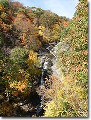
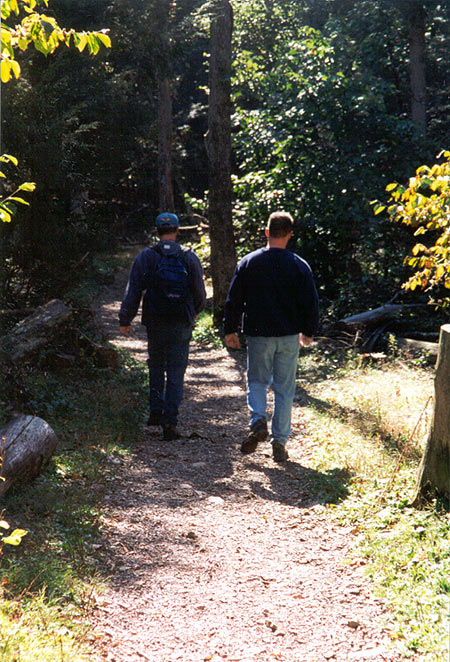
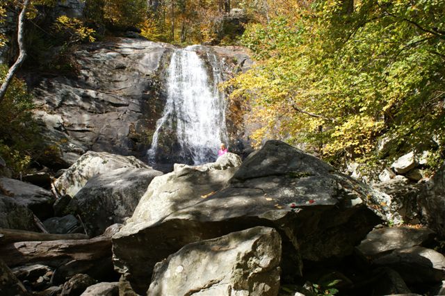
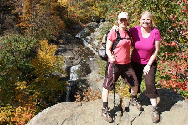
I've done the loop several times but chose to do this short out and back with my family to show them what I think are probably the best falls in the park. The fall colors are definitely coming in and the scenery was gorgeous, but the trail was a constant stream of people and the viewpoint at the top of the falls was packed. It was difficult to get pictures with several groups picnicking or just hanging out and not freeing up space for others. We went to the bottom of the upper falls for lunch and surprisingly there was nobody else there. Chatty groups, unleashed and in one case a leashed but aggressive dog, took away from the obvious beauty of this hike. Parking lot was 70% full when we got there (10:30) and overflowing by the time we left (about 1:45). If you value solitude then do this hike early, or on a weekday, or wait until the leaves drop. If crowds don't matter, then you'll thoroughly enjoy this hike especially now with all the color.
|
|
| By:
barb |
Rating: |
 |
Date of Hike: Monday, September 14, 2015 |
Love this hike! I have hiked with family and/or friends a few times from the top down and the bottom up. We have seen BlackBear on both routes which is always exciting. I highly recommend the bottom up for newer hikers that need to be reassured that hiking is an amazing adventure. The beauty of the waterfalls comes a bit quicker on this route and you dont have to drive the Shenandoah trail, you do still pay for entrance though unless you are during non peek hours.
|
|
| By:
Bernard in Virginia |
Rating: |
|
Date of Hike: Saturday, August 23, 2014 |
Great hike, beautiful trail and falls. We were out here on a rainy Saturday and still we saw a couple dozen or so other hikers. If you want a little solitude, I recommend a weekday and an early start. The plus is that our fellow hikers were all polite and apparently experienced hikers, so no litter, noise, etc., that you sometimes see on popular trails.
|
|
| By:
Paul |
Rating: |
|
Date of Hike: Sunday, June 15, 2014 |
There are few places as spectacular as this!
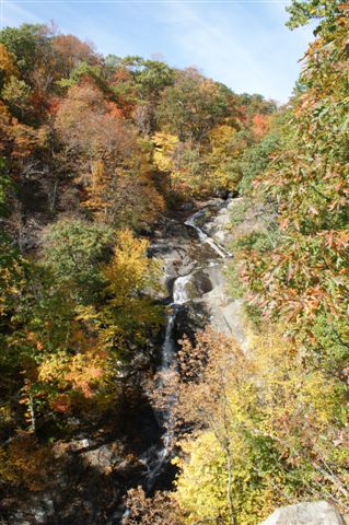
Plenty of water...plenty of cascades...
Non-stop waterfall action...going up WOC is cool...but I would really try this hike in reverse...
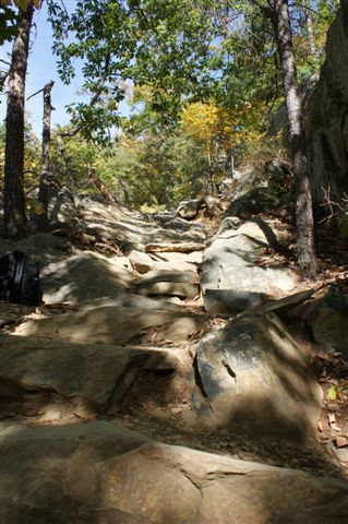
Cedar Run is extremely rocky...and going down is quite challenging...
White Oak down is probably easier on the ankles...
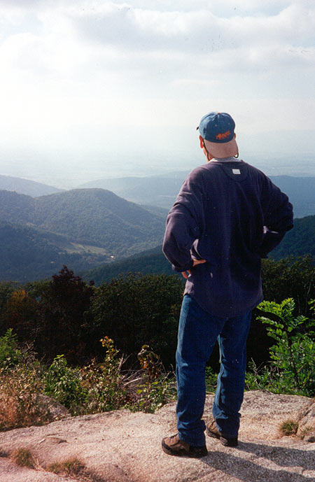
You cannot do this loop without the excursion to Hawksbill...just under a two mile round tripper...the .8 miles uphill is certainly worth it (on a clear day) and this day was practically cloudless...get up there...this makes this hike a 6 for views...
And Cedar Run the encore...what a beautiful trail...the water was extremely cold...dunked myself in a swimming hole just before the "slide"...thought I would hypothermiate....cold was an understatement...
One of the best hikes in the area...one of my favorite places on earth...especially as a water person...
|
|
| By:
Paul |
Rating: |
|
Date of Hike: Wednesday, October 23, 2013 |
|
Wonderful place!
The Falls seem to sing to you.
Second time visiting and first in autumn.
Did the Skyline Drive out and back trail near Skyland on Skyline Dirve and while it was not as difficult as the White Oak/Cedar Run Loop, we went a little farther down than the directions indicated. Deserved a 3.5 difficulty I believe. Much steeper below the main falls.
Beautiful drive back on Skyline Drive just at the end of the peak color season.
Perhaps I'll go back when the Falls are frozen. Must be incredible then.
A true four season spectacular!
|
|
| By:
Biswamber Pal |
Rating: |
|
Date of Hike: Saturday, September 21, 2013 |
Entered from Thornton Gap entrance and it was already raining. Started hike around 10:35AM and completed at around 3:15PM. It was very foggy, for about initial 1 mile or so, the trail is ok but after that it becomes very rocky. Since the day i hiked it was raining continuously, rocks were very slippery. Had no problem in reaching the base of 1st fall. But return was very strenuous for me. Had to take almost 15 to 20 stops. I am not a regular hiker and ok built with 135 lb and 5.7" hight. Some how felt very very exhausted. I was carrying a big camera big with tripod too. Carry lots of water, just one bottle may not be enough, carry two if possible. Also carry trail bars as you will feel hungry. I would like to hike this trail once again to cover all the 5 left over falls.
|
|
| By:
Dennis Loufik |
Rating: |
|
Date of Hike: Saturday, September 14, 2013 |
This loop hike is awesome!!!! It is a natural waterpark. The best approach is to hike from the valley and go to the right towards the White Oak falls and finish with a refreshing dip on the Cedar Run trail. It is wise to get to the parking area early like by 8:00 am for easy parking. There will be a park fee of $15.00 per vehicle. There are porta-johns at the trailhead.
|
|
| By:
Drew |
Rating: |
|
Date of Hike: Friday, May 17, 2013 |
I do this hike many times a year. Eight in the last two. The falls were flowing harder today than I have ever seen them before. If you get a chance go out this weekend before they die down. The only gripe I have is the trail actually misses a lot of great spots, falls even. I take the trail to the first of the lower falls and than hike right up the creek bed (should have 1 pair of shoes to hike through water and one dry pair for climbing) zig zagging back and forth traversing the terrain. Hands down the most spectacular way to see White Oak Canyon. Only for extremely seasoned hikers and climbers there are a few places were you are climbing almost vertically right next to a fall with at times only a crack a half inch deep to stick your fingers in. Today was the first day we could not make it the entire way up. The falls were pretty powerful today but we were still able to make it up to the sixth fall but climbing up the side of that one was just too risky today. Anyway you do this hike though, you will have an amazing time and this is from someone that is very difficult to please. Enjoy guys!
|
|
| By:
Meaghan and Dan |
Rating: |
|
Date of Hike: Saturday, August 4, 2012 |
Great Hike! We started from the top of the trail in Shenandoah National Park and hiked all the way down to the lower falls. Trail was pretty easy for the first 1/3 of the trail, and then definitely was pretty steep and mainly downhill for the rest. There are many pretty falls, going swimming holes and a natural rock slide at the bottom. Definitely refreshing and lots of families/people eat lunch. The hike back up was continuous and difficult but was a good workout.
A great hike - would definitely do it again. We also saw lots of dogs on the hike, so if you have a pooch definitely bring him along.
|
|
 View all 35 archived reviews for the White Oak Canyon hike
|


