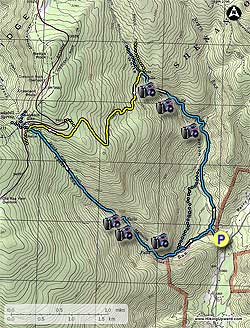
This
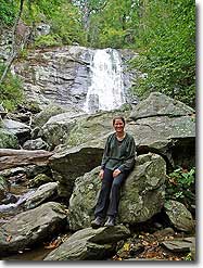
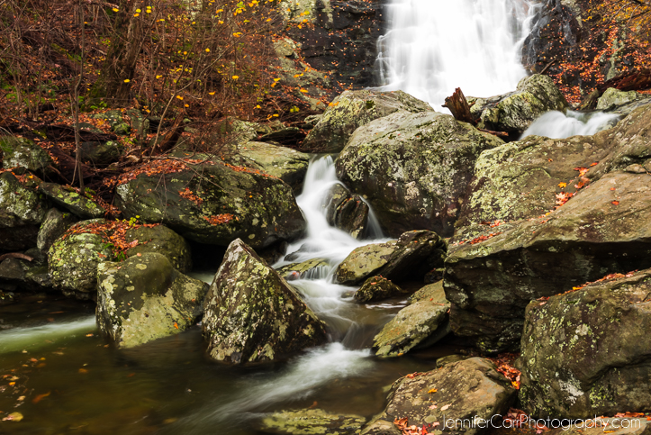
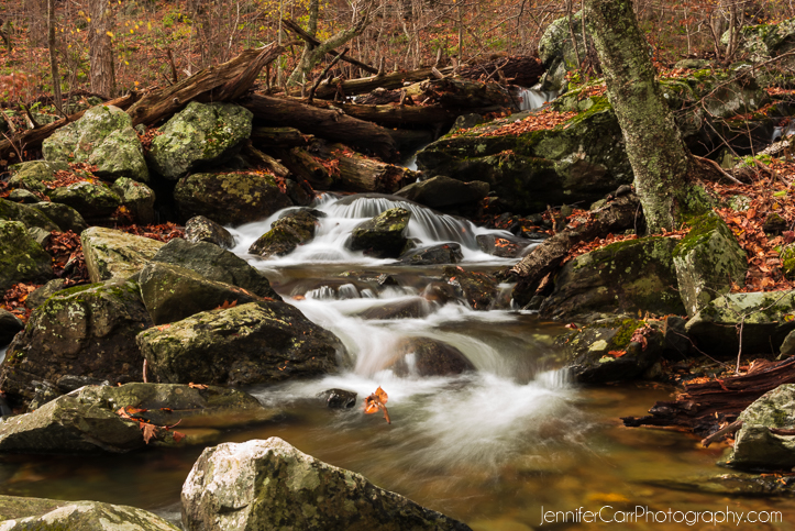
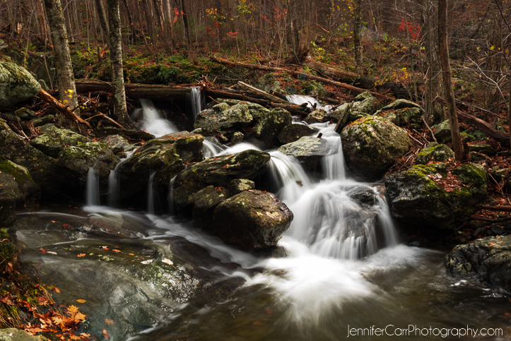
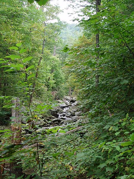
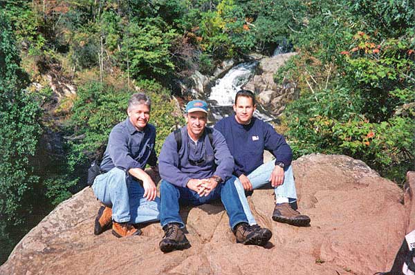
hike has some of the most spectacular waterfalls in the Shenandoah National
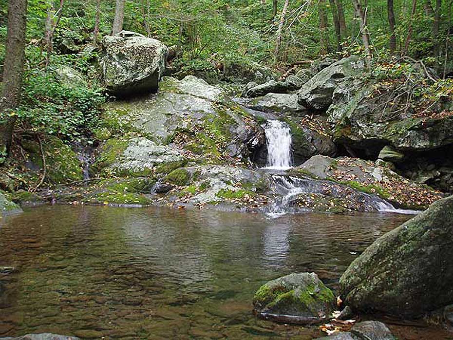
Park. Combining two out-and-back hikes, White Oak Canyon & Cedar Run, this loop starts at the bottom of the valley and cuts over near the top of the ridge. With five major falls, numerous smaller cascades and pools, this circuit hike is one of the best.
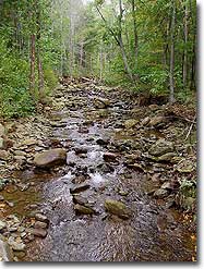
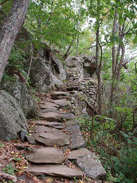
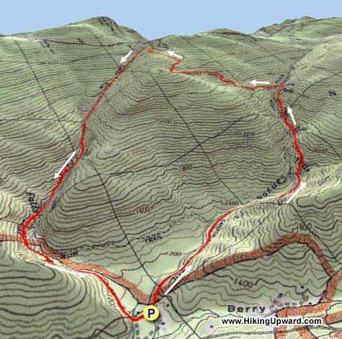
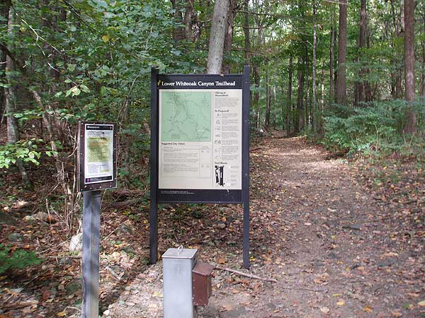
Follow the blue blazed trail on the right side of WOC Run reaching the WOC/Cedar Run Connector Trail in 0.6 miles. Stay straight on the right side of WOC Run for another 0.7 miles, cross a small stream, then arrive the base of the first set of major falls.
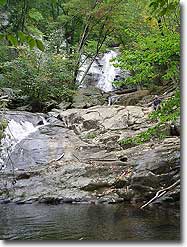
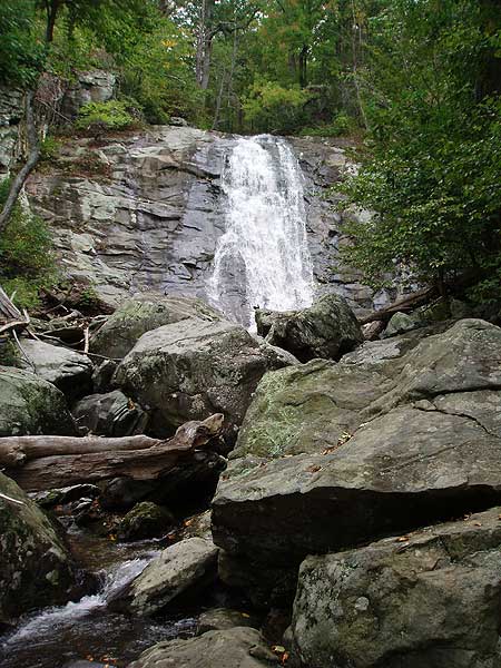
The trail will now make several switchbacks as the grade gets steeper, then reaches the second set of falls in 0.6 miles. Again, the trail will switchback several times, then become less steep, and arrive at a concrete marker for the base of the main WOC falls. To see the falls from the base, follow the side trail straight for 100 yards. Continue uphill on the WOC Trail as it steeply climbs the last 0.1 miles to the main WOC falls overlook.
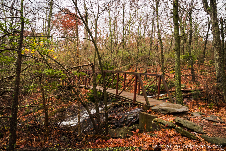
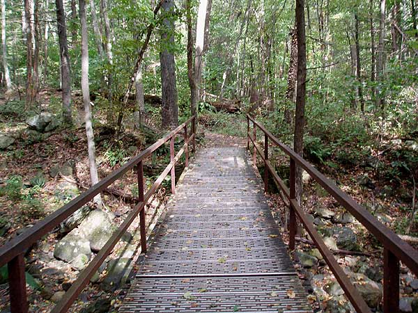
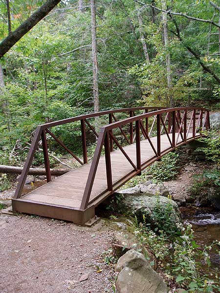
Continuing uphill from the main overlook, and shortly arrive at the yellow blazed Bridge Path Trail that comes in from the right. Stay straight, then cross WOC Run in another 40 yards at the horse rail. If WOC Run is high, continue up the right side of WOC Run and cross a footbridge in 120 yards.
After crossing the run follow the wide yellow blazed WOC Fire Road/Horse Trail. In 1.6 miles the WOC Fire Road/Horse Trail will veer right. Stay left on the narrower yellow blazed trail, marked on a concrete post as "Horse Tr To Big Meadows". In 0.6 miles the horse trail intersects the blue blazed Cedar Run Trail.
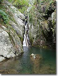
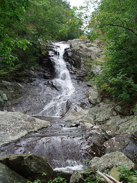
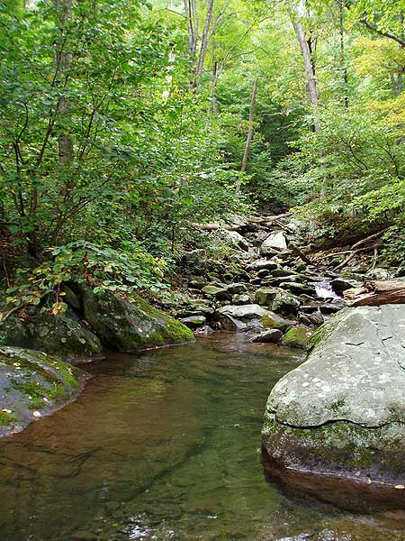
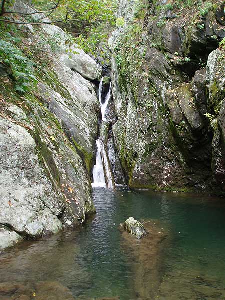
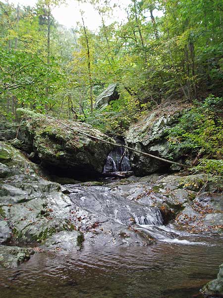
Turn left downhill on the blue blazed Cedar Run Trail, then in 1.3 miles cross Cedar Run. In 0.2 miles after crossing Cedar Run reach the top set of main falls at Halfmile Cliff known as "The Slide". 60 yards below the main falls is a pool where Cedar Run passes through a narrow gorge.
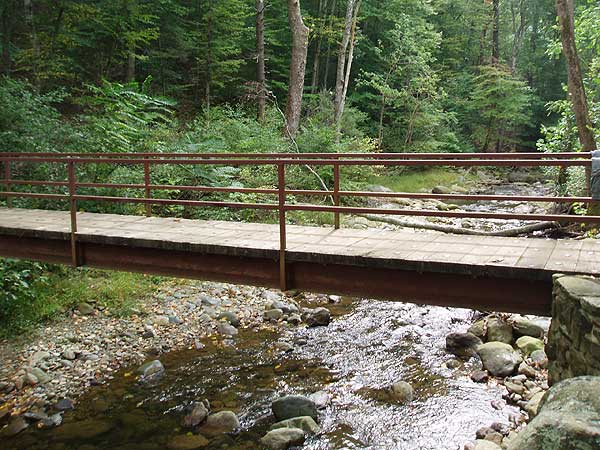
Continue downward on the Cedar Run Trail for 0.5 miles where the blue blazed trail makes a sharp left to cross Cedar Run for the last time. After crossing Cedar Run follow the trail for 0.3 miles to the intersection of the WOC/Cedar Run Connector Trail. Turn right downhill on the Cedar Run Trail towards RT600, and in 0.4 miles arrive back at the WOC Trail intersection. Turn right, re-cross the steal footbridge, and arrive back at the parking area.
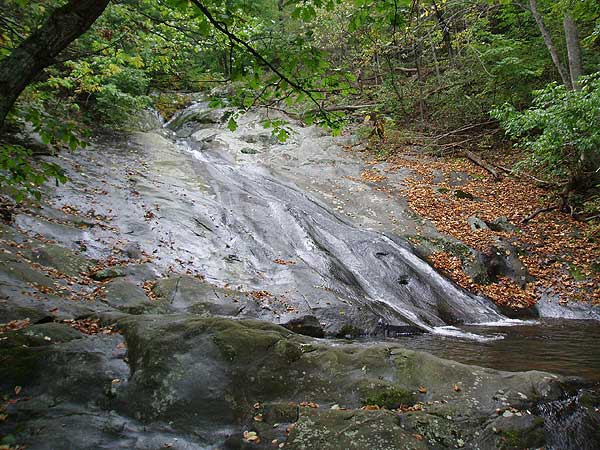
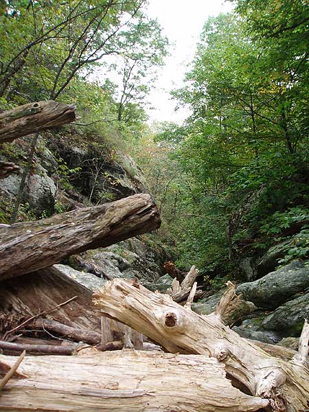
Waterfalls, waterfalls, waterfalls! This has to be the most spectacular waterfall hike in Shenandoah National Park. With three sets of falls on the way up White Oak Canyon and three smaller falls heading down Cedar Run, this circuit is among the mid-Atlantic's most popular. Lots of company on the trail.
Usually, the ideal time for this hike is in early spring, but with the rain we've had in the last month, all the falls were near their best. The wildlife was also out; we came across several black snakes, this guy (vid) was a local celebrity with hikers on Saturday, and we also saw a juvenile black bear on the trail.
Cedar Run
White Oak/Cedar Run Hike Comments
Archived Comments
By:Luanne
Rating:
Date of Hike: Tuesday, October 1, 2019
As we were approaching the parking area, there was a sign posted about 3 miles away "White Oak Trail Closed". The inside the car immediately became quiet. Apparently, they are replacing a bridge right next to the parking area. This was closed beginning Sept 15 and don't know when it will reopen. You are now forewarned.
By:Erin
Rating:
Date of Hike: Sunday, July 21, 2019
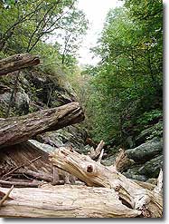
I hiked this circuit with my dog on Sunday - which also happened to be one of the hottest days of the year! We parked at the Hawksbill Summit/Cedar run parking inside the park. At 10am there were still spots left but it filled up quickly. We started down the Cedar Run trail and mostly had the trail to ourselves until the lower falls. I agree with other reviewers that this trail is more 'rustic'. There were a lot more rocky areas to scramble over and tree branches in the path. I was definitely glad to have good hiking boots on! In several places we had to jump over fallen trees and sometimes it was hard to know where the trail continued because the fallen trees obscured it. Fortunately my dog can smell where other people went and let the way! At the falls, we encountered a few other hikers/bathers, but just a few. They had come up from the lower parking lot and since it is a MUCH tougher climb to the Ceder Run falls (as opposed to the White Oak falls), very few come up that way. Its nice if you prefer a quieter hike. In some cases, we had the falls all to ourselves, even on a hot Sunday in July! After descending Cedar Run, we took the link trail over to White Oak. At some point we lost the marked trail and had to ford a river in the absence of any marking. I could see hikers on the other side going up White Oak but could not find the path. We scrambled up a muddy bank on the far side which would not have been passable in the rain. We then took White Oak all the way back up to the Fire Road, stopping at various falls. The White Oak falls were all pretty crowded as they are popular bathing areas. We saw a copperhead snake on the trail at one point...and others saw copperheads too...so be careful with kids and dogs. We took the Fire Road/Bridal Trail back over to Cedar Run, at which point it began raining buckets. Fortunately the Fire Road is an easy path and we made it back to the car where dry clothes and cold drinks were waiting. All in all, it was about 7.5 hours and pretty strenuous, but a great sense of accomplishment when we completed it!
By:Alan from DC
Rating:
Date of Hike: Saturday, April 20, 2019
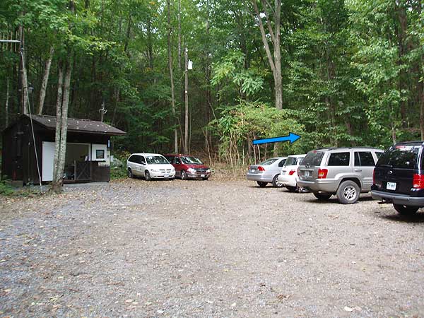
Parking lot was at 10:15am when we arrived. We ended up parking at the private overflow lot and paid the guy $10. There were two cars there at the lot when we arrived. So you might luck out with a free spot before 10. This like old rag now where you have to pay $10 to park in the overflow lot.
Theres no White Oak Canyon loop on the free map so we ended up hiking all the way up and down the Appalachian trail back to Cedar Run instead of taking the shortcut across using the fire road to Cedar Run. Wife was not too happy about my poor research on this hike.
The water were strong and high during our hike. We had to wade over the river at multiple places. Our hiking boots were wet from it. We should have taken it off.
The views were pretty nice but I enjoyed the waterfalls on the cedar run side more.
By:Mike D
Rating:
Date of Hike: Sunday, September 30, 2018
I hadn't hiked the full circuit in a long time, having done a bunch of WOC out-and-backs with the family and dog. I hiked the full circuit for the first time 40 years ago and I wanted to see if I still had it in me. The WOC falls and rock tumbles were spectacular because of all the recent rains. As previous reviewers have stated, the Cedar Run trail was very rocky, steep and difficult and not as well maintained as the WOC trail. I would characterize it as a "primitive trail" for about 2 miles of the descent. The two Cedar Run crossings were challenging due to the high water. I took off my shoes and stumbled and slipped across one crossing and found a fallen tree to use for the second crossing. If you want to do the full circuit I would recommend going up the Cedar Run trail and coming down the White Oak Canyon trail. Having said, that it was a great hike and, yes, I still had it in me.
By:CER
Rating:
Date of Hike: Saturday, September 22, 2018
Did this with Boy Scouts with full packs. This is a challenging circuit hike and would not recommend for young scouts, i.e., less than 14 and not with full packs. Beautiful hike, but do it as a day hike with light packs.
By:Suzanne
Rating:
Date of Hike: Saturday, September 1, 2018
Make no mistake about it, this is a great hike. Scenery is tremendous. Today there was a fog/mist storm on the ridge that blanketed the mountain to create a neat affect. Love it.
However, be aware that going down Cedar Run! At stretches I was fighting for every step. Between boulders, rocks and roots, on the steep incline, the going was slow. Good balance is must.
Next time I will do an out and back on White Oak.
By:Rebecca Faeder
Rating:
Date of Hike: Thursday, August 23, 2018
My friend and I hiked this today. The falls are spectacular!! We took our dogs and they loved it, too. We hiked counterclockwise up the WOC trail, saw all the beautiful falls (which, btw, are abundant, deep, and flowing wildly, because of all the rains), crossed the falls via the bridge and continued on the Fire Rd. This was the only part, at the time, that seemed a bit boring to me. But, boy oh boy, by the time wed hit the Cedar Run trail, we were begging to be back on the Fire Rd. The going was tough coming down. Wear your waterproof hiking boots and watch your steps carefully. Also, take a bathing suit, water shoes, and a picnic. About half way down we had a hard time finding the trail marking. My friend finally found it....across a huge section of falls, clear on the other side. We waded across very carefully. It was not an easy feat with two dogs. We continued the long hike down over rough rocks and boulders. In order to reach the parking lot we had to cross the falls again, in even deeper water!
Yes, it was strenuous coming down, but, wow, SO worth it. This has become one of my favorite hikes ever. Do it now before the water lowers! Youll be so glad you did.
By:F&B
Rating:
Date of Hike: Saturday, August 18, 2018
My wife and I took this hike to celebrate the 22nd anniversary of the day we met. It turned out to be quite a nice hike and a bit of adventure--not unlike our life together! The scenery was beautiful beyond words. Because of the recent rains, the water falls are spectacular! And the waters so clear and cool! We started at the Rt600 entrance, counter-clockwise, did the the WOC trail first and returned from the Cedar Run trail. Now is the adventure: First, after we turned from the fire road to the blue blazed Cedar Run Trail, a couple in front of us turned back and warned us there was a bear up front. So we hiked back, and followed the fire road up to Skyline, and walked on the pavement for about 1 mile to the hawksbill trail head and from there hiked down the Cedar Run Trail. Half way down I slipped and sprained my right knee--and my speed reduced to barely faster than crawling. Now it got late and it started to get dark quickly. In the hurry we missed an intersection and went on the WOC-CR link trail, which took us to WOC way above where we should be. We walked (with a broken knee) about 2 extra miles, and finally returned to the parking lot when it was completely dark, more than 2 hours later than we planned! The Cedar Run part of the trail is very steep and full of rocks. With the recent rain, much of the trail is wet and very slippery. Also the trail is not marked super clearly. But overall, this is a great hike and all the "misfortunes" just make the memory more special!
By:PeaksInSanity
Rating:
Date of Hike: Friday, July 27, 2018
This quickly rose to the top of my area favorites list! The falls were really impressive - all of them - and there were tons! Aside from the fire road, you are right next to water during the entire hike, which kept things cool and peaceful. There were plenty of opportunities to take a quick (or prolonged) dip in, and the cool air coming off the falls was just as refreshing. The fire road was a little less interesting until the bear stepped onto the trail. It was my first East Coast sighting and livened that stretch up quite a bit! I expected the Cedar trail back down to be less eventful but between the run crossings, rock formations, butterflies, and sounds of rushing water, it was the perfect way home.
When I hike it again I'll bring a bathing suit, towel, and some water shoes! And lunch. It was more challenging than I expected and a little more fuel than a Kind bar would have been smart.
By:Gabby
Rating:
Date of Hike: Saturday, July 21, 2018
This was the most incredible hike I have ever done! We started at the Whiteoak Boundary parking lot and went up the Cedar Run trail. Whichever side you start with, it is very steep with little reprieve for several miles. The effort, however, is well worth it. Every turn exposed another gorgeous landscape. There are also many swimming holes to cool off in!
Just as a heads up, the hike is about 10 miles, not the approximately 8 miles stated on the maps. It took us about 5.5 hours (including stops to swim) and we were moving at a fairly quick pace.


