|
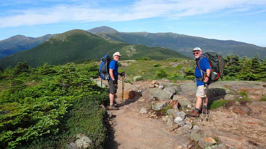
 The Presidential Range in the White Mountains of NH is a true bucket list hike. Hiking above treeline for most of the hike will give some of the best views we have seen in the Eastern U.S. Make no mistake, it will take some effort to get to those views and then you can enjoy the hospitality of AMC's famous White Mountain Huts at the end of each day. There is also the potential for severe weather year round so go prepared. This is one hike you should put on your bucket list! The Presidential Range in the White Mountains of NH is a true bucket list hike. Hiking above treeline for most of the hike will give some of the best views we have seen in the Eastern U.S. Make no mistake, it will take some effort to get to those views and then you can enjoy the hospitality of AMC's famous White Mountain Huts at the end of each day. There is also the potential for severe weather year round so go prepared. This is one hike you should put on your bucket list!
Hike Notes:
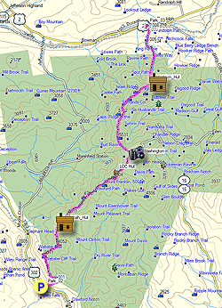
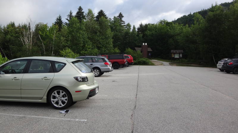
Parking is near the AMC Highland Center Lodge with a shuttle to the trailhead. See end of write up for additional information and logistics regarding this hike.
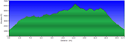
Day 1 – 10.8 miles
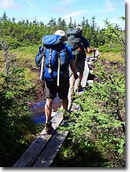
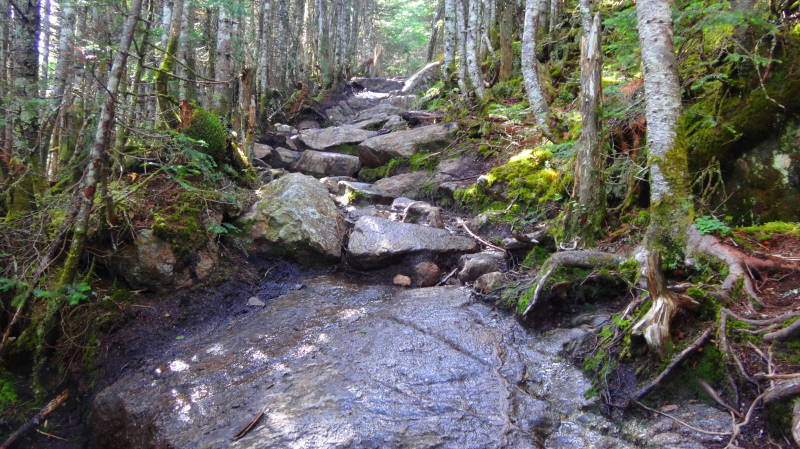
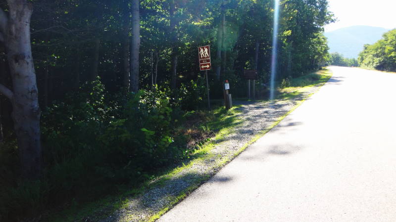
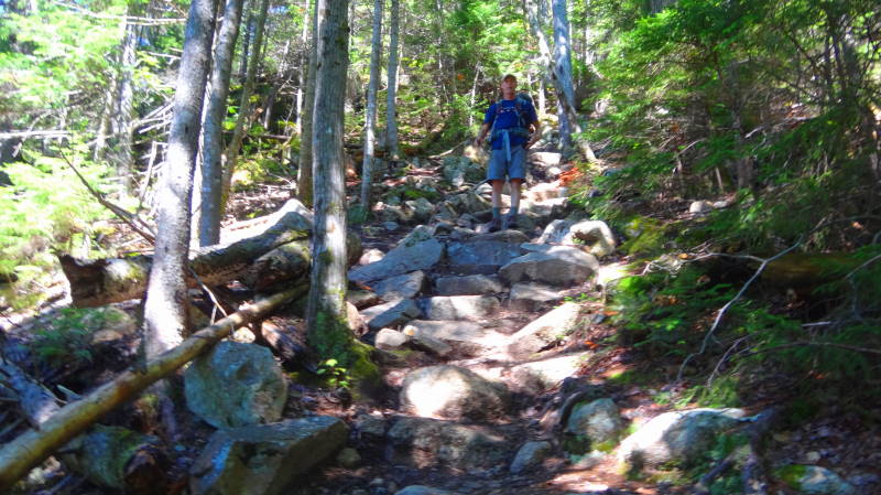
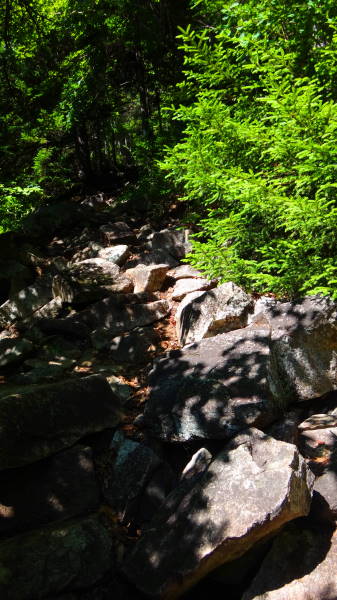
- Mile 0.0 – The trail begins at the Webster /AT Trailhead (1300') on Route 302 about 4 miles from the AMC Highland Center. Head North to begin your climb to Mt Webster. This was some of the toughest 3 miles we have done with over 2600' of elevation gain before reaching Mt Webster. I don't remember any switchbacks!
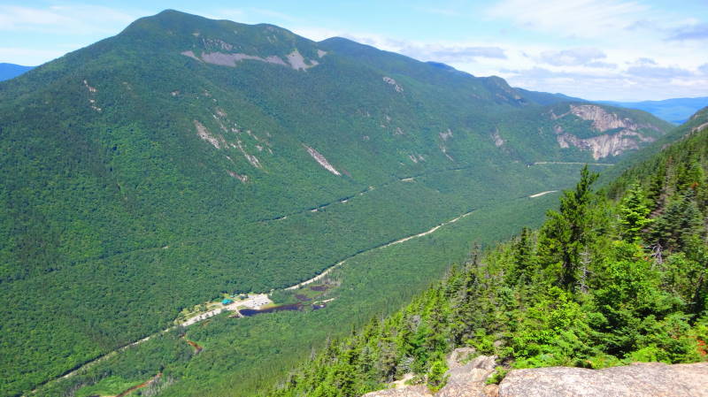
- Mile 3.3 – Mt Webster summit (3910'), enjoy some great views of Crawford Notch. The Webster Jackson Trail (Webster Branch) comes in on the left, continue on the Webster Cliff Trail/AT.
- Mile 4.6 – Mt Jackson summit (4052'). The Webster-Jackson Trail (Jackson Branch) comes in on the left, continue on Webster Cliff Trail/AT, you will come across a few places with wood planks going through muddy areas.
- Mile 6.1 – Mizpah Spring Hut (3777'), Mizpah Cutoff Trail comes in on the left. Fill up with water here during open season. Continue on Webster Cliff Trail/AT, another tough climb.
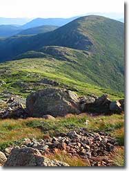
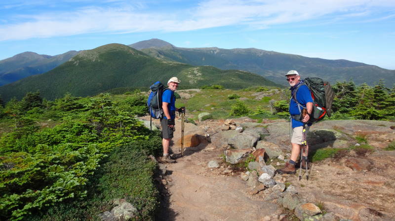
- Mile 6.9 – Mt Pierce Summit (4312') with great views to the Northeast of Eisenhower, Monroe and Washington. Just after the summit the Webster Cliff Trail/AT merges with the Crawford Trail that comes in from the left. Continue on the Crawford Path/AT.
- Mile 8.1– Mt Eisenhower (4760') Loop trail on the left. We bypassed the summit and stayed on the Crawford Path/AT
- Mile 8.6 – Mt Eisenhower Loop trail rejoins Crawford Path/AT.
- Mile 9.7 – Mt Franklin (4961') continue on the Crawford Path/AT.
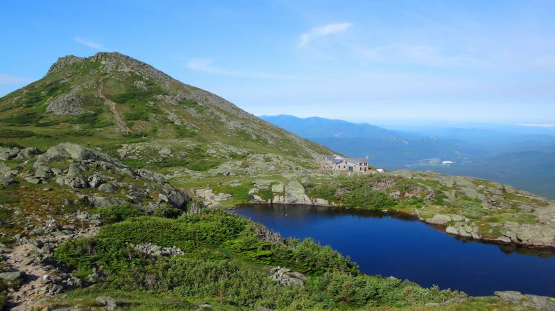
- Mile 9.9 – Mt Monroe (5372') Loop Trail on left. We bypassed the summit and stayed on the Crawford Path/AT. After a long day hiking, the Lakes of the Woods Hut is a beautiful site.
- Mile 10.7 – Mt Monroe Loop trail comes back in on the left just before the Lakes of the Clouds Hut.
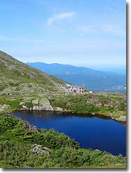
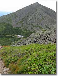
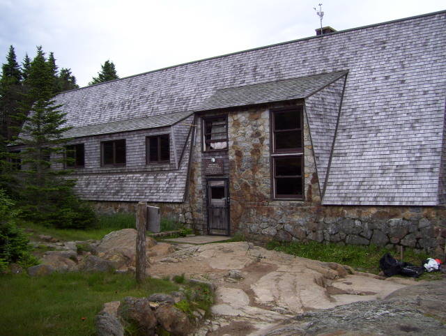
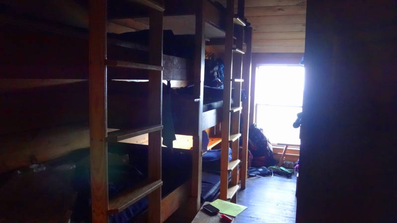
- Mile 10.8 – Reach Lakes of the Clouds Hut, enjoy a great dinner and a well earned rest.
Day 2 – 7 miles
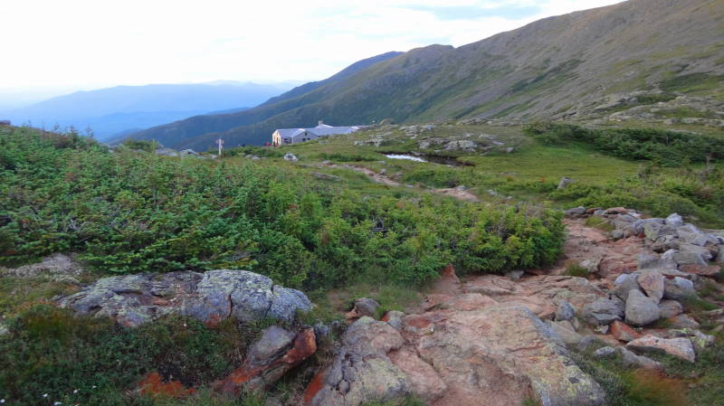
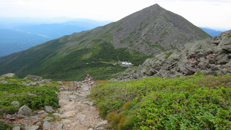
- Mile 10.8 – Eat a hearty breakfast at the Hut and then begin the climb on the Crawford Path/AT to Mt Washington. Be sure to look back at the Hut as you climb Mt Washington.
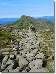
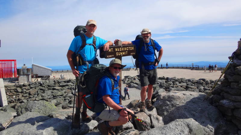
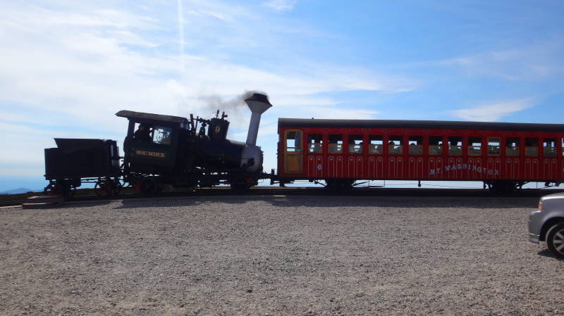
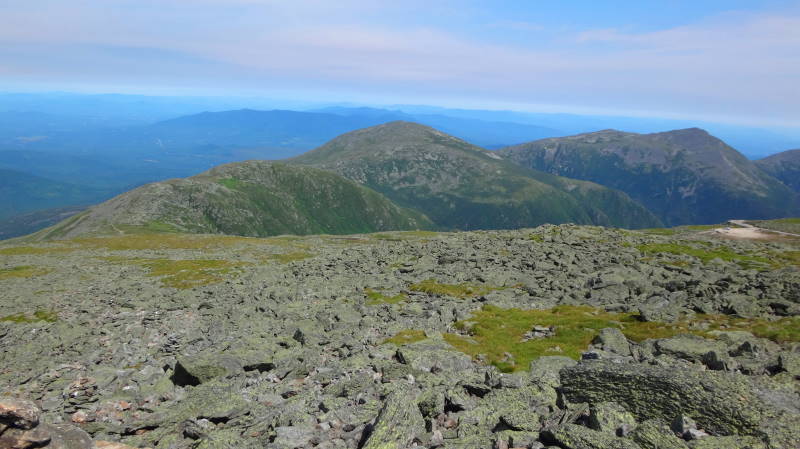
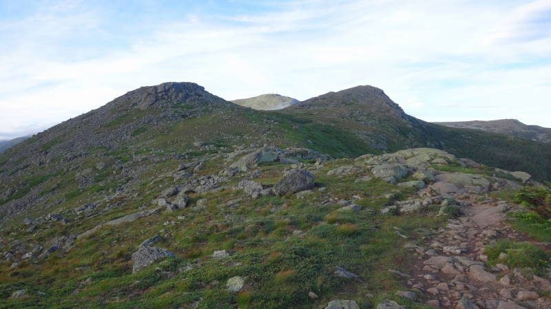
- Mile 12.2 – Mt Washington (6288') summit, try and get there early before the crowds that drive up or take the Cog Train. If the weather is hospitable, take in the views. Take Gulfside Trail/AT from Mt Washington towards Mt Clay.
- Mile 12.7 – Great Gulf Trail on right, stay on Gulfside Trail/AT. The Great Gulf to your east is amazing
- Mile 13.2 – Mt Clay (5533') Loop Trail on right, bear left and stay on Gulfside Trail/AT. We bypassed the summit.
- Mile 13.5 – Jewell Trail on left, stay on Gulfside Trail/AT.
- Mile 14.2 – Mt Clay Loop trail interection, stay on Gulfside Trail/AT
- Mile 14.3 – Sphinx Trail on right, stay on Gulfside Trail/AT.
- Mile 14.8 – Mt Jefferson (5716') Loop Trail on left, we bypassed the summit, stay on Gulfside Trail/AT.
- Mile 15.3 – Six Husbands trail on the right.
- Mile 15.5 – Mt Jefferson Loop, stay on Gulfside Trail/AT.
- Mile 15.8 – Edmunds Col
- Mile 16.4 – Israel Ridge Path on left, stay on Gulfside Trail/AT.
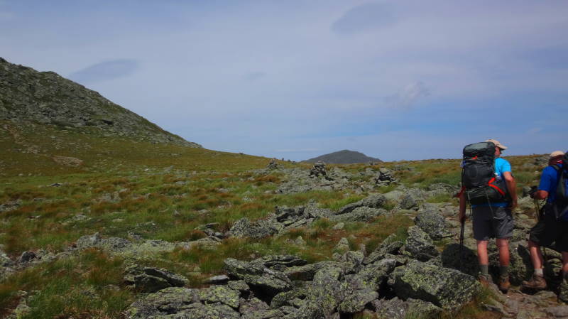
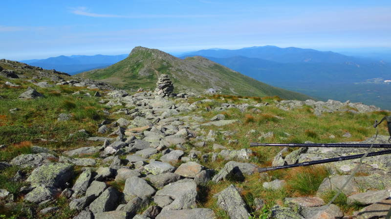
- Mile 16.9 – Mt Adams (5799') Loop trail on right. To the west and northwest are Mt Sam Adams (5585') and Mt Abigail Adams (5355'). Stay on Gulfside Trail/AT passing Mt JQ Adams.
- Mile 17.8 – Arrive at Madison Spring Hut (4800'). Mt Madison (5366') is to the east directly above the hut. Day 2 could be referred to as “Rock & Boulders Day”, it seems like most of the day we were on rocks and boulders. Another well deserved dinner and rest.
Day 3 – 3.6 miles
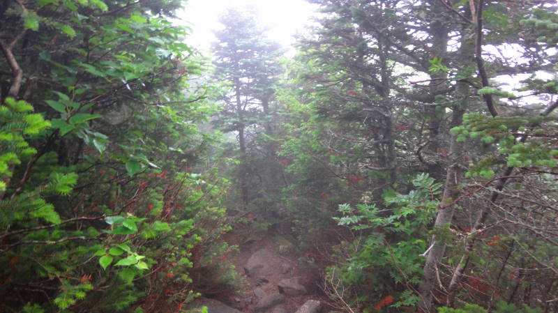
- Mile 17.8 – Madison Spring Hut, enjoy another hearty breakfast. Begin your descent by taking Valley Way Trail to Appalachia, at the first intersection just after the hut, Airline Trail bears left but bear right to stay on the Valley Way trail. The first mile or so is tough then gets easier. We were able to hike this section in 2 ½ hours and caught the 11:45 AMC Shuttle.
- Mile 21.4 – Appalachia Parking area, Route 2, catch AMC Shuttle to AMC Highland Center. This was the only section we walked faster than 1 MPH!
Arrive at AMC Highland Center then walk across Route 302 to the Mt Clinton Parking Lot. |
Additional Hike Notes:
- The weather on this section of the AT is no joke, people die here due to sudden changes in weather and being uprepared. Go prepared, get a good weather report and have planned bail routes if the weather turns when you are above tree line. Do your homework prior to going, pack for bad weather, even in the summer.
- Book your Huts and Shuttle Rides through AMC well in advance
- We stayed at the Dry River Campground the night before our hike, not far from the AMC Highland Center.
- Above ankle waterproof hiking boots and hiking poles highly recommended.
- Day 1, we parked our car across from the AMC Highland Center at the Mt Clinton Parking Lot (fee based). We then caught the Shuttle to the Webster Cliffs Trail from the AMC Highland Center.
- Day 1 is some of the toughest miles we have done with lots of elevation gain.
- Plan on not doing much more than 1 MPH on the trail.
- You could take the Crawford Path from the AMC Highland Center to the Mizpah Spring Hut and catch the AT there if you want to cut down on the miles on Day 1 (reduces by about 3.7 miles) and the exertion of the Webster Cliffs Trail.
- We have marked many trail intersections but not all of them. We highly recommend either the Nat Geo or AMC maps for this section.
- The trail is on the AT/shared trails until you get to the Madison Springs Hut and then you will take the Valley Way trail to Appalachia to catch your shuttle back to the AMC Highland Center.
- This section is referred to as The Presidential Traverse, this assumes you summit each of the named mountains. We bypassed some of the summits so we did not do a true Traverse.
|


