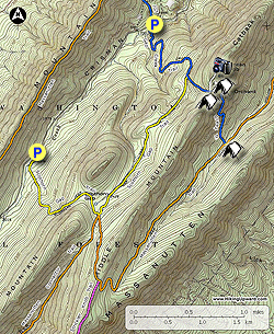
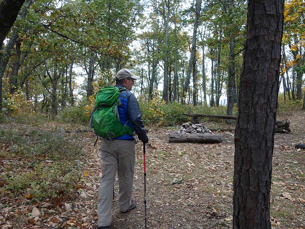
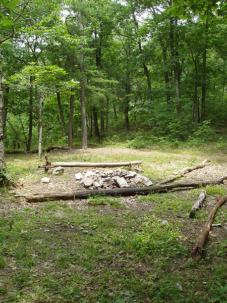
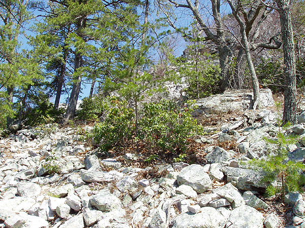
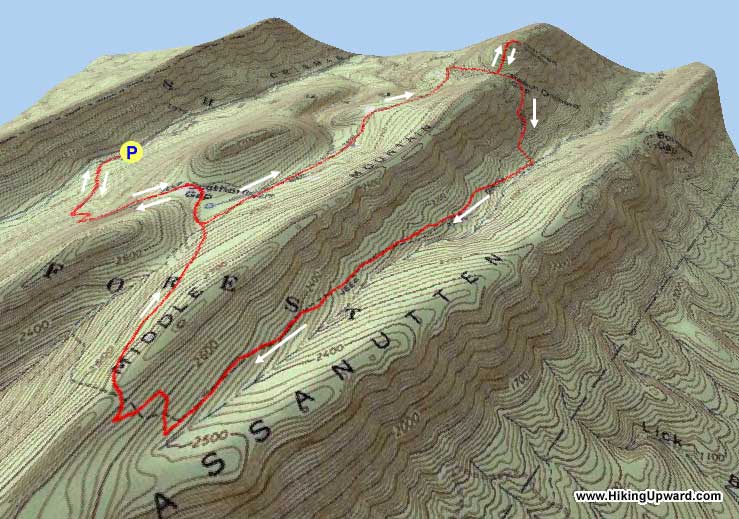
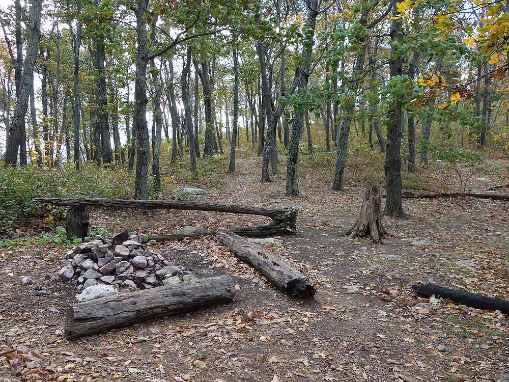
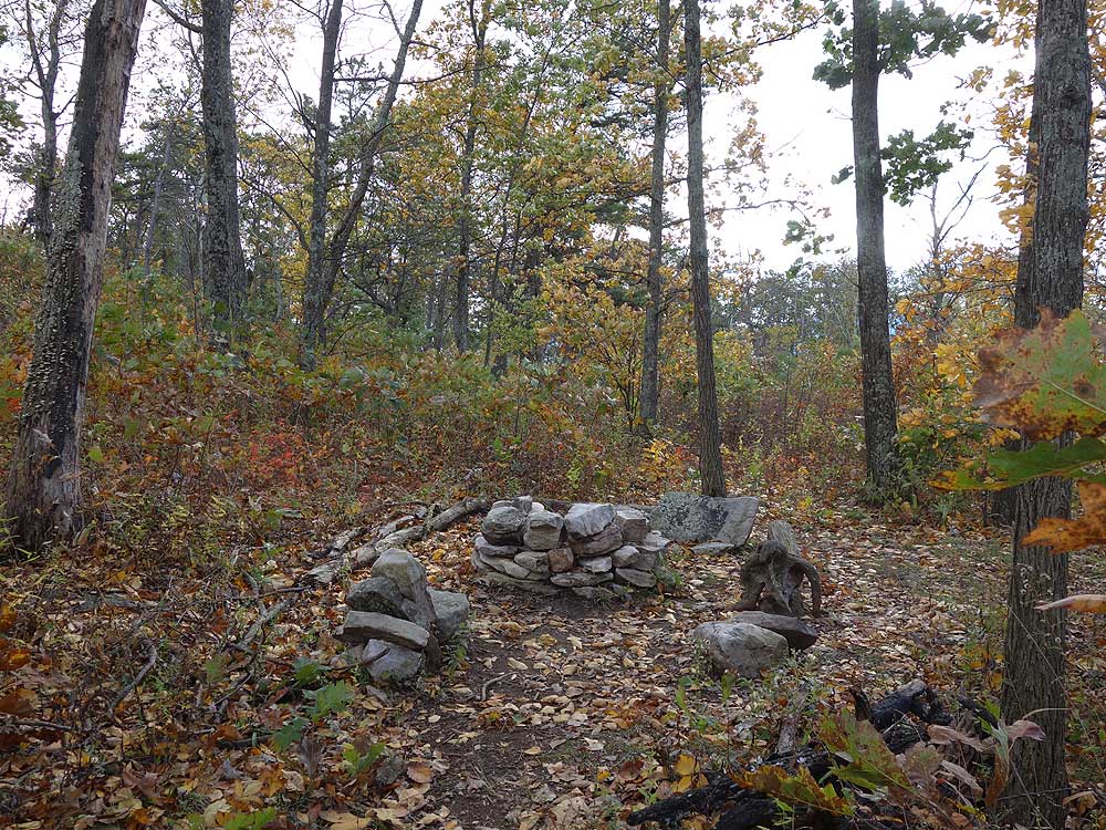
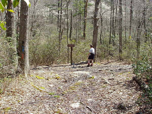
Mile 1.2 - Continue climbing on the blue blazed Gap Creek trail for another 0.3 miles to Peach Orchard Gap where there is a large campsite. The white blazed Duncan Knob Overlook Trail is on the left in the saddle.
Mile 2.1 - Turn right downhill on the blue blazed Gap Creek Trail retracing your route back to the parking area on Crisman Hollow Rd.
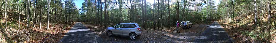
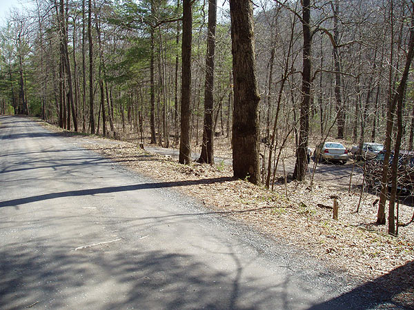
Mile 3.6 - Arrive back at the parking are on Crisman Hollow Rd.
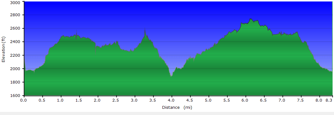
Scothorn Gap - Circuit - 8.5
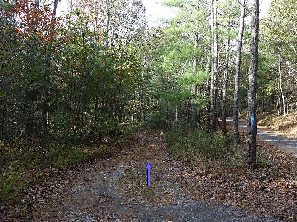
Mile 0.0 - Take the yellow blazed
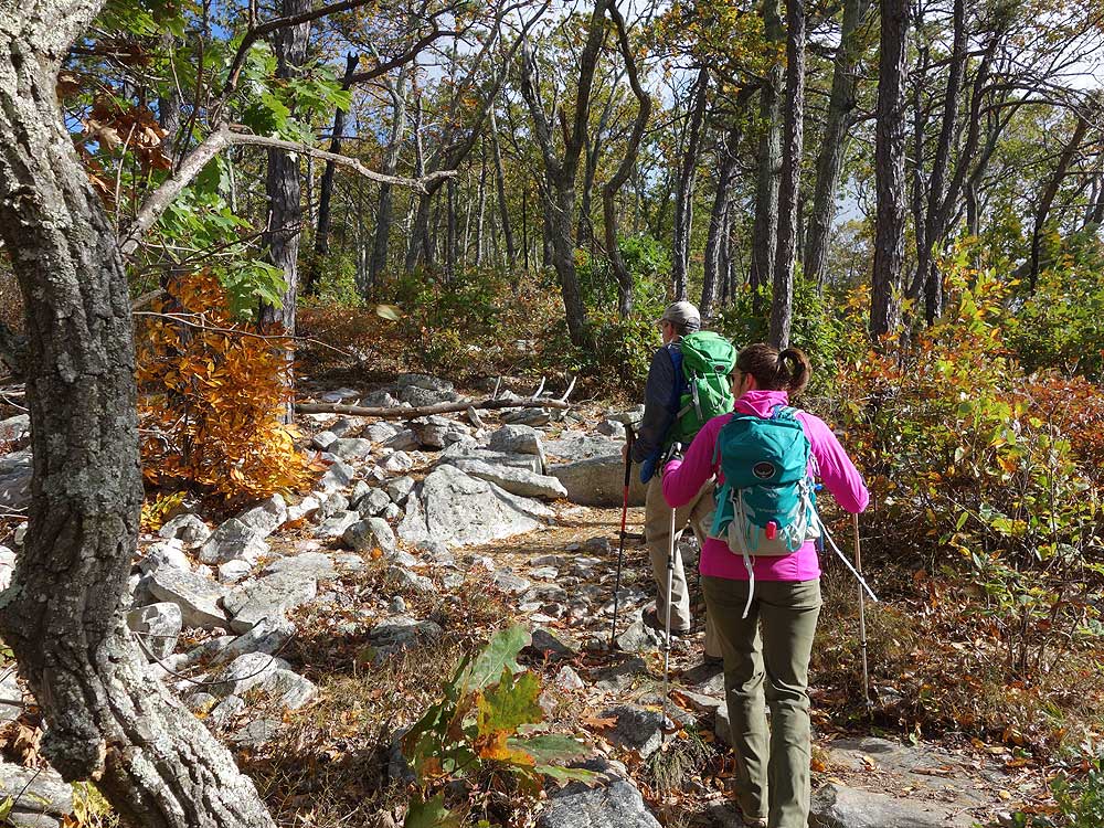
Scothorn Gap Trail uphill after crossing Passage Creek. Traverse one switchback
and climb steeply, pass a clearing then a
pond at 1.2 miles. Depending on what time of the year it is the pond
might be completely dry.
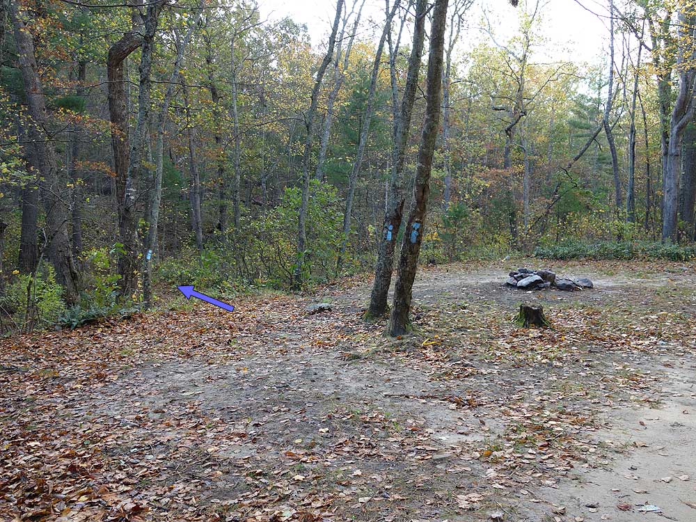
Mile 1.4 - Arrive at a
four way intersection. The yellow blazed Scothorn Gap Trail turns left, and directly ahead is the orange blazed Massanutten
Trail which you will use to return. To the right is the Massanutten
Connector Trail. Turn left staying on the Scothorn Gap Trail. The trail gradually rises and passes a small clearing then ends at the intersection of the blue blazed Gap Creek Trail.
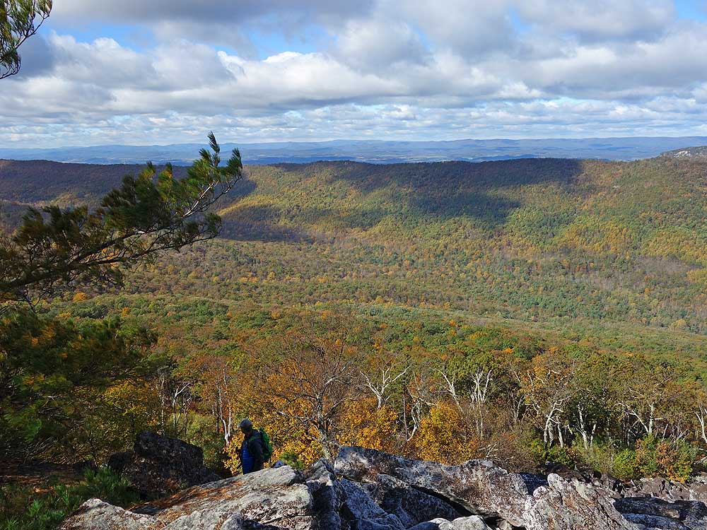
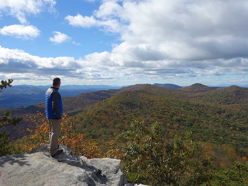
Mile 3.0 - Turn right uphill on the blue blazed Gap Creek Trail for 0.3 miles to Peach Orchard Gap where there is a large campsite. The white blazed Duncan Knob Overlook Trail is on the left in the saddle.
Mile 3.9 - Turn left downhill on the blue blazed Gap Creek Trail (steep) where the blue blazed trail ends at the intersection with the orange blazed Massanutten Trail. Directly across the run is a large campsite suitable for multiple tents.
Mile 4.4 - Turn right upstream on the orange blazed Massanutten Trail for 1.8 miles, then the trail makes two long switchbacks becoming steeper and crests Middle Mountain at the intersection with the unofficial pink blazed Strickler Knob Trail.
Mile 6.5 - Descend on the orange blazed trail back to the intersection with the yellow blazed Scothorn Gap Trail where the orange trail turns left.
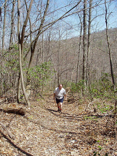
Mile 7.1 - Continue straight on the yellow blazed Scothorn Gap trail past the pond retracing your route back down to the Scothorn Gap parking area on Crisman Hollow Rd.
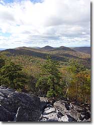
Yes a lot of rocks and gnats like the other reviewer said but who cares. Its a natural thing and to be expected, no one to blame but God and mother nature, suck it up. The hikes were no joke, if you are not in shape or want to get in shape then do the long trail around. No matter what you do the view at the top is worth it and you will need to earn that satisfaction. The camping spots along the way were really nice. We were very lucky to have perfect weather and the moon was shining on both nights. We will be going back.
By:Katy J
Rating:
Date of Hike: Tuesday, August 27, 2019
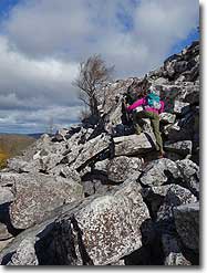
This hike could have been much better if there were less gnats or we had been wearing bug spray! We parked at the Gap Creek trail head. Until the orange-yellow blazed trail came in from the right a mile or so up the trail, the gnats were pretty horrific. We couldn't stand still for any length of time and the going was almost always UP! There were many loose rocks along the trail which prohibited looking around along the way, although the scenery was not much to look at. Much of the forest had been burned and trees were down in many places. Once we reached the boulder-sized rocks cascading down from the top, we noticed there were rock piles to help guide us along the way, but there were many, many rocks to climb up, and we decided to turn back before reaching the top. It seemed like an endless task of going slowly and carefully. Perhaps for those who are experienced at lengthy rock scrambles, this climb would not be an issue, but for me, it was a bit much. We found a flat rock half way up the rock scramble to eat our lunch. The view was fairly good from here. I realized, there were no pictures from this hike because of all the gnats and intense walking due to either loose rocks along the trail, or the expansive boulder rock climb.
By:Jean T
Rating:
Date of Hike: Saturday, April 13, 2019
We did the Gap Creek up and back. I would note that the park service is currently performing controlled burns until May, so technically the trail is closed. We went right after a rain storm and chatted with some campers who said they had not seen any rangers performing burns since they had been there so we proceeded with the hike. Half of the mountain had been burned already, so the landscape is quite charred and black. The smell in the air was still very much of a recent burn. While the hike itself was great for a quick afternoon hike, the rock slide was awesome, and the view was beautiful (though the trees have not yet sprouted leaves yet) please call the ranger's number posted on the tree at the trail head to ensure there are no burns taking place that day!!
By:Nathan Cross
Rating:
Date of Hike: Thursday, November 22, 2018
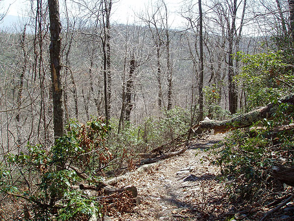
My wife and I did the Scothorn Gap Loop on Thanksgiving day. A very enjoyable hike! The route is great, and the vista from Duncan Knob is spectacular, with a fun rock scramble to get to the top. Because of all the rain this year, the trail was incredibly muddy, with large portions covered in standing or running water, forcing us to carefully pick our way along the edge of the trail (dodging the wicked briars!). It slowed us down considerably, and resulted in some damp socks by the end. I definitely recommend the hike, but be sure to do it with sturdy waterproof boots with good ankle support, as the trial is at times covered with fist-sized ankle breaker rocks. Thanks hiking upward!
By:Charles
Rating:
Date of Hike: Sunday, October 7, 2018
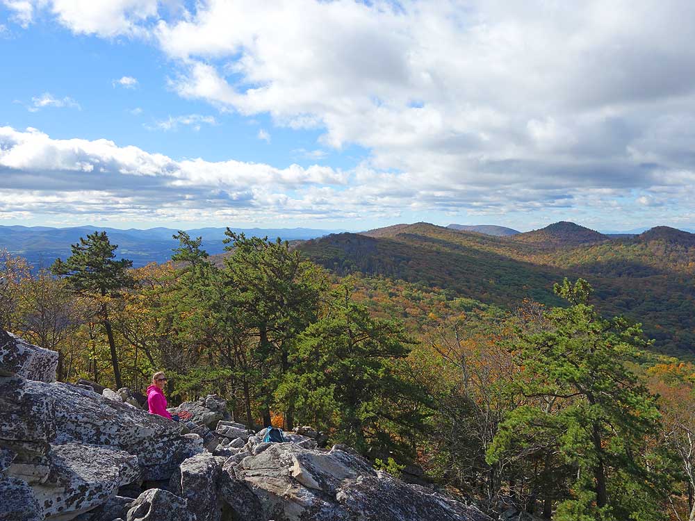
We decided to avoid the crowds at Shenandoah National Park on Columbus Day weekend, so we opted for this lesser-known GWNF hike. I was expecting more people on the trail on the knob on a warm holiday weekend, but we only saw a few groups along the way. Overall a fairly easy to moderate hike up to the Gap Creek Trail, then a fun rock scramble to the top of Duncan Knob.
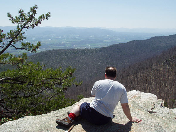
There is no set route up the knob, so we decided to go slightly to the left and straight up the rocks. On the way down, we opted for a more gradual descent on the shoulder. The views up top are great and would be even better when the leaves are off the trees. If you're planning to camp up there, make sure to bring plenty of water. We had attempted an overnight on the nearby Scothorn Gap Trail along the stream, but it was bone dry in July.
By:Derek Knight
Rating:
Date of Hike: Saturday, March 24, 2018
Bottom line: Great hike but watch out for road closures! Also, the boulder rock scramble is fantastic but very perilous in the snow.
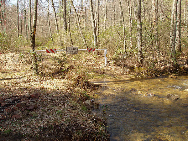
We planned on parking at the Gap Creek Parking Area and hiking around the loop. However the Crisman Hollow Road was CLOSED near the intersection of Camp Roosevelt Road, about 3 miles or so from Gap Creek Parking Area. We figured there was also no way to get to the Scothorn Gap trail head without going all the way around to 211 and who knows if Crisman would be closed off from that direction too. So, we called an audible, took a right on 675, and parked at the Stephens Trail Parking area. We took the Massanutten Trail SouthWest about 3 1/2 miles until taking a right on Gap Creek Trail towards Duncan Knob. Printing out the map from this site ahead of time was a lifesaver since we didn't have any cell signal.
Like another reviewer, we walked right past the Duncan Knob trail, even while we were looking for it. The white marker is rubbed off and the snow on the ground didn't help. However, you can avoid our error by getting to the top of the ridge - in the saddle - and looking to the right. (If you start going downhill for a while, you've missed it!) From that saddle area, you don't really need to find the exact trail. Even if you just bushwacked it from there up towards the top, you could get there just fine.
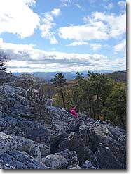
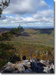
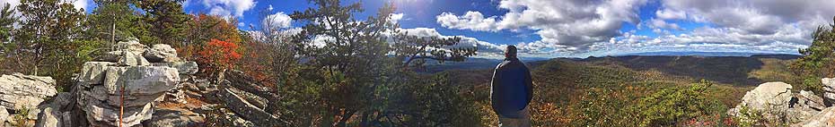
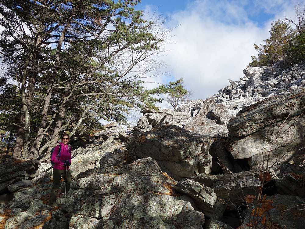
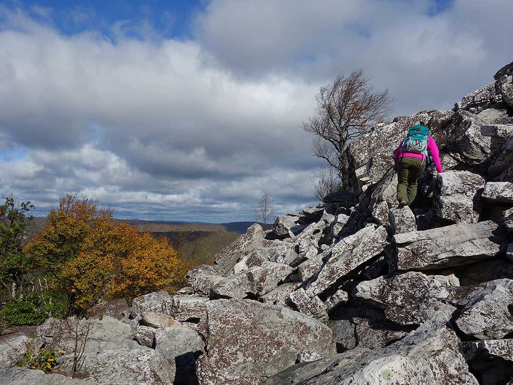
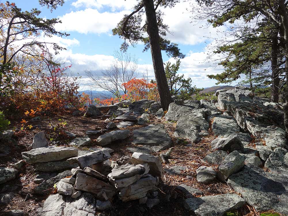
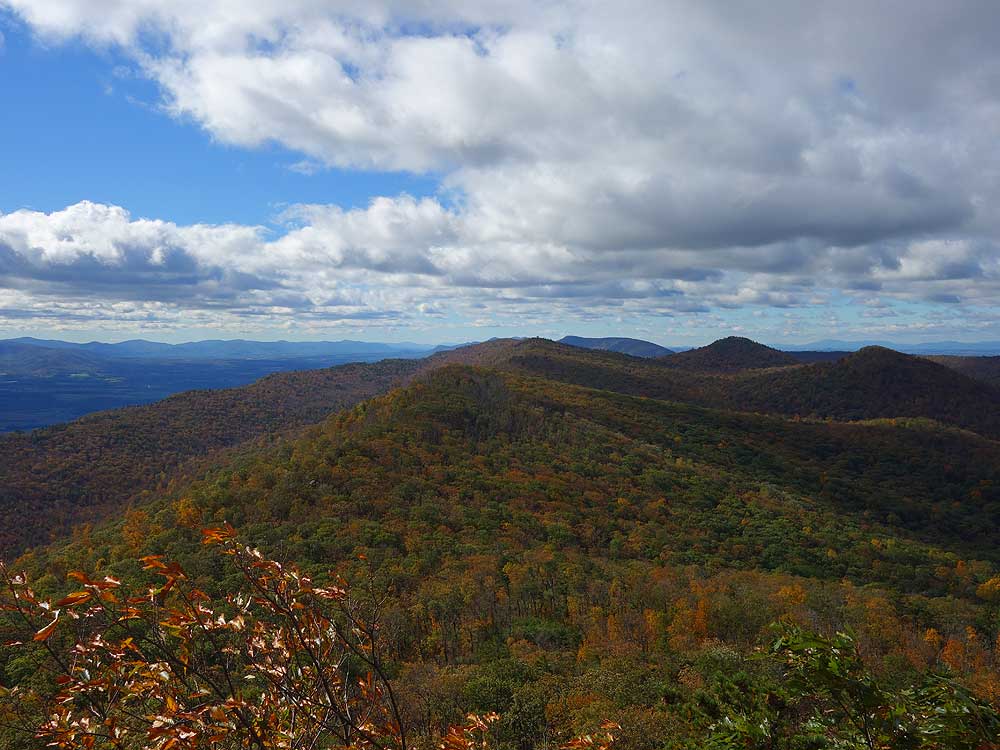
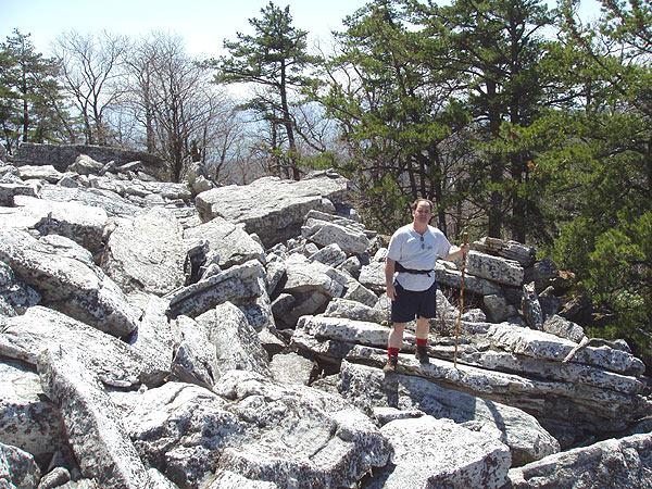
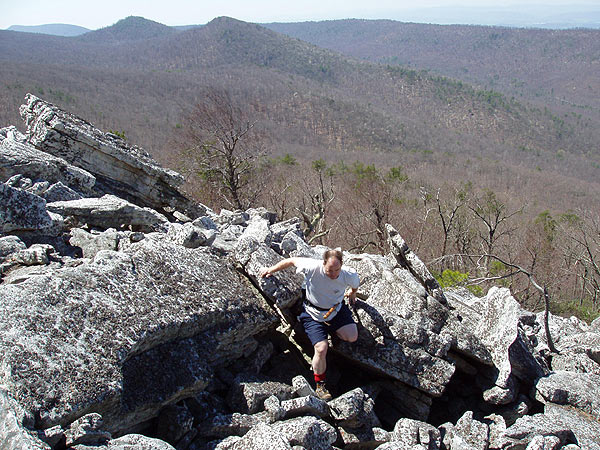
Once you get to the boulder field, following the little cairns (stacked piles of rocks) was really fun. The rock scramble to the top is great, although is was very treacherous in the snow. You couldn't see where holes were between rocks and everything was slippery. However, once we inched our way to the top, the views were really beautiful. Going in the winter meant a more expansive view without leaves blocking it.
We hiked back the way we came. If you don't miss the Duncan Knob trail like we did, the there and back distance was 9.4 miles.
By:Hans und Heidi
Rating:
Date of Hike: Sunday, May 14, 2017
Will someone please bring a can of white paint out to mark the trail to the summit? Or do the Boy Scouts do that? The white blazes are faded out. We almost missed this trail. When the blue trail is at the crest of the saddle, that is where the skinny White spur trail is. There are no blazes in sight and we walked right past it, and a runner came up behind and missed also. We doubled back before we went downhill very far. At the boulders we scrambled way to the left. It was not as steep and there was a view that otherwise one would miss if they went straight up the rocks.
It was a nice hike. The views should be great in the winter. We hiked on a blue-sky day just after 3 days of rain. The yellow trail downhill was like walking a flowing creek bed, and it was quite muddy on all the segments, but navigable.
I give it , on this day, 3 stars over all, 4 for difficulty, 5 for streams that otherwise are not there, 3 for views. We will come back here in the winter, for sure.
Peace,
H und H
By:Bryan
Rating:
Date of Hike: Saturday, October 29, 2016
Gorgeous Fall day to hike this trail. The drive from Vienna Metro Station via I-66 and down I-81 was a breeze. Navigating route 211 through New Market, VA was easy as well. However, when going up the hill, the sign for Crisman Hollow Road on the left side of the road is a "blink and you'll miss it" entry point. Once driving onto Crisman Hollow Road, it is winding and paved road for a mile and a half before turning into a dirt road. The road itself is barely large enough for 2 cars so be cautious when driving on the road.
The Scothorn Gap Parking Area holds up to 10 cars and the lot was full by the time we arrived, so we parked on the side of the road and took our chances that no one would hit my car. We followed the trail in accordance to the HikingUpward map. The incline 20-minutes into the hike (on the first segment of the Scothorn Gap Trail) was slightly challenging as it rarely plateaued enough to catch your breath. The second segment of Scothorn Gap Trail up until the Gap Creek Trail was much more manageable. The incline from the start of the Gap Creek Trail to the Duncan Knob Summit was fun, but the real test came when finagling through the lengthy rock scramble. Believe me, the rock scramble got more challenging as the elevation progressed. I highly recommend going slow over the boulders. The view from the rock outcrop at the summit was breathtaking.
The downhill portion of the Gap Creek Trail, containing a few switchbacks, could be a little claustrophobic as misplaced footing could lead to tumbling down the mountainside. The Massanutten Trail offers some incline and flat sections, plus there is a brief switchback as you get closer back to the Scothorn Gap Trail.
Overall, this is a great hike. Perfect for a dry Fall day. I would avoid this hike if it going to rain as the rocks will be rather slippery. Not sure if this hike is a good hike to do in the Spring or Summer given that the trails are narrow and hikers could easily come into contact with ticks.
By:Jimmy
Rating:
Date of Hike: Saturday, June 25, 2016
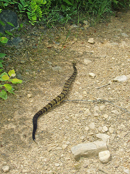
Originally planned to hike out the Scothorn Gap trail and up the blue Gap Creek to camp out on the ridge just below Duncan Knob. I've hiked the Duncan Knob Hollow trail loop previously in the winter and it's great, but this is a muddy boggy mess in the spring/summer. The initial ascent was very wet and you'll be taking your shoes off to cross Passage Creek. Lots of ticks on the way up to the the first four way intersection, so bring bug spray and/or wear pants tucked into socks.
Started down the Scothorn Gap trail after the four way intersection and ended up turning around due to the amount of water on the path. At least 6-7 inches in some areas that are unavoidable. Luckily I knew that there are a couple camping spots out on Strickler Knob, so we turned around and hiked up the Massanutten trail taking the red/pink knob trail on top of the ridge. Overall it ended up being a great overnight trip and we got a great campsite with an amazing view of the Shenandoah River Valley.
I won't be back out here anytime soon. This is certainly a 4-5 star trail in the fall/winter, but i'd avoid in spring/summer. Especially with all the recent rain.
By:yoshi
Rating:
Date of Hike: Saturday, June 18, 2016
Duncan knob is really nice. Climbing up rocks was fun. But there were many ticks, my wife and I found 14 ticks during hiking. We had to check often and we always found a couple ticks. Also there were a lot of muddy places.


