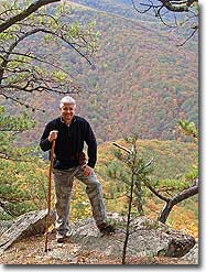
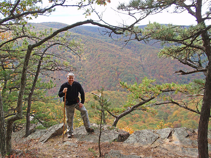
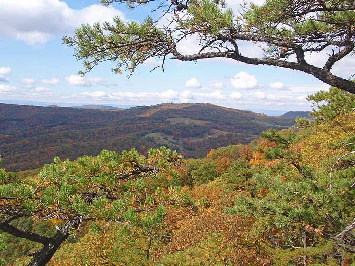
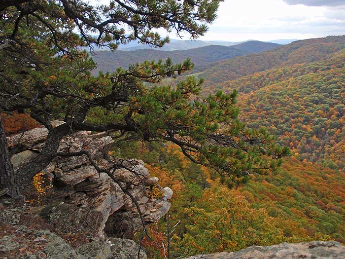
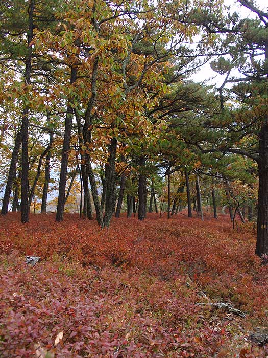
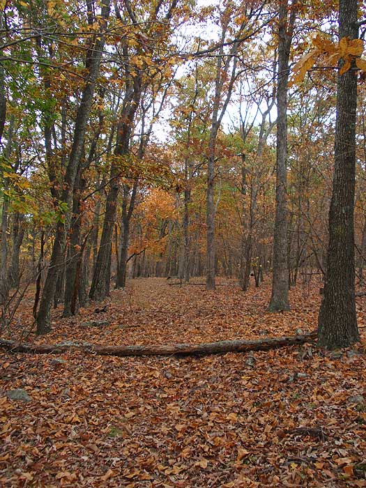
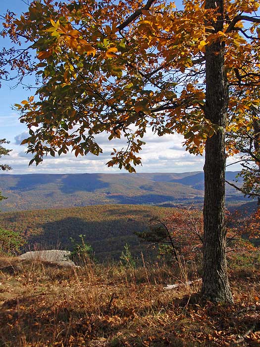
West Virginia, renowned for its state park system, has another hidden gem in the Lost River State Park. The Cranny Crow/Big Ridge hike is a combination of a loop and out/back. With Cranny Crow, Cheeks Rock, and the Big Ridge vistas, as well as the ridge meadow, this hike has beautiful scenery around every corner in its trail system.
Note: As of October 2008 the blazes on several of the trails have become faded.
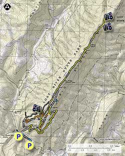
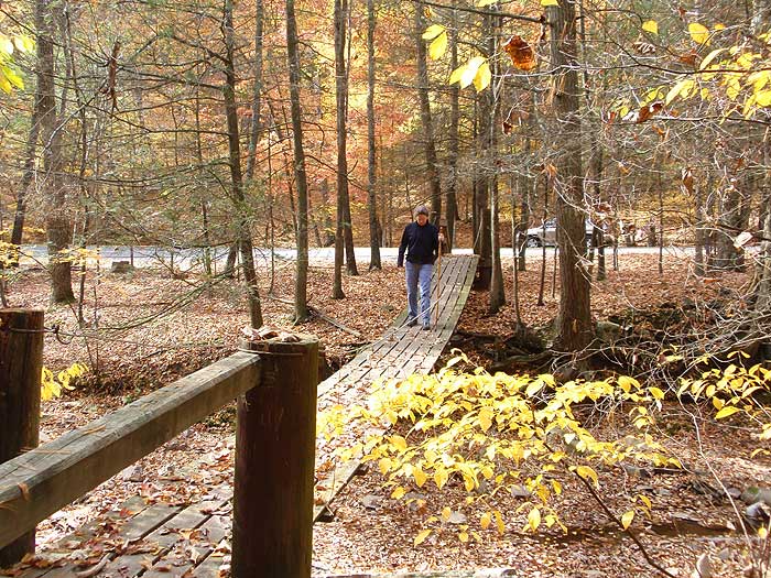
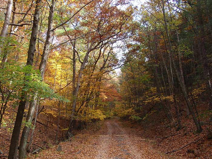
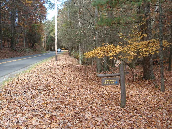
From the lower parking area at the Howard's Lick trailhead, cross the small suspension bridge and follow the blue blazed Howard's Lick trail 0.3 miles to the intersection of the state park service road and footbridge to the upper parking area. Turn right up the unblazed service road for 0.2 miles to the intersection of the Big Ridge Trail. Continue following the service road as it makes a sharp left continuing for another 0.5 miles to the intersection of the orange blazed White Oak Trail.
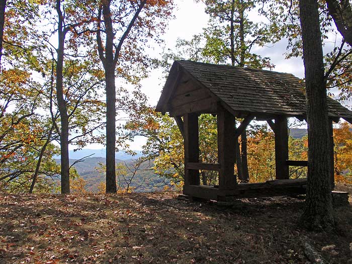
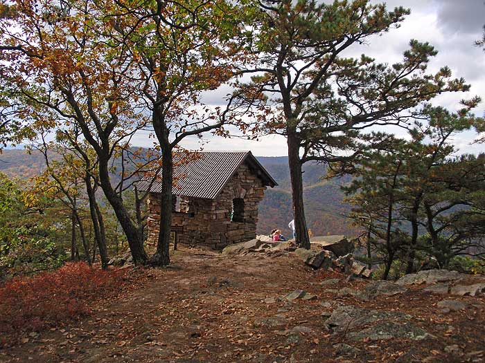
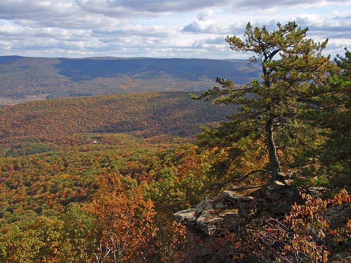
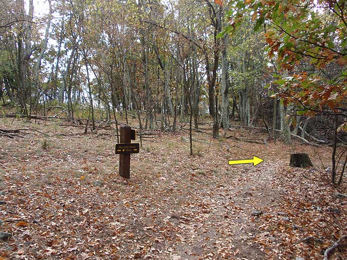
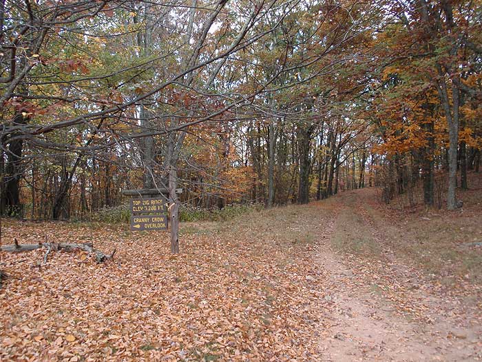
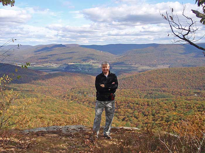
Turn right on the White Oak Trail as it continues to climb Big Ridge, then in 0.3 miles passes a small shelter and overlook. From here, the White Oak Trail will make several switchbacks before ending at the junction of the Millers Rock Trail and ridge. Turn right on the yellow blazed Millers Rock Trail, and arrive at Cranny Crow overlook in 200 yards.
Continue down the Millers Rock Trail, and pass several more overlooks of Lost River State Park, including Cheeks Rocks, before reaching the intersection of the orange blazed Virginia View Trail in another 0.3 miles.
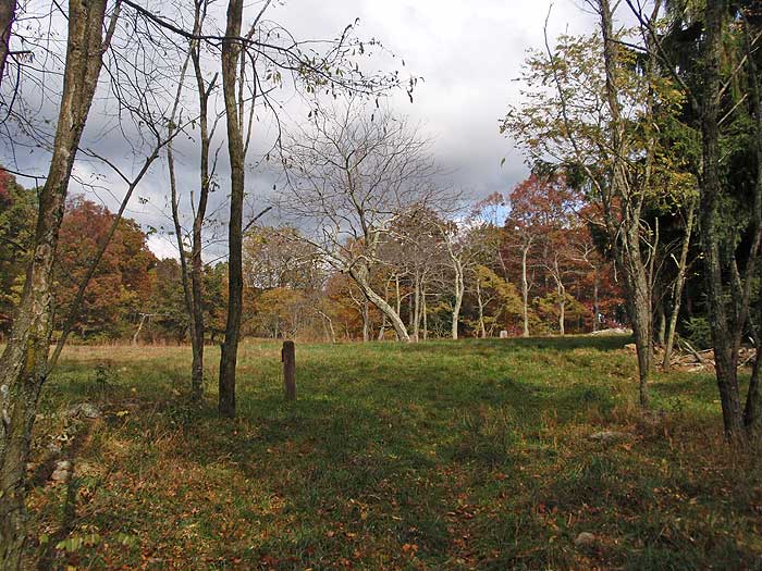
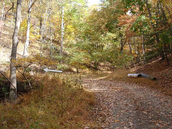
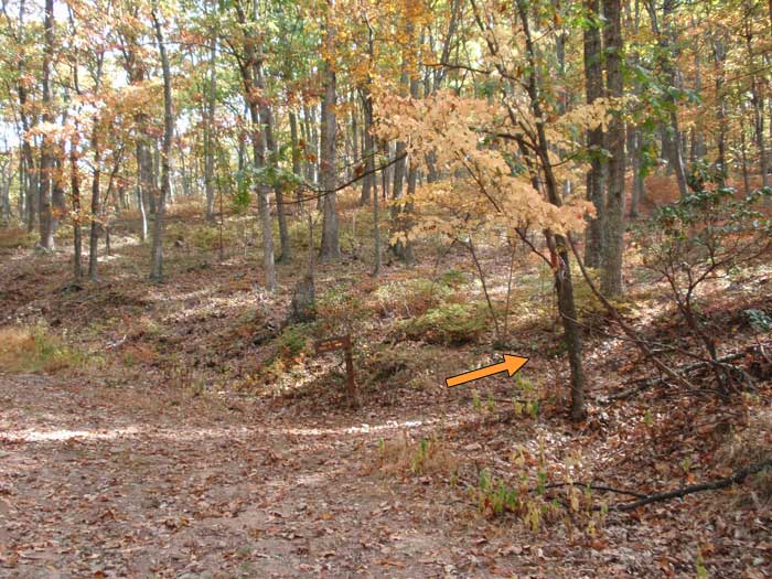
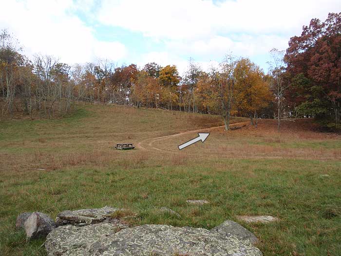
Turn left on the Virginia View Trail for 0.6 miles to the junction of the yellow blazed Big Ridge Trail. Turn left uphill for 0.1 miles to the high meadow, large shelter, and intersection of the service road. Stay left on the service road and just after exiting the meadow pass the yellow blazed Millers Rock Trail that leads back down to the Cranny Crow Overlook. Continue downhill on the service road, and in 75 yards turn right on the continuation of the yellow blazed Millers Rock Trail.
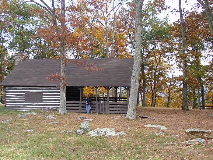
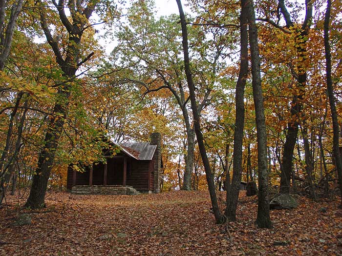
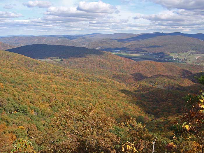
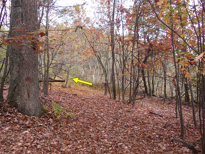
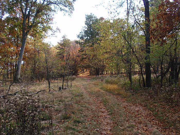
From this point, the Millers Rock Trail will continue north along the ridge before rejoining the service road in 0.4 miles. Continue north on the service road and pass the old Big Ridge lookout tower, and caretakers cabin in 0.4 miles. From this point the Millers Rock Trail begins to descend along the ridge for 2.2 miles to first main vista to the east and south. Follow the trail another 0.1 miles to the main Big Ridge overlook.
Retrace the route back on the Millers Rock Trail past the lookout tower to the intersection where the Millers Rock Trail splits right, and the service road descends to the left. Follow the unblazed service road for 0.3 miles where the trail will pass a blue blazed trail leading to a spring. Just after passing the spring trail, the service road will enter the meadow and pass an old homestead. Continue through the meadow then start back down the yellow blazed Big Ridge Trail you ascended earlier.
In 0.1 miles pass the Virginia View Trail. Continue downhill on the Big Ridge Trail as it initially heads north, then makes a switchback back to the south. The Big Ridge Trail will continue for 1.7 miles where it ends at the service road you ascended earlier. Head down the service road for 0.2 miles to the upper parking area, then turn left back down the blue blazed Howard's Lick Trail to the lower parking area.
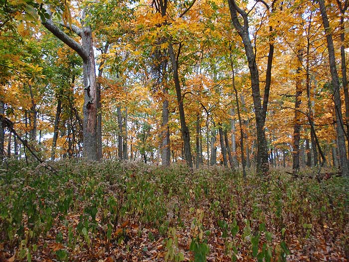
Mid October
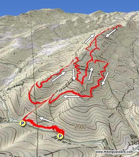
Cranny Crow/Big Ridge
Cranny Crow/Big Ridge Hike Comments
Archived Comments
By:Ed Matthews
Rating:
Date of Hike: Sunday, February 5, 2017
Let's just keep this hike a secret, eh? What a spectacular hike! We've definitely put this one on the list to re-hike in the summer when we can do a little post-hike cool off in Howard's Lick Run.
On Super Bowl Sunday, we hiked this just as it is described here, ending up a shade over 12 miles with all our exploring about on the ridge. Park at the Howard's Lick trailhead. Do not be tempted to go to the second parking area described here just to save a little mileage, because the 0.3 miles along Howard's Lick Run is so beautiful and peaceful and the (as of this writing, brand new) suspension bridge is cool. We finished in 6 hours which left us a lot of time to explore the overlooks and to have lunch at the fire warden's cabin at the abandoned fire tower.
Views are spectacular at both ends of the ridge. The trails are well maintained and extremely well marked with relatively new plastic square and diamond blazes.
We had no issues following this hike as outlined here except that in the middle of winter, it wasn't super obvious where the trail (the service road) went through the meadow by the picnic pavilion/shelter. I'm sure in summer, the road is obvious. In any case, the road leaves left/west and straight ahead/north from the meadow. You'll head left/west out to Miller's Rock and return from the north by the old cabin. The road becomes obvious as you leave the shelter area and move to the west 75 yards.
In addition, we lost the return trail from Miller's Rock once. It was obvious we were off the trail 20 yards from the previous blaze but we couldn't find the trail for the deep and mainly undisturbed leaves so we bushwhacked to the top of the hill and after just a minute of looking, spotted blazes 30 yards to our left and 125 yards in front. Following a ridge that is 50-100 yards wide and blazed every 50 yards or so, it is impossible to get lost.
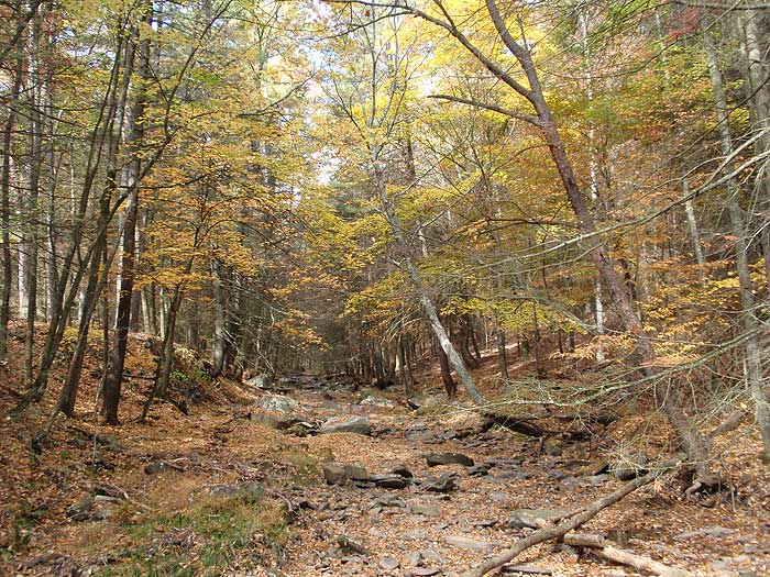
Highlights are the walk along the creek, the views from the shelter on the White Oak Trail, the climb to Cranny Crow, the phenomenal Cranny Crow overlook, the whole south end of Big Ridge, and Miller's Rock at the extreme north end of Big Ridge. Must do hike.
By:Parul
Rating:
Date of Hike: Saturday, September 24, 2016
Loved the hike! Spectacular views but without being too strenuous! I prefer solidarity and I couldn't be happier as I was pretty much the only one, enjoying a warm and breezy partly cloudy September hike. Leaves have started to fall but the fall color isnt that prominent yet. In terms of difficulty, I would give it 2 to 2.5 because the hike is fairly long but not too steep. Mostly grassy but well marked. Even though the instructions give a rough estimate of 5.5 hours plus lunch, I finished mine with lunch, within 5 hours (and I'm definitely not fast). One word of caution is definitely wear full length hiking pants and take a bug repellent with you because the trail isn't too well maintained and several patches have knee level grass and plenty of flies and mosquitoes. Some patches also had horse dung (ew!) Otherwise, I would absolutely go back especially in late October to enjoy the fall colors!
By:Alec U
Rating:
Date of Hike: Monday, June 6, 2016
Reasoning for 4 stars, other than it is the best hike I have been on in a long long time, but the trail was poorly maintained, walking through knee high grass a bushes at least a third of the way, SERIOUSLY! please Lost River State Park authories and trail crew, please please please get rid of all the discouraging knee high grass, as I did find 10 ticks on me, so cutting the grass would probably help )
other than that, one of the best hikes as I've said I've ever been on! the views aren't only incredible but relentless! everywhere you go you see beautiful views right when you hit the first overlook!
So highly recommend, quite a long hike, but SO WORTH IT!!!!
By:RedDrgn
Rating:
Date of Hike: Saturday, October 24, 2015
This was the first time my husband and I visited this park and made this hike, but it is now, definitely, one of our favorites! The views are really just spectacular, especially since we were there during peak autumn colors. Excluding Miller's Rock Trail, 90% of the trees were just glorious. Along Miller's Rock Trail, wind had stripped most of the leaves from most of the trees, though we did come across some lonely red and sugar maples in prime colors. From forested trails, to rocky outcrops and overlooks, to historical sites, to ridge lines, this hike had it all and my camera got quite a workout through the day. Plenty of wildlife to be found if you knew where to look (it was a chilly, windy day) and quite an array of flora, too! This hike looks harder on a map than it is, for its length particularly, but the difficulty rating seemed accurate. The trails were also well marked and maintained.
By:The Johnson's
Rating:
Date of Hike: Monday, April 21, 2014
I hiked Cranny Crow and Big Ridge today with my wife, and my 10 month old daughter strapped to my back. The weather was perfect. Clear skies, mid 60's at the start with temps topping out in the mid 70's. Slightly buggy, but manageable. We saw many deer while out on the trail and plenty of evidence that people bring their horses up there. For us, the solitude factor was a 6. We were truly all alone out there. The views from Cranny Crow were amazing and worth the hike alone. I really could have just sat there the rest of the day, but there's lots to see on this hike so we moved on. The only problem I have with the hike, and it's really not the hike's fault, is the difficulty rating of 3. My wife and I have hiked Elliott Knob (4), and Oak Knob (4). These hikes were tough and well deserving of the rating of 4. We have also hiked some 3's, such as Dobie Mountain, and found them quite pleasant. This hike's rating of 3, however, is very misleading. It was more on par with Elliott Knob when it comes to the "Pain" factor. Portions of this hike are very steep, rocky, and unforgiving. And the distance alone, 11.1 miles, should put this hike easily into the 4 range. Despite this, we truly enjoyed ourselves, though we were happy to be back in the car.
By:Nate
Rating:
Date of Hike: Saturday, April 19, 2014
This is overall a very nice hike with lots of pleasant views of WV and Shenandoah mountains in the distance. I accidentally did the loop portion in reverse, which seems to make things a lot more difficult. I really liked the variety of "stuff" on this trail, including the overlooks, large shelter area, ranger cabin/tower, old homestead, "natural spring" (this was actually a bit disappointing, you'll see why). Also a good amount of wildlife such as white tailed deer, red tailed hawks, crows, and we may have heard a bear shuffling around but now way to be entirely sure. Located some baby crows right on Cheeks Rocks, the crow parent was not very pleased with our presence though.
Crows in a cranny:
http://i.imgur.com/FAVtoig.jpg
By:SeriousYeti
Rating:
Date of Hike: Tuesday, October 1, 2013
Kids and dogs roaming around at the stream near the bottom near the suspension bridge. In about 1/4 mi it turned uphill and I didn't see anyone else for the rest of the day. Uphill is a slog, but not brutal or long. The trails are not clearly marked in the first 2 miles - I took the wrong one. It went uphill though, so I knew it was probably going to the same place. Once you're up, it's basically a flat to rolling well groomed trail with excellent views near the turn around.
Fire tower stairs are removed and it's from the 1930's, so it's not much of an attraction to climb as it is a landmark.
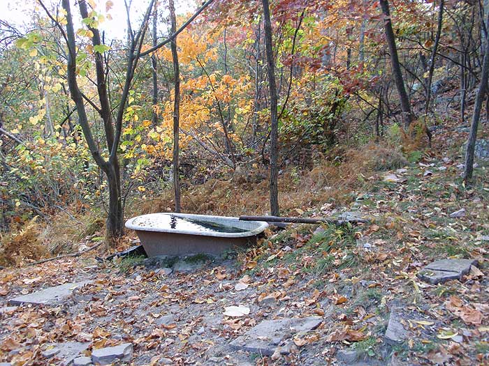
Spring flows into bathtub, where little miniature tadpoles were swimming in the green water. Very little water flow was coming out of the spring hose- it would have taken some effort and maybe 45 minutes to collect a liter from the spring hose, so you might want to bring your water up the hill with you.
Shooting activity down below, so near the fire tower, there was noise pollution from shooting - pop, pop, pop. pop, pop, pop. Sounded like they were enjoying the outdoors.
Also a lot of fresh bear scat from this point to the views/turnaround. Made me glad I wasn't camping.
Here is the kicker, once you get near the turn around, the views are amazing and there are some great level spots. Nice breeze. I'd brought some cheese, olive bread, and a pate. Perfect spot for an picnic.
Refreshed I sprinted back to the car, averaging about 3mi an hour for the hike.
By:Pete
Rating:
Date of Hike: Saturday, August 3, 2013
This hike is one of my favorite hikes. I thought I should tell everyone about a shortcut. Near the entrance to the park, on the right side as you go in there is a bridge that has been blocked off with a chain. Park across the street and cross the bridge and follow the unused service road up. When you get to where it forks (about 1/2 mile) follow the service road to the left and dont get on the trail on the right (although this is a shortcut toanother hike) continue about another 1/2 mile until you. reach the Cranny Crowe trail. Turn right and continue as normal. This has reduced my hike time. about 1/2 an hour. Be aware, though, the short cut is on a consistently steeper grade than the actual trail itself so once you get there the trail will seem really easy.
By:Goodspirit
Rating:
Date of Hike: Monday, July 29, 2013
As others say, the route up is steep, but the view at Cranny Crow overlook makes the climb worthwhile. If you are longing to fill your eyes with nearly untouched hills stretching in all directions, this is the place. It was a quiet weekday - we saw only two other hikers all day. We came down the mountain on the Virginia View trail, which I wouldn't do again it is little used and overgrown and doesn't offer much scenery. And if your knees are over 60, like mine, a hiking pole would be helpful on the descent.I suggest that you get your snacks and supplies into your daypack before you reach Mathias. Enjoy!
By:Nina F
Rating:
Date of Hike: Sunday, October 21, 2012
Great trail. Went with my non hiking but active husband and my very athletic and trail savvy dog. The trail was very dog friendly but I recommend keeping them on leash most of the time because of the cliffs along with lots of loose rocks, and slippery leaf cover. Better safe than sorry. We saw one other couple while on the trail today. Saw some deer and birds but heard lots of gun fire on the first part of our hike. The shelter area was a really nice place to stop and have lunch. It was gated so we could let our dog free while we ate with out worrying about him at all. This was a really nice hike and we would do it again.


