|
| Length |
Difficulty |
Streams |
Views |
Solitude |
Camping |
| 4.6 mls |
 |
|
 |
 |
N/A |
Hiking
Time:
Elev. Gain: |
Alum Cave Bluffs
2 hours with 20 minutes of breaks
1,160 ft |
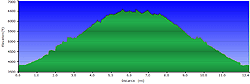
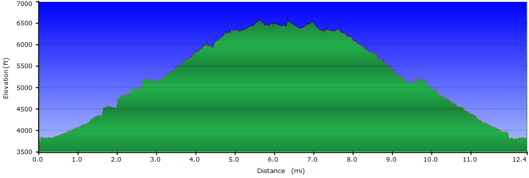
| 12.4 mls |
 |
|
 |
 |
|
Hiking
Time:
Elev. Gain:
|
Mount LeConte
7 hours with 1 hour and 30 minutes of breaks
3,753 ft
|
Links:
Resources: |
 Great Smoky Mountains National Park Great Smoky Mountains National Park
Topo Hike Trails Map (PDF)
Great Smoky Mountains National Park Map (PDF)
Gatlinburg, TN Weather Forecast
Garmin (GDB), Gaia/Trails App (GPX) (What's
this?)
3D View of Route |
 By Trail Contributor: Zach Robbins (Contact Zach) By Trail Contributor: Zach Robbins (Contact Zach)
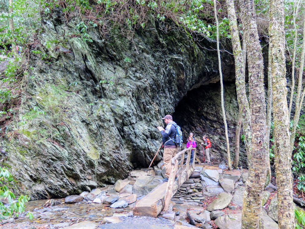
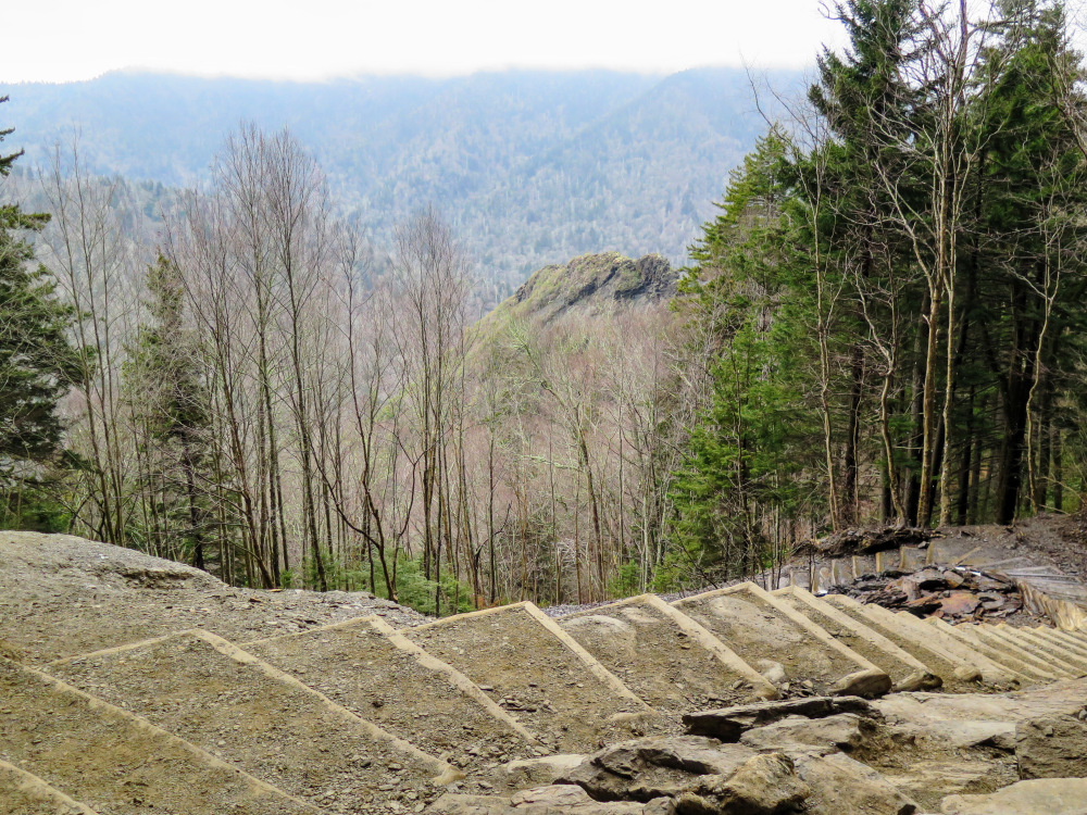
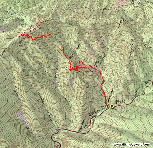
Mount LeConte is arguably the most famous mountain in Great Smoky Mountains National Park despite being the 3rd highest. The summit can be reached by five trails, none more famous than the Alum Cave Trail on U.S. 441. This is one of the most popular trails in the national park, so it is advised to arrive early no matter what time of year. The Alum Cave Trail meanders along Alum Cave Creek and Styx Branch, passing beneath Arch Rock, the first notable landmark. After leaving the branch the trail climbs to Inspiration Point with spectacular views of Chimney Tops and the peaks around Newfound Gap. Not far beyond the point are the Alum Cave Bluffs, the turnaround for many hikers. The bluffs range from 60-80 feet high, extend over 500 feet long, and completely cover the trail. In the winter the water runoff can turn into huge icicles, so watch your head. From the bluffs it is another 2.8 miles to the summit. The steady climb never gets too steep, and the views gradually pick up as you get close to the top. Mount LeConte is a huge massif, and has multiple peaks accessed by different trails. When you reach LeConte Lodge continue straight heading towards Myrtle Point, the furthest peak from the lodge. It has the best views and is less trafficked than Cliff Top. On the way back you can explore the lodge and visit the gift shop, and also hike out to see the views from Cliff Top. Although this is an extremely popular hike, you’ll feel a sense of accomplishment reaching the summit of Mount LeConte. It is a remarkable mountain on the bucket list for hikers all over the Southeast.
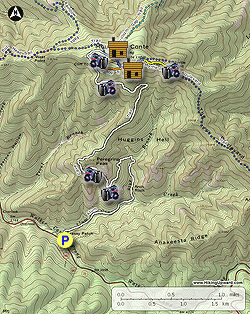
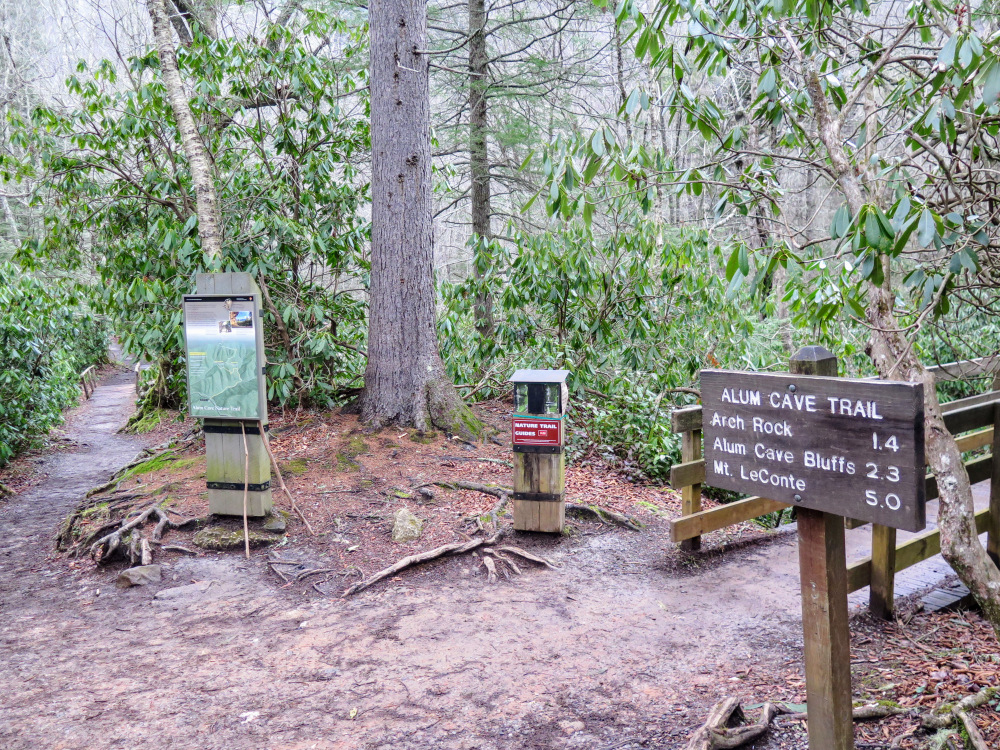
| Mile Summary and Highlights |
0.0 - Alum Cave Trail crosses Walker Camp Prong and Alum Cave Creek
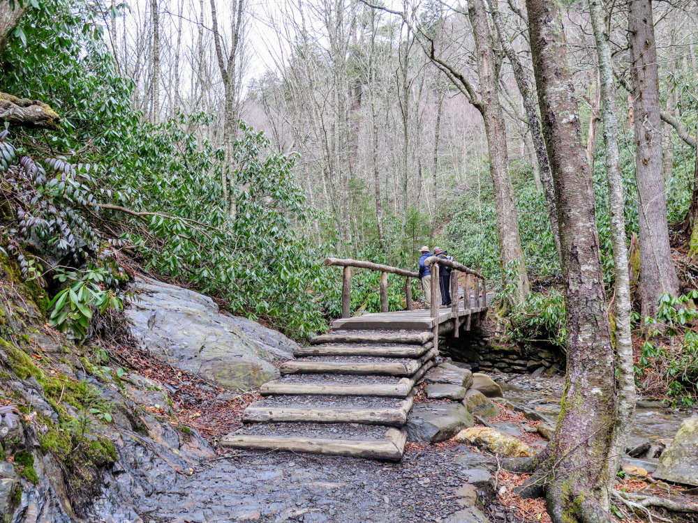
1.4 - Arch Rock stairs after third bridge over Styx Branch
2.0 - Views from Inspiration Point
2.3 - Alum Cave Bluffs soar over trail
5.2 - LeConte Lodge buildings and gift shop
5.4 - Mount LeConte Shelter for backcountry camping
5.6 - High Top - highest peak on Mount LeConte (6,593 feet)
5.8 - Myrtle Point sunrise peak with outstanding views
6.9 - Cliff Top sunset peak with views |
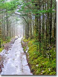
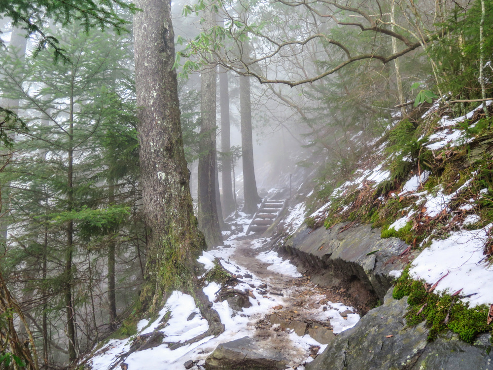
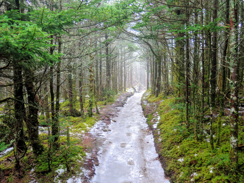
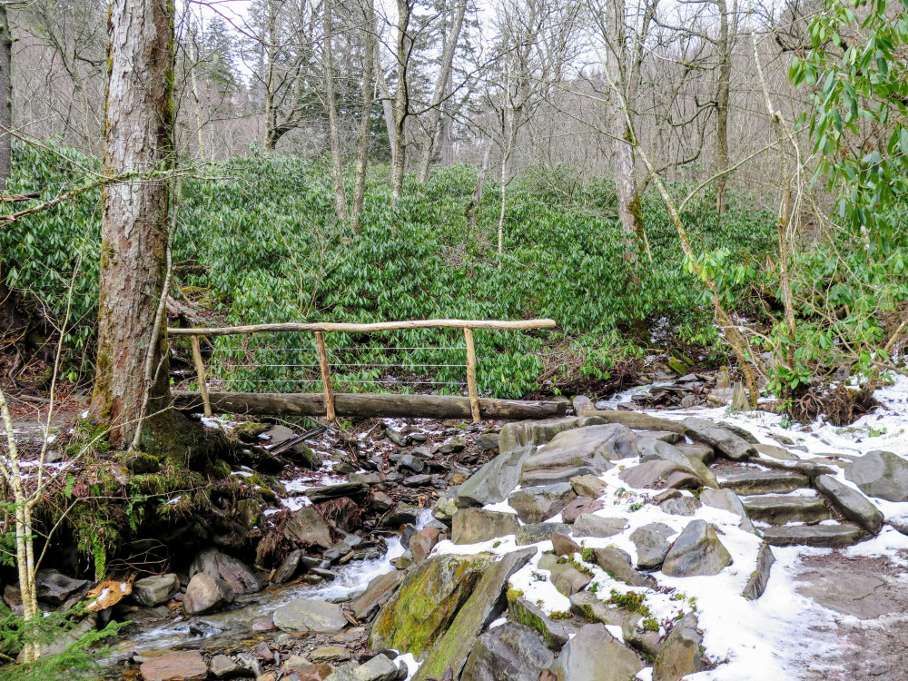
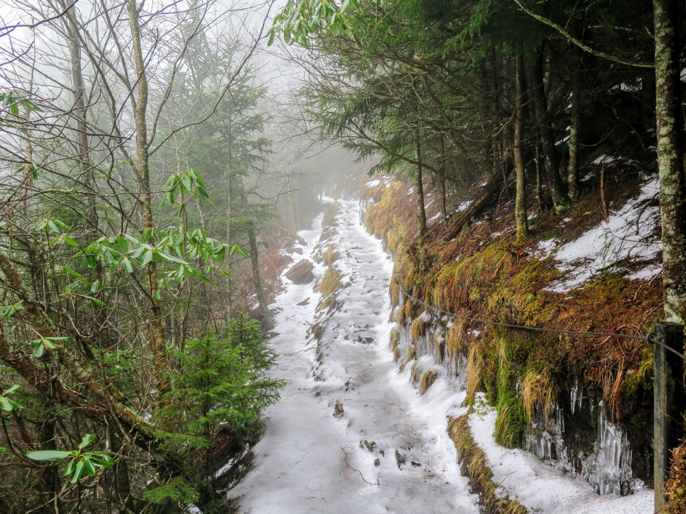
Winter Considerations – Mount LeConte is located west of the Smokies crest and often exposed to brutal winter weather. Conditions around the top of the mountain can be dangerous for unprepared hikers. The last 2 miles of the Alum Cave Trail and the summit trails will be covered in ice for most of the winter, so carrying microspikes is strongly advised. The winter caretaker of the LeConte Lodge typically posts daily updates of the localized mountain weather and trail conditions, so you should check the website before you hike.
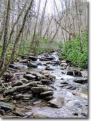
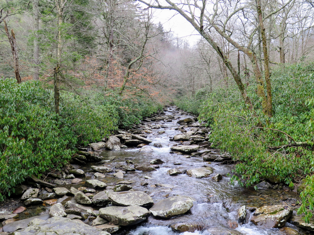
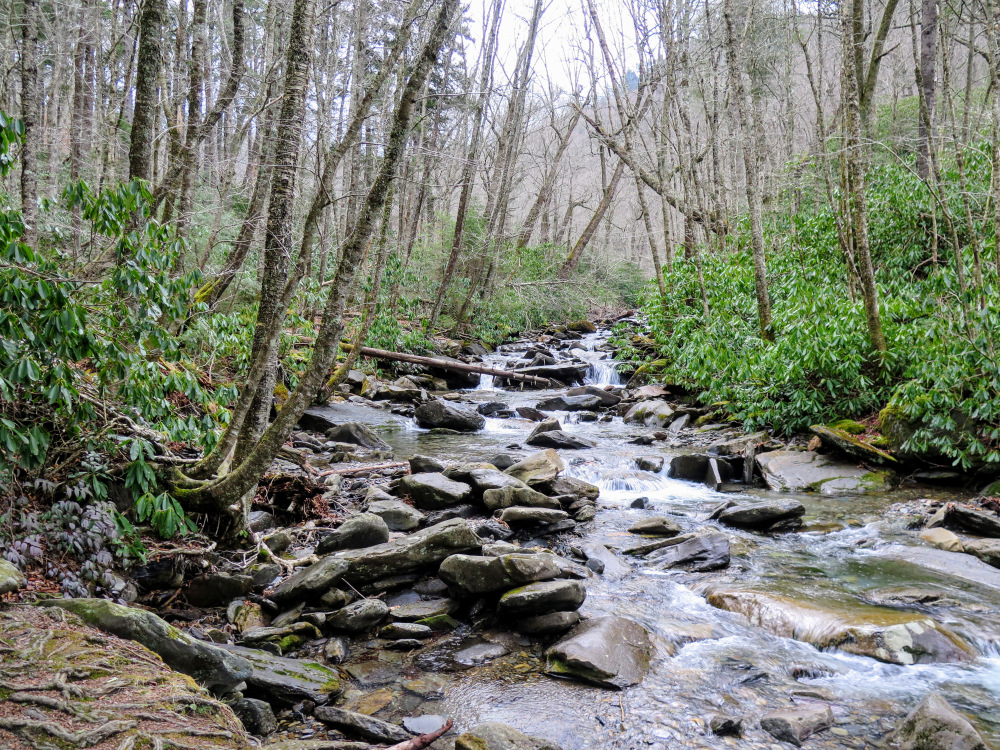
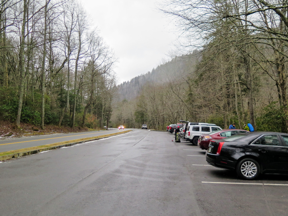
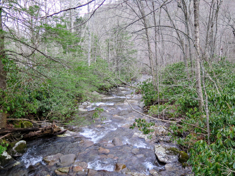
- Mile 0.0 – There are two large parking areas for the Alum Cave Trailhead, but both lots may be full on any given day of the week. This is an extremely popular hike so arrive early. The Alum Cave Trail immediately crosses a long footbridge over Walker Camp Prong. Just downstream the confluence of the prong and Alum Cave Creek forms the West Prong of the Little Pigeon River.
- Mile 0.2 – Cross a wooden bridge over Alum Cave Creek. The trail closely follows Alum Cave Creek for the next 0.8-mi.
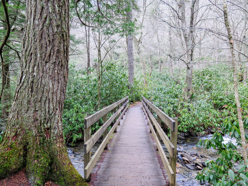
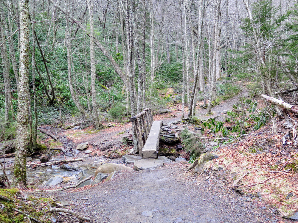
- Mile 1.15 – First crossing of Styx Branch on a wooden bridge.
- Mile 1.3 – Second crossing of Styx Branch on a wooden single-rail bridge.
- Mile 1.4 – Third crossing of Styx Branch on a wooden single-rail bridge. The trail follows stone steps under Arch Rock on the other side of the bridge.
- Mile 1.45 – Fourth crossing of Styx Branch on a wooden single-rail bridge. The trail leaves the cove named Huggins Hell and climbs towards an open ridge.
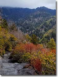
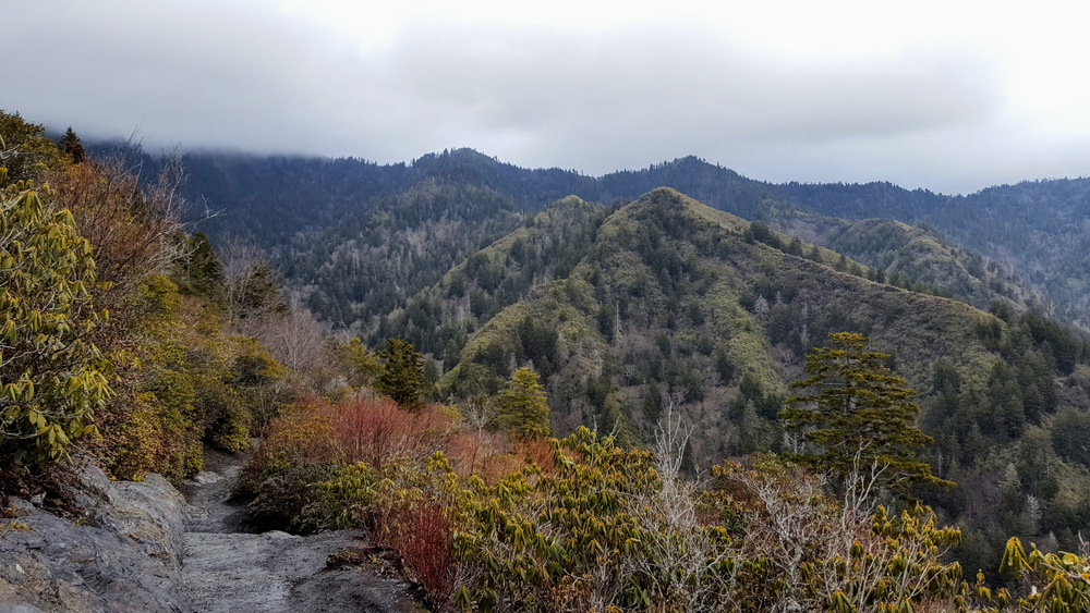
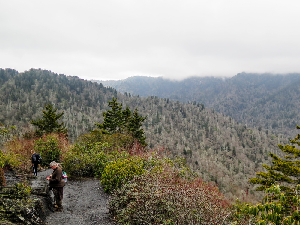
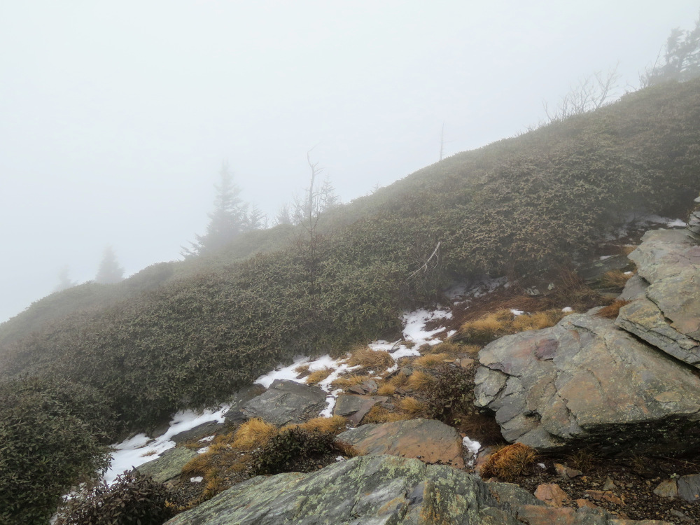
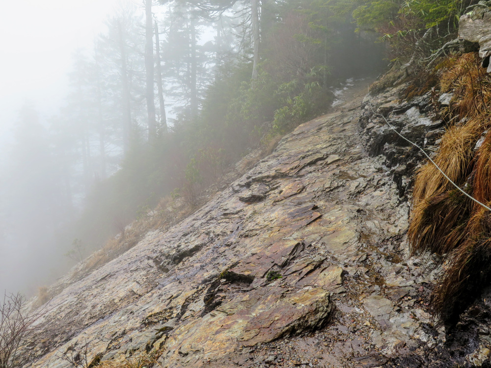
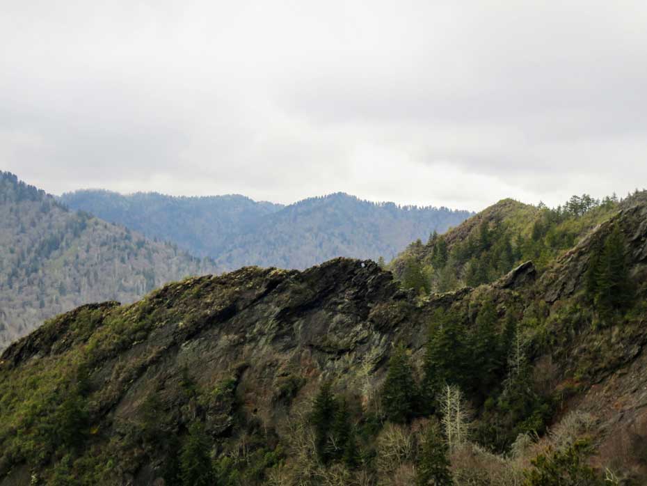
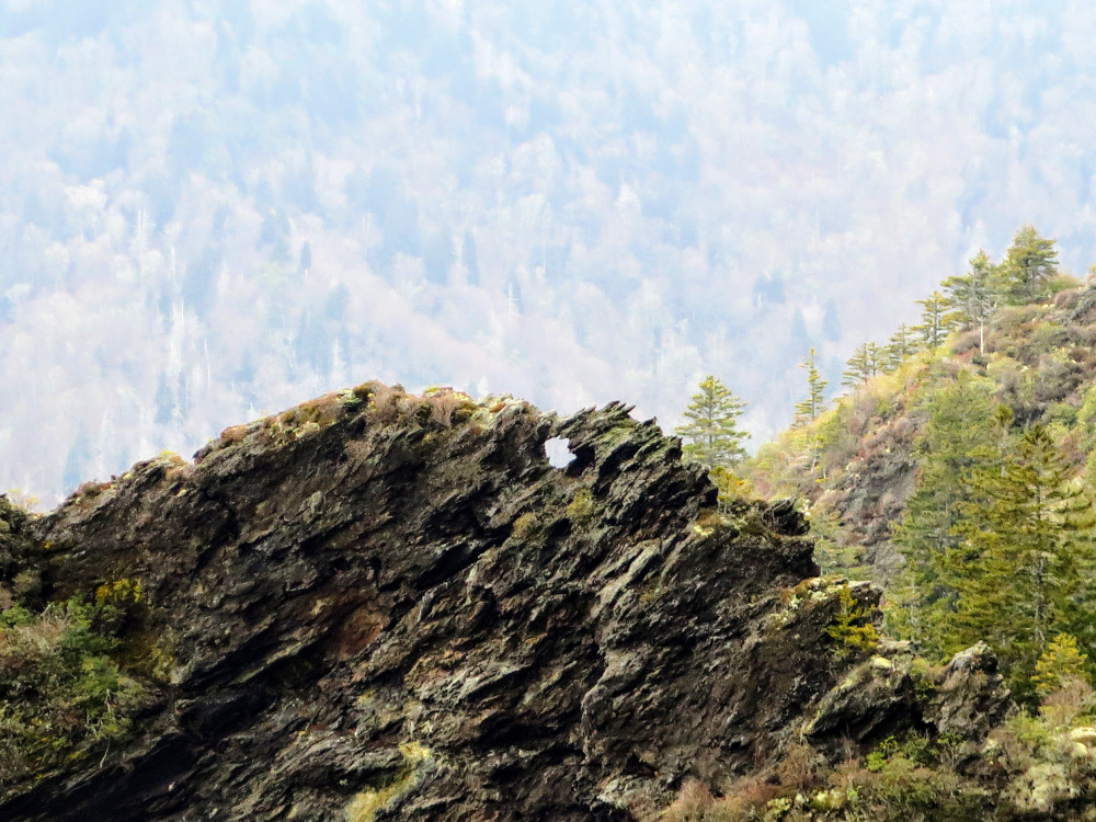
- Mile 2.0 – Make a wide right turn at Inspiration Point. Heath shrubs line the trail at this spur of Peregrine Peak. You have excellent views of the headwaters of the West Prong Little Pigeon River below Newfound Gap. As you continue beyond Inspiration Point you’ll have a great view west of precarious Little Duck Hawk Ridge. In the middle of this ridge is a small hole in the rock wall named the Eye of the Needle. This ridge is a great example of how erosion affects the slate of the localized Anakeesta Formation. This region of the Great Smokies has this particular kind of slate between 3,000-5,000 feet and you’ll see many scars and landslides on the surrounding peaks.
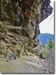
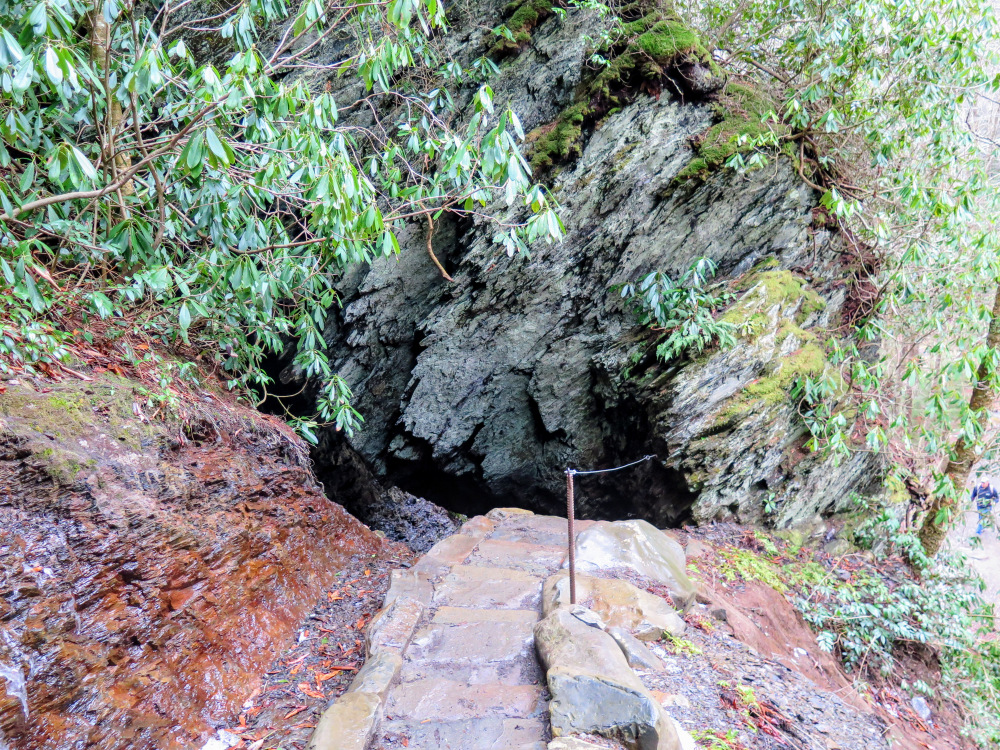
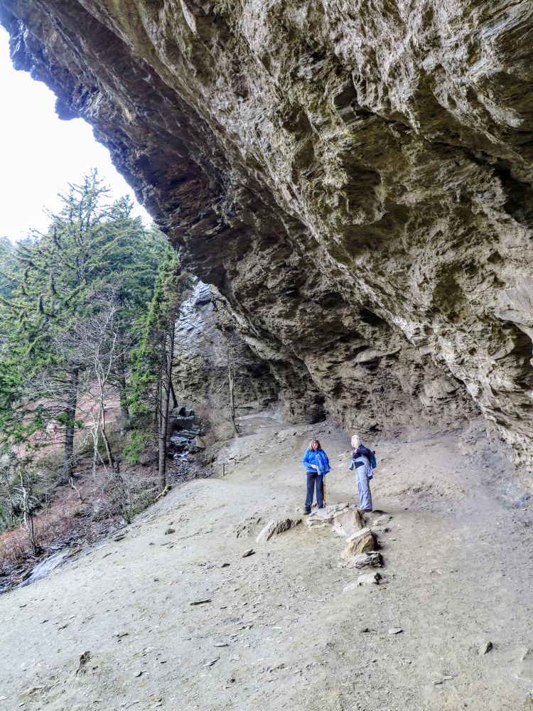
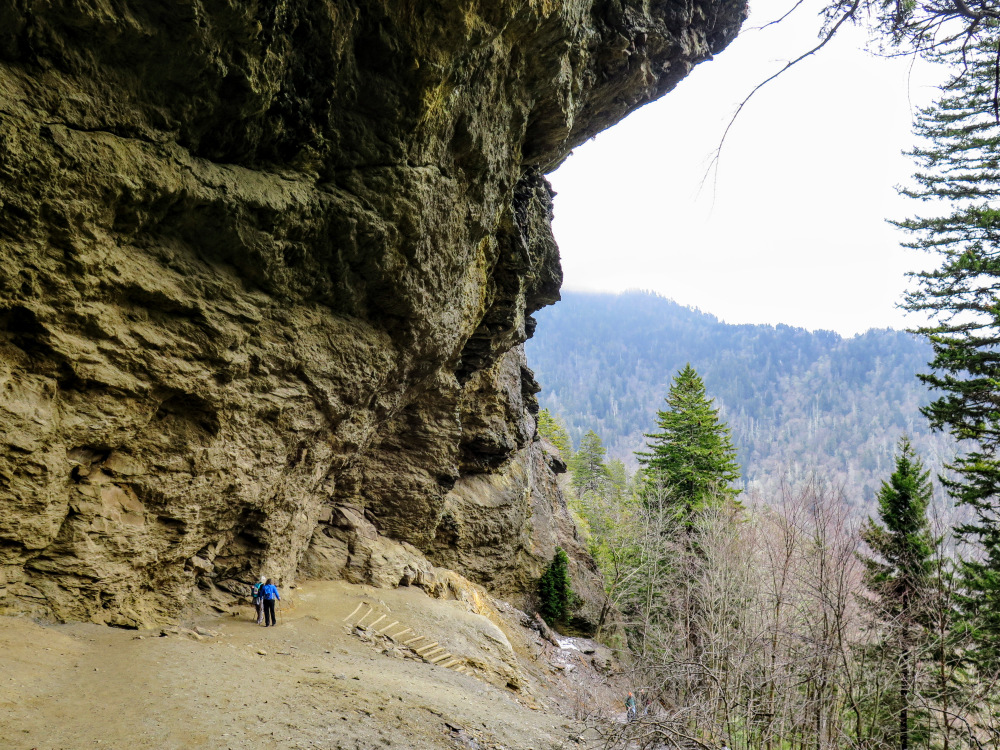
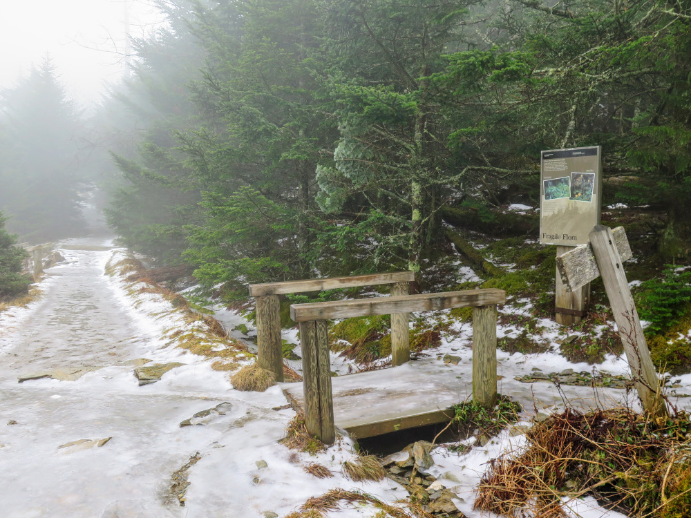
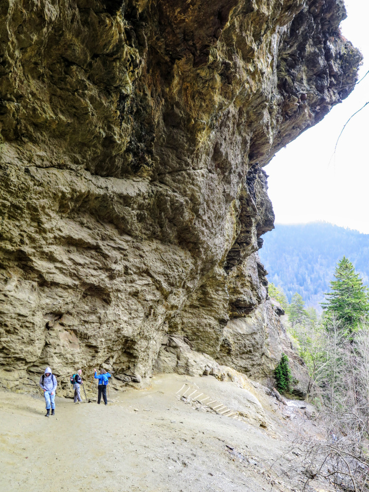
- Mile 2.3 – Reach the massive Alum Cave Bluffs. The trail closely follows the wall beneath 60-80-foot rock bluffs overhead. Epsom salt and saltpeter were mined here beginning in 1838. For many this is a common turnaround point.
For hikers going to Mount LeConte continue following the trail west. As you climb occasional steel cable handrails will line the trail on slicker rock sections. These are very useful in the winter when ice covers the trail.
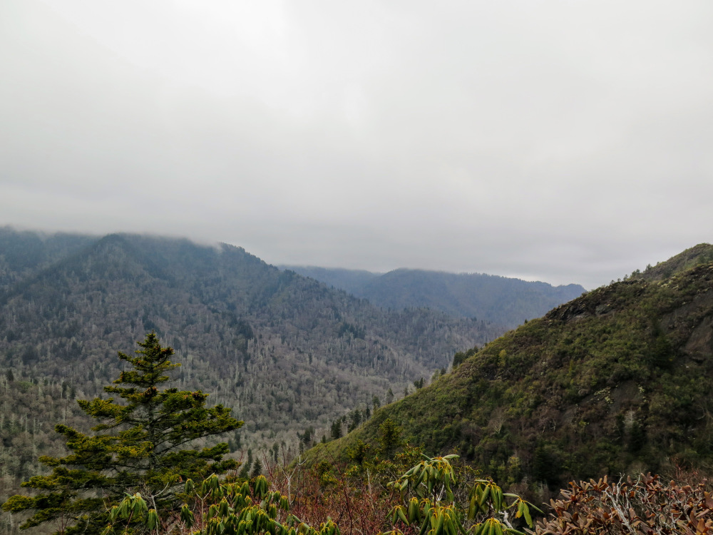
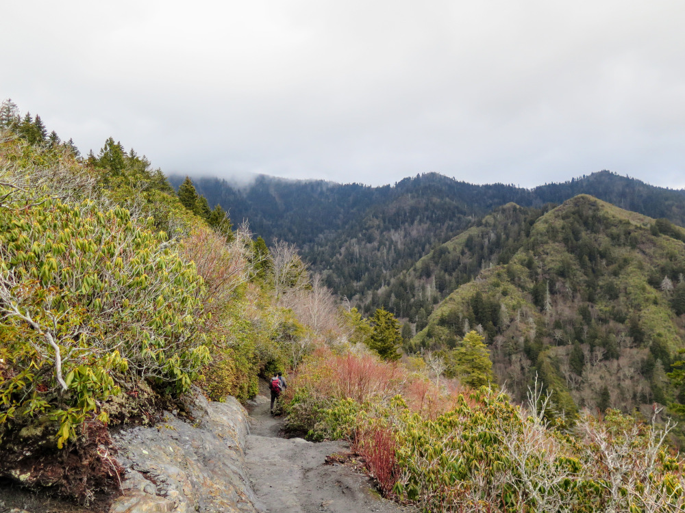
- Mile 4.3 – Cross over a landslide section with a nice view south. As you climb above 6,000 feet in elevation the fauna changes to dense southern Appalachian spruce-fir forest.
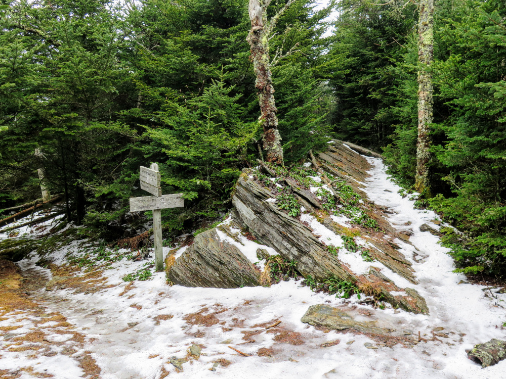
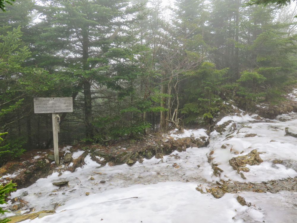
- Mile 5.1 – Y-junction with the Rainbow Falls Trail on the left. The Alum Cave Trail officially ends at this junction and you are now following the Rainbow Falls Trail east. You’ll begin seeing LeConte Lodge buildings on the left.
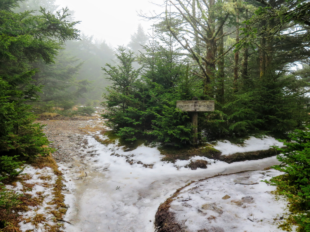
- Mile 5.2 – Cross junction with the Cliff Top Trail on the right and the main stairway to the LeConte Lodge on the left. From here you can choose which landmark you want to see first. This hike continues straight/east on the Boulevard Trail towards High Top and Myrtle Point.
- Mile 5.25 – T-junction with the Trillium Gap Trail on the left. Continue straight on the Boulevard Trail.
- Mile 5.3 – T-junction with the Cliff Top Trail on the right.
- Mile 5.4 – Above the trail to the right is the Mount LeConte Shelter in a clearing. This high elevation shelter, at 6,440 feet, is the only backcountry camping allowed for Mount LeConte if you are not staying at the lodge. The shelter requires a reservation and only fits 12 people.
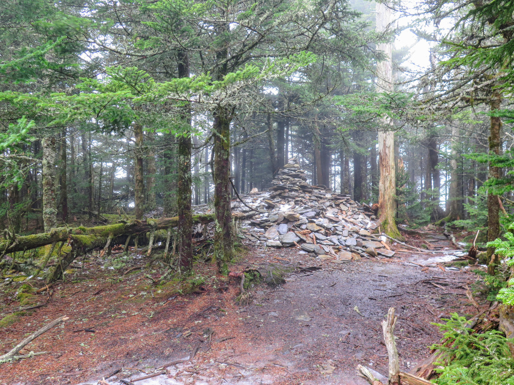
- Mile 5.6 – Pass by High Top, the highest peak on Mount LeConte at 6,593 feet. A large rock pile marks the high point. You are standing on the 3rd highest peak in the Great Smoky Mountains and the 6th highest peak in the East. There is no view from the summit, it is densely covered in southern Appalachian spruce-fir forest. Continue east on the Boulevard Trail to Myrtle Point.
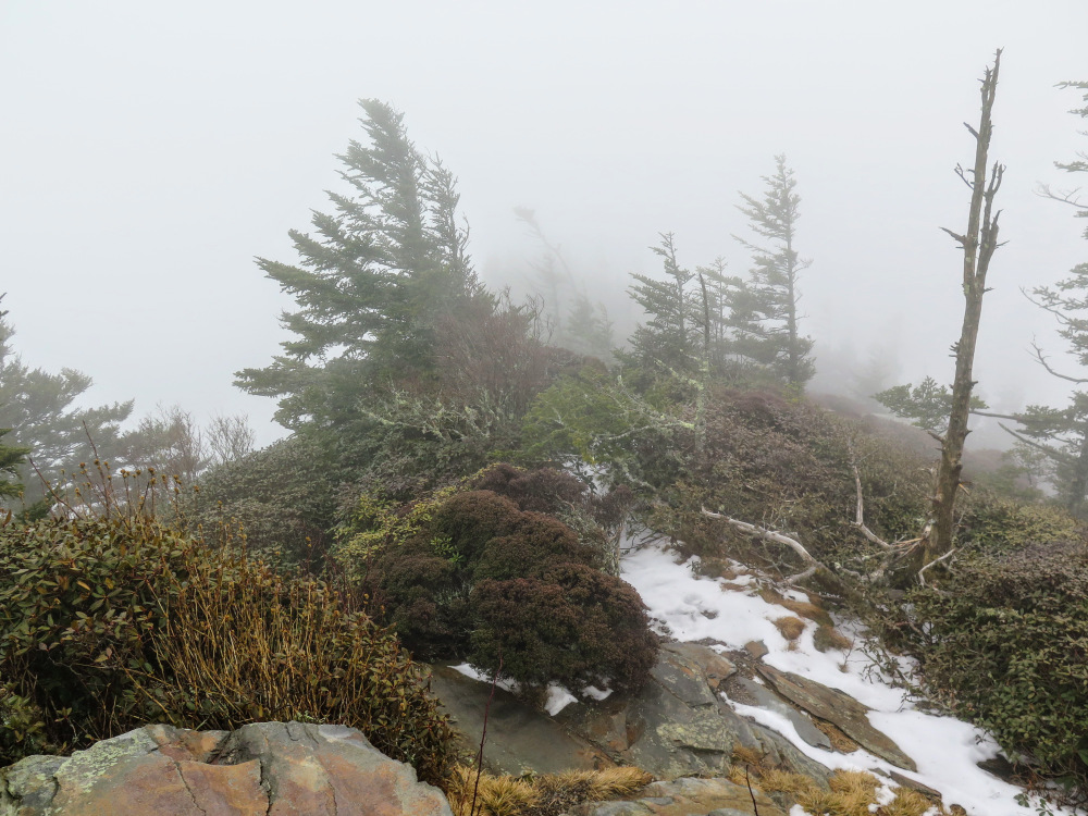
- Mile 5.75 – At a Y-junction turn right on the Myrtle Point Trail. The trail follows a narrow eastern pinnacle of Mount LeConte.
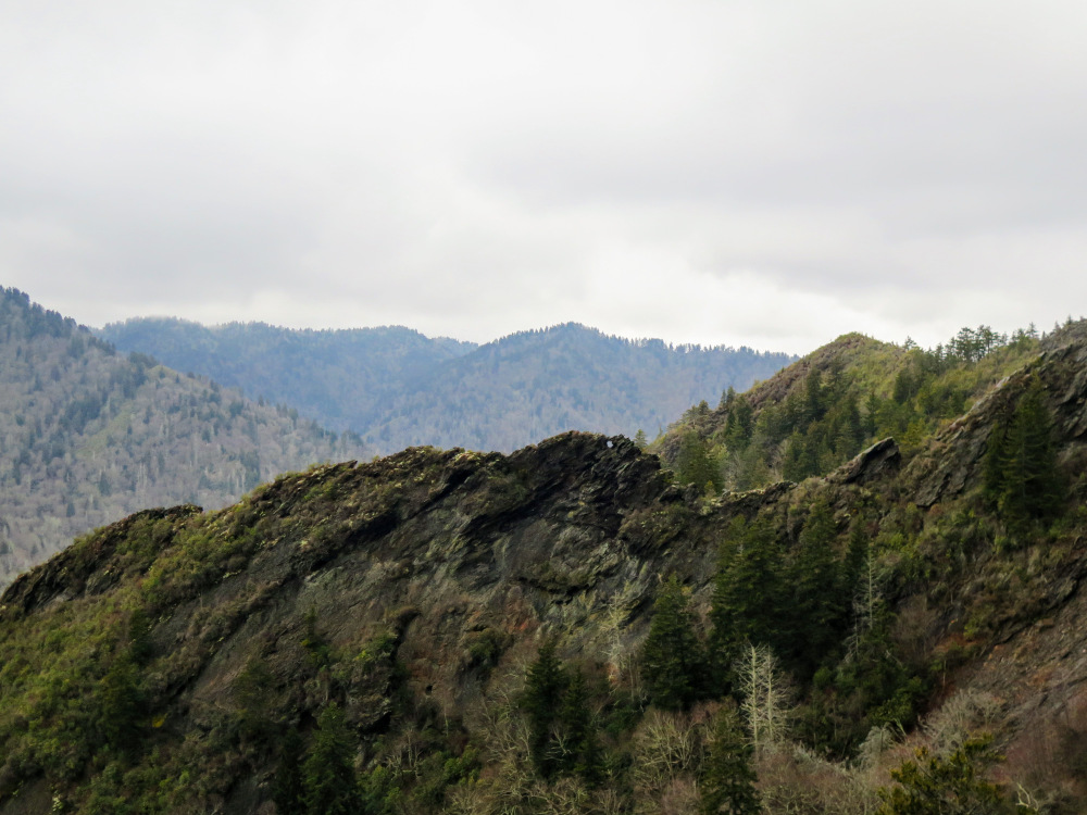
- Mile 6.0 – Trail ends at Myrtle Point (6,443 feet), the easternmost peak on Mount LeConte. From the series of outcrops you have outstanding views from north to south of the Great Smokies. Towards the northeast are the isolated 6K peaks of the northern Great Smokies. Due east are Mt. Kephart, Charlies Bunion, and The Sawteeth along the Appalachian Trail. The Anakeesta Formation is readily apparent due south towards Newfound Gap, with Clingmans Dome the massive broad peak further south.
- Mile 6.2 – Rejoin the Boulevard Trail heading west.
- Mile 6.65 – Turn left on the Cliff Top Trail.
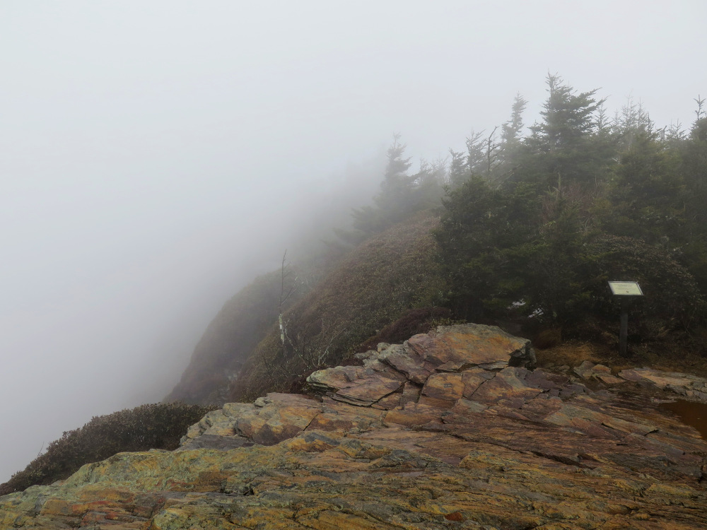
- Mile 6.9 – Reach Cliff Top (6,555 feet), the second highest peak on Mount LeConte. This is a popular sunset viewing area for overnight residents of the lodge. Do not venture west beyond the sign, it is a protected environment. The views aren’t as expansive here. Still, you have great views south of Mt. Mingus and Chimney Tops over the West Prong Little Pigeon River. Continue on the Cliff Top Trail towards the lodge.
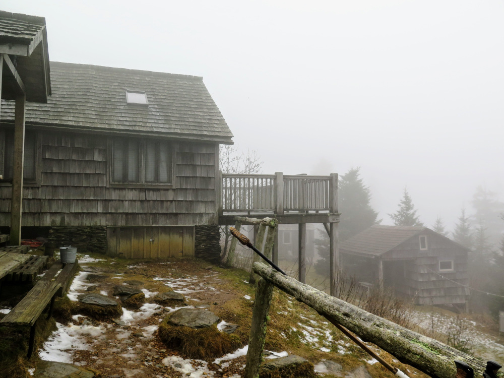
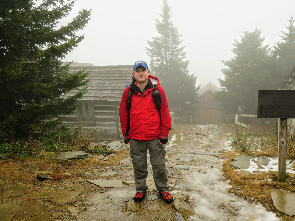
- Mile 7.15 – Cliff Top Trail ends at the four-way intersection near the lodge. To explore LeConte Lodge follow the stairs down to the main buildings. There is a good view north from the lodge, and day hikers can visit the gift shop to purchase souvenirs, food, or gear accessories. The lodge, first established in 1925 as a tent camp, predates the national park and continues to operate as a private attraction.
- Mile 7.4 – Resume your hike down the mountain following the Alum Cave Trail west from the lodge.
- Mile 12.4 – Hike ends at the Alum Cave Trailhead.
|


