|
| Length |
Difficulty |
Streams |
Views |
Solitude |
Camping |
| 4.6 mls |
 |
N/A |
N/A |
 |
N/A |
Hiking
Time:
Elev. Gain:
Links:
Resources: |
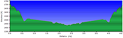
2.0 hours including breaks
470 ft
 George
Washington National Forest George
Washington National Forest
Topo Hike Trails Map (PDF)
Afton, VA Weather Forecast
Garmin (GDB), Gaia/Trails App (GPX) (What's
this?) |
 By Trail Contributor: Jeff Monroe (Email Jeff)
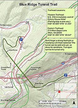
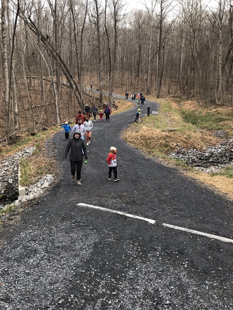
The Blue Ridge Tunnel Trail opened in November, 2020 and was an immediate hit with hikers, bikers, dog walkers and families. It offers little more than a stroll – especially if approaching from the east. But it also presents a very unique experience, that is destined to make this one of the most popular trails in Virginia. Be sure to bring a flashlight with fresh batteries.
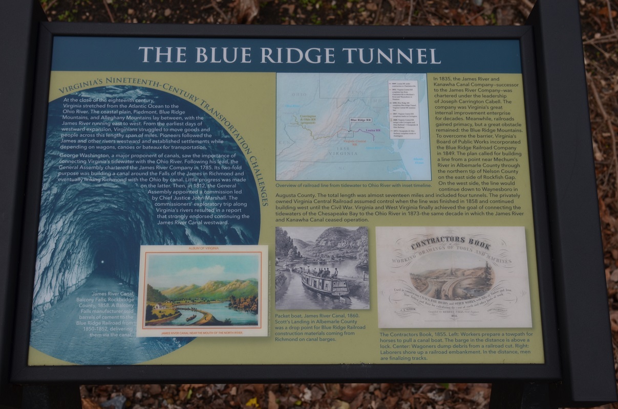
When completed in 1858 after nearly nine years of construction, the 4,273 foot Blue Ridge Tunnel was the longest tunnel in the United States. It has since been named a Historic Civil Engineering Landmark by the American Society of Civil Engineers. The chief engineer of the construction was Claudius Crozet (pronounced “Crow-say”), after whom the nearby town of Crozet was named. Prior to this trail’s completion, the tunnel had been unused since 1944, when it was replaced by a parallel tunnel that could handle increased wartime rail traffic.
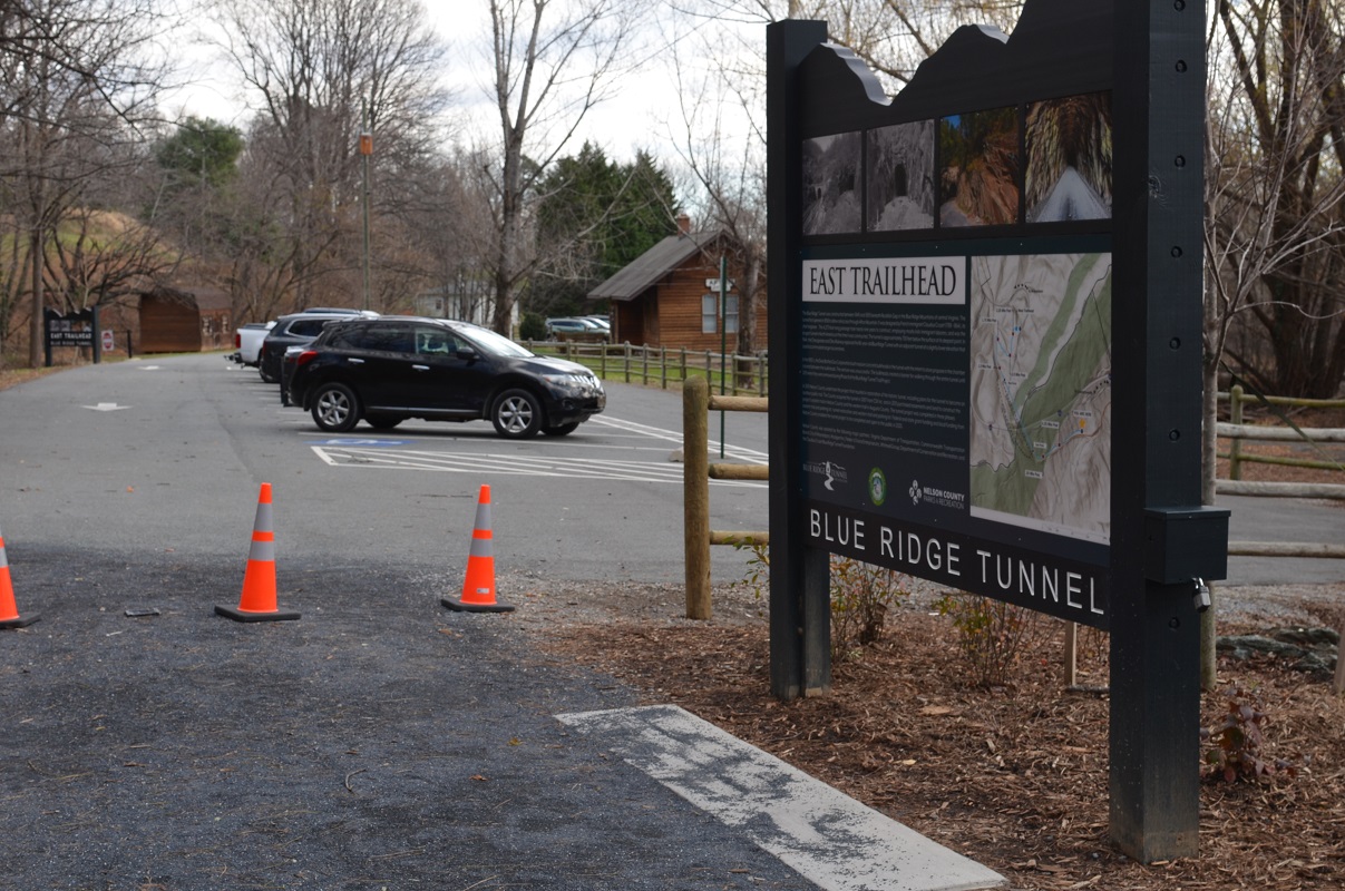
The trail has two trailheads, one on each side. The vast majority of visitors only proceed as far as the end of the tunnel before turning around. If this is your goal, the East Trailhead is closer to the tunnel and a much easier walk to the end of the tunnel (difficulty is a 1). The West Trailhead is easier to find, a longer and steeper walk. Compared with most opportunities on this website, either trailhead features a relatively easy walk.
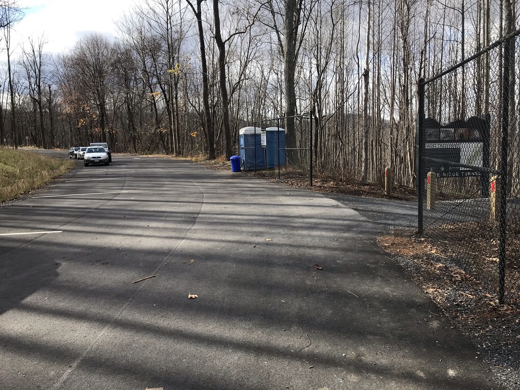
This description starts and ends at the West Trailhead, located just off of U.S. 250 between the town of Waynesboro and Rockfish Gap, where the Blue Ridge Parkway, Skyline Drive and Appalachian Trail all converge. Driving down from Exit 99 on U.S. 250, look for the entrance on your left immediately after you pass the Colony House Motel on the right. The entrance comes up fast and the parking loop is one way!
-
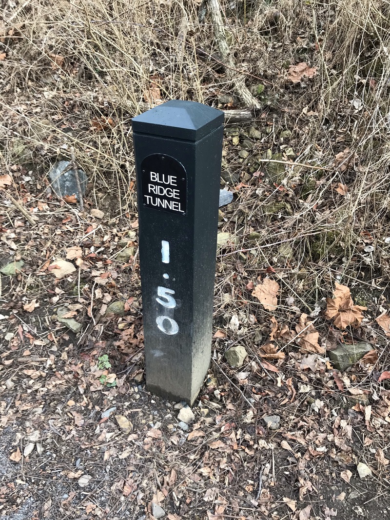
Mile 0.0 – Start the hike in a paved parking loop off of U.S. 250. There should be a porta-potty here. The trail starts downhill on a 10 foot wide trail made of crushed stone. There are multiple mileage markers along the way.
-
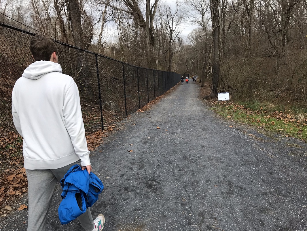
Mile 0.7 – You will encounter several short, steep ups and downs before the trail levels out parallel to the current train tracks on the other side of a large fence. The Buckingham Branch Railroad owns the active tracks, and the route serves both freight traffic and Amtrak’s Cardinal route, which runs three times a week between New York City and Chicago via Washington DC.
-
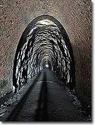
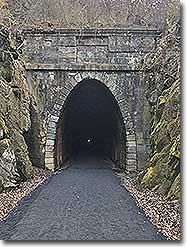
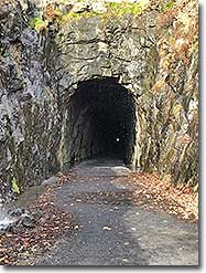
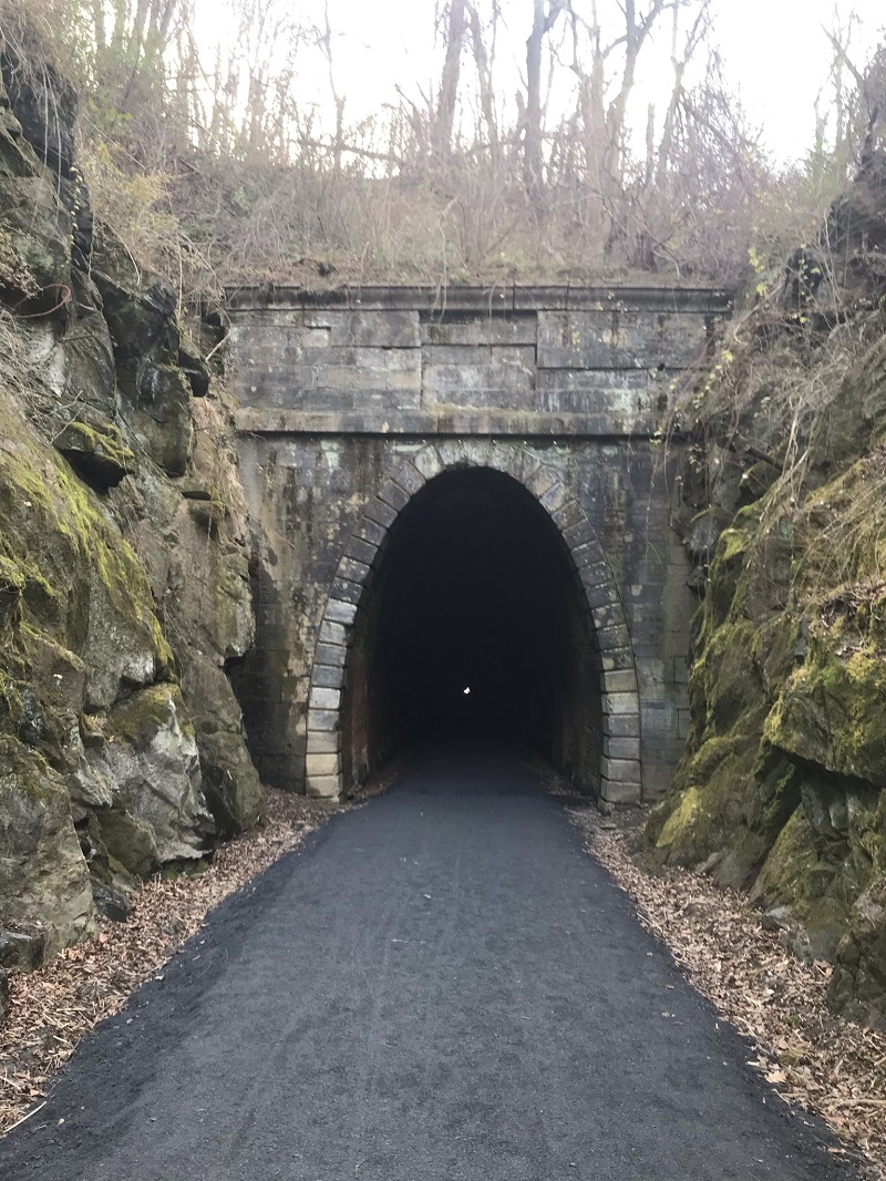
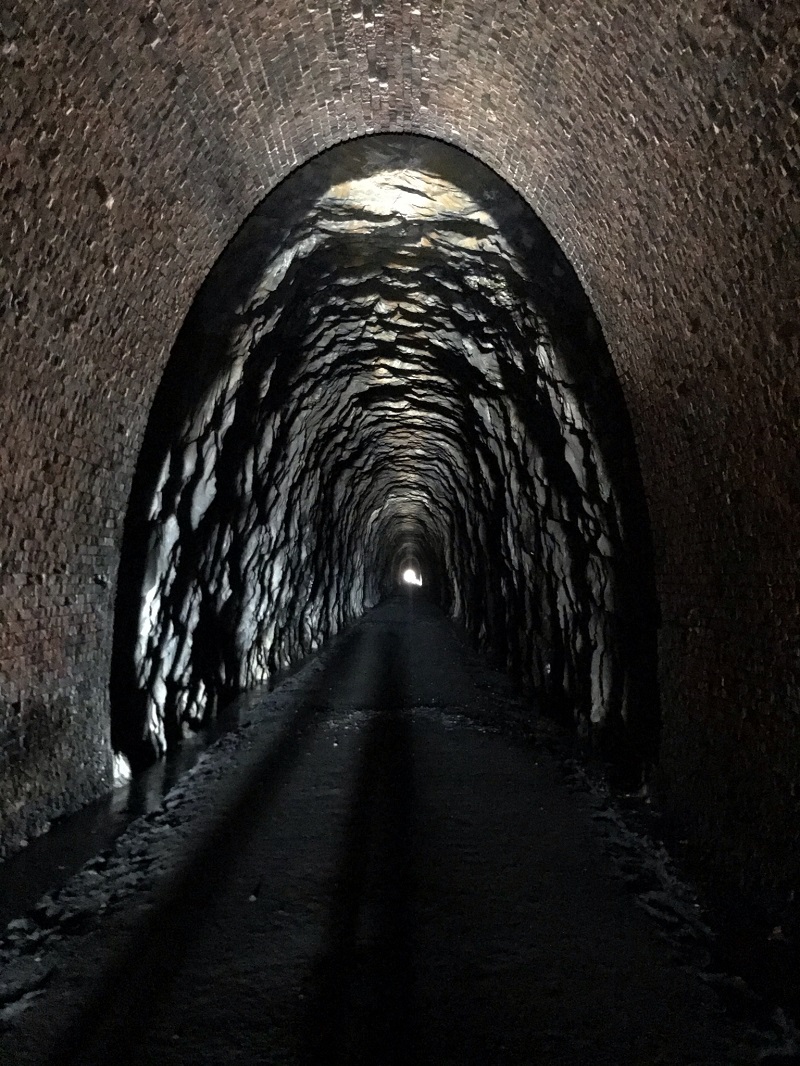
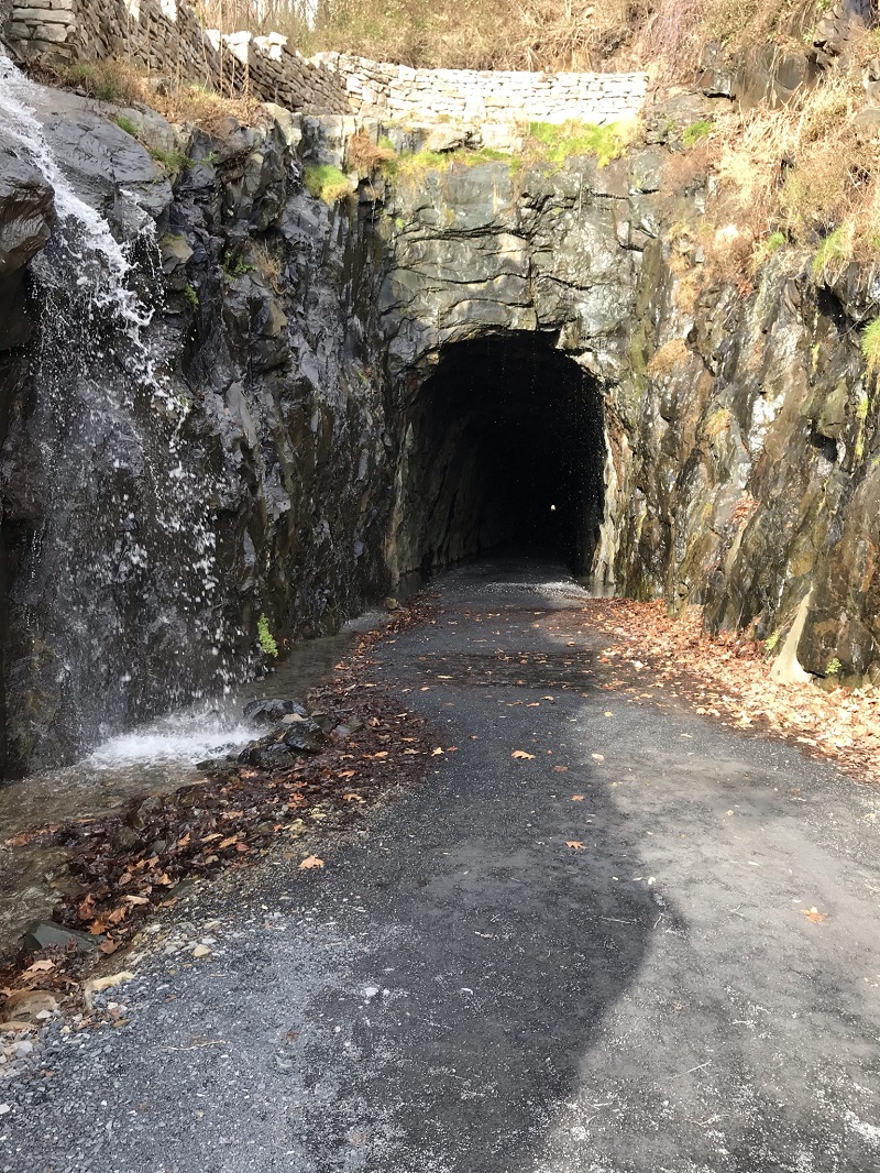
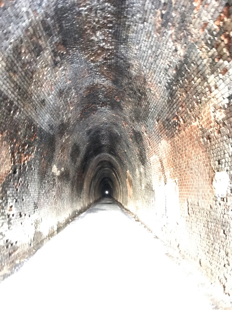
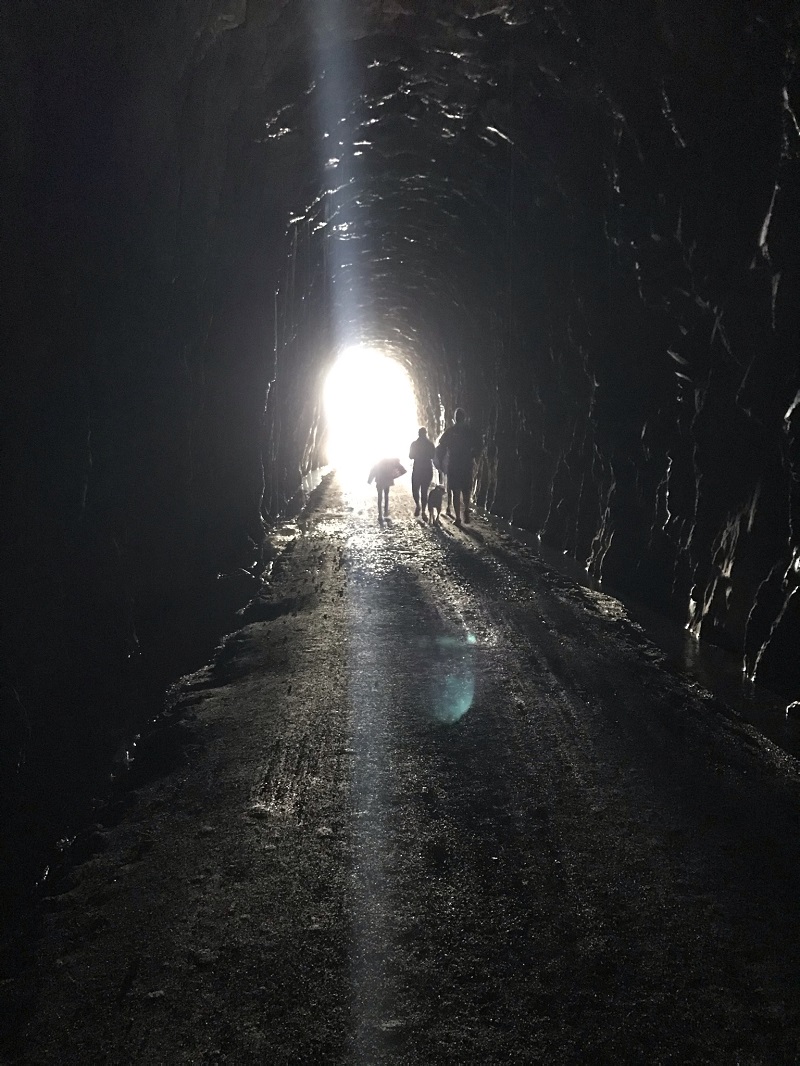
Mile 0.8 – Reach the western end of the Blue Ridge Tunnel. Notice the bricks lining the tunnel. This lining ends quickly, and the interior turns to rock. All of this was dug by hand or using black powder, as dynamite had not yet been invented when the tunnel was constructed.
-
Mile 1.2 – At about the half way mark of the tunnel, you pass under the Appalachian Trail, just north of where the AT leaves the Skyline Drive. You will be approximately 700 feet below the surface at this point. As you progress east, you will notice the tunnel become wetter. Near the eastern end, you can observe small channels on both sides of the trail to funnel water out of the tunnel.
-
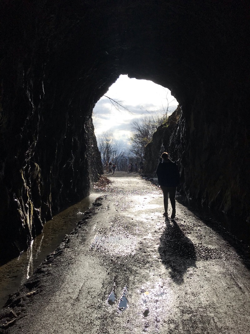
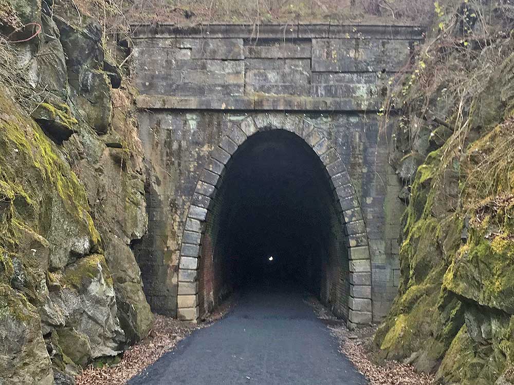
Mile 1.6 – Exit at the eastern end of the tunnel. There was lots of water flowing here after a recent rainstorm.
-
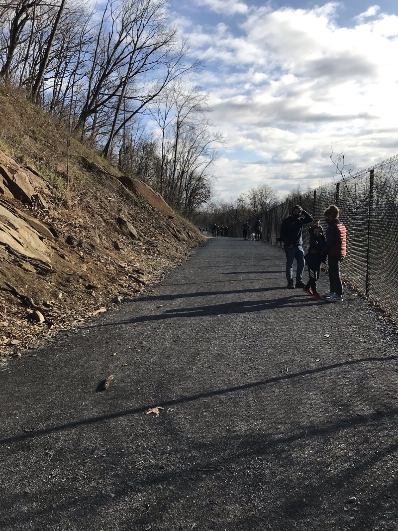
Mile 1.8 – The trail continues east, paralleling the active rail tracks. There are multiple interesting exhibits detailing the history of the tunnel and its construction.
-
Mile 2.3 – Reach the East Trailhead. Turn around here and retrace your steps. The tunnel has a very slight uphill as you walk back.
-
Mile 4.6 – Return to your vehicle after a couple of short, steep uphills, just before the parking lot.
|

