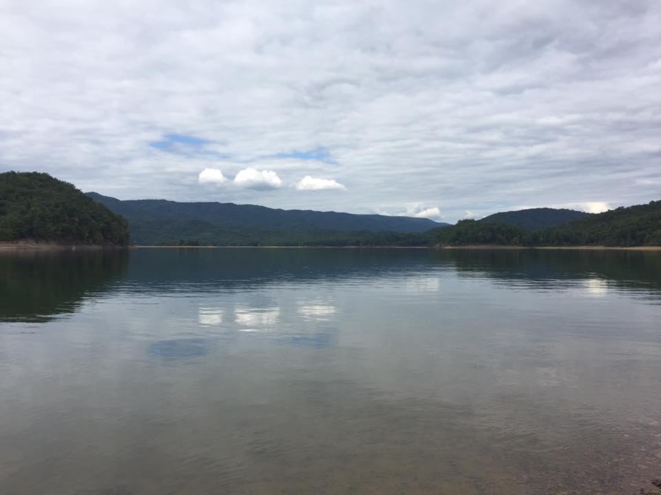
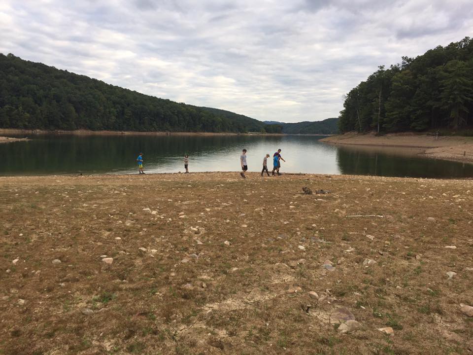
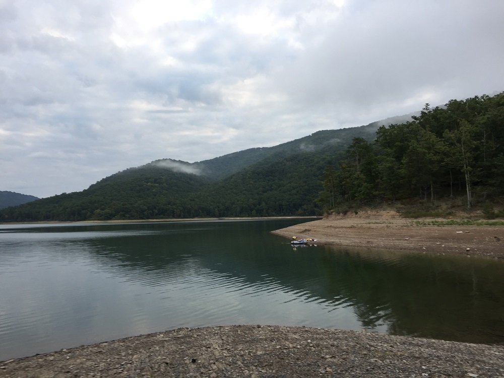
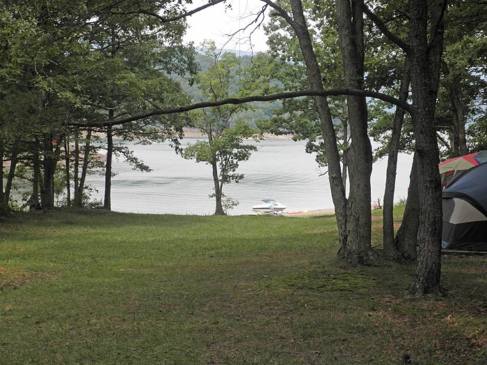
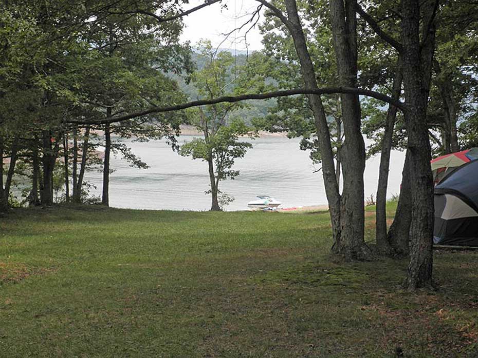
Lake Moomaw, in the Allegheny Highlands, is created by the Gathright Dam that backs up the Jackson River for over 12 miles. The dam and lake were completed by the Army Corps of Engineers in the early 1980's, and was designed to provide flood control and recreation including miles of hiking trails that surround the lake. The lake is a popular area for boaters, and many people also canoe from Campground 3 out to the Greenwood Point Campground.
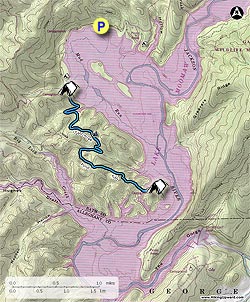
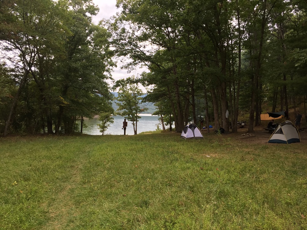
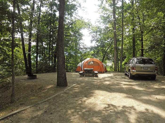
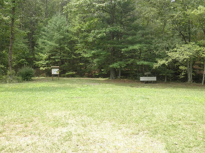
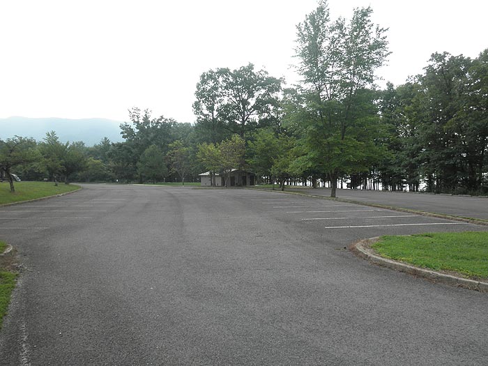
The out and back hike starts at the main parking area and beach passing the two tent camp areas Bolar Mountain 1 & 2. We highly recommend Lake Moomaw as a car camping location where you can not only hike the trails, but also swim, fish and enjoy other water sports.
Camping during the Off Season - Starting Labor Day: Campgrounds 2 and 3 closed. If you are backpacking, first stop at the marina to pay to camp and hang the pass on the car rearview mirror.
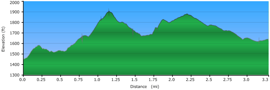
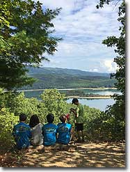
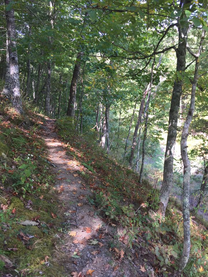
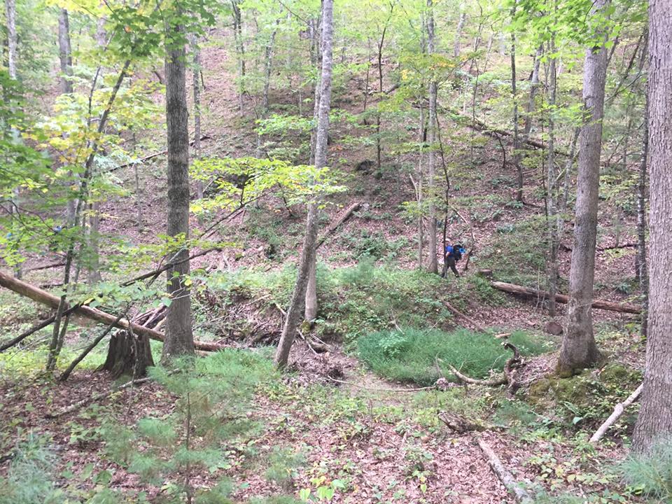
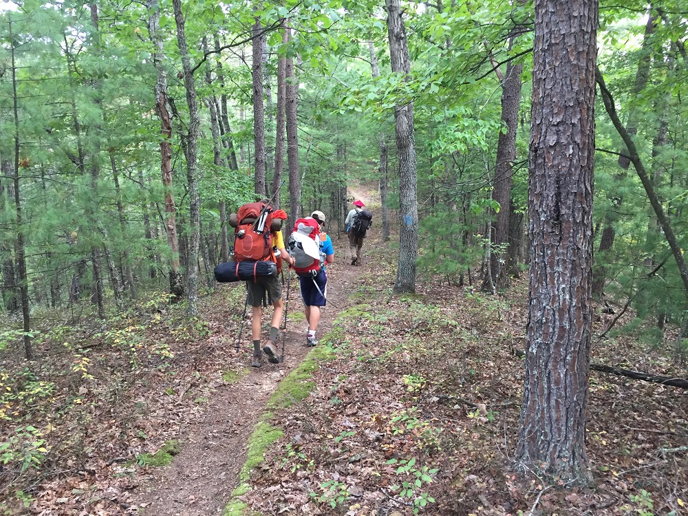
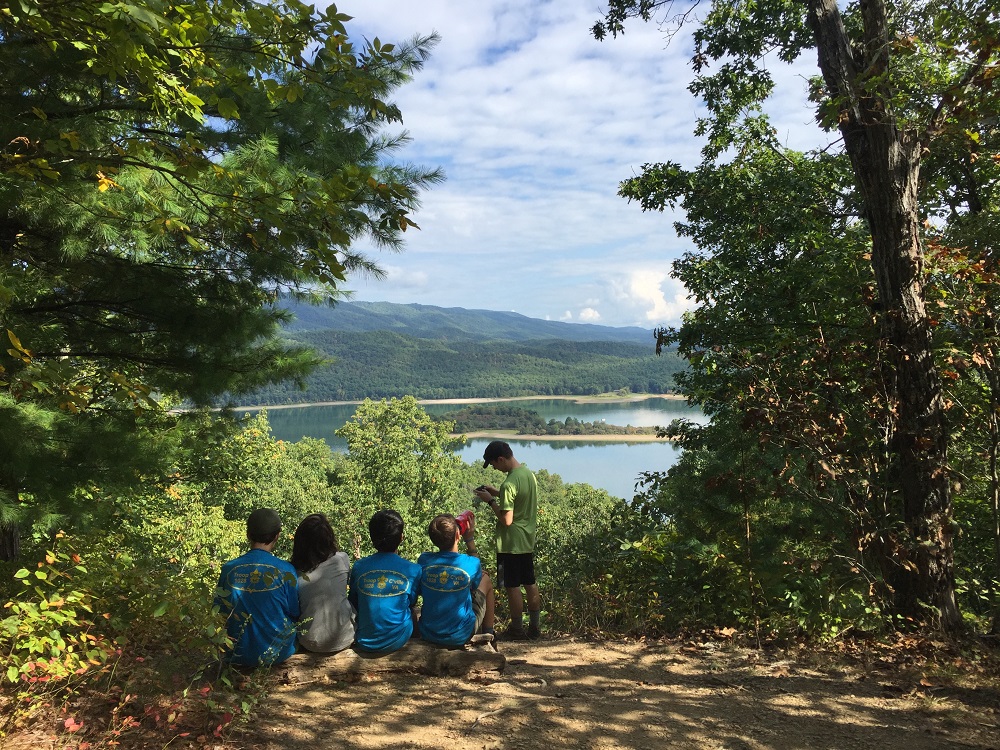
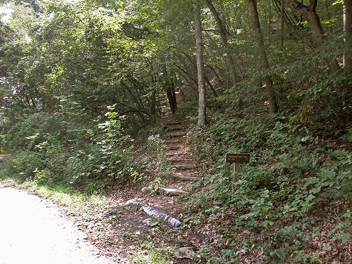
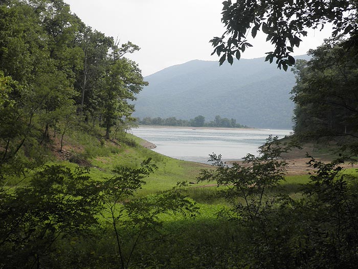
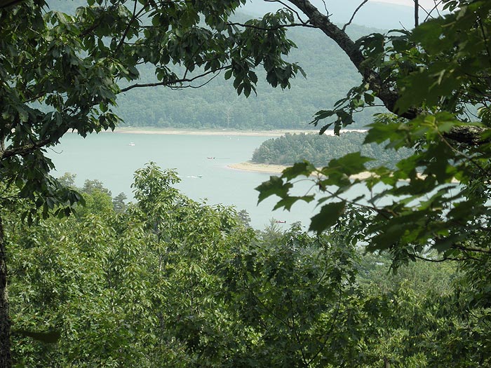
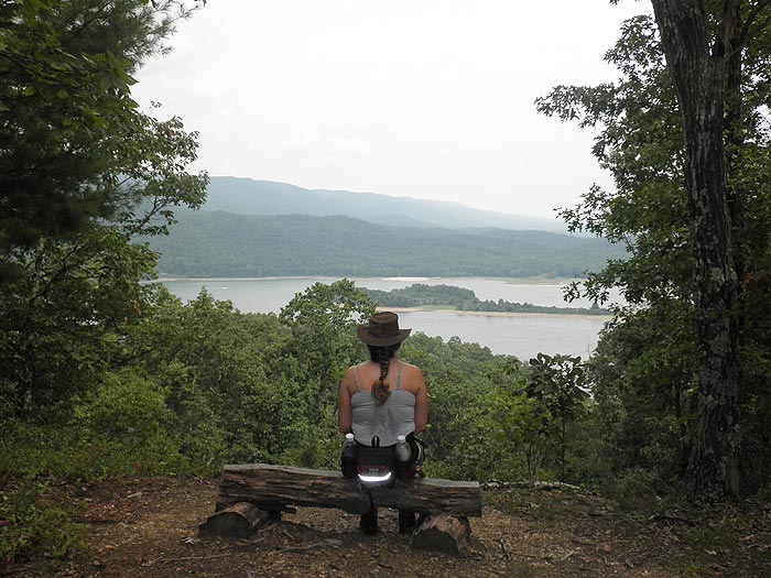
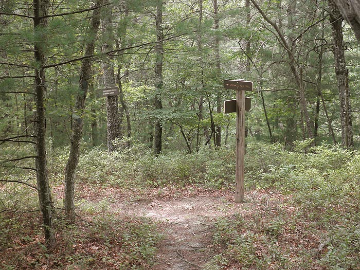
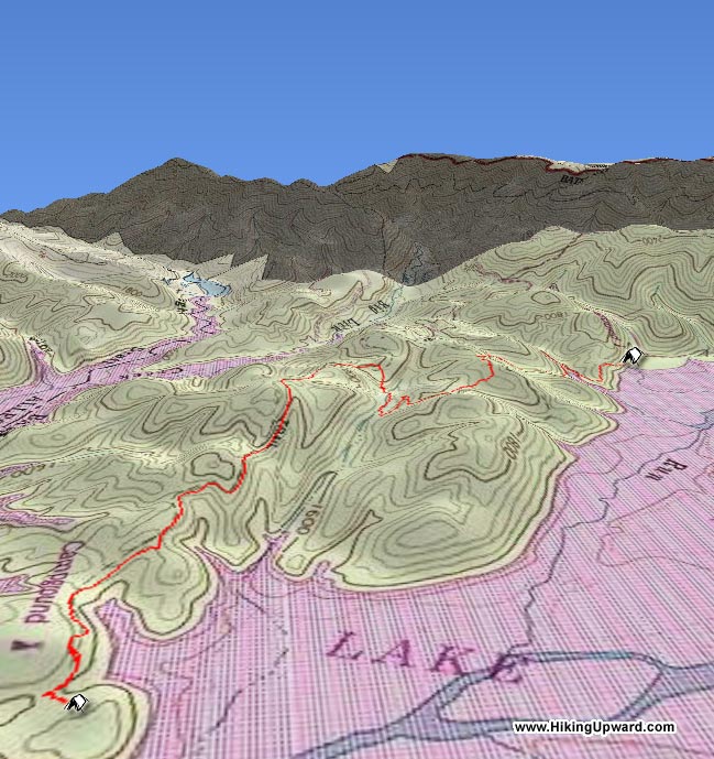
Mile 0.0 - From the trailhead next to the first camp spot of Bolar Mountain Campground 3 head up the blue blazed Greenwood Point Trail for 0.2 miles where the trail will make a turn back through the first of several gullies. Cross a small creek and turn back passing over a spur, then descend again through another gully before the steepest climb of 0.2 miles to the hike high point, and beautiful vista of Lake Moomaw.
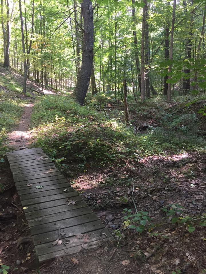
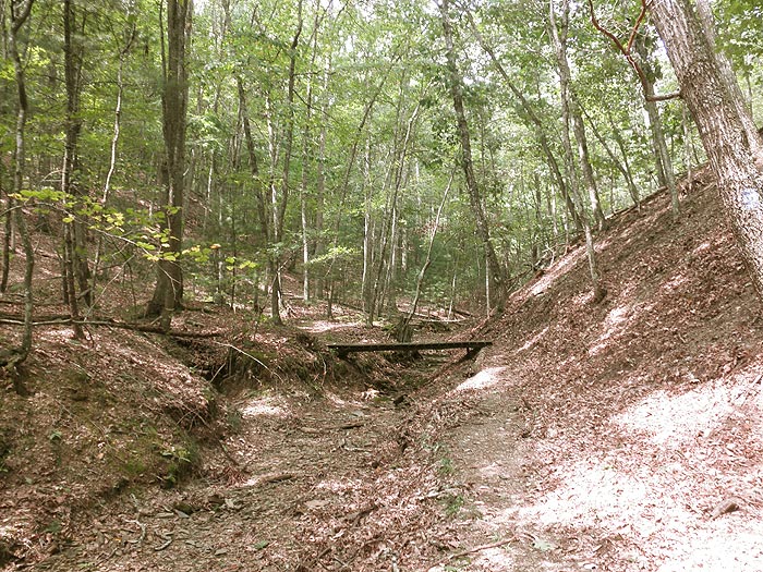
Mile 1.1 - From the high point descend for 0.4 miles crossing a stream over a wooden footbridge, then steeply ascend a spur for 0.2 miles to the intersection of an older section of the Greenwood Point Trail.
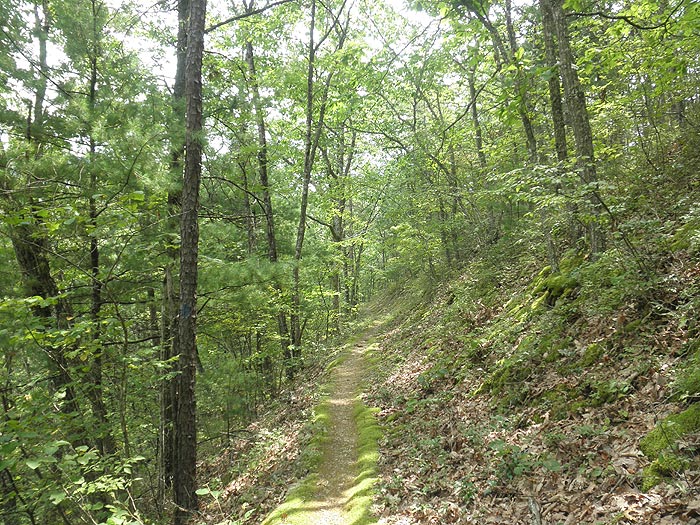
Mile 1.9 - Continue left on the older section of trail. From here the variance in grade is considerably less for the remaining 1.3 miles to the Greenwood Point Campground.
Mile 6.4 - Retrace your route and return to the parking area.
Mid September
Mid August
Lake Moomaw
Lake Moomaw Hike Comments
Archived Comments
By:MJG196
Rating:
Date of Hike: Thursday, July 14, 2016
First, let's talk parking. This trail is part of a recreational area, so there are a ton of RV/Camper campsites in the area. I was very confused about where to park my car if I was camping overnight on the trail, but eventually figured it out: Drive all the way to the turnaround-area right in front of Bolar Mountain 3 campsite area (there is a large dumpster there). Start walking toward the RV campsite loop, and the trailhead is just past the first campsite on your right.
I hiked the 3.3 miles with my 12 year old and 7 year old, but let me tell you - it is NOT an easy hike. Yes, the last 1.4 miles or so are a realtively steady descent, but you will be hiking up and down the mountain valleys before that. I was carrying all of our food and cooking gear for three days and two nights, and it was exhausting.
ATTN. BACKPACKERS: There are NO designated campsites until you reach the end of the trail. There are a couple spots in the middle of the trail, along a creek, that could serve as an emergency spot, but there is very little flat area until you reach the end. There are a couple small creeks along the trail where you can fill up your canteens.
Also, please be aware this is mos def BEAR COUNTRY, and there are signs all over the place warning you about it. Know your bear safety and be prepared. A woman we waved hello to along the trail was carrying a sidearm, and I had a big can of bear repellant (my youngest one kept a bear bell on his bag!). There were bear tracks and droppings along the trail, as well.
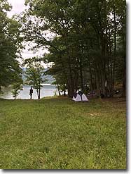
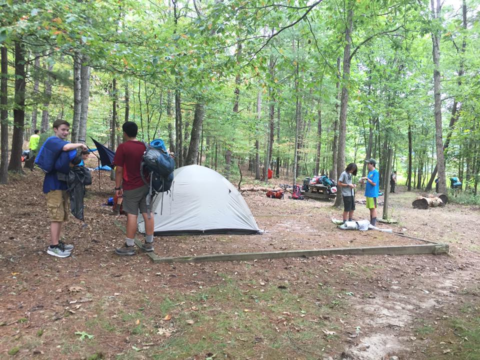
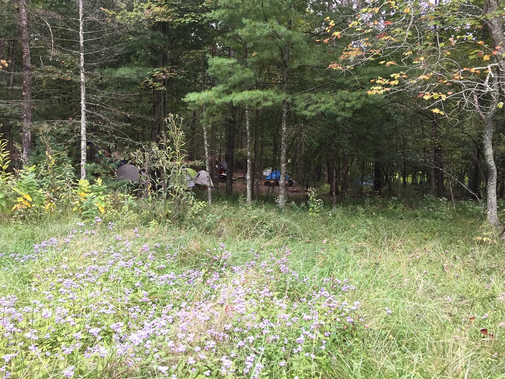
The campsites at the end of the trail, on the peninsula, are plenty big for a couple tents, and a few of them are out in the open. I chose to set up beyond the treeline, where we had some protection from the rain. Each site has a flat area for tents (if you choose to use them), a fire ring with a grill, and a picnic table.
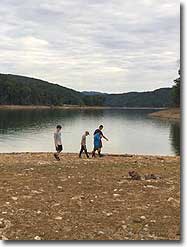
The lakeshore is gorgeous, and great for kids (as long as they have some type of sandal/water shoe (the rocks can be sharp). It is relatively shallow until about 20 feet from shore.
Two downsides - and why I gave this a 3-star review. 1) These campsites are not ideal if you don't want to hear motorboats all day long. One campsite, on the south side of the peninsula overlooks a beautiful rockface...but the people there had to deal with motorboats driving past until very late at night. There is no escaping the sound during the summer! At the end of a 3+ mile hike, I want peace and quiet. I was not prepared for the roar of engines at midnight. 2) Often, boaters will leave garbage at the campsites. One prime campsite was filled with junk, a full garbage bag, a broken tent, bottles of water (which we used!), etc.
On the way out, we stopped at the hot, powerful showers and had a very sweet-smelling drive home.
By:Wes
Rating:
Date of Hike: Saturday, April 23, 2016
Lake Moowmaw is GORGEOUS. The hike itself is not terribly difficult, my girlfriend and I both had heavy packs on and completed the hike in about 2 hours with breaks to take in the views/have a snack. Greenwood Point is a fantastic camping spot, the water is clear and clean and firewood is plentiful. The entire area is lush with vegetation, make sure to bring insect repellent! The five stars is for the camping spot itself, the hike is awesome, but the camping really made the experience for us.
By:VA paddler
Rating:
Date of Hike: Thursday, November 12, 2015
Always great to return to Lake Moomaw. Spent a perfect 2 autumn days canoeing and camping at Lake Moomaw. It was a thursday and no one was there. Was able to take some pictures too: http://waynorthblog.com/2015/11/06/lake-moomaw-in-the-fall-george-washington-national-forest-va/
By:John
Rating:
Date of Hike: Saturday, June 13, 2015
This was my second time back here and it was awesome as always. Gave it a 4/5 because of the traffic on the lake.
I wrote a full review on my blog with lots of photos for those that are interested: http://waynorthblog.com
By:Katie
Rating:
Date of Hike: Saturday, August 30, 2014
I would consider this an intense cardio workout. Also hard on your calves. There were alot of switchback, up and down, get your heart racing parts. The trail was easy to follow though it was sparsely marked. There were several downed trees and brush overgrowing the trail in a couple places. We scared off one deer and saw no other wildlife. We didn't pick up any ticks on this hike.
The bench at the top of the first steep climb was a welcomed break. The lake was very low, but the view was still beautiful. The stream crossings were all dry. There was no running water at all. There were quite a few campers at the other end, but still plenty of beach to stop and have a picnic lunch before you head back.
My husband, doggy, and I did this hike over Labor Day weekend and it was surprisingly hot out. Definitely make sure you bring plenty of water to keep hydrated. We saw only two other parties of hikers on the trail. Overall, a good hike but it was intense.
By:Outpost
Rating:
Date of Hike: Saturday, November 2, 2013
Just got back from hiking the trail out to Greenwood Point Campsite at the end of the trail. The views are wonderful. The trail is in average condition and is poorly marked on the hike in. Shortly after the fist climb on the trail is a very large tree down across the trail. There were about six more trees down that had the blue blaze on them making it tough to see them. One of the park signs at a crucial right turn was laying in the leaves. All of this made it a challenge to find the trail a few times.
The trail is covered by lots of leaves which made it a bit more difficult but beautiful. But with all of this aside it is a great 2.5 hour hike with full packs. The camp at the end of the trial is huge. It extends from one side of the point to the other side with both sides touching the water. The lake water was still quiet warm and a great water source. There are nice picnic tables and lamp stands even. There are two newer outhouses but both where occupied by mice in one and raccoons in the other.
The hike has three main ascends and descends which are more aggressive inclines on the way in. Coming out the ascends are gradual and comfortable. Watch out for a number of rebar spikes sticking out of the ground that once held log steps. The crossing bridges are in good shape and make crossing the dry creek beds easy.
We loved this camp site and plan to return from many years to come. We might ask about permission to remark the blazes.
By:Mitch House
Rating:
Date of Hike: Friday, July 26, 2013
Lake MooMaw was a good hike.
Cons: -The info says there are 4 streams which is accurate but they are all dry. So make sure you bring your own water.
-Down trees along the trail. There was one really huge down tree in the first couple hundred feet of the trailhead.
-Parts of the actual trail is on some very steep slopes (not the problem) the trail isn't well maintained in some spots and narrow so it makes it very easy to fall a long way. (the problem) Be Careful!
Pros: -Great view at mid-point.
-Lots of things to do at this location other than hike.
-The campsite has several spots to pitch your tent with a fire ring near.
-The campsite is also near to the water which lends itself to wading, swimming, and fishing. Big Plus!
When we go back we'll probably kayak to the campground not because of the trail but for people wanting to enjoy this site that can't make the walk. Overall I like this location and would hike it again.
By:Oboenerd
Rating:
Date of Hike: Sunday, April 1, 2012
This was a fun hike! I took my daughter and nephew out Sunday and we camped two nights at the campground. The hike is definitely more challenging going in (especially with full packs) than coming back, but we still made it there in 2:15 backpacking. It took us 2 hours to return on Tuesday. The trail was easy to follow and well marked. All stream crossings have bridges, so no need to get your feet wet. Greenwood Point is really beautiful - the campground is open year-round, and although their website says there are only 5 camp sites, there are actually several more, and pit latrines are available.
By:Falcon465
Rating:
Date of Hike: Friday, April 15, 2011
Overall a nice hike. Several nice views of the lake with one nice overlook (with bench). Use caution when going in due to the blazing not being done very adequate. We missed a switchback and ended up going a little out of the way but my GPS got us back on track. Coming out the blazes are much better. Some trail maintence could be useful. Really enjoyed the day at the lake. Thank you for bringing us to this trail. I grew up only a few miles from the lake but didn't realize the trail was there.


.jpg)


