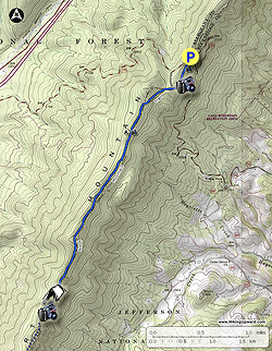
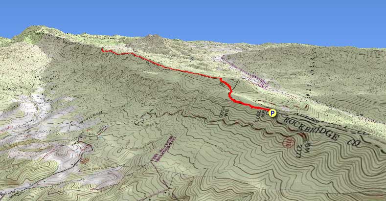
There seems to be a lot of mountains named North Mountain in Virginia, along with Brushy Mountains and Cove Mountains. This is an out-and-back hike following the ridgeline of the North Mountain that forms the boundary between Rockbridge and Alleghany Counties in Virginia.
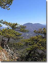
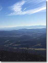
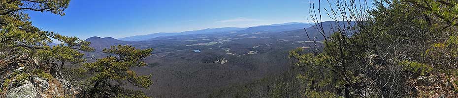
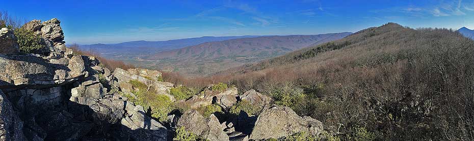
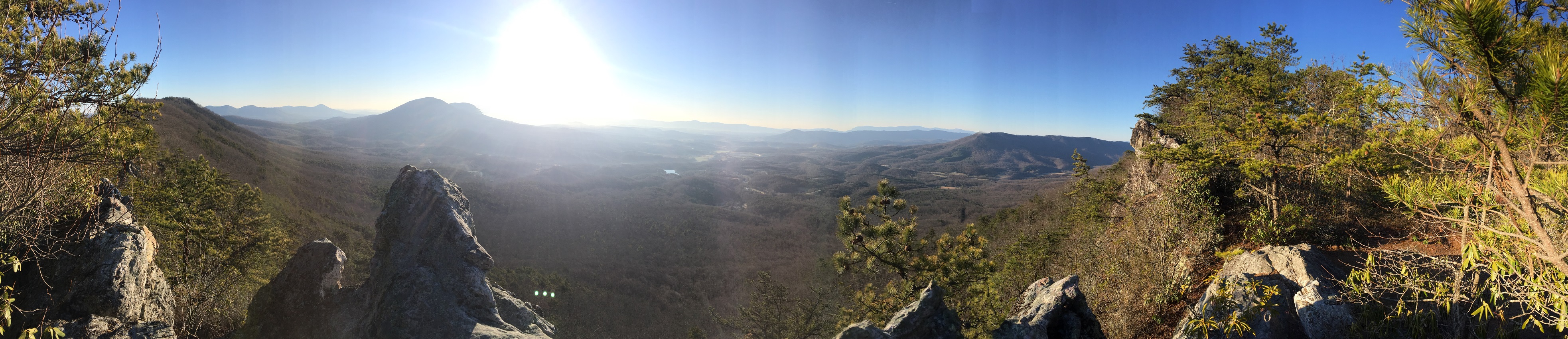
This hike contains an abundance of overlooks, many of which look east toward Big House and Little House Mountains, the town of Lexington, and the Blue Ridge Mountains near Buena Vista, Virginia. Lexington is the home of VMI and Washington and Lee University. W&L’s Outing Club published a guidebook some years ago which proclaimed of the North Mountain Trail, “Undoubtedly, this is Rockbridge County’s finest trail!” Anyone who has hiked it would be hard pressed to argue.
It is possible to start hiking the North Mountain Trail from its western end at the George Washington National Forest’s Longdale Recreation Area, but most folks drive up to the ridge line using Route 770, start from the east, and only hike the best part of the trail. That is the hike described here.
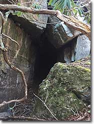
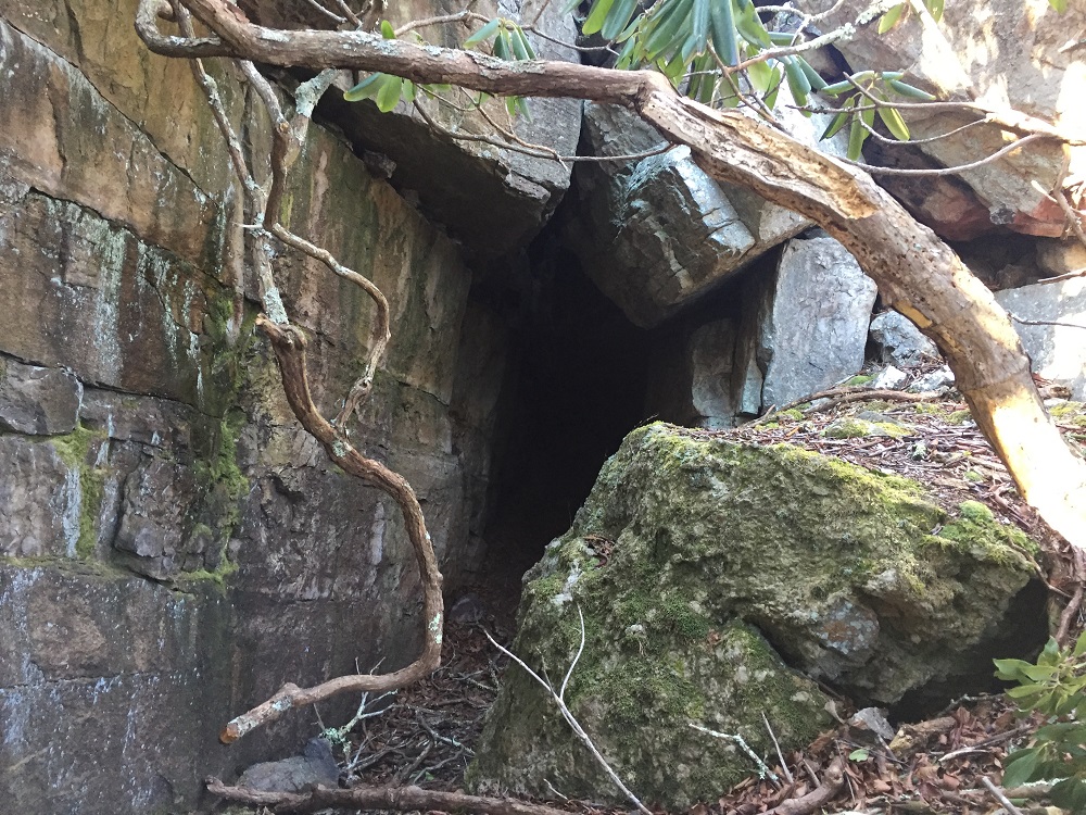
A couple of caveats: This is a well-known mountain biking trail. Be sure to keep an eye out for riders on this trail on weekends. And the description includes a location known locally as “Pete’s Cave.” We did not explore this, we do not know whether it legitimately qualifies as a “cave.” and by mentioning it we do not imply that you should explore it either. There may not even be a cave. But it is best to be safe out there!
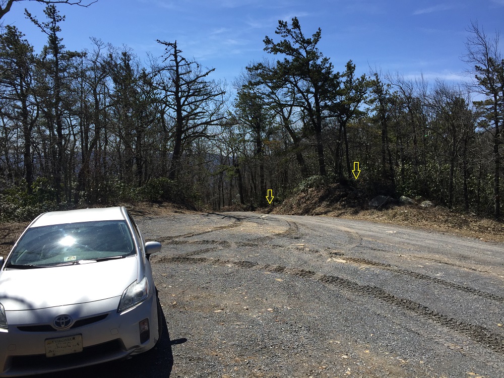
Parking: At the ridge on VA 770 you will see a small parking area. Park here, and look for the trail to start in one of two places across and a little down the east slope of the mountain. There are no trail signs here.
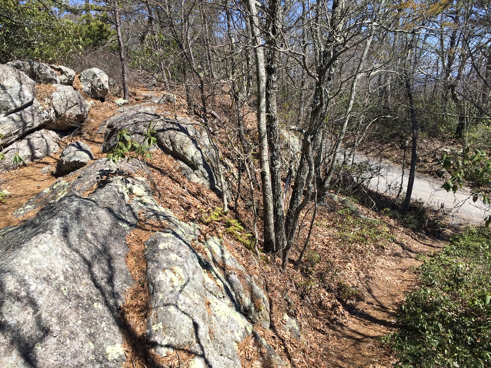
Mile 0.0 – The two trails coming off of Collierstown Road merge within 50 feet, so it does not matter which choice you make. Pass a post that appears to have once held a trail sign, and follow a rocky trail among rhododendron and Virginia Pine. Almost immediately, the blue blazed North Mountain Trail is fenced in on the left by a rock face.
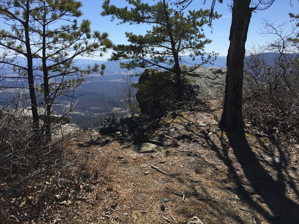
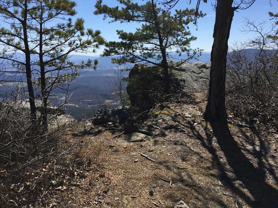
Mile 0.2 – Do not plan to race along this trail at the start of this hike, because there are serious fireworks right away. The rock face on your left can be climbed in several places to reveal spectacular views, especially near sunrise. These overlooks become progressively easier to access from the trail as you continue down the trail. The first overlook requires about a 30 foot climb. The second overlook, about 300 feet further, requires about a 15 foot climb.
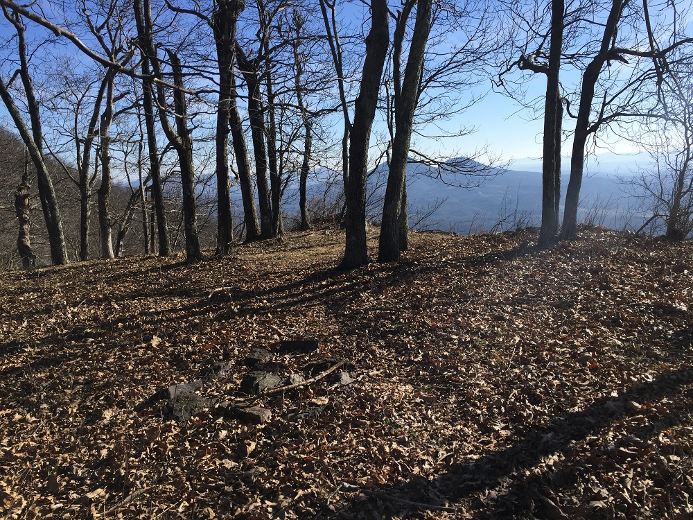
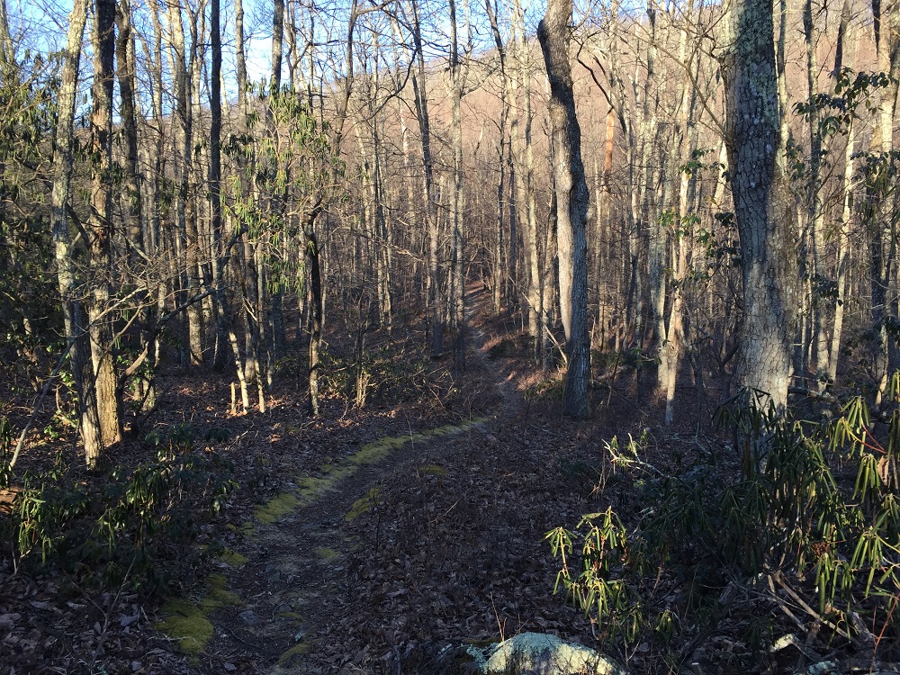
Mile 3.2 – The trail continues through the woods for another couple of miles, generally following the eastern edge of the ridge, with occasional views back towards Big and Little House Mountains. At 3.2 miles is the first and only fire ring, indicating an established campsite. The sixth eastern viewpoint is also found here. Contemplate whether these views could ever get old, but avoid staying here too long, as the highlight of the hike is just ahead.
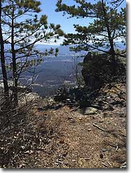
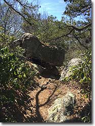
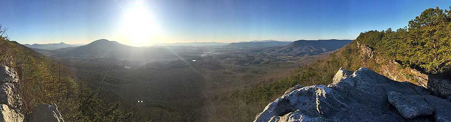
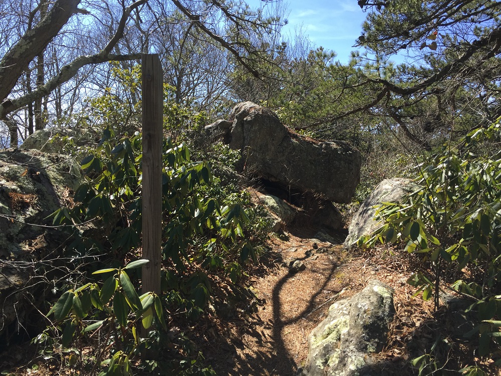
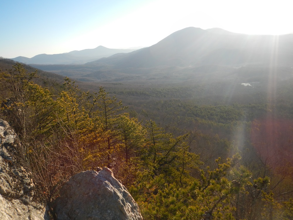
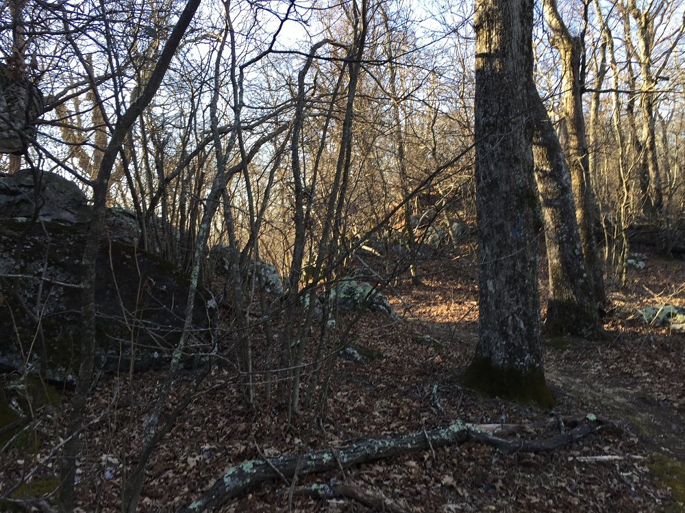
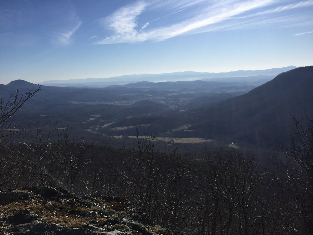
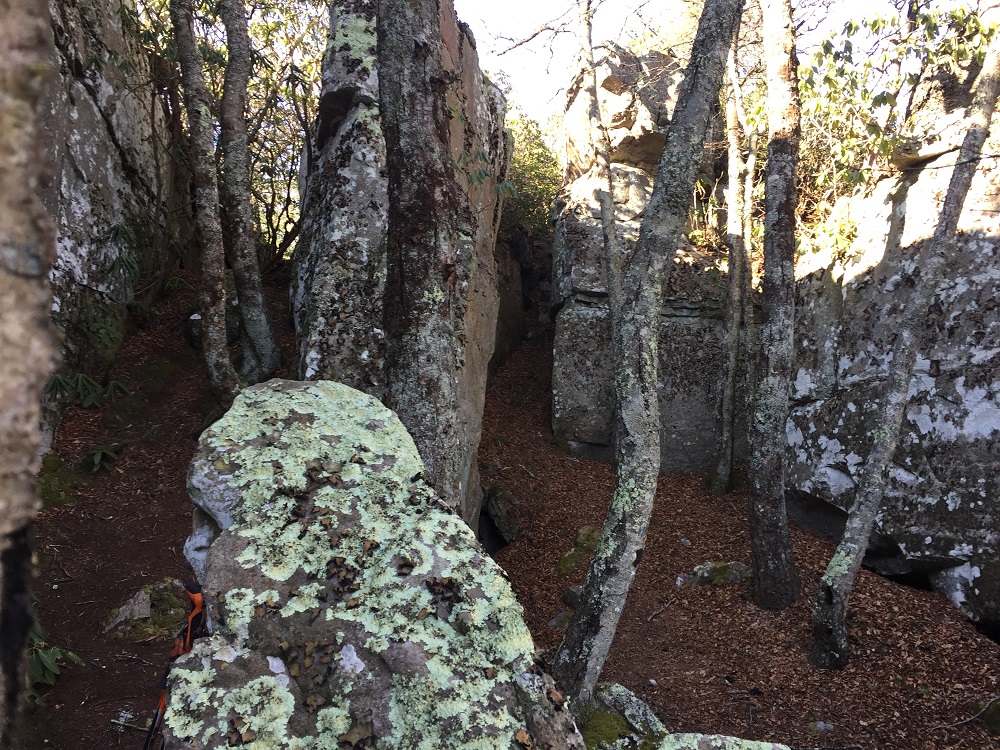
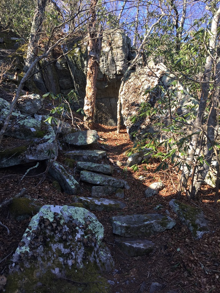
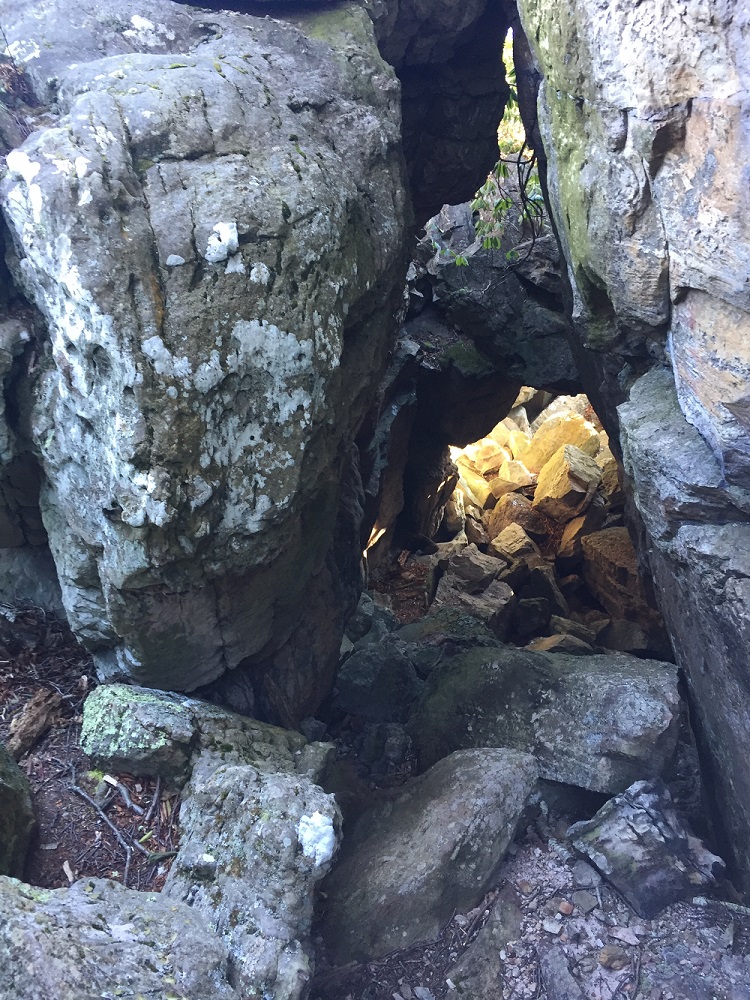
Mile 3.4– Come to a nice series of stone steps that leads into a series of large rocks after a short, steep climb. Soon, you are completely surrounded by large rock formations. There seems to be caves and tunnels all around! Climb to the top or continue on the trail (which is actually difficult to locate in this wonderland), and you will have your only views to the west. Looking west, in the foreground you will see Interstate 64, Brushy and Mill Mountains – which form the Rich Hole Wilderness. Further west, using binoculars, ridgetop houses can be seen looking down from near the Homestead Resort. All the way to your right is the ridge taking the North Mountain Trail back to your vehicle.
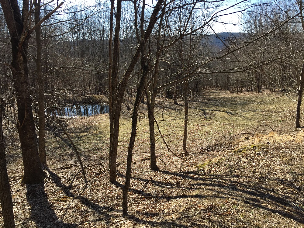
Most folks will head back to their rides from here, though the North Mountain Trail continues all the way down to Longdale Furnace Recreation Area, administered by the National Forest. There are no more views on the trail, however if you continue on another 1.1 miles, staying straight where a trail sign says that Longdale Furnace is to the right, you will come to a large flat area with a wildlife pond that appears to be a good campsite. A woods road goes down to the valley from this spot.
Mile 6.8 – Return to the parking area at the 6.8 mile mark, assuming you did not continue past the last viewpoint. On the way back, enjoy the eastern facing views all over again!
Late March
North Mountain
North Mountain/Pete's Cave Hike Comments
Archived Comments
By:Anne
Rating:
Date of Hike: Monday, October 28, 2019
This hike was very unique. Id highly recommend it on an autumn day. The views are spectacular. Walking along the ridge the forest was so alive with color and light. The Petes cave area is so unique and interesting. Lots of scrambling and interesting rock formations.
The road up is in good shape but it is steep and windy so take care. This is highly recommended, especially as a change from SNP. So different
By:Jocelyn
Rating:
Date of Hike: Monday, October 28, 2019
This is a spectacular hike with several gorgeous vistas in the first 1/2 mile. It is an extremely moderate hike ending with terrific rock formations and scrambling galore at Petes Cave. One of the best ridge hikes Ive experienced. Highly recommend you do this hike as soon as possible and especially during the fall when the colors of the leaves are so vivid.
By:Barbara Martin
Rating:
Date of Hike: Saturday, October 19, 2019
This is one of my all time favorite hikes. It's not too difficult and right off the bat has fantastic views. One is also rewarded with a very unique rock formation and fantastic viewpoint to have lunch. Who could ask for more?
By:Jason
Rating:
Date of Hike: Sunday, June 16, 2019
We started at the North Mtn Recreation area in Longdale Furnace, hiked to the ridge, and onward to 770 parking. Then, we retraced our steps back to our car. We saw four mountain bikers along the ridge. Otherwise, we were the only ones out other than all of the ticks. No snakes.
By:Jel716
Rating:
Date of Hike: Tuesday, May 28, 2019
My boyfriend and I are avid hikers. We went in the late morning to early afternoon. The parking was easy, hike was well-shaded but overgrown in some parts (I recommend bringing a good size stick or hiking poles if you do this in spring/summer) has some steep sections but is mostly flat, and the vistas are gorgeous and unique - definitely worth the work. The rock scramble/structures at the final vista are truly fascinating. Since this is a bike trail it is narrower so felt a little claustrophobic/encroached at times but was worth it. The only hiccup was encountering a huge timber rattler on the way back out about a 1/4 mile from the trailhead. He had decided to sun bathe across the trail. Boyfriend found about a ten foot long tree limb and encouraged him off the trail before he wouldn't budge anymore. He coiled and rattled we gave as wide a berth as possible going around him and thankfully no issues. We are looking forward to coming back in late fall or winter to see 360 views and no snakes :)
By:Snakebit12
Rating:
Date of Hike: Tuesday, December 18, 2018
A pleasant surprise so close to home - not sure why we haven't done this hike before. I noticed that the reviews only go back to April 2017.
Terrific views - especially this time of year. Someone had trimmed up the trail so it was smooth sailing out/back. My GPS clocked 6.6 miles + 1,080' ascent. The last campsite just before reaching the cave is a great place for lunch. Crawling around (and under) the rock formation was fun - felt like a kid again.
My group really enjoyed the hike...the views, the proximity and the difficulty level. We had experienced a string of Cat 4s over the past few weeks so a Cat 2 was a welcomed break!
By:Juliann Francis
Rating:
Date of Hike: Saturday, July 28, 2018
*Eastern Diamondback near miss!*
First of all, this is a great hike with jaw dropping views. I think there are a few things worth noting for planning purposes:
1. This path is extremely overgrown in its entirety- not just at the beginning - compared to other HU hikes (Ive done many). Could be good or bad depending on what youre looking for (we saw no evidence of any other recent hikers).
2. Probably related, we encountered an Eastern Diamondback. Two of our group walked right next to him without even noticing. He rattled to warn the third, who was already in striking distance. We halted, finally spotted the 6 foot giant poised directly next to the foot path (literally could not see him from eye level - wed never have known unless he rattled or struck). We gave a wide berth and counted our lucky stars. We were 3 miles away from parking area when this happened, and the parking area is easily an hour from the nearest hospital so this could have ended in a very bad way. Be aware you are in rattler territory if you hike in this area.
3. Do yourself s favor and look at the original posts linked photo of the parking area that marks trailhead location. A picture is worth a thousand words here as none of the descriptions were how we would have instructed someone to find the trailhead and the photo makes it quite clear.
By:Jeff Monroe
Rating:
Date of Hike: Sunday, June 17, 2018
Author's update: Hiked this in mid-June for the first time. Contrary to earlier reviews, the road from Longdale Furnace to the trailhead is in great shape. As others have noted, the trail can be a little tough to see from trailhead parking, but both entrances become obvious if you walk east downhill on Collierstown Road. (The trailhead is now marked as "North Mountain/Pete's Cave Parking" on Google Maps.) The trail itself can seem quite overgrown in sections (check for ticks), particularly right at the beginning with mountain laurel encroaching on the trail, and near Pete's Cave with thick grass. Consider bringing hand clippers and making a few clips along the way! If there is any breeze at all, this is otherwise a wonderful summer hike.
By:Ginghombre
Rating:
Date of Hike: Saturday, June 9, 2018
Enjoyable hike. Flat, easy, with lots of bling in the first 10 minutes of hiking. The parking area was a bit uncertain, however, since there were no cars there and I had some miscommunication with my map reader. (Once I looked at the map myself, it was a bit clearer.) To clarify a bit more than others have already, the "parking lot" can be missed if empty of cars because it's basically just a large intersection among 3 roads with no signage.
By my odometer, from Longdale Furnace, starting at the turnoff onto Rt. 770 you go 3.9 miles up the mountain and turn right at the intersection as mentioned by others. You will almost immediately see an unimproved "two-track" driveway (to radio tower) on your left. Don't take it you are now in the parking lot. (If you were to keep driving past this point, you'd start heading back down the mountain. If you do, there is room to turn around shortly at a large hairpin turn.) Park on the side of the road next to the tower drive entrance, where there is room for a few cars, and the trail access is behind you, across from where the tower drive enters the road . A slightly easier access is a couple of hundred feet farther down the road, to your right.
By:Bryant
Rating:
Date of Hike: Thursday, December 28, 2017
The hike has amazing views - and the road is a trip all by itself. Probably one of the best ridge hikes I've ever done - even at 6 degrees! While the views are wonderful right from the start, the real fireworks are 3.2 miles in - the rock grotto is interesting, offers many view point, and for the adventurous - a breathtaking 360 degree view after a quick scramble. I would argue this hike is the most scenic (fall and winter) in Rockbridge County.


